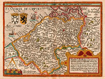
County of Flanders facts for kids
Quick facts for kids
County of Flanders
|
|||||||||||||||||
|---|---|---|---|---|---|---|---|---|---|---|---|---|---|---|---|---|---|
| 862–1797 | |||||||||||||||||
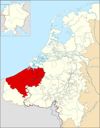
County of Flanders, 1350, in relation to the Low Countries and the Holy Roman Empire. The county was located where the border between France and the Holy Roman Empire met the North Sea.
|
|||||||||||||||||
| Status | French and Imperial fiefdom | ||||||||||||||||
| Capital | Bruges, later Ghent and Lille | ||||||||||||||||
| Common languages |
|
||||||||||||||||
| Religion |
|
||||||||||||||||
| Government | Feudal monarchy | ||||||||||||||||
| Count of Flanders | |||||||||||||||||
|
• 862–879
|
Baldwin I | ||||||||||||||||
|
• 1792–1797
|
Francis II | ||||||||||||||||
| Historical era | Middle Ages/ |
||||||||||||||||
|
• Fief granted to Count Baldwin I
|
862 | ||||||||||||||||
|
• Annexed by France
|
1797 | ||||||||||||||||
|
|||||||||||||||||
| Today part of | |||||||||||||||||
| History of the Low Countries | ||||||||
|---|---|---|---|---|---|---|---|---|
| Frisii | Belgae | |||||||
| Cana- nefates |
Chamavi, Tubantes |
Gallia Belgica (55 BC – 5th c. AD) Germania Inferior (83 – 5th c.) |
||||||
| Salian Franks | Batavi | |||||||
| unpopulated (4th–5th c.) |
Saxons | Salian Franks (4th–5th c.) |
||||||
| Frisian Kingdom (6th c.–734) |
Frankish Kingdom (481–843)—Carolingian Empire (800–843) | |||||||
| Austrasia (511–687) | ||||||||
| Middle Francia (843–855) | West Francia (843–) |
|||||||
| Kingdom of Lotharingia (855– 959) Duchy of Lower Lorraine (959–) |
||||||||
| Frisia | ||||||||
Frisian Freedom (11–16th century) |
County of Holland (880–1432) |
Bishopric of Utrecht (695–1456) |
Duchy of Brabant (1183–1430) Duchy of Guelders (1046–1543) |
County of Flanders (862–1384) |
County of Hainaut (1071–1432) County of Namur (981–1421) |
P.-Bish. of Liège (980–1794) |
Duchy of Luxem- bourg (1059–1443) |
|
Burgundian Netherlands (1384–1482) |
||||||||
Habsburg Netherlands (1482–1795) (Seventeen Provinces after 1543) |
||||||||
Dutch Republic (1581–1795) |
Spanish Netherlands (1556–1714) |
|||||||
Austrian Netherlands (1714–1795) |
||||||||
United States of Belgium (1790) |
R. Liège (1789–'91) |
|||||||
Batavian Republic (1795–1806) Kingdom of Holland (1806–1810) |
associated with French First Republic (1795–1804) part of First French Empire (1804–1815) |
|||||||
Princip. of the Netherlands (1813–1815) |
||||||||
| United Kingdom of the Netherlands (1815–1830) | Gr D. L. (1815–) |
|||||||
Kingdom of the Netherlands (1839–) |
Kingdom of Belgium (1830–) |
|||||||
| Gr D. of Luxem- bourg (1890–) |
||||||||
The County of Flanders was a very important region in the Middle Ages. It was located along the North Sea coast, in what is now Belgium. Unlike its neighbors, Flanders was part of the Kingdom of France. The rulers of Flanders, called counts, were among the most important nobles in France.
For many centuries, cities like Ghent, Bruges, and Ypres made Flanders one of the richest places in Europe. They were famous for their cloth industry and had strong trade connections with other countries.
Flanders was split into two main parts. "Royal Flanders" was west of the Scheldt river and belonged to the French king. "Imperial Flanders" was east of the river and was part of the Holy Roman Empire. This made Flanders a unique place, connected to both powerful empires.
In the late 1300s, Flanders joined other nearby regions to form the Burgundian Netherlands. This made its relationship with France more complicated. By 1795, the entire area was taken over by France. After the Battle of Waterloo in 1815, most of the old County of Flanders became part of the United Kingdom of the Netherlands. Later, in the 1830s, this kingdom split into modern-day Belgium, Luxembourg, and the Netherlands.
Today, parts of the historic County of Flanders are found in Belgium, France, and the Netherlands.
Contents
What Does "Flanders" Mean?
The name "Flanders" first appeared around the area of Bruges. It was mentioned in an old book about Saint Eligius, written before the year 684.
Some historians believe the name "Flanders" comes from an old Germanic word, *flaumaz, which means "stream" or "flood." This makes sense because the region was very wet and often flooded before people built dykes to control the water.
Where Was the County of Flanders?
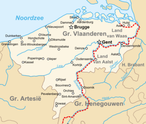
The old County of Flanders covered a larger area than the modern region of Flanders in Belgium. It stretched across parts of three countries today:
- Belgium:
- Most of West Flanders and East Flanders provinces.
- A small part of the Antwerp province.
- Part of the Hainaut province, including Tournaisis.
- France:
- Netherlands:
- This part is called Zeelandic Flanders. It's a region between Belgium and the Western Scheldt river.
What Was the Flag and Coat of Arms?
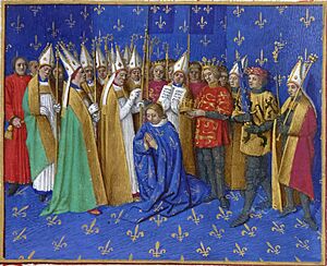
The official symbol of the County of Flanders was a black lion standing on its hind legs on a gold background. This symbol is still used today by the Flemish Community in Belgium.
People used to say that Philip of Alsace, a count from the 1100s, brought the lion flag back from the Holy Land. But this is a myth! The lion appeared on his personal seal even before he went there. Many other regions in Europe, especially those near the Holy Roman Empire, also started using lions in their symbols around the same time. This might have been a way to show their independence from the Emperor, who used an eagle as his symbol.
A Brief History of Flanders
How Did Flanders Begin?
The area that became Flanders has been lived in since ancient times. During the Iron Age, Celtic tribes lived there. Later, Julius Caesar conquered the region around 54 BC, and it became part of the Roman Empire.
After the Roman Empire weakened, Germanic tribes like the Saxons and Franks moved into the area. These groups kept their Germanic culture and language. By the 7th century, the population had grown enough to start building up towns and religious centers. Missionaries helped spread Christianity.
The first small administrative areas, called pagi or "shires," were created. These would later form the basis of the County of Flanders.
The Carolingian Era
In 751, the Carolingian dynasty took over the Frankish Empire. Charlemagne, a famous Carolingian emperor, spent time in the region. He ordered ships to be built in Boulogne and Ghent to protect against Viking attacks.
The region was rich, with important trading ports along the Scheldt river and the coast. It also had many wealthy monasteries.
After Charlemagne's death, his grandsons divided the empire. The area of Flanders became part of West Francia, which later became France. The Scheldt river became the border between West Francia and the Holy Roman Empire to the east.
How the County Grew (864–1071)
During the 9th century, Europe faced many problems, including Viking invasions. Kings struggled to protect their lands. This allowed local leaders to become more powerful.
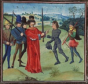
The first Count of Flanders was Baldwin I, who became count in 862. Legend says he ran away with the daughter of the French king, Charles the Bald. After some trouble, the king made Baldwin a count and gave him land. The king hoped Baldwin would protect the northern border from Vikings.
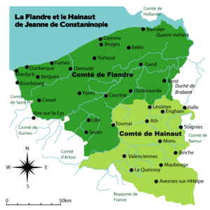
Baldwin and the counts after him were very good at expanding their territory. They took over nearby lands that had been attacked by Vikings. Over time, the County of Flanders grew to include areas south and west of the Scheldt river, becoming a very strong and important region.
Prosperity and Power (1071–1278)
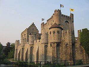
In 1071, Robert I became count. Flemish knights were known as some of the best in Europe. Count Robert II even joined the First Crusade in 1096.
Under counts like Thierry of Alsace and Philip of Alsace, Flanders became even more important and powerful. Philip of Alsace gained control of the County of Vermandois, which meant his lands were almost as big as the French king's own territory!
During this time, cities grew, and new ports were built, like Gravelines and Nieuwpoort. These ports helped trade and protected the rivers.
Trade with England was especially important for Flanders' growing cloth industry. The wealth of many Flemish cities came from making cloth. They also traded grain, wine, and other goods. Flanders became one of the most urbanized (city-filled) parts of Europe.
Challenges in the 14th Century (1278–1384)
In 1278, Guy of Dampierre became count. The King of France wanted to take over Flanders completely. This led to the Franco-Flemish War (1297–1305). The strong cities of Flanders, with their own armies, fought back. They famously defeated the French at the Battle of the Golden Spurs in 1302.
However, the French eventually won another battle and forced Flanders to sign the treaty of Athis-sur-Orge in 1305. Flanders lost some land and had to pay a lot of money, but it kept its independence from France.
Despite these challenges, Flanders remained prosperous due to its cloth industry and art. But in the next century, things got harder. The Black Death (a terrible plague) reduced the population. Trade was disrupted by the Hundred Years' War between England and France. Also, England started making more of its own cloth, which hurt Flemish businesses.
The Burgundian Era (1384–1506)
In 1369, Philip the Bold, the Duke of Burgundy, married Margaret of Dampierre. This marriage ended Flanders' independence, and it became part of the powerful Burgundian State.
The cities of Ghent and Bruges had been very independent, almost like small countries. When Duke Charles the Bold died in 1477, they tried to get their old freedoms back. But the new rulers, from the House of Habsburg, eventually brought the cities back under control.
In 1493, the Treaty of Senlis was signed. This agreement made Flanders officially part of the Holy Roman Empire, no longer under France.
The Seventeen Provinces (1506–1598)
Under Charles V, Holy Roman Emperor, who was born in Ghent, Flanders became one of the Seventeen Provinces of the Low Countries. These provinces were all inherited together.
The Low Countries were very important to Charles V because they were rich from trade and industry. After Charles V, the Spanish kings of the House of Habsburg ruled Flanders.
In 1566, a religious uprising called the Beeldenstorm (Iconoclasm) began in Flanders. This led to the Eighty Years' War and the northern provinces breaking away to form the Republic of the Seven United Netherlands. Flanders initially joined them but was later reconquered by the Spanish army.
Spanish and Austrian Rule (1598–1789)
Flanders remained under Spanish control for a long time. The French king Louis XIV later took over the southern part of Flanders, which became known as French Flanders. This was made official in 1678 by the Treaty of Nijmegen.
After the Spanish Habsburgs died out, the Austrian branch of the Habsburg family became the rulers of Flanders. Under Maria Theresa of Austria, the Austrian Netherlands (which included Flanders) prospered.
The End of the County (1789–1797)
In 1789, a revolution broke out against the Austrian Emperor. In 1790, the County of Flanders declared its independence and joined the United States of Belgium.
However, the County of Flanders officially ended in 1795 when France annexed it. It was divided into two French departments: Lys and Escaut. Austria confirmed this loss in the 1797 Treaty of Campo Formio.
After the French Revolution, the county was not brought back. Instead, the two departments became the provinces of East and West Flanders in the new United Kingdom of the Netherlands. Later, after the Belgian Revolution, they became part of Belgium.
Count of Flanders Title
Since 1840, the title "Count of Flanders" has been used by the Belgian royal family. It was usually given to the second person in line to the Belgian throne. This title was officially stopped in 2001.
Important Events for the County of Flanders
- Battle of Cassel (1071)
- Battle of Bouvines (1214)
- Battle of the Golden Spurs (1302)
- Battle of Mons-en-Pevele (1304)
- Treaty of Athis-sur-Orge (1305)
- Battle of Cassel (1328)
- Battle of Westrozebeke (1382)
- Eighty Years' War (1568–1648)
- Pacification of Ghent (1576)
- Union of Utrecht (1579)
- Act of Abjuration (1581)
See also
 | James B. Knighten |
 | Azellia White |
 | Willa Brown |


