
Image: USA Virginia Northern location map

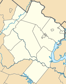
Description: Equirectangular projection, N/S stretching 130.0 %. Geographic limits of the map: top=39.324960, bottom=37.990552, left=-78.391863, right=-77.038670. Northern Virginia as defined by the Washington metropolitan area (Alexandria, Arlington County, Clarke County, Culpeper County, Fairfax County, Fairfax, Falls Church, Fauquier County, Loudoun County, Manassas, Manassas Park, Prince William County, Rappahannock County, Spotsylvania County, Stafford County, Fredericksburg, Warren County).
Title: USA Virginia Northern location map
Credit: Own work
Author: Id4abel
Usage Terms: Creative Commons Attribution-Share Alike 4.0
License: CC BY-SA 4.0
License Link: https://creativecommons.org/licenses/by-sa/4.0
Attribution Required?: Yes
Image usage
More than 100 pages link to this image. The following list shows the first 100 page links to this image only. A full list is available.
- Accotink, Virginia
- Aden, Virginia
- Airlie, Virginia
- Airmont, Virginia
- Aldie, Virginia
- Alexandria, Virginia
- Alsop, Virginia
- Annandale, Virginia
- Arcadia, Spotsylvania County, Virginia
- Arcola, Virginia
- Arcturus, Virginia
- Arlington Ridge, Virginia
- Ashburn, Virginia
- Ashby, Warren County, Virginia
- Bailey's Crossroads, Virginia
- Ballston, Arlington, Virginia
- Bealeton, Virginia
- Belle Haven, Fairfax County, Virginia
- Belle Meade, Virginia
- Belmont, Virginia
- Belmont Manor House
- Belvoir, Virginia
- Berrys, Virginia
- Bethel, Clarke County, Virginia
- Blevinstown, Virginia
- Bloomfield, Virginia
- Bluemont, Virginia
- Brambleton, Virginia
- Brentsville, Virginia
- Briggs, Virginia
- Bristersburg, Virginia
- Bristow, Virginia
- Broad Run, Virginia
- Broadlands, Virginia
- Brockroad, Virginia
- Buckland, Virginia
- Burke, Virginia
- Burke Centre, Virginia
- Butts Corner, Virginia
- Calverton, Virginia
- Canova, Virginia
- Casanova, Virginia
- Cascades, Virginia
- Castlemans Ferry, Virginia
- Catharpin, Virginia
- Catlett, Virginia
- Centreville, Virginia
- Chancellor, Virginia
- Chancellorsville, Virginia
- Chantilly, Virginia
- Clarendon, Arlington, Virginia
- Claytonville, Virginia
- Clifton, Virginia
- Cobbs Corner, Virginia
- Colchester, Virginia
- Colchester Hunt, Virginia
- Comptons Corner, Virginia
- Conklin, Virginia
- Cooktown, Virginia
- Cornwell, Virginia
- Countryside, Virginia
- Crosspointe, Virginia
- Crowells Corner, Virginia
- Culmore, Virginia
- Donovans Corner, Virginia
- Double Tollgate, Virginia
- Dover, Virginia
- Doveville, Virginia
- Dranesville, Virginia
- Dulles, Virginia
- Dunn Loring, Virginia
- Elk Run, Virginia
- Elvan, Virginia
- Eubanks, Virginia
- Fair Lakes, Virginia
- Fair Oaks, Fairfax County, Virginia
- Fairfax, Virginia
- Fairlington, Arlington, Virginia
- Farrs Corner, Virginia
- Five Forks, Fairfax County, Virginia
- Floris, Virginia
- Fort Belvoir
- Fort Hunt, Virginia
- Four Corners, Virginia
- Fredericksburg, Virginia
- Hamilton, Virginia
- Haymarket, Virginia
- Herndon, Virginia
- Hillsboro, Loudoun County, Virginia
- Langley, Virginia
- Leesburg, Virginia
- Lovettsville, Virginia
- Manassas, Virginia
- McLean, Virginia
- Middleburg, Virginia
- Moorefield, Virginia
- Purcellville, Virginia
- Round Hill, Loudoun County, Virginia
- Tysons, Virginia
- Vienna, Virginia
