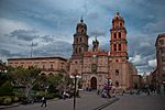
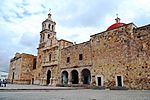
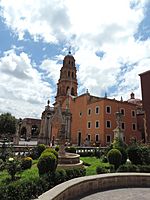
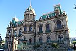
List of World Heritage Sites in Mexico facts for kids
The United Nations Educational, Scientific and Cultural Organization (UNESCO) helps protect important places around the world. These places are called World Heritage Sites. They can be special because of their history, culture, or natural beauty. Mexico joined this effort on February 23, 1984.
As of 2018, Mexico has thirty-five World Heritage Sites. This includes 27 cultural sites, 6 natural sites, and 2 mixed sites. Mexico has the most World Heritage Sites in the Americas. It ranks seventh globally.
Mexico's first six sites were added in 1987. These included Sian Ka'an, the ancient city of Palenque, and the Historic Centre of Mexico City. Also added were Xochimilco, the ancient city of Teotihuacan, and the historic centers of Oaxaca and Puebla. These sites were chosen at a meeting in Paris, France.
Besides these famous places, Mexico also has 21 other sites on a "tentative list." These are places that might become World Heritage Sites in the future.
Mexico also has 9 traditions and celebrations that are considered Intangible Cultural Heritage. These are living traditions that are important to Mexican culture. Some examples are the Indigenous festivals dedicated to the dead, the ceremony of the Flying Dancers, and Mariachi music.
Contents
Location of Sites
This map shows where Mexico's World Heritage Sites are located.
Numbered sites:
- 1. Downtown Mexico City and Xochimilco
- 2. Central campus of the University City of UNAM
- 3. Monasteries on the slopes of Popocatépetl
- 4. Luis Barragan House and Studio
- 5. Aqueduct of Padre Tembleque
- 6. San Miguel de Allende
Legend:
 World Cultural Heritage Site
 World Natural Heritage Site
 World Cultural and Natural Heritage Site (Mixed)
 Silver Road (cultural)
World Heritage Sites in Mexico
Here is a list of the World Heritage Sites in Mexico. The table shows the site's name, pictures, where it is, why it's special (criteria), its size, and when it was added to the list.
![]() In danger
In danger
| Site | Image | Location | Criteria | Area ha (acre) |
Year | Description |
|---|---|---|---|---|---|---|
| Historic Center of Mexico City and Xochimilco | 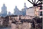
|
Mexico City 19°25′6″N 99°7′58″W / 19.41833°N 99.13278°W |
Cultural: (ii)(iii)(iv)(v) |
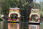
— | 1987 | Mexico City was founded in the 1300s as the Aztec capital, Tenochtitlan. The Spanish rebuilt it in 1521. Today, it is a huge city. You can find Aztec temple ruins and a large cathedral here. Xochimilco is south of Mexico City. It has canals and artificial islands, showing how the Aztecs lived on a lake. |
| Historic Centre of Oaxaca and Archaeological site of Monte Albán |
 |
Oaxaca 17°3′43″N 96°43′18″W / 17.06194°N 96.72167°W |
Cultural: (i)(ii)(iii)(iv) |
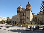
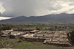
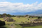
375 (930) | 1987 | Monte Albán was home to the Olmec, Zapotec, and Mixtec peoples for 1,500 years. They carved terraces, pyramids, and mounds into the mountain. Oaxaca city is nearby, built in a grid pattern by the Spanish. Its strong buildings were made to withstand earthquakes. |
| Historic Centre of Puebla |  |
Puebla 19°2′50″N 98°12′13″W / 19.04722°N 98.20361°W |
Cultural: (ii)(iv) |
690 (1,700) | 1987 | Puebla was founded in 1531, east of Mexico City. It has many old religious buildings, like its 16th-century cathedral. Many houses have colorful tiles called azulejos. The city's style mixes European and American designs. |
| Pre-Hispanic City and National Park of Palenque |  |
Chiapas 17°29′0″N 92°3′0″W / 17.48333°N 92.05000°W |
Cultural: (i)(ii)(iii)(iv) |
1,772 (4,380) | 1987 | Palenque is a great example of a Mayan city from AD 500 to 700. Its buildings show amazing skill and beauty. The carved art tells stories from Mayan myths. This site shows the creative genius of the Mayan people. |
| Pre-Hispanic City of Teotihuacán | 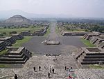 |
State of Mexico 19°41′30″N 98°50′30″W / 19.69167°N 98.84167°W |
Cultural: (i)(ii)(iii)(iv) |
3,381.71 (8,356.4) | 1987 | Teotihuacan, meaning 'where the gods were created,' is near Mexico City. It was built between the 1st and 7th centuries A.D. It has huge monuments like the Pyramids of the Sun and Moon. Teotihuacan was a very powerful cultural center in Mesoamerica. |
| Sian Ka'an |  |
Quintana Roo 19°23′0″N 87°47′30″W / 19.38333°N 87.79167°W |
Natural: (vii)(x) |
528,000 (1,300,000) | 1987 | Sian Ka'an means 'Origin of the Sky' in Mayan. This nature reserve is on the Yucatán peninsula. It has tropical forests, mangroves, and a large ocean area with a coral reef. Many animals live here, including over 300 bird species. |
| Historic Town of Guanajuato and Adjacent Mines | 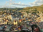 |
Guanajuato 21°1′1″N 101°15′20″W / 21.01694°N 101.25556°W |
Cultural: (ii)(iv) |
2,167.5 (5,356) | 1988 | Guanajuato was founded in the 1500s. It became a top silver mining center in the 1700s. You can see its mining past in its "underground streets." The town has beautiful Baroque and neoclassical buildings. |
| Pre-Hispanic City of Chichen-Itza |  |
Yucatán 20°40′0″N 88°36′0″W / 20.66667°N 88.60000°W |
Cultural: (i)(ii)(iii) |
— | 1988 | Chichen-Itza was a major Mayan center in Yucatán. Different groups influenced the city over 1,000 years. Its stone buildings show Mayan and Toltec ideas about the world. Famous structures include the Warriors’ Temple and El Castillo. |
| Historic Centre of Morelia | 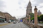 |
Michoacán 19°42′16″N 101°11′30″W / 19.70444°N 101.19167°W |
Cultural: (ii)(iv)(vi) |
390 (960) | 1991 | Morelia was built in the 1500s. Its city plan mixes Spanish and Mesoamerican ideas. Over 200 historic buildings are made of pink stone. They show a mix of medieval, Renaissance, Baroque, and neoclassical styles. |
| El Tajin, Pre-Hispanic City | 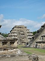 |
Papantla, Veracruz 20°26′47″N 97°22′38″W / 20.44639°N 97.37722°W |
Cultural: (i)(ii)(iv) |
176.5 (436) | 1992 | El Tajin was important from the 9th to 13th centuries. It became a major center after Teotihuacan fell. Its unique architecture has detailed carvings. The 'Pyramid of the Niches' is a masterpiece of ancient Mexican building. |
| Rock Paintings of the Sierra de San Francisco |  |
Baja California Sur 27°39′20″N 112°54′58″W / 27.65556°N 112.91611°W |
Cultural: (i)(iii) |
182,600 (451,000) | 1993 | These rock paintings were made by an ancient people from 100 B.C. to A.D. 1300. They are very well-preserved due to the dry climate. The paintings show humans and animals, revealing a complex culture. They are a unique artistic record. |
| Whale Sanctuary of El Vizcaino |  |
Baja California Sur 27°47′32″N 114°13′40″W / 27.79222°N 114.22778°W |
Natural: (x) |
369,631 (913,380) | 1993 | This sanctuary has special ecosystems. The lagoons are key breeding and wintering spots for grey whales and other marine animals. Four types of endangered sea turtles also live here. |
| Historic Centre of Zacatecas | 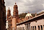 |
Zacatecas 22°46′0″N 102°33′20″W / 22.76667°N 102.55556°W |
Cultural: (ii)(iv) |
207.72 (513.3) | 1993 | Zacatecas was founded in 1546 after silver was found. It was very rich in the 16th and 17th centuries. The city is built on steep slopes with great views. Its cathedral has a mix of European and local art. |
| Earliest 16th-Century Monasteries on the Slopes of Popocatepetl | 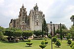 |
Morelos and Puebla 18°56′5″N 98°53′52″W / 18.93472°N 98.89778°W |
Cultural: (ii)(iv) |
— | 1994 | These 14 monasteries are near the Popocatepetl volcano. They are well-preserved examples of early 16th-century missionary architecture. They show a new style where open spaces were important. This style influenced buildings across Mexico. |
| Historic Monuments Zone of Querétaro | 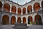 |
Querétaro 20°35′0″N 100°22′0″W / 20.58333°N 100.36667°W |
Cultural: (ii)(iv) |
— | 1996 | Querétaro is unique because it has both Spanish grid streets and winding Indian alleys. Different cultures lived together peacefully here. The city has many beautiful Baroque buildings from the 17th and 18th centuries. |
| Pre-Hispanic Town of Uxmal | 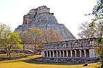 |
Yucatán 20°21′42″N 89°46′13″W / 20.36167°N 89.77028°W |
Cultural: (i)(ii)(iii) |
— | 1996 | Uxmal was a Mayan town founded around A.D. 700. Its buildings show knowledge of astronomy. The Pyramid of the Soothsayer is a main feature. The art and architecture here are considered high points of Mayan culture. |
| Hospicio Cabañas, Guadalajara | 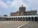 |
Jalisco 20°40′26″N 103°20′23″W / 20.67389°N 103.33972°W |
Cultural: (i)(ii)(iii)(iv) |
— | 1997 | The Hospicio Cabañas was built in the early 1800s to help orphans and the sick. It was unique for its time, designed to meet the needs of its residents. The chapel has amazing murals by José Clemente Orozco, a famous Mexican artist. |
| Historic Monuments Zone of Tlacotalpan | 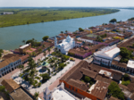 |
Veracruz 18°36′30″N 95°39′30″W / 18.60833°N 95.65833°W |
Cultural: (ii)(iv) |
75 (190) | 1998 | Tlacotalpan is a Spanish colonial river port from the mid-1500s. It has kept its original wide streets and colorful houses. Many old trees fill its public spaces and gardens. |
| Archaeological Zone of Paquimé, Casas Grandes |  |
Chihuahua 30°22′33″N 107°57′20″W / 30.37583°N 107.95556°W |
Cultural: (iii)(iv) |
146.72 (362.6) | 1998 | Paquimé was important for trade between cultures in the southwestern U.S. and Mesoamerica. It was at its peak in the 14th and 15th centuries. The ruins show a strong culture that fit its environment well. |
| Historic Fortified Town of Campeche |  |
Campeche 19°50′47″N 90°32′14″W / 19.84639°N 90.53722°W |
Cultural: (ii)(iv) |
181 (450) | 1999 | Campeche is a classic Spanish colonial port town. Its historic center still has its original walls and forts. These were built to protect the Caribbean port from sea attacks. |
| Archaeological Monuments Zone of Xochicalco | 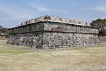 |
Morelos 18°48′37″N 99°16′30″W / 18.81028°N 99.27500°W |
Cultural: (iii)(iv) |
707.65 (1,748.6) | 1999 | Xochicalco is a very well-preserved ancient center. It was a strong political, religious, and trade hub from 650 to 900 AD. This was a time of change after big Mesoamerican states broke apart. |
| Franciscan Missions in the Sierra Gorda of Querétaro | 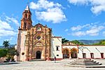 |
Querétaro de Arteaga 21°12′16″N 99°27′51″W / 21.20444°N 99.46417°W |
Cultural: (ii)(iii) |
103.7 (256) | 2003 | These five Franciscan missions were built in the mid-1700s. They helped spread Christianity in Mexico. Their church fronts are richly decorated, showing art created by both missionaries and local people. |
| Luis Barragán House and Studio |  |
Mexico City 19°25′6″N 99°11′54″W / 19.41833°N 99.19833°W |
Cultural: (i)(ii) |
0.1161 (0.287) | 2004 | This house and studio were built in 1948 by architect Luis Barragán. It's a great example of his work after World War II. Barragán mixed modern and traditional styles. His designs influenced gardens and landscapes. |
| Islands and Protected Areas of the Gulf of California† | 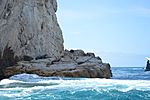 |
Baja California, Baja California Sur, Sonora, Sinaloa and Nayarit 27°37′36″N 112°32′45″W / 27.62667°N 112.54583°W |
Natural: (vii)(ix)(x) |
688,558 (1,701,460) | 2005 | This site includes islands and protected areas in the Gulf of California. It is home to many different kinds of plants and animals. |
| Agave Landscape and Ancient Industrial Facilities of Tequila | 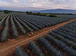 |
Jalisco 20°51′47″N 103°46′43″W / 20.86306°N 103.77861°W |
Cultural: (ii)(iv)(v)(vi) |
35,018.852 (86,533.47) | 2006 | This area is famous for its blue agave plants, used to make tequila. People have used agave here for at least 2,000 years. The landscape shows how the plant has been grown and processed for centuries. |
| Central University City Campus of the Universidad Nacional Autónoma de México (UNAM) |  |
Mexico City 19°19′56″N 99°11′17″W / 19.33222°N 99.18806°W |
Cultural: (i)(ii)(iv) |
176.5 (436) | 2007 | This university campus was built from 1949 to 1952. Over 60 architects and artists worked on it. It's a unique example of 20th-century modern design. It blends city planning, architecture, and art. |
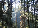
| Monarch Butterfly Biosphere Reserve |
 |
Michoacán and State of Mexico 19°36′23″N 100°14′30″W / 19.60639°N 100.24167°W |
Natural: (vii) |
13,551.552 (33,486.61) | 2008 | Every autumn, millions of monarch butterflies fly to this reserve. They cover the trees, making them look orange. In spring, they start an 8-month journey back to Canada. It's a mystery how they find their way. |
| Protective town of San Miguel de Allende and the Sanctuary of Jesús Nazareno de Atotonilco | 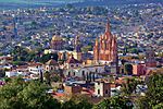 |
Guanajuato 20°54′52″N 100°44′47″W / 20.91444°N 100.74639°W |
Cultural: (ii)(iv) |
46.95 (116.0) | 2008 | San Miguel de Allende was built in the 1500s to protect a trade route. Many beautiful Baroque buildings were added in the 1700s. The nearby Sanctuary of Jesús Nazareno de Atotonilco is a great example of Baroque art. |
| Camino Real de Tierra Adentro |
|
Various states 22°36′29″N 102°22′45″W / 22.60806°N 102.37917°W |
Cultural: (ii)(iv) |
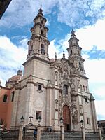
3,101.91 (7,665.0) | 2010 | This "Royal Inland Road" was also called the Silver Route. It was used for 300 years to transport silver. It also helped connect Spanish and Native American cultures. The site includes 55 important places along the route. |
| Prehistoric Caves of Yagul and Mitla in the Central Valley of Oaxaca | 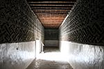
|
Oaxaca 16°57′3″N 96°25′16″W / 16.95083°N 96.42111°W |
Cultural: (iii) |
1,515.17 (3,744.1) | 2010 | This site has ancient caves and rock shelters. Some show how people changed from hunting to farming. Seeds found here are some of the oldest signs of domesticated plants in the Americas. |
| El Pinacate and Gran Desierto de Altar Biosphere Reserve | 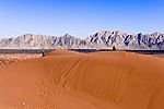 |
Sonora 32°0′0″N 113°55′0″W / 32.00000°N 113.91667°W |
Natural: (vii)(viii)(x) |
714,566 (1,765,730) | 2013 | This reserve has two parts: volcanic areas with lava flows and a desert with huge sand dunes. It's a dramatic landscape with unique plants and animals. Ten large, round craters add to its beauty. |
| Ancient Maya City and Protected Tropical Forests of Calakmul, Campeche | 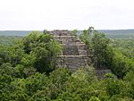 |
Campeche 18°3′11″N 89°44′14″W / 18.05306°N 89.73722°W |
Mixed: (i)(ii)(iii)(iv)(ix)(x) |
331,397 (818,900) | 2014 | This site is deep in the tropical forest of the Yucatán Peninsula. It includes the important Maya city of Calakmul. The well-preserved structures show what life was like in an ancient Maya capital. |
| Aqueduct of Padre Tembleque Hydraulic System | 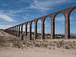 |
State of Mexico and Hidalgo 19°50′7″N 98°39′45″W / 19.83528°N 98.66250°W |
Cultural: (i)(ii)(iv) |
6,540 (16,200) | 2015 | This 16th-century aqueduct is on the Central Mexican Plateau. It's a system of canals, springs, and bridges. It has the tallest single-level arch ever built in an aqueduct. It mixes European and Mesoamerican building styles. |
| Revillagigedo Archipelago | 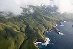 |
Colima 18°47′17″N 110°58′31″W / 18.78806°N 110.97528°W |
Natural: (vii)(ix)(x) |
636,685.375 (1,573,283.82) | 2016 | This group of four remote islands is in the Pacific Ocean. They are the tops of volcanoes rising from the sea. The islands are important homes for seabirds. The waters around them have many large ocean animals like manta rays and sharks. |
| Tehuacán-Cuicatlán Valley: originary habitat of Mesoamerica |  |
Puebla and Oaxaca 17°59′24″N 97°11′14″W / 17.99000°N 97.18722°W |
Mixed: (iv)(x) |
145,255.2 (358,933) | 2018 | This valley is an arid area with the most biodiversity in North America. It has the world's densest forests of tall cacti. Ancient remains show early farming and water systems. These systems helped agricultural settlements grow. |
Tentative List
Countries can suggest sites for the World Heritage list. These sites go on a "tentative list" first. As of 2023, Mexico has 23 properties on its tentative list.
| Site | Image | Location | Criteria | Area ha (acre) |
Year of submission | Description |
|---|---|---|---|---|---|---|
| Chapultepec Woods, Hill and Castle | Mexico City , 19°24′47″N 99°11′52″W / 19.413056°N 99.197778°W | Cultural (i)(iii)(iv)(vi) | 2001 | |||
| Church of Santa Prisca and its Surroundings |  |
Taxco, Guerrero,18°33′23″N 99°36′17″W / 18.556301°N 99.604588°W | Cultural (i)(iv)(vi) | 2001 | ||
| Diego Rivera and Frida Kahlo's Home-Study Museum | 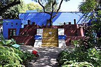 |
Mexico City , 19°21′18″N 99°09′46″W / 19.355031°N 99.162844°W | Cultural (i)(iv)(vi) | 2001 | ||
| Great City of Chicomostoc-La Quemada | 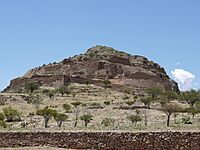 |
Zacatecas,22°27′23″N 102°49′16″W / 22.456389°N 102.821111°W | Cultural (i)(iv) | 2001 | ||
| Historic Town of Alamos | 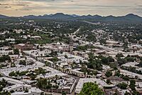 |
Sonora,27°01′39″N 108°56′24″W / 27.0275°N 108.94°W | Cultural (iv)(vi) | 2001 | ||
| Historic Town of San Sebastián del Oeste | 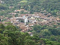 |
Jalisco,20°45′40″N 104°51′08″W / 20.76114°N 104.852273°W | Mixed (iii)(iv)(v)(ix)(x) | 2001 | ||
| Pre-Hispanic City of Cantona | 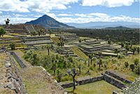 |
Puebla,19°33′08″N 97°29′09″W / 19.552222°N 97.485833°W | Cultural (iii)(iv) | 2001 | ||
| Banco Chinchorro Biosphere Reserve | 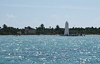 |
Quintana Roo,18°35′13″N 87°19′10″W / 18.586944°N 87.319444°W | Mixed (i)(ii)(iii)(iv)(vii)(viii)(ix)(x) | 2004 | ||
| Flora and Fauna Protection Area of Cuatro Ciénegas | 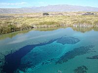 |
Coahuila, 26°59′10″N 102°03′59″W / 26.986111°N 102.066389°W | Natural | 2004 | ||
| Historical Town The Royal of the Eleven Thousand Virgins of Cosala in Sinaloa | 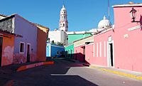 |
Sinaloa, 24°24′45″N 106°41′30″W / 24.4125°N 106.691667°W | Cultural (ii)(iv) | 2004 | ||
| Huichol Route through the sacred sites to Huiricuta (Tatehuari Huajuye) | 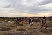 |
Jalisco, San Luis Potosí, Zacatecas, 22°09′00″N 104°10′00″W / 22.15°N 104.166667°W | Mixed | 2004 | ||
| Lacan-Tún – Usumacinta Region | 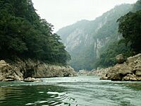 |
Chiapas, Tabasco,18°38′58″N 92°28′04″W / 18.6495°N 92.467778°W | Mixed | 2004 | ||
| Tecoaque | 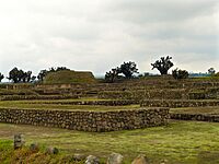 |
Tlaxcala,19°35′09″N 98°37′28″W / 19.5857°N 98.62458°W | Cultural (ii)(iii)(iv) | 2004 | ||
| Valle de los Cirios | 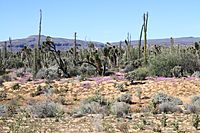 |
Baja California, 30°02′N 115°10′W / 30.03°N 115.17°W | Natural | 2004 | ||
| Cuetzalan and its Historical, Cultural and Natural Surrounding | 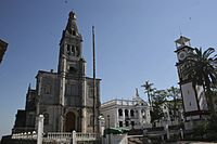 |
Puebla,20°02′00″N 97°31′00″W / 20.033333°N 97.516667°W | Mixed (iii)(iv)(v)(viii)(ix) | 2006 | ||
| Historical city of Izamal (Izamal, Mayan continuity in an Historical City) | 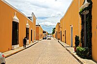 |
Yucatán, 20°55′53″N 89°01′04″W / 20.931389°N 89.017778°W | Cultural (iii)(iv)(vi) | 2008 | ||
| Los Petenes-Ría Celestún | 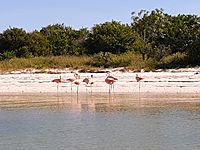 |
Campeche, Yucatán, 20°11′00″N 90°32′00″W / 20.1833333°N 90.533333°W | Natural (ix)(x) | 2008 | ||
| Las Pozas, Xilitla | 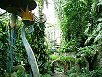 |
San Luis Potosí, 21°23′02″N 98°59′24″W / 21.384°N 98.99°W | Cultural (i)(iii) | 2009 | ||
| El Arco del Tiempo del Río La Venta | Chiapas, 16°56′04″N 93°44′03″W / 16.934344°N 93.734231°W | Mixed (iii)(vii)(viii)(x) | 2010 | |||
| Las Labradas, Sinaloa archaeological site | 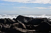 |
Sinaloa, 23°36′52″N 106°45′52″W / 23.6143465°N 106.7643885°W | Cultural (iii)(iv)(v) | 2012 | ||
| Ring of cenotes of Chicxulub Crater, Yucatan | 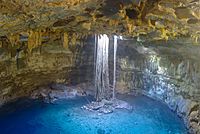 |
Yucatán, 20°20′00″N 88°30′00″W / 20.333333°N 88.5°W | Natural (vii) | 2012 | ||
| San Juan de Ulua, Site of Memory and Historical Resistances | 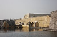 |
Veracruz, 19°12′33″N 96°07′53″W / 19.209167°N 96.131389°W | Cultural (ii) (vi) | 2022 | ||
| Patzcuaro, Site of Humanistic Memory and Cultural Confluence | 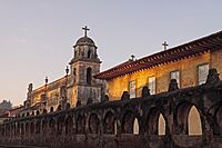 |
Michoacán, 19°30′59″N 101°36′35″W / 19.516389°N 101.609722°W | Cultural (ii)(iv)(vi) | 2023 |
Sometimes, countries work together to nominate a site that crosses their borders.
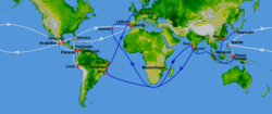
In 2014, Mexico and the Philippines started talking about nominating the historic Manila-Acapulco Galleon Trade Route. This route was used for trade for many years. Experts from both countries met to discuss how to show its importance. They looked at old maps, forts, food, and art related to the route. Spain has also supported this idea. They suggested that old records about the route should be added to another UNESCO list, the Memory of the World Register. In 2017, the Philippines opened a museum about the Manila-Acapulco Galleon in Metro Manila.
| Type (criteria) | Site | Location | Description | Image | Ref |
|---|---|---|---|---|---|
| Mixed | The Historic Manila‑Acapulco Galleon Trade Route | Philippines and Mexico |
See also
 In Spanish: Anexo:Patrimonio de la Humanidad en México para niños


