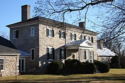
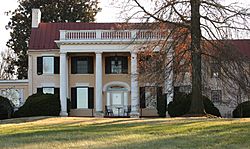
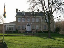
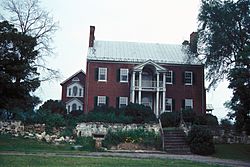
List of plantations in West Virginia facts for kids
Imagine huge farms with grand houses, where many people lived and worked. These were called plantations and they were found in what is now West Virginia. Most were in the eastern parts of the state, especially near the Kanawha and Ohio River valleys.
Starting in the late 1700s, important families, like the Washingtons (relatives of George Washington), built beautiful homes on their plantations. These homes were often in the Shenandoah Valley and along the South Branch Potomac River. Plantations were a big part of life and business in Virginia at the time, and this way of life spread into the western areas.
Contents
How Plantations Grew in West Virginia
After the French and Indian War, more people moved into the Shenandoah and South Branch Potomac valleys. This led to more farms and plantations being built. For example, George Washington's brother, Samuel Washington, built Harewood in 1774. His younger brother, Charles Washington, built Happy Retreat in 1780. Both are near Charles Town.
Other plantations grew in different areas. By the end of the 1700s, Harman Blennerhassett built a large house on Blennerhassett Island in the Ohio River. Also, Moses Shepherd built Shepherd Hall near Wheeling. Even though these large farms brought wealth to their owners, many parts of the Allegheny Mountains remained less populated. Most people there were small farmers who grew just enough food for themselves.
By 1860, the counties with the most enslaved people in West Virginia were Berkeley, Greenbrier, Hampshire, Hardy, Jefferson, Kanawha, and Monroe.
Plantations During the Civil War
The western and eastern parts of Virginia began to have different ideas about money and government. When Virginia decided to leave the Union in 1861, a new government for Virginia was set up in Wheeling. Even though West Virginia became a separate state in 1863, people's loyalties were still divided. This was especially true in areas where plantations were important to the economy.
However, many plantation owners in western Virginia had fewer enslaved people than those in eastern Virginia. Many of them did not support Virginia leaving the Union. For example, in Mason County, where small farms depended on enslaved labor, most people supported the Union.
During the American Civil War, many plantations in West Virginia were used by both Union and Confederate soldiers. They were good places for military leaders to meet or set up headquarters because they had plenty of space and supplies. Altona near Charles Town was used by Union generals Philip Sheridan and Ulysses S. Grant. Other plantations, like Mill Island, Willow Wall, and Elmwood, became hospitals for wounded soldiers.
The End of Plantations and Their Preservation
Slavery officially ended in West Virginia on February 3, 1865, when the West Virginia Legislature passed a law. This brought an end to the plantation system in the state.
Since the 1960s, many of West Virginia's old plantation houses have been added to the National Register of Historic Places. This is a special list by the U.S. government that recognizes important historical places. These places are considered worthy of being protected and preserved.
One special plantation house, Traveller's Rest near Kearneysville, is even a National Historic Landmark. This means it's important to the history of the entire country! Most of West Virginia's plantation houses are still privately owned today.
Key
| Color and symbol | Historic register listing |
|---|---|
| * | National Historic Landmark |
| † | National Register of Historic Places |
| ‡ | United States Historic District |
| Not listed on a register. |
List of Plantations
Here is a list of some of the plantations that operated in West Virginia. Many of these old homes are now protected as historic places.
| NRHP reference number | Name | Image | Date designated | Locality | County |
|---|---|---|---|---|---|
| 03000346† | Christian Allemong House |  |
May 2, 2003 | Summit Point 39°14′14″N 77°58′43″W / 39.23722°N 77.97861°W |
Jefferson |
| 95001322† | Altona |  |
November 24, 1995 | Charles Town 39°17′24″N 77°52′57″W / 39.29000°N 77.88250°W |
Jefferson |
| 80004024† | Aspen Hill | March 13, 1980 | Charles Town 39°19′18″N 77°51′44″W / 39.32167°N 77.86222°W |
Jefferson | |
| 07000241† | Barleywood | May 24, 2007 | Charles Town 39°18′54″N 77°54′42″W / 39.31500°N 77.91167°W |
Jefferson | |
| 73001914† | Beall-Air |  |
August 17, 1973 | Halltown 39°18′55″N 77°48′44″W / 39.31528°N 77.81222°W |
Jefferson |
| 84003588† | Belvedere | January 12, 1984 | Charles Town 39°17′5″N 77°50′43″W / 39.28472°N 77.84528°W |
Jefferson | |
| 87000486† | Beverley |  |
March 20, 1987 | Charles Town 39°15′3″N 77°53′34″W / 39.25083°N 77.89278°W |
Jefferson |
| 82004319† | Blakeley |  |
April 15, 1982 | Charles Town 39°15′36″N 77°54′22″W / 39.26000°N 77.90611°W |
Jefferson |
| 72001294‡ | Blennerhassett Island |  |
September 7, 1972 | Blennerhassett Island 39°16′19″N 81°37′29″W / 39.27194°N 81.62472°W |
Wood |
| 99001397‡ | Boidstones Place | November 22, 1999 | Shepherdstown 39°28′11″N 77°48′6″W / 39.46972°N 77.80167°W |
Jefferson | |
| 82004321† | The Bower |  |
April 15, 1982 | Leetown 39°21′54″N 77°57′27″W / 39.36500°N 77.95750°W |
Jefferson |
| The Burg |  |
Mechanicsburg 39°20′8.84″N 78°48′32.78″W / 39.3357889°N 78.8091056°W |
Hampshire | ||
| 74002004† | Cedar Lawn |  |
December 4, 1974 | Charles Town 39°17′6″N 77°55′22″W / 39.28500°N 77.92278°W |
Jefferson |
| 73001908† | Claymont Court |  |
July 25, 1973 | Charles Town 39°16′7″N 77°54′21″W / 39.26861°N 77.90583°W |
Jefferson |
| 73001917† | Cold Spring |  |
August 14, 1973 | Shepherdstown 39°23′48″N 77°49′5″W / 39.39667°N 77.81806°W |
Jefferson |
| 07000239† | Cool Spring |  |
March 27, 2007 | Charles Town 39°14′44″N 77°55′55″W / 39.24556°N 77.93194°W |
Jefferson |
| 94001292† | Cool Spring |  |
November 21, 1994 | Gerrardstown 39°19′53″N 78°06′23″W / 39.33139°N 78.10639°W |
Berkeley |
| 80004431† | Edgewood | December 10, 1980 | Bunker Hill 39°19′49″N 78°3′29″W / 39.33028°N 78.05806°W |
Berkeley | |
| 73001918† | Elmwood | 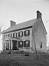 |
August 17, 1973 | Shepherdstown 39°23′50″N 77°48′50″W / 39.39722°N 77.81389°W |
Jefferson |
| 76001942† | Elmwood | May 13, 1976 | Union 37°35′44″N 80°32′23″W / 37.59556°N 80.53972°W |
Monroe | |
| 73001918‡ | Fort Hill |  |
January 9, 1997 | Burlington 39°18′37″N 78°56′8″W / 39.31028°N 78.93556°W |
Mineral |
| 78002791† | Green Bottom |  |
May 22, 1978 | Lesage 38°35′12″N 82°14′58″W / 38.58667°N 82.24944°W |
Cabell |
| 88002956‡ | Samuel Gwinn Plantation | March 8, 1989 | Lowell 37°38′55″N 80°43′35″W / 37.64861°N 80.72639°W |
Summers | |
| 73001912† | Happy Retreat |  |
July 2, 1973 | Charles Town 39°16′56″N 77°51′35″W / 39.28222°N 77.85972°W |
Jefferson |
| 73001909† | Harewood |  |
March 14, 1973 | Charles Town 39°18′9″N 77°55′11″W / 39.30250°N 77.91972°W |
Jefferson |
| 76001938† | Hazelfield |  |
December 12, 1976 | Shenandoah Junction 39°22′25″N 77°51′36″W / 39.37361°N 77.86000°W |
Jefferson |
| 86000811‡ | Henderson Hall |  |
April 17, 1986 | Williamstown 39°22′40″N 81°28′58″W / 39.37778°N 81.48278°W |
Wood |
| 11000556† | Hickory Grove | August 18, 2011 | Romney 39°19′29″N 78°46′50″W / 39.32472°N 78.78056°W |
Hampshire | |
| 85003521† | Hillside | December 12, 1985 | Charles Town 39°15′47″N 77°52′5″W / 39.26306°N 77.86806°W |
Jefferson | |
| 74002007† | Holly Grove |  |
August 28, 1974 | Charleston 38°20′11″N 81°36′56″W / 38.33639°N 81.61556°W |
Kanawha |
| 94000214† | Hopewell | March 25, 1994 | Millville 39°16′4″N 77°47′36″W / 39.26778°N 77.79333°W |
Jefferson | |
| 84003476† | Lick Run Plantation |  |
January 12, 1984 | Bedington 39°31′10″N 77°54′2″W / 39.51944°N 77.90056°W |
Berkeley |
| 84003623† | Longmeadow/The Holmwood |  |
August 23, 1984 | Southside 38°42′11″N 81°58′4″W / 38.70306°N 81.96778°W |
Mason |
| 91000452‡ | Lynnside Manor |  |
April 26, 1991 | Sweet Springs 37°32′42″N 80°41′14″W / 37.54500°N 80.68722°W |
Monroe |
| 80004408‡ | Maidstone Manor |  |
December 10, 1980 | Hedgesville 39°35′14″N 77°54′32″W / 39.58722°N 77.90889°W |
Berkeley |
| 04000311† | Maidstone-on-the-Potomac |  |
April 15, 2004 | Falling Waters 39°35′59″N 77°50′21″W / 39.59972°N 77.83917°W |
Berkeley |
| 75001886† | The Manor | December 18, 1975 | Petersburg 39°0′36″N 79°7′40″W / 39.01000°N 79.12778°W |
Grant | |
| 93000616† | Media | November 10, 1994 | Shenandoah Junction 39°19′46″N 77°50′32″W / 39.32944°N 77.84222°W |
Jefferson | |
| 73001904† | Mill Island | July 2, 1973 | Moorefield 39°2′22″N 78°57′38″W / 39.03944°N 78.96056°W |
Hardy | |
| 75001888† | Montescena | November 12, 1975 | Lewisburg 37°46′14″N 80°28′33″W / 37.77056°N 80.47583°W |
Greenbrier | |
| 73001916† | Prato Rio |  |
April 11, 1973 | Leetown 39°20′49″N 77°56′12″W / 39.34694°N 77.93667°W |
Jefferson |
| 73001911† | Richwood Hall |  |
June 19, 1973 | Charles Town 39°17′32″N 77°55′51″W / 39.29222°N 77.93083°W |
Jefferson |
| 01001328‡ | Ridgedale | November 29, 2001 | Springfield 39°24′49″N 78°44′19″W / 39.41361°N 78.73861°W |
Hampshire | |
| 82004320† | Rion Hall | September 20, 1982 | Halltown 39°18′4″N 77°49′2″W / 39.30111°N 77.81722°W |
Jefferson | |
| 89002316‡ | Rockland | February 5, 1990 | Shepherdstown 39°24′30″N 77°51′29″W / 39.40833°N 77.85806°W |
Jefferson | |
| 84003500† | Rural Hill |  |
January 12, 1984 | Hedgesville 39°30′55″N 78°0′5″W / 39.51528°N 78.00139°W |
Berkeley |
| 78002791† | Shepherd Hall |  |
December 18, 1970 | Wheeling 40°2′33″N 80°39′33″W / 40.04250°N 80.65917°W |
Ohio |
| 95000418† | Snow Hill | April 14, 1995 | Leetown 39°20′7″N 77°54′30″W / 39.33528°N 77.90833°W |
Jefferson | |
| 80004021† | Sycamore Dale | December 2, 1980 | Romney 39°20′15″N 78°46′24″W / 39.33750°N 78.77333°W |
Hampshire | |
| 72001288* | Traveller's Rest |  |
November 15, 1972 | Kearneysville 39°23′17.3″N 77°54′04.3″W / 39.388139°N 77.901194°W |
Jefferson |
| 12001050† | Valley View |  |
December 12, 2012 | Romney 39°21′23.4″N 78°45′35.25″W / 39.356500°N 78.7597917°W |
Hampshire |
| 84003594† | Vinton | January 12, 1984 | Charles Town 39°16′8″N 77°51′38″W / 39.26889°N 77.86056°W |
Jefferson | |
| 77001378† | Walnut Grove | August 22, 1977 | Union 37°36′9″N 80°32′29″W / 37.60250°N 80.54139°W |
Monroe | |
| Wappocomo |  |
Romney 39°21′37.24″N 78°45′10.21″W / 39.3603444°N 78.7528361°W |
Hampshire | ||
| 73001906† | Willow Wall |  |
July 2, 1973 | Old Fields 39°7′40″N 78°57′56″W / 39.12778°N 78.96556°W |
Hardy |
| 93001358† | Willowbrook | December 2, 1993 | Union 37°34′30″N 80°32′19″W / 37.57500°N 80.53861°W |
Monroe | |
| 00000254† | Woodlawn | March 24, 2000 | Kearneysville 39°20′21″N 77°53′07″W / 39.33917°N 77.88528°W |
Jefferson | |
| 06000654† | York Hill |  |
July 26, 2006 | Shenandoah Junction 39°22′36″N 77°50′47″W / 39.37667°N 77.84639°W |
Jefferson |
See also
- History of slavery in West Virginia
- List of plantations in the United States
- National Register of Historic Places listings in West Virginia


