
San Andreas Fault facts for kids
Quick facts for kids San Andreas Fault |
|
|---|---|

The fault (right)
and the Carrizo Plain (left) |
|

Arrows show relative motion of the North American Plate (southeastward) and the Pacific Plate (northwestward)
|
|
| Named by | Andrew Lawson |
| Year defined | 1895 |
| Country | United States (extends into Mexico) |
| State | California (portions in Baja California and Sonora) |
| Cities | San Francisco, San Bernardino, San Juan Bautista |
| Characteristics | |
| Segments | Calaveras, Hayward, Elsinore, Imperial, Laguna Salada, San Jacinto |
| Length | 1,200 km (750 mi) |
| Displacement | 20–35 mm (0.79–1.38 in)/yr |
| Tectonics | |
| Plate | North American & Pacific |
| Status | Active |
| Earthquakes | 1857, 1906 (Mw ≈7.8), 1957 (Mw 5.7), 1989 (Mw ≈6.9), 2004 |
| Type | Transform fault |
| Movement | Dextral |
| Age | Neogene-Holocene |
| Orogeny | Gorda-California-Nevada |

The San Andreas Fault is a very long crack in the Earth's crust in California. It stretches for about 1,200 kilometers (750 miles) through the state. This fault is the boundary where two huge pieces of the Earth's crust, called tectonic plates, meet. These are the Pacific Plate and the North American Plate. The plates slide past each other sideways, which is why it's called a transform fault.
The San Andreas Fault is not just one straight line. It's made up of three main sections, and each part acts a little differently. The speed at which the plates slide past each other along the fault is about 20 to 35 millimeters (0.8 to 1.4 inches) per year.
Professor Andrew Lawson from UC Berkeley first identified this fault in 1895. He found the northern part of it. The fault is often thought to be named after San Andreas Lake. However, Professor Lawson actually named it after the surrounding San Andreas Valley. After the big 1906 San Francisco earthquake, Lawson realized the fault went all the way to southern California. Later, in 1953, a geologist named Thomas Dibblee suggested that the plates could move hundreds of miles along the fault over a long time.
Scientists have even drilled deep into the fault near Parkfield to study it. This project, called the San Andreas Fault Observatory at Depth (SAFOD), helps them understand how the fault behaves.
Contents
Understanding the Fault
The San Andreas Fault is a major example of a transform plate boundary. This means that instead of crashing into each other or pulling apart, the two plates slide horizontally past each other. This movement causes a lot of stress to build up in the rocks, which is eventually released as earthquakes.
Sections of the Fault
The San Andreas Fault is divided into three main parts. Each part has its own unique features and different levels of earthquake risk.
Northern Section

The northern part of the fault starts near Hollister. It goes through the Santa Cruz Mountains, where the 1989 Loma Prieta earthquake happened. Then it runs up the San Francisco Peninsula. This is where Professor Lawson first found the fault. It goes offshore near Daly City, close to where the 1906 San Francisco earthquake started.
The fault then comes back onto land at Bolinas Lagoon in Marin County. It goes back underwater through Tomales Bay, which separates the Point Reyes Peninsula from the mainland. It returns to land at Fort Ross. In the San Francisco Bay Area, there are also several "sister faults" that run almost parallel to the San Andreas. These can also cause strong earthquakes. From Fort Ross, the northern section continues overland, forming a long valley where the Gualala River flows. It goes back offshore at Point Arena and stays underwater until it reaches Cape Mendocino. Here, it starts to bend west and ends at the Mendocino Triple Junction.
Central Section
The central part of the San Andreas Fault runs northwest from Parkfield to Hollister. While the southern section and the parts near Parkfield have earthquakes, most of the central section behaves differently. This part experiences something called aseismic creep. This means the fault slips slowly and continuously without causing big earthquakes.
Southern Section


The southern part of the fault is also known as the Mojave section. It begins near Bombay Beach, California. You can see rocks that have been pushed up by the fault near the Salton Sea. The fault then runs along the southern base of the San Bernardino Mountains. It crosses through the Cajon Pass and continues northwest along the northern base of the San Gabriel Mountains. These mountains were formed by the movement of the San Andreas Fault.
In Palmdale, you can easily see a part of the fault at a roadcut along the Antelope Valley Freeway. The fault continues northwest past Elizabeth Lake. As it passes Gorman, Tejon Pass, and Frazier Park, the fault starts to bend northward. This bend is called the "Big Bend." Scientists think this is where the fault gets stuck in Southern California. This part of the fault usually has a major earthquake every 140 to 160 years. Northwest of Frazier Park, the fault goes through the Carrizo Plain. This is a long, treeless area where you can clearly see the fault line.
The southern section, from Parkfield to the Salton Sea, is capable of a very strong earthquake, possibly a magnitude 8.1. This part of the fault is only about 56 kilometers (35 miles) northeast of Los Angeles. A large earthquake here could cause many deaths and billions of dollars in damage in cities like Los Angeles, San Bernardino, and Riverside.
How the Plates Move
The Pacific Plate, which is west of the fault, is moving northwest. The North American Plate, which is east of the fault, is moving southeast. The plates slide past each other at an average speed of about 33 to 37 millimeters (1.3 to 1.5 inches) per year across California.
The movement of the North American Plate towards the Pacific Plate creates pressure along the eastern side of the fault. This pressure has helped form the Coast Ranges. The northwest movement of the Pacific Plate also creates strong pressure, especially where the North American Plate forces the San Andreas to bend westward. This has led to the formation of the Transverse Ranges in Southern California and the Santa Cruz Mountains (where the 1989 Loma Prieta earthquake happened in 1989).
Scientists have found that only about 75% of the plate movement can be explained by the San Andreas Fault and its branches. The rest of the movement happens in an area east of the Sierra Nevada mountains called the Walker Lane. Scientists are still trying to understand why this happens. One idea is that the plate boundary might be slowly shifting eastward away from the San Andreas Fault towards the Walker Lane.
If the plate boundary doesn't change, scientists predict that the land west of the San Andreas Fault, including Los Angeles, will eventually slide past San Francisco. Over millions of years, it could continue northwest towards the Aleutian Trench.
How the Fault Formed

The San Andreas Fault started to form about 30 million years ago, during the mid-Cenozoic Era. At that time, a "spreading center" (where new crust is formed) between the Pacific Plate and the Farallon Plate began to reach the "subduction zone" (where one plate slides under another) off the coast of North America.
As the Pacific and North American Plates moved differently from the Farallon and North American Plates, the spreading ridge started to go under the North American Plate. This created a new type of movement and changes along the plate boundaries. These changes are what we mostly see along the San Andreas Fault today. This process also might have caused the Basin and Range region to form, the Baja California Peninsula to separate, and the Transverse Range to rotate.
The main southern part of the San Andreas Fault has only been around for about 5 million years. Before that, other fault systems were active in the area. Scientists believe that the modern San Andreas Fault will eventually transfer its movement to a fault within the Eastern California Shear Zone. This complex history, especially in the southern part, is mainly due to the "Big Bend" and differences in how the plates move compared to the direction of the fault.
Studying the San Andreas Fault
Early Discoveries

The fault was first identified in Northern California by geology professor Andrew Lawson in 1895. He named it after the Laguna de San Andreas, a small lake in a valley formed by the fault south of San Francisco. Eleven years later, after the 1906 San Francisco earthquake, Lawson discovered that the San Andreas Fault extended south into southern California. The idea that hundreds of miles of sideways movement could happen along the fault was first suggested in 1953 by geologists Mason Hill and Thomas Dibblee. This idea was considered very new at the time but has since been proven true by modern plate tectonics.
Current Research
Scientists have noticed that the San Andreas Fault near Parkfield in central California often has a magnitude 6.0 earthquake about every 22 years. After earthquakes in 1857, 1881, 1901, 1922, 1934, and 1966, scientists predicted another earthquake in Parkfield in 1993. It finally happened in 2004. Because of how often and predictably it moves, Parkfield is one of the most important places in the world for studying large earthquakes.
In 2004, work began north of Parkfield on the San Andreas Fault Observatory at Depth (SAFOD). The goal of SAFOD is to drill a hole almost 3 kilometers (1.9 miles) deep into the Earth's crust and right into the San Andreas Fault. Sensors will be placed inside to record earthquakes that happen nearby. This helps scientists understand the fault better.
The Next "Big One"
A study published in 2006 suggested that the San Andreas Fault has enough stress built up for an earthquake larger than magnitude 7.0. This study also found that the risk of a large earthquake might be growing faster than scientists thought. The risk is currently highest on the southern section of the fault, near Los Angeles. This is because the central and northern parts of the fault have had major earthquakes more recently (1857 and 1906), but the southern section hasn't had a similar break in at least 300 years.
According to this study, a major earthquake on the southern San Andreas Fault would cause huge damage to cities like Palm Springs and Indio. It would also be strongly felt and could cause significant damage throughout much of Southern California, including Los Angeles, Ventura, Orange, and San Diego counties. Older buildings and those built on loose ground or in areas with high water levels would be especially at risk.
A scientist named Yuri Fialko said, "All these data suggest that the fault is ready for the next big earthquake but exactly when the triggering will happen and when the earthquake will occur we cannot tell. It could be tomorrow or it could be 10 years or more from now."
Even though that study was published years ago, there hasn't been a major earthquake in the Los Angeles area. The U.S. Geological Survey (USGS) has made different predictions about future earthquakes. Predicting major earthquakes precisely is still very difficult.
The latest forecast from the USGS, called UCERF3 (Uniform California Earthquake Rupture Forecast 3), was released in 2013. It estimated that an earthquake of magnitude 6.7 or greater happens about once every 6.7 years across California. The same report also estimated there is a 7% chance that an earthquake of magnitude 8.0 or greater will happen somewhere along the San Andreas Fault in the next 30 years. A different USGS study in 2008 looked at what would happen if a major earthquake hit southern California. That study predicted that a magnitude 7.8 earthquake along the southern San Andreas Fault could cause about 1,800 deaths and $213 billion in damage.
Connection to Cascadia
A 2008 study found a link between past earthquakes on the northern San Andreas Fault and the southern part of the Cascadia subduction zone. This zone stretches from Vancouver Island to northern California. Scientists believe that earthquakes in the Cascadia subduction zone might have triggered most of the big earthquakes on the northern San Andreas over the last 3,000 years. The evidence also shows that the breaks in the fault usually moved from north to south in these linked events. However, the 1906 San Francisco earthquake seems to be an exception. In that case, the plate movement was mostly from south to north, and there wasn't a major earthquake in the Cascadia zone before it.
Major Earthquakes
The San Andreas Fault has been responsible for several important earthquakes in recorded history:
- 1857 Fort Tejon earthquake: This earthquake ruptured about 350 kilometers (220 miles) in central and southern California. Although it's known as the Fort Tejon earthquake, its starting point was likely further north, just south of Parkfield. Only two deaths were reported. Its magnitude was 7.9.
- 1906 San Francisco earthquake: About 430 kilometers (270 miles) of the fault ruptured in Northern California. The earthquake started near San Francisco. At least 3,000 people died from the earthquake and the fires that followed. The magnitude was estimated to be 7.8.
- 1957 San Francisco earthquake: This was a magnitude 5.7 earthquake. It started on the San Andreas fault in the ocean west of San Francisco and Daly City.
- 1989 Loma Prieta earthquake: About 40 kilometers (25 miles) of the fault ruptured near Santa Cruz, California. The break did not reach the surface. This earthquake caused 63 deaths and moderate damage in some areas of the San Francisco Bay Area. Its magnitude was about 6.9. This quake happened on October 17, 1989, around 5:04 PM PDT.
- 2004 Parkfield earthquake: On September 28, 2004, at 10:15 AM PDT, a magnitude 6.0 earthquake struck the Parkfield area. People felt it across the state, including in the San Francisco Bay Area.
Images for kids
-
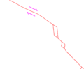
Southern San Andreas Fault. The red lines are simplified faults. Right-lateral direction of motion of the transform fault is shown (pink arrows). The red rhombs are pull-apart basins; the northern one is the site of the Niland geothermal field, the southern the Cerro Prieto geothermal field.

See also
 In Spanish: Falla de San Andrés para niños
