York County, South Carolina facts for kids
Quick facts for kids
York County
|
||
|---|---|---|
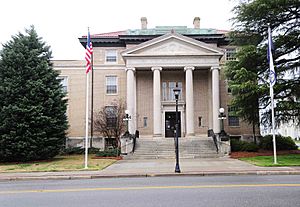
York County Courthouse
|
||
|
||
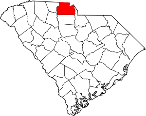
Location within the U.S. state of South Carolina
|
||
 South Carolina's location within the U.S. |
||
| Country | ||
| State | ||
| Founded | 1785 | |
| Named for | James II of England | |
| Seat | York | |
| Largest community | Rock Hill | |
| Area | ||
| • Total | 696.09 sq mi (1,802.9 km2) | |
| • Land | 681.03 sq mi (1,763.9 km2) | |
| • Water | 15.06 sq mi (39.0 km2) 2.16% | |
| Population
(2020)
|
||
| • Total | 282,090 | |
| • Estimate
(2023)
|
298,320 |
|
| • Density | 405.249/sq mi (156.468/km2) | |
| Time zone | UTC−5 (Eastern) | |
| • Summer (DST) | UTC−4 (EDT) | |
| Congressional district | 5th | |
York County is a county located in the northern part of South Carolina, right on the border with North Carolina. In 2020, about 282,090 people lived here, making it the seventh-most populated county in the state. The main city and county seat is York, but the largest community is Rock Hill. Interstate 77 is a major highway that runs through the county. York County is also part of the larger Charlotte area, which includes cities like Charlotte, Concord, and Gastonia.
Contents
History of York County
Early People and European Settlers
Long ago, around the 1540s, the Catawba tribe lived in this area. There were nearly 6,000 Catawba people when the first Europeans arrived. They were mostly farmers. The explorer Hernando de Soto passed through in the 1540s looking for gold. Later, another explorer, Juan Pardo, saw the Catawba tribe near where Fort Mill is today, close to the Catawba River.
The Province of South Carolina was started in 1670. Twelve years later, it was split into three counties. Craven County covered the northern part of the colony, including the southern half of what is now York County. The northern part of York County was considered part of North Carolina at that time.
The first European settlers in the Carolina Piedmont were mostly Scots-Irish people who followed the Presbyterian faith. They moved south from Pennsylvania because land was becoming too expensive. They started arriving in the area west of the Catawba River in the 1740s and settled in what is now York County in the 1750s.
North Carolina's Influence
Before the exact border between North and South Carolina was set, the northern part of York County was part of Bladen County, North Carolina. In 1750, it became part of the new Anson County, North Carolina. Later, in 1762, Mecklenburg County, North Carolina was formed from Anson, and it included northern York County. By 1767, this area was part of Tryon County, North Carolina. This continued until 1772, when the border between the Carolinas was finally decided.
The New Acquisition and County Formation
After 1772, much of this area was called the New Acquisition. In 1785, York County became one of the first counties in the new state of South Carolina. Its borders stayed the same until 1897, when a small part of the northwestern corner was given to the new Cherokee County, South Carolina.
By 1780, the Carolina Upcountry had over 250,000 people. Most were Scots-Irish Presbyterians, but there were also many other Protestants from Great Britain. These Scots-Irish families often settled in groups, like small communities, around their Presbyterian churches. In York County, the oldest churches are Bethel, Bethesda, Beersheba, and Bullock's Creek, often called the "Four B" churches.
Early settlers faced challenges from Native American tribes like the Cherokee, Shawnee, and Creek. They also felt ignored by English officials in Charleston. Local groups called "militia" helped keep order. They patrolled for Native American issues, dealt with runaway enslaved people, and controlled outlaw groups. Every able-bodied man on the frontier joined these militia units.
Revolutionary War in York County
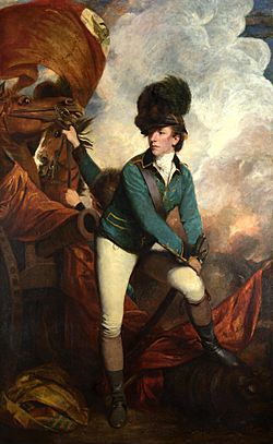
At first, people in the Upcountry didn't want to pick sides in the American Revolutionary War. They just wanted to be left alone. But in 1780, things changed when British forces invaded the area three times. The first invasion was led by Banastre Tarleton and his "Green Dragoons." Then, Lord Cornwallis led two more invasions.
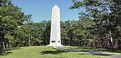
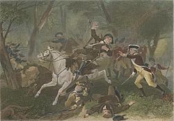
After the British took Charleston, most of South Carolina gave up. However, after the Waxhaw Massacre in nearby Lancaster County in May 1780, people in the New Acquisition decided to fight back. Leaders like William "Billy" Hill, William Bratton, and Samuel Watson helped organize the resistance. Important battles like Huck's Defeat and the Battle of Kings Mountain were fought in the New Acquisition. These defeats forced Cornwallis to move north, which eventually led to his surrender at Yorktown.
Growth of York County and Its Seat
After the British were defeated, people in the Upcountry had more say in how their region was run. The area grew very quickly after the war. In the first U.S. census in 1790, York County had 6,604 people. About 923 of them were enslaved. Less than 15% of the county's population was enslaved in 1790, while the state average was 30%.
A county seat was planned in 1786 at Fergus' Cross Roads, where several roads met near the center of the county. The new town was first called the village of York, or more often, York Court House. In 1841, it became the town of "Yorkville." In 1823, it had 441 people. By 1860, the population had grown to over 1,300. Before the Civil War, many wealthy planters from the Lowcountry would visit Yorkville as a summer resort to escape the hot, humid climate. During the Civil War, many people from the Lowcountry came to Yorkville to find safety from Union soldiers.
Farming and the Civil War Era
When the cotton gin was invented in the 1790s, cotton became very important to the county's economy. This also led to a big increase in the number of enslaved people. In 1800, 25% of white families in the Upcountry owned enslaved people. By 1820, this number was almost 40%. The number of enslaved people in York County grew a lot between 1800 and 1860. Most of them worked on small and medium-sized farms, not huge plantations.
In 1800, white people made up 82.10% of York County's population. By 1860, this dropped to 62.50%. In 1860, about 70% of farms had fewer than 10 enslaved people, and less than 3% had 50 or more.
By 1850, York District had 15,000 residents, and over 40% of them were enslaved. Just before the Civil War, the county's population was about 21,500, with almost half being enslaved people. York County relied heavily on farming. In 1850, 93% of workers were involved in growing crops.
In 1825, York County only had three post offices. By 1852, it had 27. The county's first newspaper, The Yorkville Pioneer, started in 1823. The Yorkville Enquirer began in 1855 and is still published today.
The Kings Mountain Railroad Company started building a railway line in 1848, connecting Yorkville to the Charlotte and South Carolina Railway. This line was finished in 1852. Rock Hill, which was on this railway route, quickly grew into a transportation hub in eastern York County. It had 100 residents in 1860.
Many schools were operating in the county before the Civil War. The most famous was the Kings Mountain Military Academy in Yorkville, started in 1854.
When the Civil War began, York District was one of the most populated areas in Upstate South Carolina. In 1860, there were 4,379 white men in York County. Fourteen infantry companies were formed in York County after the war started. Of the 4,379 white men who joined, 805 were killed, and hundreds more were wounded. York District had the highest death rate of any county in South Carolina. Only one small battle was fought in York District, at the Catawba Bridge in 1865.
Early Industry and 20th Century Changes
After the Civil War, during the Reconstruction period, many large landowners in York County had to sell parts of their land to smaller farmers. The average farm size became much smaller, and the number of small farms increased. Farming in York County in the late 1800s often involved small farms that didn't use different types of crops, which led to farming problems in the 1890s, 1920s, and 1930s.
Railroad building continued after the war. In 1880, the Rock Hill Cotton Factory opened. It was the first cotton factory in South Carolina to use steam power, starting a new time of industrial growth. The Rock Hill Buggy Company, started by John Gary Anderson, later became the Anderson Motor Company, the first car factory in the South. At the same time, Rock Hill's population grew from 809 to over 5,500 between 1880 and 1895.
Cotton farming was still very important in York County in the early 1900s, and the textile industry kept growing. Rock Hill became the center of this industry, with mills opening all over the county. South Carolina had its biggest cotton harvest in 1921. After that, cotton production slowly went down because of problems like boll weevil insects and soil erosion. New government programs in the 1930s encouraged farmers to grow different crops, and cotton became less important to the county's economy.
In 1904, the Catawba Dam and Power Plant were finished, creating Lake Wylie. The Catawba Power Company was started in 1899. When the dam and power plant were completed, they were a very important engineering achievement in the southeastern United States. This project eventually led to the creation of Duke Power Company. Many more dams and hydroelectric facilities were built on the Catawba River in both North and South Carolina. The Catawba Power Plant helped bring industry to the Catawba Valley. By 1911, it powered over a million textile spindles.
Geography and Climate of York County
York County is in north-central South Carolina, along the North Carolina border. The Broad River is on its west side, and the Catawba River is on its east side. All of York County is in the Piedmont region. Even though many rural areas are heavily wooded, York County is part of the larger Charlotte region. It includes Rock Hill, the largest city, and smaller cities like Tega Cay and York. There are also smaller towns like Clover, Fort Mill, Hickory Grove, McConnells, Sharon, and Lake Wylie.
Henry's Knob is a mountain in the county. It used to be a large open-pit mining site for kyanite. It stands at about 1,120 feet (341 meters) above sea level, near the North Carolina border and the town of Clover.
Mountains in York County
York County's Climate
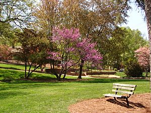
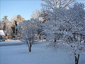
York County has a humid subtropical climate. This means it has hot, humid summers and cool, dry winters. The amount of rain doesn't change much between seasons. July is the hottest month, with an average high temperature of 91°F (33°C) and an average low of 71°F (22°C). January is the coldest month, with an average high of 53°F (12°C) and an average low of 33°F (1°C). The hottest temperature ever recorded in Rock Hill was 106°F (42°C) on August 21, 1985. The coldest was -6°F (-21°C) on January 21, 1983.
Neighboring Counties
York County borders counties in both North and South Carolina:
- Gaston County, North Carolina - north
- Mecklenburg County, North Carolina - northeast
- Lancaster County - east
- Chester County - south
- Union County - southwest
- Cherokee County - west
- Cleveland County, North Carolina - northwest
Major Roads and Highways
Protected Natural Areas
- Kings Mountain National Military Park (partially in York County)
- Kings Mountain State Park
- Historic Brattonsville
People and Population (Demographics)
| Historical population | |||
|---|---|---|---|
| Census | Pop. | %± | |
| 1790 | 6,604 | — | |
| 1800 | 10,250 | 55.2% | |
| 1810 | 10,032 | −2.1% | |
| 1820 | 14,936 | 48.9% | |
| 1830 | 17,790 | 19.1% | |
| 1840 | 18,383 | 3.3% | |
| 1850 | 19,433 | 5.7% | |
| 1860 | 21,502 | 10.6% | |
| 1870 | 24,286 | 12.9% | |
| 1880 | 30,713 | 26.5% | |
| 1890 | 38,831 | 26.4% | |
| 1900 | 41,684 | 7.3% | |
| 1910 | 47,718 | 14.5% | |
| 1920 | 50,536 | 5.9% | |
| 1930 | 53,418 | 5.7% | |
| 1940 | 58,663 | 9.8% | |
| 1950 | 71,596 | 22.0% | |
| 1960 | 78,760 | 10.0% | |
| 1970 | 85,216 | 8.2% | |
| 1980 | 106,720 | 25.2% | |
| 1990 | 131,497 | 23.2% | |
| 2000 | 164,614 | 25.2% | |
| 2010 | 226,073 | 37.3% | |
| 2020 | 282,090 | 24.8% | |
| 2023 (est.) | 298,320 | 32.0% | |
| U.S. Decennial Census 1790–1960 1900–1990 1990–2000 2010 2020 |
|||
Population in 2020
| Race | Number | Percentage |
|---|---|---|
| White (not Hispanic) | 188,015 | 66.65% |
| Black or African American (not Hispanic) | 51,298 | 18.18% |
| Native American | 1,892 | 0.67% |
| Asian | 8,745 | 3.1% |
| Pacific Islander | 111 | 0.04% |
| Other/Mixed | 13,091 | 4.64% |
| Hispanic or Latino | 18,938 | 6.71% |
In 2020, there were 282,090 people living in York County. There were 108,400 households and 74,041 families.
Population in 2010
In 2010, York County had 226,073 people. The population density was about 332 people per square mile. The racial makeup was mostly white (74.8%) and black or African American (19.0%). About 4.5% of the population was Hispanic or Latino.
The average household size was 2.59 people, and the average family size was 3.06 people. The average age in the county was 37.2 years old. The median income for a household was $51,925, and for a family, it was $65,188. About 12.5% of the population lived below the poverty line.
Economy of York County
In 2022, the total value of goods and services produced in York County (called GDP) was about $16.7 billion.
As of April 2024, some of the biggest employers in York County include 7-Eleven, Bank of America, Continental AG, Food Lion, Meritor, Schaeffler Group, Walmart, and Wells Fargo.
| Industry Type | Number of Jobs | Job Percentage (%) | Average Yearly Wage ($) |
|---|---|---|---|
| Hotels and Restaurants | 11,769 | 11.3 | 21,996 |
| Office Support and Waste Management | 5,831 | 5.6 | 45,188 |
| Farming, Forestry, and Fishing | 391 | 0.4 | 36,244 |
| Arts, Entertainment, and Fun | 3,009 | 2.9 | 22,568 |
| Construction | 4,893 | 4.7 | 66,092 |
| Education Services | 9,303 | 8.9 | 52,832 |
| Finance and Insurance | 3,788 | 3.6 | 91,416 |
| Health Care and Social Help | 11,376 | 10.9 | 51,948 |
| Information Technology | 1,948 | 1.9 | 92,092 |
| Company Management | 2,562 | 2.5 | 106,704 |
| Manufacturing | 10,968 | 10.5 | 67,080 |
| Mining and Quarrying | 42 | 0.0 | 81,744 |
| Other Services (not government) | 3,005 | 2.9 | 44,252 |
| Professional and Technical Services | 4,725 | 4.5 | 83,304 |
| Public Administration (Government) | 4,024 | 3.9 | 54,964 |
| Real Estate and Rentals | 1,936 | 1.9 | 117,000 |
| Retail Stores | 13,154 | 12.6 | 37,492 |
| Transportation and Storage | 5,348 | 5.1 | 50,908 |
| Utilities (Power, Water) | 1,199 | 1.2 | 101,972 |
| Wholesale Trade | 4,983 | 4.8 | 100,152 |
| Total Jobs | 104,254 | 100.0% | 56,684 |
Education in York County
York County has four public school districts. District One serves the central and western parts of the county, including the town of York. District Two serves northern York County and the town of Clover. District Three serves the City of Rock Hill and southern York County. District Four serves eastern York County and the town of Fort Mill. York County is also home to three colleges in Rock Hill: York Technical College, Clinton College, and Winthrop University.
Communities in York County
Cities
Towns
- Clover
- Fort Mill
- Hickory Grove
- McConnells
- Sharon
- Smyrna (partly in Cherokee County)
Census-Designated Places (CDPs)
These are areas that are like towns but are not officially incorporated as cities or towns.
- Catawba
- India Hook
- Lake Wylie
- Lesslie
- Newport
- Riverview
Other Unincorporated Communities
These are smaller communities that are not officially part of a city or town.
- Holy Islamville
- Hopewell
- Ogden
- Red River
- Smith
- Tirzah
See also
 In Spanish: Condado de York (Carolina del Sur) para niños
 | Jackie Robinson |
 | Jack Johnson |
 | Althea Gibson |
 | Arthur Ashe |
 | Muhammad Ali |


