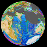
Indian subcontinent facts for kids
|
|
|
| Area | 4,440,000 km2 (1,710,000 sq mi) |
|---|---|
| Population | c. 1.8 billion |
| Demonym | South Asian Desi (colloquial) |
| Countries | |
| Dependencies |
Disputed (1)
|
| Languages | |
| Time zones |
List:
Bangladesh Standard Time (BST)
Bhutan Time (BTT) Indian Standard Time (IST) Maldives Time (MVT) Nepal Standard Time (NPT) Pakistan Standard Time (PKT) Sri Lanka Standard Time (SLST) |
| Largest cities | |
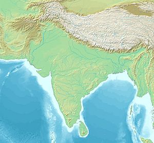
The Indian subcontinent is a large area of land in Asia that's mostly surrounded by the Indian Ocean. It includes countries like India, Pakistan, Bangladesh, Nepal, Bhutan, Sri Lanka, and the Maldives. Sometimes, Myanmar is also included.
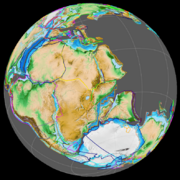
This huge landmass was once part of a supercontinent called Gondwana. A supercontinent is a very large landmass that includes many continents.
Even though "Indian subcontinent" and "South Asia" are often used to mean the same thing, the term "South Asia" sometimes includes Afghanistan. Afghanistan is generally not seen as part of the Indian subcontinent.
What's in a Name?
For a long time, the area around the Indus River was simply called "India." Historians used this name for the whole region until the time of the British Raj. The British Raj was when the British ruled over a large part of India. During this period, "India" started to mean a specific political area that later became the country we know today.
The word "subcontinent" means a part of a continent that has its own special geography, politics, or culture. It also means a big landmass that is a bit smaller than a full continent. People started using "Indian subcontinent" in the early 1900s. Back then, most of this land was either part of the British Empire or connected to it. It was a useful way to talk about the region that included both British-ruled areas and smaller states.
The term "Indian subcontinent" is often used in countries that were once part of the British Empire. In Europe and North America, people more commonly use the term "South Asia."
How the Land Formed
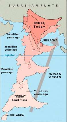
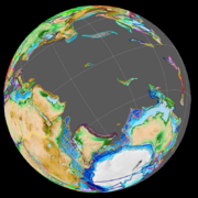
The Indian subcontinent was once part of Gondwana. This huge supercontinent formed a very long time ago. Gondwana started to break apart during the Mesozoic Era. The land that would become India separated from Antarctica about 130 to 120 million years ago. It then split from Madagascar around 90 million years ago.
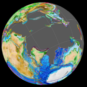
This piece of land, called Insular India, then slowly drifted northeast. It crashed into the Eurasian Plate about 55 million years ago. This massive collision formed the Indian subcontinent as we know it today. The area where the Eurasian and Indian plates meet is still very active. This is why there are often big earthquakes in the region.
Geographically, the Indian subcontinent is a peninsula in South Asia. It is bordered by the Himalayas in the north, the Hindu Kush mountains in the west, and the Arakanese mountains in the east. It stretches south into the Indian Ocean. The Arabian Sea is to its southwest, and the Bay of Bengal is to its southeast. Most of this region sits on the Indian Plate. It is separated from the rest of Asia by these large mountain ranges.
The Laccadive Islands, Maldives, and Chagos Archipelago are groups of coral atolls and small islands. They are also on the Indian Plate. These islands formed as the Indian Plate moved north over a hot spot in the Earth's crust.
Land and Water Features
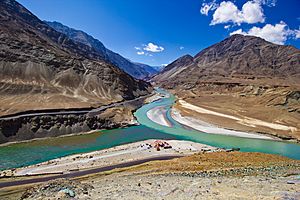
This natural landmass in Southern Asia is the dry part of the Indian Plate. It has been quite separate from the rest of Eurasia. The Himalayas in the east and west, the Karakoram mountains, and the Hindu Kush mountains form its northern edge.
To the west, it is bordered by parts of the Hindu Kush, Sulaiman Mountains, and other mountain ranges. The Indian Ocean, Bay of Bengal, and Arabian Sea form the southern, southeastern, and southwestern borders.
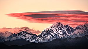
Because it's so hard to travel through the Himalayas, people in the Indian subcontinent mostly connected with others through valleys. These valleys are in Afghanistan to the northwest and Manipur to the east. People also traveled by sea. Although more difficult, historical interactions also happened through paths found by the Tibetans.
These routes helped Buddhism spread from the subcontinent to other parts of Asia. Islam also came to the subcontinent in two ways: by land through Afghanistan and by sea to the Indian coast through the Arabian Sea.
Related pages
See also
 In Spanish: Subcontinente indio para niños
 | Misty Copeland |
 | Raven Wilkinson |
 | Debra Austin |
 | Aesha Ash |


