Northeastern United States facts for kids
Quick facts for kids
Northeastern United States
American Northeast, the Northeast
|
|
|---|---|
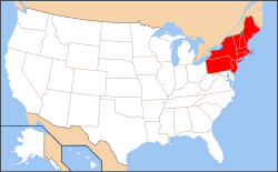
A map of the Northeastern United States as defined by the Census Bureau
|
|
| Subregions | |
| Country | United States |
| States | |
| Area | |
| • Region | 181,324 sq mi (469,630 km2) |
| • Land | 162,257 sq mi (420,240 km2) |
| • Water | 19,067 sq mi (49,380 km2) 9.51% |
| • Urban | 74,800 sq mi (194,000 km2) |
| Highest elevation
(Mount Washington, New Hampshire)
|
6,288 ft (1,916.66 m) |
| Lowest elevation
(Atlantic Ocean)
|
0 ft (0 m) |
| Population
(2020)
|
|
| • Region | 57,609,148 |
| • Density | 317.7139/sq mi (122.6700/km2) |
| Demonym(s) | Northeasterner, Yankee |
| GDP | |
| • Region | $5.1 trillion (2022) |
| • Per capita | $88,600 (2022) |
| Time zone | UTC-5 (EST) |
| • Summer (DST) | UTC-4 (EDT) |
The Northeastern United States is one of the four main regions of the United States. It's also called the Northeast or the American Northeast. This area is on the Atlantic coast of North America. It shares borders with Canada to the north, the Southern United States to the south, the Midwestern United States to the west, and the Atlantic Ocean to the east.
The United States Census Bureau defines the Northeast region for collecting statistics. It includes six New England states: Connecticut, Maine, Massachusetts, New Hampshire, Rhode Island, and Vermont. It also includes three other northeastern states: New Jersey, New York, and Pennsylvania. Sometimes, people include Delaware, Maryland, and Washington, D.C. in this region too.
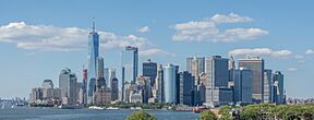
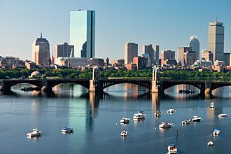
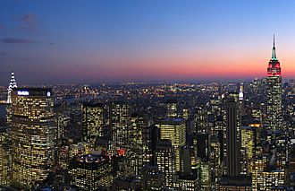
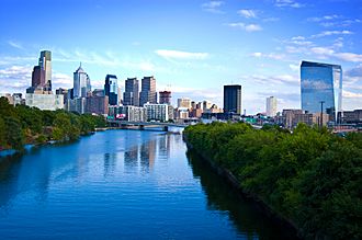
The Northeast is home to the Northeast megalopolis, a huge urban area with many large cities. These include Boston, New York City, and Philadelphia. About 67% of the region's 57.6 million people live in this megalopolis. The region's economy was worth $5.1 trillion in 2022. It has some of the most developed states in the U.S. It is also the most crowded region, with about 320 people per square mile. The Northeast is the smallest U.S. region by total area, covering about 181,324 square miles.
Contents
History of the Northeast
Early People of the Northeastern Woodlands
Long before Europeans arrived, many different groups of Native Americans lived in the Northeast. This area, known as the "Northeastern Woodlands," also stretched into parts of Canada and other eastern U.S. regions.
Some of the well-known tribes were the Iroquois nations and many Algonquian peoples. These groups often lived in villages. Today, 18 federally recognized tribes still live in the Northeast.
Colonial History and Early Settlements
All the states in the Northeast were part of the original Thirteen Colonies of Great Britain. However, some states like Maine, Vermont, and Delaware were part of other colonies at first. The two main parts of the Northeast, New England and the Mid-Atlantic, have different histories.
New England's Beginnings
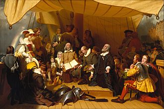
The first Europeans to settle in New England were Pilgrims from England. They arrived in what is now Massachusetts in 1620 on the ship Mayflower. They founded Plymouth Colony so they could practice their religion freely.
Ten years later, a larger group called Puritans settled near Boston. They formed the Massachusetts Bay Colony. In 1636, colonists started Connecticut Colony and Providence Plantations. Providence was founded by Roger Williams, who believed in religious freedom for everyone. This made it the first colony to guarantee this right.
New England was important for early American education. In the 17th century, towns opened grammar schools, which were like early high schools. The first public school in the English colonies, the Boston Latin School, was founded in 1635. In 1636, Harvard College was started, becoming the oldest university in the United States.
Mid-Atlantic's Development
The first European explorer to map the Atlantic coast of the Northeast was Giovanni da Verrazzano in 1524. Later, in 1609, Henry Hudson explored the area around present-day New York. He claimed it for the Netherlands, and it became known as New Netherland. In 1625, New Amsterdam (now New York City) became its capital.
The Dutch settlements along the Hudson River and the Swedish settlements along the Delaware River separated the English colonies. But in 1664, England took control of New Netherland. It then became the colonies of New York and New Jersey.
In 1681, William Penn founded Pennsylvania. He wanted a place where Quakers and all other citizens could have religious freedom. Pennsylvania also gained access to the sea through what became Delaware.
Geography of the Northeast
The U.S. Census Bureau defines the Northeast as nine states: Maine, New York, New Jersey, Vermont, Massachusetts, Rhode Island, Connecticut, New Hampshire, and Pennsylvania. This region is often split into two parts: New England (the six states east of New York) and the Mid-Atlantic states (New York, New Jersey, and Pennsylvania). This definition has been used since 1880.
Many other groups also use this definition. However, some include Delaware, Maryland, and Washington, D.C. in the Northeast. The narrowest definitions only include the New England states.
| City | City population | Metro population | U.S. Rank |
|---|---|---|---|
| New York | 8,804,190 | 20,140,470 | 1 |
| Philadelphia | 1,603,797 | 6,245,051 | 6 |
| Boston | 675,647 | 4,941,632 | 24 |
| Newark | 311,549 | See New York | 66 |
| Pittsburgh | 302,971 | 2,370,930 | 68 |
| Jersey City | 292,449 | See New York | 75 |
| Buffalo | 278,349 | 1,125,637 | 78 |
Northeast Environment and Nature
Land and Mountains
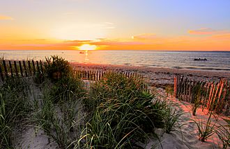
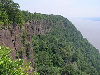
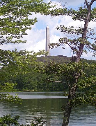
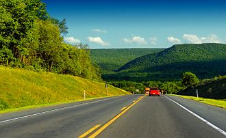
Most of the Northeastern United States is part of the Appalachian Highlands. Some areas are also part of the Atlantic coastal plain, which is generally low and flat. These flat areas include Cape Cod in Massachusetts and Long Island in New York.
The highlands, like the Appalachian Mountains, are mostly covered in forests. They have rolling hills and some peaks over 6,000 feet (1,800 meters) high. The highest point in the Northeast is Mount Washington in New Hampshire, which is 6,288 feet (1,917 meters) tall.
Forests and Urban Areas
As of 2012, about 60% of the Northeast was covered by forests. This is twice the national average. About 12% of the land is urbanized, meaning it's developed with cities and towns. This is more than any other U.S. region.
Northeast Climate
The Northeast has different climates from north to south. Summers are warm in the northern parts and hot in the southern parts. In winter, cold air from Canada brings snow and rain.
The climate can be split into two main types:
- A colder, snowier interior (like western Maryland, most of Pennsylvania, and New England).
- A milder coast and flat coastal areas (from Cape Cod south to Baltimore).
Most of the Northeast has a humid continental climate. This means it has warm, humid summers and cold, snowy winters. Some coastal areas have a humid subtropical climate, with milder winters.
Wildlife and Nature Preserves
The Northeast is home to 72 National Wildlife Refuges. These refuges cover over 500,000 acres. They help protect many of the 92 different threatened and endangered species that live in the region.
People of the Northeast (Demographics)
As of the 2020 United States census, the Northeast had a population of 57,609,148 people. It is the most crowded region in the U.S., with about 345 people per square mile. This is 2.5 times more crowded than the next most crowded region, the South.
Over the last century, many people have moved away from the Northeast and Midwest to the South and West. However, the Northeast still has two of the most densely populated areas in the U.S.: the Mid-Atlantic and New England.
| State | 2020 census | 2010 census | Change | Area | Density |
|---|---|---|---|---|---|
| Connecticut | 3,605,944 | 3,574,097 | +0.89% | 4,842.35 sq mi (12,541.6 km2) | 741/sq mi (286/km2) |
| Maine | 1,362,359 | 1,328,361 | +2.56% | 30,842.90 sq mi (79,882.7 km2) | 43/sq mi (17/km2) |
| Massachusetts | 7,029,917 | 6,547,629 | +7.37% | 7,800.05 sq mi (20,202.0 km2) | 879/sq mi (339/km2) |
| New Hampshire | 1,377,529 | 1,316,470 | +4.64% | 8,952.64 sq mi (23,187.2 km2) | 150/sq mi (58/km2) |
| Rhode Island | 1,097,379 | 1,052,567 | +4.26% | 1,033.81 sq mi (2,677.6 km2) | 1,025/sq mi (396/km2) |
| Vermont | 643,077 | 625,741 | +2.77% | 9,216.65 sq mi (23,871.0 km2) | 68/sq mi (26/km2) |
| New England | 15,116,205 | 14,444,865 | +4.65% | 62,688.4 sq mi (162,362 km2) | 236/sq mi (91/km2) |
| New Jersey | 9,288,994 | 8,791,894 | +5.65% | 7,354.21 sq mi (19,047.3 km2) | 1,225/sq mi (473/km2) |
| New York | 20,201,249 | 19,378,102 | +4.25% | 47,126.36 sq mi (122,056.7 km2) | 421/sq mi (163/km2) |
| Pennsylvania | 13,002,700 | 12,702,379 | +2.36% | 44,742.67 sq mi (115,883.0 km2) | 286/sq mi (110/km2) |
| Middle Atlantic | 42,492,943 | 40,872,375 | +3.96% | 99,223.24 sq mi (256,987.0 km2) | 420/sq mi (160/km2) |
| Total | 57,609,148 | 55,317,240 | +4.14% | 161,911.64 sq mi (419,349.2 km2) | 354/sq mi (137/km2) |
Economy of the Northeast
As of 2012, the Northeast produced about 23% of the entire nation's gross domestic product (GDP). This means it creates a large portion of the country's total economic output.
New York City is a major financial center for the world. In 2018, the New York metropolitan area produced nearly $1.8 trillion in goods and services. If it were a country, its economy would be the eighth largest in the world!
Transportation in the Northeast
The Northeast has many ways to get around, including extensive rail systems, bus routes, and major airports.
Rail Systems
The region has a large network of trains, including subways, light rail, and commuter trains.
| No. | Name | State | City | No. of lines | Rail type |
|---|---|---|---|---|---|
| 1 | New York City Subway | New York City | New York | 36 | Metro System |
| 2 | SEPTA Trolley | Pennsylvania | Philadelphia | 8 | Light Rail |
| 3 | SEPTA Regional Rail | Pennsylvania | Philadelphia | 13 | Commuter Rail |
| 4 | NJ Transit Tram | New Jersey | Trenton/Camden/Newark/Jersey City | 3 | Light Rail |
| 5 | SEPTA Metro | Pennsylvania | Philadelphia | 3 | Metro System |
| 6 | NJ Transit Commuter Rail | New Jersey | Northern NJ/Atlantic City | 11 | Commuter Rail |
| 7 | Port Authority Trans-Hudson | NJ/NY | Newark/Jersey City/Manhattan | 4 | Metro System |
| 8 | Long Island Rail Road | New York | NYC-Long Island | 13 | Commuter Rail |
| 9 | Metro North Railroad | CT/NY/NJ | NYC, Stamford, Norwalk, Danbury, Waterbury, Bridgeport, New Haven | 3-4 | Commuter Rail |
| 10 | Hartford Line | Connecticut/MA | New Haven, Hartford, Springfield | 1 | Commuter Rail |
| 11 | Shore Line East | Connecticut | New Haven, New London | 1 | Commuter Rail |
| 12 | MBTA Boston City | Massachusetts | Boston | 12 | Metro/Light Rail |
| 13 | MBTA Massachusetts
Commuter Rail |
Massachusetts/RI | Boston, Providence, Worcester | 14 | Commuter Rail |
Bus Routes
Many bus systems help people travel within and between cities.
| No. | Name | State | City | No. of lines |
|---|---|---|---|---|
| 1 | NJ Transit | New Jersey | All NJ | 873 |
| 2 | SEPTA | Pennsylvania, New Jersey, Delaware | Philadelphia, Wilmington, Delaware, Trenton, New Jersey, and their subs | 121 |
Airports
The Northeast has several large airports that serve millions of travelers.
| Rank | Metro area served | Airport code |
Airport name | Largest airline |
|---|---|---|---|---|
| 12 | New York | EWR | Newark Liberty International Airport | United (53%) |
| 13 | New York | LGA | LaGuardia Airport | Delta (23%) |
| 14 | Boston | BOS | Logan International Airport | JetBlue (29%) |
| 17 | Washington, D.C. | DCA | Ronald Reagan Washington National Airport | American (28%) |
| 19 | New York | JFK | John F. Kennedy International Airport | JetBlue (38%) |
| 21 | Philadelphia | PHL | Philadelphia International Airport | American (41%) |
| 25 | Washington, D.C. | IAD | Dulles International Airport | United (55%) |
| 26 | Baltimore | BWI | Baltimore/Washington International Airport | Southwest (71%) |
Roads and Bridges
Many major highways, like Interstate 95 (I-95), cross the Northeast, connecting its cities and states. I-95 runs all the way from Florida to Maine. Other important interstates include I-80, I-81, and I-90.
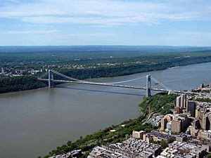
The region has many famous bridges and tunnels. The George Washington Bridge connects New Jersey and New York over the Hudson River. The Holland Tunnel also goes under the Hudson River, linking New Jersey to Manhattan. The Verrazzano-Narrows Bridge connects Staten Island to Brooklyn. These crossings are vital for daily travel and trade.
| Number | Length (mi) | Length (km) | Southern or western terminus | Northern or eastern terminus | Formed | Removed | Notes |
|---|---|---|---|---|---|---|---|
| 2,171.71 | 3,495.03 | I-15 in Cove Fort, Utah | I-695 at Woodlawn, Baltimore County, Maryland | 1956 | current | Serves one Northeastern state: Pennsylvania Associated routes: I-270, I-370 |
|
| 435.66 | 701.13 | I-71 in Westfield Center, Ohio | I-295 at Bellmawr, New Jersey | 1964 | current | Serves two Northeastern states: Pennsylvania, New Jersey Associated routes: I-176, I-276, I-376, I-476, I-676 |
|
| 146.28 | 235.41 | I-81 at Jonestown, Pennsylvania | Canal Street in New York City | 1957 | current | Serves three Northeastern states: Pennsylvania, New Jersey, New York Associated routes: I-278, I-478, I-678, I-878 |
|
| 343.46 | 552.75 | I-77 in Charleston, West Virginia | PA 5 in Erie, Pennsylvania | 1967 | current | Serves one Northeastern state: Pennsylvania Associated routes: I-279, I-579 |
|
| 2,899.59 | 4,666.44 | US 101 in San Francisco, California | I-95 in Teaneck, New Jersey | 1956 | current | Serves two Northeastern states: Pennsylvania and New Jersey Associated routes: I-180, I-380, I-280 |
|
| 855.02 | 1,376.02 | I-40 in Dandridge, Tennessee | Canadian border at Wellesley Island, New York | 1961 | current | Serves two Northeastern states: Pennsylvania, New York Associated routes:I-481 and I-781 |
|
| 85.03 | 136.84 | President Street and Fayette Street in Baltimore, Maryland | I-81 in Harrisburg, Pennsylvania | 1959 | current | Serves one Northeastern state: Pennsylvania Associated route: I-283 |
|
| 232.71 | 374.51 | I-81 in Scranton, Pennsylvania | I-90 in Sturbridge, Massachusetts | 1963 | current | Serves four Northeastern states: Pennsylvania, New York, Connecticut, Massachusetts Associated routes: I-384, I-684 |
|
| 223.39 | 359.51 | I-90 near North East, Pennsylvania | NY 17/NY 79 in Windsor, New York | 1999 | current | Unfinished in New York Serves two Northeastern states: Pennsylvania, New York Associated routes: none |
|
| 333.49 | 536.70 | I-278 in New York City | A-15 at Canadian border in Champlain, New York | 1957 | current | New York only Associated routes: I-287, I-587, I-787 |
|
| 117.75 | 189.50 | I-81 in Binghamton, New York | I-90 in Schenectady, New York | 1968 | current | New York only Associated routes: none |
|
| 191.12 | 307.58 | I-93/SR 3A in Bow, New Hampshire | Route 133/Future A-35 at Canadian border in Highgate, Vermont | 1960 | current | Serves two Northeastern states: New Hampshire, Vermont Associated route: I-189 |
|
| 3,020.44 | 4,860.93 | SR 519/4th Avenue/Edgar Martinez Drive in Seattle, Washington | MA 1A in Boston, Massachusetts | 1956 | current | Serves three Northeastern states: Pennsylvania, New York, Massachusetts Associated routes: I-190 (New York), I-290 (New York), I-390, I-490, I-590, I-690, I-790, I-890, I-990, I-190 (Massachusetts), I-290 (Massachusetts) Longest Interstate highway in the US |
|
| 290.37 | 467.31 | I-95 in New Haven, Connecticut | A-55 at Canadian border in Derby Line, Vermont | 1958 | current | Serves three Northeastern states: Connecticut, Massachusetts, Vermont Associated routes: I-291 (Connecticut), I-291 (Massachusetts) I-391, I-691 |
|
| 189.95 | 305.69 | I-95/US 1 in Canton, Massachusetts | I-91 in St. Johnsbury, Vermont | 1957 | current | Serves three Northeastern states: Massachusetts, New Hampshire, Vermont Associated routes: I-293, I-393 |
|
| 1,919.31 | 3,088.83 | US 1 in Miami, Florida | NB 95 at Canadian border in Houlton, Maine | 1957 | current | Serves eight Northeastern states: Pennsylvania, New Jersey, New York, Connecticut, Rhode Island, Massachusetts, New Hampshire, Maine Associated routes: I-195, I-295, I-395, I-495, I-695, I-895 Longest primary north-south Interstate highway |
|
| 98.34 | 158.26 | I-70/I-76 in Bedford, Pennsylvania | I-86/NY 17 in Painted Post, New York | 1998 | current | Unfinished in Pennsylvania Serves two Northeastern states: Pennsylvania, New York Associated routes: none |
Culture and Identity
The Northeast is known for being a "culture hearth," meaning it has influenced the rest of the nation's culture. However, it doesn't have one single cultural identity. Instead, smaller areas within the Northeast have their own unique cultures.
Famous Landmarks
Almost half of the National Historic Landmarks in the United States are located in the Northeast. These are places recognized for their important history.
Religion in the Northeast
The Northeast has a different religious makeup compared to much of the U.S. This is because many immigrants came from Ireland, Italy, Quebec, Portugal, and Eastern Europe in the late 1800s and early 1900s. These immigrants were often Catholic.
States like Massachusetts, Rhode Island, New York, and New Jersey have more Catholics than Protestants. However, the Northeast, along with the Pacific Northwest, has some of the lowest rates of people attending religious services regularly. Many people in states like Maine, New Hampshire, and Vermont say they don't have a religious identity.
Sports in the Northeast
The Northeast is a big hub for professional sports. It has many teams in the "Big Four" leagues: NFL (football), NBA (basketball), NHL (hockey), and MLB (baseball). These teams have won over 100 championships combined!
- New York City area: Giants, Jets (NFL), Yankees, Mets (MLB), Knicks, Nets (NBA), Rangers, Islanders, Devils (NHL)
- Philadelphia: Eagles (NFL), Phillies (MLB), 76ers (NBA), Flyers (NHL)
- Boston: Patriots (NFL), Red Sox (MLB), Celtics (NBA), Bruins (NHL)
- Pittsburgh: Steelers (NFL), Pirates (MLB), Penguins (NHL)
- Buffalo: Bills (NFL), Sabres (NHL)
The region also has teams in Major League Soccer (soccer) and the Women's National Basketball Association (WNBA).
The Northeast is also known for popular sports like ice hockey and lacrosse.
See also
 In Spanish: Nordeste de Estados Unidos para niños
- Atlantic Northeast
- Jersey Shore
- New England–Acadian forests
- Northeast Corridor
- Northeast megalopolis
- Northeastern coastal forests
- Rust Belt


