Myanmar facts for kids
Quick facts for kids
Republic of the Union of Myanmar
|
|
---|---|
|
|
Capital | Naypyidaw 21°00′N 96°00′E / 21.000°N 96.000°E |
Largest city | Yangon |
Official language | Burmese |
Recognised regional languages |
|
Ethnic groups
(2019)
|
|
Religion |
|
Demonym(s) |
|
Government | Unitary assembly-independent republic under a military junta |
• Acting President, SAC Chairman, and Prime Minister
|
Min Aung Hlaing |
• SAC Vice Chairman and Deputy Prime Minister
|
Soe Win |
Legislature | State Administration Council |
Formation | |
23 December 849 | |
16 October 1510 | |
29 February 1752 | |
1 January 1886 | |
• Independence from the United Kingdom
|
4 January 1948 |
• 1962 coup d'état
|
2 March 1962 |
• 1988 coup d'état
|
18 September 1988 |
• Current constitution
|
31 January 2011 |
1 February 2021 | |
Area | |
• Total
|
676,579 km2 (261,229 sq mi) (39th) |
• Water (%)
|
3.06 |
Population | |
• 2022 estimate
|
55,770,232 (26th) |
• Density
|
196.8/sq mi (76.0/km2) (125th) |
GDP (PPP) | 2024 estimate |
• Total
|
$283.572 billion (64th) |
• Per capita
|
$5,200 (146th) |
GDP (nominal) | 2024 estimate |
• Total
|
$68.006 billion (87th) |
• Per capita
|
$1,250 (167th) |
Gini (2017) | ▼ 30.7 medium · 106th |
HDI (2022) | 0.608 medium · 144th |
Currency | Kyat (K) (MMK) |
Time zone | UTC+06:30 (MMT) |
Driving side | right |
Calling code | +95 |
ISO 3166 code | MM |
Internet TLD | .mm |
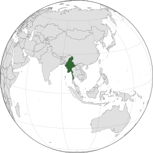
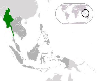
Myanmar is a country in South East Asia. Its full name is the Republic of the Union of Myanmar. It is also sometimes called Burma. Myanmar is the largest country in South East Asia that is not an island. It is also part of South Asia.
It is bordered by China on the north, Laos on the east, Thailand on the southeast, Bangladesh on the west, and the India on the northwest, with the Andaman Sea to the south, and the Bay of Bengal to the southwest. There are over 2,000 kilometres (1,200 mi) of coast line.
Contents
Origin and history of the name
In 1989, the military junta officially changed the English version of its name from Burma to Myanmar. It also made a new name in English for places in the country, such as its former capital city, from Rangoon to Yangon. The official name of the country in the Burmese language, Myanma did not change, however. The renaming was controversial, seen by some as linguistically bad. Accepting the name change in the English-speaking world has been slow, with many people still using the name Burma to refer to the country. Major news organizations like the BBC still call it Burma. Some question the military junta's authority to "officially" change the name in English in the first place. Aung San Suu Kyi, however, calls the country Myanmar now.
History
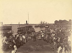
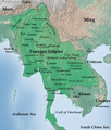
Early civilisations in the area included the Tibeto-Burman-speaking Pyu city-states in Upper Myanmar and the Mon kingdoms in Lower Myanmar. In the 9th century, the Bamar people entered the upper Irrawaddy valley, and following the establishment of the Pagan Kingdom in the 1050s, the Burmese language, culture, and Theravada Buddhism slowly became dominant in the country. The Pagan Kingdom fell to Mongol invasions, and several warring states emerged. In the 16th century, reunified by the Taungoo dynasty, the country became the largest empire in the history of Southeast Asia for a short period. The early 19th-century Konbaung dynasty ruled over an area that included modern Myanmar and briefly controlled Assam, the Lushai Hills, and Manipur as well. The British East India Company seized control of the administration of Myanmar after three Anglo-Burmese Wars in the 19th century, and the country became a British colony. After a brief Japanese occupation, Myanmar was reconquered by the Allies. On 4 January 1948, Myanmar declared independence under the terms of the Burma Independence Act 1947.
Myanmar's post-independence history has been checkered by continuing unrest and conflict to this day. The coup d'état in 1962 resulted in a military dictatorship under the Burma Socialist Programme Party. On 8 August 1988, the 8888 Uprising then resulted in a nominal transition to a multi-party system two years later, but the country's post-uprising military council refused to cede power, and has continued to rule the country through to the present. The country remains riven by ethnic strife among its myriad ethnic groups and has one of the world's longest-running ongoing civil wars. The United Nations and several other organisations have reported consistent and systemic human rights violations in the country. In 2011, the military junta was officially dissolved following a 2010 general election, and a nominally civilian government was installed. Aung San Suu Kyi and political prisoners were released and the 2015 Myanmar general election was held, leading to improved foreign relations and eased economic sanctions, although the country's treatment of its ethnic minorities, particularly in connection with the Rohingya conflict, continued to be a source of international tension and consternation. Following the 2020 Myanmar general election, in which Aung San Suu Kyi’s party won a clear majority in both houses, the Burmese military (Tatmadaw) again seized power in a coup d'état. The coup, which was widely condemned by the international community, led to continuous ongoing widespread protests in Myanmar and has been marked by violent political repression by the military, as well as a larger outbreak of the civil war. The military also arrested Aung San Suu Kyi in order to remove her from public life, and charged her with various crimes; all of the charges against her are "politically motivated" according to independent observers.
Geography
Myanmar has a total area of 678,500 square kilometres (262,000 sq mi). It lies between latitudes 9° and 29°N, and longitudes 92° and 102°E. Myanmar is bordered in the northwest by the Chittagong Division of Bangladesh and the Mizoram, Manipur, Nagaland and Arunachal Pradesh states of India. Its north and northeast border is with the Tibet Autonomous Region and Yunnan for a Sino-Myanmar border total of 2,185 km (1,358 mi). It is bounded by Laos and Thailand to the southeast. Myanmar has 1,930 km (1,200 mi) of contiguous coastline along the Bay of Bengal and Andaman Sea to the southwest and the south, which forms one quarter of its total perimeter.
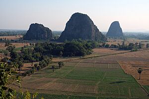
In the north, the Hengduan Mountains form the border with China. Hkakabo Razi, located in Kachin State, at an elevation of 5,881 metres (19,295 ft), is the highest point in Myanmar. Many mountain ranges, such as the Rakhine Yoma, the Bago Yoma, the Shan Hills and the Tenasserim Hills exist within Myanmar, all of which run north-to-south from the Himalayas. The mountain chains divide Myanmar's three river systems, which are the Irrawaddy, Salween (Thanlwin), and the Sittaung rivers. The Irrawaddy River, Myanmar's longest river at nearly 2,170 kilometres (1,348 mi), flows into the Gulf of Martaban. Fertile plains exist in the valleys between the mountain chains. The majority of Myanmar's population lives in the Irrawaddy valley, which is situated between the Rakhine Yoma and the Shan Plateau.
Administrative divisions
Myanmar is divided into seven states (ပြည်နယ်) and seven regions (တိုင်းဒေသကြီး), formerly called divisions. Regions are predominantly Bamar (that is, mainly inhabited by Myanmar's dominant ethnic group). States, in essence, are regions that are home to particular ethnic minorities. The administrative divisions are further subdivided into districts, which are further subdivided into townships, wards, and villages.
Below are the number of districts, townships, cities/towns, wards, village groups and villages in each division and state of Myanmar as of 31 December 2001:
No. | State/Region | Districts | Town ships |
Cities/ Towns |
Wards | Village groups |
Villages |
---|---|---|---|---|---|---|---|
1 | Kachin State | 4 | 18 | 20 | 116 | 606 | 2630 |
2 | Kayah State | 2 | 7 | 7 | 29 | 79 | 624 |
3 | Kayin State | 3 | 7 | 10 | 46 | 376 | 2092 |
4 | Chin State | 2 | 9 | 9 | 29 | 475 | 1355 |
5 | Sagaing Region | 8 | 37 | 37 | 171 | 1769 | 6095 |
6 | Tanintharyi Region | 3 | 10 | 10 | 63 | 265 | 1255 |
7 | Bago Region | 4 | 28 | 33 | 246 | 1424 | 6498 |
8 | Magway Region | 5 | 25 | 26 | 160 | 1543 | 4774 |
9 | Mandalay Region | 7 | 31 | 29 | 259 | 1611 | 5472 |
10 | Mon State | 2 | 10 | 11 | 69 | 381 | 1199 |
11 | Rakhine State | 4 | 17 | 17 | 120 | 1041 | 3871 |
12 | Yangon Region | 4 | 45 | 20 | 685 | 634 | 2119 |
13 | Shan State | 11 | 54 | 54 | 336 | 1626 | 15513 |
14 | Ayeyarwady Region | 6 | 26 | 29 | 219 | 1912 | 11651 |
Total | 63 | 324 | 312 | 2548 | 13742 | 65148 |
Climate
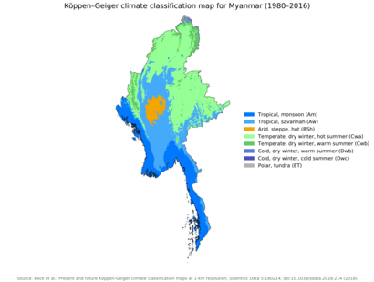
Much of the country lies between the Tropic of Cancer and the Equator. It lies in the monsoon region of Asia, with its coastal regions receiving over 5,000 mm (196.9 in) of rain annually. Annual rainfall in the delta region is approximately 2,500 mm (98.4 in), while average annual rainfall in the dry zone in central Myanmar is less than 1,000 mm (39.4 in). The northern regions of Myanmar are the coolest, with average temperatures of 21 °C (70 °F). Coastal and delta regions have an average maximum temperature of 32 °C (89.6 °F). Previously and currently analysed data, as well as future projections on changes caused by climate change predict serious consequences to development for all economic, productive, social, and environmental sectors in Myanmar. In order to combat the hardships ahead and do its part to help combat climate change Myanmar has displayed interest in expanding its use of renewable energy and lowering its level of carbon emissions. Groups involved in helping Myanmar with the transition and move forward include the UN Environment Programme, Myanmar Climate Change Alliance, and the Ministry of Natural Resources and Environmental Conservation which directed in producing the final draft of the Myanmar national climate change policy that was presented to various sectors of the Myanmar government for review.
In April 2015, it was announced that the World Bank and Myanmar would enter a full partnership framework aimed to better access to electricity and other basic services for about six million people and expected to benefit three million pregnant woman and children through improved health services. Acquired funding and proper planning has allowed Myanmar to better prepare for the impacts of climate change by enacting programs which teach its people new farming methods, rebuild its infrastructure with materials resilient to natural disasters, and transition various sectors towards reducing greenhouse gas emissions.
Biodiversity
Myanmar is a biodiverse country with more than 16,000 plant, 314 mammal, 1131 bird, 293 reptile, and 139 amphibian species, and 64 terrestrial ecosystems including tropical and subtropical vegetation, seasonally inundated wetlands, shoreline and tidal systems, and alpine ecosystems. Myanmar houses some of the largest intact natural ecosystems in Southeast Asia, but the remaining ecosystems are under threat from land use intensification and over-exploitation. According to the IUCN Red List of Ecosystems categories and criteria more than a third of Myanmar's land area has been converted to anthropogenic ecosystems over the last 2–3 centuries, and nearly half of its ecosystems are threatened. Despite large gaps in information for some ecosystems, there is a large potential to develop a comprehensive protected area network that protects its terrestrial biodiversity.
Myanmar continues to perform badly in the global Environmental Performance Index (EPI) with an overall ranking of 153 out of 180 countries in 2016, among the worst in the South Asian region. The environmental areas where Myanmar performs worst (i.e. highest ranking) are air quality (174), health impacts of environmental issues (143) and biodiversity and habitat (142). Myanmar performs best (i.e. lowest ranking) in environmental impacts of fisheries (21) but with declining fish stocks. Despite several issues, Myanmar also ranks 64 and scores very good (i.e. a high percentage of 93.73%) in environmental effects of the agricultural industry because of an excellent management of the nitrogen cycle. Myanmar is one of the most highly vulnerable countries to climate change; this poses a number of social, political, economic and foreign policy challenges to the country. The country had a 2019 Forest Landscape Integrity Index mean score of 7.18/10, ranking it 49th globally out of 172 countries.
Myanmar's slow economic growth has contributed to the preservation of much of its environment and ecosystems. Forests, including dense tropical growth and valuable teak in lower Myanmar, cover over 49% of the country, including areas of acacia, bamboo, ironwood and Magnolia champaca. Coconut and betel palm and rubber have been introduced. In the highlands of the north, oak, pine and various rhododendrons cover much of the land.
Heavy logging since the new 1995 forestry law went into effect has seriously reduced forest area and wildlife habitat. The lands along the coast support all varieties of tropical fruits and once had large areas of mangroves although much of the protective mangroves have disappeared. In much of central Myanmar (the dry zone), vegetation is sparse and stunted.
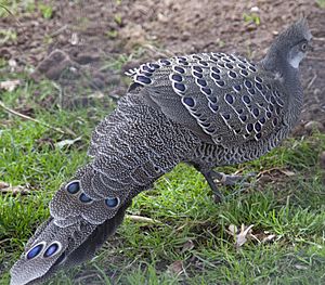
Typical jungle animals, particularly tigers, occur sparsely in Myanmar. In upper Myanmar, there are rhinoceros, wild water buffalo, clouded leopard, wild boars, deer, antelope, and elephants, which are also tamed or bred in captivity for use as work animals, particularly in the lumber industry. Smaller mammals are also numerous, ranging from gibbons and monkeys to flying foxes. The abundance of birds is notable with over 800 species, including parrots, myna, peafowl, red junglefowl, weaverbirds, crows, herons, and barn owl. Among reptile species there are crocodiles, geckos, cobras, Burmese pythons, and turtles. Hundreds of species of freshwater fish are wide-ranging, plentiful and are very important food sources.
Government and politics
Myanmar operates de jure as a unitary assembly-independent republic under its 2008 constitution. But in February 2021, the civilian government led by Aung San Suu Kyi, was deposed by the Tatmadaw. In February 2021, Myanmar military declared a one-year state emergency and First Vice President Myint Swe became the Acting President of Myanmar and handed the power to the Commander-in-Chief of Defence Services Min Aung Hlaing and he assumed the role Chairman of the State Administration Council, then Prime Minister. The President of Myanmar acts as the de jure head of state and the Chairman of the State Administration Council acts as the de facto head of government.
The constitution of Myanmar, its third since independence, was drafted by its military rulers and published in September 2008. The country is governed as a parliamentary system with a bicameral legislature (with an executive president accountable to the legislature), with 25% of the legislators appointed by the military and the rest elected in general elections.
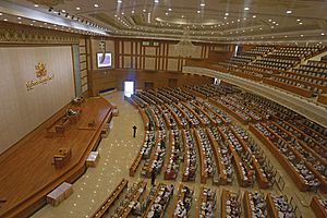
The legislature, called the Assembly of the Union, is bicameral and made up of two houses: The 224-seat upper House of Nationalities and the 440-seat lower House of Representatives. The upper house consists 168 members who are directly elected and 56 who are appointed by the Burmese Armed Forces. The lower house consists of 330 members who are directly elected and 110 who are appointed by the armed forces.
Economy
Myanmar's economy is one of the fastest growing economies in the world with a nominal GDP of US$76.09 billion in 2019 and an estimated purchasing power adjusted GDP of US$327.629 billion in 2017 according to the World Bank.
The informal economy's share in Myanmar is one of the biggest in the world and is closely linked to corruption, smuggling and illegal trade activities.
Agriculture
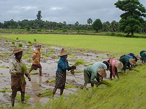
The major agricultural product is rice, which covers about 60% of the country's total cultivated land area. Rice accounts for 97% of total food grain production by weight. Through collaboration with the International Rice Research Institute, 52 modern rice varieties were released in the country between 1966 and 1997, helping increase national rice production to 14 million tons in 1987 and to 19 million tons in 1996. By 1988, modern varieties were planted on half of the country's ricelands, including 98 percent of the irrigated areas. In 2008 rice production was estimated at 50 million tons.
Extractive industries
Myanmar produces precious stones such as rubies, sapphires, pearls, and jade. Rubies are the biggest earner; 90% of the world's rubies come from the country, whose red stones are prized for their purity and hue. Thailand buys the majority of the country's gems. Myanmar's "Valley of Rubies", the mountainous Mogok area, 200 km (120 mi) north of Mandalay, is noted for its rare pigeon's blood rubies and blue sapphires.
Many U.S. and European jewellery companies, including Bulgari, Tiffany and Cartier, refuse to import these stones based on reports of deplorable working conditions in the mines. Human Rights Watch has encouraged a complete ban on the purchase of Burmese gems based on these reports and because nearly all profits go to the ruling junta, as the majority of mining activity in the country is government-run. The government of Myanmar controls the gem trade by direct ownership or by joint ventures with private owners of mines.
Rare-earth elements are also a significant export, as Myanmar supplies around 10% of the world's rare earths. Conflict in Kachin State has threatened the operations of its mines as of February 2021.
Other industries include agricultural goods, textiles, wood products, construction materials, gems, metals, oil and natural gas. Myanmar Engineering Society has identified at least 39 locations capable of geothermal power production and some of these hydrothermal reservoirs lie quite close to Yangon which is a significant underutilised resource for electrical production.
Tourism
The government receives a significant percentage of the income of private-sector tourism services. The most popular available tourist destinations in Myanmar include big cities such as Yangon and Mandalay; religious sites in Mon State, Pindaya, Bago and Hpa-An; nature trails in Inle Lake, Kengtung, Putao, Pyin Oo Lwin; ancient cities such as Bagan and Mrauk-U; as well as beaches in Nabule, Ngapali, Ngwe-Saung, and Mergui. Nevertheless, much of the country is off-limits to tourists, and interactions between foreigners and the people of Myanmar, particularly in the border regions, are subject to police scrutiny. They are not to discuss politics with foreigners, under penalty of imprisonment and, in 2001, the Myanmar Tourism Promotion Board issued an order for local officials to protect tourists and limit "unnecessary contact" between foreigners and ordinary Burmese people.
The most common way for travellers to enter the country is by air. According to the website Lonely Planet, getting into Myanmar is problematic: "No bus or train service connects Myanmar with another country, nor can you travel by car or motorcycle across the border – you must walk across." They further state that "It is not possible for foreigners to go to/from Myanmar by sea or river." There are a few border crossings that allow the passage of private vehicles, such as the border between Ruili (China) to Mu-se, the border between Htee Kee (Myanmar) and Phu Nam Ron (Thailand)—the most direct border between Dawei and Kanchanaburi, and the border between Myawaddy and Mae Sot, Thailand. At least one tourist company has successfully run commercial overland routes through these borders since 2013.
Flights are available from most countries, though direct flights are limited to mainly Thai and other ASEAN airlines. According to Eleven magazine, "In the past, there were only 15 international airlines and increasing numbers of airlines have begun launching direct flights from Japan, Qatar, Taiwan, South Korea, Germany and Singapore."
Demographics
The provisional results of the 2014 Myanmar Census showed that the total population was 51,419,420. This figure includes an estimated 1,206,353 persons in parts of northern Rakhine State, Kachin State and Kayin State who were not counted. People who were out of the country at the time of the census are not included in these figures. There are over 600,000 registered migrant workers from Myanmar in Thailand, and millions more work illegally. Burmese citizens account for 80% of all migrant workers in Thailand. At the beginning of the 20th century, Burma's population was approximately 10 million. The national population density is 76 per square kilometre (200/sq mi), among the lowest in Southeast Asia.
Largest cities
Largest cities or towns in Myanmar
geohive.com |
||
---|---|---|
Rank | Name | Pop. |
1 | Yangon | 5,211,431 |
2 | Mandalay | 1,225,546 |
3 | Naypyidaw | 1,160,242 |
4 | Bago | 491,434 |
5 | Hpa-An | 421,575 |
6 | Taunggyi | 381,636 |
7 | Monywa | 372,095 |
8 | Myitkyina | 306,949 |
9 | Mawlamyine | 289,388 |
10 | Magway | 289,247 |
Ethnic groups
Myanmar is ethnically diverse. There are at least 108 different ethnolinguistic groups in Myanmar, consisting mainly of distinct Tibeto-Burman peoples, but with sizeable populations of Tai–Kadai, Hmong–Mien, and Austroasiatic (Mon–Khmer) peoples.
The Bamar form an estimated 68% of the population. 10% of the population are Shan. The Kayin make up 7% of the population. The Rakhine people constitute 4% of the population. Overseas Chinese form approximately 3% of the population.
Languages
Myanmar is home to four major language families: Sino-Tibetan, Tai–Kadai, Austroasiatic, and Indo-European. Sino-Tibetan languages are most widely spoken. They include Burmese, Karen, Kachin, Chin, and Chinese (mainly Hokkien). The primary Tai–Kadai language is Shan. Mon, Palaung, and Wa are the major Austroasiatic languages spoken in Myanmar. The two major Indo-European languages are Pali, the liturgical language of Theravada Buddhism, and English. More than a hundred languages are spoken in total. Since many of them are known only within small tribes around the country, they may have been lost (many if not all) after a few generations.
Burmese, the mother tongue of the Bamar and official language of Myanmar, is related to Tibetan and Chinese. It is written in a script consisting of circular and semi-circular letters, which were adapted from the Mon script, which in turn was developed from a southern Indian script in the 5th century. The earliest known inscriptions in the Burmese script date from the 11th century. It is also used to write Pali, the sacred language of Theravada Buddhism, as well as several ethnic minority languages, including Shan, several Karen dialects, and Kayah (Karenni), with the addition of specialised characters and diacritics for each language.
Religion
According to 2014 census, 6.2% of the population identifies as Christian; 4.3% as Muslim; 0.8% as followers of tribal religions; 0.5% as Hindus; 0.2% as followers of other religions; and 0.1% follow no religion. According to the 2010 estimates of the Pew Research Center, 7% of the population is Christian; 4% is Muslim; 1% follows traditional animistic beliefs; and 2% follow other religions, including Mahayana Buddhism, Hinduism, and East Asian religions. Jehovah's Witnesses have been present since 1914 and have about 80 congregations around the country and a branch office in Yangon publishing in 16 languages. A tiny Jewish community in Yangon had a synagogue but no resident rabbi.
Although Hinduism is practised by 0.5% of the population, it was a major religion in Myanmar's past. Burmese folk religion is practised by many Bamars alongside Buddhism.
Culture
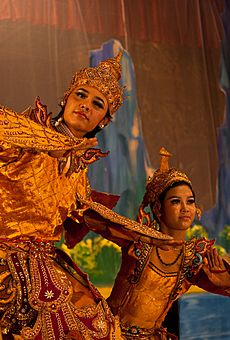
A diverse range of indigenous cultures exist in Myanmar, with majority culture primarily Buddhist and Bamar. Bamar culture has been influenced by the cultures of neighbouring countries, manifested in its language, cuisine, music, dance and theatre. The arts, particularly literature, have historically been influenced by the local form of Theravada Buddhism. Considered the national epic of Myanmar, the Yama Zatdaw, an adaptation of India's Ramayana, has been influenced greatly by Thai, Mon, and Indian versions of the play. Buddhism is practised along with nat worship, which involves elaborate rituals to propitiate one from a pantheon of 37 nats.
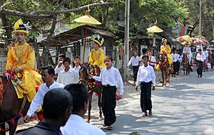
In a traditional village, the monastery is the centre of cultural life. Monks are venerated and supported by the lay people. A novitiation ceremony called shinbyu is the most important coming of age events for a boy, during which he enters the monastery for a short time. All male children in Buddhist families are encouraged to be a novice (beginner for Buddhism) before the age of twenty and to be a monk after the age of twenty. Girls have ear-piercing ceremonies (နားသ) at the same time. Burmese culture is most evident in villages where local festivals are held throughout the year, the most important being the pagoda festival. Many villages have a guardian nat, and superstition and taboos are commonplace.
British colonial rule introduced Western elements of culture to Myanmar. Myanmar's education system is modelled after that of the United Kingdom. Colonial architectural influences are most evident in major cities such as Yangon. Many ethnic minorities, particularly the Karen in the southeast and the Kachin and Chin who populate the north and northeast, practice Christianity. According to The World Factbook, the Burman population is 68% and the ethnic groups constitute 32%. In contrast, the exiled leaders and organisations claim the country is 40% ethnic.
Cuisine
Burmese cuisine is characterised by extensive use of fish products such as fish sauce, ngapi (fermented seafood) and dried prawn. Mohinga is the traditional breakfast dish and is Myanmar's national dish. Seafood is a common ingredient in coastal cities, while meat and poultry are more commonly used in landlocked cities like Mandalay. Freshwater fish and shrimp have been incorporated into inland cooking as a primary source of protein and are used in a variety of ways, fresh, salted whole or filleted, salted and dried, made into a salty paste, or fermented sour and pressed. Burmese cuisine also includes a variety of salads (a thoke), centred on one major ingredient, ranging from starches like rice, wheat and rice noodles, glass noodles and vermicelli, to potato, ginger, tomato, kaffir lime, long bean, and lahpet (pickled tea leaves).
Sport
The Lethwei, Bando, Banshay, and Pongyi thaing martial arts and chinlone are traditional sports in Myanmar. Football is played all over the country, even in villages, and its national team is ruled by the Myanmar Football Federation. The 2013 Southeast Asian Games took place in Naypyidaw, Yangon, Mandalay and Ngwesaung Beach in December representing the third occasion that the event has been staged in Myanmar. Myanmar previously hosted the games in 1961 and 1969.
Art
Burmese traditional art concepts are popular and respected by the Burmese people and people from abroad. Burmese contemporary art has developed quite rapidly on its own terms. Artists born after the 1980s have had greater chances of art practice outside the country.
One of the first to study western art was Ba Nyan. Together with Ngwe Gaing and a handful of other artists, they were the pioneers of western painting style. Later on most young children learned the concepts from them. Some well known contemporary artists are Lun Gywe, Aung Kyaw Htet, MPP Yei Myint, Myint Swe, Min Wai Aung, Aung Myint, Kin Maung Yin, Po Po and Zaw Zaw Aung.
Film
Myanmar's first film was a documentary of the funeral of Tun Shein—a leading politician of the 1910s, who campaigned for Burmese independence in London. The first Burmese silent film Myitta Ne Thuya (Love and Liquor) in 1920 which proved a major success, despite its poor quality. During the 1920s and 1930s, many Burmese-owned film companies made and produced several films. The first Burmese sound film was produced in 1932 in Bombay, India with the title Ngwe Pay Lo Ma Ya (Money Can't Buy It). After World War II, Burmese cinema continued to address political themes. Many of the films produced in the early Cold War era had a strong propaganda element.
In the era that followed the political events of 1988, the film industry has been increasingly controlled by the government. Film stars who had been involved in the political activities were banned from appearing in films. The government issues strict rules on censorship and largely determines who produces films, as well as who gets academy awards.
Over the years, the movie industry has also shifted to producing many lower-budget direct-to-video films. Most of the movies produced nowadays are comedies. In 2008, only 12 films worthy of being considered for an Academy Award were made, although at least 800 VCDs were produced. Myanmar is the primary subject of a 2007 graphic novel titled Chroniques Birmanes by Québécois author and animator, Guy Delisle. The graphic novel was translated into English under the title Burma Chronicles in 2008. In 2009, a documentary about Burmese videojournalists called Burma VJ was released. This film was nominated for Best Documentary Feature at the 2010 Academy Awards. The Lady had its world premiere on 12 September 2011 at the 36th Toronto International Film Festival.
National symbols of Myanmar
Related pages
Images for kids
-
Pyu city-states, c. 8th century; Pagan is shown for comparison only and is not contemporary.
-
Pagodas and kyaungs in present-day Bagan, the capital of the Pagan Kingdom
-
Toungoo Empire under Bayinnaung in 1580
-
British troops firing a mortar on the Mawchi road, July 1944
-
Protesters gathering in central Rangoon, 1988.
-
Protesters in Yangon during the 2007 Saffron Revolution with a banner that reads non-violence: national movement in Burmese. In the background is Shwedagon Pagoda.
-
Cyclone Nargis in southern Myanmar, May 2008.
-
U.S. President Barack Obama and Secretary of State Hillary Clinton with Aung San Suu Kyi and her staff at her home in Yangon, 2012
-
Map of Myanmar and its divisions, including Shan State, Kachin State, Rakhine State and Karen State.
See also
In Spanish: Birmania para niños