Geelong facts for kids
Quick facts for kids GeelongVictoria |
|||||||||
|---|---|---|---|---|---|---|---|---|---|
|
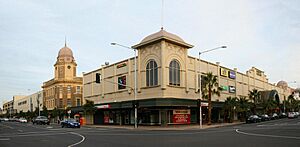
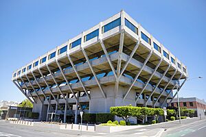
City Centre and surrounds
Town Hall
Post Office
St Mary of the Angels Basilica
T & G Building
|
|||||||||
| Population | 282,809 (2020) (12th) | ||||||||
| • Density | 212.80/km2 (551.1/sq mi) | ||||||||
| Established | 1838 | ||||||||
| Postcode(s) | 3220 | ||||||||
| Elevation | 21 m (69 ft) | ||||||||
| Area | 1,329 km2 (513.1 sq mi) | ||||||||
| Time zone | AEST (UTC+10) | ||||||||
| • Summer (DST) | AEDT (UTC+11) | ||||||||
| Location |
|
||||||||
| LGA(s) | City of Greater Geelong | ||||||||
| County | Grant | ||||||||
| State electorate(s) |
|
||||||||
| Federal Division(s) | |||||||||
|
|||||||||
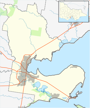
Geelong (pronounced jih-LONG) is an important port city in Victoria, Australia. It sits at the eastern end of Corio Bay, which is part of Port Phillip Bay. The city is also on the left bank of the Barwon River. It's about 75 km southwest of Melbourne.
With over 282,000 people in 2023, Geelong is the second-largest city in Victoria. It's the main centre for the City of Greater Geelong area. This area includes the city, rural lands, coastal spots, and the whole Bellarine Peninsula. It stretches from Lara in the north to Waurn Ponds in the south.
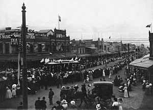
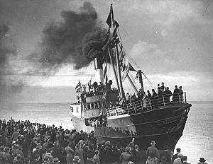
The original owners of the land are the Wadawurrung (also called Wathaurong) Aboriginal people. The name Geelong comes from their word Djilang, which might mean "land," "cliffs," or "tongue of land." European settlers first surveyed the area in 1838. During the 1850s Victorian gold rush, Geelong grew quickly. It was the main port for the goldfields.
Later, Geelong became a big manufacturing centre. It had wool mills, rope factories, and paper mills. People from Geelong were sometimes called "Geelongites" or "Pivotonians." This was because the city was known as "The Pivot," a key shipping and rail hub. Geelong officially became a city in 1910. Its industries grew until the 1960s.
Today, Geelong is becoming a leader in healthcare, education, and modern manufacturing. Even though it lost some heavy industries, other service industries are growing fast. It's now Australia's second fastest-growing city. Geelong is called the "Gateway City" because of its important location. It connects other western Victorian towns to Melbourne. It's also home to the Geelong Football Club, one of the oldest clubs in the Australian Football League.
Contents
Geelong's History
The Name Geelong
The name Geelong comes from Djilang. This was the name used by the Wadawurrung people. They were the traditional owners of the land when Europeans first arrived.
Early Days and Settlement
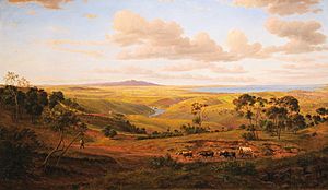
The lands around Geelong and the Bellarine Peninsula belong to the Wadawurrung (or Wathaurong) Indigenous Australian tribe. The first non-Indigenous person to visit was Lieutenant John Murray in 1802. He explored the area and claimed it for Britain. He named the bay Port King, but it was later renamed Port Phillip.
Another explorer, Matthew Flinders, also mapped the bay in 1802. In 1803, Surveyor-General Charles Grimes mapped the area. He thought it wasn't good for settlement. Later that year, a penal colony was set up at Sullivan Bay.
Explorers Hamilton Hume and William Hovell reached the area in 1824. They reported that the Aboriginal people called the bay Djillong. A convict named William Buckley escaped from Sullivan Bay in 1803. He lived with the Wadawurrung people for 32 years.
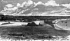
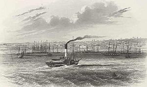
In 1836, three settlers arrived and made their homes here. Geelong was first surveyed in 1838. It was officially named a town on October 10, 1838. By 1841, wool was being sent to England. A regular steamer service ran between Geelong and Melbourne.
Captain Foster Fyans became the local Police Magistrate in 1837. He built a breakwater to improve the city's water supply. In 1849, Fyans was the first Mayor of the Geelong Town Council.
The Gold Rush Years (1850s)
Gold was found near Ballarat in 1851. This made Geelong's population grow to 23,000 by the mid-1850s. Geelong became a key port for the goldfields. The first newspaper, the Geelong Advertiser, started in 1840. Its founder, James Harrison, also invented the world's first ice-making machine.
The Geelong Hospital opened in 1852. The Geelong City Hall started being built in 1855. Work on the Port of Geelong began in 1853. The Geelong-to-Melbourne railway opened in 1857. Rabbits were brought to Australia in 1859 by Thomas Austin for hunting.
One of Geelong's famous department stores, Bright & Hitchcocks, opened in 1861. The HM Prison Geelong was built using convict labour and opened in 1864.
The "Sleepy Hollow" Period (1860s)
After the gold rush, Ballarat and Bendigo grew larger than Geelong. Some people called Geelong 'Sleepy Hollow'. But new industries started, like Victoria's first woollen mill in 1868. Transport improved, making Geelong a centre for the Western District. Railway lines were extended to Colac and Queenscliff.
The Geelong Cup horse race began in 1872. Victoria's first long-distance telephone call was made from Geelong in 1878. Geelong also had a successful wine industry. However, a pest called Phylloxera vastatrix destroyed the grapevines in 1875. This ended the wine industry until the 1960s.
More industries grew, like the Fyansford cement works in 1890. The town was called "The Pivot" because it was a major rail and shipping hub.
Geelong Becomes a City (1900s)
Geelong officially became a city on December 8, 1910. It gained important services like electricity in 1902. The Geelong Harbour Trust was formed in 1905. Electric trams started running in 1912.
Geelong's industries grew even faster in the 1920s. Woollen mills, fertiliser plants, Ford's car plant, and a Corio whisky factory were built. The local radio station 3GL (now K-Rock) started in 1930. The Great Ocean Road opened in 1932. By 1936, Geelong was Victoria's second-largest city.
The Eastern Beach foreshore and pool were finished in 1939. Before World War II, more factories opened. These included International Harvester and the Shell Australia oil refinery.
After World War II
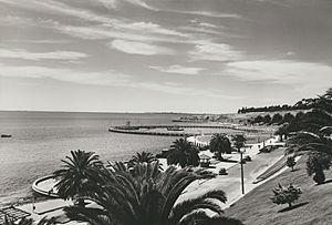
New homes were built in suburbs like East Geelong, Norlane, and Corio from the 1950s. Geelong continued to grow rapidly. Cars became the main way to get around. The city's first supermarket opened in 1965.
Industries kept growing. A second cement works opened in Waurn Ponds in 1964. The Alcoa Point Henry aluminium smelter was built in 1962.
From the 1970s, many Geelong factories closed. This was due to changes in government policies. The Target head office opened in North Geelong. Deakin University was started in Waurn Ponds in 1974. The Geelong Performing Arts Centre opened in 1981. Later, the Australian Animal Health Laboratory (1985) and the National Wool Museum (1988) opened.
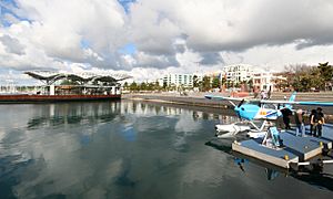
The first enclosed shopping centre, Market Square, opened in 1985. The Pyramid Building Society, founded in Geelong, collapsed in 1990. This caused problems for the local economy. In 1993, the City of Greater Geelong was formed by joining smaller councils. The Waterfront Geelong area was redeveloped starting in 1994.
Geelong in the 21st Century
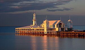
In 2000, the Carousel Pavilion opened on the waterfront. Avalon Airport was upgraded in 2004 for passenger flights. It became a base for Jetstar airline. Geelong is growing towards the south coast. A new suburban area called Armstrong Creek is being built for thousands of people. The Geelong Ring Road opened in 2009. It helps traffic bypass the city.
In 2007, over $500 million worth of construction was happening. This included the Westfield Geelong expansion and new buildings for Deakin University. The Transport Accident Commission moved its headquarters from Melbourne to Geelong in 2006. This created many jobs.
New tall apartment buildings are changing the city's skyline. In 2012, "The Sea Dragon" was chosen as a new city icon design. Geelong's new Library and Heritage Centre opened in 2015. It won an award for its design.
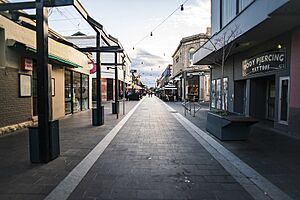
Geelong is currently undergoing a big makeover called the Green Spine Project. This project will connect Johnstone Park to the Botanic Gardens with trees along Malop Street. It includes bike lanes separated by plants. This is an Australian first! Art sculptures and street art are also being added.
New high-rise buildings are being built, creating more jobs and homes. Worksafe Victoria opened a 14-storey building in 2018. The Mercer and Miramar Apartments are two new residential towers.
Geelong's Geography
Geelong is on the western edge of Corio Bay, which is an inlet of Port Phillip Bay. On clear days, you can see the Melbourne skyline from higher parts of Geelong. The Barwon River flows through the southern part of the city. It then goes into Lake Connewarre and the estuary at Barwon Heads, finally reaching the Bass Strait.
Geelong is located between the Otway Ranges and Brisbane Ranges. It's the only low-lying path between the Werribee Plain and the Western Volcanic Plains. The land around Geelong has different types of soil. These soils are good for farming, grazing, forestry, and growing grapes for wine.
Many buildings in Geelong were made from local stone. Bluestone came from the You Yangs, and sandstone from the Brisbane Ranges. There are also small amounts of brown coal near Anglesea. Limestone has been dug up for cement production since the late 1800s.
City and Suburbs
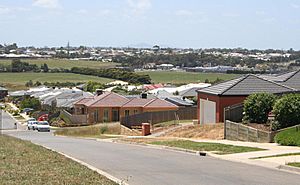
Geelong has over 60 suburbs. Some of these include Anakie, Armstrong Creek, Avalon, Barwon Heads, Belmont, Corio, Drysdale, East Geelong, Fyansford, Geelong West, Highton, Lara, Leopold, Newtown, Norlane, Ocean Grove, Queenscliff, Rippleside, and Waurn Ponds.
The city first grew along Corio Bay. Then it spread south towards the Barwon River. Major growth south of the river in Belmont started in the 1920s. Industrial areas were usually near the bay for port access.
After World War II, heavy industries moved to the flatter northern suburbs. New homes were built there for workers. From the 1960s, homes spread to the Highton hills and Grovedale. Many old wool stores in the city centre were redeveloped. This led to the Waterfront Geelong project. Today, the main areas for new homes are north towards Lara, east towards Leopold, and south towards Mount Duneed.
Geelong's Climate
Geelong has a mild oceanic climate. This means it has mild to warm summers and cool winters. February is the hottest month, and July is the coldest. The highest temperature ever recorded was 47.4°C in February 2009. The lowest was -4.3°C in July 1997. The city gets about 37 clear days each year.
The average yearly rainfall is around 525.2 mm. This makes Geelong one of the driest cities in Australia. This is because the Otway Ranges to the southwest block much of the rain. Within the city, southern suburbs get more rain than northern ones.
| Climate data for Grovedale (Geelong Airport, 1983–2011) | |||||||||||||
|---|---|---|---|---|---|---|---|---|---|---|---|---|---|
| Month | Jan | Feb | Mar | Apr | May | Jun | Jul | Aug | Sep | Oct | Nov | Dec | Year |
| Record high °C (°F) | 45.3 (113.5) |
47.4 (117.3) |
41.5 (106.7) |
34.8 (94.6) |
27.6 (81.7) |
23.4 (74.1) |
20.5 (68.9) |
25.8 (78.4) |
30.9 (87.6) |
37.1 (98.8) |
37.3 (99.1) |
43.1 (109.6) |
47.4 (117.3) |
| Mean daily maximum °C (°F) | 24.5 (76.1) |
24.7 (76.5) |
23.0 (73.4) |
20.2 (68.4) |
17.0 (62.6) |
14.5 (58.1) |
13.9 (57.0) |
14.9 (58.8) |
16.5 (61.7) |
18.7 (65.7) |
20.7 (69.3) |
22.8 (73.0) |
19.3 (66.7) |
| Mean daily minimum °C (°F) | 13.0 (55.4) |
13.5 (56.3) |
12.0 (53.6) |
9.5 (49.1) |
7.8 (46.0) |
6.3 (43.3) |
5.4 (41.7) |
5.8 (42.4) |
6.6 (43.9) |
7.6 (45.7) |
9.5 (49.1) |
10.9 (51.6) |
9.0 (48.2) |
| Record low °C (°F) | 4.5 (40.1) |
5.8 (42.4) |
3.6 (38.5) |
1.4 (34.5) |
0.0 (32.0) |
−3.1 (26.4) |
−4.3 (24.3) |
−2.1 (28.2) |
0.6 (33.1) |
−1.3 (29.7) |
2.6 (36.7) |
3.3 (37.9) |
−4.3 (24.3) |
| Average rainfall mm (inches) | 37.3 (1.47) |
31.5 (1.24) |
32.0 (1.26) |
45.2 (1.78) |
46.5 (1.83) |
40.4 (1.59) |
49.2 (1.94) |
49.1 (1.93) |
49.7 (1.96) |
51.3 (2.02) |
52.8 (2.08) |
40.1 (1.58) |
525.2 (20.68) |
| Average rainy days (≥ 0.2 mm) | 7.0 | 5.8 | 8.2 | 11.9 | 13.0 | 15.0 | 16.8 | 16.7 | 16.0 | 13.5 | 10.3 | 9.0 | 143.2 |
| Average afternoon relative humidity (%) | 55 | 55 | 54 | 57 | 65 | 70 | 68 | 64 | 63 | 60 | 59 | 55 | 60 |
| Source: Bureau of Meteorology; Grovedale (Geelong Airport, 1983–2011) | |||||||||||||
Geelong's Economy
Over 10,000 businesses operate in the Geelong region. They employ more than 80,000 people. Manufacturing and processing industries provide about 15,000 jobs. Retail (shops) provides 13,000 jobs. Health and community services offer 8,000 jobs.
A research paper called "Resilient Geelong" was published in 2020. It looks at Geelong's economy over many years. It also suggests ways for Geelong's future growth.
Some of Geelong's biggest employers were the Ford Motor Company engine plant (closed in 2016). Others included aircraft maintenance at Avalon Airport and the head office of Target Australia (until 2018). The Bartter (Steggles) chicken plant and the Shell oil refinery were also major employers. GMHBA Limited, a health insurance company, has its main office in Geelong.
Geelong attracts many tourists. Over 6 million people visited in 2001. Popular places to visit include the Waterfront Geelong area and Eastern Beach. The National Wool Museum is also a big attraction. Geelong hosts international events like the Australian International Airshow.
Geelong has many shopping areas. The two main centres are Westfield Geelong and Market Square in the city centre. Smaller centres are in the suburbs. The opening of these large centres has changed shopping habits.
Geelong is home to important research labs. These include the CSIRO Australian Animal Health Laboratory.
In 2013, Ford announced it would close its manufacturing plant in Geelong by 2016. This was a big change for the city. The Shell oil refinery also closed in 2013. In 2016, Target moved its head office out of North Geelong.
Geelong's Population
| Population over time | |
|---|---|
| 1841 | 454 |
| 1846 | 2,065 |
| 1851 | 8,291 |
| 1854 | 20,115 |
| 1861 | 22,929 |
| 1891 | 17,445 |
| 1901 | 25,017 |
| 1907 | 28,021 |
| 1921 | 31,689 |
| 1933 | 39,223 |
| 1946 | 51,000 |
| 1954 | 72,995 |
| 1961 | 91,666 |
| 1966 | 105,059 |
| 1976 | 122,080 |
| 1981 | 141,279 |
| 1988 | 146,349 |
| 2006 | 160,991 |
| 2009 | 179,971 |
| 2010 | 184,583 |
In 2006, about 160,000 people lived in Geelong. The average age was 37 years. About 19.4% of the people were children aged 0–14. About 26.6% were 55 years or older. The average household had 2.59 people.
About 78.4% of people in Geelong were born in Australia. The most common countries of birth for others were England, Italy, Croatia, the Netherlands, and Scotland. About 14.2% of homes speak a language other than English. Geelong has a large Croatian community. German settlers also founded Germantown (now Grovedale) in 1849.
In 2006, the most common religion was Catholicism (29.4%). Many people also reported having no religion (20.5%). Geelong has many Christian churches.
How Geelong is Governed
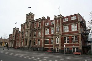
The City of Greater Geelong council manages the Geelong region. This council was formed in 1993. Its offices are at the Geelong City Hall. The city is divided into four areas called wards: Brownbill, Bellarine, Kardinia, and Windermere. Each ward has councillors who represent the people.
From 2012 to 2016, the Mayor of Geelong was chosen directly by the public. In 2016, the Victorian Government removed the Mayor and Councillors. This was because of problems with how the council was run. Administrators were appointed to manage the council until new elections in 2017.
In state politics, Geelong is covered by four areas in the Legislative Assembly. These are Geelong, South Barwon, Lara, and Bellarine. After the 2022 election, all four areas are held by the Australian Labor Party.
In federal politics, Geelong is covered by two areas in the House of Representatives. These are the Division of Corio and the Division of Corangamite. Corio covers the northern part of Geelong. It has been a safe Australian Labor Party area since the 1970s. Corangamite covers the southern part of Geelong and the Bellarine Peninsula. It was traditionally a safe area for the Liberal Party. However, it has become more competitive recently.
Geelong's Culture
Events and Festivals
The Royal Geelong Show happens every year at the Geelong Showgrounds. Other events include Pako Festa (in February) and the Family Fun Day. The Geelong Heritage Festival celebrates the city's history.
Geelong also hosts 'VIGEX', an international photography show, every two years. Geelong's history is kept alive by the Geelong Historical Society. The Geelong Heritage Centre is in the new library building.
Arts and Entertainment
Geelong was named a UNESCO Creative City of Design in 2017. This recognizes its history of good design.
Geelong has many pubs, nightclubs, and places for live music. Many famous Australian bands and musicians started in Geelong. These include Magic Dirt and Jeff Lang.
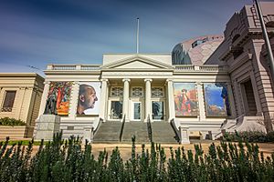
Geelong also hosts music festivals like the Meredith Music Festival. The city's main cultural venues are the Geelong Performing Arts Centre (GPAC) and the Geelong Art Gallery.
Back to Back Theatre is a famous theatre company based in Geelong. It creates plays that explore important questions about humanity. The company often tours its shows around the world.
Creative Geelong Inc. supports local artists and creative businesses. In 2017, they made documentaries about Geelong's change. These films showed how old factories became new creative spaces.
Media
The Geelong Advertiser newspaper started in 1840. It is one of the oldest newspapers in Victoria. Other local newspapers are the free Geelong Independent and Geelong News.
Geelong receives all the main TV channels from Melbourne. These include ABC, SBS, Seven, Nine, and Ten.
Local radio stations include K-Rock (rock and pop music) and Bay FM (adult contemporary music). Most Melbourne radio stations can also be heard clearly in Geelong.
Sport in Geelong

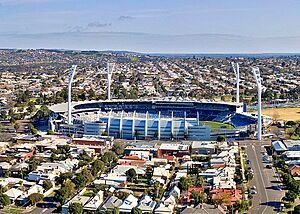
The Geelong Football Club was started in 1859. It is the second-oldest club in the Australian Football League (AFL). Its home ground is Kardinia Park stadium. It has over 80,000 members. This is the highest for a football club not based in a capital city.
The Geelong Arena is home to the Geelong Supercats basketball team. It was also used for basketball games during the 2006 Commonwealth Games.
North Geelong Warriors FC is the main soccer club in the region. Other soccer clubs include Geelong Rangers FC and Geelong SC. Western United also plays some home games in Geelong.
Geelong has a horse-racing club. It holds about 22 races a year, including the Geelong Cup. The Geelong Cup is an important race before the Melbourne Cup.
The Geelong Lawn Tennis Club has 27 courts. It hosts tennis tournaments, including the Davis Cup.
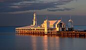
The Eastern Beach area hosts international triathlons. It also has annual sports car and racing car events. Corio Bay is popular for sailing and yachting. Geelong also has many golf courses and sports fields. You can also enjoy water skiing, rowing, fishing, and hiking.
Geelong is home to Australia's largest indoor skate park. It has "more skate parks per person than any other council area in Australia."
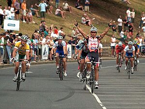
The Cadel Evans Great Ocean Road Race starts in Geelong. This cycling race is named after Tour de France winner Cadel Evans. It goes through the Bellarine Peninsula and along the Great Ocean Road.
Geelong's Kardinia Park Stadium hosted the first match of the 2022 Men's T20 cricket World Cup. Geelong was also set to host parts of the 2026 Commonwealth Games before they were cancelled.
Public Services in Geelong
Education and Learning
Geelong has many public and private schools. Over 40,000 students attend primary and secondary schools. Another 27,000 students are in college or university programs. Some of the first schools were established in the 1850s. These include the historic private schools The Geelong College and Geelong Grammar School.
Geelong High School (established 1910) is Victoria's oldest state secondary school.
The Gordon Memorial Technical College opened in 1888. Today, it is known as the Gordon Institute of TAFE. In 1976, its academic courses became part of the new Deakin University. Deakin University welcomed its first students in 1977 at its Waurn Ponds campus. The university also has a campus on the waterfront in Geelong's city centre. Since 2008, the Waurn Ponds campus has had Victoria's first regional medical school.
Utilities and Services
Barwon Water manages water supply in Geelong. Water comes from the Barwon, East Moorabool, and West Moorabool Rivers. These rivers get water from the Brisbane Ranges and the Otway Ranges. Sewage from Geelong is treated at the Black Rock Treatment Plant.
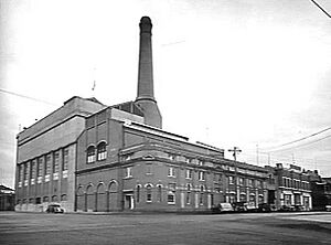
Geelong first received electricity in 1902 from the Geelong Power Station. In 1936, Geelong was connected to the state's main electrical grid. Piped coal gas started in Geelong in 1860. Geelong switched to natural gas in 1971.
Getting Around Geelong
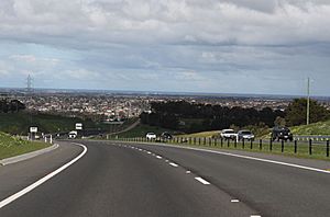
Most people in Geelong use cars to get around. Geelong has good road connections. The Princes Freeway (M1) connects it to Melbourne. The Princes Highway (A1) goes to Warrnambool. The Bellarine Highway (B110) connects to the Bellarine Peninsula. The Midland Highway (A300) goes to Ballarat. The Hamilton Highway (B140) goes to Hamilton. The Geelong Ring Road helps traffic bypass the city. The Lewis Bandt Bridge is part of this new road. It's named after the inventor of the "ute."
Avalon Airport
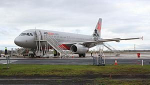
Avalon Airport is about 15 km northeast of Geelong. It was built in 1953 for making military aircraft. It's also used for fixing commercial planes and pilot training. Avalon Airport has been home to the low-cost airline Jetstar since 2004. Flights to Sydney use this airport. Avalon Airport also hosts the 'Thunder Down Under' Australian International Airshow.
Train Services
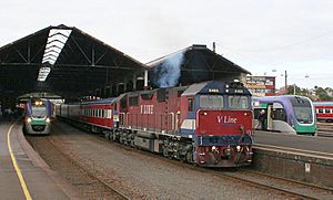
Geelong is a major train hub in Victoria. It has frequent services to Melbourne. It's where the Port Fairy, Western standard gauge, and Geelong-Ballarat lines meet. There are eight train stations in the city area. All are on the Warrnambool line and served by V/Line trains. The Geelong line carries more passengers than any other regional train line in Australia.
Geelong's stations include Lara, Corio, North Shore, Geelong, South Geelong, and Waurn Ponds.
In the past, a train line connected Geelong to the Bellarine Peninsula. The Bellarine Railway now runs a part of this line as a tourist attraction.
Passenger trains go to Warrnambool three times a day. This connects Geelong with Colac and other towns. The Overland train service between Melbourne and Adelaide stops at North Shore station. Freight trains also run from Melbourne to Geelong.
Victoria's electronic ticketing system, Myki, started on Geelong train services in 2013. The Victorian government is looking into building a new train line to Torquay.
Ports and Ferries
The Port of Geelong is on Corio Bay. It is Australia's sixth-largest seaport by weight of goods. It handles things like crude oil, grain, and woodchips. The Bellarine Peninsula has been linked to the Mornington Peninsula by the Searoad ferry since 1987. This ferry runs every hour between Queenscliff and Sorrento.
Port Phillip Ferries started daily services between Portarlington and Melbourne Docklands in 2016. A similar service from Geelong to Docklands started later. These ferry services are popular with tourists and people commuting to work.
On October 23, 2022, the Tasmanian ferry service, the Spirit of Tasmania, started operating from a new terminal in North Geelong. It used to operate from Port Melbourne.
Bus and Taxi Services
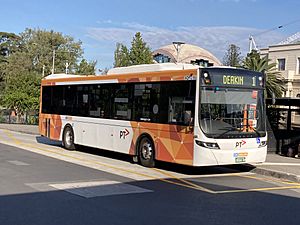
A bus network covers the city centre and most suburbs. Public Transport Victoria hires CDC Geelong and McHarry's Buslines to run Geelong's bus services. Buses also go to Torquay and the Bellarine Peninsula. V/Line buses connect Geelong with Ballarat, Bendigo, and other towns.
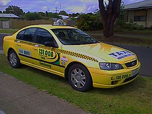
Taxi services in Geelong are provided by Geelong Taxi Network.
Cycling and Walking Paths
Geelong has many kilometres of bicycle trails. These include:
- Bay Trail, from Corio Quay to Limeburners Point
- Barwon River trail – 20 km long
- Bellarine Rail Trail – a 32 km path between South Geelong and Queenscliffe
- Cowies Creek Trail
- Hovells Creek Trail
- Ted Wilson trail – follows the Geelong Ring Road for 12 km
- Tom McKean Linear Park
- Waurn Ponds trail – follows over 6 km of the Waurn Ponds creek
See also
 In Spanish: Geelong para niños
 | Mary Eliza Mahoney |
 | Susie King Taylor |
 | Ida Gray |
 | Eliza Ann Grier |


