
Marin County, California facts for kids
Quick facts for kids
Marin County
|
|
|---|---|
| County of Marin | |
    Images, from top down, left to right: Marin County Civic Center, Point Reyes National Seashore, Stinson Beach, Mount Tamalpais at sunset
|
|

Location in the state of California
|
|
| Country | United States |
| State | California |
| Area | San Francisco Bay |
| Incorporated | February 18, 1850 |
| Named for | Chief Marin, "great chief of the tribe Licatiut" |
| County seat | San Rafael |
| Largest city | San Rafael (population) Novato (area) |
| Government | |
| • Type | Council–Administrator |
| Area | |
| • Total | 828 sq mi (2,140 km2) |
| • Land | 520 sq mi (1,300 km2) |
| • Water | 308 sq mi (800 km2) |
| Highest elevation | 2,574 ft (785 m) |
| Population
(2020)
|
|
| • Total | 262,231 |
| • Density | 504/sq mi (195/km2) |
| GDP | |
| • Total | $35.698 billion (2022) |
| Time zone | UTC−8 (Pacific) |
| • Summer (DST) | UTC−7 (PDT) |
| Area codes | 415 and 628, 707 (Tomales and Dillon Beach only) |
| FIPS code | 06-041 |
| GNIS feature ID | 277285 |
| Congressional district | 2nd |
Marin County is a county in the northwestern part of the San Francisco Bay Area in California. In 2020, about 262,231 people lived here. Its main city and county seat is San Rafael. Marin County is located just across the Golden Gate Bridge from San Francisco.
Marin County is famous for its beautiful natural places. These include the Muir Woods redwood forest, the Marin Headlands, Stinson Beach, the Point Reyes National Seashore, and Mount Tamalpais. It's known as one of the wealthiest counties in the United States. The county is run by the Marin County Board of Supervisors.
The Marin County Civic Center was designed by the famous architect Frank Lloyd Wright. Many people visit each year to see its unique arch and atrium design. Marin County is also where the United States' oldest cross country running event, the Dipsea Race, takes place every year. Modern mountain biking also started on the slopes of Mount Tamalpais.
Contents
History of Marin County
Early Native American Life
Thousands of years ago, the Coast Miwok people were the first to live in the area we now call Marin County. In 1770, there were between 1,500 and 2,000 Coast Miwok people living in about 600 villages across the county.
In 1967, the Marin Museum of the American Indian was created. It shows off Coast Miwok artifacts, crafts, and art. Today, there are still events led by Indigenous people, like drumming, traditional dancing, and trade feasts.
How Marin County Got Its Name

Marin County is one of California's first 27 counties. It was created on February 18, 1850. The county was named after Chief Marin, who was a "great chief of the Licatiut tribe." Chief Marin's original name was "Huicmuse" before he was baptized as "Marino." He was part of the Huimen people, a Coast Miwok tribe that lived in the San Rafael area.
General Mariano Vallejo, who helped name California's counties, believed that Chief Marin fought bravely against the Spanish. Marino lived at Mission Dolores in San Francisco for a long time and later served as an overseer at the San Rafael Mission. He lived there on and off until he passed away in 1839. In 2009, a special plaque honoring Chief Marin was placed in Mill Valley.
Another idea for the county's name is that a bay in the area was called Bahía de Nuestra Señora del Rosario la Marinera in 1775. "Marin" might just be a shorter version of this name.
The first Spanish settlement in Marin was the Mission San Rafael Arcángel, founded in 1817. It was the 20th Spanish mission in California. It was built partly because the Russians had built Fort Ross to the north.
Geography of Marin County
Marin County covers about 828 square miles. About 520 square miles is land, and 308 square miles is water. This means a big part of the county, about 37%, is water!


Geographically, Marin County is a large peninsula that faces south. The Pacific Ocean is to its west, and San Pablo Bay and San Francisco Bay are to its east. The city of San Francisco is to the south, across the Golden Gate. Marin County's northern border is with Sonoma County.
Most people in Marin County live on the eastern side. Cities like Sausalito, Tiburon, Corte Madera, San Rafael, and Novato are all along U.S. Route 101 and the San Francisco Bay. The middle part of the county has lots of farms and open spaces. West Marin, along State Route 1, has many small towns that rely on farming and tourism. Its beaches are very popular for surfers and visitors all year.
Neighboring Counties
- Sonoma County – to the north
- San Francisco – to the south
Protected Natural Areas
Marin County has many beautiful protected areas, including:
- Golden Gate National Recreation Area (part of it)
- Marin Islands National Wildlife Refuge
- Muir Woods National Monument
- Point Reyes National Seashore
- San Pablo Bay National Wildlife Refuge (part of it)
- Gulf of the Farallones National Marine Sanctuary (part of it)
The Marin County Department of Parks and Open Space also manages many county parks and open spaces. The Marin Municipal Water District has over 130 miles of trails for hiking and exploring.
State Parks
- Angel Island State Park
- China Camp State Park
- Mount Tamalpais State Park
- Olompali State Historic Park
- Samuel P. Taylor State Park
- Tomales Bay State Park
Underwater Parks
These special areas help protect ocean animals and their homes:
- Estero Americano State Marine Recreational Management Area
- Estero de San Antonio State Marine Recreational Management Area
- Point Reyes State Marine Reserve & Point Reyes State Marine Conservation Area
- Estero de Limantour State Marine Reserve & Drakes Estero State Marine Conservation Area
- Duxbury Reef State Marine Conservation Area
Ecology and Wildlife

Marin County is part of the California Floristic Province, which is a place with many different kinds of plants and animals. You can find various natural areas here, like redwood forests, oak woodlands, and chaparral.
There are also many protected plant and animal species. Animals include the California red-legged frog and California freshwater shrimp. Plants include Marin Dwarf Flax and Tiburon Jewelflower.

Several important creeks flow through Marin County, such as Walker Creek and Lagunitas Creek. The Lagunitas Creek Watershed is especially important because it's home to the largest group of wild coho salmon in Central California. These salmon are an endangered species, meaning they are at risk of disappearing.
People have been working hard since the 1980s to protect and help these salmon. About half of the places where salmon used to live are now blocked by dams. Efforts are also being made to protect the parts of the creeks that don't have dams, especially in the San Geronimo Valley. This is where many salmon lay their eggs each year.
The "Salmon Protection and Watershed Network" offers tours in winter for people to see the salmon. They also have chances for people to help restore the streams and rescue young fish. About 490 different kinds of birds have been seen in Marin County.

Even with dry conditions in 2014, about 20,000 young Coho salmon made their way from Lagunitas Creek to the Pacific Ocean. This was a big increase from the 11,000 recorded in 2006. In 2010, all of Marin County's beaches were named the cleanest in California.
Long ago, in 1835, people saw large groups of tule elk near the Golden Gate. It's not clear if they were on the Marin side or the San Francisco side, but it shows how much wildlife used to be here.
Population and People
| Historical population | |||
|---|---|---|---|
| Census | Pop. | %± | |
| 1850 | 323 | — | |
| 1860 | 3,334 | 932.2% | |
| 1870 | 6,903 | 107.0% | |
| 1880 | 11,324 | 64.0% | |
| 1890 | 13,072 | 15.4% | |
| 1900 | 15,702 | 20.1% | |
| 1910 | 25,114 | 59.9% | |
| 1920 | 27,342 | 8.9% | |
| 1930 | 41,648 | 52.3% | |
| 1940 | 52,907 | 27.0% | |
| 1950 | 85,619 | 61.8% | |
| 1960 | 146,820 | 71.5% | |
| 1970 | 206,038 | 40.3% | |
| 1980 | 222,568 | 8.0% | |
| 1990 | 230,096 | 3.4% | |
| 2000 | 247,289 | 7.5% | |
| 2010 | 252,409 | 2.1% | |
| 2020 | 262,231 | 3.9% | |
| 2023 (est.) | 254,407 | 0.8% | |
| U.S. Decennial Census 1790–1960 1900–1990 1990–2000 2010 2020 |
|||
In 2020, Marin County had a population of 262,231 people. Most residents are White, with growing numbers of Hispanic or Latino, Asian, and people of two or more races.
Life Expectancy
People in Marin County tend to live longer than in many other places in the United States. In 2010, women in Marin County were expected to live about 85 years, which was the longest life expectancy for women in any U.S. county at that time.
Income and Economy

Marin County is known for having a high average income. In 2007, the average household income was about $83,732. The county often has one of the lowest unemployment rates in California.
Many large companies and organizations are major employers in Marin County. These include Kaiser Permanente, MarinHealth, Autodesk, and BioMarin Pharmaceutical. Farming is also important, especially livestock and their products like milk and eggs.
Transportation
Main Roads
 Interstate 580
 U.S. Route 101 (also called Redwood Highway)
 State Route 1
 State Route 37
 State Route 131 (Tiburon Boulevard)
Public Transport

Golden Gate Transit offers bus services along U.S. 101, connecting Marin County cities with San Francisco and Sonoma County. You can also take ferries to San Francisco from Larkspur, Sausalito, and Tiburon.
Local bus routes within Marin County are run by Marin Transit. They also have the West Marin Stage for rural areas and a shuttle to Muir Woods. The Sonoma–Marin Area Rail Transit (SMART) system started in 2017. It's a train service that connects Sonoma and Marin counties.
For air travel, the nearest airports with commercial flights are San Francisco International Airport and Oakland International Airport. The Marin Airporter provides bus service to and from San Francisco Airport.
Education
Marin County Free Library is the county's library system, based in San Rafael. There's also the Belvedere-Tiburon Library in Tiburon.
College of Marin was started in 1926 and has two campuses. It offers many different degree programs and certificates. About 9,000 students attend each term.
Marin is also home to Dominican University of California in San Rafael. It was founded in 1890 as a college for women and became a coeducational university in 1971. It has about 1,400 undergraduate and 500 graduate students.
Culture and Museums
Marin County has several interesting museums:
- Marin Museum of the American Indian
- Marin Museum of Contemporary Art
- Marin Museum of Bicycling
- Museum of International Propaganda
- The Space Station Museum
Media
Marin County has its own local media, including:
- Marin Magazine, a monthly magazine.
- Marin Independent Journal, a daily newspaper.
- Pacific Sun, a free weekly newspaper.
- Novato Advance, a weekly newspaper for Novato.
- The Point Reyes Light, a weekly newspaper.
- KWMR radio, also known as West Marin Radio.
- Channel 26, a public-access TV channel.
Communities in Marin County
Cities and Towns
- Belvedere
- Corte Madera
- Fairfax
- Larkspur
- Mill Valley
- Novato
- Ross
- San Anselmo
- San Rafael
- Sausalito
- Tiburon
Census-Designated Places (CDPs)
These are areas that are like towns but are not officially incorporated as cities.
- Alto
- Black Point-Green Point
- Bolinas
- Dillon Beach
- Inverness
- Kentfield
- Lagunitas-Forest Knolls
- Lucas Valley-Marinwood
- Marin City
- Muir Beach
- Nicasio
- Point Reyes Station
- San Geronimo
- Santa Venetia
- Sleepy Hollow
- Stinson Beach
- Strawberry
- Tamalpais-Homestead Valley
- Tomales
- Woodacre
Other Communities
These are smaller areas that are not officially cities or CDPs.
- Bel Marin Keys
- Burdell
- California Park
- Dogtown
- Fallon
- Greenbrae
- Hamlet
- Ignacio
- Inverness Park
- Las Gallinas
- Los Ranchitos
- Marconi
- Marshall
- Olema
- Paradise Cay
- San Quentin
- Shafter
- Tocaloma
Images for kids
-
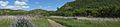
Looking east along the Tennessee Valley Trail, part of the Golden Gate National Recreation Area.
See also
 In Spanish: Condado de Marin para niños
