
Crawley facts for kids
Quick facts for kids
Crawley
|
||
|---|---|---|
|
Town and non-metropolitan borough
|
||
| Borough of Crawley | ||
|
The High Street, Queen's Square, Goff's Park House and the Memorial Gardens with the centre in the background
|
||
|
||
| Motto(s):
"I Grow and I Rejoice"
|
||

Crawley
Location in West Sussex
|
||
| Sovereign state | United Kingdom | |
| Constituent country | England | |
| Region | South East England | |
| Ceremonial county | West Sussex | |
| Historic county | Sussex (Town centre and outlying areas) Surrey (Gatwick Airport) |
|
| Admin HQ | Crawley Town Hall | |
| Founded | 5th century | |
| Borough status | 1974 | |
| Government | ||
| • Type | Borough | |
| • Body | Crawley Borough Council | |
| Area | ||
| • Borough | 17.36 sq mi (44.96 km2) | |
| Population
(2005 est.)
|
||
| • Borough | 112,409 (ranked 213th) | |
| • Density | 5,750/sq mi (2,221/km2) | |
| Ethnicity (2021) | ||
| • Ethnic groups |
List
|
|
| Religion (2021) | ||
| • Religion |
List
42.6% Christianity
35.1% no religion 9.7% Islam 5.7% not stated 5.1% Hinduism 0.7% Sikhism 0.5% other 0.4% Buddhism 0.1% Judaism |
|
| Time zone | UTC+0 (Greenwich Mean Time) | |
| Postcode |
RH6 and RH10–11
|
|
| Area code(s) | 01293 | |
| ISO 3166-2 | GB-WSX (West Sussex) | |
| ONS code | 45UE (ONS) E07000226 (GSS) |
|
| OS grid reference | TQ268360 | |
| NUTS 3 | UKJ24 | |
_-_geograph.org.uk_-_2555359.jpg)
.jpg)
.jpg)
.jpg)

Crawley is a town and borough in West Sussex, England. It is about 28 miles (45 km) south of London and 18 miles (29 km) north of Brighton and Hove. Crawley covers an area of 17.36 square miles (44.96 km²) and had a population of 118,493 people in 2021.
People have lived in the Crawley area since the Stone Age. It was a place where ironworking happened during Roman times. Crawley slowly grew into a market town from the 13th century, serving the villages around it. Its location on the main road from London to Brighton meant many travellers passed through, which helped coaching inns to grow. A train line to London opened in 1841.
Gatwick Airport, one of Britain's busiest international airports, started commercial flights near the town in 1933. This led to more businesses and industries moving to Crawley. After the Second World War, the British Government planned to move many people and jobs out of London to new towns. Crawley was chosen as one of these "new towns" in 1946. A big plan was made to build new homes, shops, and factories. This rapid growth made the town much bigger and its population grew a lot over a few decades.
Today, Crawley has 14 neighbourhoods that spread out from the old market town centre. Main roads and railway lines separate these areas. Nearby places like Ifield, Pound Hill, and Three Bridges became part of the new town as it grew. Crawley has become a major centre for industry and jobs between London and the south coast. Its large industrial area supports many companies, especially those linked to the airport. Shops and businesses also continue to expand.
Contents
- Exploring Crawley's Past: A Journey Through Time
- Crawley's Location and Environment
- Who Lives in Crawley?
- Crawley's Economy and Businesses
- Public Services in Crawley
- Getting Around Crawley
- Sports and Fun in Crawley
- Crawley's Heritage and Landmarks
- Learning in Crawley
- Media and News in Crawley
- Crawley's Twin Towns
- Famous People and Music Groups from Crawley
- Images for kids
- See also
Exploring Crawley's Past: A Journey Through Time
How Crawley Began
The area where Crawley is now might have been settled during the Mesolithic period, which was a very long time ago. Tools from the Neolithic period and the Bronze Age have been found here. Crawley is on the edge of the High Weald, a region that produced iron for over 2,000 years. In Goffs Park, which is now a park in the south of the town, there were two iron furnaces from the late Iron Age. Ironworking continued during Roman times, especially in the Broadfield area.
.JPG)
Around the 5th century, Saxon settlers called the area Crow's Leah. This meant "crow-infested clearing" or "Crow's Wood." This name slowly changed to Crawley by the early 14th century. Other nearby settlements were already well-known, like the Saxon church at Worth, built between 950 and 1050 AD.
Crawley itself isn't mentioned in the Domesday Book of 1086, but Ifield and Worth are. The first written record of Crawley is from 1202. King John allowed a weekly market to be held there on Wednesdays. Crawley slowly became more important over the centuries. In the 18th century, a new road, the turnpike, was built between London and Brighton. This made travel safer and faster. Crawley, being about halfway, became a busy stop for coaches.
By 1839, coaches ran almost every hour to both London and Brighton. The George, a building from the 15th century, grew into a large coaching inn. It even had an extra building in the middle of the wide High Street until the 1930s. The original building is now The George Hotel. It still has old features like an iron fireback.
Crawley's oldest church is St John the Baptist's. It's located between the High Street and The Broadway. People say it dates back to the 13th century, but much of it was rebuilt, especially in the 19th century. The oldest part left is the south wall of the nave, thought to be from the 14th century. The church has a 15th-century tower, which was rebuilt in 1804.
The Railway and Victorian Times

The first railway line in the Crawley area was the Brighton Main Line, which opened in 1841. A station was built at Three Bridges, which was then called East Crawley. Crawley railway station opened in 1848 at the end of the High Street. By 1861, a quarter of the people in Three Bridges worked for the railway.
The Longley company, a big building firm, moved to Crawley in 1881. By 1898, over 700 people worked there. Many new houses were built in the late 19th century. Areas like "New Town," West Green, and Southgate grew. The population reached 4,433 in 1901, up from 1,357 a century before.
In 1891, a racecourse opened at Gatwick. It was used for horse racing and even hosted the Grand National during the First World War. The racecourse had its own train station. By 1914, Crawley was a small but thriving town. Most homes had piped water and electricity, and gas lighting had been around for 50 years. A private airfield opened in 1930 near the racecourse. The Royal Air Force used it during the Second World War.
Building the New Town
In May 1946, Crawley was chosen to become a "New Town." This was made official on January 9, 1947. The new town covered about 5,920 acres (2,396 ha) across three counties. Thomas Bennett was put in charge of the Crawley Development Corporation. The plan was to fill in the spaces between the villages of Crawley, Ifield, and Three Bridges. Bennett thought it would take 15 years to build the town and increase its population from 9,500 to 40,000.
Work started quickly. A full plan was ready by 1949. It aimed for a population of 50,000, with homes in nine neighbourhoods around the town centre and a separate industrial area to the north. Each neighbourhood would have shops, a church, a public house, a primary school, and a community centre.
The first new homes were in West Green in the late 1940s. In 1950, Princess Elizabeth (who later became Queen Elizabeth II) officially opened the Manor Royal industrial area. Building continued through the 1950s in West Green, Northgate, Three Bridges, and later in Langley Green, Pound Hill, and Ifield. In 1956, land at "Tilgate East" became the new neighbourhood of Furnace Green.
The expected population of the town kept increasing. The 1949 plan was for 50,000, but this changed to 55,000 in 1956. By 1969, they even thought about expanding to 120,000 people.

New shops were built east of the old high street. The Broadwalk opened in 1954, and Queen's Square was officially opened by Queen Elizabeth II in 1958. Crawley railway station was moved closer to the new shops.
.JPG)
By April 1960, the town's population was 51,700. Many factories and industrial spaces had been built, and 21,800 people had jobs. The corporation had built over 10,000 houses.
New plans in 1961 suggested new neighbourhoods at Broadfield and Bewbush. Building started in Broadfield in the early 1970s and in Bewbush in 1974. These two neighbourhoods were larger than the first nine. Work also began in Ifield West.
By 1980, land at Maidenbower was chosen for another new neighbourhood, and building started in 1986. However, private companies built these homes, unlike the earlier ones owned by the council.
In 1999, plans for a 14th neighbourhood at Tinsley Green were announced. This was approved in 2011 and named Forge Wood. Construction began in 2015. Another neighbourhood, Kilnwood Vale, started building in 2012 on the western side of Crawley.
Crawley's Location and Environment
At 51.1092°N, 0.1872°W, Crawley is in the northeast part of West Sussex in South East England. It's about 28 miles (45 km) south of London and 18 miles (29 km) north of Brighton. Other towns nearby include Horley, Redhill, and Horsham. Crawley is bordered by districts like Mid Sussex and Horsham.
Crawley is in the Weald area, between the North and South Downs. The ground beneath the town is made of two types of rock: sandstone and clay. The highest point in the borough is 486 feet (148 m) above sea level. Crawley doesn't have large rivers, but several small streams flow into the River Mole, which starts near Gatwick Airport. There are also lakes at Tilgate Park and a mill pond at Ifield.
In 1822, a fossil collector named Gideon Mantell found teeth and bones of a huge lizard-like animal in Tilgate Forest near Crawley. He named it Iguanodon in 1825. In 1832, he also found and named the Hylaeosaurus dinosaur from the same forest.
Understanding Crawley's Weather
Crawley is in the Sussex Weald, an area with varied land, so the weather can change a lot over short distances. The nearest weather stations that record long-term weather are Gatwick and Charlwood, both about 3 miles north of Crawley town centre.
Generally, Crawley's location means summer temperatures are among the highest in the UK. Charlwood recorded 36.3°C (97.3°F) and Gatwick 36.4°C (97.5°F) on July 19, 2006. The highest temperature ever recorded at Charlwood was 36.5°C (97.7°F) on August 10, 2003.
The coldest temperature recorded at Gatwick since 1960 was −16.7°C (1.9°F) in January 1963. Air frost happens on about 58 nights a year at Gatwick.
Crawley gets more sunshine than many other inland areas because it's further south. Gatwick averaged 1,574 hours of sunshine per year between 1961 and 1990.
Snowfall can be heavier in the Sussex Weald than in other low-lying parts of central and southern England. This is because of moist weather systems coming from the south. However, because it's in the south, warmer air from the English Channel often melts the snow quickly.
Rainfall is lower than the English average but higher than some other areas in the South East. It rains 1mm or more on about 117 days a year.
| Climate data for Gatwick, elevation 62m,1971–2000, Sunshine 1961–90, extremes 1960– | |||||||||||||
|---|---|---|---|---|---|---|---|---|---|---|---|---|---|
| Month | Jan | Feb | Mar | Apr | May | Jun | Jul | Aug | Sep | Oct | Nov | Dec | Year |
| Record high °C (°F) | 14.0 (57.2) |
17.0 (62.6) |
22.2 (72.0) |
24.5 (76.1) |
30.0 (86.0) |
33.8 (92.8) |
36.4 (97.5) |
35.6 (96.1) |
31.6 (88.9) |
24.7 (76.5) |
18.3 (64.9) |
15.2 (59.4) |
36.4 (97.5) |
| Mean daily maximum °C (°F) | 7.3 (45.1) |
7.6 (45.7) |
10.4 (50.7) |
12.8 (55.0) |
16.7 (62.1) |
19.5 (67.1) |
22.2 (72.0) |
22.1 (71.8) |
18.9 (66.0) |
14.8 (58.6) |
10.5 (50.9) |
8.2 (46.8) |
14.3 (57.7) |
| Mean daily minimum °C (°F) | 1.1 (34.0) |
0.8 (33.4) |
2.3 (36.1) |
3.7 (38.7) |
6.8 (44.2) |
9.6 (49.3) |
11.9 (53.4) |
11.5 (52.7) |
9.2 (48.6) |
6.5 (43.7) |
3.2 (37.8) |
2.0 (35.6) |
5.8 (42.4) |
| Record low °C (°F) | −16.7 (1.9) |
−14.5 (5.9) |
−11.3 (11.7) |
−5.7 (21.7) |
−4 (25) |
−1.6 (29.1) |
2.8 (37.0) |
1.6 (34.9) |
−0.7 (30.7) |
−4.7 (23.5) |
−8.6 (16.5) |
−12 (10) |
−16.7 (1.9) |
| Average precipitation mm (inches) | 83.85 (3.30) |
51.84 (2.04) |
59.89 (2.36) |
50.84 (2.00) |
49.30 (1.94) |
58.80 (2.31) |
42.36 (1.67) |
52.66 (2.07) |
65.29 (2.57) |
82.14 (3.23) |
78.86 (3.10) |
84.36 (3.32) |
746.97 (29.41) |
| Mean monthly sunshine hours | 52.4 | 71.3 | 113.4 | 153.0 | 204.3 | 204.3 | 204.5 | 195.3 | 148.1 | 110.5 | 69.3 | 47.8 | 1,574.2 |
| Source 1: YR.NO | |||||||||||||
| Source 2: NOAA | |||||||||||||
Crawley's Neighbourhoods and Areas


Crawley has 14 neighbourhoods, each with different types of homes like terraced, semi-detached, and detached houses, as well as flats and bungalows. There are no tall residential tower blocks, except for the 8-storey Milton Mount Flats in Pound Hill. Many houses have gardens and are set back from the roads.
Each neighbourhood has a small shopping area, a community centre, a church, a school, and green spaces for recreation. The original idea was for neighbourhood shops to sell only basic items, and for people to do most of their shopping in the town centre.
Each of the 14 neighbourhoods has its own colour. This colour is shown on street name signs throughout the town.
| Number on map |
Name | Colour | Construction commenced |
Population |
|---|---|---|---|---|
| 1 | Langley Green | Grey | 1952 | 7,286 |
| 2 | Northgate | Dark green | 1951 | 4,407 |
| 3 | Pound Hill | Orange | 1953 | 14,716 |
| 4 | Maidenbower | Blue | 1987 | 8,070 |
| 5 | Furnace Green | Light green | 1960 | 5,734 |
| 6 | Tilgate | Red | 1955 | 6,198 |
| 7 | Broadfield | Sky blue | 1969 | 12,666 |
| 8 | Bewbush | Light brown | 1975 | 9,081 |
| 9 | Ifield | Purple | 1953 | 8,414 |
| 10 | West Green | Dark blue | 1949 | 4,404 |
| 11 | Gossops Green | Maroon | 1956 | 5,014 |
| 12 | Southgate | Brown | 1955 | 8,106 |
| 13 | Three Bridges | Yellow | 1952 | 5,648 |
| 14 | Forge Wood | Pink | 2014 |
There are also areas near Crawley that are not official neighbourhoods:
- The Manor Royal industrial estate is in the north. Its street signs say "Industrial" on a black background.
- Crawley's town centre is in the southernmost part of Northgate.
- Gatwick Airport was built where Gatwick Manor used to be, near Lowfield Heath village. Most of the village was removed for the airport, but St Michael and All Angels Church still stands.
- Worth was a village that is now mostly within Crawley's boundaries.
- Tinsley Green, a small settlement in Worth parish, is now part of the Forge Wood neighbourhood. It's famous for hosting the British and World Marbles Championship every year since 1932.
- The small settlement of Fernhill is east of Gatwick Airport. It became fully part of Crawley in 1990.
 |
Dorking | Horley, Reigate, Redhill | Copthorne | |
| Horsham | Crawley Down, East Grinstead | |||
| St Leonards Forest | Haywards Heath, Burgess Hill | Balcombe |
Who Lives in Crawley?
| Year | Population |
|---|---|
| 1901 | 4,433 |
| 1921 | 5,437 |
| 1941 | 7,090 |
| 1961 | 25,550 |
| 1981 | 87,865 |
| 2001 | 99,744 |
| 2011 | 106,597 |
| 2021 | 118,493 |
In the 2011 census, Crawley's population was 106,597. By the 2021 census, it had grown to 118,493. This growth is much faster than many other towns of similar size.
According to the 2021 census, 73.4% of Crawley's population was White. Of these, 61.8% identified as White British. People of Asian background made up 15.4% of the population, with Indians and Pakistanis being the largest groups. People of Black descent made up 4.5%. Crawley also has a notable Mauritian community.
The largest religious group was Christianity at 42.6%. Many people, 35.1%, said they had no religion. Islam was the third largest at 9.7%, followed by Hinduism at 5.1%.
Most people (84.3%) in Crawley speak English as their main language. Other languages spoken include Romanian (2.1%), Polish (1.7%), and Portuguese (1.4%). There is also a Tamil learning centre in the town.
Many Chagossians who moved from the Chagos Archipelago in the Indian Ocean settled in Crawley in the 1960s and 1970s. In 2016, it was reported that about 3,000 Chagossians lived in Crawley. The local MP, Henry Smith, said Crawley is home to "perhaps the largest Chagossian population in the world."
Crawley has about 2,635 people per square kilometre, making it the second most crowded district in West Sussex. In 2021, about 28.6% of people worked in management, administration, or professional jobs. This varied across different areas of the town.
The number of people in Crawley with higher education qualifications is lower than the national average. About 27.5% have a qualification at level 4 or higher, compared to 33.9% across the UK.
Crawley's Economy and Businesses
| Labour Profile | ||
|---|---|---|
| Total employee jobs | 79,700 | |
| Full-time | 58,100 | 72.9% |
| Part-time | 21,600 | 27.1% |
| Manufacturing | 7,500 | 9.4% |
| Construction | 1,800 | 2.2% |
| Services | 70,100 | 87.9% |
| Distribution, hotels & restaurants | 19,600 | 24.6% |
| Transport & communications | 23,900 | 30.0% |
| Finance, IT, other business activities | 15,400 | 19.3% |
| Public admin, education & health | 9,600 | 12.1% |
| Other services | 1,600 | 2.0% |
| Tourism-related | 6,600 | 8.3% |
Crawley started as a market town. The Development Corporation wanted it to become a centre for manufacturing and light engineering, with a special industrial zone. The fast growth of Gatwick Airport created many jobs in aviation, transport, and storage. The importance of the airport led to the creation of the Gatwick Diamond partnership. This group works to keep Crawley and Gatwick important for the economy.
Since the Second World War, unemployment in Crawley has been low. In 2003, only 1.47% of working-age people were unemployed. Crawley has become one of the most important business and employment centres in the South East England region.
In April 2020, a group called the Centre for Cities said Crawley was at high risk of job losses due to the coronavirus pandemic. They estimated that 56% of jobs in the town were vulnerable.
Manufacturing in Crawley
Crawley was already a small industrial town by the end of the Second World War. Building was a big industry, with 800 people working for building firms. In 1949, 1,529 people worked in manufacturing, mainly in light engineering and aircraft repair. Many of these jobs needed special skills.
Industrial development was important for the new town. It helped move people and jobs out of London, which was crowded and damaged by the war. The Development Corporation wanted Crawley to have many different types of industries. They planned for factories to be in one area, called Manor Royal. This area had flat land, was close to the railway and major roads, and had space for growth. Princess Elizabeth opened the first part of Manor Royal on January 25, 1950.
The Corporation wanted many different types of manufacturing businesses, not just one. They didn't offer money to attract companies. Instead, they made it easy for businesses to set up by offering large plots of land and ready-made buildings.
Many companies wanted to move to Manor Royal. The Development Corporation could choose the best companies to create a good mix of industries. One year after Manor Royal opened, 18 companies were operating there. By 1964, businesses that had moved to Crawley since 1950 employed 16,000 people.
Thales Group opened a new factory and office complex in Crawley in 2009. This brought together their manufacturing and offices from other parts of the south-east of England.
Service Industry and Shops

While many early jobs were in manufacturing, the service industry grew strongly from the 1960s. The Manor Royal estate, with its space and closeness to Gatwick Airport, attracted airport-related services. These included logistics, catering, and warehousing. Companies also built offices throughout the town. Office space in Crawley grew a lot between 1965 and 1984.

Companies with headquarters in Crawley include Doosan Babcock Energy, WesternGeco, Virgin Atlantic, and Dualit. The UK headquarters of Nestlé is also in the Manor Royal area. British Airways used to have offices in Crawley, called "Astral Towers."
Crawley has many hotels, including The George Hotel, which dates back to 1615. It is said to be haunted.
Shopping and Retail in Crawley
.jpg)
.JPG)
Even before the new town was planned, Crawley was a shopping centre for the area. In 1948, there were 177 shops, with 99 on the High Street. New residents relied on these shops until the new shopping area was built east of the High Street. The Broadwalk, with 23 shops, opened in 1954. The Queen's Square complex opened in the mid-1950s and was officially opened by Queen Elizabeth II in 1958. By 1960, Crawley was known as an important regional shopping centre.
In the 1960s and 1970s, large branches of Tesco, Sainsbury's, and Marks & Spencer opened. The Tesco superstore was the biggest in Britain at the time. The shopping area also expanded southeast from Queen's Square. In 1992, a large shopping centre called County Mall opened. It has major shops like The Entertainer, Boots, and WHSmith, plus over 80 smaller stores.
A plan to improve the town centre, "Centre Vision 2000," was made in 1993. This led to more shopping space in Queen's Square and The Martlets. An ASDA superstore opened in September 2003 at the south end of the High Street.
Public Services in Crawley


The police force in Crawley is Sussex Police. The British Transport Police look after the railway network. Crawley is the police headquarters for West Sussex. There is a police station in the town centre that is open 24 hours a day. Fire and rescue services are provided by the West Sussex Fire and Rescue Service. The South East Coast Ambulance Service provides ambulance services.
Crawley Hospital in West Green is run by West Sussex Primary Care Trust. Some services are also provided by the Surrey and Sussex Healthcare NHS Trust. This includes a 24-hour Urgent Treatment Centre for injuries that are not life-threatening.
Thames Water handles all wastewater and sewerage. Most residents get their drinking water from Southern Water. Some areas in the north get water from Sutton & East Surrey Water, and Maidenbower is supplied by South East Water.
UK Power Networks is in charge of electricity. Gas is supplied by Southern Gas Networks.
As the town grew in the 1950s and 1960s, new public services were opened. These included a fire station in 1958, a telephone exchange, police station, and health clinic in 1961, and an ambulance station in 1963.
In December 2008, a new three-storey library opened in Southgate Avenue. It replaced a much smaller library.
The Civil Aviation Authority has its Regulation Safety Group at Aviation House in Gatwick Airport in Crawley.
Getting Around Crawley
Crawley's growth as a market town was helped by its location on the London–Brighton turnpike road. The town got its first train links in the mid-19th century. Since it became a new town, there have been big improvements to roads, including a motorway. There's also a special guided bus system and a major international airport.
Road Travel in Crawley
The old London–Brighton turnpike road went through the centre of Crawley, forming the High Street. This road was later named the A23. In 1938, a new dual carriageway was built to bypass the town. Later, the M23 motorway opened in 1975, running east of the town. This motorway connects London's orbital motorway, the M25, to the A23 at Pease Pottage, south of Crawley. The old A23 through the town became the A2219.
The M23 has junctions near Crawley at the A2011/A264 (Junction 10) and Maidenbower (Junction 10A). The end of the motorway at Pease Pottage is Junction 11. The A2011 is another dual-carriageway that links to the town centre. The A2220 follows the old route of the A264 through the town.
Train Services in Crawley
.JPG)
The first railway line in the area was the Brighton Main Line, which opened in 1841. It ran through Three Bridges, where a station was built.
A train line to Horsham opened in 1848, and a station was built next to Crawley High Street. A new station was built slightly east in 1968, replacing the original one.
Crawley has three train stations: Crawley, Three Bridges, and Ifield railway station. Ifield station opened in 1907.
Regular train services run from Crawley and Ifield to London Victoria and London Bridge stations. You can also get to Gatwick Airport, East Croydon, Horsham, Bognor Regis, Chichester, Portsmouth, and Southampton. Three Bridges has direct Thameslink trains to Bedford and Brighton.
Bus and Fastway Services

In 1958, bus companies agreed to provide services throughout Crawley. Later, Metrobus became Crawley's main bus operator. It runs local services between the neighbourhoods and the town centre. It also has longer routes to places like Horsham, Redhill, and Brighton.
In September 2003, a guided bus service called Fastway started operating between Bewbush and Gatwick Airport. A second route from Broadfield to Horley was added in 2005.
Gatwick Airport's Role

Gatwick Airport was first licensed as a private airfield in August 1930. It was used by the RAF during the Second World War. It became a civil airport again in 1946. In 1950, the government decided to develop it as London's second airport. It was closed for rebuilding between 1956 and 1958, and Queen Elizabeth II reopened it on June 9, 1958. A second terminal, the North Terminal, was built in 1988.
There was an agreement that no second runway would be built before 2019. Discussions about expanding the airport have happened, but it was decided that no further expansion would occur unless it was impossible to meet growth targets at London Heathrow Airport without causing too much pollution.
Sports and Fun in Crawley


Crawley Town F.C. is Crawley's main football team. It was formed in 1896. In 1997, the club moved to the new Broadfield Stadium, which the council now owns. For the 2024/25 season, Crawley Town F.C. plays in League One, which is the third level of English football.
The women's football club, Crawley Wasps F.C., plays in the FA Women's National League South. Crawley Rugby Club is based in Ifield, and a golf course was built in 1982 at Tilgate Park. Crawley Hockey Club plays at Hazelwick School. Three Bridges Cricket Club is a founding member of the Sussex Cricket League.
Crawley's first leisure centre opened in the 1960s in Three Bridges. It had a large swimming pool, which opened in 1964. An athletics arena was added by 1967, and a big sports hall opened in 1974. However, these facilities became too small for the growing town.
In 2005, the old leisure centre was replaced by a new one called the K2 Leisure Centre. It is near the Broadfield Stadium. This centre has the only Olympic-sized swimming pool in South East England. It opened to the public on November 14, 2005, and was officially opened by Lord Coe in 2006. In March 2008, the K2 Leisure Centre was chosen as a training site for the 2012 Olympics in London.
The Crawley Development Corporation didn't plan much for the arts when the new town was built. It wasn't until 1988 that Crawley got a dedicated theatre and arts venue, called the Hawth Theatre. Crawley's first cinema, the Imperial Picture House, was open from 1909 until the 1940s. The Embassy Cinema on the High Street opened in 1938. Now, there's a large Cineworld cinema at the Crawley Leisure Park. This park also has ten-pin bowling, restaurants, and a fitness centre.
Each neighbourhood has its own recreational areas, and there are other larger parks in the town. The Memorial Gardens, east of Queen's Square, have art, play areas, and lawns. Goffs Park in Southgate covers 50 acres (20 ha) and has lakes, boating ponds, and a model railway. Tilgate Park and Nature Centre has walled gardens, lakes, woodlands with paths, and a collection of animals and birds.
Crawley's Heritage and Landmarks

Crawley Museum is in the town centre. It displays Stone Age and Bronze Age items found in the area. It also has more recent objects, including parts of Vine Cottage, an old timber-framed building on the High Street. This cottage was once home to Mark Lemon, the first editor of Punch magazine.
Crawley has three Grade I listed buildings. These are St Margaret's Church, Ifield, St. Nicholas' Church, Worth, and the Friends Meeting House in Ifield. There are also 12 Grade II* listed buildings and 85 Grade II listed buildings. The borough council has also given "locally listed building" status to 58 buildings.

Every November, the High Street becomes a focus for old cars. It's one of the official stops on the London to Brighton Veteran Car Run.
Learning in Crawley

.jpg)
In 2004, Crawley's schools changed from a three-tier system (first, middle, and secondary) to a more common primary/secondary system. Now, Crawley has 17 primary schools (including Church of England and Roman Catholic schools) and four pairs of infant and junior Schools.
There are six secondary schools in Crawley:
- Ifield Community College
- Hazelwick School
- Holy Trinity Church of England School
- Oriel High School
- St Wilfrid's Catholic School
- Thomas Bennett Community College
All six of these schools have a sixth form for older students.
There is also a primary and secondary school called The Gatwick School, which opened in 2014. It is a Free School. Schools at Ifield and Thomas Bennett also offer adult education programmes.
Students with special needs go to two special schools in the town: Manor Green Primary School and Manor Green College.
Desmond Anderson Primary School became an Academy in February 2017. The Atelier 21 Future School, for students aged 4 to 14, opened in Broadfield House in August 2020.
Further education is provided by Central Sussex College. It opened in 1958 as Crawley Technical College and merged with other colleges in 2005. The college also offers higher education courses with the universities at Chichester and Sussex.
Media and News in Crawley
Crawley has two main local newspapers. The Crawley Observer started in 1881. It is now owned by Johnston Press. The Crawley News first came out in 1979.
In September 2008, Johnston Press launched a new weekly newspaper called the Crawley Times.
Crawley receives TV from London (BBC London and ITV London) or from the South East (BBC South East and ITV Meridian). This means the town gets news from both London and Tunbridge Wells.
Radio Mercury started broadcasting on October 20, 1984, from Broadfield House. The station is now part of Heart South. Local BBC radio is provided by BBC Sussex.
Crawley's Twin Towns
Crawley is twinned with:
- Dorsten, Germany, since 1973
- Alytus, Lithuania
Famous People and Music Groups from Crawley
- Notable people from Crawley
-

Erin Doherty
-
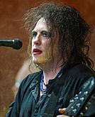
Robert Smith
-
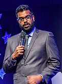
Romesh Ranganathan
-

Dan Walker
-
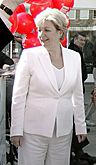
Laura Moffatt
.jpg)
_crop.jpg)
.jpg)

_2018-6-69_Gareth_Southgate.jpg)


- Simon Calder, a travel journalist, grew up in Crawley.
- Sir Charles Court, a former Premier of Western Australia, was born in Crawley.
- Erin Doherty, an actress known for The Crown.
- Caroline Haslett, an electrical pioneer and engineer, was a vice-president of the Crawley New Town Development Corporation.
- Leadley (Bethan Mary Leadley), a singer-songwriter and TV presenter.
- Simon Jeffes, a musician and composer, was born in Crawley.
- Mark Lemon, the first editor of Punch, lived on the High Street.
- Jordan Maguire-Drew, a professional footballer.
- Alan Minter, a boxer who won an Olympic bronze medal and was a world middleweight champion.
- Ross Minter, a boxer and son of Alan Minter.
- Laura Moffatt, a British politician who was the MP for Crawley from 1997 to 2010.
- Kevin Muscat, a footballer who played for Australia.
- Natasha Pyne, an actress.

- Romesh Ranganathan, a comedian and TV personality, used to be a maths teacher at Hazelwick School.
- Grace Saif, an actress known for 13 Reasons Why.
- Gareth Southgate, a former England football player and manager.
- Daley Thompson, an athlete who won two Olympic gold medals in Decathlon, trained in Crawley.
- Theresa Tomlinson, a writer for children and young adults, was born in Crawley.
- Peter Vaughan, an actor known for Game of Thrones.
- Dan Walker, a BBC presenter, was born and raised in Crawley.
- The Cure, a famous music group, was formed in Crawley in 1976.
- Members of The Feeling, a music group, also went to school in Crawley.
- Brett Marvin and the Thunderbolts, a music group, were formed in Crawley in 1968.
Images for kids
-
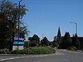
Church Road in Lowfield Heath village.
_01.JPG)
See also
 In Spanish: Crawley para niños
