North Island facts for kids
|
Te Ika-a-Māui (Māori)
|
|
|---|---|
 |
|
| Geography | |
| Location | Oceania |
| Coordinates | 39°S 176°E / 39°S 176°E |
| Archipelago | New Zealand |
| Major islands | North Island |
| Area | 113,729 km2 (43,911 sq mi) |
| Area rank | 14th |
| Highest elevation | 2,797 m (9,177 ft) |
| Highest point | Mount Ruapehu |
| Administration | |
|
New Zealand
|
|
| ISO 3166-2:NZ | NZ-N |
| Regions | 9 |
| Territorial authorities | 43 |
| Largest settlement | Auckland (pop. 1,478,800) |
| Demographics | |
| Demonym | North Islander |
| Population | 3,997,300 (June 2023) |
| Pop. density | 35.1 /km2 (90.9 /sq mi) |
| Ethnic groups | European (63.1%), Māori (19.8%), Asian (19.3%), Pacific peoples (10.6%) |
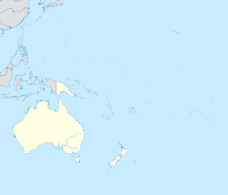
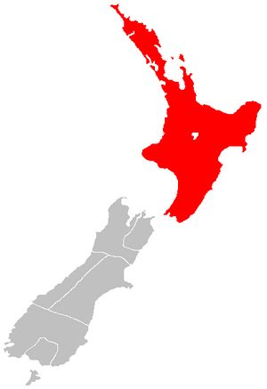
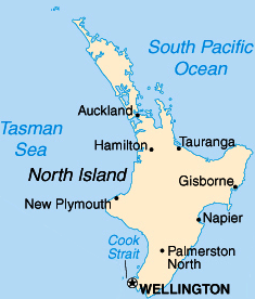
The North Island is one of the two main islands of New Zealand. It is separated from the South Island by Cook Strait. The North Island is smaller than the South Island but has more people living on it.
It covers an area of about 113,729 square kilometres. This makes it the 14th largest island in the world. It also makes up 43% of New Zealand's total land. The North Island is home to about 3,997,300 people. This is about 77% of all New Zealand residents. It is the most populated island in Polynesia. It is also the 28th most populated island globally.
Many important cities are found on the North Island. These include Auckland, which is the largest city. The capital city of New Zealand, Wellington, is also located here. Other major cities are Hamilton, Tauranga, and Rotorua.
Contents
Understanding the North Island's Names
The North Island has been known by this name for a long time. Its Māori name is Te Ika-a-Māui. This means 'the fish of Māui'. Both names, North Island and Te Ika-a-Māui, are now official.
Long ago, in the 1800s, some maps called it New Ulster. This name came from a province in Ireland. In 2009, experts found that the North Island didn't have an official name. So, in 2013, they made both "North Island" and "Te Ika-a-Māui" official.
When you talk about the island, you usually say "the North Island". For example, "Hamilton is in the North Island." But on maps or in titles, you just say "North Island."
Māori Legends of the North Island
Māori myths tell a special story about how the North and South Islands were formed. A demigod named Māui was fishing with his brothers. They were in their canoe, which became the South Island. Māui caught a giant fish and pulled it out of the sea.
While Māui wasn't looking, his brothers started fighting over the fish. They chopped it into pieces. This huge fish became the North Island. That's why one of its Māori names is Te Ika-a-Māui, meaning "The Fish of Māui." The mountains and valleys you see today are believed to be the marks from Māui's brothers chopping the fish.
When Captain James Cook explored New Zealand in the late 1700s, a Tahitian navigator named Tupaia was with him. Tupaia's maps also showed the North Island with names like "Ea Heinom Auwe." These names recognized the "Fish of Māui" story.
Another Māori name, Aotearoa, was once used for the North Island. But now, Aotearoa is the collective Māori name for all of New Zealand.
Exploring the North Island's Geography
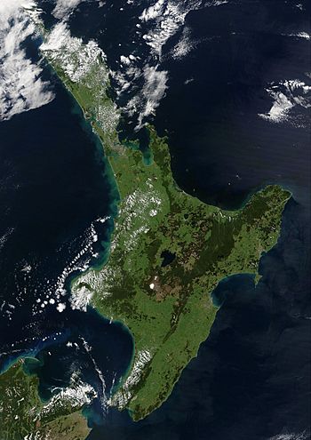
Thousands of years ago, during the last Ice Age, sea levels were much lower. The North and South Islands were actually connected by a large flat area. Most of the North Island was covered in forests and scrubland. The northern part, called the Northland Peninsula, had a warm, wet rainforest.
About 7,000 years ago, sea levels rose. This caused the islands to separate. It also connected the Cook Strait to the Tasman Sea.
Coastal Features and Bays
The North Island has many beautiful bays and coastal areas:
- Bay of Islands
- Bay of Plenty
- Hauraki Gulf
- Firth of Thames
- Hawke Bay
- Ninety Mile Beach
- North Taranaki Bight
- South Taranaki Bight
Lakes and Rivers of the North Island
Important bodies of water on the island include:
Capes and Peninsulas
The North Island has several notable capes and peninsulas:
Forests and National Parks
The North Island is home to amazing natural parks and forests:
- Egmont National Park
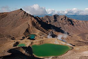
- Tongariro National Park
- Waipoua Kauri Forest
- Whanganui National Park
- Many other forest parks of New Zealand
Volcanoes and Volcanic Areas
The North Island has several active and dormant volcanoes:
- Auckland Volcanic Field
- Mount Ruapehu
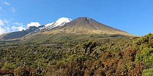
- Mount Taranaki (also called Taranaki Maunga)
- Mount Tarawera
- Whakaari / White Island
- North Island Volcanic Plateau
Other Natural Wonders
- Waitomo Caves
- Taumatawhakatangihangakoauauotamateaturipukakapikimaungahoronukupokaiwhenuakitanatahu (a very long place name!)
People and Culture of the North Island
The North Island has an estimated population of 3,997,300 as of June 2023. In the 2023 New Zealand census, the population was 3,808,005. This was an increase of over 213,000 people since 2018.
For many years, more people have moved to the North Island. This is called a "Northern drift." It means that cities in the North Island have grown faster than those in the South Island. This trend continues today, but at a slower pace. The North Island's population grows because more babies are born there than people die. Also, more people move there from other countries.
Diverse Cultures and Identities
In the 2023 census, people on the North Island identified with different ethnic groups:
- 63.1% identified as European (also called Pākehā)
- 19.8% identified as Māori
- 10.6% identified as Pacific peoples
- 19.3% identified as Asian
- 1.9% identified as Middle Eastern, Latin American, or African
- 1.1% identified with other ethnicities
People can choose more than one ethnicity. Māori people make up the majority in three North Island districts: Kawerau, Ōpōtiki, and Wairoa.
About 29.3% of North Islanders were born overseas. The most common countries they came from are England, Mainland China, India, South Africa, Australia, and Samoa.
Major Cities and Towns
The North Island has a larger population than the South Island. The country's biggest city, Auckland, and the capital, Wellington, hold almost half of the North Island's population.
Here are some of the urban areas in the North Island with populations of 10,000 or more:
| Name | Population (June 2023) |
% of island |
|---|---|---|
| Auckland | 1,478,800 | 37.0% |
| Wellington | 215,200 | 5.4% |
| Hamilton | 185,300 | 4.6% |
| Tauranga | 161,800 | 4.0% |
| Lower Hutt | 113,000 | 2.8% |
| Palmerston North | 82,500 | 2.1% |
| Napier | 67,500 | 1.7% |
| Porirua | 60,900 | 1.5% |
| Hibiscus Coast | 63,400 | 1.6% |
| New Plymouth | 59,600 | 1.5% |
| Rotorua | 58,900 | 1.5% |
| Whangārei | 56,900 | 1.4% |
| Hastings | 51,500 | 1.3% |
| Upper Hutt | 45,400 | 1.1% |
| Whanganui | 42,800 | 1.1% |
| Gisborne | 38,200 | 1.0% |
| Paraparaumu | 30,800 | 0.8% |
| Pukekohe | 27,400 | 0.7% |
| Taupō | 26,500 | 0.7% |
| Masterton | 22,600 | 0.6% |
| Cambridge | 21,800 | 0.5% |
| Levin | 19,800 | 0.5% |
| Feilding | 17,750 | 0.4% |
| Whakatāne | 16,850 | 0.4% |
| Havelock North | 15,200 | 0.4% |
| Tokoroa | 14,500 | 0.4% |
| Waikanae | 13,150 | 0.3% |
| Te Awamutu | 14,000 | 0.4% |
| Hāwera | 10,350 | 0.3% |
| Te Puke | 10,250 | 0.3% |
Economy of the North Island
The North Island's economy is very strong. In 2021, its sub-national GDP was estimated at NZ$282.355 billion. This makes up 78% of New Zealand's total national GDP.
How the North Island is Governed
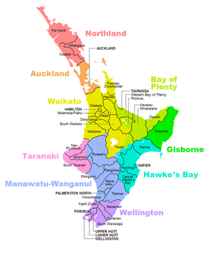
The North Island is divided into nine main areas for local government. These are called regions. Each region has its own local council that helps manage the area.
Here are the nine regions:
- Northland
- Auckland
- Waikato
- Bay of Plenty
- Gisborne
- Taranaki
- Manawatū-Whanganui
- Hawke's Bay Region
- Wellington Region
Healthcare Services
Healthcare on the North Island is managed by different District Health Boards (DHBs). These boards organize health services for specific areas.
See also
 In Spanish: Isla Norte para niños


