
Quelccaya Ice Cap facts for kids
Quick facts for kids Quelccaya |
|
|---|---|
| Quenamari | |
.jpg)
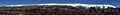
November 2022 satellite image of the glacier by Sentinel-2.
|
|

Location in Peru
|
|
| Type | Ice cap |
| Coordinates | 13°55′30″S 70°49′03″W / 13.92500°S 70.81750°W |
| Area | 42.8 sq km (16.5 sq mi) in 2009 |
| Length | 17 km |
| Width | 3-5 km |
| Thickness | 100-150 m (200 m at thickest) |
| Highest elevation | 5,700 m |
| Lowest elevation | 5,200 m |
| Status | Retreating |
The Quelccaya Ice Cap (also called Quenamari Ice Cap) is the second largest area of ice in the tropics. It is located in the Andes mountains of Peru. This huge ice cap covers about 42.8 square kilometers (16.5 square miles). The ice can be as thick as 200 meters (650 feet).
Quelccaya is surrounded by tall ice cliffs. It also has many smaller glaciers flowing out from it. The biggest of these is the Qori Kalis Glacier. You can also find lakes, rocky hills called moraines, and wet areas like peat bogs nearby. Many plants and animals live here, including birds that build nests right on the ice. Quelccaya is a very important source of water. Its melting ice flows into the Inambari and Vilcanota Rivers.
Scientists have taken long samples of ice, called ice cores, from Quelccaya. These ice cores help them learn about past climates. They show evidence of the Little Ice Age and old El Niño events. They also reveal times of drought and wet periods. Scientists regularly watch the ice cap and have a weather station there.
In the past, Quelccaya was much bigger. It grew and shrank many times over thousands of years. After a big expansion during the Little Ice Age, Quelccaya has been shrinking. This is happening because of human-caused climate change. The Qori Kalis Glacier, in particular, is melting very fast. As the ice melts, new lakes form. These lakes can be dangerous because they might cause floods if their banks break. Experts predict that Quelccaya could disappear in the next 100-200 years if climate change continues.
Contents
Where is Quelccaya Located?
The Quelccaya Ice Cap is in the high tropical mountains of southern Peru. It is part of the eastern Andes mountain range. The Amazon rainforest is only about 40 kilometers (25 miles) away. You can even see it from the top of Quelccaya. Lake Titicaca is about 120 kilometers (75 miles) to the south. Quelccaya is in the Cuzco Department of Peru.
Peru has about 70% of all tropical glaciers in the world. Quelccaya is one of the few tropical ice caps. Others are found in New Guinea and the Rwenzori Mountains in Africa.
People and the Ice Cap
The Quelccaya ice cap is in a quiet, faraway area. Local people call it Quenamari. Since 2020, Quelccaya has been part of a special protected area. The local people also see Quelccaya as an important apu, which means a holy spirit.
The area around the ice cap does not have many people. The city of Cuzco is about 130 kilometers (80 miles) away. The closest road is still 40 kilometers (25 miles) from the ice cap. It can take three days to reach the ice cap using pack animals. There are a few camps near Quelccaya for scientists and visitors.
Understanding the Ice Cap
The Quelccaya ice cap stretches about 17 kilometers (10.5 miles) from north to south. It is between 3 and 5 kilometers (1.8 to 3 miles) wide. The ice cap sits at an elevation of 5,200 to 5,700 meters (17,000 to 18,700 feet). The highest point nearby is Joyllor Puñuna, at 5,743 meters (18,842 feet).
The ice forms a fairly thin and flat shape with several ice domes. The ice is about 100-150 meters (330-490 feet) thick near the top. Its thickest point is about 200 meters (650 feet). As of 2018, the ice cap holds over 1 cubic kilometer (0.24 cubic miles) of ice.
Between 1975 and 2010, Quelccaya covered about 50.2 square kilometers (19.4 square miles). By 2009, it had shrunk to 42.8 square kilometers (16.5 square miles). This made it smaller than the ice on Coropuna, another glacier. Before this, Quelccaya was the largest ice area in the tropics.
The ice flows outwards from the center of the cap. Most of Quelccaya's edges are ice cliffs up to 50 meters (160 feet) tall. These cliffs often show layers of ice. Shorter glaciers, up to 2 kilometers (1.2 miles) long, flow down from the ice cap. The largest of these is the Qori Kalis Glacier. Most ice loss at Quelccaya happens when the ice melts at the bottom. At the very top of the ice cap, ice also turns directly into vapor, a process called sublimation.

Ice Cap Features
The surface of the ice cap has special shapes. These include penitentes, which are tall blades of ice. They are more common at lower parts of the ice cap. At higher elevations, the ice forms plate-shaped or column-shaped crystals.
Scientists explored the ice cap in the 1970s. They found glacier caves inside Quelccaya. Some caves formed when ice covered obstacles, creating empty spaces. Others formed from cracks in the ice that then froze over. These caves have wavy walls and contain ice formations. These formations look like cave corals, flowstones, stalactites, and stalagmites, but they are all made of ice!
How the Ice Works
The ice in Quelccaya is called "temperate ice." This means that below about 10 meters (33 feet) deep, the ice temperature is at 0 degrees Celsius (32 degrees Fahrenheit). Radar scans show that there are also pockets of water inside the ice.
The ice of Quelccaya has not worn away the ground much recently. This is shown by old plant remains found underneath it. It seems the ice cap was more erosive when it was shrinking. When it expanded, it was "cold-based," meaning it didn't produce much meltwater and didn't erode the ground.
Tiny particles of iron, silica, and sodium gather on the ice cap, especially in the dry season. These mostly come from the Altiplano region of the Andes. Sulfate and nitrate are also found, possibly from the Amazon rainforest. Scientists have also found tiny Diatoms, insects, and pollen in the ice.
In winter, the ice reflects about 80% of the sun's energy. This high reflectivity, along with temperature and wind, affects how the ice surface looks.
Land Around Quelccaya
The flat land that Quelccaya sits on is made of smooth rock. It slopes gently from northeast to southwest. This means even a small rise in temperature can cause a big change in the ice cap's size. The plateau is surrounded by steep slopes called escarpments. Many valleys lead away from the plateau.
West of Quelccaya, these valleys include Qori Kalis, Challpa Cocha, Huancané, and "South Fork." The Huancané valley is wide and flat. It has the Huancané River flowing through it. You can find rocky hills (moraines) left by old glaciers in these valleys. These areas also have wet spots, ponds, and peat bogs.
Many lakes are found near Quelccaya. Some examples include Laguna Accocancha, Challpacocha, and North Lake. North Lake, Base Camp Lake, and Boulder Lake formed when glaciers melted away.
Rocks and Earth
Quelccaya sits on a plateau made of volcanic rocks called ignimbrites and tuffs. These rocks formed about six million years ago. Not much erosion has happened since then. There is also a crack in the Earth's crust, called a normal fault, west of Quelccaya. This fault is still active.
Weather and Climate
About 1,150 millimeters (45 inches) of snow falls on Quelccaya each year. This is a lot wetter than most of the tropical Andes. This moisture comes from the Amazon rainforest and the Atlantic Ocean. It is carried to Quelccaya by trade winds.
Most of the rain and snow falls during the summer monsoon season. This is when warm air rises, causing strong storms. The mountains also force air upwards, creating more rain and snow. Most precipitation happens in the afternoon.
Temperatures at Quelccaya are fairly steady throughout the year. The difference between day and night temperatures is often bigger than seasonal changes. Temperatures at the top of Quelccaya are usually between -4.8°C and -4.2°C (23.4°F and 24.4°F). Because of global warming, temperatures on the summit sometimes rise above freezing. This makes the ice cap melt faster.
Winds are strongest during the day and mostly blow from the west. The ice cap also creates its own cool wind that blows downhill.
Climate Changes Over Time
The climate at Quelccaya is affected by El Niño-Southern Oscillation (ENSO). During El Niño years, there is much less rain and snow. This is because westerly winds block moisture from the east. Temperatures also change during El Niño events, usually getting warmer.
Ice cores show how the climate has changed in the past. For example, there was more rain and snow between 1870–1984 and 1500–1720. There were also dry periods, like between 1720–1860. Some dry periods have been linked to big changes in ancient Peruvian cultures. In recent years, temperatures have been steadily increasing, even if rainfall hasn't changed much.
Plants and Animals
.jpg)

The land west of Quelccaya has sparse, high-elevation tundra plants. This type of plant life is called puna grassland. Above 4,300 meters (14,100 feet), it's called "super-Puna." It includes small plants and shrubs. Trees like Polylepis also grow near the ice cap. People mainly use this area for livestock grazing.
There are over fifty plant species around the ice cap. Aquatic plants grow in the lakes. The melting ice and rain provide plenty of water. This creates wetlands called bofedales and peat bogs. These wetlands are rich in different kinds of plants and animals. The Distichia muscoides plant is common in these wet areas. However, tussock grasses are growing more as the ice melts. Other plants include Festuca orthophylla and Jarava ichu. Scientists have also found 23 types of lichen on rocks near Quelccaya.
About 60 species of birds live in the area. Mammals include Andean foxes, Andean mountain cats, deer, and vicuñas. Amphibians and tiny water fleas live in the lakes. Two birds, the glacier finch and the white-fronted ground tyrant, are known to nest on the Quelccaya ice cap itself. They often nest in hidden spaces within the ice. Besides these finches, only emperor penguins are known to nest on ice. It is a very difficult place for young birds to grow up.
Studying Quelccaya
Scientists have been watching glaciers in this region since the 1970s. They use lake sediments and peat to learn about the ice cap's past. Since 1976, Quelccaya has been regularly explored. An automated weather station was set up in 2003 to record weather data. Lonnie Thompson, an American scientist, and his team from Ohio State University (OSU) have been studying Quelccaya since 1974.
Ice Cores: A Look into the Past
The layers of ice at Quelccaya's edges suggested that scientists could take ice cores to see annual changes. In 1983, Thompson and the OSU team drilled two ice cores. They were 163.6 meters (537 feet) and 154.8 meters (508 feet) long. These were the first ice cores taken outside the North and South Poles. They used a special solar-powered drill.
These ice cores show climate information going back 1,500 years. Dust layers from the dry season help scientists count the yearly layers. Volcanic ash from the 1600 Huaynaputina eruption also helps to date the ice cores.
Many important discoveries have been made from Quelccaya's ice cores:
- The ice cores show changes in oxygen isotope ratios each year. These ratios can tell us about past temperatures and how air moves in the atmosphere.
- The ice cores clearly show the Little Ice Age. This helped scientists realize it was a worldwide event. The Little Ice Age ended quite suddenly around 1880 at Quelccaya.
- Changes in oxygen isotope ratios also show El Niño events. The 1976 and 1982–1983 El Niño events were identified in the ice cores.
- Scientists found a link between rainfall on the ice cap and water levels in Lake Titicaca. They also saw evidence of a severe drought from 1933 to 1945.
- Other events recorded in the ice cores include the 1815 eruption of Mount Tambora and a cold period in 536 AD.
- The ice cores also contain dust from earthquakes, traces of ancient Inka and Spanish industrial activity, and signs of farming around Lake Titicaca.
Quelccaya was chosen for ice core research because it is in the less-studied tropics. It is also at a high elevation, so the ice is not disturbed much by melting water. The dome shape of the ice cap means that even small climate changes can cause big changes in its size.
How Quelccaya Has Changed
Old rocky hills (moraines) show that glaciers were much larger in the past. During the Pleistocene epoch, the ice covered a wider area. It even connected with the Cordillera Vilcanota ice cap. At its largest, the ice reached down to 4,500 meters (14,700 feet) elevation. This happened around 20,000 years ago.
Around 13,600–12,800 years ago, Quelccaya started to shrink as the last ice age ended. It grew a bit again about 12,500 years ago during a colder, wetter time called the Younger Dryas. Then it started shrinking again. By 11,800–11,600 years ago, it was about the same size as it was during the Little Ice Age and today.
Changes in Recent Times
During the Holocene epoch (the last 11,700 years), Quelccaya did not grow much beyond its current size. It's possible that Quelccaya had no ice at all in the middle of the Holocene. Plant remains and ice cores suggest it was much smaller or even gone. This shrinkage might have been due to a warmer and drier climate.
The ice cap started to grow again about 5,000 years ago. This was a time of global climate change. This re-expansion was part of a worldwide glacier growth period called the neoglacial. The ice cap reached its biggest size during the Holocene in the Little Ice Age.
Around 4,000 years ago, the ice cap shrank again due to warmer and drier conditions. Another shrinkage happened between 3,000 and 1,500 years ago.
Moraines: Clues to the Past
Scientists have studied many moraines in the Huancané valley. These moraines are rocky ridges left behind by glaciers. They show three main stages of glacier growth: H1 (the shortest), H2, and H3 (the longest). These moraines are found 8 kilometers (5 miles), 4 kilometers (2.5 miles), and 1 kilometer (0.6 miles) from the ice edge in 2002.
- Huancane III moraines might be from the last big ice age.
- Huancane II moraines formed after the last ice age.
- Huancane I moraines are less than 1,000 years old. They show how far the Quelccaya ice cap reached during the Little Ice Age (about 1490 to 1880).
Similar patterns of glacier growth and retreat have been seen in other parts of the Andes and even in Patagonia and New Zealand. This suggests that these changes are linked to cold climate changes around the world.
It is hard to figure out the exact age of moraines. A melting glacier leaves new moraines as it shrinks. But a growing glacier can destroy older moraines. Scientists also look at how much sediment flows into lakes. More meltwater from shrinking glaciers means more sediment.
The size of the Quelccaya ice cap does not seem to depend only on how much snow falls. Temperature seems to be more important. Warmer and wetter climates have been linked to the ice cap shrinking.
Current Melting of Quelccaya

The glaciers are melting faster and faster. Between 1980 and 2010, the ice cap shrank by about 0.57 square kilometers (0.22 square miles) each year. It lost 30% of its area between 1979 and 2014. By 2011, Quelccaya had shrunk to a size smaller than it has been in the last 6,000 years.
The Qori Kalis glacier has been watched since 1963. Between 1963 and 1978, it melted back about 6 meters (20 feet) per year. Between 1991 and 2005, it melted back about 60 meters (200 feet) per year. The ice cap is also losing a lot of its total volume. This melting rate is faster than at the end of the last ice age.
Other tropical glaciers are also melting quickly. This is linked to the increase in global temperatures. These higher temperatures are caused by human-made greenhouse gas emissions. This warming is unlike anything seen in the last few thousand years.
What Happens When the Ice Melts?
As the ice melts, new lakes form in front of the glaciers. These are called proglacial lakes. These lakes could cause dangerous glacial lake outburst floods in the future. Two such floods happened in 2006 and 2007. They damaged property and killed farm animals. Also, some lakes have drained, and the paths of streams have changed as the glaciers melt.
The freezing level often rises above the top of Quelccaya. This means that meltwater now soaks into the ice. This melting water can damage the climate records stored in the ice cores. This shows how climate change threatens these important scientific archives. As the ice melts, new plants and animals are moving into the newly exposed land. The melting ice has even uncovered plant remains that were covered by ice 5,000 years ago.
What the Future Holds
Scientists expect the central Andes to get 3-5°C (5.4-9°F) warmer in the future. Higher elevations might warm even more. If climate change continues at a high rate, the entire ice cap will become a zone of melting. This means Quelccaya could disappear in the 21st or 22nd century. If people take strong action to reduce climate change, the ice cap might last longer.
Water and Its Importance
Meltwater from glaciers is a very important source of water. This is especially true in dry years and during the dry season. It provides water for the Altiplano region and the dry coasts of Peru. For example, about 80% of Peru's hydropower (electricity from water) relies on glacial meltwater.
Increased melting might be adding to streamflow. In the past, meltwater may have helped form large lakes in the Altiplano.
Most of Quelccaya's water flows into the Inambari River watershed. The western parts of the ice cap drain into the Vilcanota River/Urubamba River area. Several rivers flow out from the ice cap. These include the Rio Chimboya, Rio Quelcaya Mayu, and Rio Huancané. These rivers eventually join larger rivers like the Rio Corani and Rio Salcca.
Quelccaya is the largest glaciated area that feeds the San Gabán hydropower plant. Its water is also used by the Cusco Region for irrigation (watering crops) and making electricity. The people in this region are mostly rural and have low incomes. This makes them very sensitive to the effects of climate change. Also, glaciers have important religious and social meaning for the local communities.
Images for kids
-
View of Quelccaya from the south in 2012
See also
 In Spanish: Glaciar Quelccaya para niños
