Washington County, Pennsylvania facts for kids
Quick facts for kids
Washington County
|
||
|---|---|---|
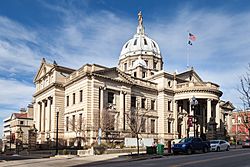
Washington County Courthouse
|
||
|
||
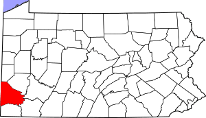
Location within the U.S. state of Pennsylvania
|
||
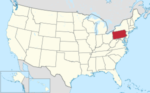 Pennsylvania's location within the U.S. |
||
| Country | ||
| State | ||
| Founded | March 28, 1781 | |
| Named for | George Washington | |
| Seat | Washington | |
| Largest city | Peters Township | |
| Area | ||
| • Total | 861 sq mi (2,230 km2) | |
| • Land | 857 sq mi (2,220 km2) | |
| • Water | 3.9 sq mi (10 km2) 0.5%% | |
| Population
(2020)
|
||
| • Total | 209,349 |
|
| • Density | 240/sq mi (90/km2) | |
| Time zone | UTC−5 (Eastern) | |
| • Summer (DST) | UTC−4 (EDT) | |
| Congressional district | 14th | |
Washington County is a county in Pennsylvania, United States. In 2020, about 209,349 people lived here. Its main town, or county seat, is Washington. The county is part of the larger Greater Pittsburgh area. You can also find the Washington County Airport here, which is about 3 miles (5 km) southwest of Washington.
Contents
History of Washington County
Washington County was created on March 28, 1781. It was formed from a part of Westmoreland County. Both the county and its main town, Washington, were named after George Washington. He was a famous leader in the American Revolutionary War and later became the first President of the United States.
The town of Charleroi in the county got its name from a city in Belgium. Many Belgian immigrants moved to the Monongahela area in the late 1800s. Some of them were skilled glass makers.
Geography of Washington County
Washington County covers about 861 square miles (2,230 km²). Most of this area, 857 square miles (2,219 km²), is land. Only a small part, about 3.9 square miles (10 km²), is water. Washington County is also part of a larger region called "Greater Appalachia."
Neighboring Counties
Washington County shares its borders with several other counties:
- Beaver County (north)
- Allegheny County (north)
- Westmoreland County (east)
- Fayette County (southeast)
- Greene County (south)
- Marshall County, West Virginia (southwest)
- Ohio County, West Virginia (west)
- Brooke County, West Virginia (west)
- Hancock County, West Virginia (northwest)
Main Roads
Many important roads run through Washington County. These include major interstate highways and U.S. routes.
Washington County's Flag
Flag Design
The flag of Washington County, Pennsylvania, has a light blue background. In the center is the county's official seal. This seal shows the county courthouse, a covered bridge, a Native American, and an early settler. Around these images, it says "Historical Washington County" and "1781" in a circle.
Climate
Washington County has a humid continental climate. This means it has warm summers and cold, snowy winters. It rains most in the summer months. On average, the county gets about 38.87 inches (987 mm) of rain each year. Snow usually falls between November and April. The county gets about 37.8 inches (96 cm) of snow on average each year.
| Climate data for Washington, Pennsylvania (3mi NE) (1981–2010 normals, extremes 1975–present) | |||||||||||||
|---|---|---|---|---|---|---|---|---|---|---|---|---|---|
| Month | Jan | Feb | Mar | Apr | May | Jun | Jul | Aug | Sep | Oct | Nov | Dec | Year |
| Record high °F (°C) | 70 (21) |
75 (24) |
82 (28) |
90 (32) |
94 (34) |
93 (34) |
100 (38) |
96 (36) |
95 (35) |
87 (31) |
80 (27) |
76 (24) |
100 (38) |
| Mean daily maximum °F (°C) | 35.1 (1.7) |
38.5 (3.6) |
48.5 (9.2) |
60.7 (15.9) |
69.4 (20.8) |
78.0 (25.6) |
81.6 (27.6) |
80.7 (27.1) |
73.9 (23.3) |
62.3 (16.8) |
51.0 (10.6) |
39.1 (3.9) |
59.6 (15.3) |
| Daily mean °F (°C) | 26.0 (−3.3) |
28.6 (−1.9) |
37.2 (2.9) |
48.6 (9.2) |
57.5 (14.2) |
66.2 (19.0) |
70.0 (21.1) |
69.0 (20.6) |
61.9 (16.6) |
50.6 (10.3) |
41.1 (5.1) |
30.5 (−0.8) |
48.9 (9.4) |
| Mean daily minimum °F (°C) | 16.8 (−8.4) |
18.7 (−7.4) |
26.0 (−3.3) |
36.5 (2.5) |
45.6 (7.6) |
54.4 (12.4) |
58.5 (14.7) |
57.3 (14.1) |
49.9 (9.9) |
39.0 (3.9) |
31.1 (−0.5) |
21.8 (−5.7) |
38.0 (3.3) |
| Record low °F (°C) | −25 (−32) |
−20 (−29) |
−1 (−18) |
9 (−13) |
20 (−7) |
32 (0) |
38 (3) |
29 (−2) |
30 (−1) |
18 (−8) |
−4 (−20) |
−16 (−27) |
−25 (−32) |
| Average precipitation inches (mm) | 2.87 (73) |
2.47 (63) |
3.25 (83) |
3.11 (79) |
4.16 (106) |
3.91 (99) |
3.94 (100) |
3.19 (81) |
3.28 (83) |
2.46 (62) |
3.37 (86) |
2.97 (75) |
38.87 (987) |
| Average snowfall inches (cm) | 10.5 (27) |
9.3 (24) |
6.6 (17) |
1.2 (3.0) |
0 (0) |
0 (0) |
0 (0) |
0 (0) |
0 (0) |
0.2 (0.51) |
2.1 (5.3) |
7.9 (20) |
37.8 (96) |
| Average precipitation days (≥ 0.01 in) | 16 | 14 | 14 | 14 | 15 | 12 | 12 | 11 | 11 | 13 | 14 | 15 | 162 |
| Average snowy days (≥ 0.1 in) | 12 | 10 | 5 | 1 | 0 | 0 | 0 | 0 | 0 | 0 | 3 | 8 | 38 |
| Source: NOAA | |||||||||||||
Population and People
The population of Washington County has grown a lot over the years. In 1790, there were about 23,892 people. By 2020, the population had increased to 209,349.
| Historical population | |||
|---|---|---|---|
| Census | Pop. | %± | |
| 1790 | 23,892 | — | |
| 1800 | 28,298 | 18.4% | |
| 1810 | 36,289 | 28.2% | |
| 1820 | 40,038 | 10.3% | |
| 1830 | 42,784 | 6.9% | |
| 1840 | 41,279 | −3.5% | |
| 1850 | 44,939 | 8.9% | |
| 1860 | 46,805 | 4.2% | |
| 1870 | 48,483 | 3.6% | |
| 1880 | 55,418 | 14.3% | |
| 1890 | 71,155 | 28.4% | |
| 1900 | 92,181 | 29.5% | |
| 1910 | 143,680 | 55.9% | |
| 1920 | 188,992 | 31.5% | |
| 1930 | 204,802 | 8.4% | |
| 1940 | 210,852 | 3.0% | |
| 1950 | 209,628 | −0.6% | |
| 1960 | 217,271 | 3.6% | |
| 1970 | 210,876 | −2.9% | |
| 1980 | 217,074 | 2.9% | |
| 1990 | 204,584 | −5.8% | |
| 2000 | 202,897 | −0.8% | |
| 2010 | 207,820 | 2.4% | |
| 2020 | 209,349 | 0.7% | |
| U.S. Decennial Census 1790–1960 1900–1990 1990–2000 2010–2019 2010-2020 |
|||
In 2020, most people living in Washington County were White (about 89.3%). Other groups included Black or African American (3.3%), Asian (1%), and Hispanic or Latino (2%).
Fun Places and Events
Pony League baseball started in Washington County in 1951. It was for boys aged 13 and 14. Today, its main office is still here. More than half a million young people in the U.S. and 40 other countries play Pony League baseball. The Pony League World Series is held every August in Washington. Teams from all over the world come to play.
Washington County is also home to the Pennsylvania Trolley Museum. You can see old trolley cars there. The county is famous for the Meadowcroft Rock Shelter. This is one of the oldest and best-preserved Native American homes in the country. It shows how people lived thousands of years ago. The county also has 21 covered bridges that are still standing.
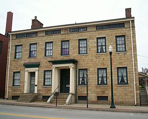
The Whiskey Rebellion ended in Washington County. This was a time when people protested a tax on whiskey. The home of David Bradford, one of the rebellion's leaders, is in Washington and is a national landmark. Nearby is the F. Julius LeMoyne House, which is now the Washington County Historical Society.
Washington County is also where the first crematory in the United States was built. In 1981, a special marker was put up to show the county's important history.
Education
Washington County has many places for learning, from colleges to local schools and libraries.
Colleges and Universities
- Community College of Allegheny County has a branch in North Franklin Township.
- Pennsylvania Western University, California is in California Borough.
- Washington & Jefferson College is in the City of Washington and East Washington Borough.
- Waynesburg University has a campus in Cecil Township called Southpointe Center.
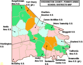
Public School Districts
Many public school districts serve the students of Washington County:
- Avella Area School District
- Bentworth School District
- Bethlehem-Center School District
- Brownsville Area School District (also in Fayette County)
- Burgettstown Area School District
- California Area School District
- Canon-McMillan School District
- Charleroi School District
- Chartiers-Houston School District
- Fort Cherry School District (also in Allegheny County)
- McGuffey School District
- Peters Township School District
- Ringgold School District
- Trinity Area School District
- Washington School District
Students can also attend:
- Intermediate Unit 1 – Coal Center
- Mon Valley Career and Technology Center – Charleroi
- Western Area Career and Technology Center – Canonsburg
Private Schools
There are also many private schools in the county:
- Calvary Chapel Christian School – Fredericktown
- Central Christian Academy – Houston
- Children's School of Washington
- Cornerstone Mennonite School – Burgettstown
- Faith Christian School of Washington – Washington
- First Love Christian Academy High – Washington
- Goddard School – Venetia
- Gwens Montessori School Inc – Washington
- Hickory Christian School – Hickory
- Huntington Learning Center – McMurray
- John F Kennedy School – Washington
- Kinder Care Learning Centers
- Lakeview Christian Academy – Bridgeville
- Madonna Catholic Regional School – Monongahela
- Mel Blount Leadership Academy – Claysville
- NHS School – Ellsworth
- Rainbows End Learning Center – Washington
- St Francis Children's School – Beallsville
- Tri-State Christian School – Burgettstown
Libraries
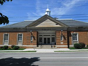
The Washington County Library System has many branches where you can borrow books and learn:
- Avella Area Library Center
- Bentleyville Public Library
- Burgettstown Community Library
- California Public Library
- Chartiers-Houston Community Library
- Citizens Library – Washington
- Donora Public Library
- Frank Sarris Public Library – Canonsburg
- Fredericktown Area Public Library
- Heritage Public Library – McDonald
- John K Tener Library – Charleroi
- Marianna Community Public Library
- Monongahela Area Library
- Peters Township Public Library
- Washington County Library System
Hospitals
Washington County has several hospitals to care for its residents:
- Canonsburg Hospital, in North Strabane Township
- Penn Highlands Mon Valley, in Carroll Township
- UPMC Washington in the City of Washington
Communities
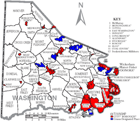
In Pennsylvania, there are different types of towns and areas. Washington County has cities, boroughs, and townships.
Cities
- Monongahela
- Washington (This is the main town, or county seat)
Boroughs
- Allenport
- Beallsville
- Bentleyville
- Burgettstown
- California
- Canonsburg
- Centerville
- Charleroi
- Claysville
- Coal Center
- Cokeburg
- Deemston
- Donora
- Dunlevy
- East Washington
- Elco
- Ellsworth
- Finleyville
- Green Hills
- Houston
- Long Branch
- Marianna
- McDonald (partly in Allegheny County)
- Midway
- New Eagle
- North Charleroi
- Roscoe
- Speers
- Stockdale
- Twilight
- West Brownsville
- West Middletown
Townships
Townships are another type of local government area. Here are some of them:
- Amwell
- Blaine
- Buffalo
- Canton
- Carroll
- Cecil
- Chartiers
- Cross Creek
- Donegal
- East Bethlehem
- East Finley
- Fallowfield
- Hanover
- Hopewell
- Independence
- Jefferson
- Morris
- Mount Pleasant
- North Bethlehem
- North Franklin
- North Strabane
- Nottingham
- Peters
- Robinson
- Smith
- Somerset
- South Franklin
- South Strabane
- Union
- West Bethlehem
- West Finley
- West Pike Run
Census-Designated Places (CDPs)
These are areas that the U.S. Census Bureau names for collecting population data. They are not official towns or cities.
- Aaronsburg
- Atlasburg
- Avella
- Baidland
- Bulger
- Cecil-Bishop
- Cross Creek
- Eighty Four
- Elrama
- Fredericktown
- Gastonville
- Hendersonville
- Hickory
- Joffre
- Langeloth
- Lawrence
- McGovern
- McMurray
- Meadowlands
- Millsboro
- Muse
- Paris
- Slovan
- Southview
- Taylorstown
- Thompsonville
- Van Voorhis
- West Alexander
- Westland
- Wickerham Manor-Fisher
- Wolfdale
- Wylandville
Other Communities
These are smaller communities that are not officially incorporated as cities, boroughs, or CDPs.
- Amity
- Blainsburg
- Condit Crossing
- Cool Valley
- Courtney
- Cracker Jack
- Daisytown
- Fallowfield
- Florence
- Frogtown
- Gambles
- Glyde
- Good Intent
- Hazel Kirk
- Laboratory
- Log Pile
- Lover
- Manifold
- Murdocksville
- McAdams
- North Fredericktown
- Old Concord
- P and W Patch
- Prosperity
- Raccoon
- Richeyville
- Scenery Hill
- Studa
- Venetia
- Vestaburg
Famous People from Washington County
Many notable people have connections to Washington County:
- Kurt Angle (born 1968), an Olympic gold medalist and Professional wrestler.
- James G. Blaine (1830–1893), a native of West Brownsville, who became a United States Secretary of State.
- Perry Como (1912–2001), a famous singer and television star from Canonsburg.
- Mitch Daniels (born 1949), from Monongahela, who was a former Governor of Indiana.
- Ken Griffey Jr. (born 1969) and Ken Griffey Sr. (born 1950), both from Donora, were famous Major League Baseball players.
- Shirley Jones (born 1934), from Charleroi, an actress known for Partridge Family and winning an Academy Award.
- Francis Julius LeMoyne (1798–1879), an abolitionist and a pioneer of cremation in the U.S.
- Jonathan Letterman (1824–1872), from Canonsburg, known as the "Father of Battlefield Medicine" during the American Civil War.
- Joe Montana (born 1956), from Monongahela, a very famous National Football League player.
- Stan Musial (1920–2013), from Donora, a legendary Major League Baseball player.
- Bobby Vinton (born 1935), a recording artist from Canonsburg.
- Bob West (born 1956), from Finleyville, a voice actor best known as the voice of Barney & Friends.
See also
 In Spanish: Condado de Washington (Pensilvania) para niños


