Antelope Valley facts for kids
Quick facts for kids Antelope Valley |
|
|---|---|
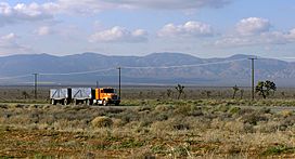
A truck passes eastbound along Highway 58 through the Antelope Valley
|
|
| Area | 2,200 square miles (5,698 km2) |
| Geography | |
| Location | California, United States |
| Population centers | Palmdale and Lancaster |
| Borders on | Victor Valley, Great Basin (east); San Gabriel Mountains (south); Tehachapis (northwest); Sierra Pelona Mountains (west) |
| Traversed by | State Route 14, State Route 58, State Route 138 |
The Antelope Valley is a special place in southern California, USA. It's found in the northern part of Los Angeles County and the southeastern part of Kern County. This valley is actually the western edge of the Mojave Desert, a famous desert region.
It sits between three mountain ranges: the Tehachapi, Sierra Pelona, and San Gabriel Mountains. The valley got its name because many pronghorns, which look like small deer, used to live here. Sadly, most of them were hunted or moved away by the 1880s. The two main cities in the Antelope Valley are Palmdale and Lancaster.
Contents
- Exploring Antelope Valley's Geography
- Wildlife and Plants of Antelope Valley
- Antelope Valley's Human Story
- People and Growth in Antelope Valley
- Military Presence in the Valley
- Industries of Antelope Valley
- Learning and Education
- Culture in Antelope Valley
- Parks to Visit
- Hospitals and Healthcare
- Getting Around Antelope Valley
- Famous People from Antelope Valley
- Cities and Towns
Exploring Antelope Valley's Geography
The Antelope Valley is the westernmost part of the Mojave Desert. To its east, it opens up to the Victor Valley and the large Great Basin. It's located north of the San Gabriel Mountains, southeast of the Tehachapis, and east of the Sierra Pelona Mountains.
This desert area covers about 2,200 square miles (5,700 square kilometers). The valley is bordered by two major fault lines, the Garlock and San Andreas fault systems. Rain and snow from the surrounding mountains help refill the underground water supply, called groundwater.
Wildlife and Plants of Antelope Valley
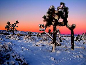
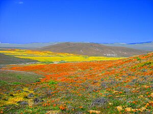
The Antelope Valley is home to many different plants and animals. You can find hundreds of plant types here, like the California juniper, Joshua tree, California scrub oak, and creosote bush. It's also famous for its beautiful wildflowers, especially the bright California poppy.
When winter brings rain, the dry ground slowly soaks it up. This helps native grasses and wildflowers grow. The best time to see the poppies depends on how much rain falls. But sometimes, unusual weather in late winter or early spring can stop a good bloom.
The valley was named for the large groups of pronghorns that used to graze here. Between 1882 and 1885, nearly half of the pronghorn population, about 30,000 animals, disappeared from the valley. Heavy snow pushed them towards their usual feeding areas in the east. However, they wouldn't cross the railroad tracks, and many starved. Settlers also hunted the remaining pronghorns for their hides. Once common, they either died out or moved to the Central Valley. A drought in the early 1900s also reduced their main food source, bunch grass. Today, seeing a pronghorn is very rare, though a small number still live in the western part of the valley.
Other common animals in the Antelope Valley include mule deer and mountain quail. You might also spot golden-mantled ground squirrels, Beechey ground squirrels, red-tailed hawks, Cooper's hawks, Stellar's jays, leopard frogs, and rattlesnakes.
Water Challenges in the Valley
People in the Antelope Valley get most of their water by pumping it from underground aquifers. They also bring in extra water from the California Aqueduct. Pumping too much groundwater for a long time has caused the water level to drop. This makes it harder to pump water and can even cause the land to sink.
While aqueducts bring more water for homes, farms, and businesses, taking water from the Sacramento-San Joaquin River Delta in northern California has caused problems for the environment there. Experts agree that the delta needs long-term solutions to provide water and keep its ecosystem healthy.
As more people move to the Antelope Valley, the demand for water increases. According to David Leighton from the United States Geological Survey, careful management will be needed to meet future water needs without harming the underground water supply or costing too much.
Antelope Valley's Human Story
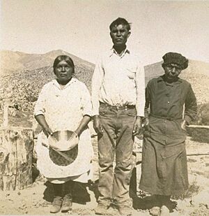
The first people to live in the Antelope Valley included the Kawaiisu, Kitanemuk, Serrano, and Tataviam tribes. Europeans first arrived in the 1770s, during the time when North America was being colonized.
A Spanish friar named Father Francisco Garcés is thought to have traveled through the western part of the valley in 1776. The Spanish later created a path called El Camino Viejo through the western valley in the 1780s. By 1808, the Spanish had moved the native people from the valley into missions.
Later explorers like Jedediah Smith (1827) and John C. Fremont (1844) also visited the valley. During the Gold Rush, many "49ers" crossed the valley on their way to the gold fields. A better wagon road, the Stockton – Los Angeles Road, was built in 1854. Stagecoach lines used this road, which was the main way to travel before the Southern Pacific Railroad arrived in 1876.
The railroad brought many new settlers, and farms and towns quickly grew. In 1952, the aircraft (now called aerospace) industry started in the valley at Plant 42. Edwards Air Force Base, then known as Muroc Army Air Field, was established in 1933. The area was once under Mexican rule and was named for the large herds of antelope.
People and Growth in Antelope Valley
In recent years, the Antelope Valley has become a "bedroom community" for the Greater Los Angeles area. This means many people live here and commute to jobs in Los Angeles. Major housing construction and population growth began in 1983. Since then, the population of Palmdale has grown about 12 times its original size by 2006. Neighboring Lancaster has also seen its population triple since the early 1980s.
Big stores and shopping centers have followed this population boom, especially around Palmdale's Antelope Valley Mall. The cities of Lancaster and Palmdale together are home to over 372,000 people.
Most of the people living in the Antelope Valley are of Hispanic or White backgrounds. Spanish and Tagalog are the most common languages spoken here besides English.
Military Presence in the Valley
Edwards Air Force Base is located east of Rosamond, about 37 miles (60 km) northeast of Palmdale. The dry lakebeds at Edwards AFB are the lowest points in the valley.
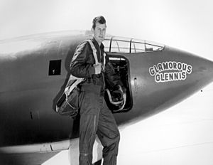
Many important US military test flights happen here. It's also where many famous aviation achievements took place, including the first flight to break the sound barrier, done by Chuck Yeager.
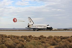
NASA Space Shuttles used to land at Edwards because its dry lakebeds offered a huge landing area. Even after NASA built a landing strip at Kennedy Space Center, Edwards remained a backup landing site in case of bad weather at Cape Canaveral.
The NASA Neil A. Armstrong Flight Research Center is also located at Edwards AFB. This center is famous for its X-15 experimental rocket ship program. It has been NASA's main place for high-performance aircraft research since the X-1 program began. Space Shuttles were serviced here after landing at Edwards.
Industries of Antelope Valley
Aerospace Industry
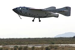
U. S. Air Force Plant 42 in northeast Palmdale is a major hub for aerospace companies like Lockheed Martin, Boeing, Northrop Grumman, and BAE Systems. Important projects built or designed here include Space Shuttle orbiters, B-1 Lancer bombers, B-2 Spirit bombers, F-117 Nighthawk fighters, F-35 Joint Strike Fighters, and Lockheed L-1011 Tristar passenger jets.
The Mojave Air and Space Port is also in this region. It's well-known as the home of Scaled Composites, the company that designed SpaceShipOne and won the X-Prize for private spaceflight.
Much of the work at these facilities is done with Edwards Air Force Base and the NASA Dryden Flight Research Center. This includes creating and testing experimental "X-planes," Space Shuttle operations, and building new military aircraft. Because of this large industry, the Antelope Valley is sometimes called "Aerospace Valley."
Farming and Agriculture
Farming was the first major industry in the valley after it became part of the United States. It was once known for its large fields of alfalfa and fruit crops. Today, farmers grow a wider variety of crops, like carrots, onions, lettuce, and potatoes. As more houses are built in the middle of the valley, farms are now found more on the western and eastern sides.
Generating Electricity
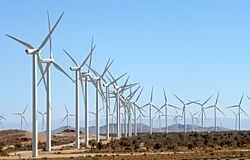
The northern part of the Antelope Valley is part of the Tehachapi Wind Resource Area, which is the largest area for wind power in California. The valley also has many solar farms, some of which are among the biggest in the United States.
Manufacturing
- U.S. Pole Company Inc.
- Senior Systems Technology
- Delta Scientific
- Lance Camper Manufacturing Corporation
- Harvest Farms Inc.
- BYD Company
Mining
The world's largest open-pit borax mine is located near Boron.
Learning and Education
Colleges and Universities
- The Antelope Valley Community College District offers two-year degrees and vocational programs. Its main campus, Antelope Valley College, is in Lancaster. It also hosts a satellite location for California State University, Bakersfield-Antelope Valley, where students can earn bachelor's and master's degrees.
- California State University Bakersfield has a campus in Lancaster offering various degrees.
- Other universities with satellite campuses in the valley include University of Phoenix, University of La Verne, DeVry University, and Chapman University.
- The AERO Institute in Palmdale is a special facility for aerospace science and engineering education. It offers distance learning programs from several universities like Purdue and the University of Southern California.
- West Coast Baptist College in Lancaster is a private college offering degrees in religious studies.
- The Lancaster University Center provides engineering and technology education from California State University, Long Beach.
High Schools
The Antelope Valley Union High School District is the main public school district for high school students in Palmdale and Lancaster. It has eight regular high schools and other specialized schools. Some of these include:
- Antelope Valley High School - Lancaster
- Eastside High School - Lancaster
- Highland High School - Palmdale
- Lancaster High School - Lancaster
- Palmdale High School - Palmdale
- Pete Knight High School - Palmdale
- Quartz Hill High School - Quartz Hill
- SOAR High School - Lancaster
Other school districts like Southern Kern Unified, Muroc Joint Unified, and Mojave Unified serve other communities in the valley. There are also several private high schools, such as Paraclete High School and Desert Christian High School.
School Districts (Elementary and Middle Schools)
- The Palmdale School District is the largest, serving over 28,000 students.
- The Lancaster School District is the third largest, with 15,000 students.
- The Westside Union School District covers western Palmdale and Lancaster.
- The Eastside Union School District covers eastern Lancaster.
- The Keppel Union School District covers eastern Palmdale and nearby communities.
- Other districts like Southern Kern Unified, Muroc Joint Unified, and Mojave Unified serve other parts of the valley.
Culture in Antelope Valley
The Antelope Valley Symphony Orchestra is a professional music group that performs several concerts each year at the Lancaster Performing Arts Center.
Antelope Valley in Movies and Music
The Antelope Valley Indian Museum State Historic Park has been seen in movies like The Magnificent Seven Ride! (1972) and The Stone Killer (1973). Parts of Mackenna's Gold (1964) were also filmed here. The music video for the R.E.M. song "Man on the Moon" was filmed in the Antelope Valley in 1992.
Parks to Visit
Hospitals and Healthcare
Major hospitals in the area include:
- Antelope Valley Hospital
- Palmdale Regional Medical Center
The valley used to have a county hospital, High Desert Hospital. But in 2003, it became an urgent care clinic due to budget issues. Now, patients needing serious care might have to travel over 50 miles to Olive View – UCLA Medical Center in Sylmar.
Getting Around Antelope Valley
Main Roads and Highways
Important roads include:
- Angeles Forest Highway, which connects Palmdale to Angeles Crest Highway.
- The Antelope Valley Freeway (State Route 14).
- State Route 18 (connects to Victor Valley).
- State Route 138 (includes Pearblossom Highway).
- State Route 58 (connects to Bakersfield and Barstow).
- U.S. Route 395 (just east of the valley).
The Angeles Crest Highway (State Route 2) winds through the Angeles National Forest for about 60 miles (100 km), leading to the greater Los Angeles area.
Train Services
- The Union Pacific Railroad provides freight service.
- Metrolink offers passenger train service to the Los Angeles area on its Antelope Valley Line. There are stations in Lancaster, Palmdale, and Vincent Grade/Acton.
- Amtrak has a bus service that stops at the Palmdale Transportation Center and Lancaster Metrolink station, connecting residents to the national train network.
- The California High-Speed Rail Authority plans to have Palmdale as a stop on a future high-speed train line between San Francisco and San Diego.
Bus Services
- The Antelope Valley Transit Authority is the local city-bus system for Palmdale and Lancaster. It also runs commuter buses to several locations in Los Angeles.
- Greyhound Bus has stops at the Palmdale Transportation Center and the Lancaster Metrolink station.
Airports
- Palmdale Regional Airport is the largest airport, mainly used for military flights, but it also has an unused commercial terminal.
- General William J. Fox Airfield in Lancaster is the busiest airport for general aviation (smaller planes).
- Mojave Air & Space Port in Mojave is a large civil aviation center. Famous aircraft like Voyager and SpaceShipOne were developed and flown from here.
- Other smaller airports include Inyokern Airport, Mountain Valley Airport, Tehachapi Municipal Airport, Agua Dulce Airpark, Rosamond Skypark Airport, California City Municipal Airport, and Crystalaire Airport.
Famous People from Antelope Valley
Many notable people have spent time in the Antelope Valley:
- The 1990s R&B group All-4-One was from the AV.
- Erik Audé, actor-stuntman and poker player, attended high school here.
- Pancho Barnes, a famous aviator, lived near Edwards Air Force Base.
- Spade Cooley was a Western swing musician and TV personality.
- Michael Deaver, a former aide to Ronald Reagan, lived in Mojave.
- R. Lee Ermey, an actor known for Full Metal Jacket, was a Palmdale resident.
- Joseph Foreman, known as Afroman, lives in Palmdale.
- Daniel Fry, a contactee, attended Antelope Valley High School.
- Judy Garland, the famous singer and actress, sang for her Lancaster neighbors as a girl.
- Paul George, an NBA player, was born and raised in Palmdale.
- Donald Glover, singer/songwriter known as Childish Gambino, was born at Edwards Air Force Base.
- Ezra M. Hamilton, a pioneer who discovered gold in Rosamond and developed Willow Springs.
- Tippi Hedren, actress from The Birds, lives nearby in Acton.
- Aldous Huxley, a famous writer, found inspiration at his Llano home. He wrote a children's book set in the valley.
- Members of the punk band Killradio are from here.
- Terence McKenna, a writer and philosopher, graduated from Antelope Valley High School.
- Debbie Rowe, second wife of Michael Jackson, lives in Palmdale.
- Burt Rutan and his brother Dick Rutan, who created SpaceShipOne and the Voyager, work at Mojave Air & Space Port.
- Members of the punk band Slick Shoes are from here.
- Kathleen Soliah, a former fugitive, grew up in Desert View Highlands.
- Chuck Yeager, the first person to break the sound barrier, was an early test pilot at Edwards Air Force Base.
- Frank Zappa, the famous musician, graduated from Antelope Valley High School and met Don Van Vliet (Captain Beefheart) there.
Cities and Towns
Cities with over 100,000 people
- Lancaster (population around 159,053 in 2018) - became a city in 1977
- Palmdale (population around 156,667 in 2018) - became a city in 1962
Cities with less than 100,000 people
- California City (population around 14,217 in 2018) - became a city in 1965
Other Towns and Areas


