Early 2014 North American cold wave facts for kids
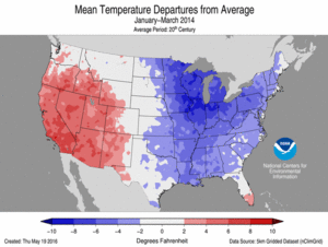
Temperature anomalies within the United States from January to March 2014, showcasing the very cold conditions
|
|
| Formed | January 2, 2014 |
|---|---|
| Dissipated | April 10, 2014 |
| Damage | $5 billion (United States) |
| Total fatalities | 21 as of January 8 |
| Areas affected | Canada, Central United States, Eastern United States, Northern Mexico |
The early 2014 North American cold wave was a time of super cold weather. It happened during the winter of 2013–2014. This cold snap hit parts of Canada and the central and northeastern United States.
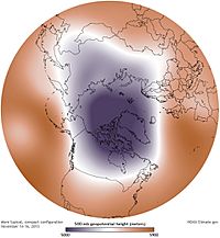
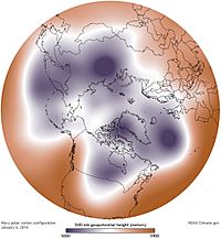
The extreme cold started in early 2014. It was caused by the North Polar Vortex moving south. This meant super chilly air from the Arctic spread across North America. The very low temperatures even lasted into March.
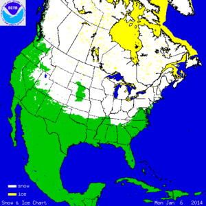
On January 2, 2014, a cold air mass from the Arctic moved across Canada and the U.S. This brought lots of snow to some places. Temperatures dropped to levels rarely seen before. Many low temperature records were broken. Schools, businesses, and roads had to close. Many flights were cancelled, especially in the Midwest. More than 200 million people felt the effects of this cold wave. It stretched from the Rocky Mountains all the way to the Atlantic Ocean.
Contents
What Caused the Cold Wave?
The cold wave began around January 2, 2014. A sudden warming high up in the atmosphere caused the polar vortex to break apart. The polar vortex is usually a strong area of cold air that stays over the Arctic.
When the vortex weakened, the very cold air was no longer trapped. It was pushed south by changes in the jet stream. Since Canada and Siberia already had lots of snow, the Arctic air stayed super cold as it moved into the United States.
The UK Met Office said the jet stream dipped south. This brought cold air with it. It happened because of a big difference between the cold air in Canada and milder winter temperatures in the U.S. This created strong winds. These winds made the already cold temperatures feel even colder due to the wind chill.
Record-Breaking Temperatures
United States Cold Records
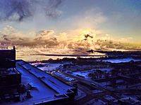
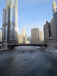
On January 5, 2014, Green Bay, Wisconsin dropped to −18 °F (−28 °C). This broke the old record for that day from 1979.
The next day, January 6, 2014, Babbitt, Minnesota was the coldest spot in the U.S. It reached −37 °F (−38 °C).
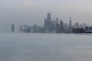
At O'Hare International Airport in Chicago, the low was −16 °F (−27 °C) on January 6. The old record was −14 °F (−26 °C), set in 1884. People even called Chicago "#Chiberia" because it was so cold, like Siberia.
The average temperature across the entire United States on January 6 was 17.9 °F (−7.8 °C). The last time it was that cold was in 1997. This 17-year gap was the longest on record.
On January 7, at least 49 new daily low temperature records were set. Detroit hit −14 °F (−26 °C) on the night of January 6–7. This broke records for both dates. Its high temperature of −1 °F (−18 °C) on January 7 was one of only six times in 140 years that the high stayed below zero.
New York City's Central Park reached 4 °F (−16 °C) on January 7, 2014. This broke a 116-year-old record. Pittsburgh and Marstons Mills, Massachusetts both hit −9 °F (−23 °C). Cleveland set a record low of −11 °F (−24 °C). Even in the south, Atlanta fell to 6 °F (−14 °C), breaking its 1970 record. Temperatures reached −6 °F (−21 °C) at Brasstown Bald, Georgia. The cold even reached Tampa, which had a low of 33 °F (1 °C). This was 18 °F (−8 °C) colder than normal.
The period from December 2013 to March 2014 was the coldest four-month stretch ever recorded around Illinois. Average temperatures in Chicago were in the upper teens to lower 20s.
Canada's Cold Records
The coldest parts of Canada were the eastern prairie provinces, Ontario, Quebec, and the Northwest Territories. But only southern Ontario set new temperature records.
Winnipeg was the coldest major city in Canada during the early cold wave. On January 6, it reached −37 °C (−35 °F). On January 7, it was −36 °C (−33 °F). The temperature stayed below −25 °C (−13 °F) on both days. Other parts of southern Manitoba saw lows below −40 °C (−40 °F).
On January 7, 2014, Hamilton, Ontario set a record low of −24 °C (−11 °F). London, Ontario was −26 °C (−15 °F). Toronto dropped to −22 °C (−8 °F), its coldest in nine years.
Other Extreme Weather Events
Heavy snow or rain fell as the cold weather moved across the U.S. Plains and Canadian prairies to the East Coast. Strong winds made the air feel much colder. This is called the wind chill factor. Some areas near the Great Lakes also had wind warnings.
United States Weather Impacts
On January 3, Boston had a temperature of 2 °F (−17 °C) with a −20 °F (−29 °C) wind chill. Over 7 inches (180 mm) of snow fell. Boxford, Massachusetts got 23.8 inches (600 mm) of snow. Fort Wayne, Indiana had a record low of −10 °F (−23 °C). In Michigan, over 11 inches (280 mm) of snow fell near Detroit. Temperatures across the state were near or below 0 °F (−18 °C). New Jersey received over 10 inches (250 mm) of snow. Schools and government offices closed.
On January 5, a storm crossed the Great Lakes. Chicago got 5 inches (130 mm) to 7 inches (180 mm) of snow. O'Hare and Midway Airports cancelled 1200 flights. Freezing rain caused a plane to slide off a taxiway at John F. Kennedy International Airport. No one was hurt. The storms caused many road closures and flight delays.
By January 8, 2014, John F. Kennedy International Airport had cancelled about 1,100 flights. Newark Liberty International Airport cancelled about 600 flights. LaGuardia Airport cancelled about 750–850 flights.
Snowfall was lighter further south. Tennessee saw between 0.5 and 2 inches (13 and 51 mm) of snow.
In New York City, temperatures dropped by as much as 50 °F (28 °C) overnight. This was the biggest temperature swing since 1921.
Between January 5 and 6, temperatures in Middle Tennessee fell 50 °F (28 °C). Nashville had a high of only 9 °F (−13 °C) on January 6. The cold put a strain on power supplies. About 1,200 customers in Nashville lost power. Around 7,500 customers in Blount County also lost power. The Tennessee Emergency Management Agency declared a state of emergency.
Twenty-four thousand homes lost power in Indiana, Illinois, and Missouri.
Canada Weather Impacts
In Canada, the cold front brought rain and snow to most areas on January 5 and 6. This was the second big storm in less than a week for Nova Scotia and Newfoundland.
Southwestern Ontario had a second round of heavy snow. This was due to lake-effect snow from January 6 to 8. The Northwest Territories and Nunavut had a record-breaking blizzard on January 8.
Many highways in Southwestern Ontario closed because of heavy lake-effect snow. Winds reached 70 kilometres per hour (43 mph) in some areas near Lake Erie. Gusts were as high as 100 kilometres per hour (62 mph). This made the wind chill feel as low as −48 °C (−54 °F).
Some places in Ontario near Lake Ontario and the St. Lawrence Valley experienced "frost quakes." These are loud noises caused by the ground freezing quickly.
Mexico Weather Impacts
Cold air moving into the Gulf of Mexico created strong winds in Mexico. These winds reached 41 knots (76 km/h; 47 mph). Saltillo, in northeast Mexico, had freezing drizzle and temperatures as low as −6 °C (21 °F).
On January 29, Monterrey had −1 °C (30 °F) and light snow.
How the Cold Wave Affected People
The extreme cold stopped thousands of flights. It also made other types of travel very difficult. Many power companies asked people to use less electricity.
Impact in the United States
The cold weather had a big effect on the U.S. economy. It caused a 2.9% drop in the country's economic growth. Experts said the bad weather made it hard for factories to produce goods. It also stopped construction and shipments. People bought fewer homes and cars.
One expert called it the worst weather event for the economy since Hurricane Sandy. The cold wave cost about $5 billion. Airlines lost $50 to $100 million because they cancelled 20,000 flights.
When schools closed, many parents had to stay home from work. Some industries actually did well, like video on demand and restaurants that delivered food. People also used gift cards to shop online. Searches for flights to warm places like Cancun, Mexico, went up a lot in northern cities.
Sadly, more than a dozen deaths were linked to the cold wave. This was due to dangerous roads and the extreme cold.
At O'Hare International Airport in Chicago, even the jet fuel and de-icing fluids froze.
Amtrak cancelled train services that went through Chicago. This was because of heavy snow and extreme cold. Three Amtrak trains got stuck overnight near Mendota, Illinois. About 500 passengers had to be put on buses the next morning. Another Amtrak train was stuck near Kalamazoo, Michigan for 8 hours. Commuter trains in Chicago also had many problems. Detroit even shut down its People Mover train system.
The Weather Channel reported power outages in several states. Cars were left abandoned on highways in North Carolina. Freezing rain fell in Louisiana.
Impact in Canada
A power failure in Newfoundland on January 5 left 190,000 homes without electricity. Most power was back on the next day.
Flights were delayed at airports in Montreal and Ottawa. All flights were cancelled at Toronto Pearson International Airport. This was due to worries about de-icing planes.
Impact on Nature
At first, some thought the cold would kill many emerald ash borer insects. These insects harm ash trees. But later studies showed that the cold probably did not help much.
Climate Change and the Cold Wave
Scientists are studying if single extreme weather events are linked to long-term climate change. Before 2014, some studies suggested a link between climate change and extreme cold in places like North America.
One idea is that the fast melting of polar sea ice plays a role. When ice melts, dark ocean water takes its place. This dark water absorbs more heat than white ice. So, the Arctic has been warming faster than other parts of the world.
This warming might make the jet stream weaker and more wobbly. A weaker jet stream could let cold air, usually trapped at the poles, move further south.
This wobbly jet stream can also bring warm air north. So, while the eastern U.S. was very cold, places like Greenland and Alaska had unusually warm winter temperatures. A strong high-pressure area over the North Pacific Ocean made California unusually warm and dry. This made ongoing drought conditions worse there.
Scientists have found that sudden stratospheric warming (SSW) events happen often. About 60% of winters since 1948 have had a major warming event in January or February. Nearly half of these events led to the polar vortex splitting. This can cause the same kind of Arctic cold front seen in January 2014.
Some studies from the early 2000s found no clear trend of fewer extreme cold events. However, a 2009 study suggested that such events might be increasing. This could be caused by the rapid loss of Arctic ice pack.
Similar SSW events happened in 1985 in North America. They also occurred in Europe in 2009 and 2010.
Long-Lasting Cold
United States Extended Cold
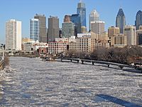
The NOAA's National Climatic Data Center found that December 2013 through February 2014 was the 34th-coldest such period for the U.S. since 1895. They also reported that 91% of the Great Lakes were covered in ice. This was the second highest amount ever recorded. The ice on the Great Lakes did not fully melt until early June. This was the latest date for ice on the Great Lakes.
The average temperature for the U.S. during that winter was 31.3 °F (−0.4 °C). This was one degree below the average for the 20th century. More daily record-low temperatures were set than record-high temperatures in early 2014.
In contrast, California had its warmest winter ever. It was 4.4 °F (−15.3 °C) above average. The first two months of 2014 were the warmest on record in cities like Fresno, Los Angeles, San Francisco, Las Vegas, and Phoenix.
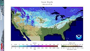
Even though the winter was dry in the West, the U.S. had the 10th largest snow cover since 1966. New York City, Philadelphia, and Chicago had one of their ten snowiest winters. Detroit had its snowiest winter ever. The lower temperatures meant that snow had more moisture. This led to very deep snowfalls.
Many cities had their coldest February in years:
- Rochester, Minnesota had its fourth-coldest February.
- Green Bay, Wisconsin saw its third-coldest February.
- Minneapolis-St. Paul tied its record for the seventh-coldest February.
- Dubuque, Iowa had its third-coldest February.
- Madison, Wisconsin saw its tenth-coldest February.
- Moline, Illinois tied its record for the fifth-coldest February.
- Fort Wayne, Indiana had its sixth-coldest February.
- Peoria, Illinois saw its sixth-coldest February.
- Kansas City, Kansas had its ninth-coldest February.
Daily record lows were set on February 28. For example, Gaylord, Michigan reached −29 °F (−34 °C). Newberry, Michigan dropped to −41 °F (−41 °C).
The first week of March 2014 also saw very low temperatures. Eighteen states set all-time records for cold. Flint, Michigan reached −16 °F (−27 °C) on March 3. Rockford, Illinois was −11 °F (−24 °C).
Caribou and Bangor, Maine, and Montpelier, Vermont, had their coldest March ever in 2014. March was the second-coldest on record for Concord, New Hampshire, and Flint.
The entire December–March period in Chicago was the coldest on record. It was even colder than the famously cold winters of the late 1970s. The average temperature in Chicago from December 1, 2013, to March 31, 2014, was 22 °F (−6 °C). This was 10 °F (5.6 °C) below average.
The state of Iowa had its ninth-coldest winter in 141 years.
March 2014 was the coldest on record in Vermont. It was the second coldest for New Hampshire and Maine.
During this cold wave, North America was much colder than Sochi, Russia. Sochi was hosting the 2014 Winter Olympics at the time.
Meteorologists expected normal temperatures to return from April to mid-May. On April 10, 2014, warmer weather moved into the Eastern United States. This ended the cold wave. But even on April 15, snow showers still happened in New York City. New York City did not have an above-average month until May.
Canada Extended Cold
As of February 27, Winnipeg was having its second-coldest winter in 75 years. Saskatoon was having its coldest winter in 18 years. Windsor, Ontario, had its coldest winter in 35 years and its snowiest ever. Toronto had its coldest winter in 20 years. St. John's, Newfoundland and Labrador, had its coldest winter in 20 years. Vancouver had one of its coldest and snowiest Februarys in 25 years. On February 28, Hamilton, Ontario set a record low of −22 °C (−8 °F).
Even though the U.S. had its coldest winter in 25 years, Canada had its warmest winter on record in 2014.
See also
 In Spanish: Vórtice polar en América del Norte de 2014 para niños
- January 1998 North American ice storm
- December 2013 North American storm complex
- January 2014 Gulf Coast winter storm
- February 11–17, 2014 North American winter storm
- 2013–14 North American winter storms
- 2014–15 North American winter
- November 2014 Bering Sea cyclone
- November 2014 North American cold wave


