List of South Dakota state parks facts for kids
The state of South Dakota has many amazing outdoor places! It manages 13 state parks, 43 recreation areas, 6 nature areas, and 1 long trail. All together, these spots cover about 96,000 acres. The South Dakota Department of Game, Fish, and Parks takes care of them.
These special places help protect natural rock formations and important historical sites. They also preserve sacred areas for Plains Indian tribes and old pioneer settlements and forts. Plus, they offer fun activities and easy access to lakes and rivers. Many recreation areas are along the big Missouri River.
South Dakota's state parks and recreation areas come in all sizes. The smallest is Sandy Shore Recreation Area at 19 acres. The largest is Custer State Park, which is huge at 71,000 acres! Custer State Park was the very first park, started in 1919. The newest park, Good Earth State Park at Blood Run, was added in 2013. In 2016, over 7.5 million people visited these parks!
Discover South Dakota's Parks and Fun Spots
| Name | Type of Park | County | Size | Location | Year Opened | Cool Facts | Picture | ||
|---|---|---|---|---|---|---|---|---|---|
| acres | ha | ||||||||
| Adams Homestead and Nature Preserve | Nature area | Union | 1,600 | 650 | 42°32′21″N 96°31′41″W / 42.53905°N 96.528179°W | 1997 | This preserve on the Missouri River has a historic farm and one of the biggest groups of cottonwood trees in the state. | ||
| Angostura Recreation Area | Recreation area | Fall River | 1,125 | 455 | 43°20′45″N 103°25′19″W / 43.345873°N 103.42202°W | 1954 | Enjoy the beaches and shoreline along the eastern side of Angostura Reservoir. | ||
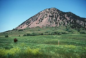
| Bear Butte State Park | State park | Meade | 1,935 | 783 | 44°27′36″N 103°27′03″W / 44.45989°N 103.45085°W | 1961 | This park protects a special mountain that is a sacred place for the Lakota Indians. | ||
| Beaver Creek Nature Area | Nature area | Minnehaha | 165 | 67 | 43°33′29″N 96°32′30″W / 43.558174°N 96.541611°W | 1967 | Explore natural prairie, old farm fields, and a historic log cabin from the 1870s. | ||
| Big Sioux Recreation Area | Recreation area | Minnehaha | 430 | 170 | 43°34′23″N 96°35′40″W / 43.57305°N 96.594378°W | 1978 | This park along the Big Sioux River is home to some of the largest trees in South Dakota. | ||
| Big Stone Island Nature Area | Nature area | Roberts | 100 | 40 | 45°20′50″N 96°29′17″W / 45.34723°N 96.487953°W | 1976 | An island in Big Stone Lake that was once a Plains Indian village and later a vacation resort. | ||
| Burke Lake Recreation Area | Recreation area | Gregory | 106 | 43 | 43°10′59″N 99°15′36″W / 43.183192°N 99.260023°W | 1947 | A recreation area that surrounds the 25-acre Burke Lake, perfect for water fun. | ||
| Buryanek Recreation Area | Recreation area | Gregory | 166 | 67 | 43°24′55″N 99°10′23″W / 43.415231°N 99.173167°W | 1983 | This Missouri River area is where George Shannon of the Lewis and Clark Expedition got lost in 1804. | ||
| Chief White Crane Recreation Area | Recreation area | Yankton | 186 | 75 | 42°51′04″N 97°27′36″W / 42.851249°N 97.460067°W | 2001 | Located on the Missouri River, this park is known for its bald eagles. It's named after a Plains Indian leader. | ||
| Cow Creek Recreation Area | Recreation area | Sully | 257 | 104 | 44°33′20″N 100°28′34″W / 44.555685°N 100.47618°W | 2001 | A great spot for fishing and launching boats on the shore of Lake Oahe along the Missouri River. | ||
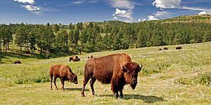
| Custer State Park | State park | Custer | 71,000 | 29,000 | 43°46′14″N 103°23′47″W / 43.7706°N 103.3964°W | 1919 | South Dakota's first and largest state park, famous for its wild bison herd and beautiful Sylvan Lake. | ||
| Farm Island Recreation Area | Recreation area | Hughes | 1,800 | 730 | 44°20′45″N 100°16′48″W / 44.345921°N 100.27995°W | 1946 | This park was once an island in the Missouri River, but now it's connected to the mainland by a bridge. | ||
| Fisher Grove State Park | State park | Spink | 277 | 112 | 44°53′00″N 98°21′24″W / 44.883461°N 98.356702°W | 1946 | The first stagecoach road from Watertown to Pierre crossed the James River right here. | ||
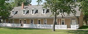
| Fort Sisseton Historic State Park | State park | Marshall | 125 | 51 | 45°39′34″N 97°31′42″W / 45.659398°N 97.528266°W | 1959 | This park protects the old buildings of historic Fort Sisseton, which was built in 1864. | ||
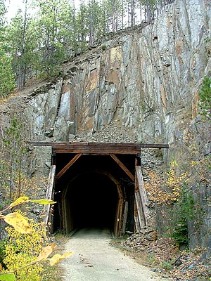
| George S. Mickelson Trail | Trail | Lawrence, Pennington, Custer, Fall River | 1998 | A 109-mile long trail for biking and walking. It follows an old railroad line through the beautiful Black Hills. | |||||
| Good Earth State Park at Blood Run | State park | Lincoln | 650 | 260 | 43°28′32″N 96°35′39″W / 43.475595°N 96.5942°W | 2013 | This park is the largest known site of the ancient Oneota culture in the upper Midwest. | ||
| Hartford Beach State Park | State park | Roberts | 331 | 134 | 45°24′08″N 96°40′23″W / 45.402196°N 96.673074°W | 1945 | You can find American Indian burial mounds and an old trading post here, right on Big Stone Lake. | ||
| Indian Creek Recreation Area | Recreation area | Walworth | 187 | 76 | 45°31′20″N 100°23′13″W / 45.522137°N 100.38682°W | 2001 | A great spot for camping and launching your boat on the Missouri River. | ||
| LaFramboise Island Nature Area | Nature area | Hughes | 555 | 225 | 44°21′40″N 100°21′45″W / 44.361169°N 100.36242°W | 2002 | This sandy island is located in the middle of the Missouri River. | ||
| Lake Alvin Recreation Area | Recreation area | Lincoln | 59 | 24 | 1957 | A popular beach and fishing area surrounding Lake Alvin. | |||
| Lake Cochrane Recreation Area | Recreation area | Deuel | 88 | 36 | 44°42′51″N 96°28′44″W / 44.714191°N 96.478932°W | 1974 | This park is tucked between Lake Cochrane and Lake Oliver, offering beautiful views. | ||
| Lake Herman State Park | State park | Lake | 227 | 92 | 43°59′34″N 97°09′38″W / 43.992878°N 97.160426°W | 1946 | A good place to see wildlife and visit the historic Herman Luce settler's cabin on Lake Herman. | ||
| Lake Hiddenwood Recreation Area | Recreation area | Walworth | 332 | 134 | 45°32′59″N 99°59′06″W / 45.549856°N 99.985001°W | 1947 | One of South Dakota's oldest human-made lakes, created way back in 1927. | ||
| Lake Louise Recreation Area | Recreation area | Hand | 320 | 130 | 44°37′14″N 99°08′26″W / 44.620547°N 99.140553°W | 1945 | This area is right next to the 164-acre Lake Louise, offering lakeside fun. | ||
| Lake Poinsett Recreation Area | Recreation area | Brookings | 196 | 79 | 44°32′03″N 97°05′02″W / 44.534183°N 97.083956°W | 1976 | A great spot for camping and launching boats on the southern shore of Lake Poinsett. | ||
| Lake Thompson Recreation Area | Recreation area | Kingsbury | 416 | 168 | 44°19′24″N 97°26′05″W / 44.323468°N 97.434631°W | 1998 | Located on the northern shore of Lake Thompson, famous from Laura Ingalls Wilder's Little House on the Prairie books. | ||
| Lake Vermillion Recreation Area | Recreation area | McCook | 267 | 108 | 43°35′41″N 97°11′07″W / 43.594764°N 97.185172°W | 1967 | Enjoy fishing, swimming, and boating on the southern end of the 512-acre Lake Vermillion. | ||
| Lewis & Clark Recreation Area | Recreation area | Yankton | 928 | 376 | 42°52′04″N 97°31′17″W / 42.867723°N 97.521526°W | 1966 | This park is located near Gavins Point Dam on the Missouri River, where Fort Yankton used to be. | ||
| Little Moreau Recreation Area | Recreation area | Dewey | 160 | 65 | 45°20′57″N 101°05′04″W / 45.349193°N 101.08448°W | 1962 | This area has grasslands and was once a winter camp for Plains Indian tribes. | ||
| Llewellyn Johns Recreation Area | Recreation area | Perkins | 114 | 46 | 45°46′31″N 102°10′39″W / 45.775402°N 102.17742°W | 1945 | A campground near where explorer Hugh Glass was attacked by a grizzly bear in 1823. | ||
| Mina Lake Recreation Area | Recreation area | Edmonds | 300 | 120 | 45°26′51″N 98°44′27″W / 45.447464°N 98.74082°W | 1950 | A great place for boating, fishing, and swimming on the shores of the human-made Mina Lake. | ||
| Newton Hills State Park | State park | Lincoln | 948 | 384 | 43°13′09″N 96°34′13″W / 43.219041°N 96.570193°W | 1949 | Enjoy rolling hills and beautiful woodlands in this park, part of the Coteau des Prairies land formation. | ||
| North Point Recreation Area | Recreation area | Charles Mix | 1,055 | 427 | 43°04′59″N 98°33′01″W / 43.083064°N 98.550327°W | 2001 | Located on the eastern shore of Lake Francis Case on the Missouri River, above Fort Randall Dam. | ||
| North Wheeler Recreation Area | Recreation area | Charles Mix | 43°10′19″N 98°49′32″W / 43.171927°N 98.825552°W | 2001 | A small park and campground with easy access to Lake Francis Case on the Missouri River. | ||||
| Oahe Downstream Recreation Area | Recreation area | Stanley | 933 | 378 | 44°26′13″N 100°23′59″W / 44.436944°N 100.39978°W | 2002 | Located on the Missouri River just below the big Oahe Dam. | ||
| Oakwood Lakes State Park | State park | Brookings | 293 | 119 | 44°26′59″N 96°58′55″W / 44.449753°N 96.981982°W | 1945 | This park was a meeting place for American Indians. It's surrounded by eight connected lakes and has a historic log cabin from 1869. | ||
| Okobojo Point Recreation Area | Recreation area | Sully | 135 | 55 | 44°34′33″N 100°29′44″W / 44.57596°N 100.49547°W | 2001 | A sandy piece of land sticking out into Lake Oahe on the Missouri River. | ||
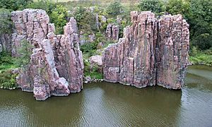
| Palisades State Park | State park | Minnehaha | 434.5 | 175.8 | 43°41′16″N 96°31′02″W / 43.687645°N 96.517166°W | 1972 | See unique pink rock formations called Sioux quartzite along Split Rock Creek. | ||
| Pease Creek Recreation Area | Recreation area | Charles Mix | 600 | 240 | 43°08′25″N 98°43′55″W / 43.140208°N 98.731855°W | 2001 | Access the river where Pease Creek meets the Missouri River. | ||
| Pelican Lake Recreation Area | Recreation area | Codington | 152 | 62 | 44°51′08″N 97°12′30″W / 44.852222°N 97.208448°W | 1978 | Enjoy camping, boating, and other activities on the southern shore of Pelican Lake. | ||
| Pickerel Lake Recreation Area | Recreation area | Day | 368 | 149 | 45°29′08″N 97°14′53″W / 45.485552°N 97.248138°W | 1949 | This park has east and west sections on the 955-acre Pickerel Lake. | ||
| Pierson Ranch Recreation Area | Recreation area | Yankton | 60 | 24 | 42°52′25″N 97°28′56″W / 42.873642°N 97.482167°W | 2001 | Mainly a campground located between Lewis & Clark Recreation Area and Chief White Crane Recreation Area. | ||
| Platte Creek Recreation Area | Recreation area | Charles Mix | 252 | 102 | 43°17′55″N 98°59′52″W / 43.298531°N 98.997651°W | 1983 | Great for fishing and river access where Platte Creek joins Lake Francis Case on the Missouri River. | ||
| Randall Creek Recreation Area | Recreation area | Gregory | 184 | 74 | 43°03′04″N 98°33′19″W / 43.051021°N 98.555139°W | 2002 | Just below Fort Randall Dam on the Missouri River, known for its bald eagles. | ||
| Revheim Bay Recreation Area | Recreation area | Walworth | 296 | 120 | 45°31′22″N 100°24′27″W / 45.522778°N 100.4074°W | 2001 | A park for day visits on the Missouri River near Mobridge. | ||
| Richmond Lake Recreation Area | Recreation area | Brown | 349 | 141 | 45°32′24″N 98°36′40″W / 45.539902°N 98.611093°W | 1947 | This park on Richmond Lake has separate areas for camping, watching wildlife, and boat access. | ||
| Rocky Point Recreation Area | Recreation area | Butte | 350 | 140 | 44°42′33″N 103°42′45″W / 44.709229°N 103.71253°W | 2005 | Located on the large 8,000-acre Belle Fourche Reservoir. | ||
| Roy Lake State Park | State park | Marshall | 560 | 230 | 45°42′35″N 97°26′56″W / 45.709686°N 97.448803°W | 1946 | Great for fishing, beaches, and camping on Roy Lake, in an area formed by glaciers. | ||
| Sandy Shore Recreation Area | Recreation area | Codington | 19 | 7.7 | 44°53′38″N 97°14′27″W / 44.893844°N 97.240953°W | 1969 | A nice beach area on the banks of Lake Kampeska. | ||
| Shadehill Recreation Area | Recreation area | Perkins | 2,150 | 870 | 45°45′40″N 102°13′07″W / 45.761144°N 102.21849°W | 1952 | Features a long shoreline of Shadehill Reservoir, one of the biggest lakes in western South Dakota. | ||
| Sheps Canyon Recreation Area | Recreation area | Fall River | 6,565 | 2,657 | This park offers camping, water access, and horse riding trails on the western side of Angostura Reservoir. | ||||
| Sica Hollow State Park | State park | Marshall, Roberts | 900 | 360 | 45°44′32″N 97°14′34″W / 45.7421°N 97.242668°W | 1968 | An important historical site for the Sioux Indians. Its name means "evil" or "bad" in Dakota, referring to the red bogs. | ||
| Snake Creek Recreation Area | Recreation area | Charles Mix | 695 | 281 | 43°23′24″N 99°07′10″W / 43.389979°N 99.119491°W | 1983 | Enjoy easy access and activities on Lake Francis Case along the Missouri River. | ||
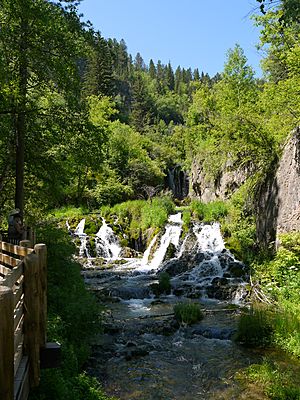
| Spearfish Canyon Nature Area | Nature area | Lawrence | 127 | 51 | 44°21′00″N 103°56′40″W / 44.349956°N 103.94432°W | 2008 | A popular spot to see beautiful waterfalls in Spearfish Canyon. | ||
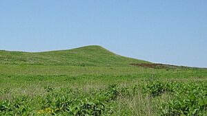
| Spirit Mound Historic Prairie | Nature area | Clay | 320 | 130 | 42°52′03″N 96°57′16″W / 42.867608°N 96.954431°W | 2001 | This prominent hill is part of Plains Indian legends and was visited by the Lewis and Clark Expedition. | ||
| Spring Creek Recreation Area | Recreation area | Hughes | 149 | 60 | 44°32′46″N 100°29′10″W / 44.546055°N 100.486216°W | 2001 | A park for day visits where Spring Creek meets Lake Oahe on the Missouri River. | ||
| Springfield Recreation Area | Recreation area | Bon Homme | 24 | 9.7 | 42°51′21″N 97°53′05″W / 42.855881°N 97.884586°W | 1957 | Provides access to Lake Oahe on the Missouri River. | ||
| Swan Creek Recreation Area | Recreation area | Walworth | 106 | 43 | 45°19′09″N 100°18′00″W / 45.319177°N 100.3°W | 1983 | Features bluffs and water access on the eastern shore of Lake Oahe on the Missouri River. | ||
| Union Grove State Park | State park | Union | 282 | 114 | 42°55′13″N 96°47′07″W / 42.920242°N 96.785321°W | 1947 | A beautiful prairie woodland along Brule Creek, great for birdwatching and seeing fall colors. | ||
| Walkers Point Recreation Area | Recreation area | Lake | 41 | 17 | 43°57′25″N 97°01′43″W / 43.956806°N 97.028614°W | 1990 | Offers camping and access to the 2,800-acre Lake Madison. | ||
| West Bend Recreation Area | Recreation area | Hughes | 154 | 62 | 44°10′15″N 99°43′16″W / 44.170744°N 99.721021°W | 1984 | A recreation area with a marina on Lake Sharpe of the Missouri River. | ||
| West Pollock Recreation Area | Recreation area | Campbell | 243 | 98 | 45°53′04″N 100°20′08″W / 45.884314°N 100.33565°W | 2001 | Provides water access and a hunting area on Lake Oahe of the Missouri River. | ||
| West Whitlock Recreation Area | Recreation area | Potter | 260 | 110 | 45°02′53″N 100°15′58″W / 45.048094°N 100.26607°W | 1983 | Offers Missouri River access and was a historic campsite for Arikara and Mandan Plains Indians. | ||
Future Plans for South Dakota Parks
South Dakota is thinking about adding a new state park in Spearfish Canyon. This new park would cover about 1,600 acres. It would include beautiful spots like Spearfish Falls and Roughlock Falls, and parts of Little Spearfish Canyon. The land for this possible new park is currently owned by the state and the U.S. government.
See Also
 | William L. Dawson |
 | W. E. B. Du Bois |
 | Harry Belafonte |


