Nablus facts for kids
Quick facts for kids
Nablus
|
||
|---|---|---|
|
City
|
||
| Arabic transcription(s) | ||
| • Arabic | نابلس | |
| • Latin | Nābulus (official) | |
|
Left-to-right from top:
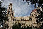
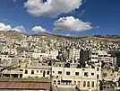
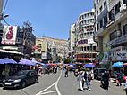
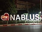
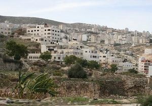
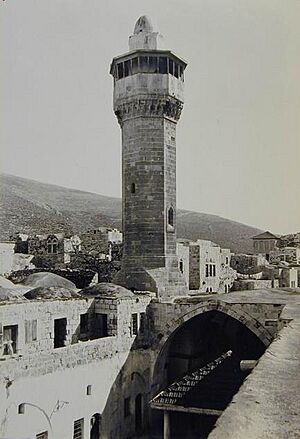
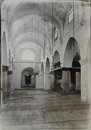
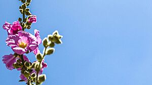
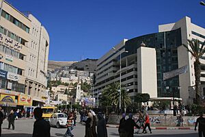
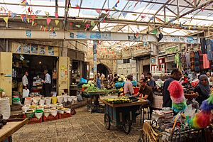
Nablus and Mount Gerizim skyline; Manara Clock Tower and An-Nasr Mosque; Joseph's Tomb chamber; Old City of Nablus; Tell Balata archaeological site; Eastern Orthodox Church of Bir Ya'qub, where Jacob's Well is located; Mount Ebal; and a Nablus shopping district. |
||
|
||
| Country | ||
| Governorate | Nablus Governorate | |
| Founded | 72 CE | |
| Government | ||
| • Type | Municipality Level A (from 1995) | |
| Area | ||
| • City | 28,564 dunams (28.6 km2 or 11.0 sq mi) | |
| Population
(2023)
|
||
| • City | 174,387 | |
| • Density | 6,097/km2 (15,792/sq mi) | |
| • Metro | 431,584 | |
| Website | nablus.org | |
Nablus is a city in Palestine, located about 49 kilometers (30 miles) north of Jerusalem. It has a population of around 156,906 people. The city sits between two mountains, Mount Ebal and Mount Gerizim. Nablus is the main city of the Nablus Governorate and is an important center for business and culture in Palestine. It is home to An-Najah National University, one of the biggest universities in the area. Nablus is managed by the Palestinian National Authority (PNA).
The city's modern name comes from the Roman period. In 72 CE, the Roman emperor Vespasian named it Flavia Neapolis, meaning "new city." During the Byzantine period, there were conflicts between the Samaritans and Christians living in the city. After the Muslim conquest of the Levant in the 7th century, the city became known by its current Arabic name, Nablus.
Later, during the Crusades, the Crusaders created laws for the Kingdom of Jerusalem in Nablus. People of different faiths, including Christians, Samaritans, and Muslims, lived well together. The city then came under the control of the Ayyubids and the Mamluk Sultanate. The Ottoman Turks took over Nablus in 1517. Under their rule, Nablus became a major center for trade and administration in the northern West Bank.
After British forces captured the city during World War I, Nablus became part of Mandatory Palestine in 1922. Following the 1948 Arab–Israeli War, the entire West Bank, including Nablus, was controlled by Jordan. Since the 1967 Arab–Israeli War, Israel has occupied the West Bank. Since 1995, Nablus has been governed by the PNA. Today, most of the people in Nablus are Muslim, but there are also smaller Christian and Samaritan communities.
Contents
History of Nablus
Ancient Times
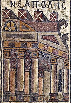
The city of Flavia Neapolis was named in 72 CE by the Roman emperor Vespasian. It was built near an older Samaritan village called Mabartha. The new city was located between Mount Ebal and Mount Gerizim, about 2 kilometers (1.2 miles) west of the ancient city of Shechem. Important holy places like Joseph's Tomb and Jacob's Well are found near where the city was founded. Because of its good location and many springs, Neapolis grew and became very successful.
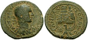
The city was built with a Roman grid plan and settled by Roman soldiers and other colonists. In the 2nd century CE, Emperor Hadrian built a large theater in Neapolis that could hold up to 7,000 people. Coins from this time show Roman symbols and Greek gods. At first, Neapolis was a pagan city. It grew until a civil war in 198–9 CE. After siding with the losing side, the city temporarily lost some of its special rights.
In 244 CE, Emperor Philip the Arab made Flavia Neapolis a Roman colony called Julia Neapolis. This status lasted until 251 CE. Christianity became common in the city by the 2nd or 3rd century. A bishop from Nablus even attended the First Council of Nicaea in 325 CE. Records from the 4th century CE show that Samaritans lived in the city.
During the Byzantine period, Neapolis was a large city, possibly three times bigger than when it was first built. It is estimated that around 20,000 people lived there.
Conflicts between the Christian and Samaritan communities grew. In 484, a deadly event happened when Samaritans attacked Christians in the cathedral. As a result, the Byzantine emperor Zeno built a church dedicated to Mary on Mount Gerizim. He also stopped Samaritans from holding religious ceremonies on the mountain and took over their synagogue there. These actions made the Samaritans even angrier.
The Samaritans rebelled again under Emperor Anastasius I. They took back Mount Gerizim, but it was soon recaptured by Byzantine forces. A third Samaritan revolt in 529 was very violent. The bishop of Neapolis and priests were killed. Emperor Justinian I sent his army to stop the revolt, which led to many Samaritans in the city being killed.
Early Islamic Period
In 636, Nablus and most of Palestine were conquered by Muslims under Khalid ibn al-Walid, a general of Umar ibn al-Khattab. The city's name became Nabulus in Arabic. Nablus remained an important trade center for centuries under different Islamic rulers like the Umayyad, Abbasid, and Fatimid dynasties.
Under Muslim rule, Nablus had a mix of people, including Arabs, Persians, Muslims, Samaritans, Christians, and Jews. In the 9th century, it was reported that Nablus had a mixed population. In the 10th century, a geographer described Nablus as a city with many olive trees, a big marketplace, a beautiful Great Mosque, stone houses, and a stream running through it. It was even called "Little Damascus." Linen made in Nablus was famous across the Old World.
Crusader and Mamluk Rule
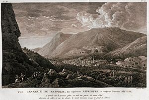
The Crusaders captured Nablus in 1099 and renamed it Naples. They took supplies from the city but did not destroy it, likely because many Christians lived there. Nablus became part of the Kingdom of Jerusalem. Muslims, Orthodox Christians, and Samaritans continued to live in the city, joined by some Crusaders. In 1120, the Crusaders held the Council of Nablus and created the first written laws for their kingdom. They turned the Samaritan synagogue into a church, but the Samaritans built a new synagogue in the 1130s.
In 1137, troops from Damascus attacked Nablus, harming many Christians and burning churches. However, they could not take the city. Queen Melisende of Jerusalem lived in Nablus from 1150 to 1161. Crusaders also built Christian buildings, including a church and a place for pilgrims.
Crusader rule ended in 1187 when the Ayyubids, led by Saladin, captured Nablus. Latin Christians left, but Orthodox Christians stayed. A geographer wrote that Ayyubid Nablus was a "celebrated city" with wide lands. He also mentioned the large Samaritan population. After the Muslims took it back, the Great Mosque of Nablus, which had been a church, was made a mosque again.
In 1242, the Knights Templar attacked Nablus. This was a very violent event where the mosque was burned, and many residents, both Christians and Muslims, were harmed or taken captive.
In 1244, the Samaritan synagogue was turned into al-Khadra Mosque. Two other Crusader churches became the An-Nasr Mosque and al-Masakim Mosque.
The Mamluk dynasty took control of Nablus in 1260. They built many mosques and schools. Under Mamluk rule, Nablus had running water and many Turkish baths. It exported olive oil and soap to Egypt, Syria, and other places. The city's olive oil was even used in the Umayyad Mosque in Damascus. The Arab explorer Ibn Battuta visited Nablus in 1355 and described it as a city "full of trees and streams and full of olives."
Ottoman Rule

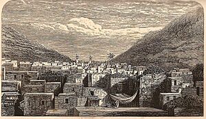
Nablus became part of the Ottoman Empire in 1517. The Ottomans divided Palestine into districts, and Nablus was one of them. During the 16th century, most people in Nablus were Muslim, with smaller groups of Jewish, Samaritan, and Christian people.
In the 17th century, the Ottomans sent soldiers to Nablus to strengthen their control. These soldiers, mostly Arab officers, were given land. Over time, these families became very powerful in Nablus. The most important families were the Nimrs, the Akhrami, and later the Jarrars and Tuqans. The Tuqans and Nimrs often competed for power within the town. These families remained powerful until the mid-19th century.
In the mid-18th century, Zahir al-Umar, a ruler from the Galilee, became very strong. He wanted to control the trade of cotton and olive oil, which Nablus produced a lot of. He tried to take Nablus twice but failed. Still, these attempts made Acre more important than Nablus for a while. After Zahir's rule ended in 1804, Nablus became independent again, and the Tuqan family gained more power.
Egyptian and Later Ottoman Rule
In 1831–32, Muhammad Ali of Egypt conquered Palestine from the Ottomans. New rules about joining the army and paying taxes led to a revolt in Nablus and other cities. In May 1834, local leaders from Nablus led thousands of rebels to attack Jerusalem. They took the city but were later defeated by Egyptian forces. The revolt was stopped, and its leader was executed.
Egyptian rule in Palestine led to Nablus becoming even more important. The Ottomans took Palestine back from Egypt in 1840–41. However, the Abd al-Hadi family, who had supported the Egyptians, remained powerful in Nablus.
Throughout the 18th and 19th centuries, Nablus was the main trade and manufacturing center in Ottoman Syria. It was more economically active than Jerusalem and coastal cities like Jaffa. Olive oil was Nablus's most important product, helping industries like soap-making and basket weaving. It was also the biggest producer of cotton in the region. Nablus had more freedom from direct Ottoman control than other areas, perhaps because it was in a hilly region with no foreign officials.
World War I and British Mandate
In 1918, during the last months of World War I, a major battle called the Battle of Nablus took place. British forces attacked Ottoman armies near Nablus.
The 1927 Jericho earthquake damaged many historic buildings in Nablus, including the An-Nasr Mosque. These buildings were later rebuilt in the 1930s. During the 1936–1939 Arab revolt in Palestine, British authorities destroyed some buildings in the Old City that they thought were hiding rebels or weapons. Jewish immigration did not change the population of Nablus much. The 1947 UN plan suggested Nablus be part of an Arab state.
Jordanian and Israeli Periods
During the 1948 Arab–Israeli War, Nablus came under Jordanian control. Thousands of Palestinian refugees came to Nablus from areas taken by Israeli forces, settling in camps around the city. The city's population doubled, putting a strain on resources. Three refugee camps, Ein Beit al-Ma', Balata, and Askar, are still within the city limits today. Jordan officially took over Nablus in 1950.
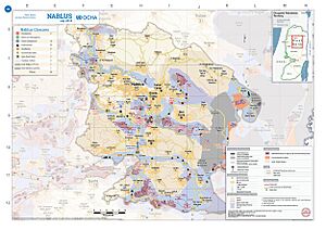
The Six-Day War in 1967 led to the Israeli occupation of Nablus. Many Israeli settlements were built around Nablus in the 1980s and early 1990s. Restrictions during the First Intifada encouraged people to grow their own food and boosted local farming.
In 1976, Bassam Shakaa was elected mayor. In 1982, the Israeli administration removed him and put an army officer in charge for three and a half years. In 1985, the Israeli army imposed a 5-day curfew on the city, the longest at that time. It was lifted for two hours each day for people to get food.
In 1986, Zafer al-Masri became mayor. He was a popular leader and started improving the town. However, he was sadly killed on March 2, 1986.
Palestinian Control
Control of Nablus was given to the Palestinian National Authority on December 12, 1995, as part of the Oslo Accords. Nablus is surrounded by Israeli settlements and saw regular clashes during the First Intifada.
From the start of the Second Intifada in September 2000, Nablus became a center of clashes between the Israel Defense Forces (IDF) and Palestinians. The city has a history of political activity, earning it the nickname jabal al-nar (Fire Mountain). For several years, movement in and out of the city was very limited due to Israeli checkpoints.
From 2000 to 2005, 522 residents of Nablus and nearby refugee camps were killed, and 3,104 were injured during IDF military operations. In April 2002, Israel launched a major military operation called Operation Defensive Shield, targeting Nablus and Jenin.
This operation caused serious damage to the historic parts of Nablus, with 64 old buildings heavily damaged or destroyed. IDF forces re-entered Nablus in June 2002 and stayed until the end of September. During these three months, there were over 70 days of full 24-hour curfews. Some mosques and churches were damaged, and about 60 houses were destroyed. The cost of the damage was estimated at $80 million US.
In August 2016, the Old City of Nablus saw fierce clashes between a militant group and Palestinian police.
Geography of Nablus
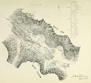
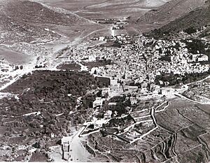
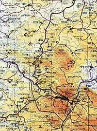
Nablus is in a good location where two old trade roads meet. One road connects the Sharon coastal plain to the Jordan valley. The other connects Nablus to the Galilee in the north and Judea in the south. The city is about 550 meters (1,800 feet) above sea level. It lies in a narrow valley between two mountains: Mount Ebal to the north, which is 940 meters (3,080 feet) high, and Mount Gerizim to the south, which is 881 meters (2,890 feet) high.
Nablus is located 42 kilometers (26 miles) east of Tel Aviv, Israel, 110 kilometers (68 miles) west of Amman, Jordan, and 63 kilometers (39 miles) north of Jerusalem. Nearby towns include Huwara and Aqraba to the south, Beit Furik to the southeast, Tammun to the northeast, Asira ash-Shamaliya to the north, and Kafr Qaddum and Tell to the west.
The Old City
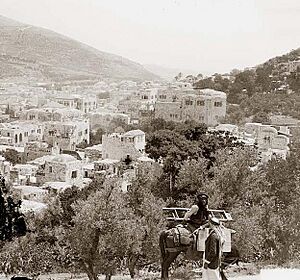
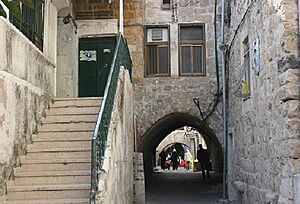
The center of Nablus is its old city, which has six main areas: Yasmina, Gharb, Qaryun, Aqaba, Qaysariyya, and Habala. Habala is the largest area. The old city is very crowded, and important families like the Nimrs, Tuqans, and Abd al-Hadis live there. The large Abd al-Hadi Palace from the 19th century is in Qaryun. The Nimr Hall and the Tuqan Palace are in the middle of the old city.
There are several mosques in the Old City, including the Great Mosque of Nablus, An-Nasr Mosque, and al-Khadra Mosque.
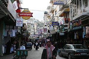
The Old City also has six hamaams (Turkish baths). Al-Shifa was built in 1624. Al-Hana was the last hamaam built in the city in the 19th century. It closed in 1928 but was fixed up and reopened in 1994. Many leather workshops, markets (souks), and textile shops are found on the Old City streets. The 15th-century Khan al-Tujjar caravanserai and the Manara Clock Tower, built in 1906, are also in the Old City.
Climate of Nablus
Nablus has a mild Mediterranean climate. This means it has hot, dry summers and cool, rainy winters. Spring usually arrives around March or April. The hottest months are July and August, with average high temperatures around 29.6°C (85.3°F). January is the coldest month, with temperatures usually around 6.2°C (43.2°F). Rain mostly falls between October and March, with about 656 millimeters (25.8 inches) of rain each year.
| Climate data for Nabulus ( 570 meters above sea level) 1972-1997 | |||||||||||||
|---|---|---|---|---|---|---|---|---|---|---|---|---|---|
| Month | Jan | Feb | Mar | Apr | May | Jun | Jul | Aug | Sep | Oct | Nov | Dec | Year |
| Record high °C (°F) | 22.9 (73.2) |
28.1 (82.6) |
30.4 (86.7) |
35 (95) |
38.6 (101.5) |
38 (100) |
38.1 (100.6) |
38.6 (101.5) |
38.8 (101.8) |
35.3 (95.5) |
30.7 (87.3) |
28 (82) |
38.8 (101.8) |
| Mean daily maximum °C (°F) | 13.1 (55.6) |
14.4 (57.9) |
17.2 (63.0) |
22.2 (72.0) |
25.7 (78.3) |
27.9 (82.2) |
29.1 (84.4) |
29.4 (84.9) |
28.4 (83.1) |
25.8 (78.4) |
20.2 (68.4) |
14.6 (58.3) |
22.35 (72.23) |
| Daily mean °C (°F) | 9.0 (48.2) |
8.8 (47.8) |
11.9 (53.4) |
16.6 (61.9) |
20.7 (69.3) |
24.0 (75.2) |
24.8 (76.6) |
24.4 (75.9) |
22.5 (72.5) |
20.5 (68.9) |
17.5 (63.5) |
13.1 (55.6) |
17.8 (64.0) |
| Mean daily minimum °C (°F) | 6.2 (43.2) |
6.7 (44.1) |
8.8 (47.8) |
12.1 (53.8) |
14.9 (58.8) |
17.4 (63.3) |
19.3 (66.7) |
19.5 (67.1) |
18.5 (65.3) |
16.2 (61.2) |
12.1 (53.8) |
7.8 (46.0) |
13.3 (55.9) |
| Record low °C (°F) | −0.6 (30.9) |
−2.8 (27.0) |
−1 (30) |
0.6 (33.1) |
6.9 (44.4) |
11.4 (52.5) |
12.3 (54.1) |
15.9 (60.6) |
13 (55) |
9.3 (48.7) |
1.4 (34.5) |
0.3 (32.5) |
−2.8 (27.0) |
| Average precipitation mm (inches) | 155 (6.1) |
135 (5.3) |
90 (3.5) |
34 (1.3) |
5 (0.2) |
0 (0) |
0 (0) |
0 (0) |
2 (0.1) |
17 (0.7) |
60 (2.4) |
158 (6.2) |
656 (25.8) |
| Average relative humidity (%) | 74 | 75 | 66 | 55 | 47 | 50 | 65 | 62 | 73 | 62 | 54 | 69 | 63 |
| Source: Arab Meteorology Book | |||||||||||||
People of Nablus
| Year | Population |
|---|---|
| 1596 | 4,300 |
| 1849 | 20,000 |
| 1860 | 15,000 |
| 1922 | 15,947 |
| 1931 | 17,181 |
| 1945 | 23,250 |
| 1961 | 45,768 |
| 1987 | 93,000 |
| 1997 | 100,034 |
| 2007 | 126,132 |
| 2017 | 156,906 |
In 1596, Nablus had about 4,300 people, mostly Muslim, with some Samaritan, Christian, and Jewish families. By 1849, the population grew to around 20,000. In 1922, a British census showed 15,947 people, mainly Muslims, with smaller groups of Christians and Samaritans. The population continued to grow, reaching 17,189 in 1931.
According to the Palestinian Central Bureau of Statistics (PCBS), Nablus had 126,132 people in 2007. In 1997, the city had 100,034 people, including 23,397 Palestinian refugees, who made up about 24% of the city's residents. The Old City of Nablus had 12,000 people in 2006. About 40% of the people in the Nablus Governorate live in Nablus city.
Around half of the population is under 20 years old. In 1997, 28.4% of people were under 10, and 20.8% were between 10 and 19. The population was almost evenly split between males and females.
Religions in Nablus
In 891 CE, Nablus had a mix of Samaritans, Muslims, and Christians. Later, under Mamluk rule, the city was home to Muslims, Samaritans, Orthodox Christians, Catholics, and Jews.
Today, most people in Nablus are Muslim. However, there are still small Christian and Samaritan communities. Many Palestinian Muslims in Nablus are believed to be descendants of Samaritans who converted to Islam. Some Nabulsi family names are linked to Samaritan ancestors.
In 1967, there were about 3,500 Christians in Nablus, but this number dropped to about 650 by 2008. Most Christians used to live in the Rafidia suburb.
The Old City has seventeen Islamic monuments and eleven mosques. Nine of these mosques were built before the 15th century. Besides Muslim places of worship, Nablus also has an Orthodox church, built in 1898, and an ancient Samaritan synagogue that is still used today.
Economy of Nablus
Starting in the early 16th century, Nablus developed trade connections with Damascus and Cairo. It also set up trading posts in the Hejaz and Gulf regions, as well as in Turkey and the Mediterranean islands. Nablus traded with cities like Aleppo and Baghdad. The Ottoman government helped ensure safe travel for the yearly pilgrimage caravan from Damascus to Mecca and Medina, which helped Nablus economically.
In 1882, Nablus had 32 soap factories and 400 looms, exporting products across the Middle East. Nablus sent three-fourths of its soap, its most important product, to Cairo. From Egypt, Nablus merchants imported rice, sugar, spices, and textiles. They exported cotton, soap, olive oil, and textiles to Damascus, and imported silks and jewelry. Farming was a huge part of the local economy. Outside the city, there were many olive groves, fig and pomegranate orchards, and grape vineyards. Nablus was also the biggest producer of cotton in the region.
Nablus now has a busy modern business center with restaurants and shopping malls. Traditional industries like soap, olive oil, and handicrafts still operate. Other industries include making furniture, tiles, and textiles. The city is famous for sweets like kunafah, olive oil, soap, and ice cream.
The Vegetable Oil Industry Co. in Nablus makes refined vegetable oils, especially olive oil, and exports vegetable butter to Jordan. The al-Huda Textiles factory is also in Nablus. Before 2000, it made 500 pieces of clothing daily, but production dropped later. Al-Huda mostly imports textiles from China and exports finished products to Israel. Nablus has eight restaurants and four hotels.
Nablus's soap industry, once thriving, has faced challenges due to travel restrictions. Today, only two soap factories are still working.
The Al-Arz ice-cream company is the largest of six ice-cream makers in the Palestinian territories. It started as an ice factory in 1950. It produces 50 tons of ice cream a day and exports to Jordan and Iraq. Most ingredients come from Israel.
Before 2000, 13.4% of Nablus residents worked in Israel, but this dropped to 4.7% in 2004. The city's manufacturing sector also decreased. Since 2000, most people work in farming and local trade. After the Intifada, unemployment rates rose sharply. A report in 2008 said that checkpoints around the city caused many businesses to move, leading to high unemployment.
Since the removal of the Hawara roadblock, the old market (casbah) has become very lively. Nablus is home to the Palestine Securities Exchange (PSE), located in the al-Qasr building. The PSE started trading on February 19, 1997.
Education in Nablus
In 1997, 44,926 students were in schools in Nablus. About 41.2% were in primary school, 36.2% in secondary school, and 22.6% in high school. In 2006, the Nablus Governorate had 234 schools and 93,925 students. Most schools are run by the Palestinian National Authority's Education Ministry.
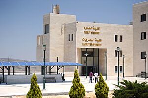
Nablus is also home to an-Najah National University, the largest Palestinian university in the West Bank. It started as a school in 1918 and became a university in 1977. An-Najah was closed by Israeli authorities during the First Intifada but reopened in 1991. Today, the university has three campuses in Nablus with over 16,500 students and 300 professors. It offers many subjects in both the humanities and sciences.
Nablus is considered one of the best cities in the Middle East to learn Arabic, ranking 5th on a list. An-Najah University offers Arabic language courses for non-Arabic speakers.
Healthcare in Nablus
There are six hospitals in Nablus. The four main ones are al-Ittihad, St. Lukes, al-Watani (the National), and the Rafidia Surgery Hospital. Rafidia, located in a western suburb, is the largest hospital in the city. Al-Watani Hospital specializes in oncology (cancer treatment). The Anglican St. Lukes hospital was founded in 1900, and the National Hospital in 1910.
Besides hospitals, Nablus has clinics like al-Rahma and at-Tadamon, the al-Razi medical center, the Amal Center for Rehabilitation, and 68 pharmacies. In 2001, Nablus Speciality Hospital was built, which specializes in open heart surgery, angiograms, and angioplasties.
Culture and Arts in Nablus
Nablus and its culture are well-known throughout the Palestinian Territories and the Arab world. The city has made important and unique contributions to Palestinian culture, cuisine, and costume. The word Nabulsi, meaning "from Nablus," is used to describe things like handicrafts (such as Nabulsi soap) and food products (like Nabulsi cheese) that are made in Nablus or in the traditional Nablus style.
Traditional Clothing
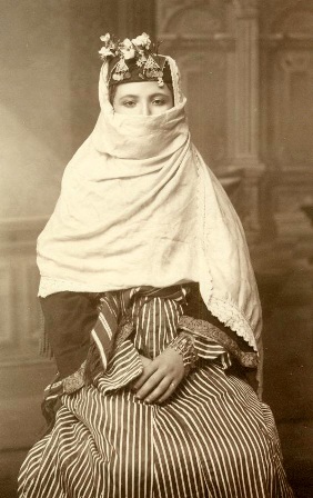
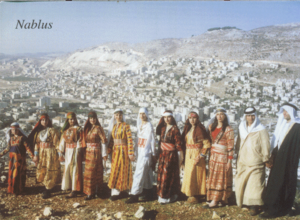
Nablus clothing had a special style with colorful mixes of different fabrics. Because Nablus was an important trade center with a busy market (souk), there was a wide choice of fabrics available in the late 19th century. These included Damascus and Aleppo silks, and Manchester cottons. Similar to clothes worn in the Galilee, both long and short Turkish style jackets were worn over the thob (robe). For everyday wear, thobs were often made of white cotton or linen with wide sleeves. In summer, clothes often had striped bands of red, green, and yellow, with decorations on the chest area.
Nabulsi Food
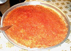
Nablus is one of the Palestinian cities known for its "high cuisine," similar to Damascus or Baghdad. The city is famous for several food products known across the Middle East and former Ottoman areas.
Kanafeh (or Kunafa) is the most famous Nabulsi sweet. It is made of thin pastry noodles with honey-sweetened cheese in the middle. The top layer is usually dyed orange and sprinkled with crushed pistachios. While now made throughout the Middle East, kanafeh Nabulsi uses a special white cheese called jibneh Nabulsi. Boiled sugar is used as a syrup for kanafeh.
Other sweets made in Nablus include baklawa, "Tamriya", mabrumeh, and ghuraybeh. Ghuraybeh is a simple pastry made of butter, flour, and sugar, shaped like an "S" or like fingers or bracelets.
Cultural Places
Nablus has three cultural centers. The Child Cultural Center (CCC), founded in 1998 in a renovated old building, offers art workshops, a stage for plays, a music room, a children's library, and a multimedia lab. The Children Happiness Center (CHC) was also started in 1998. It promotes Palestinian culture through social events, dabke dance classes, and field trips. The CHC also has a football and chess team. The Nablus municipal government opened its own cultural center in 2003, called the Nablus Municipality Cultural Center (NMCC), to create and improve educational facilities.
Soap Making
Nabulsi soap, or sabon nabulsi, is a type of castile soap made only in Nablus. It has three main ingredients: pure olive oil, water, and a sodium compound. Since the 10th century, Nabulsi soap has been known as a high-quality product and was exported across the Arab world and to Europe. Although the number of soap factories has dropped from thirty in the 19th century to only two today, people are working to keep this important part of Palestinian and Nabulsi culture alive.
Nabulsi soap is shaped like a cube, about 1.5 inches (3.8 cm) tall and 2.25 by 2.25 inches (5.7 by 5.7 cm) wide. Its color is like "the page of an old book." The cubes are stamped with the factory's seal. The sodium compound for the soap used to come from the barilla plant. Before the 1860s, the barilla was burned, and its ashes were brought to Nablus from modern-day Jordan by large caravans. In the city, the ashes were ground into a fine natural alkaline powder called qilw. Today, qilw is still used with lime.
City Services
In 1997, almost all households in Nablus (99.7%) had electricity from a public network. Before 1957, electricity came from private generators. Today, most people in 18 nearby towns, as well as Nablus residents, get electricity from the Nablus network.
Most homes are connected to a public sewage system (93%). The rest use cesspits. The sewage system, built in the early 1950s, also serves the refugee camps of Balata, Askar, and Ein Beit al-Ma'. All homes in the city have piped water, mostly from a public network (99.3%). The water network was set up in 1932 by the British and gets water from four nearby wells.
Fire Department
Nablus is one of the few cities in the West Bank with a fire department, which started in 1958. Back then, it had five members and one fire truck. In 2007, the department had seventy members and over twenty vehicles. Until 1986, it covered the entire northern West Bank, but now it only covers the Nablus and Tubas Governorates. From 1997 to 2006, Nablus's fire department put out 15,346 fires.
Getting Around Nablus
In the early 20th century, Nablus was the southernmost stop on a railway line that connected to the Hejaz railway. This railway extension was built in 1911–12. During the British Mandate, one train ran weekly from Haifa to Nablus. The railway was destroyed during the 1948 Arab–Israeli War.
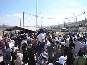
The main Beersheba–Nazareth road goes through the middle of the West Bank and ends in Nablus. However, local Arab travel on this road is very limited. Nablus was connected to Tulkarm, Qalqilya, and Jenin by roads, but these are now blocked by the Israeli West Bank barrier. From 2000 to 2011, Israel had checkpoints like Huwwara checkpoint that effectively cut off the city, making travel difficult. Since 2011, travel restrictions have eased, and some checkpoints have been removed.
The closest airport is Ben Gurion International Airport in Lod, Israel. However, due to travel restrictions for Palestinians entering Israel, many residents must travel to Amman, Jordan, to use the Queen Alia International Airport. This trip requires passing through several checkpoints and the Jordanian border. Taxis are the main way to get around Nablus, and the city has 28 taxi offices.
Sports in Nablus
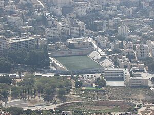
The Nablus football stadium can hold 8,000 people. It is the home of the city's football club, al-Ittihad, which plays in the main league of the Palestinian Territories. The club took part in the Middle East Mediterranean Scholar Athlete Games in 2000.
Nablus and Other Cities
Sister Cities
Nablus has sister city relationships with several cities around the world:
See also
 In Spanish: Nablus para niños
 | Shirley Ann Jackson |
 | Garett Morgan |
 | J. Ernest Wilkins Jr. |
 | Elijah McCoy |


