Grays Harbor County, Washington facts for kids
Quick facts for kids
Grays Harbor County
|
|
|---|---|

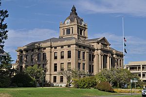
Grays Harbor County Courthouse
|
|

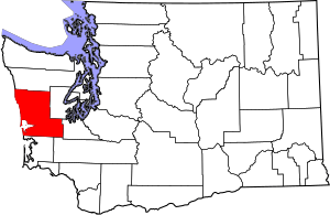
Location within the U.S. state of Washington
|
|
 Washington's location within the U.S. |
|
| Country | |
| State | |
| Founded | April 14, 1854 |
| Named for | Grays Harbor |
| Seat | Montesano |
| Largest city | Aberdeen |
| Area | |
| • Total | 2,224 sq mi (5,760 km2) |
| • Land | 1,902 sq mi (4,930 km2) |
| • Water | 322 sq mi (830 km2) 14%% |
| Population
(2020)
|
|
| • Total | 75,636 |
| • Estimate
(2023)
|
77,290 |
| • Density | 38.3/sq mi (14.8/km2) |
| Time zone | UTC−8 (Pacific) |
| • Summer (DST) | UTC−7 (PDT) |
| Congressional district | 6th |
Grays Harbor County is a county in the state of Washington. It is located in the western part of the state. In 2020, about 75,636 people lived here. The main town, called the county seat, is Montesano. The biggest city in the county is Aberdeen.
Contents
History of Grays Harbor County
The land that is now Grays Harbor County was first home to several Native American groups. These included the Quinault and Lower Chehalis tribes. They are part of the Coast Salish people. European explorers first met these tribes in the late 1700s. Sadly, many tribes later suffered from widespread diseases.
Grays Harbor was named after Robert Gray. He was a fur trader from Boston. He sailed into the bay on May 7, 1792. The bay was first called Bullfinch Harbor. Then it was named Chehalis Bay before getting its current name. The first permanent white settler in the area was William O'Leary. He was an Irish immigrant who settled there in 1848.
The Washington Coast was once part of the Oregon Country. This area was shared by the United States and British North America. In 1846, the Oregon Treaty gave this land to the United States. Before the treaty, the American Provisional Government of Oregon created Lewis County in 1845. This county covered most of the land north of the Columbia River. The Grays Harbor area stayed part of Lewis County. It became part of the Oregon Territory in 1848. Later, it joined the Washington Territory in 1853.
On April 14, 1854, the Washington Territorial Legislature created Chehalis County. This new county was made from parts of Lewis and Thurston counties. It surrounded Grays Harbor. The first county seat was in Bruceport. But in 1860, people voted to move it to the Scammon family's land. This place is now Montesano.
The towns of Aberdeen and Hoquiam grew along the north side of Grays Harbor. They became official cities by 1890. By 1900, these cities had 80 percent of the county's population. They tried to move the county seat to one of their cities, but they were not successful. Later, a plan to create a new county called Grays Harbor was approved. The Washington State Legislature passed a bill for it. However, the Supreme Court said it was against the rules on February 27, 1907.
The state legislature passed a new bill on March 15, 1915. This bill officially changed the name from Chehalis County to Grays Harbor County. The name change took effect on June 9. This helped avoid confusion with the town of Chehalis. That town is in nearby Lewis County.
Geography of Grays Harbor County
Grays Harbor County covers about 2,224 square miles. About 1,902 square miles is land. The other 322 square miles, or 14%, is water.
The county's land is mostly flat. The Chehalis River flows through it and drains into the Pacific Ocean. Because of this, the area often has floods. High tides and heavy rains can cause the water to rise. It is often hard for the water to drain away. As of 2024, buildings and roads in flood-risk areas are worth over $1.0 billion.
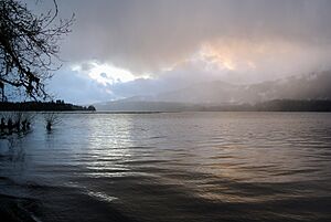
Geographic Features in Grays Harbor County
|
|
State Parks in Grays Harbor County
- Griffiths-Priday State Park
- Lake Sylvia State Park
- Ocean City State Park
- Pacific Beach State Park
- Twin Harbors State Park
- Westhaven State Park (now part of Westport Light State Park)
- Westport Light State Park
Major Highways in Grays Harbor County
Counties Next to Grays Harbor County
- Jefferson County – to the north
- Mason County – to the northeast
- Thurston County – to the east/southeast
- Lewis County – to the south/southeast
- Pacific County – to the south
Protected Natural Areas in Grays Harbor County
- Chehalis Indian Reservation
- Colonel Bob Wilderness
- Copalis National Wildlife Refuge
- Grays Harbor National Wildlife Refuge
- Olympic National Forest (part)
- Olympic National Park (part)
- Quinault Indian Reservation
People and Population in Grays Harbor County
| Historical population | |||
|---|---|---|---|
| Census | Pop. | %± | |
| 1860 | 285 | — | |
| 1870 | 401 | 40.7% | |
| 1880 | 921 | 129.7% | |
| 1890 | 9,249 | 904.2% | |
| 1900 | 15,124 | 63.5% | |
| 1910 | 35,590 | 135.3% | |
| 1920 | 44,745 | 25.7% | |
| 1930 | 59,982 | 34.1% | |
| 1940 | 53,166 | −11.4% | |
| 1950 | 53,644 | 0.9% | |
| 1960 | 54,465 | 1.5% | |
| 1970 | 59,553 | 9.3% | |
| 1980 | 66,314 | 11.4% | |
| 1990 | 64,175 | −3.2% | |
| 2000 | 67,194 | 4.7% | |
| 2010 | 72,797 | 8.3% | |
| 2020 | 75,636 | 3.9% | |
| 2023 (est.) | 77,290 | 6.2% | |
| U.S. Decennial Census 1790–1960 1900–1990 1990–2000 2010–2020 |
|||
Grays Harbor County in 2010
In 2010, there were 72,797 people living in Grays Harbor County. There were 28,579 households, which are groups of people living together. About 18,493 of these were families. The county had about 38 people per square mile.
Most people in the county were white (84.9%). About 4.6% were Native American. About 1.4% were Asian, and 1.1% were Black. About 8.6% of the people were of Hispanic or Latino background.
About 28.8% of households had children under 18 living with them. The average household had 2.45 people. The average family had 2.94 people. The average age of people in the county was 41.9 years old.
The average yearly income for a household was $41,899. For families, it was $49,745. About 16.1% of all people in the county lived below the poverty line. This means they had a very low income. This included 23.1% of those under 18.
Economy of Grays Harbor County
The main ways people make money in Grays Harbor County are:
- Making wood and paper products.
- Processing food, especially seafood.
- Manufacturing different goods.
Infrastructure in Grays Harbor County
To help with flooding, Grays Harbor County has improved its flood protection systems. This work started in 2012. It is a team effort by the Chehalis River Basin Flood Authority and local governments. These projects include building pump houses in areas that flood often. They also build floodwalls and levees to hold back water. As of 2024, this ongoing project is expected to cost over $50 million. It helps protect more than 5,100 homes and 1,300 businesses.
Communities in Grays Harbor County
Cities in Grays Harbor County
- Aberdeen
- Cosmopolis
- Elma
- Hoquiam
- McCleary
- Montesano (county seat)
- Oakville
- Ocean Shores
- Westport
Census-Designated Places in Grays Harbor County
These are areas that are like towns but are not officially incorporated as cities.
Other Unincorporated Communities in Grays Harbor County
These are smaller communities that are not officially cities or census-designated places.
Notable People from Grays Harbor County
- Robert Arthur, actor
- Elton Bennett, artist
- Adam Bighill, CFL player
- Gail Brown, actress
- Trisha Brown, choreographer
- Mark Bruener, NFL player
- Jeff Burlingame, author
- Daniel Bryan, professional wrestler
- Robert Eugene Bush, Medal of Honor recipient
- Kurt Cobain, musician
- Colin Cowherd, ESPN Radio host (The Herd with Colin Cowherd)
- Dale Crover, musician
- Reuben H. Fleet, aviation pioneer
- Clarence Chesterfield Howerton, circus performer
- Jerry Lambert, actor
- Robert Motherwell, artist
- Peter Norton, software developer (Norton Utilities)
- Krist Novoselic, musician
- Buzz Osborne, musician
- Douglas Osheroff, Nobel-winning physicist
- Blanche Pennick, Washington State legislator
- Patrick Simmons, musician
- Kurdt Vanderhoof, musician
See also
 In Spanish: Condado de Grays Harbor para niños


