
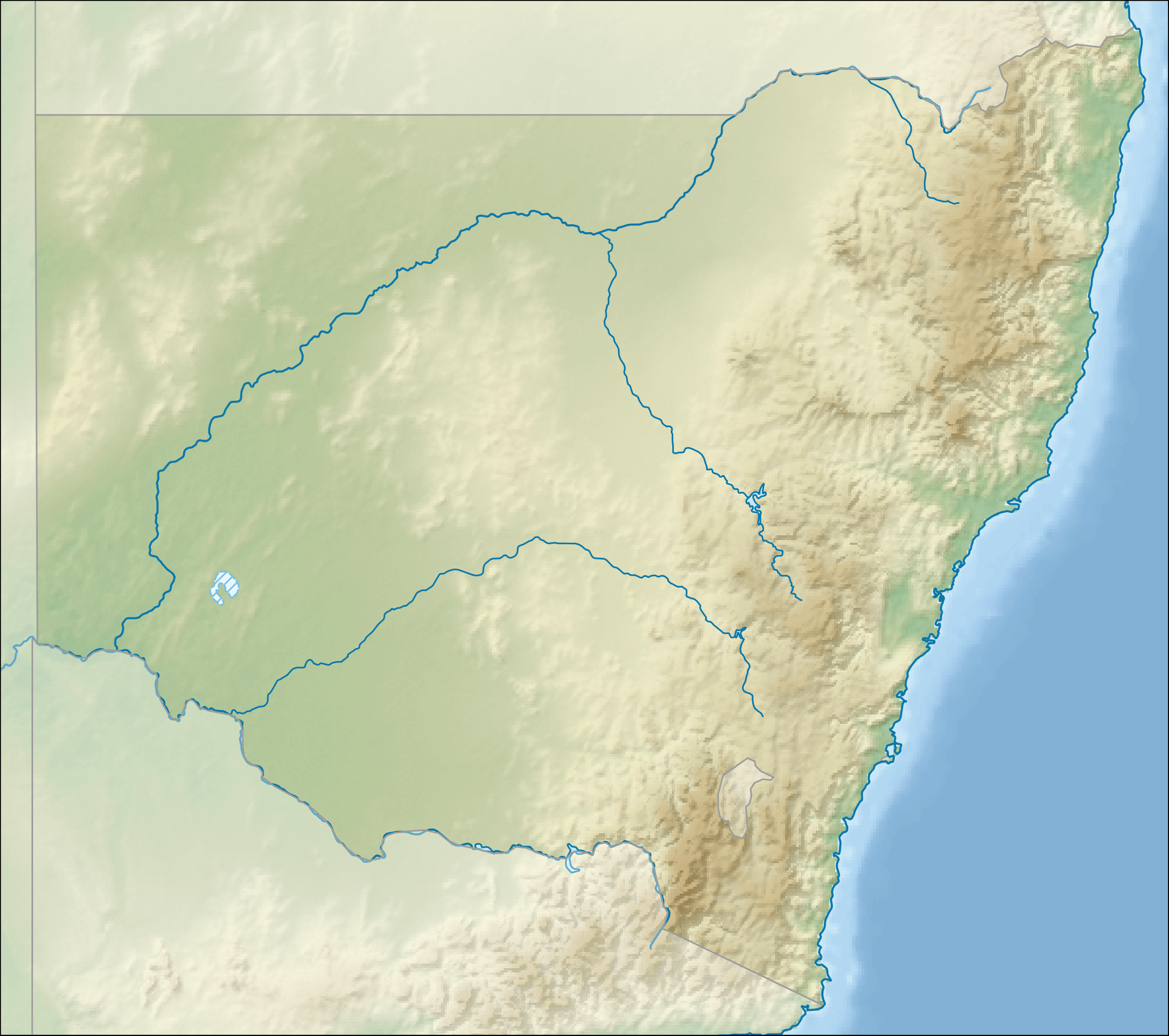
Image: Australia New South Wales relief location map
Size of this preview: 677 × 600 pixels. Other resolutions: 271 × 240 pixels | 2,226 × 1,972 pixels.
Original image (2,226 × 1,972 pixels, file size: 864 KB, MIME type: image/png)
Description: Relief location map of New South Wales, Australia Equidistant cylindrical projection, latitude of true scale 32.82° S (equivalent to equirectangular projection with N/S stretching 119 %). Geographic limits of the map: N: 27.9° S S: 37.8° S W: 140.6° E E: 153.9° E
Title: Australia New South Wales relief location map
Credit: DEM: CleanTOPO 2 Shaded relief, coastline, boundaries, rivers and lakes: Natural Earth
Author: Tentotwo
Usage Terms: Creative Commons Attribution-Share Alike 3.0
License: CC BY-SA 3.0
License Link: http://creativecommons.org/licenses/by-sa/3.0
Attribution Required?: Yes
Image usage
More than 100 pages link to this image. The following list shows the first 100 page links to this image only. A full list is available.
- Abercrombie River National Park
- Aberfoyle River
- Adelong Creek
- Adjungbilly Creek
- Albury
- Allyn River
- Andrew Johnston Big Scrub Nature Reserve
- Avon Dam
- Bald Hill (Australia)
- Bald Rock National Park
- Balgalal Creek
- Bantry Bay (New South Wales)
- Barmedman Creek
- Barrenjoey Head Lighthouse
- Barrier Ranges
- Barrington Tops National Park
- Barwon River (New South Wales)
- Bathurst, New South Wales
- Bathurst Correctional Centre
- Ben Boyd National Park
- Berrigan, New South Wales
- Blue Cow Mountain
- Bogan River
- Border Downs, New South Wales
- Broken Head, New South Wales
- Broken Hill
- Brooklyn, New South Wales
- Broughton Island (New South Wales)
- Castle Hill, New South Wales
- Central Coast (New South Wales)
- Christ Church Cathedral, Newcastle
- Coffs Harbour
- Dunoon, New South Wales
- Eastwood, New South Wales
- Ebor, New South Wales
- Ferodale, New South Wales
- Field of Mars Reserve
- Five Islands Nature Reserve
- Forbes, New South Wales
- Fountaindale, New South Wales
- Fowlers Gap Arid Zone Research Station
- Girilambone, New South Wales
- Glenworth Valley, New South Wales
- Grafton, New South Wales
- Hunter Region
- Ilford, New South Wales
- Katoomba, New South Wales
- Knights Hill (New South Wales)
- Lake Bathurst (New South Wales)
- Lake Cathie, New South Wales
- Lake George (New South Wales)
- Lake Illawarra, New South Wales
- Lake Macquarie (New South Wales)
- Lake Victoria (New South Wales)
- Lake Wyangan
- Lion Island (New South Wales)
- Lisarow, New South Wales
- Mangrove Creek Dam
- Mascot, New South Wales
- Milton, New South Wales
- Mortdale, New South Wales
- Mount Burrell
- Mount Duval (New South Wales)
- Mount Hay (New South Wales)
- Mount Hopeless (New South Wales)
- Mount Irvine, New South Wales
- Mount Keira
- Mount Kembla
- Mount Lindesay (New South Wales)
- Mount Nebo (New South Wales)
- Mount Oxley (New South Wales)
- Mount Sugarloaf (New South Wales)
- Mount Tomah, New South Wales
- Mount Trickett
- Mount Wilson, New South Wales
- Mullion Creek, New South Wales
- Newcastle, New South Wales
- Norah Head, New South Wales
- Ourimbah, New South Wales
- Pandoras Pass
- Perisher Valley, New South Wales
- Quirindi
- Raymond Terrace
- Saddleback Mountain (New South Wales)
- Seven Mile Beach (New South Wales)
- Siding Spring Observatory
- South Tamworth, New South Wales
- Stockton Beach
- Tabourie Lake, New South Wales
- Tanilba Bay, New South Wales
- Tarana, New South Wales
- Thredbo, New South Wales
- Three Brothers (New South Wales)
- Ulladulla, New South Wales
- Wallerawang
- Waterloo, New South Wales
- Wyong, New South Wales
- Yarragrin
- Young, New South Wales
- Template:Infobox bridge

All content from Kiddle encyclopedia articles (including the article images and facts) can be freely used under Attribution-ShareAlike license, unless stated otherwise.