Mountains and hills of England facts for kids
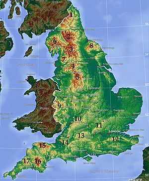
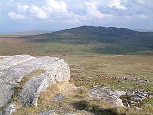
The mountains and hills of England are very different from each other. Some are tall mountains almost 1,000 meters (3,280 feet) high. Others are smaller hills, foothills, or even cliffs by the sea. Many of these beautiful areas are protected as national parks or Areas of Outstanding Natural Beauty (AONB). The tallest and biggest hills are mostly in the north and west of England. The middle, south-east, and east parts of the country are usually quite flat.
Contents
Northern England's High Peaks
The Lake District: England's Tallest Mountains
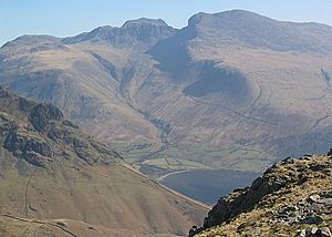
In the north of England, you'll find the country's highest mountains in the Lake District in Cumbria. This was one of the first national parks created in the United Kingdom in 1951.
The tallest mountain here is Scafell Pike, which is 978 meters (3,209 feet) high. Several other peaks are also over 3,000 feet tall! The mountains are mostly made of old rocks like slate and volcanic rock. A famous writer named Alfred Wainwright wrote books about 214 of these peaks, which are now known as "Wainwrights."
Hills Near the Scottish Border
North of Hadrian's Wall, the land rises to form the Border Moors and Forests. This is a high, flat area close to the border with Scotland. It includes Kielder Water and Kielder Forest, and parts of it are in the Northumberland National Park.
The Cheviot Hills are just north of the Border Moors. They stretch into Scotland and are also part of the Northumberland National Park.
The Pennines: England's Backbone
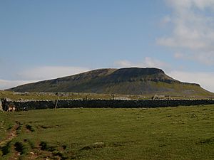
The Pennines are often called "the backbone of England" because they run down the middle of the country.
The North Pennines are an Area of Outstanding Natural Beauty (AONB). They are made of younger rocks, mostly limestone. These mountains have gentler slopes covered with moorland plants. The highest point here is Cross Fell at 893 meters (2,930 feet).
Further south, the Pennines continue into the Yorkshire Dales. This area is also mostly limestone with wide valleys and moorland. The Yorkshire Three Peaks are some of the highest points here. The Yorkshire Dales became a national park in 1954.
The Pennines then become a range of moorland between the big cities of Greater Manchester and West Yorkshire. This area is known as "Brontë country." The local landscape inspired many books by the Brontë sisters, including Wuthering Heights.
The Forest of Bowland is another AONB in Lancashire. It's a western part of the Pennines. The lonely Pendle Hill is also found here.
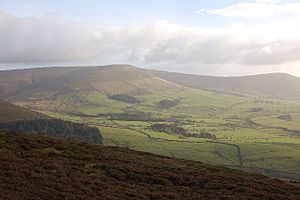
The Peak District was one of the first national parks created in 1951. It's very popular because it's close to many large cities. The Pennine Way, a very long walking path, starts in the Peak District.
The southern part of the Peak District has lots of limestone and many caves, especially around Castleton. The Pennine hills eventually become flatter here, blending into the lowlands of the English Midlands.
Other Northern Uplands
The Howgill Fells and Orton Fells are other hilly areas in Cumbria. They are located between the Lake District and the Yorkshire Dales. Both areas are mostly within the Yorkshire Dales National Park.
North York Moors: Eastern Hills
Near the North Yorkshire coast, you'll find the North York Moors. This is one of the few big hilly areas in eastern England. The highest point is Urra Moor at 454 meters (1,490 feet). The rocks here are full of fossils, which are often uncovered by the sea cliffs.
Midlands: Gentle Hills
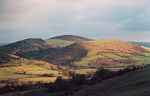
The English Midlands are mostly flat. However, there are some hills, especially in the north and west. The Shropshire Hills in the west, near Wales, reach over 500 meters (1,640 feet). These include the Long Mynd, Clee Hills, and Stiperstones. Wenlock Edge is a long, low ridge that stretches for over 15 miles (24 km). Further south, the Welsh border reaches over 700 meters (2,300 feet) at Black Mountain in Herefordshire.
The Malverns are made from some of England's oldest rocks, about 680 million years old! They stretch for about 8 miles (13 km) through Worcestershire and Herefordshire. The highest point is the Worcestershire Beacon at 425 meters (1,394 feet).
The Cotswolds cover a huge area, over 90 miles (145 km) long, across six counties. They reach 330 meters (1,083 feet) high at Cleeve Hill and became an AONB in 1966.
Other smaller hills in the Midlands include Cannock Chase in Staffordshire, Charnwood Forest in Leicestershire, and the Lincolnshire Wolds.
South East England: Chalk Hills
South East England, including East Anglia and London, is mostly flat. The hills here are made of chalk. The main hilly areas are the Chiltern Hills (Haddington Hill: 267 meters or 876 feet), the North Wessex Downs (Walbury Hill: 297 meters or 974 feet), the North Downs (Leith Hill: 294 meters or 965 feet), and the South Downs. The South Downs include the famous chalk cliffs at Beachy Head and Seven Sisters.
South West England: Moors and Coasts
South of Bristol and Bath, you'll find the Mendip Hills (Black Down: 325 meters or 1,066 feet). The Purbeck Hills run along the south coast. Other hills in this area include the Quantock Hills (Will's Neck: 384 meters or 1,260 feet), Blackdown Hills, Dorset Downs, Salisbury Plain, and Cranborne Chase. Glastonbury Tor, though not very high (158 meters or 518 feet), is famous for its connection to the legends of King Arthur.
The highest and largest hilly areas in the south-west are the moors of the South-west Peninsula. Exmoor, in northern Somerset, reaches 519 meters (1,703 feet) at Dunkery Beacon. It's famous as the setting for the book Lorna Doone.
Dartmoor, in Devon, is even higher, reaching over 600 meters (1,969 feet) at High Willhays (621 meters or 2,037 feet). This wild landscape was used in the Sherlock Holmes story The Hound of the Baskervilles.
Bodmin Moor, further to the south-west, is smaller (Brown Willy: 420 meters or 1,378 feet). It's sometimes known for tales of the "Beast of Bodmin Moor." Like Dartmoor, it's a granite plateau, while Exmoor is made from older sediments.
 | Jessica Watkins |
 | Robert Henry Lawrence Jr. |
 | Mae Jemison |
 | Sian Proctor |
 | Guion Bluford |


