
National Register of Historic Places listings in Greene County, New York facts for kids

Greene County, New York, is a special place with many historic buildings and areas. These places are so important that they are listed on the National Register of Historic Places. This is like a special list kept by the United States government. It helps protect places that are important to American history, architecture, archaeology, engineering, or culture.
When a place is on this list, it means it's recognized for its unique story and value. It also helps make sure these places are looked after for future generations. In Greene County, you'll find everything from old houses and churches to bridges and even a lighthouse on this list!
Two places in Greene County are even more special: the Pieter Bronck House and the Thomas Cole House. They are called National Historic Landmarks, which means they are super important to the whole country's history. The Thomas Cole House is also a National Historic Site, which means it's managed by the National Park Service to help people learn about it.
| Albany (Albany) – Allegany – Bronx – Broome – Cattaraugus – Cayuga – Chautauqua – Chemung – Chenango – Clinton – Columbia – Cortland – Delaware – Dutchess (Poughkeepsie, Rhinebeck) – Erie (Buffalo) – Essex – Franklin – Fulton – Genesee – Greene – Hamilton – Herkimer – Jefferson – Kings – Lewis – Livingston – Madison – Monroe (Rochester) – Montgomery – Nassau – New York (Below 14th Street, 14th to 59th Streets, 59th to 110th Streets, Above 110th Street, Islands) – Niagara – Oneida – Onondaga (Syracuse) – Ontario – Orange – Orleans – Oswego – Otsego – Putnam – Queens – Rensselaer – Richmond – Rockland – St. Lawrence – Saratoga – Schenectady – Schoharie – Schuyler – Seneca – Steuben – Suffolk – Sullivan – Tioga – Tompkins – Ulster – Warren – Washington – Wayne – Westchester (Northern, Southern, New Rochelle, Peekskill, Yonkers) – Wyoming – Yates |
Contents
- Exploring Greene County's Historic Treasures
- Historic Homes and Buildings
- Historic Churches and Religious Sites
- All Souls Church
- Centre Presbyterian Church
- Christ Church
- Greenville Presbyterian Church Complex
- Leeds Dutch Reformed Church
- North Settlement Methodist Church
- Oak Hill Methodist Episcopal Church
- St. Paul's Lutheran Church
- Trinity Episcopal Church
- West Settlement Methodist Church
- Zion Lutheran Church
- Historic Districts and Areas
- Unique Historic Sites
- Images for kids
Exploring Greene County's Historic Treasures
Greene County is full of amazing historic sites. Let's explore some of them!
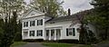
Historic Homes and Buildings
Many old houses and buildings in Greene County tell stories of the past.
The Pieter Bronck House
The Pieter Bronck House in Coxsackie is one of the oldest buildings in New York State. It was built way back in 1663! This house is a great example of early Dutch architecture. It shows us how people lived centuries ago. It's so important that it's a National Historic Landmark.
The Thomas Cole House
In Catskill, you can visit the Thomas Cole House. Thomas Cole was a famous painter. He started the Hudson River School art movement. This movement was all about painting beautiful landscapes. His house is a National Historic Landmark and a National Historic Site. It's a wonderful place to learn about art and history.
Bronck Farm 13-Sided Barn
Also in Coxsackie, there's a really unique building called the Bronck Farm 13-Sided Barn. As its name suggests, it has 13 sides! This unusual barn was built in 1888. It's a rare example of a multi-sided barn. It shows how creative people were with farm buildings.
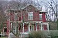
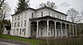
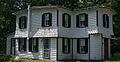
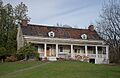
The L.E. Cleveland House
The L.E. Cleveland House in Durham is another historic home. It was built around 1830. This house is a great example of Federal style architecture. It shows the popular building styles of that time.
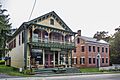
W. F. DeWitt Hotel
The W. F. DeWitt Hotel in Durham was built in 1850. It was a popular hotel for many years. Imagine all the travelers who stayed there! It's a reminder of how people traveled and rested in the past.
Joseph Hallock House
In Catskill, the Joseph Hallock House was built around 1830. This house is a fine example of Greek Revival style. It has classic columns and a grand entrance. It shows the elegance of homes from that era.
William Lampman House
The William Lampman House in Catskill was built in 1830. It's another example of the Greek Revival style. These homes often had large, impressive fronts. They were built to look like ancient Greek temples.
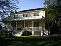
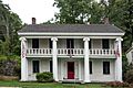
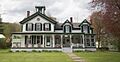
Zadock Pratt House
The Zadock Pratt House in Prattsville was built in 1828. Zadock Pratt was a very important person. He was a tanner and later a U.S. Congressman. His house reflects his importance in the community.
Wiley Hose Company Building
The Wiley Hose Company Building in Catskill was built in 1895. It was a fire station. This building shows the history of fire fighting in the area. It's a cool example of a community service building.
David Van Gelder Octagon House
The David Van Gelder Octagon House in Catskill is very special. It was built in 1860. It has eight sides, making it an octagon! This unique shape was popular for a short time. It was thought to be more efficient and spacious.
Historic Churches and Religious Sites
Greene County has many beautiful old churches. They show the history of different faiths in the area.
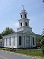
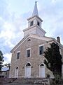
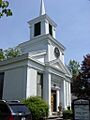
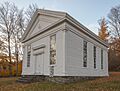
All Souls Church
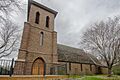
All Souls Church in Tannersville was built in 1894. It's a lovely example of Gothic Revival architecture. Its tall spires and pointed arches are very impressive.
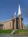
Centre Presbyterian Church
The Centre Presbyterian Church in Windham was built in 1830. It's a classic example of a rural church. It has served its community for almost 200 years.
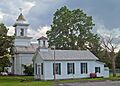
Christ Church
Christ Church in Greenville was built in 1857. It's made of local red sandstone. This church is another beautiful example of Gothic Revival style.
Greenville Presbyterian Church Complex
The Greenville Presbyterian Church Complex in Greenville was built in 1860. It's a Greek Revival church. This church was home to the first non-Dutch church group in the Catskill region.
Leeds Dutch Reformed Church
The Leeds Dutch Reformed Church in Leeds was built in 1808. It's one of the oldest churches in the county. It shows the strong Dutch heritage in the area.
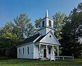
North Settlement Methodist Church
The North Settlement Methodist Church in Ashland was built in 1860. It's a simple but beautiful country church. It represents the spiritual life of early settlers.
Oak Hill Methodist Episcopal Church
The Oak Hill Methodist Episcopal Church in Oak Hill was built in 1855. It's a grand church with a tall steeple. It stands out in the small village.
St. Paul's Lutheran Church
St. Paul's Lutheran Church in Oak Hill was built in 1849. It's another historic church that has served its community for a long time.
Trinity Episcopal Church
The Trinity Episcopal Church in Ashland was built in 1894. It's a charming church with beautiful stained glass. It's a peaceful place of worship.
West Settlement Methodist Church
The West Settlement Methodist Church in Ashland was built in 1860. It's a small, historic church. It shows the simple beauty of rural religious buildings.
Zion Lutheran Church
The Zion Lutheran Church in Athens was built in 1850. It's a lovely church with a classic design. It's an important part of the Athens community.
Historic Districts and Areas
Some areas have many historic buildings together. These are called Historic Districts.
Athens Lower Village Historic District
The Athens Lower Village Historic District in Athens is a whole area with many historic buildings. It's near the Hudson River. Walking through it feels like stepping back in time.
Brick Row Historic District
The Brick Row Historic District in Athens is famous for its brick buildings. These buildings were built close together. They show how people lived and worked in the past.
East Side Historic District
The East Side Historic District in Catskill is another large historic area. It includes many old homes and businesses. It shows the growth of Catskill as a river town.
New Baltimore Hamlet Historic District
The New Baltimore Hamlet Historic District in New Baltimore includes Main Street and other nearby streets. It has many historic buildings. It shows the history of this charming hamlet.
Tannersville Main Street Historic District
The Tannersville Main Street Historic District is the heart of Tannersville. It has many historic shops and buildings. It shows the town's history as a mountain resort.
Twilight Park Historic District
The Twilight Park Historic District in Haines Falls is a unique area. It was a private summer community. Many of its old cottages and buildings are still there. It's like a step back to a Victorian summer.
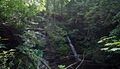
Unique Historic Sites
Greene County also has some very unique historic places.
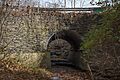
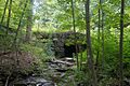
Allan Teator Road Stone Arch Bridge
The Allan Teator Road Stone Arch Bridge in West Durham is an old stone bridge. It was built in the 1800s. These bridges are amazing examples of old engineering.
Brand Hollow Road Stone Arch Bridge
Another stone bridge, the Brand Hollow Road Stone Arch Bridge in West Durham, is also very old. These bridges were built to last. They are a testament to the skill of early builders.
Hudson–Athens Lighthouse
The Hudson–Athens lighthouse is a beautiful lighthouse in the Hudson River. It was built in 1874. Lighthouses guided ships safely. This one is still a landmark today.
Hunter Mountain Fire Tower
The Hunter Mountain Fire Tower is on top of Hunter Mountain. It was built in 1909. This tower was used to spot forest fires. It was the first fire lookout tower in the Catskills.
Pratt Rock Park
Pratt Rock in Prattsville is a very unusual site. It has carvings on the rock face! These carvings were made by Zadock Pratt. They tell the story of his life and achievements.
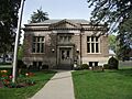
Rowena Memorial School
The Rowena Memorial School in Palenville was built in the early 1900s. It was a gift to the community. It served as a school for many years. It shows how important education was to the people.
Susquehannah Turnpike
The Susquehannah Turnpike was an old road. It started in Catskill. Turnpikes were important roads for travel and trade in the past. This one helped connect different parts of New York.
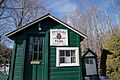
Ulster and Delaware Railroad Station
The Ulster and Delaware Railroad Station in Haines Falls was built in 1899. It was a train station. Trains were a major way to travel and transport goods. This station reminds us of the railroad era.
Images for kids
-
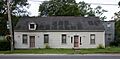
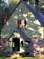
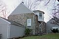
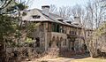
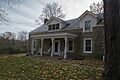
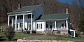
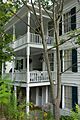
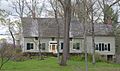
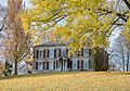
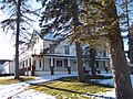
The A. T. House in Oak Hill.
-
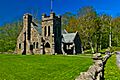
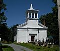
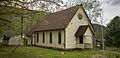
All Souls Church in Tannersville.
-
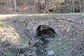
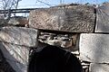
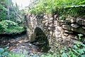
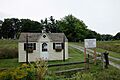
The Allan Teator Road Stone Arch Bridge.
-
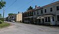
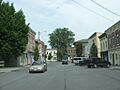
A building in the Athens Lower Village Historic District.
-
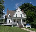
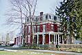
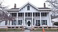
The Henry T. Botsford House in Greenville.
-
The Brand Hollow Road Stone Arch Bridge.
-
The William Brandow House in Athens.
-
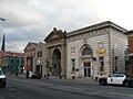
Buildings in the Brick Row Historic District.
-
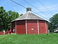
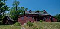
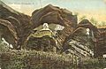
The unique 13-sided barn at Bronck Farm.
-
The historic Pieter Bronck House.
-
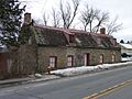
The Bronk-Silvester House in Coxsackie.
-
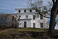
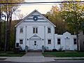
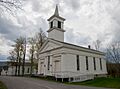
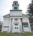
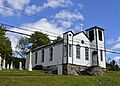
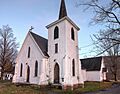
Centre Presbyterian Church in Windham.
-
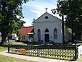
Christ Church in Greenville.
-
The Church of St. John the Evangelist in Hunter.
-
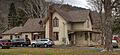
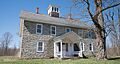
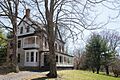
The L.E. Cleveland House in Durham.
-
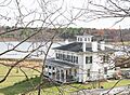
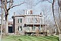
The Thomas Cole House in Catskill.
-
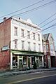
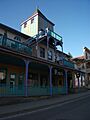
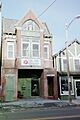
A commercial building on West Bridge Street in Catskill.
-
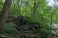
Ruins of the Croswell-Parsons Paper Mill.
-
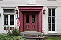
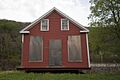
The doorway of the W. F. DeWitt Hotel.
-
District School No. 11 in Catskill.
-
The DuBois Stone House in Catskill.
-
The Benjamin DuBois Stone House-Captain Martin Stone House.
-
Buildings in the East Side Historic District in Catskill.
-
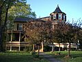
The Harry Fischel House in Hunter.
-
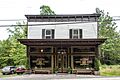
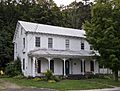
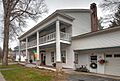
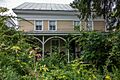
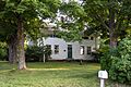
Ford's Store in Durham.
-
The Greenville Presbyterian Church.
-
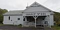
Halcott Grange No. 881.
-
The Joseph Hallock House in Catskill.
-
Hathaway in Tannersville.
-
The Haxton–Griffin Farm in Athens.
-
The Hervey Street Road Stone Arch Bridge.
-
The Hop-o'-Nose Knitting Mill in Catskill.
-
The Peter Houghtaling Farm and Lime Kiln.
-
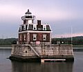
The Hudson–Athens Lighthouse.
-
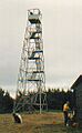
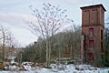
The Hunter Mountain Fire Tower.
-
The Hunter Synagogue.
-
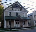
The IOOF Hall in Hunter.
-
The Jewett Presbyterian Church Complex.
-
The William Lampman House in Catskill.
-
The John and Martinus Laraway Inn in Prattsville.
-
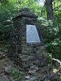
The Frank D. Layman Memorial.
-
The Leeds Dutch Reformed Church.
-
The Leeds Flat Site.
-
The Lexington House.
-
The Methodist Episcopal Church of Windham Centre.
-
The Moore Road Stone Arch Bridge.
-
The Morss Homestead/Federal City Homestead.
-
A church in the New Baltimore Hamlet Historic District.
-
The Newkirk Homestead.
-

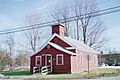
The North Settlement Methodist Church.
-
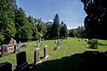
Oak Hill Cemetery.
-
The Oak Hill Methodist Episcopal Church.
-
The Old Episcopal Manse in Prattsville.
-
The Mrs. Osburn House in Durham.
-
The Parsonage in Oak Hill.
-
The Charles Pierce House in Durham.
-
The Old Platte Clove Post Office.
-
Pratt Rock.
-
The Zadock Pratt House.
-
The Prattsville Commercial Building.
-
The Prattsville Reformed Dutch Church.
-
The Prevost Manor House in Greenville.
-
Buildings in the Reed Street Historic District.
-
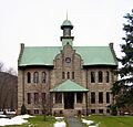
The Rowena Memorial School.
-
Rushmore Farm in Athens.
-
St. Francis DeSales Church in Lexington.
-
St. Mary's of the Mountain Church in Hunter.
-
St. Paul's Lutheran Church in Oak Hill.
-
Salisbury Manor in Leeds.
-
The Shady Glen Road Stone Arch Bridge.
-
Stanton Hill Cemetery.
-
The Stranahan-DelVecchio House in Athens.
-
The Elijah Strong House in Ashland.
-

The Susquehannah Turnpike.
-
Buildings in the Tannersville Main Street Historic District.
-
The Torry-Chittenden Farmhouse in Durham.
-
Trinity Episcopal Church in Ashland.
-
The Tripp House and Store Complex in Durham.
-
A building in the Twilight Park Historic District.
-
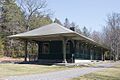
The Ulster and Delaware Railroad Station in Haines Falls.
-
Union Chapel in Windham.
-
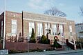
The US Post Office in Catskill.
-
The Van Bergen House in New Baltimore.
-
The unique David Van Gelder Octagon House.
-
The Albertus Van Loon House in Athens.
-
The John Van Vechten House in Leeds.
-
The Weldon House in East Durham.
-
The West Settlement Methodist Church.
-
The Wiley Hose Company Building.
-
The Woodward Road Stone Arch Bridge.
-

Zion Lutheran Church in Athens.


