
National Register of Historic Places listings in Erie County, New York facts for kids

Erie County, New York, is home to many amazing places that are officially recognized for their special history and architecture. These places are listed on the National Register of Historic Places. Think of it like a special hall of fame for buildings, neighborhoods, and other sites that tell important stories about the past.
This list helps us keep track of all the historic spots in Erie County. It includes places both inside and outside the city of Buffalo. There are 246 such places in the whole county! Buffalo has a lot of them, with 170 listings, which are on their own separate list. This article focuses on the 76 incredible historic places found outside Buffalo.
| Albany (Albany) – Allegany – Bronx – Broome – Cattaraugus – Cayuga – Chautauqua – Chemung – Chenango – Clinton – Columbia – Cortland – Delaware – Dutchess (Poughkeepsie, Rhinebeck) – Erie (Buffalo) – Essex – Franklin – Fulton – Genesee – Greene – Hamilton – Herkimer – Jefferson – Kings – Lewis – Livingston – Madison – Monroe (Rochester) – Montgomery – Nassau – New York (Below 14th Street, 14th to 59th Streets, 59th to 110th Streets, Above 110th Street, Islands) – Niagara – Oneida – Onondaga (Syracuse) – Ontario – Orange – Orleans – Oswego – Otsego – Putnam – Queens – Rensselaer – Richmond – Rockland – St. Lawrence – Saratoga – Schenectady – Schoharie – Schuyler – Seneca – Steuben – Suffolk – Sullivan – Tioga – Tompkins – Ulster – Warren – Washington – Wayne – Westchester (Northern, Southern, New Rochelle, Peekskill, Yonkers) – Wyoming – Yates |
Contents
What is the National Register of Historic Places?
The National Register of Historic Places is the official list of the United States' historic places worth saving. It's managed by the National Park Service. When a place is added to this list, it means it's important to the history, architecture, archaeology, engineering, or culture of the nation.
Why are these places important?
Listing a place on the National Register helps protect it. It also makes people more aware of its historical value. Sometimes, it can even help property owners get grants or tax benefits to help preserve these special sites. These places are like time capsules, showing us how people lived, worked, and built things long ago.
Exploring Historic Sites in Erie County
Erie County has a wide variety of historic places. From old churches and schools to unique homes and even parts of canals, each site has a story. Let's look at some cool examples outside of Buffalo.
Unique Buildings and Homes
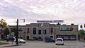
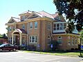
- Automobile Club of Buffalo in Clarence: This building, listed in 2012, reminds us of the early days of cars and road trips.
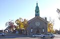
- Baker Memorial Methodist Episcopal Church in East Aurora: This beautiful church, added in 2012, is a great example of historic religious architecture.
- The Baptist Church of Springville in Springville: Now known as the Springville Center for the Arts, this building has been a community hub since 2008.
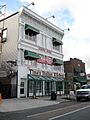
- Bruce-Briggs Brick Block in Lancaster: Listed in 1999, this block of buildings shows the classic brick style of the late 1800s.
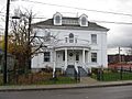
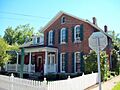
- Clark-Lester House in Lancaster: This house, also listed in 1999, is another example of the historic homes in the area.
- Community of True Inspiration Residence in West Seneca: This unique residence, listed in 2013, has a special historical background.
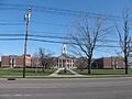
- Depew High School in Depew: Built in 1914 and expanded in 1927, this school is an early example of how school buildings were designed. It's now being turned into senior housing.
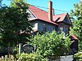
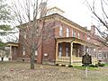
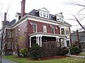
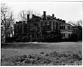
- Eberhardt Mansion in Kenmore: This grand mansion, listed in 1983, is a striking example of historic residential architecture.
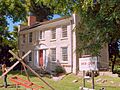
- Millard Fillmore House in East Aurora: This house was once home to Millard Fillmore, who became the 13th President of the United States! It's a very important historical site, listed in 1974.
- First Church of Evans Complex in Derby: This church complex, listed in 2006, shows the history of early religious communities in the area.
- Graycliff in Derby: Designed by famous architect Frank Lloyd Wright between 1926 and 1931, this stunning home was a summer estate. It's also a New York State Landmark, listed in 1998.
- Warren Hull House in Lancaster: This historic house was listed in 1992.
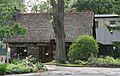
- Johnson-Jolls Complex in Orchard Park: This complex was listed in 1980.
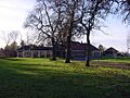
- Kibler High School in Tonawanda: Listed in 1999, this school building has been an important part of the community for many years.
- Lancaster Municipal Building in Lancaster: This building, listed in 1999, served as the local government center.
- Rich-Twinn Octagon House in Akron: This very cool house, listed in 1995, is shaped like an octagon (an eight-sided figure)! It's a rare and interesting architectural style.
- John Richardson House in Lancaster: Another historic home in Lancaster, listed in 1999.
- Roycroft Campus in East Aurora: This campus, listed in 1974, was a famous center for the Arts and Crafts movement in the early 1900s. It's a National Historic Landmark.
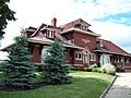
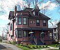
- George and Gladys Scheidemantel House in East Aurora: This house was listed in 1993.
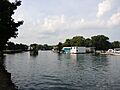
- Spaulding-Sidway Boathouse in Grand Island: This boathouse, built in 1903, was listed in 1998. It shows the history of recreation on the water.
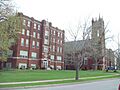
- St. Mary of the Angels Motherhouse Complex in Williamsville: This large complex, listed in 2002, has a rich history related to a religious order.
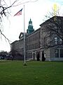
- Tonawanda Municipal Building in Kenmore: Built in the 1930s, this building is a great example of the Art Deco style of architecture. It was listed in 2013.
- Villa Maria Motherhouse Complex in Cheektowaga: This complex was listed in 2006.
- Williamsville Christian Church in Williamsville: This church was listed in 2002.
- Williamsville Junior and Senior High School in Williamsville: Listed in 2008, this school building has served many generations of students.
- Williamsville Water Mill Complex in Williamsville: This historic mill complex, listed in 1983, shows how water power was used in the past.
Historic Districts and Areas
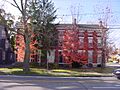
- Broadway Historic District in Lancaster: This district, listed in 2015, features many buildings from the late 1800s and early 1900s, showing different architectural styles.
- Central Avenue Historic District in Lancaster: This district, listed in 2014, is the historic heart of the village, with many important buildings.
- East Hill Historic District in Springville: This area, listed in 2015, was one of the first residential neighborhoods in the village.
- East Main-Mechanic Streets Historic District in Springville: This district, listed in 2002, is another important historic area in Springville.
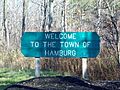
- Hamburg Downtown Historic District in Hamburg: This district, listed in 2012, has a well-preserved downtown area.
- Thomas Indian School in Irving: Located on the Cattaraugus Reservation, this school, listed in 1973, has a significant history for Native American communities.
Other Interesting Sites
- Buffalo Harbor South Entrance Light in Lackawanna: This lighthouse, listed in 2007, helped guide ships into Buffalo Harbor.
- Buffalo, Rochester and Pittsburgh Railroad Station in Springville: This old train station, listed in 1991, was once a busy hub for travelers and goods.
- Buffalo, Rochester and Pittsburgh Railroad Station in Orchard Park: Another historic train station, listed in 2007.
- Chapel of Our Lady Help of Christians in Cheektowaga: This chapel was listed in 1978.
- Citizens National Bank in Springville: This bank building was listed in 1996.
- Entranceways at Main Street (various locations in Amherst): Several historic entranceways along Main Street in Amherst were listed between 2005 and 2009. They are important parts of the "Suburban Development of Buffalo, New York" plan.
- J. Eshelman and Company Store in Clarence Center: This old store, listed in 1982, gives us a glimpse into how people shopped long ago.
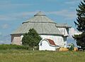
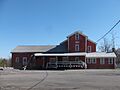
- Gamel Hexadecagon Barn in North Collins: This barn, listed in 1984, is unique because it has 16 sides! It's part of a special group of "Central Plan Dairy Barns" in New York.
- Garrison Cemetery in Cheektowaga: This historic cemetery was listed in 2002.
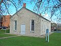
- Lancaster District School No. 6 in Lancaster: This old schoolhouse was listed in 2008.
- Liebler-Rohl Gasoline Station in Lancaster: This old gas station, listed in 1999, shows how transportation changed over time.
- Newton–Hopper Village Site in Elma: This site, listed in 2012, is an archaeological area that tells us about early settlements.
- New York State Barge Canal in Amherst and Tonawanda: This canal, listed in 2014, is a huge historic waterway that replaced the famous Erie Canal. It was built to help transport goods and compete with railroads.
- Dr. John J. Nowak House in Lancaster: This house was listed in 1999.
- Old Sardinia Town Hall in Sardinia: This historic town hall was listed in 2008.
- Pioneer Cemetery in Evans Center: This cemetery, listed in 2012, is a resting place for early settlers.
- Former Reformed Mennonite Church in Williamsville: This old church building was listed in 2003.
- Rider-Hopkins Farm and Olmsted Camp in Sardinia: This farm and camp, listed in 1999, has a unique history.
- Scobey Power Plant and Dam in Springville: This power plant and dam, listed in 1996, shows how electricity was generated in the past.
- John P. Sommers House in Lancaster: This house was listed in 2012.
- Tonawanda (25th Separate Company) Armory in Tonawanda: This impressive armory building, built in 1896, was listed in 1994. It looks like a castle!
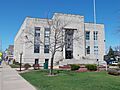
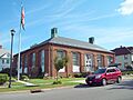
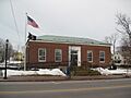
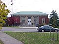
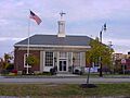
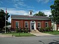
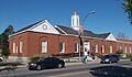
- U.S. Post Office (various locations): Several historic post office buildings in Akron, Angola, Depew, Lancaster, Springville, and Tonawanda were listed between 1988 and 1989. These buildings are examples of government architecture from that time.
- Herman B. VanPeyma House in Lancaster: This house was listed in 1999.
- Zuidema-Idsardi House in Lancaster: This house was listed in 1999.
These are just some of the many fascinating historic places in Erie County. Each one helps us understand the rich past of this area and why it's important to protect these treasures for future generations.
Images for kids
-
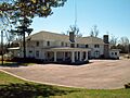
Automobile Club of Buffalo
-
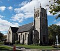
Baker Memorial Methodist Episcopal Church
-
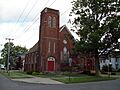
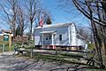
The Baptist Church of Springville
-
Broadway Historic District
-
Bruce-Briggs Brick Block
-
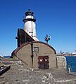
Buffalo Harbor South Entrance Light
-
Buffalo, Rochester and Pittsburgh Railroad Station (Springville)
-
Buffalo, Rochester and Pittsburgh Railroad Station (Orchard Park)
-
Chapel of Our Lady Help of Christians
-
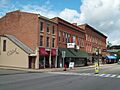
Central Avenue Historic District
-
Citizens National Bank
-
Clark-Lester House
-
Community of True Inspiration Residence
-
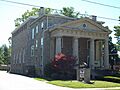
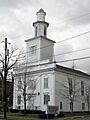
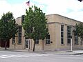
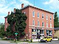
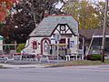
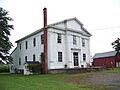
DePew Lodge No. 823, Free and Accepted Masons
-
East Hill Historic District
-
East Main-Mechanic Streets Historic District
-
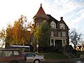
Eberhardt Mansion
-
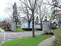
Entranceway at Main Street at Darwin Drive
-
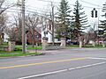
Entranceway at Main Street at High Park Boulevard
-
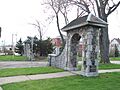
Entranceway at Main Street at Lafayette Boulevard
-
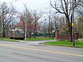
Entranceway at Main Street at LeBrun Road
-
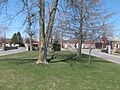
Entranceway at Main Street at Roycroft Boulevard
-
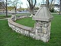
Entranceway at Main Street at Westfield Road and Ivyhurst Road
-
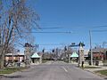
Entranceways at Main Street at Lamarck Drive and Smallwood Drive
-
J. Eshelman and Company Store
-
Millard Fillmore House
-
First Church of Evans Complex
-
Gamel Hexadecagon Barn
-
Garrison Cemetery
-
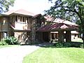
Graycliff
-
Hamburg Downtown Historic District
-
Warren Hull House
-
Johnson-Jolls Complex
-
Kibler High School
-
Kleis Site
-
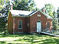
Lancaster District School No. 6
-
Lancaster Municipal Building
-
Liebler-Rohl Gasoline Station
-
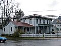
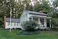
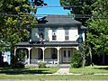
Miller-Mackey House
-
New York State Barge Canal
-
Dr. John J. Nowak House
-
Old Sardinia Town Hall
-

Pioneer Cemetery
-
Former Reformed Mennonite Church
-
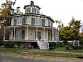
Rich-Twinn Octagon House
-
John Richardson House
-
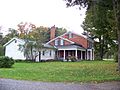
Rider-Hopkins Farm and Olmsted Camp
-
Roycroft Campus
-
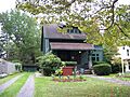
George and Gladys Scheidemantel House
-
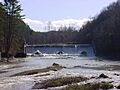
Scobey Power Plant and Dam
-
John P. Sommers House
-
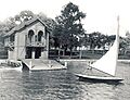
Spaulding-Sidway Boathouse
-
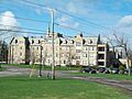
St. Mary of the Angels Motherhouse Complex
-
Thomas Indian School
-
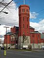
Tonawanda (25th Separate Company) Armory
-
Tonawanda Municipal Building
-
US Post Office-Akron
-
US Post Office-Angola
-
US Post Office-Depew
-
US Post Office-Lancaster
-
US Post Office-Springville
-
US Post Office-Tonawanda
-
Herman B. VanPeyma House
-
Villa Maria Motherhouse Complex
-
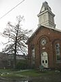
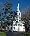
Williamsville Christian Church
-
Williamsville Junior and Senior High School
-
Williamsville Water Mill Complex
-
Zuidema-Idsardi House


.jpg)


.JPG)
.JPG)


