San Juan River (Colorado River tributary) facts for kids
Quick facts for kids San Juan River |
|
|---|---|
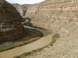
The lower San Juan River, Utah
|
|
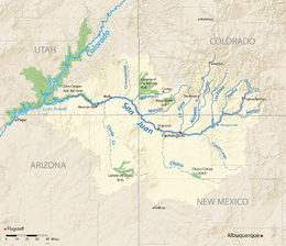
Map of the San Juan River watershed
|
|
| Other name(s) | Są́ bito' |
| Country | United States |
| States | Colorado, New Mexico, Utah |
| Physical characteristics | |
| Main source | San Juan Mountains Archuleta County, Colorado 7,553 ft (2,302 m) 37°21′55″N 106°54′02″W / 37.36528°N 106.90056°W |
| River mouth | Colorado River (Lake Powell) San Juan County, Utah 3,704 ft (1,129 m) 37°10′47″N 110°54′03″W / 37.17972°N 110.90083°W |
| Length | 383 mi (616 km) |
| Basin features | |
| Basin size | 24,649 sq mi (63,840 km2) |
| Tributaries |
|
The San Juan River is a big river in the Southwestern United States. It flows into the Colorado River. The San Juan River drains the Four Corners area, where the states of Colorado, New Mexico, Utah, and Arizona meet.
The river starts from snowmelt in the San Juan Mountains in Colorado. It flows for 383 miles (616 km) through deserts in New Mexico and Utah. Finally, it joins the Colorado River at Glen Canyon. This area is part of the Colorado Plateau, which is very dry. The San Juan River is often the only important source of fresh water for many miles around. It's also one of the muddiest rivers in North America. It carries about 25 million tons of mud and dirt each year.
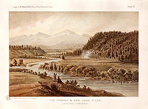
Long ago, the San Juan River was a border. It separated the land of the Navajo to the south from the Ute to the north. European explorers came to the Four Corners area in the 1700s. But many settlers didn't arrive until the 1860s, when people came looking for gold and silver. After some disagreements over land, Native Americans were moved to special areas called reservations. Their families still live there today.
In the 1900s, people started drilling for oil and gas in the San Juan Basin. They also mined uranium along the lower river in Utah. This caused worries about water quality. Especially for the Navajo Nation, where the river is vital for watering crops. Water flowing from old gold and silver mines has also caused problems. For example, in 2015, the 2015 Gold King Mine waste water spill polluted the Animas River. The Animas River is a main branch of the San Juan.
The U.S. government has built large dams on the San Juan River. These dams help control floods and provide water for farms and homes. Also, the lower part of the river is now covered by Lake Powell. This is one of the biggest water storage areas in the United States. Managing the water carefully is important. It ensures there's enough water for farms, cities, boating, fishing, and nature. However, a lot of water is used. This has reduced the river's flow by about 25 percent compared to before dams were built. Also, warmer temperatures in the Rocky Mountains might mean less snow. This could further reduce the river's water flow.
River's Journey: Where the San Juan Flows
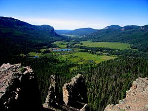
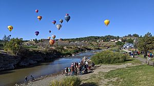
The San Juan River starts in Archuleta County, Colorado. It forms where its East and West Forks meet. Both forks begin high up in the eastern San Juan Mountains. They are part of the San Juan National Forest.
The river flows southwest through the Rocky Mountains' foothills. It passes through the town of Pagosa Springs. Then it reaches the Navajo Lake reservoir. This is just north of the New Mexico border, near Arboles, Colorado. Below the Navajo Dam, the San Juan River flows west. It goes through a narrow farming valley in the high desert of the Colorado Plateau. At Farmington, New Mexico, a major branch joins it from the north. This is the Animas River, which also starts in the San Juan Mountains.
From Farmington, the San Juan River flows west through the Navajo Nation. It turns northwest near Shiprock and its famous rock. It briefly crosses back into southwest Colorado. This is very close to the Four Corners Monument. Then it enters southeastern Utah. West of Bluff, Utah, the river cuts through Comb Ridge. It then enters a series of deep, winding canyons. These canyons are often over 1,500 feet (460 m) deep.
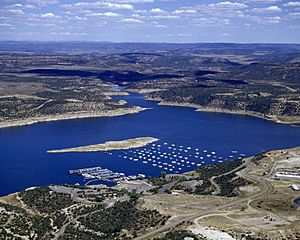
The last 70 miles (110 km) of the San Juan River are in a remote part of the Glen Canyon National Recreation Area. This section is covered by Lake Powell. Lake Powell is formed by Glen Canyon Dam on the Colorado River. The San Juan River joins the Colorado River in San Juan County, Utah. This spot is about 15 miles (24 km) north of Navajo Mountain.
River Branches and Water Flow
Many smaller rivers flow into the San Juan River. Above Navajo Dam, these include the Rio Blanco and the Navajo River. Also, the Piedra River and Los Pinos River join the San Juan in Navajo Lake.
Below Farmington, other important branches join. These are the La Plata River and Mancos River in New Mexico. McElmo Creek joins in Utah. The San Juan also has branches that flow only at certain times of the year. These drain dry areas of the Colorado Plateau. Examples are Cañon Largo and the Chaco River in New Mexico. Also, Montezuma Creek and Chinle Creek in Utah.
The northern branches of the San Juan River get their water from snowmelt. They flow strongest between March and June. Southern branches like the Chaco River are usually dry. But they can carry huge amounts of water during flash floods.
How Much Water Flows?
The U.S. Bureau of Reclamation says that the San Juan River basin's natural flow was about 2,900 cubic feet per second (82 m3/s) each year from 1906 to 2014. This is like 2,101,000 acre-feet (2.592 km3) of water. The most water flowed in 1941, and the least in 2002.
A lot of water is used from the river. This has made its flow much lower since the early 1900s. The U.S. Geological Survey (USGS) measures the river's flow at Bluff, Utah. From 1915 to 2013, the average flow was 2,152 cubic feet per second (60.9 m3/s). Before big dams were built, the river sometimes dried up completely in summer. This happened in 1934 and 1939. The most water ever measured at Bluff was 70,000 cubic feet per second (2,000 m3/s) on September 10, 1927. The biggest flood on record was in October 1911. It happened before the USGS started measuring there. That flood might have reached 148,000 cubic feet per second (4,200 m3/s).
| USGS real-time stations on the San Juan River | ||||||
|---|---|---|---|---|---|---|
| Gage location (ID number) |
Start year |
Average discharge |
Maximum discharge |
Minimum discharge |
Drainage area |
Percent of total watershed |
| Pagosa Springs, CO 09342500 |
1935 | 368 ft3/s (10 m3/s) |
25,000 ft3/s (708 m3/s) |
8.3 ft3/s (0.2 m3/s) |
281 mi2 (728 km2) |
1.1% |
| Carracas, CO 09346400 |
1961 | 587 ft3/s (17 m3/s) |
8,590 ft3/s (243 m3/s) |
0.8 ft3/s (0.02 m3/s) |
1,250 mi2 (3,240 km2) |
5.1% |
| Archuleta, NM 09355500 |
1954 | 1,070 ft3/s (30 m3/s) |
18,900 ft3/s (535 m3/s) |
8 ft3/s (0.2 m3/s) |
3,260 mi2 (8,443 km2) |
13.3% |
| Farmington, NM 09365000 |
1931 | 1,980 ft3/s (56 m3/s) |
30,000 ft3/s (849 m3/s) |
27 ft3/s (0.8 m3/s) |
7,240 mi2 (18,750 km2) |
29.4% |
| Shiprock, NM 09368000 |
1935 | 1,983 ft3/s (56 m3/s) |
80,000 ft3/s (2,265 m3/s) |
8 ft3/s (0.2 m3/s) |
12,900 mi2 (33,400 km2) |
52.4% |
| Four Corners, CO 09371010 |
1977 | 1,959 ft3/s (55 m3/s) |
16,900 ft3/s (479 m3/s) |
110 ft3/s (3 m3/s) |
14,600 mi2 (37,800 km2) |
59.3% |
| Bluff, UT 09379500 |
1914 | 2,152 ft3/s (61 m3/s) |
70,000 ft3/s (1,982 m3/s) |
0 ft3/s (0 m3/s) |
23,000 mi2 (59,700 km2) |
93.5% |
| These stations measure river flow from upstream to downstream. The amount of water can change due to dams and how people use the water. | ||||||
The San Juan River's flow changes a lot during the year. It flows fastest in June and slowest in December. When Navajo Dam was finished in 1963, it changed the river's flow. The river now flows less than before. But the dam also makes sure the river doesn't dry up in summer. Recent droughts have also made the river flow even less.
River's History: How the San Juan Formed
The oldest rocks in the San Juan River area are in the San Juan Mountains. These mountains are made of very old rock and volcanic rock. Millions of years ago, streams flowed from these mountains. They filled the San Juan Basin with thick layers of dirt and sand. Over time, dead plants and animals were buried under these layers. This created the large amounts of coal, oil, and natural gas found there today.
About 5 million years ago, a river flowed west across the Colorado Plateau. It joined the Colorado River. This might have been an older version of the Dolores River. When the San Juan Basin became full, its water flowed west. This created the San Juan River's path we see today.
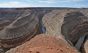
About 2-3 million years ago, the land in southeast Utah and northeast Arizona rose up. But the river kept flowing in its path. It cut deep canyons through the reddish rock. In some places, like Goosenecks State Park, the San Juan River winds for 6 miles (9.7 km) to travel only 1.5 miles (2.4 km) in a straight line. This is because it cut its old winding path deep into the rock. The river cut these canyons faster during the Ice Ages. The climate was much wetter then. This caused huge floods, ten times bigger than any floods seen today.
The San Juan River flows through soft rock like sandstone and shale. This makes it a very muddy river. It carries more than half the mud that ends up in the upper Colorado River. This is even though it only provides 14 percent of the water.
From 1914 to 1980, the U.S. Geological Survey measured the mud carried by the San Juan River. It was about 25.41 million tons each year. Since the Glen Canyon Dam was built in 1963, the mud has been building up in Lake Powell. It forms a delta instead of flowing down the Colorado River.
San Juan River's Land: The Watershed
Geography of the San Juan Watershed
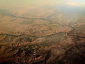
The San Juan River collects water from about 24,600 square miles (64,000 km2) of land. This area is in Colorado, New Mexico, Utah, and Arizona. It's almost as big as the state of West Virginia. The main part of the river doesn't flow through Arizona, but it comes very close.
The highest point in the San Juan River watershed is Windom Peak. It is 14,091-foot (4,295 m) high. The lowest point is where the San Juan River flows into Lake Powell. This area is mostly rural, meaning it's not very populated. About 75 percent of the land is covered in shrubs, rangeland, and grass. Not much farming happens here because there's little rain and not much underground water. But there are farms in river valleys and higher areas where it's wetter. Forests cover about 20 percent of the watershed, mostly in the mountains.
The San Juan Mountains and Ute Mountains are to the north of the watershed. The Jemez Mountains are to the east. Other high areas of the Colorado Plateau are to the south and west. The San Juan Basin is a special part of the watershed. It's known for its large amounts of oil, gas, and coal. The watershed is very dry, getting less than 10 inches (250 mm) of rain each year on average. But in the mountains, it can get as much as 61 inches (1,500 mm) of rain, much of it as snow. In the desert, most rain comes from strong thunderstorms in July and August.
About 90 percent of the river's water comes from snowmelt in the Rocky Mountains. But the largest part of the land that drains into the river is in New Mexico. This is about 40 percent of the watershed. Another 23 percent is in Colorado, 20 percent in Arizona, and 17 percent in Utah. The Chaco River drains the largest area, followed by Chinle Creek. The Animas River brings the most water, even though its drainage area is smaller. In recent years, less snow has fallen in the San Juan Mountains due to warmer winters. This raises concerns about the river's water supply in the future. Also, dust storms from the Great Basin can make snow melt faster.
Who Manages the Land and How It's Used
More than half of the San Juan River watershed is Native American land. The largest is the Navajo Nation, which spans parts of New Mexico, Arizona, and Utah. Other Native American lands include the Jicarilla Apache Nation and the Ute Mountain and Southern Ute Indian Reservations.
Government agencies manage about 25 percent of the watershed. These include the Bureau of Land Management, Forest Service, and National Park Service. About 13 percent of the land is privately owned.
Protected areas in the watershed are places like Mesa Verde National Park and Canyons of the Ancients National Monument in Colorado. Also, Chaco Culture National Historical Park in New Mexico, Canyon de Chelly National Monument in Arizona, and Bears Ears National Monument in Utah. These parks are famous for their old Native American homes and sites. The San Juan National Forest covers over 1.8 million acres of mountains, forests, and desert. It includes parts of the South San Juan Wilderness and Weminuche Wilderness. Other famous places are Shiprock, a tall rock important to the Navajo, and Monument Valley, known from many movies.
The watershed doesn't have many people. Most towns are along the San Juan and Animas Rivers. Farmington, New Mexico is the biggest city. Other cities include Durango, Colorado and Cortez, Colorado. The San Juan Basin has a big economy based on digging up resources. These include oil, natural gas, coal, and uranium. Historically, gold, silver, and copper were also mined.
River's Past: A Look at San Juan History
Early Peoples and the River
The San Juan River was important for Native Americans as far back as 10,000 BC. That's when Paleo-Indians lived in the Four Corners area. Later, the Ancestral Puebloans (also called Anasazi) lived here. They built clever ways to water their crops and made stone buildings called pueblos. Many of their old sites are still in the San Juan watershed, like at Mesa Verde National Park. Most of their settlements were along the upper San Juan River. This area had flatter land and more water. The lower San Juan River flows through canyons that were hard to live in. Around 1300 AD, the climate got warmer. Long dry periods forced the Puebloans to leave their homes. They moved to the Rio Grande Valley, where their families live today.
The Navajo still live along the San Juan River. They are thought to have moved into the Four Corners area by the 1500s. They might have met the last of the Anasazi leaving. The Navajo name for the river was Są́ Bitooh, meaning "Old Age River." The Navajo believed the San Juan was a "male river." Its meeting with the Colorado River (the "female river") was a sacred place. They made offerings to the river to bless the land with water. The Weminuche Ute lived mostly in Colorado. They used the San Juan River as their southern border with the Navajo. The two groups often saw each other as enemies.
Spanish and American Settlers Arrive
The name Rio San Juan was first used by Spanish explorer Juan Rivera in 1765. His route later became part of the Old Spanish Trail. In 1776, the Domínguez–Escalante expedition traveled through the San Juan River area. They were looking for a route from Santa Fe to California. They crossed the San Juan River near where Navajo Lake is now. They said the land was good for farming but "excessively cold." Their journey helped open the area for future European settlement.
Neither Spain nor Mexico built lasting settlements here. This was due to the harsh winters and local Native American groups. In 1848, the area became part of the United States after the Mexican–American War. In the late 1850s, people found placer gold in the San Juan River's branches. This started a gold rush in the San Juan Mountains. The gold rush peaked after Colorado Territory was created in 1861. Thousands of people came looking for riches. Silver was found in 1871 along the Animas River. This led to the growth of Silverton. A narrow-gauge railway was built in 1881. It connected Durango with other towns.
More settlers meant more conflicts with the Ute and Navajo people. In 1863, the U.S. Army forced almost 10,000 Navajo from their lands near the San Juan River. Many died during the 300-mile (480 km) "Long Walk." But the Navajo were allowed to return in 1868. A special area, a reservation, was set up south of the San Juan River. The Utes also faced problems with settlers. Most of the valuable minerals were on Ute lands. The U.S. Army moved the last of the Utes from southwest Colorado by 1881. Then, a huge area of land was opened for ranching and farming.
These conflicts also affected future water rights. When the Navajo reservation was created in 1868, it meant they had rights to a lot of water. This was because their land was not very fertile and needed much water for farming. The U.S. Supreme Court later ruled that reservations had a right to the water needed for a permanent home. In 2005, New Mexico and the Navajo Nation agreed. The Navajo finally secured their claim to over 600,000 acre-feet (0.74 km3) of San Juan River water. Because of old water laws, the Navajo now have the best water rights to the San Juan River.
The lower San Juan River area stayed remote until the late 1800s. In 1879, over 200 Mormon pioneers started the San Juan Expedition. They created the farming town of Bluff, Utah in 1880. The trail they made became important for travel. The colony struggled with floods, but the settlers stayed. In 1882, an oil prospector explored the lower San Juan canyons. Later, gold was found along the river. This brought over 2,000 miners to Bluff in the 1890s, but the boom didn't last long.
The 1900s and Today
In October 1911, heavy rains caused the biggest flood ever on the San Juan River. It badly damaged the river and its branches. Over 100 bridges and 300 miles (480 km) of railroad tracks were destroyed in Colorado. Along the Animas River, almost all crops were ruined. In Bluff, most of the town was flooded.
Farmington, the largest city on the San Juan River, grew a lot in the 1920s. This was because coal, oil, and natural gas were found there. Uranium was discovered near Bluff in the 1940s. It became important for the U.S. nuclear program. But over 500 old mining sites still pollute the San Juan River and local groundwater. Oil spills have also polluted the river. In 1972, over 4.5 million gallons of oil leaked into the San Juan River.
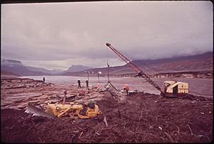
The gold and silver mining slowed down in the 1950s. This left many abandoned mines. These mines cause problems with acid mine drainage. Train traffic along the San Juan River also decreased. When Navajo Dam was built, it flooded towns and part of the railroad. The government paid to move the railroad line.
In 2015, a major environmental problem happened. The Gold King Mine near Silverton had a huge wastewater spill. This happened when the U.S. Environmental Protection Agency was trying to drain polluted water from the mine. Over 3 million gallons of very acidic waste spilled into the Animas and San Juan Rivers. It turned the water a bright yellow-orange. The spill temporarily threatened water for farms and homes in the Navajo Nation. It also polluted the riverbed with heavy metals. The EPA said it would take "full responsibility" for the spill.
Dams and Water Projects
Even 2,000 years ago, the Anasazi built dams and smart irrigation systems. They used them to water their crops from the San Juan River's branches. In the 1800s, early European settlers built small dams. These dams provided water for farms and mines. They also generated electricity.
In 1901, a study found that the San Juan River had enough water to irrigate a huge amount of land. But it was too expensive to bring water to the desert. So, no one wanted to pay for such big projects. The U.S. Reclamation Service (now the Bureau of Reclamation) studied dam sites in 1914. They considered building a dam near Bluff. But they decided not to because the river carried too much mud. This mud would quickly fill up any reservoir. By the 1920s, the government saw a need for a big dam project on the upper San Juan River. This project later became Navajo Dam.
Most of the big water projects in the San Juan River basin were built after the 1950s. They are part of the Colorado River Storage Project. This project aims to control the water supply of the upper Colorado River system. It also helps control floods and generate power.
Navajo Dam was finished in 1963. It holds 1.7 million acre feet of water in Navajo Lake. The dam helps control floods, store water for a long time, and provide water for farms. Its operations are linked to two other major water projects. The San Juan-Chama Project moves almost 100,000 acre-feet (0.12 km3) of water each year from the San Juan watershed to the Rio Grande system. This water serves Albuquerque, New Mexico. The Navajo Indian Irrigation Project provides water for 63,900 acres (25,900 ha) of farmland on the Navajo Nation. These projects were designed to use the water given to New Mexico by the 1922 Colorado River Compact. This agreement divided the waters of the Colorado River among seven U.S. states.
Today, a total of 200,000 acres (81,000 ha) of land are watered in the San Juan watershed. This water comes from federal and local agencies. Other federal projects include the Pine River Project, with Vallecito Dam on the Los Pinos River. Also, the Florida Project with Lemon Dam on the Florida River. The Hammond Project is along the San Juan River below Navajo Dam. The Dolores Project moves water from the Dolores River to farmers near Cortez, Colorado. The newest project is the Animas-La Plata Water Project near Durango. It was finished in 2013. It now provides water for homes and industries. The Navajo-Gallup Water Supply Project is being built now. It will carry water 280 miles (450 km) south from Navajo Lake to parts of the Navajo Nation and Gallup, New Mexico.
River Life: San Juan Ecology
The San Juan River is home to at least eight native fish species. These include cutthroat trout, roundtail chub, speckled dace, flannelmouth sucker, bluehead sucker, mottled sculpin, Colorado pikeminnow, and razorback sucker. A ninth, the bonytail chub, might also be there. The Colorado pikeminnow, razorback sucker, and bonytail chub are considered endangered. They are rarely found in the San Juan River today.
Except for trout and dace, which live in cold mountain streams, most native fish like the warm, shallow, and muddy water of the lower San Juan. The San Juan cutthroat trout is a special type of trout found only in this river. It was thought to be gone until it was found again in 2018. About 23 types of fish that are not native to the area have also been put into the San Juan River watershed. The common carp and channel catfish are now common in the lower parts of the river. Below Navajo Dam, introduced rainbow and brown trout do well. This is because the dam releases cold, steady water.
Native fish in the San Juan River lay their eggs during high spring floods. Historically, these floods would spread out into the areas next to the river. This created special places for fish to lay eggs. After Navajo Dam was built, the river between the dam and Farmington became less suitable for native fish. This is because the water flow doesn't change as much with the seasons. However, at Farmington, the San Juan is joined by the Animas River. The Animas River doesn't have big dams. So, the San Juan River gets some of its seasonal changes back. Also, the dam doesn't seem to stop much mud from flowing. So, the lower San Juan River still looks somewhat like it did before dams were built.
Since 1999, the way water is released from Navajo Dam has changed. It now tries to copy the river's natural seasonal flow. This helps native fish. The San Juan River Basin Recovery Implementation Program asks for bigger water releases in spring. This helps match the snowmelt from the Animas River. The program also works to improve fish passage at dams. It removes old dams and gets rid of non-native fish like catfish.
Fun on the San Juan: Recreation
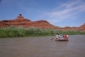
The San Juan is a popular river for fun activities, even though some parts are very remote. Near where the river starts, Pagosa Springs, Colorado is known for its natural hot springs. These are right on the banks of the San Juan River.
In the foothills, the 15,600-acre (6,300 ha) Navajo Lake is one of the biggest lakes in Colorado and New Mexico. Navajo State Park in Colorado and Navajo Lake State Park in New Mexico offer boating, water-skiing, fishing, and camping. There are two marinas in the New Mexico part of the lake. The 6 miles (9.7 km) of river below Navajo Dam are known as some of the best trout fishing waters in the United States. This is because the dam releases cold, clear water. Cutthroat, rainbow, and brown trout are found here. Many people come to fish in these "Quality Waters" of the San Juan River each year.
The part of the river between Farmington and Bluff flows through Navajo lands. The Navajo Nation Parks and Recreation Department manages this area. They issue permits for hiking and camping. But not many boaters visit this section because it's hard to get to the river.
The lower San Juan River below Bluff is very popular for whitewater boating and rafting. Many boaters start at Sand Island. They often finish their trip at Mexican Hat, Utah. This is about 20 miles (32 km) down the river. Some continue through the lower canyons to Clay Hills, near Lake Powell. This is 56 miles (90 km) further downstream. Commercial trips usually happen in late spring and early summer when the snow melts. The rapids between Mexican Hat and Clay Hills are moderate. Below Clay Hills, the San Juan flows through very isolated country to Lake Powell. Here, you need to paddle a long way on flat water to reach services.
See also
 In Spanish: Río San Juan (Utah) para niños
 | Charles R. Drew |
 | Benjamin Banneker |
 | Jane C. Wright |
 | Roger Arliner Young |


