U.S. Route 99 in California facts for kids
Quick facts for kids
U.S. Route 99 |
||||
|---|---|---|---|---|
| Pacific Highway Golden State Highway |
||||
| Lua error in Module:Infobox_road/map at line 15: attempt to index field 'wikibase' (a nil value). | ||||
| Route information | ||||
| Maintained by Caltrans | ||||
| Existed | 1926–1972 | |||
| Major junctions | ||||
| South end | ||||
|
||||
| North end | ||||
| Highway system | ||||
| United States Numbered Highways List • Bannered • Divided • Replaced State highways in California(list • pre-1964)
|
||||
U.S. Route 99 (often called US 99) was once a super important highway in the western United States. It ran all the way from the Mexican border in Calexico, California, up to the Canadian border in Blaine, Washington. People called it the "Golden State Highway" or "The Main Street of California."
This highway was especially important in the 1930s. It helped many farm workers, who were moving because of the Dust Bowl, travel through California. US 99 was created in 1926. It was mostly replaced by Interstate 5 (I-5) in 1964. Today, a big part of it in the Central Valley is known as State Route 99 (SR 99).
Contents
Exploring the Route of US 99
From Mexico to Los Angeles
The journey on US 99 began right at the border with Baja California in Calexico, California. From there, it headed north, following the western side of the Salton Sea. This part of the road is now called SR 86.
US 99 then continued along what is now SR 111. It went through Coachella. At Dillon Road, it met two other major US routes: US 60 and US 70.
The highway then became US 60/US 70/US 99. It went north through Indio and then turned west. It passed through the San Gorgonio Pass on its way to Los Angeles. This section is very similar to today's I-10. In Beaumont, US 60 split off and headed west to Los Angeles on its own.
Before the big, modern highways were built, US 99 entered Los Angeles on Valley Boulevard. It shared this road with US 70. US 70 ended in downtown Los Angeles. But US 99 turned north again. It mostly followed the path of today's I-5. This included going over the Tehachapi Mountains to reach the San Joaquin Valley.
The original path of US 99 over the Tehachapi Mountains was called the Ridge Route. It was the first direct road connecting the Los Angeles Basin to the San Joaquin Valley. This old road, built in 1915, was very winding and narrow. It was considered dangerous for early cars and trucks. In 1933, a new, wider "Alternate Ridge Route" was built to make travel safer and faster.
After coming down from the Tehachapis, US 99 entered the San Joaquin Valley. This was at the bottom of a steep hill called the Grapevine. From there, it continued its journey north.
US 99 in Los Angeles
When US 99 was first planned in 1926, it ran with US 66. This route went from San Bernardino through Pasadena to Los Angeles. Then it turned north towards San Fernando. This path was used until 1933.
By 1942, US 99 had its own path from San Bernardino to Los Angeles. It shared this path with US 70 and US 60 west of Pomona. This route used Garvey Avenue from Pomona. It then turned onto Ramona Boulevard (now part of I-10) in Alhambra. It reached Macy Street (now Cesar E. Chavez Avenue) near downtown Los Angeles.
From there, it turned north onto Figueroa Street. It went through the Figueroa Street Tunnels. Then it turned off at Avenue 26 to reach San Fernando Road. As new freeways like the San Bernardino Freeway were built, US 99 was moved onto them. In 1962, with the Golden State Freeway finished, US 99 was moved onto it. This helped it avoid some older, busier parts of the city.
From Los Angeles to Sacramento
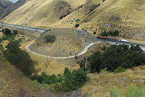
Leaving Los Angeles, US 99 followed San Fernando Road. It passed through Glendale and Burbank to Sylmar. From 1937 to 1964, it shared this route with US 6. Today, a part of this old highway through the Santa Clarita Valley is called "The Old Road."
"The Old Road" starts near the Newhall Pass Interchange. It goes north, passing under today's I-5. It winds past Pico Canyon Road and reaches McBean Parkway. This is near places like the California Institute of the Arts and Six Flags Magic Mountain. In Castaic, "The Old Road" becomes a local street. A large part of the original road is now under Pyramid Lake.
US 99 then went over Tejon Pass into the San Joaquin Valley. Just north of where it entered the valley, I-5 splits off. US 99 continued on what is now SR 99. It went through cities like Bakersfield, Fresno, and Sacramento. Many old parts of the highway between the "Grapevine" and Sacramento still exist. They are now local streets, often with "Golden State" in their names.
From Sacramento to Oregon
North of Sacramento, the route of US 99 split into two parts: US 99W and US 99E.
US 99W traveled west with US 40 to Davis. It then continued north on what is now SR 113 into Woodland. From there, it followed a path similar to the current I-5, going through towns like Corning and Red Bluff. Many parts of this old road still exist today, signed as 99W or CR 99.
US 99E went east from Sacramento, following a path similar to I-80 to Roseville. Then it went north along SR 65 to Olivehurst. From there, it followed SR 70 to Marysville. It crossed the Feather River on SR 20 to Yuba City. Finally, it followed the current SR 99 north to Red Bluff, where it met up with 99W again.
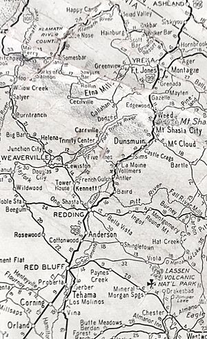
From Red Bluff, US 99 continued north. It followed a route similar to I-5. However, it went through Redding along what is now SR 273. It also used SR 263 from Yreka to near Black Mountain.
North of Redding, the highway went through Mountain Gate. This area is now under Shasta Lake. During dry years, you can still see parts of the old bridges and roads when the water level is low. The highway then had to navigate the difficult Sacramento River Canyon. Many old bridges from this time can still be found.
In Siskiyou County, the highway wound through Dunsmuir. It then headed north to Mount Shasta and up to Weed. In Weed, a short section became SR 265 before heading north to Gazelle.
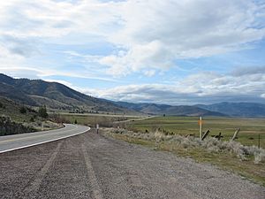
There's a 22.7-mile (36.5 km) stretch of "Old Highway 99" in Siskiyou County. It's between Weed and Yreka. This road looks much like it did when it was US 99. It runs alongside I-5, but sometimes moves several miles away. North of Yreka, the highway becomes SR 263. It joins SR 96 and heads north to Hornbrook. Much of the old highway between Hornbrook and Oregon has been removed or is now on private land.
The History of US 99
US 99 was officially removed as a US highway by 1968. This happened as I-5 was completed in Washington and California. However, the process of replacing US 99 started earlier, on July 1, 1964. This was due to a new law called Collier Senate Bill No. 64, passed in 1963. This law aimed to make California's highway numbering system much simpler. It also removed confusing situations where multiple highway numbers shared the same road.
Here are some of the highways that replaced parts of US 99:
- SR 111 and SR 86 took over the section between the Mexican border and Indio.
- I-10 replaced US 60 and US 70 between Indio and Los Angeles.
- US 101 and SR 110 took over parts in downtown Los Angeles.
- I-5 replaced US 99 from north of downtown Los Angeles all the way to Wheeler Ridge.
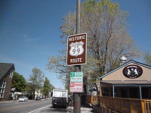
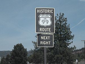
The 424-mile (682 km) stretch between Wheeler Ridge and Red Bluff is now signed as SR 99. This makes it California's second-longest state highway, after SR 1. There's also a "Historic U.S. Route 99" that goes from Indio in the Coachella Valley down through the Imperial Valley to Calexico at the Mexican border.
Major Intersections Along US 99
This section lists the main roads that US 99 crossed or joined with during its time.
- Mexican Border: US 99 started at the border with Mexico, connecting to Federal Highway 5 in Mexicali.
- Calexico: It met SR 98.
- El Centro: US 99 joined and then left US 80.
- Indio: It began sharing the road with US 60 and US 70. It also joined and left SR 111.
- Beaumont: US 60 split off from US 99.
- Colton: US 99 intersected with US 91 and US 395.
- Los Angeles: US 99 had many important connections here. It joined and left US 101, US 6, and US 66.
- Newhall: US 6 split off from US 99.
- Bakersfield: US 99 joined and left US 466.
- Fresno: It intersected with SR 41 and SR 180.
- Merced: US 99 joined and left SR 140.
- Modesto: It joined and left SR 132.
- Stockton: US 99 joined US 50.
- Sacramento: US 99 left US 50. Here, US 99 split into US 99E and US 99W.
- Red Bluff: US 99E and US 99W rejoined to form US 99 again.
- Redding: US 99 joined and left US 299.
- Weed: It intersected with US 97.
- Oregon Border: US 99 continued north into Oregon as US 99.
What Were US 99W and US 99E?
|
|
|
|---|---|
| Location: | Central Valley to Stockton |
| Existed: | 1929–1933 |
|
|
|
|---|---|
| Location: | Central Valley to Stockton |
| Existed: | 1929–1933 |
For a short time, from about 1929 to 1933, US 99 had two alternate routes in the Central Valley of California. These were called U.S. Route 99W and U.S. Route 99E. Both routes started north of Manteca and ended in Stockton.
US 99W followed French Camp Road and El Dorado Street. US 99E used what is now SR 99 and Mariposa Road. The exact points where they ended in Stockton are not completely clear today.
Before 1926, the main road from Los Angeles to Sacramento was called Legislative Route 4. This route went from Manteca to Stockton through French Camp, which later became US 99W.
Around 1929, the main Route 4 was changed between Manteca and Stockton. This new path became US 99E, and the old path became US 99W. Around 1933, US 99W was removed, and US 99E became the main US 99 route. Today, most of the old US 99E is part of SR 99. However, the old US 99W has been replaced by I-5.
 | Stephanie Wilson |
 | Charles Bolden |
 | Ronald McNair |
 | Frederick D. Gregory |


