Amazon River facts for kids
Quick facts for kids Amazon River |
|
|---|---|
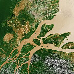
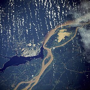
Satellite image of the Amazon Delta
|
|
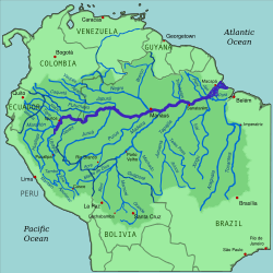
Amazon River and its drainage basin
|
|
| Other name(s) | Rio Amazonas |
| Country | Peru, Colombia, Brazil |
| Cities | Iquitos (Peru); Leticia (Colombia); Tabatinga (Brazil); Tefé (Brazil); Itacoatiara (Brazil) Parintins (Brazil); Óbidos (Brazil); Santarém (Brazil); Almeirim (Brazil); Macapá (Brazil); Manaus (Brazil) |
| Physical characteristics | |
| Main source | Apurímac River, Mismi Peak Arequipa Region, Peru 5,220 m (17,130 ft) 15°31′04″S 71°41′37″W / 15.51778°S 71.69361°W |
| River mouth | Atlantic Ocean Brazil 0°42′28″N 50°5′22″W / 0.70778°N 50.08944°W |
| Length | 3,750 km (2,330 mi)
(Amazon–Ucayali–Tambo–Ené– Apurimac 6,400 km (4,000 mi) to 6,500 km (4,000 mi) (Amazon–Marañón 5,700 km (3,500 mi) |
| Width |
|
| Depth |
|
| Discharge (location 2) |
(Basin size: 6,743,000 km2 (2,603,000 sq mi) to 7,000,000 km2 (2,700,000 sq mi) |
| Discharge (location 3) |
46,130 m3/s (1,629,000 cu ft/s)(Year: 2023)
(Year: 2022)406,000 m3/s (14,300,000 cu ft/s) |
| Discharge (location 4) |
(Period: 1903–2023)95,000 m3/s (3,400,000 cu ft/s)
(Period: 1971–2000)173,272.6 m3/s (6,119,060 cu ft/s) (Period: 1928–1996)176,177 m3/s (6,221,600 cu ft/s) (Period: 01/01/1997–31/12/2015)178,193.9 m3/s (6,292,860 cu ft/s)
(Period: 1903–2023)260,000 m3/s (9,200,000 cu ft/s) 394,000 m3/s (13,900,000 cu ft/s)(Year: 1953) |
| Discharge (location 5) |
105,720 m3/s (3,733,000 cu ft/s) |
| Basin features | |
| Basin size | 7,000,000 km2 (2,700,000 sq mi) 6,743,000 km2 (2,603,000 sq mi) |
| Tributaries |
|
The Amazon River is a giant river in South America. It carries more water than any other river on Earth. It's also one of the longest rivers in the world, maybe even the longest. Some people say the Nile is longer.
For a long time, people thought the Amazon started at the Apurímac River on Nevado Mismi in Peru. But a 2014 study found it might start even further away, at the Mantaro River. The Mantaro and Apurímac rivers join up. Then, with other smaller rivers, they form the Ucayali River. The Ucayali then meets the Marañón River near Iquitos, Peru. Most countries call this meeting point the start of the Amazon.
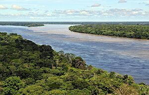
However, in Brazil, they call this part the Solimões River. It becomes the "Amazon River" to Brazilians after it joins the Rio Negro. This meeting point is called the Meeting of Waters (Encontro das Águas) near Manaus. Manaus is the biggest city along the river.
The Amazon River pours about 215,000 to 230,000 cubic meters of water into the ocean every second. This is more water than the next seven largest rivers combined! Two of the world's top ten rivers by water flow are actually smaller rivers that feed into the Amazon. The Amazon alone sends 20% of all river water on Earth into the oceans.
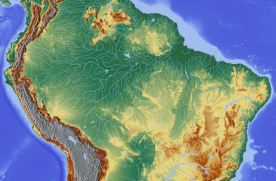
The area of land that drains into the Amazon River, called its drainage basin, is the largest in the world. It covers about 7 million square kilometers. The part of this basin that is just in Brazil is bigger than any other river's basin in the world. When the Amazon enters Brazil, it only has one-fifth of the water it will have when it reaches the Atlantic Ocean. Yet, even at that point, it already carries more water than any other river on Earth.
Contents
History of the Amazon River
Recent studies of the Earth's geology suggest that millions of years ago, the Amazon River flowed in the opposite direction. It used to flow from east to west. But then the Andes Mountains formed. These mountains blocked the river's path to the Pacific Ocean. This forced the Amazon to change direction and flow east towards the Atlantic Ocean, which is how it flows today.
Ancient People of the Amazon

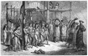
There is a lot of proof that large and complex groups of people lived around the Amazon River long ago. These were mainly chiefdoms, who built towns and cities. Archaeologists believe that over 3 million native people lived around the Amazon by 1541. This was when the Spanish explorer De Orellana traveled across the river. These ancient settlements had very advanced ways of life.
Europeans Arrive in the Amazon
In March 1500, the Spanish explorer Vicente Yáñez Pinzón was the first European known to sail up the Amazon River. Pinzón called the river Río Santa María del Mar Dulce, which means "Saint Mary River of the Sweet Sea." This name was later shortened to Mar Dulce, or "Sweet Sea." He called it this because its fresh water pushed far out into the ocean.
Another Spanish explorer, Francisco de Orellana, was the first European to travel the entire length of the river. He went from its beginnings in the Andes mountains all the way to its mouth. During this trip, Orellana named some of the Amazon's smaller rivers, like the Rio Negro and the Napo.
The name "Amazonas" is thought to come from the native warriors who attacked Orellana's group. Many of these warriors were women. This reminded Orellana of the mythical female Amazon warriors from ancient Greek stories.
Exploring the Amazon
In 1541, Gonzalo Pizarro set out to explore east of Quito in South America. He was looking for El Dorado, the "city of gold," and La Canela, the "valley of cinnamon". His second-in-command was Francisco de Orellana.
They traveled about 170 kilometers until the Coca River joined the Napo River. They stopped there for a few weeks to build a boat. They continued downriver through an empty area where they couldn't find food. Orellana offered to go down the Napo River, then called "Cinnamon River," to find food. They expected to find food within a few days by going up another river to the north.
Orellana took about 57 men, the boat, and some canoes. They left Pizarro's group on December 26, 1541. However, Orellana missed the river where he was supposed to find supplies. By the time he and his men reached another village, many were sick from hunger. Seven men died there. His men threatened to rebel if they turned back to rejoin Pizarro. They were already very far downstream.
So, Orellana agreed to change their goal. They would now explore new lands for the king of Spain. The men built a bigger boat to travel further downstream. After going 600 kilometers down the Napo River, they reached a major meeting point of rivers near modern Iquitos. They then followed the upper Amazon, now called the Solimões, for another 1200 kilometers. They reached its meeting point with the Rio Negro near modern Manaus on June 3, 1542.
Pizarro had reported to the king that they found cinnamon trees. But true cinnamon is not from South America. Pizarro likely saw other plants that looked similar. Orellana's group reached the mouth of the Amazon on August 24, 1542. This showed that the huge river could be traveled by boat.
In 1560, another Spanish explorer, Lope de Aguirre, might have been the second European to travel down the Amazon. Historians are not sure if it was the Amazon or the Orinoco River, which flows nearby to the north.
Portuguese explorer Pedro Teixeira was the first European to travel up the entire river. He reached Quito in 1637 and returned the same way.
From 1648 to 1652, a Portuguese Brazilian explorer named António Raposo Tavares led a trip from São Paulo. He went overland to the mouth of the Amazon. He explored many of its smaller rivers, including the Rio Negro. His journey covered over 10,000 kilometers.
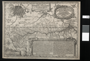
Along the main rivers and their smaller branches, many settlements were started. These were for trade, getting slaves, and teaching Christianity to the native people. In the late 1600s, a Czech Jesuit priest named Samuel Fritz started about forty mission villages. Fritz believed that the Marañón River was the source of the Amazon. He noted on his 1707 map that the Marañón "has its source on the southern shore of a lake that is called Lauricocha." For most of the 18th, 19th, and into the 20th century, the Marañón was generally thought to be the Amazon's source.
Scientific Exploration of the Amazon
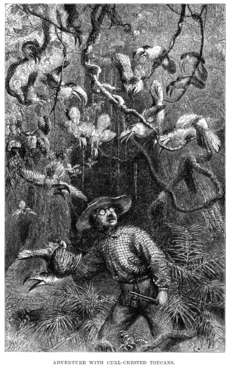
Scientists began exploring the Amazon River and its basin in the 1700s and early 1800s. They studied its animals, plants, and geography.
- Charles Marie de La Condamine explored the river in 1743.
- Alexander von Humboldt explored from 1799 to 1804.
- Henry Walter Bates and Alfred Russel Wallace explored from 1848 to 1859.
Modern Growth and Challenges
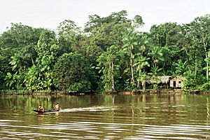
By 1850, about 300,000 people lived in the Brazilian part of the Amazon basin. Most were Europeans, and some were slaves. The main trading city, Pará (now Belém), had about 10,000 to 12,000 people. The town of Manáos (now Manaus) had about 1,000 to 1,500 people. Other villages were quite small.
In 1850, the Emperor of Brazil allowed steamships on the Amazon. A company called "Companhia de Navegação e Comércio do Amazonas" started in 1852. They began operating with four small steamers. At first, ships mostly stayed on the main river. This was the first step to opening up the huge inland area.
The success of this company showed how much money could be made from the Amazon. Other companies soon started trading on its smaller rivers. The Amazonas Company also grew its fleet of ships. Many private people also began running their own small steamships.
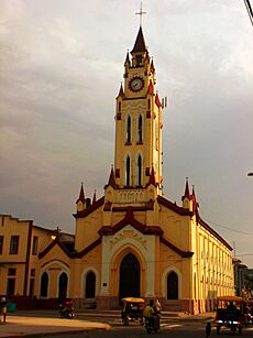
In 1867, Brazil's government opened the Amazon to ships from all countries. This helped trade grow a lot, especially with the demand for natural rubber. The Peruvian city of Iquitos became a busy trading hub. Foreign companies moved to Iquitos to control rubber collection. In 1851, Iquitos had 200 people. By 1900, it had 20,000. By 1911, rubber exports were a big part of Peru's trade. During the rubber boom, diseases brought by immigrants, like typhus and malaria, sadly killed many native Amazonians.
Direct foreign trade with Manaus started around 1874. Local trade along the river was done by the Amazon Steam Navigation Company and many small steamboats. These boats traveled on the Rio Negro, Madeira, Purús, and other smaller rivers.
By the early 1900s, the main exports from the Amazon basin were rubber, cacao beans, and Brazil nuts. Other products included animal furs, forest goods like resins, and lumber and gold.
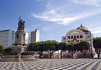
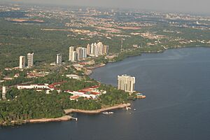
Manaus is the largest city on the Amazon. In 2014, it had 1.9 million people. Manaus makes up about half the population of the largest Brazilian state, Amazonas.
The Amazon River itself does not have any dams. However, about 412 dams are built on its smaller rivers, called tributaries. Only 4% of the Amazon's potential for hydropower (electricity from water) has been used. This means many more dam projects are planned.
Challenges Facing the Amazon River
The Amazon River is super important for over 47 million people who live in its basin. But it faces many problems that threaten its amazing ecosystem and the native communities.
For example, the Yanomami tribe, with about 29,000 people, is struggling. Illegal gold miners are moving onto their land. This causes problems like malnutrition and malaria.
In 2022, a bad drought hit the region. The water in the river got very hot, reaching 39.1 degrees Celsius. This caused 125 Amazon river dolphins to die. This sad event shows how the environment is getting worse. It also shows how sensitive the river's ecosystem is.
In recent years, the Amazon River has had its lowest water levels in over a century. Brazil, which looks after a big part of this river, is working hard to help communities and nature deal with this drought. This shows how important it is to manage the environment carefully and protect the river.
Plants and Animals of the Amazon
More than one-third of all known species in the world live in the Amazon rainforest. It is the richest tropical forest on Earth in terms of different kinds of life. Besides thousands of fish species, the river is home to crabs, algae, and turtles.
Amazon Mammals
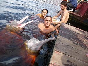
The Amazon is one of the main homes for the boto, also called the Amazon river dolphin. It is the largest type of river dolphin. It can grow up to 2.6 meters long. Its skin changes color as it gets older. Young dolphins are gray, but they turn pink and then white as they grow. These dolphins use echolocation (like sonar) to find their way and hunt in the river's deep, tricky waters.
The tucuxi is another type of dolphin found in the Amazon. The Amazonian manatee is also found in the northern Amazon River basin. It is a mammal that eats plants. Unlike other manatees, it only lives in fresh water. It is considered a vulnerable species, meaning its population is at risk.
The Amazon and its smaller rivers are the main home of the giant otter. Sometimes called the "river wolf," it is one of South America's top meat-eaters. Its population has dropped a lot because of habitat loss and hunting. Now, it is protected by international rules that ban its trade.
Amazon Reptiles
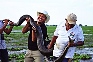
The Anaconda lives in shallow waters in the Amazon basin. It is one of the world's largest snake species. The anaconda spends most of its time in the water with only its nose above the surface. Different kinds of caimans, which are like alligators, also live in the Amazon. Various types of turtles are found there too.
Amazon Fish
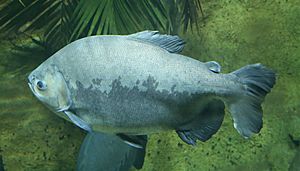
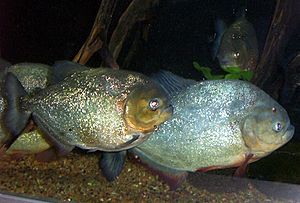
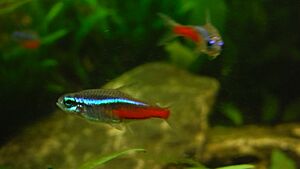
The Amazon has the most diverse fish life in the world for its region. Some of these fish are popular in home aquariums, like the neon tetra and the freshwater angelfish. As of 2011, over 5,600 species were known. About fifty new species are found every year.
The arapaima, also called pirarucu, is a South American freshwater fish. It is one of the largest freshwater fish in the world, growing up to 4.5 meters long. Another Amazonian freshwater fish is the arowana. The silver arowana is a predator that looks like the arapaima but only grows to 120 cm.
The famous piranha is also found in large numbers. This fish eats both plants and meat. Piranhas gather in large groups and can attack animals. There are about 30 to 60 different kinds of piranhas.
The candirú is a type of parasitic catfish found in the Amazon. It is just one of over 1200 species of catfish in the Amazon basin. Some catfish can even "walk" on land using their fins. The kumakuma or "goliath catfish" can reach 3.6 meters in length and weigh 200 kg.
The electric eel and over 100 other species of electric fish live in the Amazon basin. River stingrays are also found there. The bull shark has been seen as far as 4,000 kilometers up the Amazon River in Iquitos, Peru.
Protected Areas
| Name | Country | Coordinates | Image | Notes |
|---|---|---|---|---|
| Allpahuayo-Mishana National Reserve | Peru | 3°56′S 73°33′W / 3.933°S 73.550°W | ||
| Amacayacu National Park | Colombia | 3°29′S 72°12′W / 3.483°S 72.200°W | ||
| Amazônia National Park | Brazil | 4°26′S 56°50′W / 4.433°S 56.833°W | ||
| Anavilhanas National Park | Brazil | 2°23′S 60°55′W / 2.383°S 60.917°W |
Bridges Across the Amazon
There are no bridges that cross the entire width of the Amazon River. This is not because the river is too wide. For most of its length, engineers could easily build a bridge. However, for most of its path, the river flows through the Amazon Rainforest. In this area, there are very few roads and cities. Most of the time, people cross the river using a ferry. The Manaus Iranduba Bridge connects the cities of Manaus and Iranduba. It crosses the Rio Negro, which is the second-largest river flowing into the Amazon, just before it joins the main Amazon River.
Major Rivers that Join the Amazon
The Amazon has over 1,100 smaller rivers that flow into it. These are called tributaries. Twelve of these tributaries are over 1,500 kilometers long! Some of the most important ones include:
Longest Tributaries of the Amazon
Here are some of the longest rivers in the Amazon system:
- 6,400 km (6,275 to 7,025 km) – Amazon, South America
- 3,250 km – Madeira, Bolivia/Brazil
- 3,211 km – Purús, Peru/Brazil
- 2,820 km – Japurá or Caquetá, Colombia/Brazil
- 2,639 km – Tocantins, Brazil
- 2,627 km – Araguaia, Brazil (flows into Tocantins)
- 2,400 km – Juruá, Peru/Brazil
- 2,250 km – Rio Negro, Brazil/Venezuela/Colombia
- 1,992 km – Tapajós, Brazil
- 1,979 km – Xingu, Brazil
- 1,900 km – Ucayali River, Peru
- 1,749 km – Guaporé, Brazil/Bolivia (flows into Madeira)
- 1,575 km – Içá (Putumayo), Ecuador/Colombia/Peru
- 1,415 km – Marañón, Peru
Rivers by Water Flow into the Amazon
This table shows which rivers add the most water to the Amazon:
| Rank | Name | Average water flow (cubic meters per second) | % of Amazon's total flow |
|---|---|---|---|
| Amazon | 209,000 | 100% | |
| 1 | Madeira | 31,200 | 15% |
| 2 | Negro | 28,400 | 14% |
| 3 | Japurá | 18,620 | 9% |
| 4 | Marañón | 16,708 | 8% |
| 5 | Tapajós | 13,540 | 6% |
| 6 | Ucayali | 13,500 | 5% |
| 7 | Purus | 10,970 | 5% |
| 8 | Xingu | 9,680 | 5% |
| 9 | Putumayo | 8,760 | 4% |
| 10 | Juruá | 8,440 | 4% |
| 11 | Napo | 6,976 | 3% |
| 12 | Javari | 4,545 | 2% |
| 13 | Trombetas | 3,437 | 2% |
| 14 | Jutaí | 3,425 | 2% |
| 15 | Abacaxis | 2,930 | 2% |
| 16 | Uatumã | 2,190 | 1% |
See Also
 In Spanish: Río Amazonas para niños


