
Islands in the River Thames facts for kids
The River Thames in England is home to many islands! This article will tell you all about these islands, including some that are no longer there. An island is a piece of land completely surrounded by water. On the Thames, many islands have special names like "ait" or "eyot," which are old English words for small islands.
Most of these islands were formed naturally. They grew from things like gravel, mud, and even bird droppings, with plants like willow trees helping to hold them together. Other islands were made by people who dug new channels in the river to make it easier for boats to travel. Today, all the islands on the Thames are fixed in place. People have worked hard to protect them from the river's flow, using things like concrete, wood, and even special plants called water reeds.
Contents
Islands That Are No Longer There
Some parts of the land that used to be islands on the River Thames are now connected to the mainland. This happened over time as the river changed or as people built things. Here are a few examples of places that were once islands:
- Frog Island near Rainham
- Isle of Dogs in Poplar, London
- Isle of Grain in Kent
- Thorney Island was a large area around Westminster Abbey.
- Bermondsey was formed by a small river called the River Neckinger. Today, a small part of that old channel is St Saviour's Dock.
- Isle of Thanet in Kent, which is closer to the English Channel and North Sea.
Islands You Can See Today
The islands below are listed starting from the sea and moving upstream towards the source of the Thames. Some of these islands are very large, while others are quite small. The table shows their names and sizes.
| Name | Area (acres) |
Area (hectares) |
Location | |
|---|---|---|---|---|
| Isle of Sheppey† | 23,040 | 9,320 | 9324.8 | Near the mouth of the Thames |
| Two Tree Island† | 640 | 260 | 259.0 | Leigh-on-Sea |
| Canvey Island† | 4,556 | 1,844 | 1843.7 | Near the mouth of the Thames |
| Lower Horse Island† | 31.1 | 12.6 | 12.6 | Corringham |
| Chiswick Eyot | 3.266 | 1.322 | 1.322 | Chiswick |
| Oliver's Island | 0.90 | 0.36 | 0.364 | Strand-on-the-Green |
| Brentford Ait | 4.572 | 1.850 | 1.850 | Brentford |
| Lot's Ait | 1.724 | 0.698 | 0.698 | Brentford |
| Isleworth Ait | 9.370 | 3.792 | 3.792 | Isleworth |
| Corporation Island | 0.796 | 0.322 | 0.322 | Richmond |
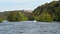
| Glover's Island | 0.536 | 0.217 | 0.217 | Twickenham |
| Eel Pie Island | 8.935 | 3.616 | 3.616 | Twickenham |
| Swan Island | 0.250 | 0.101 | 0.101 | Twickenham |
| Trowlock Island | 3.700 | 1.497 | 1.497 | Teddington |
| Steven's Eyot | 0.372 | 0.151 | 0.151 | Kingston upon Thames |
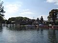
| Raven's Ait | 1.268 | 0.513 | 0.513 | Surbiton |
| Boyle Farm Island | 0.407 | 0.165 | 0.165 | Thames Ditton |
| Thames Ditton Island | 4.287 | 1.735 | 1.735 | Thames Ditton |
| Ash Island | 4.513 | 1.826 | 1.826 | East Molesey |
| Tagg's Island | 3.681 | 1.490 | 1.490 | Hampton |
| Garrick's Ait | 0.798 | 0.323 | 0.323 | Hampton |
| Benn's Island | 0.1 | 0.040 | 0.040 | Hampton |
| Platts Eyot | 7.710 | 3.120 | 3.120 | Hampton |
| Grand Junction Isle | 0.452 | 0.183 | 0.183 | Sunbury |
| Sunbury Court Island | 2.457 | 0.994 | 0.994 | Sunbury |
| Rivermead Island | 6.672 | 2.700 | 2.700 | Sunbury |
| Sunbury Lock Ait | 7.735 | 3.130 | 3.130 | Walton on Thames |
| Wheatley's Ait | 11.928 | 4.827 | 4.827 | Sunbury-on-Thames |
| Desborough Island | 112.00 | 45.32 | 45.325 | Shepperton |
| D'Oyly Carte Island | 1.427 | 0.577 | 0.577 | Weybridge |
| Lock Island | 4.662 | 1.887 | 1.887 | Shepperton |
| Hamhaugh Island | 9.897 | 4.005 | 4.005 | Shepperton |
| Pharaoh's Island | 4.1 | 1.7 | 1.659 | Shepperton |
| Laleham Burway | 396 | 160 | 160.25 | Chertsey |
| Penton Hook Island | 11.443 | 4.631 | 4.631 | Laleham |
| Truss's Island | 0.310 | 0.125 | 0.125 | Thorpe |
| Church Island | 2.069 | 0.837 | 0.837 | Staines-upon-Thames |
| Hollyhock Island with Holm Island | 2.429 | 0.983 | 0.983 | Staines-upon-Thames |
| The Island | 3.953 | 1.600 | 1.600 | Hythe End |
| Magna Carta Island | 1.706 | 0.690 | 0.690 | Runnymede |
| Unnamed island | 0.690 | 0.279 | 0.279 | Wraysbury |
| Pats Croft Eyot | 0.518 | 0.210 | 0.210 | Runnymede |
| Friary Island | 7.309 | 2.958 | 2.958 | Wraysbury |
| Friday Island | 0.154 | 0.062 | 0.062 | Old Windsor |
| Ham Island | 126.0 | 51.0 | 51.0 | Old Windsor |
| Lion Island | 0.353 | 0.143 | 0.143 | Old Windsor |
| Sumptermead Ait | 5.180 | 2.096 | 2.096 | Datchet |
| Black Potts Ait | 1.81 | 0.73 | 0.732 | Windsor |
| Romney Island | 6.304 | 2.551 | 2.551 | Windsor |
| Cutlers Ait | 0.955 | 0.386 | 0.386 | Windsor |
| Firework Ait | 0.022 | 0.0089 | 0.009 | Windsor |
| Barry Avenue Island | 0.641 | 0.259 | 0.259 | Windsor |
| Deadwater Ait | 0.550 | 0.223 | 0.223 | Windsor |
| Baths Island | 3.42 | 1.38 | 1.384 | Eton Wick |
| Bush Ait | 1.118 | 0.452 | 0.452 | Windsor |
| Queen's Eyot | 4.209 | 1.703 | 1.703 | Dorney |
| Monkey Island | 5.276 | 2.135 | 2.135 | Bray |
| Pigeonhill Eyot | 2.625 | 1.062 | 1.062 | Bray |
| Headpile Eyot | 3.440 | 1.392 | 1.392 | Bray |
| Guards Club Island | 0.640 | 0.259 | 0.259 | Maidenhead |
| Bridge Eyot | 2.262 | 0.915 | 0.915 | Maidenhead |
| Grass Eyot | 1.258 | 0.509 | 0.509 | Maidenhead |
| Ray Mill Island | 0.991 | 0.401 | 0.401 | Maidenhead |
| Boulter's Island | 3.474 | 1.406 | 1.406 | Maidenhead |
| Glen Island | 4.104 | 1.661 | 1.661 | Maidenhead |
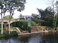
| Bavin's Gulls | 1.856 | 0.751 | 0.751 | Maidenhead |
| Formosa | 126.597 | 51.232 | 51.232 | Cookham |
| Sheriff Island | 2.410 | 0.975 | 0.975 | Marlow |
| Gibraltar Islands | 5.491 | 2.222 | 2.222 | Marlow |
| Temple Mill Island | 3.815 | 1.544 | 1.544 | Hurley |
| Frog Mill Ait | 4.213 | 1.705 | 1.705 | Hurley |
| Black Boy Island | 5.344 | 2.163 | 2.163 | Hurley |
| Magpie Island | 3.1 | 1.3 | 1.255 | Medmenham |
| Hambleden Mill island | 1.584 | 0.641 | 0.641 | Hambleden |
| Temple Island | 1.051 | 0.425 | 0.425 | Remenham |
| Rod Eyot | 2.159 | 0.874 | 0.874 | Henley-on-Thames |
| Ferry Eyot | 1.482 | 0.600 | 0.600 | Harpsden |
| Poplar Eyot | 0.958 | 0.388 | 0.388 | Wargrave |
| Handbuck Eyot | 0.770 | 0.312 | 0.312 | Wargrave |
| Unnamed Eyot | 2.378 | 0.962 | 0.962 | Wargrave |
| Shiplake railway bridge island | 1.193 | 0.483 | 0.483 | Shiplake |
| Shiplake weir island | 1.579 | 0.639 | 0.639 | Shiplake |
| Phillimore Island | 0.399 | 0.161 | 0.161 | Charvil |
| The Lynch | 3.248 | 1.314 | 1.314 | Lower Shiplake |
| Hallsmead Ait | 4.745 | 1.920 | 1.920 | Lower Shiplake |
| Buck Ait | 0.596 | 0.241 | 0.241 | Sonning |
| Long Ait | 2.623 | 1.061 | 1.062 | Sonning |
| Sonning Eye | 9.222 | 3.732 | 3.732 | Sonning |
| Sonning Hill island | 0.578 | 0.234 | 0.234 | Sonning |
| Sonning Marsh, Caversham Lakes Island | 0.561 | 0.227 | 0.227 | Sonning |
| Heron Island | 1.668 | 0.675 | 0.675 | Reading |
| View Island | 3.5 | 1.4 | 1.416 | Reading |
| De Bohun Island | 1.122 | 0.454 | 0.454 | Reading |
| Fry's Island | 3.561 | 1.441 | 1.441 | Reading |
| Pipers Island | 0.147 | 0.059 | 0.059 | Reading |
| St Mary's Island | 0.958 | 0.388 | 0.388 | Reading |
| Appletree Eyot | 0.730 | 0.295 | 0.295 | Tilehurst |
| Poplar Island | 0.740 | 0.299 | 0.300 | Tilehurst |
| Mapledurham Mill Island | 1.322 | 0.535 | 0.535 | Mapledurham |
| Whitchurch Mill Greater Island | 1.945 | 0.787 | 0.787 | Whitchurch |
| Lower Basildon marsh island | 0.759 | 0.307 | 0.307 | Lower Basildon |
| Streatley Mill Greater Island | 1.977 | 0.800 | 0.800 | Streatley |
| Cleeve Mill lower island | 1.945 | 0.787 | 0.787 | Goring |
| Cleeve Mill island | 0.979 | 0.396 | 0.396 | Goring |
| Cleeve Mill upper island | 1.416 | 0.573 | 0.573 | Goring |
| Cholsey Marsh island | 1.2 | 0.49 | 0.486 | Cholsey |
| Crowmarsh Mill Island | 3.160 | 1.279 | 1.279 | Crowmarsh |
| Little Wittenham Footbridge Island | 2.316 | 0.937 | 0.937 | Little Wittenham |
| Clifton Cut Island | 61.864 | 25.035 | 25.035 | Clifton |
| Long Wittenham Backwater Island | 9.477 | 3.835 | 3.835 | Long Wittenham |
| Culham Cut Island | 70.638 | 28.586 | 28.586 | Culham |
| Sutton Pools Island | 6.056 | 2.451 | 2.451 | Sutton Courtney |
| Nag's Head Island | 1.876 | 0.759 | 0.759 | Abingdon |
| Andersey Island | 273 | 110 | 110.48 | Abingdon |
| Tiger Island | 19.830 | 8.025 | 8.025 | Abingdon |
| Lock Wood Island | 1.930 | 0.781 | 0.781 | Nuneham Courtenay |
| Fiddler's Elbow | 11.688 | 4.730 | 4.730 | Sandford-on-Thames |
| Fidder’s Elbow far northern section | 6.425 | 2.600 | 2.600 | Sandford-on-Thames |
| Swan Inn, Rose, Kennington or St Michael Isle | 1.197 | 0.484 | 0.484 | Kennington |
| Folly Island | 0.65 | 0.26 | 0.263 | Folly Bridge, Oxford |
| Osney Island | 108.34 | 43.84 | 43.848 | Oxford |
| Fiddler's Island | 4.105 | 1.661 | 1.661 | Oxford |
| Godstow Bridge Island | 2.181 | 0.883 | 0.883 | Godstow |
| King's Lock Island | 2.558 | 1.035 | 1.035 | King's Lock |
| Pinkhill Lock Island | 3 | 1.2 | 1.214 | Pinkhill Lock |
| Shifford Cut Island | 110.832 | 44.852 | 44.852 | Chimney Meadows, Chimney, Oxfordshire |
| Radcot Bridge Lower Island | 3.648 | 1.476 | 1.476 | Radcot |
| Radcot Bridge Upper Island | 5.746 | 2.325 | 2.325 | Radcot |
| Swan Hotel Island | 0.885 | 0.358 | 0.358 | Radcot |
| St Mary’s Mead | 3.697 | 1.496 | 1.496 | Buscot |
| St John's Bridge Island | 1.208 | 0.489 | 0.489 | Lechlade (borders Buscot) |
| Northern meadow | 27.875 | 11.281 | 11.289 | Castle Eaton |
| Cricklade north-east meadow | 7.747 | 3.135 | 3.135 | Cricklade |
| Island between High and Oaklake bridges† | 51.72 | 20.93 | 20.93 | Ashton Keynes |
| Manor stream island | 86.195 | 34.882 | 34.882 | Somerford Keynes and Kemble |
How the River Thames Creates Islands in Oxford
In the Oxford area, the River Thames splits into many smaller streams. These streams flow across the flat land, called a floodplain, and create lots of islands. For example, a big island is formed by the Seacourt Stream, Botley Stream, and Bulstake Stream. There are also smaller islands, like Osney, which is now mostly built up with buildings.
The Oxford suburbs of Grandpont and New Hinksey are on an island made by the Bulstake Stream, Hinksey Stream, and Weirs Mill Stream. Another area, Iffley Meadows, is an island west of Iffley Lock, located between Weirs Mill Stream, Hinksey Stream, and the Thames.
On the other side of the river, Fiddler's Island and the historic Osney island are found between Castle Mill Stream and the Thames. Cripley Meadow is also an island, created by Fiddler's Island Stream, Castle Mill Stream, and Sheepwash Channel.
Eton and Dorney: A Man-Made Island?
The areas of Eton, Berkshire and Dorney are interesting because they might be considered a man-made island. These areas are made up of small villages that existed before the 1900s. In the 19th century, much of this land was prone to flooding. This led to people wanting better flood protection.
Since 2002, Eton and Dorney have been on a more protected, man-made island. This island was created by the Jubilee River. The Jubilee River is a special channel built to help control floods. It always has water flowing through it. Because of this, some people now consider Eton and Dorney to be on an island of the Thames.
Islands at Locks
Many locks on the Thames have their own artificial islands. A lock is like a water elevator that helps boats move between different water levels. These islands were often created when the lock was built, separating it from the weir (a small dam that controls water flow).
Sometimes, an island was built in the river, or a new canal was dug for the lock, turning the land in between into an island. Many of these lock islands have a lock keeper's house on them and can be reached by crossing the lock gates. Only lock islands with their own special names are listed in the table above. You can find all the Thames locks listed in Locks and weirs on the River Thames.
Images for kids
-
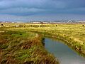
Sheppey - Minster from Elmley Marshes
-
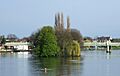
Oliver's Island looking downstream
-
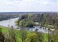
Glover's Island from Richmond Hill
-
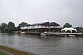
Raven’s Ait from Queen's Promenade
-
Platts Eyot - Port Hampton
-
Ham Island - The Cut
-
Bavin's Gulls and Cliveden
-
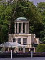
Temple Island, Henley


.JPG)

