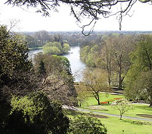
Tideway facts for kids
The Tideway is a special part of the River Thames in England where the water level changes with the tides. This section of the river starts after Teddington Lock and goes all the way to the wider Thames Estuary, including the famous Pool of London. It's like the river breathing in and out with the sea!
Contents
Understanding the River Tides
The river's water level changes twice a day, rising and falling with the ocean tides. This can be by as much as 7 m (24 ft)! Because the tide pushes against the fresh water flowing out from the Thames Basin, it takes longer for the water to go out (6–9 hours) than to come in (4–5 hours).
London Bridge is a key spot for checking tide times. High tide reaches Putney about 30 minutes later.
Protecting London from Floods
Low-lying areas of London can be flooded by big storm surges. This risk has grown because the sea level is slowly rising. This is due to Britain's land tilting very slowly and climate change. To protect the city, huge barriers like the Thames Barrier were built across the Thames at Woolwich.
Who Looks After the River?
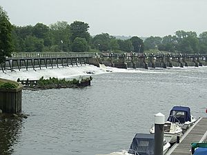
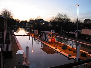
The Port of London Authority (PLA) manages the Tideway, which is also known as the Port of London. Their area starts near Teddington Lock and goes out to sea. The PLA is also in charge of Richmond Lock.
River Police and Emergency Services
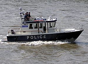
Within London, the Metropolitan Police Marine Policing Unit keeps the Tideway safe. Further east, Essex Police and Kent Police take over. The London Fire Brigade also has a fire boat ready for emergencies in central London.
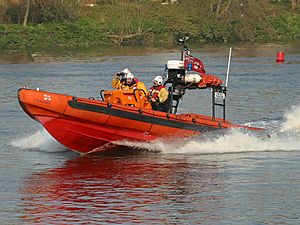
After a serious boat accident in 1989, the Government asked the Maritime and Coastguard Agency, the Port of London Authority, and the Royal National Lifeboat Institution (RNLI) to create a special rescue service for the tidal Thames. Since 2002, four lifeboat stations have opened: at Teddington, Chiswick, Tower Pier, and Gravesend.
Boats and Travel on the River
Large ships can sail on the river as far as the Pool of London at London Bridge. The Port of London is the second busiest port in the UK for how much cargo it handles. Today, not many big cargo ships go past the Thames Barrier. Sometimes, cruise ships or warships visit central London. They often moor near HMS Belfast. Most big trade now happens at places like the Port of Tilbury.
River Rules and Activities
There are speed limits on the river. West of Wandsworth Bridge, boats must go no faster than 8 knots (15 km/h). Between Wandsworth Bridge and Margaretness, the limit is 12 knots (22 km/h).
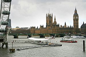
The tidal river is also popular for fun activities. In London, you can take sightseeing tours past famous places like the Houses of Parliament and the Tower of London. There are also regular riverboat services. However, the strong currents near the bridges make it hard for sports here.
Rowing is very popular upstream from Putney Bridge. Sailing also happens in this area and further out in the Estuary. The annual Great River Race for traditional rowed boats goes from Greenwich to Ham.
Connecting Canals
The Grand Union Canal joins the river at Brentford. A branch of it, the Regent's Canal, connects at Limehouse Basin. Another canal system that connects to the Tideway is the River Lea Navigation through Bow Lock.
| Thames Reaches east of Westminster |
|---|
| Reach 1 Upper Pool, Lower Pool and Limehouse Reach |
| Reach 2 Limehouse, Greenwich and Blackwall Reach |
| Reach 3 Bugsby's and Woolwich Reach |
| Reach 4 Gallions and Barking Reach |
| Reach 5 Halfway and Erith Reach |
| Reach 6 Erith Reach, Erith Rands and Long Reach |
| Reach 7 Long Reach and Fiddler's Reach |
| Reach 8 Northfleet Hope |
| Reach 9 Gravesend Reach |
| Reach 10 The Lower Hope |
| Reach 11 Sea Reach |
The River Environment
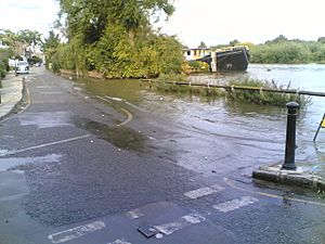
Some low areas next to the tidal Thames sometimes flood during very high tides. This helps special plants that like salty water to grow. For example, at Chiswick Lane South, the river can overflow onto the road a few times a year.
Cleaning Up the Thames
The water quality in the Thames has gotten much better over the last 40 years. Efforts to clean up the Tideway have brought back marine life and birds. However, the river still faces challenges. Heavy rainfall in London can cause overflows from the city's old sewer system. This means that a mix of untreated water and rainwater can sometimes flow into the Tideway.
The Thames Tideway Scheme, which is currently being built, aims to fix this. It will send most of these overflows into a huge new tunnel under the river, making the Thames much cleaner.
Exploring the Thames Estuary
The Thames Estuary is where the River Thames meets the sea. It's one of the biggest inlets on the coast of Great Britain. The water here can rise by 4 metres and move at a speed of 8 miles per hour.
The estuary reaches into London near Tower Bridge. It has an Outer Estuary with saltmarshes and mudflats, and an Inner Estuary closer to London. Many parts of the Outer Estuary have man-made walls to protect the land. This area is also a major route for ships.
The Thames Gateway Area
The Thames Gateway is about 70 kilometres (43 mi) long. It stretches from the Isle of Sheppey to Westferry in Tower Hamlets. This area used to have many large factories and industries. When these industries closed, they left behind empty and sometimes polluted land. This has created a chance for big new building projects. Famous places in this area include the London Docklands, the Millennium Dome, and the Thames Barrier.
Major Crossings in the Gateway
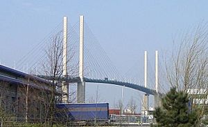
- Dartford Crossing (includes two tunnels from 1963 and 1980, and the cable-stayed Queen Elizabeth II Bridge from 1991)
- Blackwall Tunnels (first built in 1897, second in 1967)
- Jubilee line and Docklands Light Railway tunnels (for trains)
- Greenwich foot tunnel (built in 1902 for walking)
- Rotherhithe Tunnel (built in 1908)
Rivers Joining the Gateway
- Pitsea Creek, Mar Dyke and River Ingrebourne
- River Rom (lower part called the Beam) and River Dart
- River Roding (tidal part called 'Barking Creek')
- River Lea or Lee (tidal part called 'Bow Creek')
- Ravensbourne (tidal part called 'Deptford Creek')
Islands and Peninsulas in the Gateway
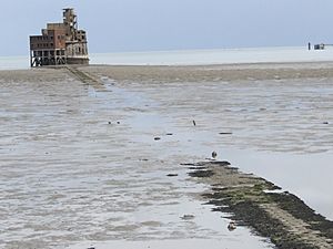
- Isle of Grain (actually a peninsula)
- Two Tree Island
- Canvey Island
- Lower Horse Island
- Frog Island, Rainham
- Isle of Dogs (actually a peninsula)
The Historic Pool of London
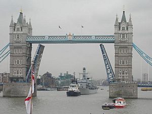
The Pool of London is split into two parts: the Lower Pool and the Upper Pool. The Lower Pool goes from Cherry Garden Pier to Tower Bridge. The Upper Pool is between Tower Bridge and London Bridge.
In the 1700s and 1800s, this area was packed with ships and warehouses. There wasn't enough space, so people built the London Docklands with enclosed docks for better security. When shipping containers became popular in the 1960s, most commercial ships stopped using the Pool of London. This led to all the old wharves closing. The area has since been redeveloped with new homes and businesses, often using the old warehouses.
Major Crossings in the Pool of London
- Rotherhithe Tunnel (built in 1908)
- Thames Tunnel (from Wapping to Rotherhithe, built in 1843; the world's first underwater tunnel, now part of the East London Line)
- Tower Bridge (built in 1894)
Famous Central London Landmarks
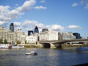
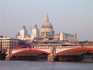
Between London Bridge and Putney Bridge, the river flows through central London. You can see many famous landmarks here.
| North Bank | South Bank |
|---|---|
| Monument St Paul's Cathedral Inner Temple Somerset House Victoria Embankment HMS President HMS Wellington Cleopatra's Needle Charing Cross railway station Norman Shaw Buildings Houses of Parliament Tate Britain Thames Embankment |
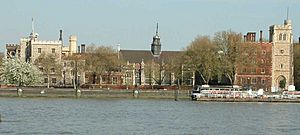
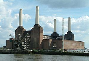
Southwark Cathedral St Saviour's Dock Globe Theatre Tate Modern Royal National Theatre Royal Festival Hall London Eye Albert Embankment County Hall, London St Thomas' Hospital Lambeth Palace SIS Building Battersea Power Station |
River boats take tourists up and down the river. They also offer a regular service for people commuting to work.
Major Crossings in Central London
- Northern line, Waterloo & City line, Bakerloo line, Jubilee line, Victoria line (underground train tunnels)
- London Bridge (built in 1973)
- Cannon Street Railway Bridge (built in 1982)
- Southwark Bridge (built in 1921)
- Millennium Bridge (built in 2002)
- Blackfriars Railway Bridge (built in 1886)
- Blackfriars Bridge (built in 1869)
- Waterloo Bridge (built in 1945) (known as the "women's bridge")
- Hungerford Footbridges (Golden Jubilee Bridges) (built in 2002)
- Charing Cross (Hungerford) Bridge (built in 1864)
- Westminster Bridge (built in 1862)
- Lambeth Bridge (built in 1932)
- Vauxhall Bridge (built in 1906)
- Grosvenor Bridge (Victoria Railway Bridge) (built in 1859)
- Chelsea Bridge (built in 1937)
- Albert Bridge (built in 1873)
- Battersea Bridge (built in 1890)
- Battersea Railway Bridge (built in 1863)
- Wandsworth Bridge (built in 1938)
- Fulham Railway Bridge (built in 1889)
Rivers Joining in Central London
(Some of these rivers now flow underground in pipes)
- Walbrook
- River Fleet
- Neckinger (except for its mouth)
- Tyburn
- Westbourne
- Counter's Creek (also called 'Chelsea Creek') (except for its mouth)
- Effra
- Wandle
Outer London Adventures
From Putney Bridge to Teddington Lock, the river flows through London's suburbs. These include places like Hammersmith, Chiswick, Barnes, and Richmond.
This part of the Tideway is a hub for rowing clubs in London. Many training sessions and races happen here all year round. The famous The Championship Course, used for The Boat Race, stretches from Putney to Mortlake.
Major Crossings in Outer London
- Putney Bridge (built in 1886)
- Hammersmith Bridge (built in 1887)
- Barnes Railway Bridge (built in 1849)
- Chiswick Bridge (built in 1933)
- Kew Railway Bridge (built in 1869)
- Kew Bridge (built in 1903)
- Richmond Lock and Footbridge (built in 1894)
- Twickenham Bridge (built in 1933)
- Richmond Railway Bridge (built in 1848)
- Richmond Bridge (built in 1777)
Rivers Joining in Outer London
- Beverley Brook
- Stamford Brook
- Brent
- Duke of Northumberland's River (this one was made by people!)
- Crane
- Sudbrook
Islands in Outer London
 | Anna J. Cooper |
 | Mary McLeod Bethune |
 | Lillie Mae Bradford |


