Allegany County, Maryland facts for kids
Quick facts for kids
Allegany County
|
|||
|---|---|---|---|
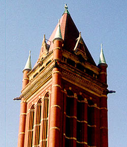
Allegany County Courthouse
|
|||
|
|||
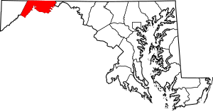
Location within the U.S. state of Maryland
|
|||
 Maryland's location within the U.S. |
|||
| Country | |||
| State | |||
| Founded | December 25, 1789 | ||
| Named for | Allegheny Mountains | ||
| Seat | Cumberland | ||
| Largest city | Cumberland | ||
| Area | |||
| • Total | 430 sq mi (1,100 km2) | ||
| • Land | 424 sq mi (1,100 km2) | ||
| • Water | 5.8 sq mi (15 km2) 1.3% | ||
| Population
(2020)
|
|||
| • Total | 68,106 | ||
| • Estimate
(2023)
|
67,273 |
||
| • Density | 158.4/sq mi (61.2/km2) | ||
| Time zone | UTC−5 (Eastern) | ||
| • Summer (DST) | UTC−4 (EDT) | ||
| Congressional district | 6th | ||
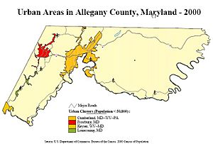
Allegany County is a county located in the northwestern part of the U.S. state of Maryland. In 2020, about 68,106 people lived there. Its main city and government center is Cumberland.
The name Allegany might come from a local Lenape word. It could mean 'best flowing river of the hills' or 'beautiful stream'. Many places in the Appalachian region share similar names. Allegany County is part of the Western Maryland area. It is also part of the Cumberland metropolitan area.
Contents
History of Allegany County
The western part of Maryland, including what is now Allegany County, was first part of Prince George's County. This was back in 1696 when Maryland was created. Over time, this large county was split into smaller ones.
Allegany County was officially formed in 1789. It was created by splitting off a part of Washington County. At that time, it was the westernmost county in Maryland. Later, in 1872, Allegany County was split again. This created Garrett County, which is now the westernmost county in Maryland.
Before 1789, the state of Virginia also claimed this area. Old maps show that Hampshire County, Virginia, once included parts of what is now Maryland. This can sometimes make historical research tricky.
Geography of Allegany County
Allegany County covers about 430 square miles. Most of this area is land, with a small part being water.
The county is mostly in the Ridge-and-Valley Country. This is a part of the Appalachian Mountains. To the north, it borders Pennsylvania along the Mason–Dixon line. To the south, it borders the Potomac River and West Virginia. Washington County is to its east. Garrett County is to its west.
The western part of the county has the steep Allegheny Front. This area leads to higher lands like the Appalachian Plateau. For example, Frostburg is nearly 2,100 feet high. But Cumberland, just eight miles away, is only 627 feet high.
Mountains in Allegany County
- Breakneck Hill (1,872 ft)
- Collier Mountain (1,460 ft)
- Dans Mountain (2,898 ft)
- Evitts Mountain (1,959–2,260 ft.)
- Green Ridge Mountain
- Haystack Mountain (1,240+ ft.)
- Irons Mountain
- Martin Mountain (1,974 ft)
- Nicholas Mountain (1,760 ft)
- Piney Mountain
- Polish Mountain (1,783 ft)
- Ragged Mountain (1,740 ft)
- Town Hill (2,039 ft)
- Warrior Mountain (2,185 ft)
- Wills Mountain (1,960+ ft.)
Neighboring Counties
- Somerset County, Pennsylvania (northwest)
- Bedford County, Pennsylvania (north)
- Fulton County, Pennsylvania (northeast)
- Washington County (east)
- Morgan County, West Virginia (southeast)
- Hampshire County, West Virginia (south)
- Mineral County, West Virginia (southwest)
- Garrett County (west)
Protected Natural Areas
Population Facts
| Historical population | |||
|---|---|---|---|
| Census | Pop. | %± | |
| 1790 | 4,809 | — | |
| 1800 | 6,303 | 31.1% | |
| 1810 | 6,909 | 9.6% | |
| 1820 | 8,654 | 25.3% | |
| 1830 | 10,609 | 22.6% | |
| 1840 | 15,690 | 47.9% | |
| 1850 | 22,769 | 45.1% | |
| 1860 | 28,348 | 24.5% | |
| 1870 | 38,536 | 35.9% | |
| 1880 | 38,012 | −1.4% | |
| 1890 | 41,571 | 9.4% | |
| 1900 | 53,694 | 29.2% | |
| 1910 | 62,411 | 16.2% | |
| 1920 | 69,938 | 12.1% | |
| 1930 | 79,098 | 13.1% | |
| 1940 | 86,973 | 10.0% | |
| 1950 | 89,556 | 3.0% | |
| 1960 | 84,169 | −6.0% | |
| 1970 | 84,044 | −0.1% | |
| 1980 | 80,548 | −4.2% | |
| 1990 | 74,946 | −7.0% | |
| 2000 | 74,930 | 0.0% | |
| 2010 | 75,087 | 0.2% | |
| 2020 | 68,106 | −9.3% | |
| 2023 (est.) | 67,273 | −10.4% | |
| U.S. Decennial Census 1790–1960 1900–1990 1990–2000 2010 2020 |
|||
In 2020, Allegany County had a population of 68,106 people. Most residents were White (about 85%). About 7.76% were Black or African American. Other groups included Asian, Native American, and people of mixed races. About 1.69% of the population was Hispanic or Latino.
In 2010, the average household had 2.30 people. The average family had 2.86 people. The median age was 40.9 years old. The median income for a household was $37,747. About 14.5% of the population lived below the poverty line.
Economy and Jobs
Allegany County has several important employers. These companies and organizations provide many jobs for the people living in the county.
| Employer | Employees (2021) |
Employees (2012) |
|---|---|---|
| UPMC Western Maryland | 2,200 | 2,290 |
| Allegany County Board of Education | 1,350 | 1,346 |
| Northrop Grumman | 1,050 | 1,396 |
| Frostburg State University | 1,003 | 922 |
| Hunter Douglas | 900 | 580 |
| New Page Corporation | NR | 870 |
| CSX Transportation | 635 | 900 |
| Western Correctional Institution | 588 | 552 |
| North Branch Correctional Institution | 574 | 557 |
| American Woodmark | 572 | NR |
| Allegany College | 509 | 559 |
Communities in Allegany County
Allegany County has different types of communities. These include cities, towns, and other areas.
Cities
Towns
Census-Designated Places (CDPs)
Some areas are called Special Tax Districts. These are like small towns but don't have full local government power. They need the state's approval for changes.
- Bel Air
- Bowling Green
- Cresaptown
- Ellerslie
- LaVale
- McCoole
- Mount Savage
- Potomac Park
Other census-designated places include:
Unincorporated Communities
- Amcelle
- Dickens
- Evitts Creek
- George's Creek
- Loartown
- McKenzie
- Narrows Park
- Pinto
- Town Creek
Transportation in Allegany County
Allegany County has always been important for travel and trade. It's a key spot for moving goods and people between the East Coast and the Midwest. The Cumberland Narrows is a natural gap in the mountains. It makes it easier to pass through this steep region. Because of this, Cumberland has been a center for many transportation projects.
During the French and Indian War, General Edward Braddock built a road here. This road followed an old Native American path. It went from Fort Cumberland to what is now Pittsburgh. This road later became part of the National Road. A monument in Cumberland marks the start of this historic road.
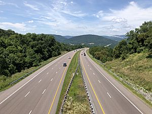
Today, Allegany County is still a major crossroads. Interstate 68 and US Route 40 cross the county from east to west. US Route 220 runs north to south.
Major Highways
 Interstate 68
 U.S. Route 40
 US 40 Alt.
 U.S. Route 40 Scenic
 U.S. Route 220
 Maryland Route 35
 Maryland Route 36
 Maryland Route 47
 Maryland Route 49
 Maryland Route 51
 Maryland Route 53
 Maryland Route 55
 Maryland Route 135
 Maryland Route 144
 Maryland Route 638
 Maryland Route 657
 Maryland Route 658
 Maryland Route 935
 Maryland Route 936
 Maryland Route 956
Rail Travel
Public Transportation
- Allegany County Transit
Education in Allegany County
Public schools in Allegany County are managed by Allegany County Public Schools (ACPS). A Board of Education, with five elected members, oversees the schools. ACPS has three high schools, three middle schools, and 13 elementary schools. There is also one K-8 school. The county also has a Center for Career and Technical Education.
Allegany County is also home to three private Christian schools. These include Bishop Walsh School in Cumberland.
For higher education, there is Frostburg State University. It is one of Maryland's public universities. Founded in 1898, it offers over 40 different majors. More than 5,000 students attend each year.
Allegany College of Maryland is also located in Cumberland. It offers over 50 associate degree programs. It also has more than 20 certificate programs. Over 3,500 students are enrolled here.
Natural Resources
Allegany County has important natural resources. These include coal, iron, sandstone, and limestone. Coal is mostly found in the Georges Creek Basin. This area is in the western part of the county.
Notable People from Allegany County
- Thomas Cresap (c. 1702 – c. 1790), a frontiersman who founded Oldtown.
- Michael Cresap (1742–1775), an officer in the American Revolutionary War.
- Patrick Hamill (1817–1895), a United States Congressman from Maryland.
- Lloyd Lowndes Jr. (1845–1905), a former Governor of Maryland.
- Lefty Grove (1900–1975), a Hall of Fame baseball pitcher. He played for the Philadelphia Athletics and Boston Red Sox.
- William H. Macy (born 1950), a famous American actor.
- Sam Perlozzo, former manager of the Baltimore Orioles baseball team.
- Leo Mazzone, a former pitching coach for baseball teams.
- Casper R. Taylor Jr., a former Speaker of the House in Maryland.
- Eddie Deezen, (born 1957), an American actor.
- Ty Johnson (born 1997), a running back for the Detroit Lions.
- Drew Hankinson, also known as "Luke Gallows" (born 1983), a professional wrestler.
- Bob Robertson (Born 1946), played in Major League Baseball. He was a first baseman for the Pittsburgh Pirates.
Images for kids
See also
 In Spanish: Condado de Allegany (Maryland) para niños


