
Image: Relief Map of Tasmania

Size of this preview: 489 × 600 pixels. Other resolutions: 196 × 240 pixels | 780 × 957 pixels.
Original image (780 × 957 pixels, file size: 494 KB, MIME type: image/png)
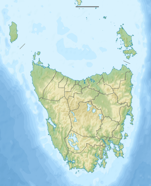
Description: Relief map of Tasmania.
Title: Relief Map of Tasmania
Credit: ETOPO1 dataset for relief and bathymetry GSHHS dataset for coastline File:Australia Tasmania location map.svg for borders; by NordNordWest Own work using Created with Generic Mapping Tools (GMT) This vector image was created with Inkscape.
Author: Nzeemin
Usage Terms: Creative Commons Attribution-Share Alike 3.0
License: CC BY-SA 3.0
License Link: http://creativecommons.org/licenses/by-sa/3.0
Attribution Required?: Yes
Image usage
More than 100 pages link to this image. The following list shows the first 100 page links to this image only. A full list is available.
- Andover, Tasmania
- Anne River (Tasmania)
- Arthur-Pieman Conservation Area
- Arthur Range (Tasmania)
- Bass Strait
- Bathurst Harbour, Tasmania
- Ben Lomond (Tasmania)
- Boomer Island (Tasmania)
- Burnie, Tasmania
- Calder River (Tasmania)
- Cape Bruny Lighthouse
- Cape Wickham Lighthouse
- Cathedral Mountain (Tasmania)
- Centurion (tree)
- Cradle Mountain
- Crotty, Tasmania
- Crotty Dam
- D'Entrecasteaux Channel
- Darwin Crater
- Dry's Bluff
- Eaglehawk Neck
- Eldon Range
- Eldon River
- Exeter, Tasmania
- Federation Peak
- Flowerdale River
- Fortescue Bay
- Forty Lake Peak
- Frankland Peak
- Frankland Range
- Franklin River
- Frenchmans Cap
- Gordon River
- Gordon Splits
- Great Lake (Tasmania)
- Great Western Tiers
- Hartz Mountains (Tasmania)
- Howden, Tasmania
- Huonville
- Inglis River
- Ironstone Mountain
- Jocks Lagoon
- Kettering, Tasmania
- King River (Tasmania)
- Kutikina Cave
- Lake Barrington (Tasmania)
- Lake Beatrice
- Lake Burbury
- Lake Crescent (Tasmania)
- Lake Dulverton
- Lake Edgar
- Lake Fidler
- Lake Flannigan
- Lake Margaret (Tasmania)
- Lake Pedder
- Lake Rosebery (Tasmania)
- Lake St Clair (Tasmania)
- Liffey River (Tasmania)
- Low Head Lighthouse
- Mackintosh River
- Magra, Tasmania
- Margate, Tasmania
- Mount Anne
- Mount Barrow
- Mount Darwin (Tasmania)
- Mount Dundas (Tasmania)
- Mount Field West (Tasmania)
- Mount Geikie
- Mount Huxley (Tasmania)
- Mount Jukes (Tasmania)
- Mount Lyell (Tasmania)
- Mount Murchison (Tasmania)
- Mount Olympus (Tasmania)
- Mount Ossa (Tasmania)
- Mount Owen (Tasmania)
- Mount Pelion East
- Mount Pelion West
- Mount Read (Tasmania)
- Mount Sedgwick (Tasmania)
- Mount Sorell
- Mount Strahan
- Mount Tyndall (Tasmania)
- Mount Victoria Forest Reserve
- Mount Wellington (Tasmania)
- Norfolk Bay (Tasmania)
- Ocean Beach (Tasmania)
- Orielton Lagoon
- Parangana Power Station
- Pelion Range
- Peter Murrell Conservation Area
- Pieman River
- Pipers River
- Port Davey
- Right Angle Peak
- Sandfly, Tasmania
- Secheron Peak
- Serpentine Dam (Tasmania)
- Snug, Tasmania
- South West Cape (Tasmania)
- The Cupola (mountain)

All content from Kiddle encyclopedia articles (including the article images and facts) can be freely used under Attribution-ShareAlike license, unless stated otherwise.