
List of municipalities in Lycoming County, Pennsylvania facts for kids

Lycoming County, Pennsylvania, has 52 different local governments, called municipalities. These are like mini-governments that manage local areas. In Pennsylvania, there are three main types of municipalities: cities, boroughs, and townships.
To become a borough, a place needs at least 10 people. If a township or borough grows to have 10,000 people or more, it can ask the state government to become a city. Every part of Pennsylvania belongs to some kind of municipality, so there are no "unincorporated" areas (places without their own local government).
This article will tell you about Lycoming County's municipalities. You'll learn their names, where their names came from, when they were settled, and how big they are. We'll also look at some areas that used to be part of Lycoming County but are now in other counties.
In 2000, Lycoming County had about 120,044 people. This made it a "Fifth Class County" in Pennsylvania. The main city and county seat is Williamsport. Lycoming County is in north central Pennsylvania. It's about 130 miles (209 km) northwest of Philadelphia. It's also about 165 miles (266 km) east-northeast of Pittsburgh.
Contents
Understanding Lycoming County's Municipalities

As of 2012, Lycoming County has 52 official municipalities. These include one city, nine boroughs, and 42 townships. Townships can also contain smaller areas called census-designated places (CDPs) or villages.
CDPs are special areas defined by the U.S. Census Bureau. They help collect population data. Villages are marked with signs by the Pennsylvania Department of Transportation. But remember, neither CDPs nor villages are actual governments. They are legally part of the township they are in. The list below will point out the CDP and villages within their townships.
Lycoming County is the largest county in Pennsylvania by land area. It covers about 1,244 square miles (3,222 km2). That's even bigger than Rhode Island, the smallest U.S. state!
The municipalities in Lycoming County vary a lot in size. Some boroughs are as small as 0.6 square miles (1.7 km2). The largest is McHenry Township, at 76.5 square miles (198.1 km2).
Williamsport is the biggest city by population. In 2000, it had 30,706 people. This was about a quarter of the county's total population. The smallest population is in Brown Township, with only 111 people. Most people in the county live in the valley along the West Branch Susquehanna River.
-
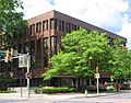
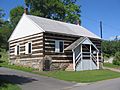
Lycoming County Courthouse, Williamsport -
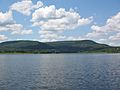
Rose Valley Lake, Gamble Township -
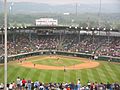
Little League World Series, South Williamsport -
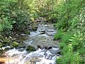
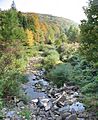
White Deer Hole Creek in Washington Township


Cities and Boroughs of Lycoming County
Here is a list of the incorporated cities and boroughs in Lycoming County. You can see their names, interesting facts about them, when they were settled, and their size and population.
| Municipality (type) |
Remarks | Settled | Incorporated | Formed from | Area in square miles (km2) | Population as of 2000 |
Map |
|---|---|---|---|---|---|---|---|
| Williamsport (city) | Named for William Ross (son of founder Michael Ross); county seat; laid out 1796 | 1769 | 1806 (borough), 1866 (city) |
Loyalsock Township | 9.5 sq mi (24.7 km2) |
30,706 |  |
| Duboistown (borough) | Named for founders John and Mathias Dubois, laid out 1852 | 1773 | 1878 | Armstrong Township | 0.6 sq mi (1.7 km2) |
1,280 |  |
| Hughesville (borough) | Named for founder Jeptha Hughes; laid out 1816 | 1816 | 1852 | Muncy Township | 0.6 sq mi (1.7 km2) |
2,200 |  |
| Jersey Shore (borough) | Named the "Jersey Shore" as its founders were from New Jersey and it was on the shore of the West Branch Susquehanna River; laid out 1820 | 1785 | 1826 | Porter Township | 1.2 sq mi (3.2 km2) |
4,482 |  |
| Montgomery (borough) | Named for the "Montgomery Station" post office; known as "Black Hole" until circa 1836 (for Black Hole Creek) | 1783 | 1887 | Clinton Township | 0.6 sq mi (1.5 km2) |
1,695 |  |
| Montoursville (borough) | Named for Madame Montour and her son Andrew Montour; laid out 1820 | 1768 | 1850 | Fairfield Township | 4.2 sq mi (10.8 km2) |
4,777 |  |
| Muncy (borough) | Named for the Munsee phratry of the Lenape; laid out 1797 | 1797 | 1826 | Muncy Township | 0.8 sq mi (2.2 km2) |
2,663 |  |
| Picture Rocks (borough) | Named for Indian pictographs found on the cliffs above Muncy Creek | 1848 | 1875 | Wolf Township | 0.9 sq mi (2.4 km2) |
693 |  |
| Salladasburg (borough) | Named for founder Jacob P. Sallada; laid out 1837 | 1837 | 1884 | Mifflin Township | 0.8 sq mi (2.0 km2) |
260 |  |
| South Williamsport (borough) | Named for its geographic location, south of Williamsport; | 1790 | 1886 | Armstrong Township | 2.1 sq mi (5.5 km2) |
6,412 |  |
Townships of Lycoming County
Here is a list of the townships in Lycoming County. You can see their names, interesting facts about them, when they were settled, and their size and population.
| Municipality (type) |
Remarks | Settled | Incorporated | Formed from | Area in square miles (km2) | Population as of 2000 |
Map |
|---|---|---|---|---|---|---|---|
| Anthony Township | Named for Joseph B. Anthony, a county judge circa 1844 and later Pennsylvania Supreme Court justice | 1773 | 1844 | Lycoming Township | 15.9 sq mi (41.1 km2) |
904 |  |
| Armstrong Township | Named for James Armstrong, a local lawyer | 1795 | 1842 | Clinton Township | 25.6 sq mi (66.2 km2) |
717 |  |
| Bastress Township | Named for Solomon Bastress of Jersey Shore, former member of the state legislature and associate judge | 1837 | 1854 | Susquehanna Township | 8.6 sq mi (22.4 km2) |
574 |  |
| Brady Township | Named for the Brady family, some of the earliest settlers in the area | 1790 | 1855 | Washington Township | 8.6 sq mi (22.4 km2) |
494 |  |
| Brown Township | Named for Jacob Brown, a general from Pennsylvania in the War of 1812; includes the villages of Cedar Run and Slate Run | 1790 | 1815 | Mifflin and Pine Townships | 73.7 sq mi (190.8 km2) |
111 |  |
| Cascade Township | Named for its cascading mountain streams; includes the village of Kellyburg | 1843 | 1843 | Hepburn and Plunketts Creek Townships | 40.9 sq mi (105.9 km2) |
419 |  |
| Clinton Township | Named for DeWitt Clinton, governor of New York (1817–1822, 1824–1828) | 1825 | 1825 | Washington Township | 28.8 sq mi (74.5 km2) |
3,947 |  |
| Cogan House Township | Named for David Cogan, a pioneer who settled on Larrys Creek in 1825; includes the villages of Beech Grove, Brookside, Cogan House, and White Pine | 1825 | 1843 | Jackson and Mifflin Townships | 69.9 sq mi (181.1 km2) |
974 |  |
| Cummings Township | Named for John Cummings, an associate on the bench; includes the village of Waterville, as well as two state parks: Little Pine and Upper Pine Bottom | 1784 | 1832 | Mifflin and Brown Townships | 69.4 sq mi (179.7 km2) |
355 |  |
| Eldred Township | Named for C. D. Eldred, an associate on the bench; includes the village of Warrensville | 1802 | 1858 | Hepburn Township | 14.3 sq mi (37.1 km2) |
2,178 |  |
| Fairfield Township | Named for "beautiful rolling land of the fertile river bottom" | 1742 | 1825–1826 | Muncy Township | 11.7 sq mi (30.4 km2) |
2,659 |  |
| Franklin Township | Named for Benjamin Franklin; includes the village of Lairdsville | 1795 | 1822 | Moreland Township | 24.5 sq mi (63.4 km2) |
915 |  |
| Gamble Township | Named for James Gamble, the judge who authorized the election that led to its creation; includes the village of Calvert and Rose Valley Lake | 1784 | 1875 | Lewis and Cascade Townships | 46.2 sq mi (119.5 km2) |
854 |  |
| Hepburn Township | Named for William Hepburn, a founding father of Williamsport and Lycoming County; includes the villages of Cogan Station (also in Lycoming Township) and Hepburnville | 1784 | 1804 | Loyalsock Township | 16.6 sq mi (43.1 km2) |
2,836 |  |
| Jackson Township | Named for Andrew Jackson (prior to his presidency); includes the village of Buttonwood | 1811 | 1824 | Lycoming Township | 35.6 sq mi (92.2 km2) |
414 |  |
| Jordan Township | Named for Alexander Jordan, president judge of the district court when formed; includes the villages of Lungerville and Unityville | 1812 | 1854 | Franklin Township | 20.7 sq mi (53.6 km2) |
878 |  |
| Lewis Township | Named for Ellis Lewis, president judge of the district court when formed; includes the villages of Bodines, Field Station, and Trout Run | 1812 | 1835 | Hepburn Township | 37.8 sq mi (98.0 km2) |
1,139 |  |
| Limestone Township | Named for its abundant limestone, originally known as "Adams Township" for John Adams (name changed 1835); includes the villages of Collomsville, Oriole, and Oval | 1789 | 1824 | Nippenose and Wayne Townships | 34.2 sq mi (88.5 km2) |
2,136 |  |
| Loyalsock Township | Named for Loyalsock Creek; second most populous municipality in the county | 1768 | 1786 | Muncy Township | 21.2 sq mi (55.0 km2) |
10,876 |  |
| Lycoming Township | Named for Lycoming Creek; includes the villages of Cogan Station (also in Hepburn Township) and Quiggleville | 1773 | 1858 | Old Lycoming Township | 15.4 sq mi (39.8 km2) |
1,606 |  |
| McHenry Township | Named for Alexander H. McHenry, a Jersey Shore surveyor; includes the villages of Cammal, Haneyville, Jersey Mills, and Okome | 1785 | 1861 | Brown and Cummings Townships | 76.5 sq mi (198.1 km2) |
145 |  |
| McIntyre Township | Named for Archibald McIntyre, a founder of the Williamsport and Elmira Railroad; includes the villages of Marsh Hill and Ralston | 1794 | 1848 | Lewis Township | 47.2 sq mi (122.4 km2) |
539 |  |
| McNett Township | Named for H. I. McNett, who led the drive for its formation; includes the villages of Chemung, Ellenton, Leolyn, Penbryn, and Roaring Branch | 1805 | 1878 | McIntyre Township | 33.8 sq mi (87.5 km2) |
211 |  |
| Mifflin Township | Named for Thomas Mifflin, the first governor of Pennsylvania (1790–1799) | 1790 | 1803 | Old Lycoming Township | 27.9 sq mi (72.2 km2) |
1,145 |  |
| Mill Creek Township | Named for Mill Creek; includes part of the village of Huntersville (also in Wolf Township) | 1795 | 1879 | Muncy Township | 11.4 sq mi (29.5 km2) |
572 |  |
| Moreland Township | Named for a legend that the acres surveyed here were larger than a standard acre; includes the village of Opp | 1790 | 1813 | Muncy Creek Township | 23.9 sq mi (62.0 km2) |
1,036 |  |
| Muncy Township | Named for the Munsee phratry of the Lenape; as it is older than Lycoming County, it is often called the "Mother Township"; includes the village of Pennsdale | 1772 | 1772 | One of the seven original townships of Northumberland County | 15.8 sq mi (40.8 km2) |
1,059 |  |
| Muncy Creek Township | Named for Muncy Creek; includes the village of Clarkstown | 1773 | 1797 | Muncy Township | 20.7 sq mi (53.7 km2) |
3,487 |  |
| Nippenose Township | Named for the Indian phrase, "Nippeno-wi", meaning a warm and genial summer like place; includes the village of Antes Fort, which was named for Fort Antes (abandoned during the Big Runaway) | 1769 | 1786 | Bald Eagle Township | 11.2 sq mi (29.1 km2) |
729 |  |
| Old Lycoming Township | Named indirectly for Lycoming Creek, it was originally part of Lycoming Township, the name was changed in 1858 when the township was divided; includes the census-designated place of Garden View | 1773 | 1785 | Iroquois land purchased as part of Northumberland County, before this was run by the Fair Play Men | 9.5 sq mi (24.6 km2) |
5,508 |  |
| Penn Township | Named for Penn Township, Berks County; includes part of the village of Glen Mawr (also in Shrewsbury Township) | 1774 | 1828 | Muncy Township | 26.7 sq mi (69.2 km2) |
900 |  |
| Piatt Township | Named for William Piatt, an associate county judge when it was created; includes the village of Larryville | 1769 | 1858 | Mifflin Township | 10.1 sq mi (26.3 km2) |
1,259 |  |
| Pine Township | Named for its vast stands of pine trees; includes the villages of English Center and Oregon Hill | 1806 | 1856 | Brown, Cummings and Cogan House Townships | 75.8 sq mi (196.3 km2) |
329 |  |
| Plunketts Creek Township | Named for Plunketts Creek; includes the villages of Barbours and Proctor | 1776 | 1838 | Franklin Township and Davidson Township now part of Sullivan County | 55.2 sq mi (143.1 km2) |
771 |  |
| Porter Township | Named for David R. Porter, Pennsylvania governor (1839–1845) | 1772 | 1840 | Mifflin Township | 7.9 sq mi (20.6 km2) |
1,633 |  |
| Shrewsbury Township | Named for Shrewsbury Township, New Jersey; includes the villages of Glen Mawr (also in Penn Township) and Tivoli | 1794 | 1804 | Muncy Township | 17.5 sq mi (45.3 km2) |
433 |  |
| Susquehanna Township | Named for the West Branch Susquehanna River which forms the northern boundary; includes the village of Nisbet | 1801 | 1838 | Nippenose and Armstrong Townships | 7.8 sq mi (20.2 km2) |
993 |  |
| Upper Fairfield Township | Originally named "Pollock Township" for local judge, name changed to Fairfield Township in 1853; includes the villages of Farragut and Loyalsockville | 1796 | 1851 | Fairfield Township | 18.2 sq mi (47.2 km2) |
1,854 |  |
| Washington Township | Named for George Washington; includes the village of Elimsport | 1760 | 1785 | Bald Eagle Township | 48.5 sq mi (125.7 km2) |
1,613 |  |
| Watson Township | Named for Oliver Watson, president of a bank in Williamsport; includes the village of Tombs Run | 1784 | 1845 | Porter and Cummings Townships | 23.5 sq mi (61.0 km2) |
550 |  |
| Wolf Township | Named for George Wolf, governor of Pennsylvania (1829–1835); | 1777 | 1834 | Muncy Township | 19.6 sq mi (50.7 km2) |
2,707 |  |
| Woodward Township | Named for Apollos Woodward, an associate judge; includes the village of Linden | 1772 | 1855 | Anthony Township | 13.6 sq mi (35.3 km2) |
2,397 |  |
| Garden View, (census-designated place) | Not a municipality, just a part of Old Lycoming Township | 1.0 sq mi (2.7 km2) |
2,679 |  |
-
Dunkard Church, Hepburn Township -
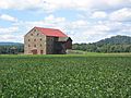
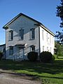
Stone Barn in Fairfield Township -
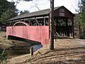
Covered Bridge in Cogan House Township


How Lycoming County Changed Over Time

The land that is now Lycoming County was bought from the Iroquois Native American tribe. This happened in two treaties signed at Fort Stanwix in New York, in 1768 and 1784. Lycoming County itself was officially created on April 13, 1795. It was formed from a part of Northumberland County.
When it was first formed, Lycoming County was huge! It was estimated to be about 12,000 square miles (31,000 km2). Its land stretched all the way north to the New York state line. It went west to the Allegheny River and south almost to the start of the West Branch Susquehanna River. It also included what is now Sullivan County and more.
However, just five years later, in 1800, parts of Lycoming County started to be used to create new counties. This process continued until 1847. Today, 20 other Pennsylvania counties contain land that was once part of Lycoming County.
- Five counties were made completely from Lycoming County: Jefferson, McKean, Potter, Tioga, and Sullivan.
- Eight counties were made from Lycoming County and other counties: Armstrong, Bradford, Centre, Clearfield, Clinton, Indiana, Venango, and Warren.
- Some counties were even formed from counties that were partly made from Lycoming County. These include Cameron, Clarion, and Elk.
- Forest was formed from a county that was completely made from Lycoming County.
- Luzerne and Wyoming counties contain land that was part of Lycoming County in 1795.
- Finally, Union received a township from Lycoming County in 1861.
Former Townships of Lycoming County
This table lists some of the areas that used to be townships within Lycoming County. They are now part of other counties.
| Municipality (type) |
Remarks | Settled | Incorporated | Area in square miles (km2) | Population as of 2000 |
Map |
|---|---|---|---|---|---|---|
| Allison Township | Now in Clinton County, incorporated as part of Lycoming County | ? | before 1839 | 2.0 mi2 (5.2 km2) |
198 |  |
| Brady Township (now Gregg Township) | Now in Union County, incorporated as part of Lycoming County | 1798 | 1798 | 15.1 mi2 (39.2 km2) |
4,687 |  |
| Ceres Township | Now in McKean County, incorporated as part of Lycoming County | 1798 | 1798 | 40.7 mi2 (105.4 km2) |
1,003 |  |
| Chapman Township | Now in Clinton County, incorporated as part of Lycoming County | 1780 | before 1839 | 99.9 mi2 (258.7 km2) |
848 |  |
| Cherry Township | Now in Sullivan County, incorporated as part of Lycoming County | 1816 | 1824 | 57.8 mi2 (149.8 km2) |
1,718 |  |
| Colebrook Township | Now in Clinton County, incorporated as part of Lycoming County | 1777 | before 1839 | 18.7 mi2 (48.4 km2) |
179 |  |
| Davidson Township | Now in Sullivan County, incorporated as part of Lycoming County | 1806 | 1833 | 78.2 mi2 (202.3 km2) |
626 |  |
| Dunnstable Township | Now in Clinton County, incorporated as part of Lycoming County | 1785 | before 1810 | 9.6 mi2 (24.8 km2) |
993 |  |
| Elkland Township | Now in Sullivan County, incorporated as part of Lycoming County | 1798 | 1804 | 38.7 mi2 (100.2 km2) |
607 |  |
| Forks Township | Now in Sullivan County, incorporated as part of Lycoming County | 1794 | 1833 | 43.9 mi2 (113.7 km2) |
407 |  |
| Fox Township | Now in Sullivan County, incorporated as part of Lycoming County | 1800 | 1839 | 38.6 mi2 (100.0 km2) |
332 |  |
| Grove Township | Now in Cameron County, incorporated as part of Lycoming County, then one of twelve original townships in Clinton County (1839), then one of four original townships in Cameron (1860) | 1811 | before 1839 | 74.0 mi2 (191.6 km2) |
179 |  |
| Limestone Township (now Crawford Township) | Now in Clinton County, incorporated as part of Lycoming County, name changed 1841. | 1780 | 1824 | 22.1 mi2 (57.2 km2) |
848 |  |
| Lower Bald Eagle Township (now Bald Eagle Township) | Now in Clinton County, incorporated as part of Northumberland County, became part of Lycoming County in 1795 | 1772 | 1772 | 41.6 mi2 (107.7 km2) |
1,898 |  |
| Lumber Township | Now in Cameron County, incorporated as part of Lycoming County, then one of twelve original townships in Clinton County (1839), then one of four original townships in Cameron (1860) | 1810 | before 1839 | 51.5 mi2 (133.4 km2) |
241 |  |
| Pine Creek Township | Now in Clinton County, incorporated as part of Lycoming County | 1785 | 1772 | 14.9 mi2 (38.6 km2) |
3,184 | |
| Pine Creek Township | Now in Jefferson County, incorporated as part of Lycoming County | 1785 | 1772 | 28.5 mi2 (73.9 km2) |
1,369 |  |
| Plunketts Creek Township (now Hillsgrove Township) | Now in Sullivan County, incorporated as part of Lycoming County, name changed in 1856. | 1786 | 1847 | 28.4 mi2 (73.6 km2) |
265 |  |
| Shrewsbury Township | Now in Sullivan County, incorporated as part of Lycoming County | 1799 | 1803 | 48.1 mi2 (124.5 km2) |
328 |  |
| Tioga Township | Now in Tioga County, incorporated as part of Lycoming County | 1792 | 1797 | 40.5 mi2 (104.8 km2) |
995 |  |
| Upper Bald Eagle Township (now Spring Township) | Now in Centre County, incorporated as part of Northumberland County, became part of Lycoming County in 1795; Name changed in 1801 to "Spring Township" | 1772 | 1772 | 25.9 mi2 (67.0 km2) |
6,117 |  |
| Wayne Township | Now in Clinton County, incorporated as part of Lycoming County; named for "Mad" Anthony Wayne | 1768 | 1798 | 22.8 mi2 (59.2 km2) |
1,363 |  |
-
Pleasant Stream in McNett and Cascade Townships -
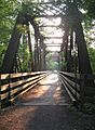
Little Pine Creek Bridge in Cummings Township -
Eagle Grange No. 1, Clinton Township -

TWA Flight 800 Memorial in Montoursville


Interactive Map of Lycoming County
The map below is interactive! You can click on any municipality's name to go to its specific article.
Twp.
Twp.
Twp.
House
Twp.
Twp.
Twp.
Twp.
ming
Twp.
Twp.
Creek
Twp.
Twp.
Twp.
Creek Twp.
nose Twp.
Twp.
Creek
Twp.
Twp.
Twp.
Twp.


More About Lycoming County
- History of Lycoming County, Pennsylvania
- List of villages in Lycoming County, Pennsylvania
