
North York Moors facts for kids
Quick facts for kids North York Moors |
|
|---|---|
|
IUCN Category V (Protected Landscape/Seascape)
|
|

North York Moors National Park
sign near Great Ayton
|
|

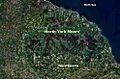
The North York Moors from space
|
|
| Location | North Yorkshire, England |
| Area | 554 sq mi (1,430 km2) |
| Established | 1952 |
| Governing body | North York Moors National Park Authority |
The North York Moors is a beautiful upland area in north-eastern Yorkshire, England. It is famous for having one of the largest areas of heather moorland in the United Kingdom. This special place became a National Park in 1952. This means it is protected for its natural beauty and wildlife.
The park covers about 554 square miles (1,435 square kilometers). Around 23,380 people live within its boundaries. The North York Moors National Park Authority manages and looks after the park. Their main office is in Helmsley.
Contents
- Exploring the North York Moors: Location & Travel
- The Landscape of the North York Moors: Physical Geography
- High Points of the Moors: Hills
- Wildlife and Nature: Natural History of the Moors
- A Journey Through Time: History of the North York Moors
- Life and Work: Economy of the North York Moors
- Images for kids
- See also
Exploring the North York Moors: Location & Travel

The North York Moors has clear natural borders. To the east, you'll find amazing cliffs along the North Sea coast. In the north and west, steep hills like the Cleveland Hills and Hambleton Hills mark the edge. To the south, there are the Tabular Hills and the Vale of Pickering.
Getting Around the Moors: Roads & Railways
Several main roads cross the North York Moors from north to south. The A171 connects Whitby and Scarborough in the east. The A169 runs between Pickering and Whitby. A smaller road goes from Keldholme through Castleton to the A171. The B1257 links Helmsley to Stokesley. The A170 from Thirsk to Scarborough forms the southern boundary.
You can also travel by train. The Esk Valley line runs from Whitby to Middlesbrough in the north. The North Yorkshire Moors steam railway is a fun way to see the park. It runs from Pickering to Grosmont, with a link to Whitby.
Cyclists in the 2018 and 2019 Tour de Yorkshire races also rode through parts of the North York Moors.
The Landscape of the North York Moors: Physical Geography
The North York Moors is mostly a high, flat area called a plateau. This plateau is cut by many deep valleys, known as dales. These dales often have farms or woodlands.
Rivers and Valleys: Dales of the Moors
The biggest dale is Eskdale, where the River Esk flows. It runs from west to east and empties into the North Sea at Whitby. North of Eskdale are the Cleveland Hills. Eskdale splits into three smaller dales: Westerdale, Baysdale, and Commondale. Many smaller dales, like Danby Dale and Glaisdale, feed into Eskdale from the south. Kildale is drained by the River Leven, which flows west to the River Tees.
On the south side of the moorland, rivers have carved out more dales. These include Rye Dale, Bilsdale, Bransdale, Farndale, Rosedale, and Newton Dale. The River Derwent also starts in the southeast and flows into the River Ouse.
About 23% of the North York Moors is covered by trees, which is over 300 square kilometers. It has the largest number of very old and important trees in northern England.
Weather in the Moors: Climate Overview
Like the rest of the United Kingdom, the North York Moors has warm summers and fairly mild winters. The weather changes daily and seasonally. The area gets a lot of westerly winds, bringing unsettled and windy weather, especially in winter. Sometimes, high-pressure systems bring clear, fine weather.
The Gulf Stream in the North Atlantic Ocean makes winters milder and summers cooler here. Temperatures are usually lower at night, and January is the coldest month. The Pennines mountains protect the area from some moist westerly winds. The nearby North Sea also affects the climate.
Springs can be chilly, and summers are warm. Autumn often brings nice weather. Winds from the sea in spring and early summer can cause mists or low clouds, known as "sea frets," along the coast and moorland. Local differences in height and shelter also affect the climate.
Snowfall varies each year, but the North York Moors gets more snow than many other parts of the UK. Heavy snow often comes with northeasterly winds from the North Sea. Roads over the high moorland can get blocked by snowdrifts.
Here are some average weather details:
- About 100 wet days per year
- About 215 dry days per year
- About 50 snowfall days per year
- Rainfall: 1000 to 1520 mm (39 to 60 inches) near the coast
- Rainfall: 635 to 760 mm (25 to 30 inches) inland
- Summer temperatures: 20 to 32 °C (68 to 90 °F)
- Winter temperatures: -1 to 10 °C (30 to 50 °F)
| Climate data for North York Moors | |||||||||||||
|---|---|---|---|---|---|---|---|---|---|---|---|---|---|
| Month | Jan | Feb | Mar | Apr | May | Jun | Jul | Aug | Sep | Oct | Nov | Dec | Year |
| Record high °C (°F) | 15 (59) |
17 (63) |
21 (70) |
25 (77) |
29 (84) |
32 (90) |
34 (93) |
33 (91) |
28 (82) |
26 (79) |
19 (66) |
16 (61) |
34 (93) |
| Mean daily maximum °C (°F) | 3 (37) |
4 (39) |
8 (46) |
10 (50) |
15 (59) |
18 (64) |
21 (70) |
20 (68) |
17 (63) |
13 (55) |
8 (46) |
4 (39) |
12 (53) |
| Mean daily minimum °C (°F) | −2 (28) |
−1 (30) |
0 (32) |
2 (36) |
4 (39) |
8 (46) |
10 (50) |
10 (50) |
8 (46) |
5 (41) |
1.5 (34.7) |
0 (32) |
3.8 (38.7) |
| Record low °C (°F) | −16 (3) |
−14 (7) |
−10 (14) |
−7 (19) |
−5 (23) |
−1 (30) |
4 (39) |
5 (41) |
−1 (30) |
−8 (18) |
−11 (12) |
−13 (9) |
−16 (3) |
| Average precipitation mm (inches) | 73 (2.9) |
54 (2.1) |
71 (2.8) |
39 (1.5) |
43 (1.7) |
56 (2.2) |
54 (2.1) |
58 (2.3) |
47 (1.9) |
63 (2.5) |
98 (3.9) |
82 (3.2) |
738 (29.1) |
| Average snowy days | 13 | 16 | 10 | 7 | 1.4 | 0 | 0 | 0 | 0 | 1 | 5 | 9 | 62.4 |
| Mean monthly sunshine hours | 55 | 72 | 105 | 132 | 182 | 170 | 185 | 170 | 130 | 115 | 68 | 42 | 1,426 |
Understanding the Rocks: Geology of the Moors

The rocks of the North York Moors are mostly from the Jurassic period. These rocks were formed between 205 and 142 million years ago in warm, shallow seas. Changes in sea level created different types of rocks, like shales, sandstones, and limestones from ancient corals. You can see these rocks clearly along the Yorkshire coast.
Jurassic Rocks: Layers of Time
- Early Jurassic At the start of the Jurassic period, layers of shales, clays, and thin limestones were laid down in a shallow sea. These layers are very thick and include ironstone.
- Middle Jurassic The land slowly rose, and mudstone and sandstone formed on a coastal plain with large rivers. Sometimes the sea covered this land, leaving behind rocks with sea fossils.
- Late Jurassic The land sank back under the sea. First, shallow seas deposited sandy limestones. These are the Corallian rocks in the Tabular Hills.
Later, about 30 million years ago, the land was lifted up and tilted. This caused the top layers of rock to wear away, showing older rocks underneath. The oldest rocks are now seen in the north, forming the Cleveland Hills. The middle layers make up the high moorland sandstones, and the youngest limestones form the tabular hills. Rivers cutting through the dales also expose older rocks.

Ice Age Impact: Shaping the Landscape
During the Quaternary period (the last 2 million years), the area had several ice ages. The most recent one ended about 11,000 years ago. The highest parts of the North York Moors were not covered by ice. However, glaciers flowed around them.
As the climate warmed, melting snow created huge floods. Water from the Esk valley carved out the deep Newtondale valley. A massive lake formed in the Vale of Pickering. This lake eventually overflowed, cutting the steep Kirkham gorge. When the ice melted, it left behind thick deposits of clay and rocks. This clay blocked the eastern Vale of Pickering, changing the River Derwent's path forever.
High Points of the Moors: Hills
The North York Moors is home to many hills. Here are some of the tallest:
| Hill | Grid Reference | Height to summit | |
|---|---|---|---|
| metres | feet | ||
| Urra Moor (Round Hill) | 454 | 1,490 | |
| Stockdale Moor (Stony Ridge) | 434 | 1,420 | |
| Cringle Moor | 432 | 1,417 | |
| Danby High Moor | 432 | 1,417 | |
| Carlton Bank | 408 | 1,339 | |
| Glaisdale Moor | 405 | 1,328 | |
| Cold Moor | 402 | 1,319 | |
| Hasty Bank | 398 | 1,306 | |
| Bilsdale West Moor | 395 | 1,296 | |
| Brown Hill | 390 | 1,280 | |
| Warren Moor | 335 | 1,099 | |
| Gisborough Moor | 328 | 1,076 | |
| Egton High Moor (Pike Hill) | 326 | 1,070 | |
| Easby Moor | 324 | 1,063 | |
| Park Nab | 324 | 1,063 | |
| Roseberry Topping | 320 | 1,050 | |
| Great Ayton Moor | 318 | 1,043 | |
| Live Moor | 315 | 1,033 | |
| Highcliff Nab | 310 | 1,017 | |
| Codhill Heights | 296 | 971 | |
| Lilla Howe | 292 | 958 | |
| Lockton Low Moor | 289 | 948 | |
| Levisham Moor | 278 | 912 | |
| Lockton High Moor | 249 | 817 | |
Wildlife and Nature: Natural History of the Moors

The North York Moors National Park has three main types of landscapes. You can see green pastures, purple and brown heather moorland, and woodlands. There is also a coastal area. These different landscapes are due to the types of rocks underneath and support different plants and animals.
Moorland: Heather, Bogs & Birds

The sandstone rocks here break down slowly. They create poor, acidic soils that don't have many nutrients. Water doesn't drain well, leading to bogs. Sphagnum moss bogs are common where it rains a lot and drainage is poor. Cotton grass is a unique plant that grows in these boggy areas.
In the cold, acidic water of peat bogs, dead sphagnum moss builds up to form peat. This makes the bogs higher and drier, allowing heather to grow. Large parts of the moorland are covered in heather, bilberries, and grasses growing on thick layers of peat.
Acidic soils and peat bogs are not good for earthworms. So, animals that eat earthworms, like moles and common shrews, are not found here. The pygmy shrew eats insects and spiders in the heather.
Many birds breed on the moorland, including lapwings, curlews, and redshanks. Sandpipers live along the streams. Wheatears and golden plovers prefer grassier spots. Ring ouzels live in stony areas. Red grouse eat young heather shoots and are very common. Gamekeepers and farmers burn strips of heather to help new shoots grow for the grouse.
About 20% of the park is covered in bracken. Not much can grow under its thick cover, and most animals don't eat it. Bracken spreads very quickly.
Sheep are a common sight on the moorland. Their grazing helps keep the landscape open and wild, which is important for many other plants and animals.
Limestone Belt: Rich Soils & Diverse Life
Limestone rocks break down quickly to create rich, alkaline soils that drain well. Glacial meltwaters carved out amazing valleys with streams. These limestone streams have nutrient-rich water, supporting many water insects and crustaceans. These creatures, in turn, feed fish like trout and grayling.
Insects that emerge from the water in summer are a great food source for birds. You can often see Grey wagtails, swallows, and spotted flycatchers. Dippers and kingfishers are also typical. Otters, after a period of decline, are now returning to the rivers and streams.
Farndale is famous for its wild daffodils in spring. Sheltered woodlands with sessile oaks are found south of the high ground. These woods are home to pied flycatchers, sparrow hawks, and wood warblers. Roe deer and fallow deer also live here. The woodlands and sunny grasslands on the limestone belt are great for many butterflies.
The fertile alkaline soils support many wild flowers. Bluebells and primroses grow in hedgerows in spring. Rarer plants like the wood vetch and orchids can also be found.
Adders are common throughout the national park. On the moors, they eat common lizards. Near hedgerows and woodlands, they feed on mice and voles.
The limestone grasslands have a wide variety of wild flowers and many rare butterflies. You might see Pearl-bordered fritillary, Duke of Burgundy fritillary, marbled white, dingy skipper, and grayling.
Coastal Wonders: Cliffs, Bays & Sea Birds

The cliffs and sandy bays at the northern end of the Yorkshire Coast offer many different seashore habitats. The area where the Cleveland Hills meet the sea is a special Heritage coast. The cliff at Boulby is 690 feet (210 meters) high, the tallest on England's east coast. It is made of Jurassic shales, clays, and ironstones. You can also find Jurassic rocks with their unique fossils around Robin Hoods Bay and Ravenscar.
Rocky shores have many types of seaweeds, each living in zones based on how much they are exposed to air and water. Rock pools are home to sea anemones, blennies, crabs, and molluscs.
Sandy shores hide various plants and animals buried in the sand. Birds like curlews and oyster catchers poke the sand to find food. A few cormorants and fulmars breed along the coast. Stonechats and rock pipits can also be seen. Herring gulls are the most common breeding birds and sometimes nest in chimneys in coastal towns.
A Journey Through Time: History of the North York Moors
The North York Moors National Park has records of 12,000 ancient sites and features. About 700 of these are protected as scheduled monuments. Scientists use radio carbon dating of pollen found in moorland peat to learn about plants from different times in the past.
About 10,000 years ago, after the ice age, the climate warmed up. Plants, animals, and humans slowly returned to the area.
Stone Age People: Early Settlers
Around 8,000 BC, Britain was still connected to Europe. Middle Stone Age people came to England and lived in the North York Moors. We know this from flint tools and arrowheads found there. These people hunted, gathered food, and fished.
By 5000 BC, sea levels rose, and Britain became an island. During the New Stone Age (about 4500 to 2000 BC), more people lived here, and they started farming. These early farmers were the first to clear some of the forests on the moors. They lived in the fertile limestone areas, which have been farmed ever since. These farmers grew crops, kept animals, made pottery, and were skilled at making stone tools. They buried their dead in long, low mounds.
Bronze Age: Forest Clearing & Burial Mounds
Around 2000 BC, the Beaker People lived in the area during the early Bronze Age. For 1,400 years, these people lived all over the moors. They cleared much of the original forest. The climate was warmer and drier then, so people could live on the high moors all year. When land lost its nutrients, they moved on, leaving behind land that could only support heathland plants. There are about 3,000 Bronze Age burial mounds on the moors.
Iron Age: Forts and Huts
The Iron Age began around 600 BC. You can still see remains of two hill forts at Boltby Scar and Roulston Scar. There are also foundations of circular stone huts at Percy Rigg. Other signs of Iron Age life are rare because later farming activities covered them up.
Roman Times: Roads and Signal Stations
By AD 71, the Roman army reached Yorkshire and built a fort at Malton. Wade's Causeway might have been one of the Roman roads leading from this fort. It went northeast over the Vale of Pickering and across Wheeldale Moor towards the North Sea. There are Roman camps at Cawthorn and Lease Rigg. Signal stations were built along the coast at Filey, Scarborough, Ravenscar, Goldsborough, and Hunt Cliff. The Romans left Britain in AD 410.
Anglo-Saxons and Vikings: New Names and Faiths
After the Romans left, Germanic tribes like the Angles, Saxons, and Jutes settled in the area. They gave many villages on the moors their names. Christianity came to Yorkshire in AD 627. Monasteries were built at Lastingham in 654 and Whitby in 657.
In the 800s, Viking raiders attacked the Yorkshire coast. In 867, these Danes destroyed the religious houses at Whitby, Lastingham, and Hackness. They then set up a new Danish kingdom based at York. The Danes settled in the area, became Christian, and introduced their language. Some of their words are still in the local dialect today.
Middle Ages: Castles and Monasteries
In 1066, King William I and his Norman barons took control of England. They built many castles to control the land. You can see well-preserved castle ruins at Helmsley, Pickering, and Scarborough.
In the 11th and 12th centuries, monasteries were built on the moors, like Whitby Abbey, Rievaulx Abbey, Byland Abbey, and Mount Grace Priory. These monasteries received land and money, becoming very rich landowners. They owned about a third of the land in the area. The abbeys managed their land as sheep farms, which made them wealthy. They continued to clear land, shaping the moorland landscape we see today.
In the 1500s, King Henry VIII closed down the monasteries. He took their property and sold it. This land then became privately owned.
Later History: Industry and Railways
In the 17th and 18th centuries, more wild land was farmed. Landlords tried to improve their farms with drainage and fertilizers.
In the 19th century, railways were built. Lines connected Pickering to Whitby (1836), Middlesbrough to Whitby (1868), and Scarborough to Whitby (1884).
Iron ore has been mined in the North York Moors since medieval times. In the 1800s, it became a huge industry. Many ironstone mines and blast furnaces were built. High-quality ironstone was mined in Rosedale from 1856 to 1926. A railway was built to serve the mines, and kilns processed the ore. The population of Rosedale grew from 558 to almost 3000 in just two decades. Poor-quality coal was also mined in many places on the moors until the early 1900s.
The North York Moors is the only place in Britain where jet is found. Jet has been mined here since prehistoric times. The industry grew in the mid-1800s because jet jewelry became very popular. However, cheap imports caused the industry to decline in the 1880s.
You can also find the remains of alum quarries in the north and along the coast. Alum was important for the textile industry. It was used to fix dyes to cloth. This industry thrived from the early 1600s until 1871, when chemical dyes were discovered. The old industrial sites on the moors are interesting places to explore for industrial archaeology.
Life and Work: Economy of the North York Moors
The economy of the North York Moors mostly relies on tourism and agriculture.


Farming: Shaping the Landscape
For over a thousand years, farming has been the main way people made a living in the North York Moors. The beautiful countryside that attracts millions of visitors each year has been shaped by generations of farmers. In 1996, there were 2,913 people working on 1,342 farms. Sheep and cattle farming are the main sources of income for farmers.
Farms in the dales often have rights to let their sheep graze on the open moorland. These grazing rights are very important for a farm to make enough money. Recently, farming in Britain has faced challenges, and it's become harder for hill farming to be profitable. There are now environmental programs to help farmers earn more, but the industry is still shrinking.
Farming on the moors is shared with grouse shooting. Both activities help people earn money from the large areas of heather. In the southern limestone belt, the farmland is richer. Here, you'll find farms growing crops like barley, wheat, oilseed rape, potatoes, and sugar beets. Some farms also raise pigs and poultry.
Tourism: Exploring the Moors


Many visitors come to the North York Moors for outdoor activities, especially walking. The National Park has a network of public footpaths that are almost 2,300 kilometers (1,400 miles) long. Most of the open moorland areas are open for public access.
Popular long-distance walks include the Cleveland Way, which goes around the North York Moors and along the coast. The Lyke Wake Walk crosses the heart of the National Park. Part of the White Rose Way also passes through the area.
The park is also great for cycling, mountain biking, and horse-riding. There's a long circular bridle route for horses around the North York Moors. The steep edges of the National Park are used by several gliding clubs.
In late 2020, the National Park was named an International Dark Sky Reserve. This means the area has very little light pollution, making it excellent for stargazing and astronomy.
The National Park has two visitor centres with tourist information and exhibitions:
- Sutton Bank
- The Moors National Park Centre, Danby
Entertainment: Moors on Screen
The North York Moors hasn't changed much in the last 50 years. This makes it a popular place for British television shows and films. The TV series Heartbeat was filmed here. Scenes for "Hogsmeade Station" in the Harry Potter movies were filmed in Goathland.
The film version of Downton Abbey shot some scenes at the Pickering station of the North Yorkshire Moors Railway. Other films partly shot in the National Park include The Runaways (2020), The Secret Garden (2020), and Miss Willoughby and the Haunted Bookshop (2020).
Dalby Forest also hosts many events throughout the year, including outdoor concerts.
Towns and Villages: Communities of the Moors
There are not many large towns right inside or around the National Park. Some nearby towns include Helmsley, Pickering, Kirkbymoorside, Guisborough, Stokesley, Northallerton, and Whitby. The North York Moors is also close to Redcar and Middlesbrough and Scarborough.

Here are some of the villages within the park:
- Kilburn
- Castleton
- Goathland
- Grosmont
- Helmsley
- Hutton-le-Hole
- Kirkbymoorside
- Osmotherley
- Pickering
- Robin Hood's Bay
- Whitby
- Swainby
Places to Visit: Attractions in the Moors
There are many interesting places to visit in and around the North York Moors:
- International Centre for Birds of Prey, Duncombe Park
- North Yorkshire Moors Railway
- Byland Abbey (historic ruins)
- Dalby Forest (great for walking and cycling)
- Duncombe Park
- Cleveland Way (national trail)
- Lyke Wake Walk (long distance footpath)
- Forge Valley (national nature reserve)
- Farndale local nature reserve (famous for daffodils)
- Helmsley Castle
- Ryedale Folk Museum Hutton-le-Hole
- Yorkshire Wildlife Trust Reserves: Ashberry Pastures, Ellerburn Bank, Fen Bog, Garbutt Wood, Hayburn Wyke, Little Beck Wood.
- Rievaulx Abbey (historic ruins)
- Rivers: River Seven, River Dove, River Rye, River Seph, River Esk
- Rosedale Abbey (village, not an abbey ruin)
Places just outside the National Park but close by:
- Castle Howard
- Eden Camp Museum
- Flamingo Land Theme Park and Zoo
- Whitby Abbey (historic ruins)
Images for kids
-
North York Moors National Park sign near Great Ayton
-
The North York Moors from space
See also
 In Spanish: North York Moors para niños
