
Skopje facts for kids
Quick facts for kids
Skopje
|
|||
|---|---|---|---|
| Град Скопје Qyteti i Shkupit City of Skopje |
|||
|
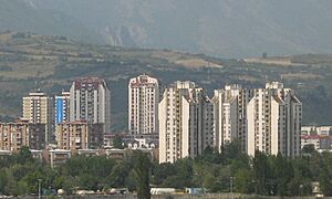
View over central Skopje with the Vardar river
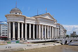
Archaeological Museum of North Macedonia
Macedonia Square
Skopje Fortress (Kale)
Porta Macedonia
Church of St. Clement of Ohrid
Stone Bridge
|
|||
|
|||

Skopje
Location in Republic of North Macedonia

Skopje
Location in Balkans

Skopje
Location in Europe
|
|||
| Country | |||
| Region | Skopje Statistical | ||
| Municipality | Greater Skopje | ||
| Government | |||
| • Type | Special unit of local self-government | ||
| • Body | Skopje City Council | ||
| Area | |||
| • Greater Skopje | 571.46 km2 (220.64 sq mi) | ||
| • Urban | 337.80 km2 (130.43 sq mi) | ||
| • Metro | 1,854.00 km2 (715.83 sq mi) | ||
| Elevation | 240 m (790 ft) | ||
| Population
(2021)
|
|||
| • Greater Skopje | 526,502 | ||
| Demonym(s) | Skopjan Macedonian: Skopjanec/Skopjanka Скопјанец/Скопјанка Albanian: Shkupjan (m), Shkupjane (f) |
||
| Official Language(s) | |||
| • primary | Macedonian, Albanian | ||
| Time zone | UTC+1 (CET) | ||
| • Summer (DST) | UTC+2 (CEST) | ||
| Postal codes |
МК-10 00
|
||
| Area code(s) | +389 2 | ||
| ISO 3166 code | MK-85 | ||
| Car plates | SK | ||
| HDI (2021) | 0.802 very high · 1st of 8 |
||
| Climate | BSk | ||

.JPG)
.jpg)


.jpg)


Skopje is the capital and largest city of North Macedonia. It is the country's main center for politics, culture, economy, and education. Skopje is located in the Skopje Basin, a valley surrounded by mountains.
The city has a long history, dating back to Roman times. It was known as Scupi in the 2nd century AD. Over centuries, it was ruled by different empires, including the Byzantine Empire, the Bulgarian Empire, and the Serbian Empire. In 1392, the Ottoman Turks took control and called it Üsküb. They ruled for over 500 years.
In 1912, Skopje became part of the Kingdom of Serbia during the Balkan Wars. After World War I, it joined the new Kingdom of Yugoslavia. During World War II, it was captured by Bulgaria. In 1945, it became the capital of SR Macedonia within Yugoslavia. The city grew fast, but a huge earthquake in 1963 caused a lot of damage.
Skopje sits on the upper part of the Vardar River. It is an important stop on the main route between Belgrade and Athens. The city is a hub for industries like chemicals, wood, textiles, and metals. It also has strong trade, banking, and cultural sectors. In 2021, Skopje had a population of 526,502 people.
Contents
- Understanding Skopje's Name
- Skopje's Location and Landscape
- Skopje's City Layout and People
- Skopje's Long History
- Skopje's Symbols
- How Skopje is Governed
- Skopje's Economy
- Skopje's Population and Diversity
- Media in Skopje
- Sports in Skopje
- Getting Around Skopje
- Skopje's Culture
- People from Skopje
- Skopje's International Connections
- See also
Understanding Skopje's Name

The city's name has changed many times throughout history. The first mention of the city was around 150 AD by Ptolemy. He called it Scupi in Latin and Σκοῦποι in ancient Greek. This name likely came from older local names.
The Albanian name for the city, Shkup, comes directly from the Roman name Scupi. This shows that Albanians lived in the area a long time ago. The definite form of Shkup in Albanian is Shkupi.
The name Skopje comes from the local Slavic (Macedonian) way of saying Scupi. When the Ottomans ruled, they called it "Üsküb". Western countries also used names like "Uskub" or "Uskup" until 1912. Some sources also called it "Scopia" or "Skopia".
In 1912, when Vardar Macedonia became part of the Kingdom of Serbia, the city was officially named "Skoplje". After World War II, the name was changed to "Skopje" to match the standard Macedonian pronunciation.
Skopje's Location and Landscape
City's Natural Setting
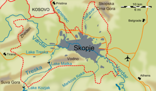
Skopje is in the northern part of North Macedonia. It is in the center of the Balkan peninsula, about halfway between Belgrade and Athens. The city is built in the Skopje valley, which stretches from west to east. The Vardar river flows through the valley and eventually reaches the Aegean Sea in Greece.
The valley is about 20 kilometers (12 miles) wide. Mountains to the north and south limit how much the city can grow. Skopje spreads out along the Vardar river and the Serava, a smaller river from the north. The city's administrative area is over 33 kilometers (20 miles) long but only 10 kilometers (6 miles) wide.
Skopje is about 245 meters (804 feet) above sea level. It covers an area of 571.46 square kilometers (220.64 sq mi). The developed part of the city is 337 square kilometers (130 sq mi). Many villages and smaller towns, like Dračevo and Bardovci, are also within Skopje's administrative borders. In 2021, the City of Skopje had 526,502 people.
The City of Skopje touches the Kosovo border to the northeast. It is also surrounded by several other municipalities.
-
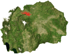
The city of Skopje; its administrative limits are in red.
-
Location of Skopje in North Macedonia
-
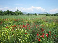
Landscape of the Skopje valley, near Bardovci

.png)

Rivers and Lakes in Skopje
The Vardar river flows through Skopje. It is about 60 kilometers (37 miles) from its source. In Skopje, the river's average flow is 51 cubic meters per second. This can change a lot with the seasons. The water temperature ranges from 4.6 °C (40.3 °F) in January to 18.1 °C (64.6 °F) in July.
Several other rivers join the Vardar within the city. The largest is the Treska, which is 130 kilometers (81 miles) long. It flows through the Matka Canyon before meeting the Vardar. The Lepenac river comes from Kosovo and joins the Vardar in the northwest. The Serava river used to flow through the Old Bazaar. It was diverted in the 1960s because it was very polluted. Now, it joins the Vardar near the ruins of Scupi. Markova Reka comes from Mount Vodno and meets the Vardar in the east. These three rivers are all shorter than 70 kilometers (43 miles).
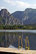
Skopje also has two artificial lakes on the Treska river. Lake Matka was created by a dam in the 1930s. Treska lake was dug in 1978 for fun activities. There are also three small natural lakes near Smilkovci, in the northeast.
The Vardar river has caused many floods in the past, like in 1962. Since the Kozjak dam was built in 1994, the risk of floods is very low.
Underground, there is a large water table fed by the Vardar river. This acts like an underground river. Most of Skopje's drinking water comes from a natural spring in Rašče, west of the city.
-
The Treska lake
-
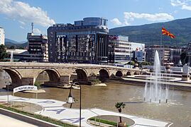
The Vardar and the Stone Bridge, a symbol of the city
-
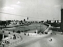
The main river running through the centre of Skopje, c. 1950
-
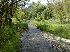
The Serava north of the city


Skopje's Ground and Mountains
The Skopje valley is surrounded by mountains. To the west are the Šar Mountains. To the south is the Jakupica range. Hills from the Osogovo range are to the east. The Skopska Crna Gora mountains are to the north. Mount Vodno, the highest point in the city, is 1066 meters (3,497 feet) high. It is part of the Jakupica range.
Even though Skopje is at the foot of Mount Vodno, most of the city is flat. There are a few smaller hills, often covered with trees and parks. These include Gazi Baba hill (325 m), Zajčev Rid (327 m), and the hill where Skopje Fortress is built.
Skopje is located near a fault line between the African and Eurasian tectonic plates. This means the area has regular earthquakes. Big earthquakes hit Skopje in 518, 1555, and 1963.
The ground beneath Skopje is made of layers of sand, silt, and clay. In some areas, the ground is karstic, which means it has caves. The Matka Canyon has ten caves, ranging from 20 to 176 meters (66 to 577 feet) deep.
-
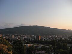
Mount Vodno in the background overlooking Skopje
-
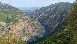
The Matka Canyon on the western edge of the City of Skopje
-
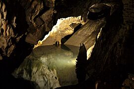
A cave at the Matka Canyon


.jpg)
Skopje's Climate and Weather
Skopje has a climate that is mostly humid subtropical. This means it has hot, dry summers and relatively cold, wet winters. The average yearly temperature is 12.6 °C (54.7 °F).
Summers are long and hot, with low humidity. The average high temperature in July is 32 °C (90 °F). Skopje usually has 88 days a year above 30 °C (86 °F). Winters are short and cold. Snow is common, but heavy snow that stays for a long time is rare.
In summer, temperatures often go above 31 °C (88 °F) and can sometimes reach over 40 °C (104 °F). Spring and autumn temperatures are usually between 15 °C (59 °F) and 24 °C (75 °F). In winter, daytime temperatures are around 5-10 °C (41-50 °F), but nights can drop below 0 °C (32 °F), sometimes even below -10 °C (14 °F).
Rainfall is spread throughout the year, but it is heaviest from October to December and from April to June.
| Climate data for Skopje International Airport (1991−2020 normals, extremes 1949−present) | |||||||||||||
|---|---|---|---|---|---|---|---|---|---|---|---|---|---|
| Month | Jan | Feb | Mar | Apr | May | Jun | Jul | Aug | Sep | Oct | Nov | Dec | Year |
| Record high °C (°F) | 19.6 (67.3) |
24.6 (76.3) |
34.2 (93.6) |
35.0 (95.0) |
35.8 (96.4) |
41.1 (106.0) |
42.8 (109.0) |
43.2 (109.8) |
38.2 (100.8) |
33.9 (93.0) |
28.2 (82.8) |
22.1 (71.8) |
43.2 (109.8) |
| Mean daily maximum °C (°F) | 4.8 (40.6) |
9.0 (48.2) |
14.5 (58.1) |
19.4 (66.9) |
24.4 (75.9) |
29.2 (84.6) |
32.0 (89.6) |
32.3 (90.1) |
26.7 (80.1) |
20.1 (68.2) |
12.5 (54.5) |
5.9 (42.6) |
19.2 (66.6) |
| Daily mean °C (°F) | 0.2 (32.4) |
3.0 (37.4) |
7.7 (45.9) |
12.4 (54.3) |
17.2 (63.0) |
21.7 (71.1) |
24.1 (75.4) |
24.1 (75.4) |
19.0 (66.2) |
13.1 (55.6) |
6.9 (44.4) |
1.8 (35.2) |
12.6 (54.7) |
| Mean daily minimum °C (°F) | −3.3 (26.1) |
−1.6 (29.1) |
1.9 (35.4) |
5.7 (42.3) |
10.3 (50.5) |
14.3 (57.7) |
16.3 (61.3) |
16.2 (61.2) |
12.2 (54.0) |
7.6 (45.7) |
2.8 (37.0) |
−1.4 (29.5) |
6.7 (44.2) |
| Record low °C (°F) | −25.6 (−14.1) |
−22.0 (−7.6) |
−19.0 (−2.2) |
−6.0 (21.2) |
−1.6 (29.1) |
3.2 (37.8) |
5.8 (42.4) |
4.3 (39.7) |
−2.3 (27.9) |
−6.4 (20.5) |
−12.2 (10.0) |
−22.9 (−9.2) |
−25.6 (−14.1) |
| Average precipitation mm (inches) | 30 (1.2) |
29 (1.1) |
38 (1.5) |
40 (1.6) |
43 (1.7) |
54 (2.1) |
38 (1.5) |
36 (1.4) |
34 (1.3) |
49 (1.9) |
45 (1.8) |
48 (1.9) |
483 (19.0) |
| Average precipitation days | 10 | 9 | 10 | 10 | 11 | 10 | 7 | 6 | 6 | 7 | 9 | 11 | 106 |
| Average snowy days | 5 | 5 | 3 | 0.2 | 0 | 0 | 0 | 0 | 0 | 0.1 | 2 | 5 | 20 |
| Average relative humidity (%) | 83 | 75 | 68 | 66 | 66 | 61 | 56 | 56 | 63 | 74 | 82 | 85 | 70 |
| Mean monthly sunshine hours | 86.9 | 112.5 | 161.1 | 198.4 | 245.2 | 276.3 | 323.0 | 305.4 | 247.5 | 188.2 | 114.8 | 79.6 | 2,339 |
| Source 1: World Meteorological Organization (precipitation days) | |||||||||||||
| Source 2: NOAA (sun, 1961–1990), UHMR (extremes, 1951-present) | |||||||||||||
Skopje's Environment and Green Spaces
Skopje has many different natural areas with rich plant and animal life. However, farming and city growth threaten these areas. Mount Vodno is the largest protected area within the city. It is a popular place for people to relax and enjoy nature. A cable car goes to its peak, and there are many walking paths through its forests. The Matka Canyon is another beautiful natural spot.
The city itself has 4,361 hectares (10,780 acres) of parks and gardens. These include the City Park, built by the Ottomans, and Žena Borec Park. Many streets and boulevards are lined with trees.
Steel production, an important industry, causes soil pollution with heavy metals like lead and zinc. It also pollutes the air with gases like nitrogen oxide. Car traffic and heating plants also add to air pollution.
Water treatment plants are being built, but some polluted water still goes into the Vardar river. Waste is dumped in an open landfill 15 kilometers (9 miles) north of the city. This landfill receives a lot of trash every day. Even with these issues, health levels in Skopje are better than in other parts of North Macedonia.

Skopje's City Layout and People
How Skopje is Built

The earthquake on July 26, 1963, greatly changed Skopje. It destroyed 80% of the city. The reconstruction that followed also shaped the city. For example, new neighborhoods were built with lower population density. This was done to reduce damage from future earthquakes.
Polish architect Adolf Ciborowski helped plan the rebuilding. He had also planned the reconstruction of Warsaw after World War II. Ciborowski divided Skopje into areas for specific activities. The Vardar riverbanks became parks. Areas between main roads got tall apartment buildings and shopping centers. Suburbs were set aside for individual houses and factories. The rebuilding had to be fast to house families and restart the economy. More roads were built to help with future city growth.

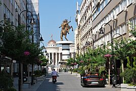
South of the Vardar river, you can see many tall buildings. The large Karpoš neighborhood was built here in the 1970s. East of the center, the new Aerodrom area was planned in the 1980s for 80,000 people. The city center, designed by Japanese architect Kenzo Tange, is between Karpoš and Aerodrom. It has a ring of long buildings that look like a wall.
On the north side of the river, where the oldest parts of the city are, the Old Bazaar was repaired. Buildings around it were kept low so they wouldn't block views of the Skopje Fortress. Some important places, like the university, were moved to the north bank. This was done to help different ethnic groups mix more. The north bank is mostly home to Muslim Albanians, Turks, and Roma. Christian ethnic Macedonians mostly live on the south bank.
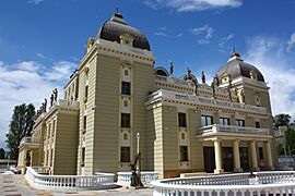
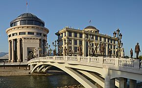
The earthquake left few old buildings. The rebuilding from the 1960s to 1980s made Skopje a very modern city. In the late 2000s, the city center changed again. A project called "Skopje 2014" was started. It aimed to give the city a more historic look. Old buildings destroyed in 1963, like the national theater, were rebuilt. Streets and squares were also improved. Many new things were added, such as fountains, statues, and bridges. This project was debated because of its cost and old-fashioned style. The large Albanian minority felt left out. They started their own projects, like a new square near the Old Bazaar.
-
Vapcarov Street, in the city centre
-
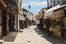
A street in the Old Bazaar
-
Highrise housing in Karpoš
-
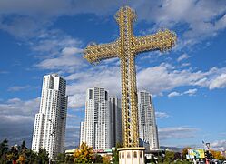
"Macedonian Cross" and Cevahir Towers.
-
The archeological museum, one of the elements of "Skopje 2014"

.jpg)


Skopje's Diverse Communities

Skopje is a city with many different ethnic groups. People often live in certain areas based on their background and religion. Macedonians make up 66% of the city's population. Albanians are 20%, and Roma are 6%.
Macedonians mostly live south of the Vardar river. These areas were rebuilt after the 1963 earthquake. Muslims live on the northern side, in the older parts of the city. The northern areas are generally poorer. This is especially true for Topaana and Šuto Orizari municipality, which are the main Roma neighborhoods. Many houses there are built without official permits and lack proper electricity or water.
Šuto Orizari is a unique municipality where Romani is an official local language. It was developed after the 1963 earthquake to house Roma people who lost their homes.
The amount of living space per person varies greatly. In 2002, the city average was 19.41 square meters (209 sq ft) per person. In the Centar area on the south bank, it was 24 square meters (258 sq ft). In Čair on the north bank, it was only 14 square meters (151 sq ft). In Šuto Orizari, it was 13 square meters (140 sq ft).
Villages and Outer Areas
.JPG)
Outside the main city area, Skopje includes many small settlements. Some are growing into outer suburbs, like Čento, which has over 23,000 people, and Dračevo, with almost 20,000 people. Other large settlements are north of the city, such as Radišani, with 9,000 people. Smaller villages can be found on Mount Vodno or in Saraj municipality, which is the most rural of Skopje's ten municipalities.
Some places just outside the city limits are also becoming suburbs. These areas, especially in Ilinden and Petrovec municipality, benefit from major roads, railways, and the airport.
Air Pollution in Skopje

Air pollution is a big problem in Skopje, especially in winter. Levels of tiny particles (PM2 and PM10) are often more than twelve times higher than what the WHO recommends. In winter, smoke can make it hard to see and cause problems for drivers. Skopje is one of the most polluted cities in Europe.
This high pollution comes from many sources. Smoke from houses, factory emissions, and vehicles all contribute. Many homes burn wood, old tires, plastic, and other waste for heating because central heating is too expensive. This releases harmful chemicals into the air.
The city's smog has made the air quality poor and affected people's health. Many citizens have become sick from pollution-related illnesses.
An app called AirCare (MojVozduh) helps people track pollution levels. It uses a traffic light system: purple for very high pollution, red for high, amber for moderate, and green for safe air. The app uses data from both government and volunteer sensors.
In December 2017, Skopje was ranked as one of the most polluted cities in the world. The city has tried to reduce pollution, for example, by installing a "CityTree" in 2017. In November 2019, thousands of people marched to protest the government's lack of action. Pollution has worsened since 2017, leading to about 1300 deaths each year.

Skopje's Long History
Early Settlements in Skopje
The first people to settle in Skopje lived on the rocky hill where Skopje Fortress now stands. The oldest signs of human life there are from the Copper Age (4th millennium BC).
This early settlement was important, but it became less active during the Bronze Age. Later, during the Iron Age, a new town called Scupi grew up about 5 kilometers (3 miles) west of the fortress. Scupi was a busy place because it was on a trade route between the Danube river and the Aegean Sea.
During the Iron Age, the Skopje area was home to the Dardani people. They remained independent even after the Romans conquered Macedon. The Dardani likely lost their independence around 28 BC.
Roman Scupi: A Prosperous City
The Romans took control of Scupi around 81–96 AD. It became a Roman colony for soldiers, mainly veterans from the Legio VII Claudia. Scupi was first a military base to keep peace in the region. It was officially named "Colonia Flavia Scupinorum." Later, it became part of the province of Moesia. In 86 AD, Scupi became a colonial city and a government center in the new province of Moesia Superior.
The city's population was very mixed. Tombstone writings show that only a few people came from Italy. Many soldiers were from other parts of the Roman Empire, like Dalmatia, Gaul, and Syria. Because of this mix, Latin remained the main language in Scupi.
Scupi grew and became very prosperous. The late 3rd and 4th centuries were especially good times. The first church was built during the rule of Constantine the Great, and Scupi became the seat of a diocese (a church district). In 395, when the Roman Empire split, Scupi became part of the Eastern Roman Empire.
At its peak, Scupi covered 40 hectares (99 acres) and was surrounded by a 3.5-meter (11.5 ft) thick wall. It had many important buildings, including a theater, public baths (thermae), and a large Christian church.
Skopje in the Middle Ages

In 518, a powerful earthquake destroyed Scupi. The city's people had already fled due to threats from invaders. The city was rebuilt by Justinian I. Many Byzantine towns were moved to hills for better defense. Scupi was moved to the promontory where the fortress now stands.
However, Slavs attacked Scupi in the late 6th century, and the city fell under Slavic rule in 595. The city was deserted for some time. Byzantines later resettled the area. In the 830s, it became part of the growing First Bulgarian Empire.
From the late 10th century, Skopje faced many wars. It was the Bulgarian capital from 972 to 992. In 1004, the Byzantine Empire took it over. Skopje was briefly captured by Slavic rebels in 1040 and 1072. In 1081, Norman troops took Skopje but left in 1088. Serbian Prince Vukan captured it in 1093.
.jpg)
During the 12th and 13th centuries, Bulgarians and Serbs formed large kingdoms. Skopje was part of the Second Bulgarian Empire from 1203 to 1246. In 1282, Serbian king Stefan Milutin captured Skopje. Under Serbian rule, the city grew outside the fortress walls. Churches, monasteries, and markets were built. Traders from Venice and Dubrovnik opened shops.
In the 14th century, Skopje became so important that King Stefan Dušan made it the capital of the Serbian Empire. In 1346, he was crowned "Emperor of the Serbs and Greeks" in Skopje. After his death, the Serbian Empire broke apart. Skopje was eventually taken by the Ottoman Empire in 1392.
Skopje Under Ottoman Rule

The Ottomans ruled Skopje for over 520 years. The city's economy thrived because of its central location in Rumelia, the European part of the Ottoman Empire. The Stone Bridge was rebuilt between 1451 and 1469. The Ottomans greatly changed the city's look. They organized the Bazaar with its inns (caravanserais), mosques, and public baths.
In 1535, all churches were ordered to be demolished by the Ottoman governor. In 1555, another strong earthquake hit the city, causing much damage. The Old Bazaar, parts of the Stone Bridge, and church murals were badly damaged.

Until the 17th century, Skopje had a long "golden age." Around 1650, Skopje had between 30,000 and 60,000 people. It was one of the largest cities in the region.
The city suffered greatly during the Great Turkish War in the late 17th century. In 1689, the Hapsburgs captured Skopje. General Silvio Piccolomini ordered the city to be burned to stop a cholera epidemic. Skopje burned for two days. The general himself died from the plague. After the war, Skopje was in ruins. Many people left the city. By 1836, Skopje had only about 10,000 people.
Skopje began to recover after 1850. Its population slowly grew, partly due to people moving from rural areas. Muslims also moved there from Serbia and Bulgaria as those countries gained independence. In 1873, the Skopje-Salonica railway was built, which helped the economy. The train station was built south of the Vardar river, leading to new development there. In 1877, Skopje became the capital of the new Kosovo Vilayet.
By 1900, Skopje had 31,900 people. This included Turks, Christian Bulgarians, Romani, Jews, and others. Many Albanians living in Skopje were counted as Turks. By 1905, the city had 32,000 people. The local economy focused on dyeing, weaving, leatherwork, and metalwork.
Skopje was one of the main centers for the Internal Macedonian Revolutionary Organization. This group led the 1903 Ilinden uprising. In 1908, after the Young Turk Revolution, the Ottoman Empire became more democratic. However, new policies upset minorities. Albanians led uprisings in 1910 and 1912. In August 1912, they took Skopje.
-
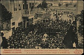
Bulgarian manifestation in support of the Young Turk Revolution
-
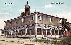
The Church of the Nativity of the Theotokos, seat of the Bulgarian Orthodox Diocese of Skopje, built in the 19th century
-
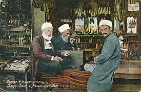
Cutlers in the Old Bazaar around 1900


From Balkan Wars to Today

In 1912, Bulgaria, Greece, and Serbia formed an alliance and declared war on the Ottoman Empire. Their goal was to remove the Ottomans from Europe. The First Balkan War began on October 8, 1912. Serbian forces reached Skopje on October 26. Ottoman forces had left the day before. During this time, Serbian irregular forces destroyed the Albanian quarter of Skopje and killed many Albanian residents. After the Serbian takeover, 725 Muslim families left the city. In 1913, Serbian authorities estimated the city's population at 37,000.

In 1915, during First World War, Bulgaria invaded Serbian Macedonia and captured Skopje on October 22. After the war, Vardar Macedonia became part of the new Kingdom of Serbs, Croats, and Slovenes. Skopje was named the capital of the Vardar Banovina in 1931. Until Second World War, Skopje grew economically and its population increased. It had 41,066 people in 1921, and 80,000 in 1941. Skopje had 45 factories, which was half of all industry in Socialist Macedonia.

In 1941, during World War II, Nazi Germany invaded Yugoslavia. Germans took Skopje on April 8 and gave it to their Bulgarian allies on April 22, 1941. The 4,000 Jews of Skopje were sent to the Treblinka extermination camp in 1943, where most were killed.
Skopje was freed on November 13, 1944, by Bulgarian and Yugoslav Partisans forces. Skopje became the capital of the new Democratic Federal Macedonia.

After World War II, Skopje benefited from Yugoslav policies that supported industry and Macedonian culture. Skopje got a national library, a philharmonic orchestra, a university, and the Macedonian Academy of Sciences and Arts. However, the 1963 earthquake greatly changed its development. The earthquake killed 1,070 people and injured 3,300. 16,000 people were trapped in ruins, and 70% of the population lost their homes. Many schools, factories, and historical buildings were destroyed.
_-_panoramio_(151).jpg)
Reconstruction after the earthquake was fast. It had a big impact on people because neighborhoods were split up. Many Albanians from Kosovo helped rebuild the city. The reconstruction finished by 1980. Skopje's look changed a lot, becoming a true example of modernist architecture. The population grew rapidly after 1963, reaching 408,100 people in 1981. Rural youth moved to Skopje to help with rebuilding. The Albanian population also grew as people moved from northern villages and Kosovo. In the 1980s and 1990s, the country faced economic problems. Things improved in the 2000s with new investments. Many landmarks were restored, and the "Skopje 2014" project changed the city center's appearance.
Skopje's Symbols
The Flag of Skopje is a red flag with a gold-colored coat of arms in the top-left corner. It can be displayed vertically or horizontally.
The city's coat of arms was adopted in the 1950s. It shows the Stone Bridge over the Vardar river. It also features the Kale Fortress and the snowy peaks of the Šar mountains.
How Skopje is Governed
City's Special Status
.png)
As the capital and largest city of North Macedonia, Skopje has a special status under the law. Its status was last updated in 2004. Since then, the City of Skopje has been divided into 10 municipalities. Each municipality has its own council and mayor, just like other municipalities in the country.
These municipalities handle local matters. The City of Skopje government deals with issues that affect all municipalities or cannot be split between them.
The City of Skopje is part of the Skopje Statistical Region. This region does not have political or administrative power.
City Council and Mayor
The City Council has 45 members, who serve for four years. They decide on the budget, overall plans, and how the city works with the national government. There are also special committees for topics like city planning and finances. The President of the council is chosen by the council members. Since 2021, the president has been Trajko Slaveski.
The Mayor of Skopje is also elected every four years. The mayor represents the city and can suggest ideas to the council. They also manage the city's administrative offices and staff.
Skopje's Municipalities
Skopje was first divided into administrative areas in 1945. The first municipalities were created in 1976. There were five: Centar, Čair, Karpoš, Gazi Baba, and Kisela Voda.
After North Macedonia gained independence in 1991, power became more centralized. Municipalities lost some of their responsibilities. A 1996 law gave them back their powers and created two new municipalities: Ǵorče Petrov and Šuto Orizari.
After the conflict between Albanian rebels and Macedonian forces in 2001, a new law in 2004 added Saraj Municipality to the City of Skopje. Saraj is mostly populated by Albanians. This change meant Albanians made up more than 20% of the city's population. As a result, Albanian became the second official language of the city administration. This was one of the demands of the Albanian rebels. In the same year, Aerodrom Municipality separated from Kisela Voda, and Butel Municipality from Čair.
Municipalities are run by a council of 23 members, elected every four years. They also have a mayor and departments for things like education and culture.
|
 |
|
Skopje's Economy
Economic Importance

Skopje is a medium-sized city in Europe. As the capital and largest city of North Macedonia, it holds a big part of the country's economy. The Skopje Statistical Region, which includes Skopje and nearby towns, produces 45.5% of North Macedonia's total economic output (GDP). In 2009, the average income per person in this region was US$6,565. This was 155% of the national average.
Many Macedonians who live outside Skopje work in the capital. The city's growth also attracts people from other countries like Kosovo, Albania, and southern Serbia.
Businesses and Industries
In 2009, Skopje had 26,056 businesses. Most of them were small or very small. A large number of businesses (9,758) were involved in trade. Others focused on real estate (3,839) and manufacturing (2,849). Even though there were few large companies, they made up 51% of the local production, not counting finance.

Skopje's industry is mainly about food processing, textiles, printing, and metal processing. In 2012, these industries made up 30% of the city's GDP. Most industrial areas are in Gazi Baba municipality, along the main roads and rail lines to Belgrade and Thessaloniki. Big companies like ArcelorMittal, Makstil steel plants, and the Skopje Brewery are located there. Other industrial zones are between Aerodrom and Kisela Voda, along the railway to Greece. These include Alkaloid Skopje (pharmaceuticals), Rade Končar (electrical supplies), Imperial Tobacco, and Ohis (fertilizers).
There are also two special economic zones near the airport and the Okta refinery. These zones have attracted foreign companies like Johnson Controls, Johnson Matthey, and Van Hool.
As the country's financial center, Skopje is home to the Macedonian Stock Exchange and the National Bank of North Macedonia. Most of the country's banks, insurance companies, and telecom companies are also here. The services sector makes up 60% of the city's GDP.
.jpg)
Skopje has many small traditional shops and two large markets: the "Zelen Pazar" (green market) and the "Bit Pazar" (flea market). These are important local places. However, since the 1970s, shopping has become more modern. Skopje now has many supermarkets and shopping centers. The largest, Skopje City Mall, opened in 2012. It has a Carrefour hypermarket, 130 shops, and a cinema, employing 2,000 people.

Jobs in Skopje
More than half (51%) of Skopje's working population is employed in small businesses. About 52% work in the services sector, and 34% work in industry. The rest are mainly in administration.
In 2009, the unemployment rate for the Skopje Statistical Region was 27%. This was slightly lower than the national rate of 30%. Unemployment in Skopje mostly affects men, people aged 25-44, and those without special qualifications. It also affects Roma people, with 70% of the active Roma population being unemployed.
In October 2010, the average monthly wage in Skopje was about €400. This was 120% of the national average.
Skopje's Population and Diversity
| Historical population | ||
|---|---|---|
| Year | Pop. | ±% p.a. |
| 1921 | 41,000 | — |
| 1931 | 68,880 | +5.32% |
| 1948 | 88,355 | +1.48% |
| 1953 | 120,130 | +6.34% |
| 1961 | 166,870 | +4.19% |
| 1971 | 314,552 | +6.54% |
| 1981 | 448,200 | +3.60% |
| 1991 | 444,760 | −0.08% |
| 2002 | 506,926 | +1.20% |
| 2021 | 526,502 | +0.20% |
Population Growth

According to the 2021 census, the City of Skopje had 526,502 people. Skopje's job market covers a large part of the country, including nearby cities like Veles and Kumanovo. More than a million people live in this wider area.
Skopje has about a quarter of North Macedonia's total population. The second largest municipality, Kumanovo, had 107,632 people in 2011.
Before the war in the late 1600s and the Great Fire of 1689, Skopje was one of the biggest cities in the Balkans. It had an estimated 30,000 to 60,000 people. After the fire, its population dropped to 10,000 in 1836. However, it started to grow again after 1850, reaching 32,000 in 1905. In the 20th century, Skopje was one of the fastest-growing cities in Yugoslavia. It had 448,200 people in 1981. Since then, its population has continued to grow steadily.
Diverse Ethnic Groups
Skopje is known for its many different ethnic groups. The city is where Macedonians and Albanians meet. Throughout history, it has also had populations of Bulgarians, Romani, Turks, Jews, and Serbs. Until the 19th century, Skopje was mainly a Muslim city. Then, many Christians began to settle there.
According to the 2021 census, Macedonians are the largest group, with 309,107 people (58.71%). Next are Albanians with 120,293 people (22.85%). Roma make up 18,498 people (3.51%). There are also Serbs (9,478), Turks (8,524), Bosniaks (7,365), and Aromanians (2,778).
Macedonians are the majority in municipalities south of the Vardar river, like Aerodrom and Centar. They are also a majority in Butel and Gazi Baba, north of the river. Albanians are the majority in Čair (around the Old Bazaar) and in Saraj. They are a large minority in Butel and Gazi Baba. Šuto Orizari, on the northern edge of the city, is mostly Roma. If an ethnic minority makes up at least 20% of a municipality's population, their language can become official there. So, Albanian is official in Čair and Saraj, and Romani is official in Šuto Orizari. This makes Šuto Orizari the only municipality in the world where Romani is an official language.
Relations between Macedonians and Albanians can sometimes be difficult. Each group sees itself as the original population of Skopje. The Roma minority faces many challenges. Their exact population is hard to know because some Roma do not identify as such in censuses. However, Skopje is believed to have the largest Roma population in the world.
Religious Beliefs in Skopje

Skopje has many different religions. Macedonians, Serbs, and Aromanians are mainly Orthodox Christians, mostly belonging to the Macedonian Orthodox Church. Turks are almost all Muslim. Most Albanians are Muslim, but Skopje also has a significant Roman Catholic Albanian community, including where Mother Teresa was born. The Roma people are a mix of Muslim and Orthodox faiths.
According to the 2002 census, 68.5% of Skopje's population was Orthodox, and 28.6% was Muslim. The city also had smaller groups of Catholics (0.5%) and Protestants (0.04%).
Before World War II, Skopje had a notable Jewish community. Most of them were Sephardis who had escaped the Inquisition in Spain. In 1939, there were 2,424 Jews in Skopje. However, most were sent away and killed by Nazis. After the war, most survivors moved to Israel. Today, there are about 200 Jewish people in the city.
Because of its 520-year Ottoman past and its current Muslim population, Skopje has more mosques than churches. Religious groups often ask for more places of worship. Skopje is home to many Macedonian religious organizations, like the Macedonian Orthodox Church and the Islamic Religious Union of Macedonia. It has an Orthodox cathedral, several Islamic schools (madrasahs), a Roman Catholic cathedral, and a synagogue.
Education in Skopje

People in Skopje are generally more educated than in the rest of North Macedonia. 16% of Skopje residents have a university degree, compared to 10% for the rest of the country. The number of people with little or no education is lower in Skopje (9%) than the national average (17%). Also, 80% of Macedonian citizens with a PhD live in Skopje.
Skopje has 21 secondary schools. Five of these are general high schools (gymnasiums), and 16 are vocational schools that teach specific trades. The city also has several higher education institutions. The most famous is Ss. Cyril and Methodius University, founded in 1949. It has 23 departments and 10 research institutes, with about 50,000 students. After the country became independent in 1991, several private universities opened. The largest private universities in Skopje are European University Skopje and FON University.
Media in Skopje

Skopje is the biggest media center in North Macedonia. In 2000, out of 818 newspapers surveyed, over 600 had their main offices in Skopje. The daily newspaper Dnevnik, started in 1996, prints 60,000 copies a day, making it the most printed newspaper in the country. Večer, also based in Skopje, prints 50,000 copies. The state owns part of Večer and Nova Makedonija. Other major private newspapers include Utrinski Vesnik, Vest, and Vreme.
The city is home to the studios of Macedonian Radio-Television (MRT), the country's public broadcaster. MRT started in 1966 and has three national TV channels that broadcast 24 hours a day. Popular private TV stations include Sitel, Kanal 5, Telma, Alfa TV, and AlsatM. MRT also runs national radio stations. Private radio stations like Antenna 5 and Metropolis are also based in Skopje.
Skopje also has major news agencies, both public, like the Media Information Agency, and private, like Makfax.
Sports in Skopje
As the capital, Skopje has many important sports facilities. The city has three large swimming pools, two of which are Olympic-sized. These pools are great for water polo teams. Skopje also has many football stadiums, like Ilinden and Železarnica, which can hold 4,000 to 4,500 fans. The Kale basketball court holds 2,200 people, and the Jane Sandanski court has 6,000 seats.

The largest stadium is Toše Proeski Arena. It was built in 1947 and was fully renovated starting in 2009 to meet FIFA standards. The stadium has 33,460 seats, a health spa, and a fitness area. The Boris Trajkovski Sports Center is the country's largest sports complex, with 6,250 seats. It opened in 2008 and is named after former president Boris Trajkovski. It has rooms for handball, basketball, volleyball, a bowling alley, a fitness area, and an ice hockey rink. Its main hall can hold about 10,000 people for concerts.
FK Vardar and FK Rabotnički are the two most popular football teams in Skopje. Their games, and those of the national team, are played at Toše Proeski Arena. Skopje also has many smaller football clubs. Basketball is also popular, with teams like MZT Skopje and Rabotnički. Handball teams include RK Vardar PRO and RK Metalurg Skopje. Skopje co-hosted the 2008 European Women's Handball Championship and hosted the 2017 UEFA Super Cup football match.
Getting Around Skopje
Major Transport Connections

Skopje is close to three other capital cities: Prishtina (87 km/54 miles), Tirana (291 km/181 miles), and Sofia (245 km/152 miles). Thessaloniki is 233 km (145 miles) south, and Belgrade is 433 km (269 miles) north. Skopje is at the meeting point of two major European transport routes: Pan-European Corridor X, which goes from Austria to Greece, and Pan-European Corridor VIII, which goes from the Adriatic Sea in Albania to the Black Sea in Bulgaria.
Corridor X includes the M-1 motorway (E75), which is the longest highway in North Macedonia. It also includes the railway line between Tabanovce and Gevgelija. Corridor VIII is less developed and includes the M-4 motorway and the Kičevo-Beljakovce railway. Even though Skopje is close to other major cities, travel and trade are not always easy, especially with Albania, due to poor infrastructure.
The first highways were built during the Yugoslav period. Skopje was connected to Belgrade (then the Yugoslav capital) and the Greek border.
Train and Bus Stations

Skopje's main railway station serves international lines to Belgrade and Thessaloniki, and to Prishtina. When the Pan-European Corridor VIII railway project is finished (planned for 2030), the city will also be linked to Tirana and Sofia. Daily trains also connect Skopje with other towns in North Macedonia.
Skopje has smaller railway stations, but they only serve intercity or international lines. Some stations are only for freight.
Skopje's coach (bus) station opened in 2005. It is located right under the main railway station. It can handle 450 buses a day. Bus connections reach more places than trains, linking Skopje to many cities both inside North Macedonia and abroad, including Istanbul, Sofia, and Prague.
City Public Transport
_JSP_(1).jpg)
Skopje has a bus network run by the city and operated by three companies. The oldest and largest is JSP Skopje, a public company started in 1948. JSP runs 67 out of 80 bus lines. Many of JSP's buses are red double-decker buses, similar to classic British buses.
A tram network has been planned for a long time in Skopje. The idea first came up in the 1980s. The project became more serious in 2006. The first line is planned for 2019.
A new network for small buses started in June 2014. These buses help reduce the number of large buses in the city center.
Skopje International Airport
The airport was built in 1928. The first commercial flights from Skopje started in 1929, connecting the city with Belgrade. Later, the route was extended to Thessaloniki and Athens. The airport also connected Skopje with other cities in Yugoslavia.
Skopje International Airport is in Petrovec, 20 kilometers (12 miles) east of the city. Since 2008, it has been managed by a Turkish company. It can handle up to four million passengers per year. The number of passengers has grown steadily since 2008, reaching one million in 2014.
Skopje's airport has flights to several European cities, including Athens, Vienna, and London. It also has direct flights to Dubai and Doha, Qatar.
Skopje's Culture
Cultural Institutions

Skopje is home to North Macedonia's largest cultural institutions. These include the National and University Library "St. Kliment of Ohrid", the Macedonian Academy of Sciences and Arts, the National Theatre, the National Philharmonic Orchestra, and the Macedonian Opera and Ballet.
Local institutions include the Brothers Miladinov Library, which has over a million documents. The Cultural Information Centre organizes festivals, exhibitions, and concerts. The House of Culture Kočo Racin focuses on contemporary art and young artists.
Skopje also has several foreign cultural centers, such as the Goethe-Institut (German), the British Council, the Alliance française (French), and an American Corner.
The city has several theaters and concert halls. The Univerzalna Sala, built in 1966, seats 1,570 people and is used for concerts and other events. The Metropolis Arena can hold 3,546 people for large concerts. Other big halls include the Macedonian Opera and Ballet (800 seats) and the National Theatre (724 seats). Smaller venues also exist, like the Albanian Theatre and the Youth Theatre. A Turkish Theatre and a Philharmonic hall are currently being built.
Museums to Explore

The largest museum in Skopje is the Museum of the Republic of North Macedonia. It tells the history of the country. Its collections of religious art (icons) and stone carvings are very rich. The Macedonian Archeological Museum, opened in 2014, displays some of the best archeological finds from North Macedonia, from ancient times to the Ottoman period.
The National Gallery of Macedonia shows paintings from the 14th to the 20th century. It is located in two former Turkish baths in the Old Bazaar. The Contemporary Art Museum was built after the 1963 earthquake with international help. Its collections include art from Macedonia and other countries, with works by famous artists like Pablo Picasso.
The Skopje City Museum is inside the remains of the old railway station, which was destroyed by the 1963 earthquake. It focuses on local history and has departments for archeology, ethnology, history, and art history. The Memorial House of Mother Teresa was built in 2009 on the site of the church where the saint was baptized. The Museum of the Macedonian Struggle is about modern national history and the fight for Macedonian independence. Nearby is the Holocaust Memorial Center for the Jews of Macedonia. The Macedonian Museum of Natural History has about 4,000 items, and the 12-hectare Skopje Zoo is home to 300 animals.
Skopje's Architecture Through Time
_-_by_Pudelek_1.JPG)
Skopje has been destroyed many times, but it still has many historical buildings. These buildings show the different groups who have ruled the city. Skopje has one of the largest Ottoman building complexes in Europe, with many Ottoman structures still used today. After the 1963 earthquake, Skopje became a place for modernist building designs. In the early 21st century, the "Skopje 2014" project brought many new buildings. Skopje is a mix of old and new, East and West.

Skopje has some remains of very old architecture from the Stone Age at the Tumba Madžari site. On the other side of the city are the ruins of ancient Scupi, with a theater, baths, and a church. The Skopje Aqueduct, between Scupi and the city center, is a mystery. Its building date is unknown, but it was likely built by the Byzantines or Turks. It has 50 arches.

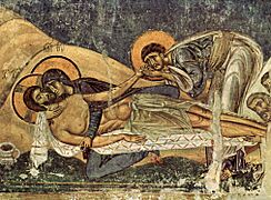
Skopje Fortress has been rebuilt many times. After the 1963 earthquake, it was restored to look like it did in medieval times. It is the only medieval monument in Skopje. However, several churches around the city show the Vardar architectural style from around 1300. These include churches around Matka Canyon and the church of Saint Panteleimon (12th century) in Gorno Nerezi. Its frescoes (wall paintings) are very expressive.

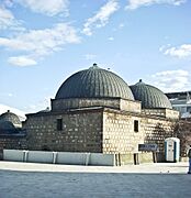
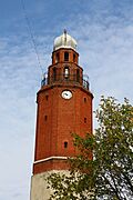
Examples of Ottoman architecture are found in the Old Bazaar. Mosques in Skopje usually have a simple design: a square base, a single dome, and a minaret. Their entrance often has a porch, like the Mustafa Pasha Mosque from the 15th century. Some mosques have unique looks. The Aladža Mosque was once covered with blue tiles, but they disappeared in the 1689 Great Fire. However, some tiles are still visible on the nearby tomb (türbe). Other Ottoman buildings include the 16th-century clock tower, a covered market (bedesten), three inns (caravanserais), two public baths (hammams), and the Stone Bridge.
The oldest churches in the city center, the Ascension and St Dimitri churches, were built in the 18th century after the 1689 Great Fire. They were both renovated in the 19th century. The Church of the Ascension is very small and partly buried so it doesn't stand taller than nearby mosques. In the 19th century, new churches were built, including the large Church of the Nativity of the Virgin Mary.

After 1912, when Skopje became part of Serbia, the city adopted more Western styles. Wealthy Serbs built grand houses like the 1926 Ristiḱ Palace. The architecture from that time looks similar to Central European styles. Some buildings are more creative, like the Neo-Moorish Arab House and the Neo-Byzantine train station, both built in 1938.
Modernism started appearing in 1933. However, it fully developed in Skopje after the 1963 earthquake. The city center's reconstruction was partly planned by Japanese architect Kenzo Tange, who designed the new train station. Macedonian architects also helped. Georgi Konstantinovski designed the City Archives building (1968) and the Goce Delčev student dorm (1975). Janko Konstantinov designed the Telecommunication Centre and the main post office (1974–1989). Slavko Brezovski designed the Church of St. Clement of Ohrid. These buildings are known for their unique style, inspired by brutalism.
The reconstruction made Skopje a truly modernist city, with large apartment blocks, plain concrete buildings, and green spaces. The city center was seen as gray and not very appealing. So, in 2010, local authorities launched the "Skopje 2014" project. This plan aimed to build many statues, fountains, bridges, and museums, costing about €500 million.
The project caused debate. Critics said the new buildings looked too old-fashioned and historic. The government was also criticized for the high cost and for not including enough monuments representing national minorities at first. However, monuments for minorities have since been added. Some people say the project turned Skopje into a "theme park" and "nationalistic kitsch." It shows how national identities are built and reflected in city spaces.
-
Fresco in the church of Saint Panteleimon
-
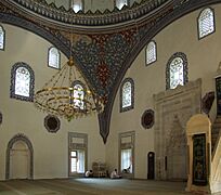
Interior of Mustafa Pasha Mosque
-
Daut Pasha Hammam
-
The historic clock tower
-

The Arab House
-
Macedonian National Theater
-
Art Bridge


.JPG)


Festivals and Events
The Skopje Jazz Festival happens every October since 1981. It is part of international jazz networks. Artists perform different styles like fusion, acid jazz, and avant-garde jazz. Famous musicians like Ray Charles and Al Di Meola have played there. Another music event is the Blues and Soul Festival, held every summer in early July.
The Skopje Cultural Summer Festival is a well-known event that takes place every summer. It includes concerts, operas, ballets, plays, art shows, and movies. It brings together 2,000 participants from around the world each year.
May Opera Evenings is a festival that has been held annually since 1972. It aims to share opera with everyone. Artists from about 50 countries have performed at this festival. There is also a major international theater festival called the Young Open Theater Festival (MOT). It happens every year in late September. Over 700 plays have been shown at this festival, many of them experimental. The MOT festival is part of an international network for performing arts.
The Skopje Film Festival is an annual event held in March. Over 50 films are shown at this five-day festival. Most are from North Macedonia and Europe, but it also includes non-commercial films from around the world.
Skopje's Nightlife

Skopje has a lively nightlife. There are many casinos, often connected to hotels. In 2010, the Colosseum club was ranked among the best clubs in Southeastern Europe. Many famous DJs and musicians have performed there. Large concerts are often held at the Toše Proeski Arena and Boris Trajkovski Sports Center.
For older people, kafeanas are popular. These are places where traditional Macedonian food is served, and traditional Macedonian music is played. Music from other Balkan countries is also popular. Besides traditional Macedonian restaurants, there are also restaurants with international food.
The Old Bazaar used to be a popular nightlife spot. The national government has a project to bring nightlife back to the Old Bazaar. Shops, cafés, and restaurants there now stay open later because many people visit. In the bazaar's restaurants, you can find traditional Macedonian wine and food, as well as dishes from Ottoman cuisine.
People from Skopje
Skopje's International Connections

Twin Towns and Sister Cities
Skopje has many twin towns and sister cities around the world:
 Bradford, United Kingdom (since 1961)
 Dijon, France (since 1961)
 Dresden, Germany (since 1967)
 Tempe, United States (since 1971)
- Roubaix, France (since 1973)
 Waremme, Belgium (since 1974)
- Nuremberg, Germany (since 1982)
 Chlef, Algeria (since 1983)
 Nanchang, China (since 1985)
 Manisa, Turkey (since 1985)
 Suez, Egypt (since 1985)
- Pittsburgh, United States (since 2002)
- Istanbul, Turkey (since 2003)
 Ljubljana, Slovenia (since 2007)
 Podgorica, Montenegro (since 2007)
 Zaragoza, Spain (since 2008)
 Zagreb, Croatia (since 2011)
 Tirana, Albania (since 2016)
 Sarajevo, Bosnia and Herzegovina (since 2017)
Partnerships
Skopje also has partnerships with:
See also
 In Spanish: Skopie para niños
