Anne Arundel County, Maryland facts for kids
Quick facts for kids
Anne Arundel County
|
|||
|---|---|---|---|
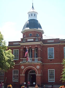
Anne Arundel County Courthouse in Annapolis
|
|||
|
|||
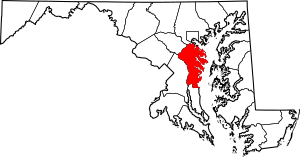
Location within the U.S. state of Maryland
|
|||
 Maryland's location within the U.S. |
|||
| Country | |||
| State | |||
| Founded | April 9, 1650 | ||
| Named for | Anne Arundell | ||
| Seat | Annapolis | ||
| Largest community | Glen Burnie | ||
| Area | |||
| • Total | 588 sq mi (1,520 km2) | ||
| • Land | 415 sq mi (1,070 km2) | ||
| • Water | 173 sq mi (450 km2) 29% | ||
| Population
(2020)
|
|||
| • Total | 588,261 | ||
| • Estimate
(2023)
|
594,582 |
||
| • Density | 1,000.4/sq mi (386.3/km2) | ||
| Time zone | UTC−5 (Eastern) | ||
| • Summer (DST) | UTC−4 (EDT) | ||
| Congressional districts | 3rd, 5th | ||
Anne Arundel County (/əˈrʌndəl/), also called AA or A.A. County, is a county in the state of Maryland, United States. In 2020, its population was 588,261 people. This was almost a 10% increase since 2010.
The county's main city and government center is Annapolis. Annapolis is also the capital city of Maryland. The county is named after Anne Arundell (around 1615/1616–1649). She was Lady Baltimore and the wife of Cecilius Calvert, 2nd Baron Baltimore, who founded the Province of Maryland colony. Anne Arundel County is part of the larger Central Maryland region. It is also part of the Washington–Baltimore–Arlington combined statistical area.
Contents
History
Anne Arundel County is named after Lady Anne Arundell (1615/1616–1649). She was the daughter of Thomas Arundell, a noble from Cornwall, England. Lady Anne married Cecilius Calvert, 2nd Baron Baltimore, who was the first leader of the Province of Maryland colony. Their marriage was arranged in 1627 or 1628.
Anne Arundel County was first part of St. Mary's County. St. Mary's was the first county created in Maryland in 1634. In 1650, the year after Lady Anne Arundell died, the county became its own area. It was the third of Maryland's 23 counties.
On March 25, 1655, a naval battle happened in Anne Arundel County. This was the Battle of the Severn, the first naval battle in North America. It was fought on the Severn River. Forces supporting the English government fought against those loyal to Lord Baltimore. The government forces won the battle.
In 1692, the Church of England became the official church of Maryland. The colony's ten counties were divided into 30 church areas called parishes. Anne Arundel County had four parishes.
Between 1694 and 1695, the capital of Maryland moved. It moved from St. Mary's City to Annapolis in Anne Arundel County. Before this, Annapolis was known as "Providence."
During the American Revolutionary War, people from Anne Arundel County helped the American army. They provided soldiers for three different regiments.
In the War of 1812, a famous U.S. Navy ship, the U.S.S. Constitution, sailed from Annapolis. It then won a battle against a British ship.
On May 22, 1830, the first horse-drawn train in the U.S. ran. It traveled 13 miles (21 km) from Baltimore to Ellicott Mills. Ellicott Mills was then part of Anne Arundel County. This was the start of regular passenger train service in the United States. In 1851, the western part of Anne Arundel County became Howard County.
Many historic places in the county are listed on the National Register of Historic Places.
Geography
Anne Arundel County covers about 588 square miles (1,523 km²). About 173 square miles (448 km²), or 29%, is covered by water. The county is located south of Baltimore.
Most of the county's edges are formed by water. To the east is the Chesapeake Bay. Many rivers and creeks flow into the bay, creating land areas called "necks." The largest rivers include the Magothy River, Severn River, South River, and West River. The Patuxent River forms the western border with Prince George's County. The Patapsco River to the north forms the border with Baltimore County.
The land in Anne Arundel County is mostly flat or gently rolling. It ranges from sea level near the bay to about 300 feet (91 m) in western areas. The county's ground is made of thick layers of gravel, sand, and clay.
Adjacent counties and independent city
- Baltimore County (north)
- Baltimore City (north)
- Calvert County (south)
- Kent County (northeast)
- Howard County (northwest)
- Prince George's County (southwest)
- Queen Anne's County (east)
- Talbot County (southeast)
National protected area
Climate
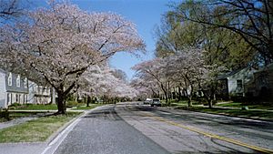
Anne Arundel County has a humid subtropical climate. This means it has hot summers and cool winters. The county gets about 40 inches (100 cm) of rain each year. Snowfall averages around 20.1 inches (51 cm) per year near BWI Airport. Higher areas may get slightly more snow.
Demographics
| Historical population | |||
|---|---|---|---|
| Census | Pop. | %± | |
| 1790 | 22,598 | — | |
| 1800 | 22,623 | 0.1% | |
| 1810 | 26,668 | 17.9% | |
| 1820 | 27,165 | 1.9% | |
| 1830 | 28,295 | 4.2% | |
| 1840 | 29,532 | 4.4% | |
| 1850 | 32,393 | 9.7% | |
| 1860 | 23,900 | −26.2% | |
| 1870 | 24,457 | 2.3% | |
| 1880 | 28,526 | 16.6% | |
| 1890 | 34,094 | 19.5% | |
| 1900 | 39,620 | 16.2% | |
| 1910 | 39,553 | −0.2% | |
| 1920 | 43,408 | 9.7% | |
| 1930 | 55,167 | 27.1% | |
| 1940 | 68,375 | 23.9% | |
| 1950 | 117,392 | 71.7% | |
| 1960 | 206,634 | 76.0% | |
| 1970 | 297,539 | 44.0% | |
| 1980 | 370,775 | 24.6% | |
| 1990 | 427,239 | 15.2% | |
| 2000 | 489,656 | 14.6% | |
| 2010 | 537,656 | 9.8% | |
| 2020 | 588,261 | 9.4% | |
| 2023 (est.) | 594,582 | 10.6% | |
| U.S. Decennial Census 1790-1960 1900–1990 1990–2000 2010 2020 |
|||
2020 census
| Race / Ethnicity (NH = Non-Hispanic) | Pop 2010 | Pop 2020 | % 2010 | % 2020 |
|---|---|---|---|---|
| White alone (NH) | 389,386 | 367,893 | 72.42% | 62.54% |
| Black or African American alone (NH) | 81,819 | 102,555 | 15.22% | 17.43% |
| Native American or Alaska Native alone (NH) | 1,365 | 1,178 | 0.25% | 0.20% |
| Asian alone (NH) | 18,154 | 25,187 | 3.38% | 4.28% |
| Pacific Islander alone (NH) | 392 | 411 | 0.07% | 0.07% |
| Some Other Race alone (NH) | 880 | 3,118 | 0.16% | 0.53% |
| Mixed Race or Multi-Racial (NH) | 12,758 | 31,123 | 2.37% | 5.29% |
| Hispanic or Latino (any race) | 32,902 | 56,796 | 6.12% | 9.65% |
| Total | 537,656 | 588,261 | 100.00% | 100.00% |
2010 census
In 2010, there were 537,656 people living in Anne Arundel County. There were 199,378 households and 139,262 families. The population density was about 1,296 people per square mile.
The people living in the county were mostly White (75.4%), Black or African American (15.5%), and Asian (3.4%). About 6.1% of the population was Hispanic or Latino.
The average household had 2.63 people, and the average family had 3.11 people. The average age of people in the county was 38.4 years. The median income for a household was $83,456. For a family, it was $97,557. About 5.3% of the population lived below the poverty line.
Economy
Principal employers
Many different companies and organizations employ people in Anne Arundel County. Here are some of the largest employers in 2014:
| Employer | Employees |
|---|---|
| Fort George G. Meade (including the National Security Agency) | 53,733 |
| Northrop Grumman | 7,725 |
| Anne Arundel Health System | 4,000 |
| Southwest Airlines | 3,200 |
| Maryland Live! Casino | 3,000 |
| University of Maryland Baltimore Washington Medical Center | 2,901 |
| U.S. Naval Academy / Naval Support Activity | 2,340 |
| Walmart / Sam's Club | 2,106 |
| Booz Allen Hamilton | 2,100 |
| Anne Arundel Community College | 1,849 |
| Allegis Group | 1,500 |
| Computer Sciences Corporation | 1,229 |
| Giant Food | 1,220 |
| Target Corporation | 1,050 |
| Lockheed Martin | 925 |
| Verizon | 844 |
| L-3 Communications | 818 |
| Safeway | 800 |
| Food Lion | 790 |
| Rockwell Collins | 773 |
| AT&T Services | 700 |
| KEYW Corp. | 683 |
| TeleCommunication Systems | 650 |
| Johns Hopkins HealthCare | 625 |
| Shoppers Food Warehouse | 625 |
| Under Armour | 617 |
| Maryland Jockey Club / Laurel Park | 616 |
| Navy Enterprise Resource Planning | 600 |
| Ciena | 600 |
| United States Coast Guard Yard | 598 |
| The Home Depot | 597 |
Correctional facilities
The state of Maryland operates several correctional facilities in Jessup, Anne Arundel County. These are places where people who have broken laws live. The District of Columbia also has a youth development center in the county. This center helps young people who have been in trouble.
U.S. Department of Defense facilities
Fort George G. Meade is a large U.S. Army base in the county. It is home to the National Security Agency. The United States Naval Academy is also located in Annapolis.
Healthcare
Anne Arundel County has two hospitals. They are Anne Arundel Medical Center in Annapolis and Baltimore Washington Medical Center in Glen Burnie.
Media
The main newspapers in the county are The Capital and the Maryland Gazette. The Maryland Gazette started in 1727.
Education
- Children in the county attend schools run by the Anne Arundel County Public Schools.
- For higher education, students can go to Anne Arundel Community College.
- The county is also home to the United States Naval Academy and St. John's College, both in Annapolis.
Transportation
Anne Arundel County is where the Baltimore-Washington International Thurgood Marshall Airport (BWI) is located. BWI is the main airport for the Baltimore area. It is also a popular airport for people living near Washington, D.C.. Many nonstop flights to different parts of the country are available from BWI.
The southern part of the Maryland Transit Administration's Light Rail system runs through the northern part of the county. This connects downtown Baltimore to BWI.
The county also has stops for the MARC commuter rail service. This includes a stop at the BWI Rail Station. Amtrak trains also stop at BWI's train station.
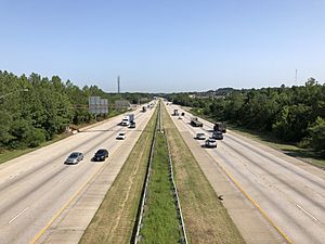
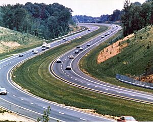
Major roads and highways
Recreation
Maryland Park Service
Sandy Point State Park is a park with a beach and a marina. It hosts many events. Helen Avalynne Tawes Garden is a 5-acre garden in Annapolis. It shows different types of plants from Maryland's regions. The county also has parts of Patapsco Valley State Park, which has forests and wetlands.
Anne Arundel Recreation and Parks
The Department of Recreation and Parks manages many parks and programs for county residents. These include sports fields, community parks, and historical sites. Some major places are the Baltimore & Annapolis Trail, Downs Park, Jug Bay Wetlands Sanctuary, Fort Smallwood Park, Kinder Farm Park, and Quiet Waters Park.
Other fun places to visit include the Maryland Renaissance Festival in Crownsville. You can also visit the Maryland State House and the Colonial Annapolis Historic District.
Anne Arundel County has two of the largest shopping malls in Maryland: Westfield Annapolis Mall and Arundel Mills in Hanover. Next to Arundel Mills is the Maryland Live! casino.
Communities
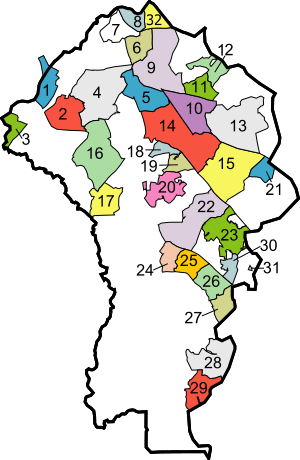
- Bracketed number refers to location on map
City
- Annapolis (23) (county seat)
Town
- Highland Beach (31)
Census-designated places
- Annapolis Neck (30)
- Arden on the Severn (18)
- Arnold (15)
- Brooklyn Park (32)
- Cape Saint Claire (21)
- Crofton (17)
- Crownsville (20)
- Deale (29)
- Edgewater (25)
- Ferndale (6)
- Fort Meade (2)
- Friendship
- Galesville
- Gambrills
- Glen Burnie (9)
- Herald Harbor (19)
- Jessup (1) (partly in Howard County)
- Lake Shore (13)
- Linthicum (7)
- Maryland City (3)
- Mayo (27)
- Naval Academy
- Odenton (16)
- Parole (22)
- Pasadena (10)
- Pumphrey (8)
- Riva (24)
- Riviera Beach (12)
- Selby-on-the-Bay (26)
- Severn (4)
- Severna Park (14)
- Shady Side (28)
- South Gate (5)
Unincorporated communities
- Beverly Beach
- Bristol
- Chestnut Hill Cove
- Churchton
- Davidsonville
- Fairhaven
- Germantown
- Gibson Island
- Green Haven
- Hanover (partly in Howard County)
- Harmans
- Harundale
- Harwood
- Hillsmere Shores
- Jacobsville
- Londontowne (25)
- Lothian
- Millersville
- Orchard Beach
- Owensville
- Riverdale
- Rose Haven
- Russett
- Sherwood Forest
- Sudley
- Tracys Landing
- Waysons Corner
- West River
- Winchester-on-the-Severn
- Woodland Beach
Notable people
- Brady Barr, herpetologist and television host
- Steve Bisciotti, owner of the Baltimore Ravens
- Peter Bondra, ice hockey player
- Tamar Braxton, entertainer
- Toni Braxton, entertainer
- Jeff Hatch, football player
- Johns Hopkins, philanthropist and founder of Johns Hopkins University
- Craig Laughlin, ice hockey player and broadcaster
- Ronald Malfi, author
- Travis Pastrana, motosports competitor
- Pat Sajak, entertainer
- Mark Teixeira, baseball player
- Steve Wojciechowski, basketball player and coach
See also
 In Spanish: Condado de Anne Arundel para niños
 | Charles R. Drew |
 | Benjamin Banneker |
 | Jane C. Wright |
 | Roger Arliner Young |


