
Antilles facts for kids

The Antilles are a group of islands, also called an archipelago. They are surrounded by the Caribbean Sea to the south and west, the Gulf of Mexico to the northwest, and the Atlantic Ocean to the north and east.
These islands are split into two main parts: the Greater Antilles and the Lesser Antilles. The Greater Antilles includes bigger islands like the Cayman Islands, Cuba, Hispaniola (which is home to the Dominican Republic and Haiti), Jamaica, and Puerto Rico. The Lesser Antilles has the Leeward Islands in the north, the Windward Islands in the southeast, and the Leeward Antilles closer to Venezuela.
Even though the Lucayan Archipelago (which includes The Bahamas and the Turks and Caicos Islands) is part of the West Indies, it's usually not considered part of the Antilles.
Geographically, the Antilles are seen as a part of North America. When we talk about culture, Cuba, the Dominican Republic, and Puerto Rico are often included in Latin America. Geologically, the Greater Antilles are made of older, continental rock. The Lesser Antilles are mostly newer islands formed by volcanoes or coral islands.
Contents
History of the Name

The name Antilles comes from a much older word, Antilia. This was a mysterious land that appeared on maps from the Middle Ages. It was sometimes shown as a group of islands, and sometimes as a large piece of land. Its exact spot on the map kept changing, usually somewhere between the Canary Islands and India.
After Christopher Columbus arrived in 1492, Europeans realized that these scattered lands formed a huge group of islands in the Caribbean Sea and the Gulf of Mexico. Before they were called the Antilles, these islands had many different names. Early Spanish visitors called them the Windward Islands. By the 1700s, the British sometimes called them the Forward Islands. Later, the name Antilles became common for this whole island group. Because of this, the Caribbean Sea was often called the "Sea of the Antilles" in many European languages.
Early Inhabitants
In 1778, a mapmaker named Thomas Kitchin mentioned that the Antilles were once called the Caribbee Isles. This name honored the Carib people, who were the first known inhabitants of these islands.
Countries and Territories
The Antilles are home to many different countries and territories. They are divided into the Greater Antilles and the Lesser Antilles. The Lucayan Archipelago is also part of the wider West Indies.
Lucayan Archipelago
Greater Antilles
- Cayman Islands (United Kingdom)
- Cuba
- Hispaniola
- Jamaica
- Puerto Rico (United States)
Lesser Antilles

Leeward Antilles
- Aruba (Kingdom of the Netherlands)
- Bonaire (Netherlands)
- Curaçao (Kingdom of the Netherlands)
- Federal Dependencies of Venezuela
- Nueva Esparta State (Venezuela)
Leeward Islands
- Anguilla (United Kingdom)
- Antigua and Barbuda
- British Virgin Islands (United Kingdom)
- Guadeloupe (France)
- La Désirade
- Les Saintes
- Marie-Galante
- Montserrat (United Kingdom)
- Saba (Netherlands)
- Saint Barthélemy (France)
- Saint Martin
- Saint Kitts and Nevis
- Sint Eustatius (Netherlands)
- Spanish Virgin Islands (Puerto Rico)
- United States Virgin Islands (United States)
Windward Islands
Other Islands
Images for kids
-
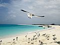
Los Roques, Venezuela, Lesser Antilles

See also
 In Spanish: Antillas para niños
