County Donegal facts for kids
Quick facts for kids
County Donegal
Contae Dhún na nGall
Tyrconnell
|
||
|---|---|---|
|
||
| Nickname(s):
The O'Donnell County, The Forgotten County
|
||
| Motto(s): | ||
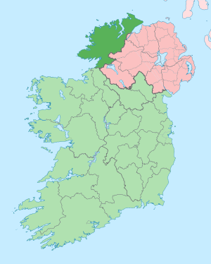
Location in Ireland, indicated in darker green
|
||
| Country | Ireland | |
| Province | Ulster | |
| Region | Northern and Western | |
| Established | 1585 | |
| County town | Lifford | |
| Largest settlement | Letterkenny | |
| Area | ||
| • Total | 4,860 km2 (1,880 sq mi) | |
| Area rank | 4th | |
| Highest elevation
(Errigal)
|
751 m (2,464 ft) | |
| Population
(2022)
|
||
| • Total | 167,084 | |
| • Rank | 13th | |
| • Density | 34.38/km2 (89.04/sq mi) | |
| Time zone | UTC±0 (WET) | |
| • Summer (DST) | UTC+1 (IST) | |
| Eircode routing keys |
F92, F93, F94
|
|
| Telephone area codes | 074 (primarily) | |
| Vehicle index mark code |
DL | |
| Coontie Dunnygal is an Ulster Scots spelling. | ||
County Donegal is a beautiful county in the province of Ulster, located in the northwest of Ireland. It gets its name from the town of Donegal. Sometimes, it's also called County Tyrconnell or Tirconaill, after an old kingdom. Donegal County Council is the local government, and Lifford is the main county town.
In 2022, about 167,084 people lived in County Donegal.
Contents
County Name
County Donegal is named after the town of Donegal. This name comes from the Irish words Dún na nGall, which means 'fort of the foreigners'.
It was also known as County Tyrconnell' or Tirconaill. This name means 'Land of Conall'. This was its official name for a few years in the 1920s. It refers to an old Gaelic kingdom called Tír Chonaill.
History of Donegal
County Donegal was once home to the powerful O'Donnell dynasty. These families were among the richest and strongest native Irish rulers until around 1600. In Ulster, only the O'Neills were more powerful. The O'Donnells ruled Tír Chonaill, a Gaelic kingdom that covered most of modern County Donegal.
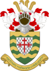
The O'Donnell leaders were called An Ó Domhnaill (The O'Donnell) and Rí Thír Chonaill (King of Tír Chonaill). They lived at Donegal Castle in Donegal Town. New O'Donnell kings were traditionally crowned at Doon Rock near Kilmacrennan. Their power ended in 1607 after the Flight of the Earls. The county's official coat of arms today is based on the old O'Donnell royal arms.
The English Crown officially created County Donegal in 1585. They combined the old Kingdom of Tír Chonaill with the Lordship of Inishowen. The English government in Dublin only gained full control after the Battle of Kinsale in 1602 and the Flight of the Earls in 1607. The county was part of the Plantation of Ulster from about 1610. The City of Derry was even part of County Donegal until 1610.
County Donegal was badly affected by the Great Famine in the 1840s. Many areas lost most of their people. Large numbers of Donegal's residents left the country, often through Foyle Port.
Effects of Partition
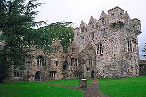
The partition of Ireland in the 1920s greatly impacted County Donegal. This division cut the county off from Derry, which had been its main port and business center for centuries. Derry became part of Northern Ireland, which remained in the United Kingdom.
This meant County Donegal was mostly cut off from the rest of the Irish Free State (now the Republic of Ireland). The county shares only a small land border with the rest of the Republic. Being separated from Derry and West Tyrone made economic life harder for Donegal.
Later, in the late 1900s, County Donegal was also affected by The Troubles in Northern Ireland. There were some bombings and killings. However, after the Good Friday Agreement in 1998, there has been more cooperation with Northern Ireland, which has helped the county.
Some politicians have called Donegal the "forgotten county." They feel it is sometimes ignored by the government, even during difficult times.
Geography and Areas
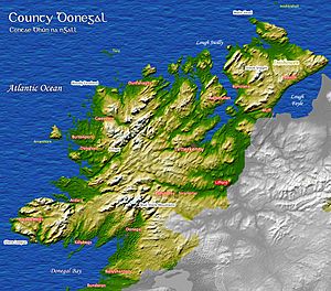
Donegal is in the northwest corner of Ireland. It is the northernmost county on the island. It is the largest county in Ulster and the fourth-largest in all of Ireland. Donegal shares a small border with only one other county in the Republic of Ireland, County Leitrim. Most of its border (93%) is with three counties in Northern Ireland: County Tyrone, County Londonderry, and County Fermanagh.
This unique location means Donegal people have a special cultural identity. The county uses the slogan "Up here it's different." While Lifford is the county town, Letterkenny is the biggest town, with nearly 20,000 people. Letterkenny and nearby Derry City are the main economic centers in the northwest.
Baronies and Townlands
Donegal has eight historic areas called baronies. These are old divisions that no longer have administrative power. The largest barony is Kilmacrennan, which is huge, covering about 312,410 acres. The smallest is Inishowen West.
Townlands are the smallest official land divisions in Ireland. Donegal has 2,787 townlands. Some are tiny, like small islands, while others are very large, like Tawnawully Mountains (6,053 acres).
Local Districts

The county has several traditional areas. In the west, there are two Gaeltacht (Irish-speaking) districts: The Rosses and Gweedore. Another Gaeltacht area is Cloughaneely in the northwest.
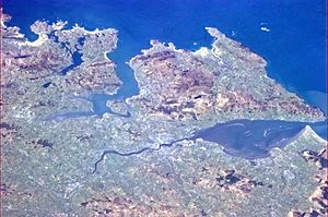
The northern part of Ireland has three peninsulas in Donegal: Inishowen, Fanad, and Rosguill. Inishowen is Ireland's largest peninsula. In the east, you'll find the Finn Valley and The Laggan district.
Donegal's Landscape
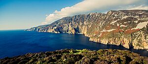
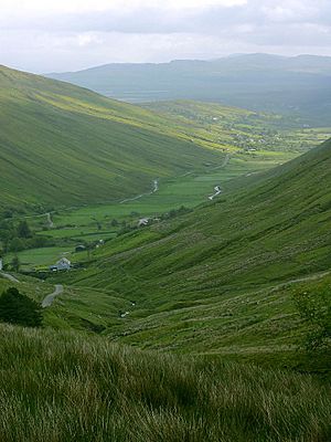
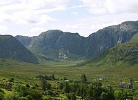
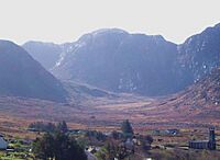
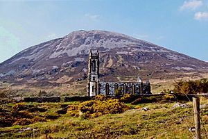
Donegal is the most mountainous county in Ulster. It has two main mountain ranges: the Derryveagh Mountains in the north and the Blue Stack Mountains in the south. Errigal is the highest peak, standing at 751 meters (2,464 feet).
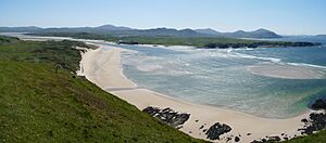
The coastline is very jagged, forming natural sea inlets called loughs. Lough Swilly and Lough Foyle are the most famous. Donegal has the longest mainland coastline of any Irish county, stretching over 1,134 kilometers (705 miles). The Slieve League cliffs are some of the highest sea cliffs in Europe. Malin Head is the most northerly point on the island of Ireland.
Two islands, Arranmore and Tory Island, are always inhabited. The 129 km (80 miles) long River Erne flows into Donegal Bay. This river and others in Donegal are used to create hydroelectric power. A canal linking the Erne to the River Shannon was built in the 1800s. It was restored and reopened in 1994.
Donegal has a low population density, meaning there are fewer people per square kilometer than in many other places. The county has many wildlife and conservation areas. These include 46 Special Areas of Conservation and Glenveagh National Park, Ireland's second-largest national park.
In 2017, National Geographic called Donegal the "Coolest place on the Planet." Lonely Planet also ranked Donegal as the 4th best region in the world for 2024, calling it "purely wild with a big heart."
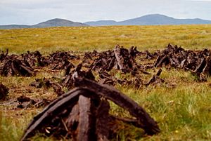
The county has about 55,534 hectares (137,227 acres) of forest. Much of this is commercial timber plantations. Donegal also has large areas of blanket bog, especially in western and upland regions.
Plants and Animals
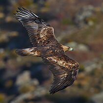
Donegal has many different habitats. Over half of Ireland's plant and animal species can be found here. About 11.4% of the county is covered in forest. Common native trees include Scots pine, birch, and oak.
Many mammals live in Donegal, such as Irish hares, red deer, pine martens, badgers, and red foxes. Marine mammals like harbour seals, grey seals, and various dolphins and whales can be seen off the coast.
Many bird species also live here, including barnacle geese, northern lapwings (Ireland's national bird), golden eagles, and Atlantic puffins. Donegal also has two types of amphibians (frogs and newts) and two reptile species (turtles and lizards).
The native Irish red deer disappeared around 1860 but were brought back in the 1890s. The Wild Ireland wildlife park shows some animals that used to live in Donegal, like brown bears and gray wolves. In 2001, the golden eagle was brought back to Glenveagh National Park.
Weather and Climate
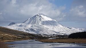
Most of Donegal has a mild oceanic climate. This means it has cool summers and mild winters. The weather is greatly affected by the North Atlantic Current. Western Donegal gets a lot of rain because of its mountains. The mountains are often cloudy, and northern Donegal is very windy.
The Atlantic Ocean keeps temperatures generally cooler, similar to western Scotland. The average high temperature in July at Malin Head is only 16.8°C (62.2°F). However, inland areas are warmer in summer and cooler in winter. Annual rainfall varies across the county.
Snow is more common in Donegal's lowland areas than in the rest of Ireland. Upland areas get snow every year. Malin Head, despite being on the coast, averages 20 days of snowfall each year.
Rocks and Landforms
Donegal's landscape was shaped by glaciers during the last Ice Age. It has one of Ireland's three glacial fjords at Lough Swilly. This is the county's largest inlet. The ice sheets carved out deep basins in the uplands. Many small lakes, called tarns, formed in these hollows. Larger lakes formed in U-shaped valleys, like Lough Beagh in Glenveagh.
The oldest rocks in Ireland, 1.78 billion years old, are found on Inishtrahull island off Donegal's coast. Donegal is also the most active part of Ireland for earthquakes. The Leenan Fault runs through the county, and many small tremors have been recorded along it.
Population and Towns
Letterkenny is the largest town in Donegal, with over 22,000 people. It is the biggest town in the Border Region of Ireland.
Most people in Donegal live in rural areas. Less than one-third of the population lives in towns with over 1,500 people.
| Town | Population |
|---|---|
| Letterkenny |
22,549
|
| Buncrana |
6,971
|
| Ballybofey/Stranorlar |
5,406
|
| Carndonagh |
2,768
|
| Donegal Town |
2,749
|
| Bundoran |
2,599
|
| Ballyshannon |
2,246
|
| Convoy |
1,702
|
| Lifford |
1,613
|
| Muff |
1,418
|
Irish Language
Donegal has the second-largest Gaeltacht (Irish-speaking area) in Ireland. The type of Irish language spoken here is called Ulster Irish.
Out of the 24,744 people in the Gaeltacht, 17,132 say they can speak Irish. There are three main Irish-speaking parishes: Gweedore, The Rosses, and Cloughaneely. All schools in these areas teach in Irish.
In 2022, about 59,130 people in Donegal (35.4% of the population) said they could speak Irish.
Freedom of Donegal Award
The Freedom of Donegal is a special award given to people who have done amazing things for the county. Famous people who have received this award include singer Daniel O'Donnell, musician Phil Coulter, and footballers Shay Given and Packie Bonner.
In 2009, the 28th Infantry Battalion of the Irish Defence Forces also received this award. It was given to them for their long service to County Donegal.
Getting Around Donegal
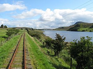
Long ago, County Donegal had a large network of railways. These trains were mostly run by the County Donegal Railways Joint Committee. However, all these railway lines closed by 1960.
Today, the closest railway station is in Derry City, run by NI Railways. This station connects to Belfast.
County Donegal has its own airport, Donegal Airport, in Carrickfinn. City of Derry Airport is also nearby. The closest major international airport is Belfast International Airport.
Culture and Traditions
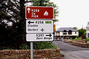
The Irish language spoken in Donegal is similar to Scottish Gaelic. The Ulster Scots language is also spoken in parts of East Donegal.
Donegal is famous for its unique fiddle music. Many musicians from Donegal, like the bands Clannad and Altan, and solo artist Enya, have become famous worldwide for their traditional music. Singer Daniel O'Donnell is a well-known ambassador for the county. Rock artist Rory Gallagher was also from Ballyshannon.
County Donegal has a rich history of writers. Patrick MacGill wrote about Irish workers in Britain in the early 1900s. The poet William Allingham was from Ballyshannon. More recently, playwrights like Frank McGuinness and Brian Friel have come from Donegal. Many of Friel's plays are set in a fictional Donegal town called Ballybeg.
Donegal is also known for its special woollen fabrics called donegal tweeds. These fabrics have short threads with tiny bits of color blended in, giving them a unique look.
There is a notable group of Ulster Protestants in County Donegal. Most of their families came during the Plantation of Ulster in the 1600s. The Church of Ireland and Presbyterianism are the largest Protestant groups. Areas like The Laggan and the Finn Valley have higher percentages of Protestants.
The Earagail Arts Festival is held in the county every July, celebrating arts and culture.
Places to Visit
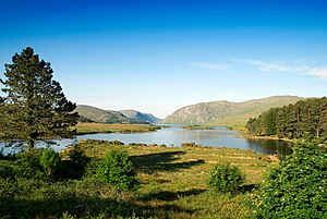
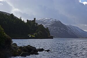
One of the main attractions is Glenveagh National Park. This huge nature reserve covers about 170 square kilometers (42,000 acres). It features mountains, bogs, lakes, and woodlands. At its center is Glenveagh Castle, a beautiful old summer home.
The Donegal Gaeltacht (Irish-speaking area) is popular with young people during summer holidays. They come for three-week courses to learn the Irish language and traditional Irish culture. Scuba diving is also very popular in Donegal Town.
Education in Donegal
Higher education in Donegal is provided by the Letterkenny campus of the Atlantic Technological University (ATU). Many young people from Donegal also go to colleges in other parts of Ireland, including Derry, Belfast, and Galway.
Sports in Donegal

Gaelic Games
Gaelic football is very popular in County Donegal. The Donegal county team has won the All-Ireland Senior Football Championship twice, in 1992 and 2012. They also won the Ulster Senior Football Championship ten times. In 2012, Donegal beat Mayo to win the Sam Maguire Cup.
Hurling is also played, but it's not as widespread. The Donegal county hurling team won the Lory Meagher Cup in 2011 and the Nicky Rackard Cup in 2013.
Rugby Union
There are several rugby teams in the county. Letterkenny RFC is one team, and their ground is named after Dave Gallaher, a famous New Zealand rugby captain who was born near Ramelton. Other teams include Ballyshannon RFC and Donegal Town RFC.
Football (Soccer)
Finn Harps is Donegal's professional football club. They play in the League of Ireland. In 2015, they were promoted to the Premier Division. Their main rivals are Derry City F.C..
Golf
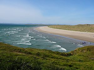
Donegal has many great golf courses. Ballyliffin Golf Club on the Inishowen peninsula is very famous. Other notable courses include Murvagh and Rosapenna.
Cricket
Cricket is mainly played in East Donegal, especially around Raphoe and St Johnston. It is mostly played by members of the Ulster Protestants in the county.
Athletics
Athletics is very popular in Donegal. Many athletes from the county have represented Ireland internationally. Some have even won medals at major events, like Danny McDaid in cross-country and Mark English in 800m races.
Other Fun Sports
Donegal's rugged landscape and coastline are perfect for active sports. You can enjoy climbing, mountain biking, hillwalking, surfing, and kite-flying here.
Famous People
See also
 In Spanish: Condado de Donegal para niños


