
List of Rocky Mountain passes on the continental divide facts for kids
The Rocky Mountains are huge mountains that stretch across North America, from Canada all the way down to the United States. Imagine a giant backbone running through the continent! This backbone is called the Continental Divide of the Americas. It's like a special line where all the rain and snow that falls on one side flows to the Pacific Ocean, and on the other side, it flows towards the Atlantic Ocean, Hudson Bay, or the Gulf of Mexico.
A "pass" is a low point or a gap in a mountain range. These passes are super important because they are the easiest ways for people, animals, roads, and even trains to cross over the mountains. For hundreds of years, explorers, traders, and settlers used these passes to travel across the continent. Today, many of them are busy highways or railway lines!
Contents
Major Mountain Passes in the Rockies
Here are some of the most important passes in the Rocky Mountains, showing how people have used them over time.
Passes in Canada
The Rocky Mountains start in Canada, and there are many important passes here.
Yukon and British Columbia Crossings
- Unnamed Portage: This was a low point used by early explorers to get from the Mackenzie River to the Yukon River. It was a key route for Canadian canoe routes.
- Alaska Highway: This major road crosses the Continental Divide in southern Yukon. Water here flows either to the Bering Sea or the Arctic Ocean.
- Dease Lake, British Columbia: The town of Dease Lake sits right on the Continental Divide. The Stewart-Cassiar Highway (also known as BC Highway 37) goes through it. Water here can go to the Pacific or Arctic Oceans.
- Summit Lake, British Columbia: Located on British Columbia Highway 97, this pass is 710 meters (2,329 feet) high. It's another spot where water splits towards the Pacific or Arctic Oceans.
- Alexander Mackenzie's Low Point: In 1793, the famous explorer Alexander Mackenzie used a low point in this area to cross the mountains.
- McGregor Pass: This pass is 1,555 meters (5,102 feet) high. Water here flows to the Pacific or Arctic Oceans.
Alberta and British Columbia Border Passes
Many significant passes are found right on the border between Alberta and British Columbia.
- Robson Pass: Near Mount Robson, this pass is 1,652 meters (5,420 feet) high. Water flows to the Pacific or Arctic Oceans.
- Yellowhead Pass: At 1,131 meters (3,711 feet), this pass is near Jasper, Alberta. It's a very important crossing for the Canadian Northern Railway (since 1910) and the north branch of the Trans-Canada Highway. Water here goes to the Pacific or Arctic Oceans.
- Athabasca Pass: This pass, 1,753 meters (5,751 feet) high, was the main route for the fur trade starting in 1811. It was used by the York Factory Express. Water flows to the Pacific or Arctic Oceans.
- Howse Pass: Discovered in 1807, this pass is 1,539 meters (5,049 feet) high. It wasn't used very often. Water flows to the Pacific Ocean or Hudson Bay.
- Kicking Horse Pass: Near Lake Louise, Alberta, this pass is 1,627 meters (5,338 feet) high. The Canadian Pacific Railway built a line here in the 1880s, and it's also part of the south branch of the Trans-Canada Highway. Water flows to the Pacific Ocean or Hudson Bay.
- Vermilion Pass: At 1,680 meters (5,512 feet), this pass is near Banff, Alberta. Highway 93 goes through it, leading south to Radium Hot Springs, British Columbia. Water flows to the Pacific Ocean or Hudson Bay.
- Simpson Pass: Southwest of Banff, this pass is 2,107 meters (6,913 feet) high. It was found by Sir George Simpson in 1841 but was rarely used. Water flows to the Pacific Ocean or Hudson Bay.
- Crowsnest Pass: This pass is 1,358 meters (4,455 feet) high and is the only road pass between Banff and the U.S. border. The Canadian Pacific Railway built a line here in 1898. Water flows to the Pacific Ocean or Hudson Bay.
Passes in the United States
The Continental Divide continues through the United States, with many famous passes.
Montana Passes
- Logan Pass: In Glacier National Park, this pass is 2,026 meters (6,646 feet) high. The Going-to-the-Sun Road crosses it. Water here divides between the Pacific Ocean and Hudson Bay.
- Marias Pass: At 1,589 meters (5,213 feet), this pass is used by the BNSF Railway (originally the Great Northern Railroad in 1889) and US Highway 2. Water divides between the Pacific and Atlantic Oceans.
- Lewis and Clark Pass: This pass, 1,958 meters (6,424 feet) high, might have been used by Meriwether Lewis on his return journey. It's a foot trail and an unimproved road. Water divides between the Pacific and Atlantic Oceans.
- Rogers Pass: At 1,710 meters (5,610 feet), this pass is crossed by Montana Highway 200. Water divides between the Pacific and Atlantic Oceans.
- Mullan Pass: This pass is 1,799 meters (5,902 feet) high. It was used by the Mullan Road and the Northern Pacific Railroad (now Montana Rail Link). Water divides between the Pacific and Atlantic Oceans.
- MacDonald Pass: At 1,924 meters (6,312 feet), this pass is crossed by US Highway 12. Water divides between the Pacific and Atlantic Oceans.
- Elk Park Pass: This pass is 1,936 meters (6,352 feet) high. It was used by the Great Northern Railroad (now abandoned) and Interstate 15. Water divides between the Pacific and Atlantic Oceans.
- Homestake Pass: At 1,929 meters (6,329 feet), this pass was used by the Northern Pacific Railroad (now BNSF Railway, but inactive) and Interstate 90. Water divides between the Pacific and Atlantic Oceans.
- Pipestone Pass: This pass is 1,967 meters (6,453 feet) high. It was used by the Chicago, Milwaukee, St. Paul and Pacific Railroad (abandoned) and Montana Highway 2. Water divides between the Pacific and Atlantic Oceans.
- Deer Lodge Pass: At 1,792 meters (5,879 feet), this pass is used by the Union Pacific railway (originally the Utah and Northern Railway) and Interstate 15. Water divides between the Pacific and Atlantic Oceans.
- Gibbons Pass: This pass is 2,117 meters (6,946 feet) high. It's part of the Nez Perce National Historic Trail and might have been used by William Clark. It's an unimproved road. Water divides between the Pacific and Atlantic Oceans.
Montana and Idaho Border Passes
Several passes are located right on the border between Montana and Idaho.
- Chief Joseph Pass: At 2,210 meters (7,251 feet), this pass is crossed by Montana Highway 43. Water divides between the Pacific and Atlantic Oceans.
- Lemhi Pass: This pass is 2,247 meters (7,373 feet) high and was the first crossing of the Continental Divide by the Lewis and Clark Expedition. It's an unimproved road. Water divides between the Pacific and Atlantic Oceans.
- Bannock Pass: At 2,342 meters (7,684 feet), this pass was used by the Gilmore and Pittsburgh Railroad (abandoned) and Idaho Highway 29. Water divides between the Pacific and Atlantic Oceans.
- Monida Pass: This pass is 2,079 meters (6,820 feet) high. It's used by the Union Pacific railway (originally the Utah and Northern Railway) and Interstate 15. Water divides between the Pacific and Atlantic Oceans.
- Raynolds Pass: At 2,086 meters (6,844 feet), this pass was explored by the Raynolds Expedition and is crossed by Montana Highway 87. Water divides between the Pacific and Atlantic Oceans.
- Targhee Pass: This pass is 2,156 meters (7,072 feet) high and is crossed by US Highway 20. Water divides between the Pacific and Atlantic Oceans.
Montana, Idaho, and Wyoming Border Passes
- Craig Pass: In Yellowstone National Park, this pass is 2,518 meters (8,262 feet) high and is crossed by U.S. Route 191. Water flows to the Pacific or Gulf of Mexico.
- Two Ocean Pass: This unique pass, 2,478 meters (8,130 feet) high, is in the Teton Wilderness. It's famous for the Parting of the Waters, where a stream literally splits, sending water to both the Pacific and Gulf of Mexico.
- Togwotee Pass: At 2,944 meters (9,658 feet), this pass is crossed by U.S. Route 287 and U.S. Route 26. Water flows to the Pacific or Gulf of Mexico.
- South Pass: This pass is 2,259 meters (7,412 feet) high and is part of a flatter area in southwest Wyoming. It was a crucial route for the Oregon Trail and Interstate 80. Water flows to the Pacific or Gulf of Mexico.
Colorado Passes
Colorado has many high and important passes.
- Rabbit Ears Pass: At 2,873 meters (9,426 feet), this pass is crossed by U.S. Route 40. Water flows to the Pacific or Gulf of Mexico.
- Muddy Pass: This pass is 2,674 meters (8,772 feet) high and is also crossed by U.S. Route 40. Water flows to the Pacific or Gulf of Mexico.
- Willow Creek Pass: At 2,844 meters (9,659 feet), this pass is crossed by Colorado State Highway 125. Water flows to the Pacific or Gulf of Mexico.
- Milner Pass: In Rocky Mountain National Park, this pass is 3,279 meters (10,759 feet) high and is crossed by U.S. Route 34. Water flows to the Pacific or Gulf of Mexico.
- La Poudre Pass: This pass is 3,104 meters (10,184 feet) high. Water flows to the Pacific or Gulf of Mexico.
- Moffat Tunnel: This railway tunnel, finished in 1928, is 2,816 meters (9,239 feet) high. It was built to avoid the much higher Rollins Pass. Water flows to the Pacific or Gulf of Mexico.
- Eisenhower Tunnel: At 3,401 meters (11,158 feet), this tunnel on Interstate 70 is the highest point on the interstate system in the U.S. It helps drivers avoid Loveland Pass. Water flows to the Pacific or Gulf of Mexico.
- Loveland Pass: This pass is 3,655 meters (11,990 feet) high and is crossed by US Highway 6. Water flows to the Pacific or Gulf of Mexico.
- Hoosier Pass: At 3,518 meters (11,542 feet), this pass is crossed by Colorado State Highway 9. Water flows to the Pacific or Gulf of Mexico.
- Fremont Pass: This pass is 3,449 meters (11,318 feet) high and is crossed by Colorado State Highway 91. Former railroad lines also used this pass.
- Tennessee Pass: At 3,177 meters (10,424 feet), this pass is crossed by U.S. Route 24 and was a main line for the Denver and Rio Grande Western Railroad.
- Hagerman Pass: This pass is 3,639 meters (11,925 feet) high. It was used by the Colorado Midland Railway through the Hagerman Tunnel. It's now an unpaved road.
- Independence Pass: At 3,687 meters (12,095 feet), this pass is crossed by Colorado State Highway 82. Until recently, it was the highest paved crossing of the Divide in the U.S. Water flows to the Pacific or Gulf of Mexico.
- Cottonwood Pass: This pass is 3,696 meters (12,126 feet) high. It's crossed by Chaffee County Road 306 and Gunnison County Road 209. It's now the highest paved crossing of the Divide in the U.S. Water flows to the Pacific or Gulf of Mexico.
- Alpine Tunnel: This tunnel, 3,512 meters (11,523 feet) high, was the first tunnel over the Continental Divide in Colorado and the highest railroad tunnel in North America. It's abandoned now.
- Monarch Pass: At 3,448 meters (11,312 feet), this pass is crossed by US Highway 50. Water flows to the Pacific or Gulf of Mexico.
- Marshall Pass: This pass is 3,305 meters (10,842 feet) high. It was used by a former narrow-gauge railroad that closed in 1955. Water flows to the Pacific or Gulf of Mexico.
- North Pass: At 3,051 meters (10,010 feet), this pass is crossed by Colorado State Highway 114. Water flows to the Pacific or Gulf of Mexico.
- Spring Creek Pass: This pass is 3,319 meters (10,889 feet) high and is crossed by Colorado State Highway 149.
- Wolf Creek Pass: At 3,309 meters (10,857 feet), this pass is crossed by U.S. Highway 160. Water flows to the Pacific or Gulf of Mexico.
More Rocky Mountain Passes and Trails
Many other passes in the Rocky Mountains are mainly used for trails, perfect for hiking and exploring! These passes are often found in beautiful national parks and wilderness areas.
- Pine Pass: In British Columbia, this pass is 875 meters (2,871 feet) high and is used by British Columbia Highway 97 and the Canadian National Railway.
- Jarvis Pass: This trail pass in British Columbia is 1,478 meters (4,849 feet) high, located in Kakwa Provincial Park.
- Kakwa Pass: Another trail pass in Kakwa Provincial Park, British Columbia, at 1,570 meters (5,151 feet).
- Yellowhead Pass: This important pass, 1,131 meters (3,711 feet) high, is used by the Canadian National Railway and connects Jasper National Park and Mount Robson Provincial Park.
- Athabasca Pass: A historic trail pass in Jasper National Park, Alberta/British Columbia, at 1,753 meters (5,751 feet).
- Kicking Horse Pass: This pass, 1,627 meters (5,338 feet) high, is used by the Trans-Canada Highway and Canadian Pacific Railway, connecting Banff National Park and Yoho National Park.
- Vermilion Pass: At 1,661 meters (5,449 feet), this pass is crossed by Alberta Highway 93 and British Columbia Highway 93, linking Banff National Park and Kootenay National Park.
- Crowsnest Pass: This pass, 1,358 meters (4,455 feet) high, is used by the Canadian Pacific Railway.
- Logan Pass: In Glacier National Park, Montana, this pass is 2,028 meters (6,654 feet) high and is crossed by the Going-to-the-Sun Road.
- Marias Pass: At 1,589 meters (5,213 feet), this pass in Montana is used by U.S. Route 2 and the BNSF Railway.
- Lewis and Clark Pass: This trail pass in Montana is 1,958 meters (6,424 feet) high and was used by Meriwether Lewis.
- Monarch Pass: In Colorado, this pass is 3,446 meters (11,306 feet) high and is crossed by U.S. Route 50.
- Wolf Creek Pass: This pass in Colorado is 3,299 meters (10,823 feet) high and is crossed by U.S. Route 160.
Images for kids
-
British Columbia Highway 97
-

Train symbol
-
Trans-Canada Highway symbol
-
Alberta Highway 93 symbol
-
British Columbia Highway 93 symbol
-

U.S. Route 2 symbol
-
Montana State Highway 200 symbol
-
Interstate 15 symbol
-
Montana State Highway 43 symbol
-
Interstate 90 in Montana symbol
-
Montana Highway 2 symbol
-
Idaho State Highway 43 symbol
-
Idaho State Highway 29 symbol
-
Montana Secondary Highway 324 symbol
-
Idaho State Highway 87 symbol
-
Montana State Highway 87 symbol
-
U.S. Route 20 symbol
-
U.S. Route 191 symbol
-
Wyoming Highway 28 symbol
-
U.S. Route 40 symbol
-
Colorado State Highway 125 symbol
-
Bikecentennial route symbol
-
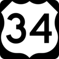
U.S. Route 34 symbol
-
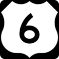
U.S. Route 6 symbol
-
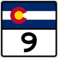
Colorado State Highway 9 symbol
-
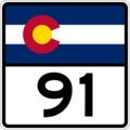
Colorado State Highway 91 symbol
-
Colorado State Highway 82 symbol
-
U.S. Route 50 symbol
-
Colorado State Highway 114 symbol
-
Colorado State Highway 149 symbol
-
U.S. Route 160 symbol


.svg)


.svg)


See also
- Rocky Mountains
- Mountain pass
- List of mountain passes in Colorado
- List of mountain passes in Montana
- List of mountain passes in Wyoming
- List of railroad crossings of the Continental Divide of North America
