List of historical highway markers in Hampshire County, West Virginia facts for kids
Historical markers are like outdoor history books! They are special signs placed along roads and in towns to tell us about important places, events, or people from the past. In Hampshire County, West Virginia, you can find many of these markers. They help us learn about the rich history of this area, from early settlements and battles to unique natural wonders.
Contents
- Discovering West Virginia's Past Through Markers
- Capon Springs: A Historic Getaway
- West Virginia and Virginia: Two States, One Story
- The Northwestern Turnpike: A Path to the West
- Fort Edwards: A Frontier Defense
- Ice Mountain: Nature's Refrigerator
- Mount Bethel Church: A Place of Worship Since 1792
- Bloomery Gap Skirmish and Iron Furnace
- Oriskany Sand: A Source of Natural Gas
- Hampshire County: West Virginia's Oldest County
- Morgan County: Named for a Revolutionary War Hero
- Caudy's Castle: A Pioneer's Stronghold
- Braddock's Gap: A General's Journey
- Blue's Gap Battle: A Civil War Skirmish
- Hampshire County and Hardy County: Neighboring Histories
- High Knob: A View from the Top
- Hanging Rocks: A Place of Battles
- Fort Forman: A Frontier Outpost
- Colonel Claudius Crozet and Mechanicsburg Gap
- Indian Mound: An Ancient Burial Site
- "Stonewall" Jackson and Romney During the Civil War
- Romney and the Early Confederate Memorial
- West Virginia Schools for the Deaf and Blind
- Hampshire County and Mineral County: Sharing a Border
- Pin Oak Fountain: A Community Landmark
- Other Interesting Markers
Discovering West Virginia's Past Through Markers
These historical markers are part of the West Virginia Highway Historical Marker Program. This program helps share the stories of West Virginia's history with everyone. It is managed by the West Virginia Archives and History.
Capon Springs: A Historic Getaway
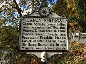
Capon Springs is a famous resort known for its "Medicine Waters." These special waters were discovered way back in 1765. Many important people visited this resort in the early days. Guests included President Franklin Pierce, famous speaker Daniel Webster, and even a British diplomat named Sir Henry Bulwer.
- Location: West Virginia Route 259, Capon Lake
West Virginia and Virginia: Two States, One Story
West Virginia was once the western part of Virginia until June 20, 1863. It became its own state during the American Civil War. Early settlers here were mostly Germans and Scotch-Irish people. This area was an important defense line between the English and French during the French and Indian War (1754-1763).
Virginia, often called "The Old Dominion," was named after Queen Elizabeth I, also known as the "Virgin Queen." It was home to the first permanent English settlement in America in 1607. Virginia was one of the original 13 colonies that formed the United States. It is also famous for being the birthplace of eight U.S. Presidents.
- Location: West Virginia Route 259, at the state line, and U.S. Route 50, at the state line.
The Northwestern Turnpike: A Path to the West
The Northwestern Turnpike was an important road proposed by George Washington in 1784. He wanted an all-Virginia route to the Ohio River. Construction began in 1831. This road is a great example of the amazing engineering skills of Charles Shaw and Colonel Claudius Crozet.
- Location: U.S. Route 50, Capon Bridge
Fort Edwards: A Frontier Defense
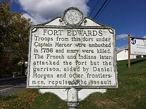
Fort Edwards was a key fort during the French and Indian War. In 1756, troops from this fort, led by Captain Mercer, were attacked. Later, French and Native American forces attacked the fort itself. However, the soldiers, helped by brave frontiersmen like Daniel Morgan, successfully fought them off.
- Location: U.S. Route 50, near the junction with County Route 14 (Cacapon River Road), Capon Bridge
Ice Mountain: Nature's Refrigerator
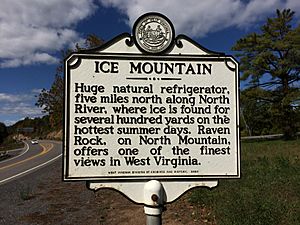
Ice Mountain is a truly unique natural wonder. It acts like a giant refrigerator! Even on the hottest summer days, you can find ice for hundreds of yards along the North River. Nearby, Raven Rock on North Mountain offers one of the most beautiful views in West Virginia.
- Location: U.S. Route 50, at the junction with West Virginia Route 29 North, and near Pleasant Dale.
Mount Bethel Church: A Place of Worship Since 1792
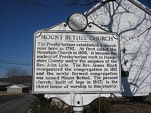
The Presbyterians started a church near this spot in 1792. It was first called the Mountain Church. In 1812, it was renamed Mount Bethel. The current church building, made of logs in 1837, is the oldest place of worship still standing in Hampshire County.
- Location: County Route 5 (Jersey Mountain Road), at the junction with County Route 5/4 (Three Churches Hollow Road), Three Churches
Bloomery Gap Skirmish and Iron Furnace
On February 14, 1862, during the Civil War, Union forces led by Brigadier General Frederick W. Lander attacked Confederate troops at Bloomery Gap. The Confederates were defeated and fled.
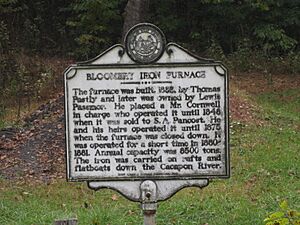
The Bloomery Iron Furnace was built in 1833. It produced a lot of iron, up to 8,500 tons each year! The iron was then transported by rafts and flatboats down the Cacapon River. The furnace operated until 1875.
- Location: West Virginia Route 127 (Bloomery Pike), 2 miles east of the junction with West Virginia Route 29
Oriskany Sand: A Source of Natural Gas
The "Oriskany Sand" is a special type of sandstone that is very important to geologists and drillers. Below it is limestone called the Helderberg. This "Oriskany Sand" has produced a huge amount of natural gas in West Virginia, more than a trillion cubic feet!
- Location: U.S. Route 50/West Virginia Route 28, two miles west of Romney; U.S. Route 50 and County Road 21, about 2 miles east of Pleasant Dale; and West Virginia Route 28 about 1.5 miles south of Springfield.
Hampshire County: West Virginia's Oldest County
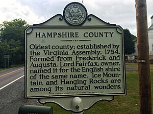
Hampshire County is the oldest county in West Virginia. It was created by the Virginia Assembly in 1754. Lord Fairfax, who owned the land, named it after the English shire of the same name. Natural wonders like Ice Mountain and Hanging Rocks are found here.
Morgan County: Named for a Revolutionary War Hero
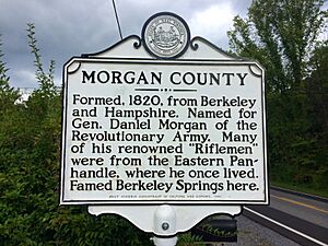
Morgan County was formed in 1820 from parts of Berkeley and Hampshire counties. It was named after General Daniel Morgan, a hero of the Revolutionary Army. Many of his famous "Riflemen" were from this area, known as the Eastern Panhandle. The well-known Berkeley Springs is located in Morgan County.
- Location: West Virginia Route 9 West and West Virginia Route 9 East.
Caudy's Castle: A Pioneer's Stronghold
Caudy's Castle is named after James Caudy, a brave pioneer and Native American fighter. During the French and Indian War, he found safety on a tall mass of rocks overlooking the Cacapon River. From this high spot, he defended himself by pushing attacking Native Americans off the precipice with the butt of his rifle. They fell hundreds of feet to the river below.
- Location: West Virginia Route 127 (Bloomery Pike), 1.5 miles east of West Virginia Route 29
Braddock's Gap: A General's Journey
To the north of this marker is the route taken by General Braddock's army in May 1755. They were on their way to attack the French at Fort Duquesne. His troops camped at Fort Capon and Fort Cox nearby before continuing their journey. Sadly, the journey ended in defeat and Braddock's death.
- Location: U.S. Route 50 and West Virginia Route 29 (Bloomery Pike), near Pleasant Dale.
Blue's Gap Battle: A Civil War Skirmish
On January 7, 1862, during the Civil War, Confederate troops led by Captain George F. Sheets were defeated by Union forces under Colonel S. H. Dunning. The North River Bridge and several buildings were burned by the Union soldiers.
- Location: U.S. Route 50, 14 miles east of Romney.
Hampshire County and Hardy County: Neighboring Histories
Hardy County was formed from Hampshire County in 1786. It was named after Samuel Hardy, a respected Virginian. In 1725, John Van Meter from New York visited the South Branch Valley. He loved it so much that his sons later bought land and settled at Old Fields.
- Location: U.S. Route 50, at the county line near Intermont; and U.S. Route 220 near Purgitsville.
High Knob: A View from the Top
High Knob is a tall peak on the Hampshire-Hardy county line. It rises a thousand feet above the surrounding hills, reaching a height of more than half a mile! From its top, you can see points in three different counties. It also overlooks "The Trough," a famous area known for its history and beautiful scenery.
- Location: U.S. Route 220 (northbound) south of Hickory Hill Road, near the Hampshire-Hardy border.
Hanging Rocks: A Place of Battles
Hanging Rocks are amazing cliffs that rise almost 300 feet straight up from the South Branch of the Potomac River. This spot was the scene of fierce battles between the Delaware and Catawba Native American tribes around 1736. Later, during the Civil War, it also saw skirmishes between Union and Confederate troops in 1861.
- Location: West Virginia Route 28, 4 miles north of Romney.
Fort Forman: A Frontier Outpost
Fort Forman was a Frontier military outpost. In 1777, Captain William Forman led a company from this county to help Fort Henry in Wheeling. Sadly, he, his two sons, and many others were killed in an ambush by Native Americans near Moundsville.
Colonel Claudius Crozet and Mechanicsburg Gap
Colonel Crozet was born in France in 1790 and came to America in 1816. He taught math at West Point for six years. In 1824, he became the chief engineer of Virginia and surveyed the Northwestern Turnpike in 1825.
Mechanicsburg Gap is a beautiful canyon cut through Mill Creek Mountain by Mill Creek. This area was once an old Native American trail that connected the Valley of Virginia to the Alleghenies. Later, it became part of the Northwestern Turnpike, and today it is the George Washington Highway.
- Location: U.S. Route 50/West Virginia Route 28, 2 miles west of Romney near Mechanicsburg
Indian Mound: An Ancient Burial Site
The Indian Mound is about 7 feet high and 15 feet wide. It is one of the largest ancient mounds left in the Eastern Panhandle of West Virginia. This mound has never been dug up, but similar mounds in the area suggest it might be from between A.D. 500 and 1000. It was likely built by the Hopewellian peoples.
- Location: Just west of Romney, U.S. Route 50/West Virginia Route 28
"Stonewall" Jackson and Romney During the Civil War
General "Stonewall" Jackson arrived in Romney on January 13, 1862, after capturing Bath. He left General Loring here and returned to Winchester. Loring's complaints almost made Jackson resign, but he changed his mind, leading to his famous Valley Campaign.
Romney was a very important town during the Civil War because of its location. It was a natural path for armies moving between the Shenandoah Valley and the Potomac and the B. & O. Railroad. No huge battles were fought here, but the town changed hands an incredible 56 times during the war!
- Location: Romney, Hampshire County Courthouse square, U.S. Route 50/West Virginia Route 28
Romney and the Early Confederate Memorial
Romney was officially made a town in 1762. Lord Fairfax owned the land and planned the town. He named it after one of the five English Channel ports in England. Nearby was Fort Pearsall, built in 1756 to defend against Native American attacks. As mentioned, the town changed military control 56 times during the Civil War (1861–1865).
In 1866, the Confederate Memorial Association was formed in Romney. On September 26, 1867, they dedicated a monument to Confederate soldiers. This was one of the very first monuments of its kind built anywhere. This site was also an ancient Native American cemetery long before European settlers arrived.
- Location: Romney, Hampshire County Courthouse square, U.S. Route 50/West Virginia Route 28
West Virginia Schools for the Deaf and Blind
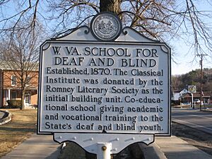
The West Virginia Schools for the Deaf and Blind were established in 1870. The first building was donated by the Romney Literary Society. This school offers co-educational academic and vocational training for young people in West Virginia who are deaf or blind.
- Location: Romney, U.S. Route 50, West Virginia Schools for the Deaf and Blind campus
Hampshire County and Mineral County: Sharing a Border
Mineral County was formed from Hampshire County in 1866. It was named for its many valuable mineral deposits. In Mineral County, you can find Fort Ashby. This is the only remaining fort from a chain of frontier forts built in 1755 under George Washington's orders.
- Location: West Virginia Route 28 near Springfield; and U.S. Route 50/U.S. Route 220 near Junction.
Pin Oak Fountain: A Community Landmark
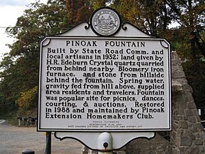
The Pin Oak Fountain was built in 1932 by the State Road Commission and local craftspeople. The land was given by H.R. Edeburn. The fountain was made from Crystal quartz quarried from behind the nearby Bloomery iron furnace, and stone from a hillside. Spring water, flowing down by gravity, provided water to local residents and travelers. This fountain was a popular spot for picnics, dances, dating, and auctions. It was restored in 1988 and is cared for by the Pin Oak Extension Homemakers Club.
Other Interesting Markers
Capon Chapel: An Old Church Building
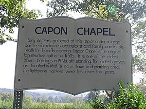
Early settlers used to gather at this spot under a large oak tree for religious events and family burials. Beneath the outer boards of Capon Chapel is the original log structure, built in the 1750s. This makes it one of the oldest church buildings still standing in West Virginia! The oldest graves were in what is now the lawn and parking area, but their stone markers have been lost over time.
- Location: Christian Church Road (County Route 13) near Capon Bridge
Whipple Truss: A Historic Bridge
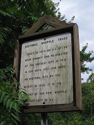
This historic Whipple Truss bridge was first built in 1874 near Romney on U.S. Route 50. It was then moved and put up again at its current location in 1939. The bridge was used until 1991 and was made a historic site by the WVDOT in 1992. It is the oldest of the few Whipple Trusses that are still left in West Virginia.
- Location: West Virginia Route 259 in Capon Lake


