
List of places of worship in the City of Leeds facts for kids
This article is a guide to different places where people worship in the city of Leeds. You'll find information about churches, mosques, synagogues, and other religious buildings that are still open today, as well as some that have closed or been taken down.
Contents
- Places of Worship Open Today
- Aberford
- Adel
- Allerton Bywater
- Alwoodley
- Armley
- Arthington
- Bardsey
- Barwick-in-Elmet
- Beeston
- Belle Isle
- Boston Spa
- Bramham
- Bramhope
- Bramley
- Burley
- Burmantofts
- Calverley
- Chapel Allerton
- Chapeltown
- Leeds City Centre
- Clifford
- Collingham
- Colton
- Cookridge
- Cottingley
- Cross Gates
- Cross Green
- Drighlington
- East End Park
- East Keswick
- Farnley
- Farsley
- Fulneck
- Garforth
- Gildersome
- Gipton
- Guiseley
- Halton
- Halton Moor
- Harehills
- Harewood
- Hawksworth (LS5)
- Hawksworth (LS20)
- Headingley
- Holbeck
- Horsforth
- Hunslet
- Hyde Park
- Ireland Wood
- Killingbeck
- Kirkstall
- Kippax
- Lincoln Green
- Little London
- Mabgate
- Meanwood
- Methley
- Micklefield
- Middleton
- Moortown and Moor Allerton
- Morley
- New Farnley
- Osmondthorpe
- Otley
- Oulton
- Pool-in-Wharfedale
- Potternewton
- Pudsey
- Rawdon
- Richmond Hill
- Rothwell
- Roundhay
- Scholes
- Scott Hall
- Seacroft
- Shadwell
- Sheepscar
- Stanningley
- Swarcliffe
- Swillington
- Swinnow
- Thorner
- Thorp Arch
- Tingley
- Walton
- Weetwood
- West Park
- Wetherby
- Whinmoor
- Whitkirk
- Woodhouse
- Woodlesford
- Wortley
- Yeadon
- Former Places of Worship
- Aberford
- Adel
- Alwoodley
- Armley
- Bardsey
- Barwick-in-Elmet
- Beeston
- Bramham
- Burley
- Burmantofts
- Carlton, near Rawdon
- Carlton, near Rothwell
- Chapeltown
- Leeds City Centre
- Cross Gates
- East Keswick
- Farsley
- Garforth
- Gipton
- Harehills
- Harewood
- Headingley
- Holbeck
- Horsforth
- Kirkstall
- Meanwood
- Middleton
- Moortown
- Morley
- New Farnley
- Otley
- Pudsey
- Rawdon
- Richmond Hill
- Rodley
- Roundhay
- Seacroft
- Shadwell
- Sheepscar
- Stanningley
- Swarcliffe
- Temple Newsam
- Thorner
- Tingley
- Weardley
- Wetherby
- Whinmoor
- Wike
- Woodhouse
- Yeadon
- Demolished Places of Worship
- Adel
- Alwoodley
- Armley
- Arthington
- Beeston
- Belle Isle
- Bramhope
- Bramley
- Burley
- Burmantofts
- Buslingthorpe
- Chapel Allerton
- Chapeltown
- City Centre
- Clifford
- Cross Gates
- Eccup
- Farsley
- Guiseley
- Halton
- Harehills
- Harewood
- Holbeck
- Horsforth
- Hunslet
- Kippax
- Leylands, The
- Little London
- Merrion Centre
- Moortown
- Newsam Green
- Otley
- Pool-in-Wharfedale
- Quarry Hill
- Richmond Hill
- Roundhay
- Rothwell
- Scarcroft
- Shadwell
- Sheepscar
- Stourton
- Swillington
- Thorpe Park
- Wetherby
- Woodhouse
- Wortley
- Yeadon
- Images for kids
- Major Sources
- See Also
Places of Worship Open Today
Aberford
- St Ricarius Church
- Location: Main Street, LS25 3BR
- Religion: Church of England
- Special Status: Grade II listed (important old building)
- Opened: 1861
- Notes: This church has very old Norman roots, but it was rebuilt in 1861. It's part of a group of churches called a benefice that includes Aberford and Micklefield.
.JPG)
Adel
- Adel Methodist Church
- Location: Holt Lane, LS16 7NX
- Religion: Methodist
- Opened: 1964
- Notes: The church hall was built earlier, in 1938. This church is part of the Leeds South and West Methodist group.
- St John the Baptist Church
- Location: Church Lane
- Religion: Church of England
- Special Status: Grade I listed (very important old building)
- Opened: 1170
- Quaker Meeting House
- Location: New Adel Lane, LS16 6AZ
- Religion: Quaker
- Opened: 1868
- Notes: Built from local stone, it has a small cottage attached for a warden.


Allerton Bywater
- St Mary the Less
- Location: Station Road WF10 2DH
- Religion: Church of England
- Opened: 1865
- Notes: Some of its beautiful stained glass windows came from another church, St Aidan, in Great Preston, which is now closed.

Alwoodley
- Alwoodley Park Methodist Church
- Location: The Lane, LS17 7BX
- Religion: Methodist
- Opened: 1956
- Notes: This church is part of the Leeds North and East Methodist group.
- St Barnabas' Church
- Location: The View, LS17 7NA
- Religion: Church of England
- Opened: 1963
- Notes: It's part of the Moor Allerton and Shadwell Team Ministry.
- St Paul the Apostle
- Location: 1 Buckstone Crescent at junction with King Lane, LS17 5ES
- Religion: Roman Catholic
- Opened: 1953
- Notes: The old church building is now used as a church hall.
- Wigton Moor URC
- Location: High Ash Drive, LS17 8RE
- Religion: United Reformed Church
- Opened: 1968
- Notes: This church started in 1967 as a mix of Congregational and Presbyterian groups, before the United Reformed Church was officially formed.


Armley
- Christ Church
- Location: Armley Ridge Road, LS12 3LN
- Religion: Church of England
- Special Status: Grade II* listed (very important old building)
- Opened: 1872
- Notes: This church was even featured in the BBC Domesday Project.
- Church at Amen Corner (Leeds Apostolic Church)
- Location: Armley Ridge Road, LS12 2RD
- Religion: Pentecostal Evangelical
- Notes: It's located where Armley, Bramley, and Kirkstall meet. Morning services are in the Yoruba language, and afternoon services are in English.
- Church of the Venerable Bede
- Location: Stanningley Road, Wyther, LS13 4AU
- Religion: Church of England
- Opened: 1937
- Notes: The church was opened by C. H. Tetley, from the famous brewing family.
- Emmanuel Earth Ministries
- Location: Mistress Lane, LS12 2LJ
- Religion: Evangelical
- Notes: This building used to be The Redeemed Evangelical Mission.
- HM Prison Armley
- Location: 2 Gloucester Terrace, LS12 2TJ
- Religion: Non-denominational (for all religions)
- Special Status: Grade II* listed (very important old building)
- Opened: 1847
- Notes: The prison has a chapel inside its "Inner Range," which is a historic building from 1847.
- Sri Guru Nanak Sikh Temple
- Location: 62 Tong Road, LS12 1LZ
- Religion: Sikh
- Notes: This building was originally a Methodist church built in 1868.
- St Bartholomew's Church
- Location: Wesley Road, LS12 1SR
- Religion: Church of England
- Special Status: Grade II* listed (very important old building)
- Opened: 1877
- Notes: It's famous for its special Schulze organ. You can still see the outline of the old church (demolished in 1909) in the churchyard.
- St Bartholomew's Church Hall
- Location: Wesley Road, LS12 1SR
- Opened: 1968
- Notes: The Church Hall was opened by Jimmy Savile. It's used for many things, including worship by the Lighthouse Chapel International (a Pentecostal church).
- Wesley Road Chapel
- Location: Wesley Road
- Religion: Methodist, Baptist and United Reformed
- Notes: Sunday worship is shared with other local Methodist churches.
- West Leeds Christadelphian Hall
- Location: 118 Town Street, LS12 3JG
- Religion: Christadelphian
- Opened: 1970
- Whingate Methodist Church and Community Centre
- Location: 61 Whingate, LS12 3EJ
- Religion: Methodist
- Opened: 1988
- Notes: The first church here was built in 1879.


Arthington
- St Mary and St Abanoub Church
- Location: Arthington Lane, LS21 1PL
- Religion: Coptic Orthodox
- Special Status: Grade II listed (important old building)
- Opened: 2007 (original building 1864)
- Notes: This building used to be a Church of England church (St Peter's) built in 1864. The Coptic Orthodox Church took it over and renamed it in 2007.

Bardsey
- All Hallows Church
- Location: Church Lane, LS17 9DH
- Religion: Church of England
- Special Status: Grade I listed (very important old building)
- Opened: 825
- Notes: The oldest parts of this church date back to 825! The upper tower is from the Saxon period (10th century).

Barwick-in-Elmet
- All Saints' Church
- Location: Main Street, LS15 4HR
- Religion: Church of England
- Special Status: Grade II* listed (very important old building)
- Opened: 14th century
- Notes: The oldest part is from the 14th century, and the tower is from the 15th century.
- Barwick Methodist Church
- Location: The Boyle, LS15 4JN
- Religion: Methodist
- Opened: 1900
- Notes: This church is part of the Leeds North and East Methodist group.


Beeston
- Beeston Hill United Free Church
- City Evangelical Church
- Location: Malvern Street, LS11 8SX
- Religion: Evangelical
- Opened: 1901
- Notes: It was originally a Baptist Chapel.
- Gurdwara Guru Nanak Nishkan Sewak Jath (GNNSJ)
- Jamia Masjid Abu Huraiara
- Location: 1 Hardy Street, LS11 6BJ
- Religion: Islam Sufi - Bareilvi
- Opened: 1986
- Notes: It's based in a building from 1897 that used to belong to the Leeds Co-operative Society.
- Masjid-e-Umar
- Location: 29 Stratford Street, LS11 6JG
- Religion: Islam Deobandi
- Opened: 2011
- Masjid Ibraheem
- Location: 4 Woodview Rd, LS11 6LE
- Religion: Islam Sunni - Deobandi
- Opened: 2015
- St Andrew's Methodist Church
- Location: Old Lane, LS11 8AL
- Religion: Methodist
- Opened: 1956
- Notes: This is a brick building from the 20th century.
- St Anthony of Padua Church
- Location: Old Lane, LS11 7AA
- Religion: Catholic
- Opened: 1904
- Notes: A bell tower was added in 1966.
- St Luke's Church
- Location: Malvern Road LS11 8PD
- Religion: Church of England
- Special Status: Grade II listed (important old building)
- Opened: 1872
- Notes: It's built in the Gothic revival style using gritstone.
- St Mary's Church
- Location: Town Street LS11 8SY
- Religion: Church of England
- Special Status: Grade II listed (important old building)
- Opened: 1886
- United Reformed Church in South Leeds
- Location: Dewsbury Road, LS11 5HT
- Religion: United Reformed Church
- Notes: This building is now used as a charity shop, but still holds monthly services.


Belle Isle
- St John and St Barnabas Church
- Location: 175 Belle Isle Road, LS10 3DN
- Religion: Church of England
- Opened: 1938
- Notes: This brick church replaced two older churches in Holbeck that were demolished.
- St Peter's Church
- Location: Petersfield Avenue, LS10 3QN
- Religion: Catholic
- Opened: 1948
- United Reformed Church in South Leeds
- Location: Nesfield Road, LS10 3LG
- Religion: United Reformed Church
- Opened: 2011
- Notes: Built on the site of a Congregational Church from 1952.
- West Grange Church
- Location: West Grange Garth, LS10 2AX
- Religion: Evangelical
- Notes: This is an independent church.


Boston Spa
- Boston Spa Methodist Church
- Location: Spa Lane, LS23 6AA
- Religion: Methodist
- Special Status: Grade II listed (important old building)
- Opened: 1847
- Notes: There's a peaceful garden between the church and the River Wharfe.
- Martin House Hospice Chapel
- Location: Grove Road, LS23 6TX
- Religion: Non-denominational
- Opened: 2005
- Notes: This chapel was built to replace an older one that was removed when a new unit for teenagers was constructed.
- St Mary the Virgin
- Location: High Street, LS23 6DR
- Religion: Church of England
- Special Status: Grade II listed (important old building)
- Opened: 1814

_001.JPG)
Bramham
- All Saints' Church
- Location: Back Lane
- Religion: Church of England
- Special Status: Grade II* listed (very important old building)
- Opened: 1150
- Notes: The church has an Anglo-Saxon oval churchyard.

Bramhope
- Bramhope Methodist Church
- Location: Eastgate, LS16 9AA
- Religion: Methodist
- Special Status: Grade II listed (important old building)
- Opened: 1895 or 1896
- Bramhope Puritan Chapel
- Location: Otley Road, LS16 9JE
- Religion: Puritan, later Church of England
- Special Status: Grade I listed (very important old building)
- Opened: 1649
- Notes: This chapel was built by Robert Dyneley. It's not used for regular services anymore but can be used for weddings and funerals.
- Bramhope Scout Campsite
- Location: Occupation Lane, LS16 9HR
- Religion: Non-denominational
- Notes: There's an outdoor chapel located within the campsite.
- St Giles' Church
- Location: Church Hill, LS16 9BA
- Religion: Church of England
- Opened: 1881
- Notes: It was built using local stone from quarries on the Chevin.


Bramley
- Christ the King
- Location: King's Approach LS13 2DX
- Religion: Catholic
- Opened: 1928
- Hunters Greave Scout Activity Centre
- Location: Pollard Lane, Newlay, LS13 1EQ
- Religion: Non-denominational
- Notes: There is a chapel on site.
- St Margaret's Church
- Location: Newlay Lane, LS13 2AJ
- Religion: Church of England
- Opened: 1958
- Notes: St Margaret's and St Peter's together form the parish of Bramley.
- St Peter's Church
- Location: Hough Lane, LS13 3JF
- Religion: Church of England
- Notes: St Margaret's and St Peter's together form the parish of Bramley.
- Trinity Methodist Church
- Location: Upper Town Street, LS13 2EP
- Religion: Methodist
- Opened: 1967
- Notes: The first Methodist Chapel in Bramley was built in 1777 on the same site.

.jpg)

.jpg)
Burley
- Calvary International Christian Centre
- Location: Calvary Cathedral, 53 Cardigan Lane, LS4 2LE
- Religion: Non-denominational
- Special Status: Grade II listed (important old building)
- Opened: 1898
- Notes: This building used to be Burley Methodist Church, which closed in 2012. It's built in the Gothic Revival style.
- Leeds Chinese Christian Church
- Location: 155 Kirkstall Rd, LS4 2AG
- Religion: Independent
- Opened: 1990
- Makkah Jamia Masjid
- Location: 36 Thornville Road, LS6 1JY
- Religion: Islam
- Opened: 2003
- Our Lady of Lourdes Church
- Location: Cardigan Road, LS6 1LU
- Religion: Catholic
- Opened: 1930
- Notes: It was originally built by the Society of Jesus as Sacred Heart Chapel.
- St Matthias' Church
- Location: St Matthias' Street, LS4 2DZ
- Religion: Church of England
- Special Status: Grade II* listed (very important old building)
- Opened: 1854
- Winners Chapel
- Location: Burley Hall, 49-51 Cardigan Lane, LS4 2LE
- Religion: Part of the Living Faith Church Worldwide
- Special Status: Grade II listed (important old building)
- Notes: This building used to be a Methodist Sunday school and Church Hall.


.jpg)

Burmantofts
- Bridge Community Church
- Location: Rider Street, LS9 7BQ
- Religion: Pentecostal
- Opened: 2016
- Notes: This church's history goes back to 1910.
- Hope City Church
- Location: 32 York Road, LS9 8SY
- Religion: Pentecostal
- Opened: 2008
- Notes: It's part of the Megacentre building, which used to be the Leeds City Council Library HQ.
- Living Hope Church
- Location: The Place, Saxton Lane, LS9 8HE
- Religion: Evangelical (Non-denominational)
- Notes: This is the main office for Living Hope Church International.
- St Agnes' Church
- Location: Stoney Rock Lane, LS9 7UQ
- Religion: Church of England and Baptist
- Special Status: Grade II listed (important old building)
- Opened: 1889
- Notes: This Church of England parish church now shares its space with a Baptist group.
- St Patrick's Church
- Location: Torre Rd, LS9 7QL
- Religion: Catholic
- Opened: 2001
- Notes: The modern church moved from an older building (from 1891) that is now used by the Leeds Playhouse.


Calverley
- St Wilfrid's Parish Church
- Location: Town Gate, LS28 5NF
- Religion: Church of England
- Special Status: Grade II* listed (very important old building)
- Opened: 1154
- Notes: The tower is from 1154, and the rest of the church is mostly from the 13th and 14th centuries. It has unusual Saxon gravestones.
- Calverley Methodist Church
- Location: Carr Road, LS28 5PQ
- Religion: Methodist
- Special Status: Grade II listed (important old building)
- Opened: 1872
- Notes: This church is part of the Bradford North Methodist group.


Chapel Allerton
- Chapel Allerton Hospital Chapel
- Location: Chapeltown Road, LS7 4SA
- Religion: Non-denominational
- Notes: The chapel is located on the third floor of the hospital's north wing.
- Chapel Allerton Methodist Centre
- Location: Town Street, LS7 4NB
- Religion: Methodist
- Opened: 1878
- Notes: This building used to be the main church but now serves as a "church centre." Chapel Allerton Baptist Church also holds services here.
- Chapel Allerton Methodist Church
- Location: Town Street, LS7 4NB
- Religion: Methodist
- Opened: 1983
- Notes: This church replaced an older one on the same street. It works closely with St. Matthew's Parish Church.
- St Matthew's Church
- Location: Wood Lane, LS7 3QF
- Religion: Church of England
- Special Status: Grade II* listed (very important old building)
- Opened: 1900
- Notes: The church was designed by a famous architect, George Frederick Bodley, and built on land given by a church member. Russian Orthodox church services also happen here.


Chapeltown
- Chapeltown Community Church
- Location: Avenue Hill, LS8 4EX
- Special Status: Grade II listed (important old building)
- Opened: 1906
- Notes: This used to be Trinity United Reformed Church. The nearby Sunday School building is also a listed building.
- Church of God of Prophecy
- Location: Austin Burke Memorial Centre, 196 Chapeltown Road, LS7 4HZ
- Religion: Pentecostal
- Opened: 1992
- Notes: This church and community centre was built for its purpose, so it doesn't have religious symbols inside.
- Gurdwara Guru Kalgidhar Sahib
- Location: Cowper Street, LS7 4EE
- Religion: Sikhism
- Opened: 2008
- Notes: This Gurdwara moved from its old location (which was the first Gurdwara in Leeds) to a bigger building.
- Holy Rosary Church
- Location: Chapeltown Road, LS7 4BZ
- Religion: Catholic
- Opened: 1937
- Notes: An earlier Holy Rosary church was built in 1886. This church was designed to hold 500 people.
- Leeds Islamic Centre
- Location: 46 Spencer Place, LS7 4BR
- Religion: Muslim
- Opened: 2001
- Notes: This site was originally a Jewish synagogue.
- Our Lady of Czestochowa and St. Stanislaw Kostka
- Location: Newton Hill Road, LS7 4EY
- Religion: Polish Roman Catholic
- Opened: 1976
- Notes: This is a Roman Catholic church that holds services in Polish.
- Ramgarhia Board Gurdwara
- Location: 8-10 Chapeltown Road LS7 3AP
- Religion: Sikh
- Opened: 1987
- Notes: This building used to be a post office. It was opened by Prince Richard, Duke of Gloucester.
- Roscoe Methodist Church
- Location: Francis Street, LS7 4BY
- Religion: Methodism
- Opened: 1974 (replacing an earlier building)
- Notes: This church is part of the Leeds North and East Methodist group.
- Sikh Temple
- Location: 192 Chapeltown Road, LS7 4HZ
- Religion: Sikhism
- Opened: 1999
- Notes: This temple replaced the former Union Chapel across the road.
- Wesleyan Holiness Church
- Location: Laycock Place, LS7 3JA
- Religion: Wesleyan Holiness Church
- Opened: 1982
- Notes: This is the only Wesleyan Holiness Church in Yorkshire.


Leeds City Centre
- Holy Trinity Church
- Location: Boar Lane, LS1 6HW
- Religion: Church of England
- Special Status: Grade I listed (very important old building)
- Opened: 1727
- Notes: This is a parish church, like Leeds Minster. The steeple was added in 1839.
- Jamyang Buddhist and Meditation Centre
- Location: 12 York Place, LS1 2DS
- Religion: Tibetan Buddhist
- Opened: 2018
- Notes: It's located in the basement and moved from a previous location.
- Leeds Cathedral
- Location: Great George Street LS2 8BE
- Religion: Catholic
- Special Status: Grade II* listed (very important old building)
- Opened: 1904
- Notes: This is the main Catholic church for the Diocese of Leeds.
- Leeds General Infirmary Chapel
- Location: Great George Street, LS1 3EX
- Religion: Non-denominational
- Special Status: Grade I listed (very important old building)
- Opened: 1868
- Notes: This chapel is dedicated to St Luke and is in the middle of the old hospital buildings.
- Leeds Minster
- Location: Kirkgate, LS2 7DJ
- Religion: Church of England
- Special Status: Grade I listed (very important old building)
- Opened: 1841
- Notes: It used to be called Leeds Parish Church and became a "Minster" in 2012. It's an important church for the new Diocese of Leeds.
- Mill Hill Unitarian Chapel
- Location: 36 Lower Basinghall Street, LS1 5JA
- Religion: Unitarian
- Special Status: Grade II* listed (very important old building)
- Opened: 1848
- Notes: It faces onto City Square.
- St George's Church
- Location: Great George Street, LS1 3BR
- Religion: Church of England
- Special Status: Grade I listed (very important old building)
- Opened: 1838
- Notes: Its tall spire was blown down in 1962 and rebuilt in 2006.
.jpg)


_012.jpg)

.jpg)
Clifford
- Clifford Methodist Church
- Location: Nursery Way, LS23 6HF
- Religion: Methodist
- Opened: 1848
- Notes: This church includes members from the Methodist church in nearby Bramham that recently closed.
- St Edward King and Confessor
- Location: Chapel Lane, LS23 6HU
- Religion: Roman Catholic
- Special Status: Grade II* listed (very important old building)
- Opened: 1859
- Notes: Building started in 1845. It's unusual for a small English village to have such a grand Catholic church.
- St Luke's Church
- Location: Bramham Road, LS23 6SL
- Religion: Church of England
- Special Status: Grade II* listed (very important old building)
- Opened: 1842


Collingham
- Collingham Methodist Church
- Location: Harewood Road, LS22 5BL
- Religion: Methodist
- Notes: It's also known as "The Ramblers' Church."
- St. Oswald's Church
- Location: Church Lane, LS22 5AU
- Religion: Church of England
- Special Status: Grade II listed (important old building)
- Notes: This is the parish church for Collingham and Harewood.
.jpg)
.jpg)
Colton
- Colton Methodist Church
- Location: Chapel Yard/Meynell Road, LS15 9AH
- Religion: Methodist
- Opened: 1980s
- Notes: It's part of Churches Together in Leeds 15.

Cookridge
- Cookridge Methodist Church
- Location: Tinshill Road, LS16 7DF (corner with Otley Old Road)
- Religion: Methodist
- Opened: 1962
- Grace Community Church (Leeds North)
- Location: Cookridge Village Hall, 45 Moseley Wood Walk, LS16 7HQ
- Religion: Non-denominational
- Holy Trinity Church
- Location: Tinshill Lane, LS16 7LW
- Religion: Church of England
- Opened: 1962


Cottingley
- Cottingley Church
- Location: 115 Cottingley Approach, LS11 0HJ
- Religion: Church of England, United Reformed Church and Methodist
- Opened: 1981
- Notes: This shared church also works as a community centre.

Cross Gates
- Christ Church
- Location: Sandiford Close, LS15 8EY
- Religion: Evangelical
- Opened: 1960
- Church of Jesus Christ of Latter-Day Saints
- Location: Kingswear Parade, LS15 8LH
- Religion: Mormon
- Cross Gates Methodist Church
- Location: Austhorpe Rd, LS15 8QR
- Religion: Methodist
- Opened: 1893
- Notes: It replaced an older Wesleyan church nearby.
- St James the Great Church
- Location: Church Lane, Manston, LS15 8JB
- Religion: Church of England
- Special Status: Grade II listed (important old building)
- Opened: 1913
- Notes: It replaced a smaller building from 1847.
- St Theresa of the Child Jesus Church
- Location: Station Road, LS15 7JY
- Religion: Catholic
- Opened: 1953
- Notes: It's located opposite Cross Gates railway station.


Cross Green
- St. Hilda's
- Location: Cross Green Lane, LS9 0DG
- Religion: Church of England
- Special Status: Grade II listed (important old building)
- Opened: 1882
- Notes: It was built for Anglo-Catholic worship.

Drighlington
- Drighlington Methodist Church
- Location: King St, BD11 1EL
- Religion: Methodist
- Opened: 1996
- Moorside Church
- Location: Moorside Road, BD11 1JB
- Religion: Evangelical
- St Paul's Church
- Location: Whitehall Road East, BD11 1LJ
- Religion: Church of England
- Special Status: Grade II listed (important old building)
- Opened: 1876


East End Park
- Wat Matchimaram
- Location: Londesboro Grove (entrance) / Londesboro Terrace (postal address) LS9 9NE
- Religion: Buddhist
- Opened: 2016
- Notes: This is a temple and home for Thai monks. Part of the building is still used as a family support centre.

East Keswick
- East Keswick Methodist Church
- Location: Main Street, LS17 9EJ
- Religion: Methodist
- Opened: 1891
- Notes: It was built "To The Glory of God" and as a memorial to Joseph Laurence, who trained young men for the Methodist Ministry.
- St Mary Magdalene Church
- Location: Moor Lane, LS17 9ES
- Religion: Church of England
- Opened: 1957
- Notes: It was built as a smaller "Chapel of Ease" for the main Parish Church in Harewood.
_003.jpg)
_008.jpg)
Farnley
- St Makarios the Great (formerly St Michael and All Angels) Church
- Location: Lawns Lane, LS12 5ET
- Religion: Romanian Orthodox
- Special Status: Grade II listed (important old building)
- Opened: 1885
- Notes: This used to be a Church of England church until 2010. The Romanian Orthodox Church took it over in 2011.
- St Wilfrid's Church
- Location: Whincover Drive, LS12 5JW
- Religion: Roman Catholic
- Opened: 1957
- Notes: This church has also been used by the St. Mary's Syro Malabar Catholic Mission since 2015.
.jpg)

Farsley
- Church of Jesus Christ of the Latter-day Saints
- Location: 80 Priesthorpe Road, LS28 5JR
- Religion: Mormon
- Opened: 1989
- Church of St John the Evangelist
- Location: New Street, LS28 5DJ
- Religion: Church of England
- Special Status: Grade II listed (important old building)
- Opened: 1843
- Notes: It has a stained glass window that shows Christ dressed as an Australian shepherd!
- Farsley Community Church
- Location: Back Lane, LS28 5EU
- Religion: Methodist/Baptist
- Opened: 1827
- Notes: After the local Baptist Church closed, its members started sharing this church with the Methodists.


Fulneck
- Fulneck Moravian Church
- Location: Fulneck
- Religion: Moravian Church
- Special Status: Grade I listed (very important old building)
- Opened: 1744
- Notes: The church is located in the historic Fulneck Moravian Settlement.

Garforth
- Garforth Evangelical Church
- Location: Salem Place, 1 Wakefield Road, LS25 1AN
- Religion: Evangelical
- Opened: 1872
- Notes: This building was originally a Methodist chapel. After being used for businesses, it was bought by Garforth Evangelical Church in the 1980s.
- Garforth Library
- Location: Main Street
- Notes: The Dayspring Church holds services here on the first and third Sundays of the month.
- Garforth Methodist Church
- Location: Church Lane, LS25 1NW
- Religion: Methodist
- Opened: 1872
- Notes: It was originally a Wesleyan Chapel.
- St Benedict's Church
- Location: Aberford Road, LS25 1PX
- Religion: Roman Catholic
- Opened: 1998
- Notes: The first church on this site was built in 1964 but blew down! A second wooden and glass building also had to be demolished. This current church opened in 1998.
- St Mary's Church
- Location: Church Lane, LS25 1NR
- Religion: Church of England
- Special Status: Grade II listed (important old building)
- Opened: 1844 or 1845

.JPG)

.JPG)

Gildersome
- Ebenezer Methodist Church
- Location: Town End, LS27 7HF
- Religion: Methodist
- Opened: 1886
- Gildersome Baptist Church
- Location: Church Street
- Religion: Baptist
- Special Status: Grade II listed (important old building)
- Opened: 1866
- Gildersome Meeting
- Location: 75 Street Lane, LS27 7HX.
- Religion: Quaker
- Special Status: Grade II listed (important old building)
- Opened: 1756
- St Peter's Church
- Location: Church View LS27 7AF
- Religion: Church of England


Gipton
- Church of the Epiphany
- Location: Beech Lane, LS9 6SW
- Religion: Church of England
- Special Status: Grade I listed (very important old building)
- Opened: 1938
- Notes: The church was designed by Nugent Cachemaille-Day and built when the surrounding housing estate was constructed.
- St Nicholas Church
- Location: Oakwood Lane, LS9 6QY
- Religion: Catholic
- Opened: 1961
- Notes: It was built to serve the large Irish population in the area.


Guiseley
- Guiseley Baptist Church
- Location: Oxford Road, LS20 9AS
- Religion: Baptist
- Guiseley Methodist Church
- Location: Oxford Road
- Religion: Methodist
- St Oswald's Church, Guiseley
- Location: The Green
- Religion: Church of England
- Special Status: Grade I listed (very important old building)
- Notes: The parents of the famous Brontë sisters (Patrick Brontë and Maria Branwell) were married here in 1812!


Halton
- Christ Church
- Location: Chapel Street, LS15 7RW
- Religion: Methodist and United Reformed Church
- Notes: This is a "Local Ecumenical Partnership" church, meaning different Christian groups work together.
- Kingdom Hall
- Location: 31A Chapel Street, LS15 7RN
- Religion: Jehovah's Witnesses
- St Wilfrid's
- Location: Selby Road LS15 7NP
- Religion: Church of England
- Opened: 1939
- Notes: Designed by architect A. Randall Wells, with furniture by Eric Gill.


Halton Moor
- Corpus Christi Church
- Location: Neville Road LS9 0HD
- Religion: Roman Catholic
- Opened: 1962
- Notes: This church was opened as a "daughter church" to the now-closed Mount St. Mary's Church in Richmond Hill. It has a large high school and primary school next to it.

Harehills
- Church of Jesus Christ Apostolic
- Location: 50 Gledhow Road, LS8 5ES
- Religion: Pentecostal
- Opened: 1983
- Notes: It was originally built in 1900 as a chapel for the Churches of Christ.
- Jamia Tul Batool Islamic Centre and Mosque
- Markazi Jamia Masjid Bilal (Harehills Mosque)
- Location: Conway Rd, LS8 5JH
- Religion: Islam (Barelvi)
- Opened: 1999
- Notes: It moved from its old site to the current building.
- Masjid Al Towbah
- Masjid-e-Quba
- Location: 24 Shepherds Lane, LS8 4LH
- Religion: Islam (Deobandi)
- Opened: 2015
- New Testament Church of God
- Location: 3 Easterly Road, LS8 2TN
- Religion: Pentecostal
- Opened: 1984
- Notes: This building was originally the Third Church of Christ Scientist, built in 1927.
- Shah Jalal Mosque
- Location: 25-27 Ellers Road, LS8 4JH.
- Religion: Islam (Deobandi)
- Opened: 2004
- Notes: The Bangladeshi Islamic Society is also located here. It's for men only.
- St Aidan's Church
- Location: Roundhay Road, LS8 5QD
- Religion: Church of England
- Special Status: Grade II* listed (very important old building)
- Opened: 1894
- St Augustine of Canterbury Church
- St Cyprian with St James
- Location: Coldcotes Avenue, LS9 6ND
- Religion: Church of England
- Opened: 1959
- Notes: The congregation grew when St James's Church in Leeds closed in 1949.
- St James' University Hospital Chapel
- Location: Beckett Street, LS8 5HS
- Religion: Non-denominational
- Special Status: Grade II listed (important old building)
- Opened: 1861
- Notes: This chapel is part of St James' University Hospital.
- St Wilfrid's Church
- Location: Chatsworth Road, LS8 3QR
- Religion: Church of England
- Opened: 1927
- Trinity United Church
- Location: Banstead Terrace West, LS8 5PL
- Religion: United Reformed and Methodist
- Opened: 1983
- Notes: The Zimbabwean Methodist Fellowship also meets at this church.
- United Afghan Community Centre and Mosque
- Location: 229 Roundhay Road, LS8 4HS
- Religion: Islam (Deobandi)
- Opened: 2012
- Notes: These are rooms on the first floor above a shop, for men only.


Harewood
- Harewood Stupa
- Location: Grounds of Harewood House
- Religion: Buddhist
- Opened: 2004
- Notes: This Buddhist monument was built by monks from Bhutan and was officially blessed in 2005.
Hawksworth (LS5)
- St Mary the Blessed Virgin Church
- Location: Hawksworth Avenue, LS5 3PN
- Religion: Church of England
- Special Status: Grade II listed (important old building)
- Opened: 1935
- Notes: It's built with Knapped flint and a slate roof.

Hawksworth (LS20)
- Hawksworth Methodist Church
- Location: Main Street, LS20 8NX
- Religion: Methodist
- Opened: 1903

Headingley
- Ebenezer Chapel
- Location: 15 Grove Lane, LS6 4DP
- Religion: Baptist
- Opened: 1967
- Hinsley Hall Chapel
- Location: 62 Headingley Lane, LS6 2BX
- Religion: Catholic
- Opened: 1998
- Notes: This building was originally a Methodist college, but it's now owned by the Leeds Catholic Diocese, who added the chapel.
- South Parade Baptist Church
- Location: South Parade, LS6 3LF
- Religion: Baptist
- Opened: 1909
- Notes: The Leeds Arabic Christian Fellowship also meets here. It became Cornerstone Baptist Church in 2020, which is "one church with three sites."
- St Chad's Church
- Location: Otley Road
- Religion: Church of England
- Special Status: Grade II* listed (very important old building)
- Opened: 1868
- Notes: This church has been used many times as a filming location for Yorkshire Television.
- St Columba's Church
- Location: Headingley Lane
- Religion: United Reformed
- Opened: 1966
- Notes: The main parts of the church face north because they were meant to face a new bypass road that was never built.
- St Luke's Church
- Location: Alma Road
- Religion: Lutheran
- Opened: 1985
- Notes: This church was converted from a house.
- St Michael and All Angels Church
- Location: Headingley Lane
- Religion: Church of England
- Special Status: Grade II* listed (very important old building)
- Opened: 1886
- St Michael's Parish Hall
- Location: 7 St Michael's Rd, LS6 3AW
- Religion: Church of England
- Notes: Used by Leeds Chinese Gospel Church Strings of Life Christian Ministry for Sunday services.
- St Urban's Church
- Location: Grove Road LS6 4AQ
- Religion: Catholic
- Opened: 1963
- Wat Buddharam Thai Temple
- Location: 45 Cliff Road, LS6 2ET
- Religion: Buddhist
- Notes: This building used to be a hotel and originally a Victorian mill owner's house.


Holbeck
- Cloverleaf Christian Centre
- Location: 18 Brown Lane West, LS11 0DN
- Religion: Non-denominational
- Opened: 2014
- St. Francis of Assisi Church
- Location: Bismarck Street, LS11 6TN
- Religion: Roman Catholic

Horsforth
- Brethren's Meeting Room
- Location: Brownberrie Lane, LS18 5HD
- Religion: Plymouth Brethren
- Opened: 2007
- Notes: Also known as Horsforth Gospel Hall.
- Central Methodist Church
- Location: Town Street
- Religion: Methodist
- Notes: This church used to be a Primitive Methodist chapel and still has signs from that time.
- Cragg Hill Baptist Church
- Location: 18 Cragg Hill, LS18 4NU
- Religion: Baptist
- Special Status: Grade II listed (important old building)
- Opened: 1803
- Notes: It's part of Cornerstone Baptist Church, which has three locations.
- Emmanuel Baptist Church
- Location: Hall Lane, LS18 5JE
- Religion: Baptist
- Opened: 2014
- Notes: This building used to be St Margaret's Parish Church Hall.
- Grove Methodist Church
- Location: Town Street
- Religion: Methodist
- Special Status: Grade II listed (important old building)
- Opened: 1868
- Kingdom Hall of the Jehovahs Witnesses
- Location: Calverley Lane
- Religion: Jehovahs Witnesses
- Leeds Trinity University Chapel
- Location: Brownberrie Lane LS18 5HD
- Religion: Roman Catholic
- Opened: 1968
- Lister Hill Baptist Church
- Location: Brownberrie Lane
- Religion: Baptist
- St James' Church
- Location: Low Lane
- Religion: Church of England
- Special Status: Grade II listed (important old building)
- Opened: 1848
- St Margaret's Church
- Location: Church Lane
- Religion: Church of England
- Special Status: Grade II listed (important old building)
- Opened: 1877
- St Mary's Church
- Location: Broadgate Lane
- Religion: Roman Catholic
- Woodside Methodist Church
- Location: Outwood Lane
- Religion: Methodist
- Willow Green Christian Fellowship
- Location: Parkside, LS18 4DJ


_001.JPG)


.JPG)


Hunslet
- Gospel Hall
- Location: Bedford Row, LS10 1BZ
- Religion: Gospel Hall Assemblies
- Opened: 1932
- Hunslet Baptist Church
- Location: Low Road, LS10 1QR
- Religion: Baptist
- Opened: 1837
- Hunslet Church of the Nazarene
- Location: Lupton Street, LS10 2QR
- Religion: Church of the Nazarene
- Hunslet Gathering
- Location: Involve Centre, Whitfield Avenue, LS10 2QE
- Religion: Church of England
- Notes: This is a "new Anglican Church" that meets once a month.
- Hunslet Methodist Church
- Location: Telford Terrace, LS10 2HR
- Religion: Methodist
- Leeds West Hunslet Salvation Army
- Location: Hunslet Hall Road, LS11 6QB
- Religion: Salvation Army
- Notes: Built before 1964.
- St Mary the Virgin Church
- Location: Church Street
- Religion: Church of England
- Special Status: Grade II listed (important old building)
- Opened: 1864
- Notes: Only the spire is original; the rest was rebuilt in the 20th century. John Wesley preached here in 1769.


Hyde Park
- All Hallows Church
- Location: 24 Regent Terrace, LS6 1NP
- Religion: Church of England
- Opened: 1974
- Notes: It replaced an older building from 1886 that was damaged by fire. There's a community garden in front of the church.
- Bethel Apostolic Church
- Location: Victoria Road, LS6 1AS
- Religion: Pentecostal
- Special Status: Grade II listed (important old building)
- Opened: 1886
- Notes: It has a stone front, but the main part of the church is red brick.
- Hindu Temple
- Location: 36 Alexandra Rd, LS6 1RF
- Religion: Hindu
- Opened: 1968
- Notes: Run by the Leeds Hindu Charitable Trust.
- Leeds Grand Mosque
- Location: 9 Woodsley Road, LS6 1SN
- Religion: Islam
- Opened: 1965
- Notes: This mosque used to be Sacred Heart Catholic Church and was changed into a mosque in 1994. It has a unique modern design.
- St Augustine's Church, Wrangthorn
- Location: Hyde Park Terrace, LS6 1BJ
- Religion: Church of England
- Special Status: Grade II listed (important old building)
- Opened: 1871
- Notes: It's located on the corner of Hyde Park Road and Hyde Park Terrace.


Ireland Wood
- Holy Name of Jesus Catholic Church
- Location: 52 Otley Old Road, LS16 6HW
- Religion: Roman Catholic
- Opened: 1953
- St Paul's Church
- Location: Raynel Drive, LS16 6BS
- Religion: Church of England
- Opened: 1965
- Notes: This church has an octagonal (eight-sided) shape.


Killingbeck
- Killingbeck Cemetery Chapel
- Location: York Road
- Religion: Roman Catholic
- Notes: It's in the middle of Killingbeck Cemetery, which was started by the Catholic Burial Board in 1895.

Kirkstall
- Church of Jesus Christ of Latter Day Saints
- Location: Vesper Road, LS5 3NX
- Religion: Mormon
- Notes: This is known as Leeds First "Ward," which is a local congregation in the LDS Church.
- Redeemed Christian Church of God
- Location: 15-17 Walter Street LS4 2BB
- Religion: Pentecostal
- Notes: Also known as the Everlasting Father's Assembly.
- St Stephen's Church, Kirkstall
- Location: Morris Lane, LS5 3HF
- Religion: Church of England
- Special Status: Grade II listed (important old building)
- Opened: 1829
- Notes: It's on high ground overlooking Kirkstall Abbey.


Kippax
- Kippax Methodist Church
- Location: Chapel Lane LS25 7HA
- Religion: Methodist
- Opened: 1970s
- Notes: The current building replaced an older Wesleyan Chapel.
- St Mary's Church
- Location: Leeds Road LS25 7HF
- Religion: Church of England
- Special Status: Grade I listed (very important old building)
- Opened: 1125
- Notes: It has been greatly restored in the 19th century and contains parts of an Anglo-Danish Cross.


Lincoln Green
- Achiever's Faith
- Location: Cherry Row, LS9 7LY
- Religion: Pentecostal
- Opened: 2006
- Notes: The chapel is a room above some cafes.
- Lincoln Green Mosque
- Location: Cherry Row, LS9 7LY
- Religion: Sunni Islam
- Opened: 2009


Little London
- All Souls' Church
- Location: Blackman Lane, LS7 1LW
- Religion: Church of England
- Special Status: Grade II* listed (very important old building)
- Opened: 1880
- Notes: It was built with money from the public in one of the poorest areas of Leeds.
- Little London Community Centre
- Location: Oatland Lane, LS7 1SP
- Religion: Evangelical
- Notes: The Resurrection Power of Jesus Ministry meets here.


Mabgate
- New City of David Ministries
- Location: 62 Mabgate LS9 7DZ
- Religion: Nondenominational Christian
- United Church of the Kingdom of God
- Location: 12 Regent Street LS2 7QA
- Religion: Nondenominational Christian
- Opened: 2015
- Wings of Refuge Ministries
- Location: 22 Regent Street LS2 7QA
- Religion: Nondenominational Christian


Meanwood
- Holy Trinity Church
- Location: Church Lane LS6 4NP
- Religion: Church of England
- Special Status: Grade II listed (important old building)
- Opened: 1864
- Notes: Meanwood Methodist Church now also worships here.
- Kingdom Hall of Jehovah's Witnesses
- Location: Stainbeck Road LS7 2QY
- Religion: Jehovah's Witnesses
- Meanwood Methodist Church
- Location: Monkbridge Road, junction with Green Road
- Religion: Methodist, now Iglesia ni Cristo
- Special Status: Grade II listed (important old building)
- Opened: 1881, extended 1886
- Notes: The Methodist church closed in 2014, and the building is now used by the Iglesia ni Cristo church.
- Meanwood Valley Baptist Church
- Location: c/o Meanwood Valley Urban Farm, Sugarwell Road, Meanwood LS7 2QG
- Religion: Baptist
- Notes: The church meets at the Meanwood Valley Urban Farm Epicentre.
- Stainbeck United Reformed Church
- Location: Stainbeck Road, LS7 2PP
- Religion: United Reformed Church
- Opened: 1931
- Notes: It's located by the corner with Stainbeck Lane.


Methley
- Methley Methodist Church
- Location: Main Street, Mickletown, LS26 9JE
- Religion: Methodist
- Opened: 1888
- Saint Oswald's Church
- Location: Church Side, LS26 9BJ
- Religion: Church of England
- Special Status: Grade I listed (very important old building)
- Opened: 14th century
- Notes: This parish church used to have a spire, but it was removed in 1937 for safety.


Micklefield
- St Mary the Virgin
- Location: Old Great North Road, LS25 4AG
- Religion: Church of England
- Opened: 1861
- Notes: It has a memorial to the 63 victims of the Peckfield Colliery disaster and a plaque for their widows.
_003.JPG)
Middleton
- Middleton Park Baptist Church
- Location: Middleton Park Avenue, LS10 4HT
- Religion: Baptist
- Notes: The church is in the middle of the Middleton council estate.
- St. Cross Church
- Location: Middleton Park Avenue
- Religion: Church of England
- Opened: 1933
- Notes: It was built to serve the new Middleton council estate.
- St. Mary the Virgin Church
- Location: Town Street
- Religion: Church of England
- Special Status: Grade II listed (important old building)
- Opened: 1846
- St Phillip's Church
- Location: St Philip's Avenue
- Religion: Catholic


Moortown and Moor Allerton
- Baab-ul-Ilm Mosque
- Location: 166 Shadwell Lane, LS17 8AD
- Religion: Muslim
- Opened: 2004
- Notes: Its name means "Gateway to Knowledge" and it has facilities for prayers, education, and social activities.
- Beth Hamidrash Hagadol Synagogue
- Location: 399 Street Lane, LS17 6HQ
- Religion: Orthodox Judaism
- Opened: 1969
- Notes: This synagogue has moved several times from its original location in the old Jewish quarter of Leeds.
- Etz Chaim Synagogue
- Location: 411 Harrogate Road, LS17 7BY
- Religion: Orthodox Judaism
- Opened: 1981
- Immaculate Heart of Mary Church
- Location: 294 Harrogate Road, LS17 6LE
- Religion: Roman Catholic
- Opened: 1959
- Notes: This was the first new Catholic parish created in Leeds after World War II.
- Iqra Centre
- Location: 4-6 Carr Manor Crescent, LS17 5DH
- Religion: Muslim
- Opened: 2001
- Notes: This is a branch of the UK Islamic Mission.
- Lingfield Centre
- Location: Lingfield Hill LS17 7EJ
- Religion: Muslim
- Opened: 2016
- Notes: It's a community centre with a prayer room for 70 people.
- Lubavitch Centre
- Location: 168 Shadwell Lane, LS17 8AD
- Religion: Orthodox Judaism
- Opened: 1986
- Notes: It's known for its large Hanukkah menorah.
- Moortown Baptist Church
- Location: 204 King Lane, LS17 6AA
- Religion: Baptist
- Moortown Methodist Church Centre
- Location: Alderton Rise, LS17 5LH
- Religion: Currently used by Showers of Mercy Ministries International, Lighthouse Chapel and Leeds Independent Seventh Day Adventist Church.
- Opened: 1953
- Notes: This building hasn't been used for Methodist services since 2015.
- St Gemma's Hospice Chapel
- Location: 329 Harrogate Road, LS17 6QD
- Religion: Non-denominational
- Opened: 1982
- Notes: This is a multi-faith space open for anyone to use, day or night.
- St John the Evangelist Church
- Location: Harrogate Road, LS17 7BZ
- Religion: Church of England
- Special Status: Grade II listed (important old building)
- Opened: 1853
- St Stephen's Church
- Location: Cranmer Road, LS17 5PX
- Religion: Church of England
- Opened: 1954
- Notes: It was built to serve the Moor Allerton council estate.
- UHC Synagogue
- Location: 151 Shadwell Lane, LS17 8DW
- Religion: Orthodox Judaism
- Opened: 1986
- Notes: This used to be the United Hebrew Congregation Leeds synagogue.


Morley
- Central Methodist Church
- Location: Wesley Street, LS27 9EE
- Religion: Methodist
- Special Status: Grade II listed (important old building)
- Opened: 1862
- Notes: It was originally known as Queen Street Wesleyan Methodist Church.
- Church of Jesus Christ of Latter Day Saints
- Location: 63 Bridge Street, LS27 OEX
- Religion: Mormon
- Newlands Methodist Church
- Location: Albert Drive, LS27 8SE
- Religion: Methodist
- St Andrew's Church
- Location: St Andrew's Avenue, Bruntcliffe
- Religion: Church of England
- Opened: 1891
- St Francis of Assisi Church
- Location: Corporation Street, Morley
- Religion: Roman Catholic
- St Mary in the Woods Church
- Location: Troy Road, LS27 8HY
- Religion: United Reformed
- Special Status: Grade II listed (important old building)
- Opened: 1878
- St Paul's Church
- Location: King Street, LS27 9ES
- Religion: Church of England
- Notes: It's known as "the church on the spoil heap" because it stands on a hill made from digging out the Morley Railway Tunnel.
- St Peter's Church
- Location: Rooms Lane, LS27 9NX
- Religion: Church of England
- Special Status: Grade II listed (important old building)
- Opened: 1840s
- Notes: This is a "Commissioners' church," meaning it received a grant from the government to be built.


New Farnley
- St James' and St Michael's Church
- Location: Whitehall Road LS12 5AA
- Religion: Church of England
- Opened: 1959
- Notes: The image shows St James' church, which is now a multi-purpose community building used for church services.

Osmondthorpe
- St Philip's Church
- Location: 86 Osmondthorpe Lane, LS9 9EF
- Religion: Church of England
- Opened: 1933
- Notes: The altar and interior woodwork were made by Robert Thompson, known as the 'Mouseman'.

Otley
- All Saints' Church
- Location: Kirkgate
- Religion: Church of England
- Special Status: Grade I listed (very important old building)
- Notes: Outside the church is a monument to the "navvies" (workers) who died building the Bramhope Tunnel.
- Beech Hill Church
- Location: 20-24 Beech Hill, Westgate, LS21 3AS
- Religion: Evangelical
- Special Status: Grade II listed (important old building)
- Opened: 2021
- Notes: This building used to be shops before becoming a church.
- Bridge Street United Reformed Church
- Location: Bridge Street, LS21 1RW
- Religion: United Reformed
- Special Status: Grade II listed (important old building)
- Opened: 1899
- Notes: It was known as the Duncan Cathedral before the United Reformed Church was formed.
- Cross Green Gospel Hall
- Location: Cross Green
- Religion: Brethren
- Notes: This was originally a Quaker Meeting House built in the 1890s.
- Otley Methodist Church
- Location: Walkergate, LS21 1HB
- Religion: Methodist
- Special Status: Grade II listed (important old building)
- Opened: 1870s
- Notes: This property was for sale in November 2022.
- Otley Spiritualist Church
- Location: New Market
- Religion: Spiritualist
- Our Lady and All Saints Catholic Church
- Location: Bridge Street
- Religion: Roman Catholic


Oulton
- Oulton Methodist Church
- Location: 63 Aberford Road LS26 8HS
- Religion: Methodist
- Opened: 1860
- St John the Evangelist's Church
- Location: Leeds Road LS26 8JU
- Religion: Church of England
- Special Status: Grade II* listed (very important old building)
- Opened: 1829
- Notes: As of 2018, it's not in use due to water damage but is being repaired.


Pool-in-Wharfedale
- Pool-in-Wharfedale Methodist Church
- Location: Main Street, Pool-in-Wharfedale
- Religion: Methodist
- St Wilfrid's Church
- Location: Main Street, Pool-in-Wharfedale
- Religion: Church of England
- Special Status: Grade II listed (important old building)
- Opened: 1840s.


Potternewton
- Harehills Lane Baptist Church
- Location: Harehills Lane, LS8 4HA
- Religion: Baptist
- Opened: 1928
- St Martin's Church
- Location: St Martin's View, LS7 3LB
- Religion: Church of England
- Special Status: Grade II listed (important old building)
- Opened: 1881
- Notes: The altar came from a demolished church in Hunslet, and a war memorial came from another church in Sheepscar.
- Three Hierarchs Church
- Location: Harehills Avenue, LS8 4HD
- Religion: Greek Orthodox (formerly Methodist)
- Special Status: Grade II listed (important old building)
- Opened: 1906


Pudsey
- Kingdom Hall
- Location: Richardshaw Lane, LS28 7ND
- Religion: Jehovah's Witnesses
- Pudsey United Reformed Church
- Location: School Street, LS28 8PN
- Religion: United Reformed Church
- St Andrew's Church
- Location: Robin Lane, LS28 7BR
- Religion: Methodist
- Opened: 1901
- Notes: This church was originally a Primitive Methodist church.
- St Joseph's Church
- Location: The Lanes, LS28 7AZ
- Religion: Roman Catholic
- Notes: It serves the Catholic community in Pudsey and surrounding areas.
- St Lawrence and St. Paul's Church
- Location: Church Lane LS28 8BE
- Religion: Church of England
- Special Status: Grade II listed (important old building)
- Opened: 1821
- Notes: This is Pudsey's parish church and a "Commissioners' church."


Rawdon
- Friends Meeting House (Quaker)
- Location: Quakers Lane, LS19 6HU
- Religion: Society of Friends
- Special Status: Grade II listed (important old building)
- Opened: 1697
- St Peter's Church
- Location: Town Street, LS19 6QZ
- Religion: Church of England
- Special Status: Grade II listed (important old building)
- Opened: 1684
- Trinity Church
- Location: Aireborough New Road Side, LS19 6QZ
- Religion: Baptist, Methodist and United Reformed
- Special Status: Grade II listed (important old building)
- Opened: 1846
- Notes: This church used to be the Benton Congregational Church.


Richmond Hill
- Christ Temple of Worship Church
- Location: 20 Shannon Street, LS9 8SS
- Religion: Pentecostal
- Deeper Life Bible Church
- Location: 18 Shannon Road, LS9 8SS
- Religion: Evangelical
- Opened: 2006
- Notes: It started as a group at the University of Leeds in 1991.
- Glory Fire Church
- Location: Curtis House Business Centre, 4 Berking Avenue, LS9 9LF
- Notes: This church is part of the ‘Supernatural Global Network’ of churches.
- Newbourne Methodist Church
- Location: Upper Accommodation Road, LS9 8JL
- Religion: Methodist
- Opened: 1971
- Notes: It's also used by God's International Deliverance Church (GIDC) for services in Ghanaian.
- St Saviour Church
- Location: Ellerby Road
- Religion: Church of England
- Special Status: Grade I listed (very important old building)
- Opened: 1845


Rothwell
- Holy Trinity Church
- Location: Wood Lane Rothwell
- Religion: Church of England
- Special Status: Grade II listed (important old building)
- Opened: 1873
- Notes: There has been a church here since 1150, but the current building is mostly from 1873.
- Rothwell Baptist Church
- Location: Wood Lane, LS26 0PG
- Religion: Baptist
- Opened: 2008
- Notes: A church hall has been here for over 90 years, but the current building is newer.
- Rothwell Methodist Church
- Location: Butcher Hill, LS26 0DB
- Religion: Methodist
- St Mary's Church
- Location: 40 Park Lane, LS26 0ES
- Religion: Roman Catholic


Roundhay
- Leeds-Oakwood Christadelphians
- Location: North Lane, LS8 2LX
- Religion: Christadelphian
- Opened: Mid-1960's
- Notes: The group started in 1940.
- Lidgett Lane Community Centre
- Location: Lidgett Lane Community Centre, Lidgett Lane, LS17 6QP
- Religion: Nondenominational Christianity
- Notes: All Nations Community Church uses a room here on Sundays.
- Lidgett Park Methodist Church
- Location: Lidgett Place, LS8 1HS
- Religion: Methodist
- Special Status: Grade II listed (important old building)
- Opened: 1926
- Notes: This church works with St Edmunds and St Andrews churches.
- Oakwood Church
- Location: Springwood Road LS8 2QA
- Religion: Methodist and Church of England
- Opened: 1986
- Notes: This is a partnership between Methodist and Anglican churches, using the former Roundhay Methodist Church building.
- Roundhay Parochial Hall
- Location: Fitzroy Drive, LS8 4AB
- Religion: Muslim and Evangelical
- Opened: 1928
- Notes: It hosts worship by the Ahmadiyyah Muslim Association UK and Roundhay Evangelical Church.
- Quaker Meeting House
- Location: 136 Street Lane LS8 2BW
- Religion: Quaker
- Opened: 1957
- Notes: This was converted from a bungalow.
- Sinai Synagogue
- Location: Roman Avenue LS8 2AN
- Religion: Reform Judaism
- Opened: 1960
- St Andrew's Church
- Location: Shaftsbury Avenue LS8 1DS
- Religion: United Reformed
- Special Status: Grade II listed (important old building)
- Opened: 1908
- Notes: It works in partnership with Lidgett Park Methodist Church.
- St Edmund's Church
- Location: Lidgett Park Road LS8 1JN
- Religion: Church of England
- Special Status: Grade II listed (important old building)
- Opened: 1910
- Notes: It also works in partnership with Lidgett Park Methodist Church.
- Third Church of Christ, Scientist
- Location: Devonshire Croft, Devonshire Lane, LS8 1AY
- Religion: Christian Science
- Opened: 1990s


Scholes
- Scholes Methodist Church
- Location: Main Street LS15 4DJ
- Religion: Methodist
- Opened: 1879
- St Philip's Church
- Location: Main Street LS15 4DJ
- Religion: Church of England
- Opened: 1966
_002.JPG)

Scott Hall
- Potternewton Centre
- Location: Potternewton View, LS7 2DW
- Religion: Baptist
- Notes: Used by Chapel Allerton Baptist Church for its Sunday services.
- Scott Hall Church
- Location: 9 Scott Hall Grove, LS7 3JH
- Religion: Evangelical
- Opened: 1970s
- Notes: It used to be called Scott Hall Christian Fellowship.


Seacroft
- Church of the Ascension
- Location: Ironwood Approach LS14 6EW
- Religion: Forward in Faith
- Opened: 1961
- Notes: It's still owned by the Church of England but is now used by Forward in Faith.
- Our Lady of Good Counsel
- Location: Kentmere Avenue, LS14 6QY
- Religion: Roman Catholic
- Opened: 1954
- Notes: The first services were held in a builders’ canteen, using the oven as an altar!
- Seacroft Congregational Church
- Location: 134 Brooklands Avenue, LS14 6RS
- Religion: United Reformed
- Opened: 1951
- Notes: It was built along with the surrounding housing estate.
- Seacroft Methodist Church
- Location: 1081 York Road, LS14 6JB
- Religion: Methodist
- Opened: 1980
- Notes: The new church was built as an extension to the 1874 building, which is now used by Chapel FM (an arts venue).
- St James' Church
- Location: Seacroft Green, LS14 6JJ
- Religion: Church of England
- Special Status: Grade II listed (important old building)
- Opened: 1846
- Notes: The church sits on the village green and dates back to when Seacroft was a village.
- St Richard's Church
- Location: Kentmere Avenue, LS14 1BN
- Religion: Church of England
- Opened: c1950s


.jpg)
Shadwell
- Shadwell Methodist Church
- Location: Main Street, LS17 8HN
- Religion: Methodist
- Opened: 1892
- Notes: The original chapel (from 1814) is now the library.
- St Paul's Church
- Location: Main Street LS17 8HD
- Religion: Church of England
- Special Status: Grade II listed (important old building)
- Opened: 1842


Sheepscar
- Dunamis International Gospel Centre
- Location: Sterling House, 1 Sheepscar Court, Northside Business Park, LS7 2BB
- Religion: Pentecostal
- His Majesties House
- Location: 8-10 Chapeltown Road
- Religion: Non-denominational
- Notes: Meets at Ramgarhia Sports Centre on Sunday afternoons.
- Leeds Central Seventh-day Adventist Church
- Location: 169 Meanwood Rd, LS7 1JW
- Religion: Seventh-day Adventist
- Opened: (1894)
- Notes: This building was originally a Primitive Methodist Chapel.
- Mountain of Fire and Miracles
- Location: 62B Roseville Road, LS8 5DR
- Religion: Non-denominational
- Notes: Part of Mountain of Fire and Miracles International.
- Redeemed Christian Church of God Power Connections Church
- Location: 236 Meanwood Road, LS7 2AH
- Religion: Evangelical
- The Redeemed Evangelical Mission - City of Praise
- Location: 5 Sheepscar Court, Meanwood Road, LS7 2BB


Stanningley
- St John's Methodist Church
- Location: Bright Street, LS28 6NJ
- Religion: Methodist
- Opened: 1886
- St Thomas' Church
- Location: Town Street, LS28 6NB
- Religion: Church of England
- Special Status: Grade II listed (important old building)
- Opened: 1841
- The Oak Church
- Location: 54, Bradford Road, LS28 6EF
- Religion: Evangelical
- Opened: 2015
- Notes: A weekly foodbank also operates from this church.

.jpg)

Swarcliffe
- St Gregory's Church
- Location: Swarcliffe Drive, LS14 5AW
- Religion: Roman Catholic
- Opened: 1970
- Swarcliffe Baptist Church
- Location: Mill Green Road, LS14 5JU
- Religion: Baptist
- Opened: 1970s
- Notes: Also known as Swarcliffe Streams Baptist Church.


Swillington
- St Mary's Church
- Location: Wakefield Road, LS26 8DS
- Religion: Church of England
- Special Status: Grade II listed (important old building)
- Opened: c. 1360

Swinnow
- Christ the Saviour Church
- Location: 1 Swinnow Walk, LS13 4NP
- Religion: Church of England
- Opened: 1959
- St Mark's Methodist Church
- Location: Swinnow Lane LS13 4RG
- Religion: Methodist


Thorner
- St Peter's Church
- Location: Church View, LS14 3ED
- Religion: Church of England
- Special Status: Grade II* listed (very important old building)
- Opened: 15th century

Thorp Arch
- All Saints' Church
- Location: Church Causeway, LS23 7AH
- Religion: Church of England
- Special Status: Grade II listed (important old building)
- Opened: 12th century
- Notes: The church is outside the village. Most of the building is from its restoration in 1871–72.
- HM Prison Wealstun
- Location: Church Causeway, LS23 7AZ
- Religion: Non-denominational
- Opened: 2005
- Notes: The chapel was officially opened in 2005.

Tingley
- Hope Church
- Location: 45 Thirlmere Drive, WF3 1PU
- Opened: 2014
- Notes: This church is part of a "church planting" effort called "Connected."
- Tingley Methodist Church
- Location: Westerton Road, WF3 1BD
- Religion: Methodist
Walton
- St Peter's Church
- Location: Main Street, LS23 7DJ
- Religion: Church of England
- Special Status: Grade II* listed (very important old building)
- Opened: 1350
- Notes: The church is believed to have been built in 1350.
_010.jpg)
Weetwood
- Hollin House
- Location: Weetwood Avenue, LS16 5NG
- Religion: Church of England
- Notes: This is the home and office of the Bishop of Leeds. The chapel is sometimes open for church groups.

West Park
- Church of the Assumption of Our Lady
- Location: Spen Lane, LS16 5EL
- Religion: Roman Catholic
- Opened: 1957
- St Andrew the Apostle
- Location: Butcher Hill, Moor Grange, LS16 5HQ
- Religion: Church of England
- Opened: 1968
- Notes: There are currently no services held at this church.
- West Park United Reformed Church
- Location: Spen Lane, LS16 5BB
- Religion: United Reformed Church
- Opened: 1937
- Notes: It used to be West Park Congregational Church.


Wetherby
- Church on the Corner
- Location: Hallfield Estate
- Religion: Church of England
- Opened: 1873
- Notes: This church is in the grounds of Wetherby Cemetery and was originally a mortuary chapel.
- St James' Church
- Location: Church Street, LS22 6LP
- Religion: Church of England
- Special Status: Grade II listed (important old building)
- Opened: 1842
- Notes: This is Wetherby's parish church and the largest church in the town.
- St Joseph's Church
- Location: Westgate
- Religion: Catholic
- Opened: 1882
- Notes: Its extension in 1987 won an architecture prize in Leeds.
- Wetherby Methodist Church
- Location: Bank Street
- Religion: Methodist
- Opened: 1829
- Notes: It was refurbished in 2012.
- Wetherby Salvation Army Church
- Location: Campus of Wetherby High School, Hallfield Lane
- Religion: Salvation Army
- Notes: The buildings used to be part of HMS Ceres.

_003.JPG)
.JPG)
.JPG)
_001.jpg)
Whinmoor
- St. Paul's Church
- Location: Whinmoor Crescent, LS14 1EG
- Religion: Church of England
- Notes: It's part of Seacroft Parish.
Whitkirk
- St Mary's Church
- Location: Selby Road, LS15 0AA
- Religion: Church of England
- Special Status: Grade I listed (very important old building)
- Opened: 15th Century
- Notes: This is the Parish Church.

Woodhouse
- Ahlulbayt Cultural Centre
- Location: 35 Hanover Square, LS3 1BQ
- Religion: Islam Shia
- Notes: This used to be Hanover Square Methodist Chapel (from 1847). It's the main Iraq/Iranian mosque in Leeds.
- Blenheim Baptist Church
- Location: Blackman Lane, LS2 9ER
- Religion: Baptist
- Notes: It's located at the base of Broadcast Tower, also known as "The Rusty Building," which is part of Leeds Beckett University.
- Cemetery Lodge
- Location: Off Clarendon Road on the University of Leeds campus
- Religion: Muslim
- Special Status: Grade II listed (important old building)
- Notes: The building has a Muslim Prayer Room for the north side of the campus.
- Central Leeds (Carlton Hill) Meeting
- Location: 188 Woodhouse Lane, LS2 9DX
- Religion: Society of Friends
- Opened: 1987
- Notes: It replaced the former Carlton Hill Meeting House further down Woodhouse Lane.
- Claire Chapel
- Location: Emmanuel Centre, University of Leeds, Woodhouse Lane
- Religion: Christian
- Notes: While the building itself used to be a church, this is a small chapel inside it, using one of the original stained glass windows.
- Gateway Church
- Location: St Mark's Street, LS2 9AF
- Religion: Evangelical
- Special Status: Grade II listed (important old building)
- Opened: 2014
- Notes: It was built as a Church of England "Commissioners' Church" in 1826. It was even used as the 'Parish Church of St Matthew' in a TV show called The Beiderbecke Affair.
- Greater World Sanctuary
- Location: 14 Clarendon Road, LS2 9NN
- Religion: Spiritualist
- Special Status: Grade II listed (important old building)
- Notes: This is a listed 19th-century house that has been changed for worship.
- Notre Dame College Chapel
- Location: St Mark's Avenue, LS2 9BL
- Religion: Catholic
- The Mount Faith Centre
- Location: The Mount, 44 Hyde Terrace, LS2 9LN
- Religion: Christian
- Notes: This is part of an NHS building for mental health care. It's open for prayer and reflection for everyone.
- University of Leeds Conference Auditorium
- Location: University of Leeds, Willow Terrace Road
- Religion: Muslim
- Notes: This university facility provides a Muslim Prayer Room for the south side of the campus.


Woodlesford
- All Saints' Church
- Location: Pottery Lane, Woodlesford
- Religion: Church of England
- Special Status: Grade II listed (important old building)
- Opened: 1870
- Notes: Due to flooding at St. John's Church, Oulton, Sunday morning services are temporarily held at All Saints Parish Hall.
- Woodlesford Methodist Church
- Location: Church Street, Woodlesford
- Religion: Methodist
- Opened: 1817


Wortley
- Holy Family Catholic Church
- Location: Green Lane, LS12 1HU
- Religion: Catholic
- Opened: 1895
- Notes: It's a Gothic Revival style church made of red brick with a slate roof.
- Lower Wortley Methodist Church
- Location: Branch Road, Lower Wortley, LS12 4RN
- Religion: Methodist
- Opened: 1884
- Notes: It also serves as a distribution centre for the Leeds North and West Foodbank.


Yeadon
- Brethren's Meeting Room
- Location: Gill Lane LS19 7DD
- Religion: Plymouth Brethren
- Notes: Also called Gospel Hall.
- New Life Community Church
- Location: Haw Lane, LS19 7XQ
- Religion: Evangelical
- Special Status: Grade II listed (important old building)
- Opened: 1891
- Notes: This used to be St Andrew's Church of England parish church.
- St John the Evangelist Church
- Location: Barcroft Grove,
- Religion: Church of England
- Opened: 1844
- Notes: This is a "Commissioners' church," meaning it received a grant to be built.
- St Peter and Paul Church
- Yeadon Methodist Church
- Location: Chapel Hill, LS19 7RG
- Religion: Methodist
- Opened: 1875


.jpg)


Former Places of Worship
Aberford
- Aberford Methodist Church
- Location: Main Street South, LS25 3DA
- Religion: Methodist
- Opened: 1912
- Closed: 2017
- Notes: This building replaced an earlier chapel from 1814 and was sold as a house in 2017.
- Gascoigne Almshouses
- Location: Bunker Hill, LS25 3DF
- Special Status: Grade II listed (important old building)
- Opened: 1845
- Closed: 1976
- Notes: These almshouses (housing for poor people) had a chapel for residents. It's now called Priory Park.
- Lotherton Hall Chapel
- Location: Collier Lane, Aberford
- Closed: 1830
- Notes: This 12th-century Norman chapel is in the grounds of Lotherton Hall. It was used until 1830 and later renovated and used as part of a hospital during World War I.


Adel
- Adel Reformatory Chapel
- Location: Tile Lane LS16 8EB
- Religion: Church of England
- Special Status: Grade II listed (important old building)
- Opened: 1882
- Closed: 1991
- Notes: This was the chapel for a reformatory school for young offenders. It later became a lecture room and gym, and has been empty since the 1990s.

Alwoodley
- St Barnabas's Church
- Location: The View, LS17 7NA
- Religion: Church of England
- Opened: 1930s
- Closed: 1963
- Notes: This building is now used as a church hall, with a new church built next to it.
- St Paul's Church
- Location: Buckstone Crescent, off King Lane
- Religion: Roman Catholic
- Opened: 1953
- Closed: 1996
- Notes: This building is now used as a church hall, with a new church built behind it.


Armley
- Branch Road Methodist Chapel 1877
- Location: Branch Road, LS12 3AQ
- Religion: Methodist
- Opened: 1877
- Closed: 1905
- Notes: The grey building on the left was the original chapel. It later became a cinema, then a laundry, then a supermarket, and is currently empty.
- Branch Road Methodist Chapel 1905
- Location: 2 Branch Road, LS12 3AQ
- Religion: Methodist
- Special Status: Grade II listed (important old building)
- Opened: 1905
- Notes: This chapel replaced the one next door. It has been a carpet shop since 1979.
- Church of the Ascension
- Location: 115 Heights Drive, LS12 3TG
- Religion: Church of England
- Opened: 1962
- Notes: Most recently used as the Family of God church.
- Methodist Free Church, Hall Lane
- Location: Hall Lane
- Religion: Methodist
- Opened: 1897
- Notes: Later Armley Congregational Church, now converted into flats.
- Methodist Free Church, Hall Road
- Location: Colton Street / Hall Road
- Religion: Methodist
- Opened: 1900
- Southfield Primitive Methodist Chapel
- Location: Wesley Road, LS12 1UL
- Religion: Methodist
- Opened: 1875
- Notes: Now used for businesses.


Bardsey
- Chapel of the Blessed Sacrament
- Location: Keswick Lane
- Religion: Roman Catholic
- Closed: 2010

Barwick-in-Elmet
- Methodist Chapel
- Location: Chapel Lane
- Religion: Methodist
- Opened: 1804
- Closed: 1900
- Notes: Used until the current Methodist Church was built, then became the Miners' Welfare Institute.

Beeston
- Beeston Methodist Church
- Location: Town Street, LS11 8RB
- Religion: Methodist
- Opened: 1866
- Notes: This church replaced an earlier Wesleyan chapel.
- Church of Holy Spirit
- Location: Tempest Road, Beeston Hill LS11
- Religion: Church of England
- Special Status: Grade II listed (important old building)
- Opened: November 1905
- Closed: May 2012
- St David's Church
- Location: Dewsbury Road
- Religion: Church of England
- Opened: 1961
- Closed: 2015
- Notes: The church and its hall have been sold, possibly for housing.


Bramham
- Bramham Methodist Church
- Location: Low Way, LS23 6QT
- Religion: Methodist
- Opened: 1906
- Closed: 2010
- Notes: This was originally a Primitive Methodist chapel and is now a house.

Burley
- St Margaret of Antioch Church
- Location: Cardigan Road, LS6 1LJ
- Religion: Church of England
- Special Status: Grade II* listed (very important old building)
- Opened: 1909
- Closed: 1995
- Notes: This building is now an arts and creative space called Left Bank Leeds.

Burmantofts
- St Patrick's
- Location: New York Road / Rider Street, Leeds LS9 7DP
- Religion: Catholic
- Special Status: Grade II* listed (very important old building)
- Opened: 1891
- Closed: 2001
- Notes: It was replaced by the new St. Patrick's Church on Torre Road.

Carlton, near Rawdon
- St Bartholomew's Church
- Location: Carlton Lane, East Carlton
- Religion: Church of England
- Special Status: Grade II listed (important old building)
- Opened: 1926
- Notes: Originally built as a school in 1818, it became a church and is now a private house.

Carlton, near Rothwell
- Carlton Primitive Methodist Chapel
- Location: 5 Primitive Street, Carlton, Rothwell, WF3 3QS
- Religion: Primitive Methodist
- Opened: 1853
- Closed: 1960s
- Notes: This building has been converted into a house.
Chapeltown
- House of Faith
- New Synagogue
- Location: 98 Chapeltown Road, LS7 4BH
- Religion: Jewish
- Special Status: Grade II listed (important old building)
- Opened: 1929
- Closed: 1985
- Notes: This Byzantine-style building was once the most popular synagogue in Leeds. It's now home to the Northern School of Contemporary Dance.
- Ramgarhia Board Gurdwara
- Location: 138 Chapeltown Road, LS7 4EE
- Religion: Sikh
- Opened: 1980
- Closed: 1987
- Notes: This building is now a children's nursery.
- Union Chapel
- Location: 218a, Chapeltown Road, LS7
- Religion: Various
- Special Status: Grade II listed (important old building)
- Opened: 1887
- Closed: 1999
- Notes: It was originally used by Baptists and Congregationalists, then a synagogue, a Hindu temple, and a Sikh temple. The inside was destroyed by fire in 2003.


Leeds City Centre
- Bridge Street Church
- Location: Bridge Street LS2
- Religion: Pentecostal
- Opened: 1931
- Closed: 2016
- Notes: It was replaced by the Bridge Community Church in Burmantofts.
- Lady Lane Chapel
- Location: Lady Lane LS2
- Religion: Methodist
- Special Status: Grade II listed (important old building)
- Opened: 1840
- Notes: This chapel was designed to hold 1,700 worshippers. It later became a warehouse and offices, and is currently empty.
- Oxford Place Methodist Church
- Location: Oxford Place, LS1 3AU
- Religion: Methodist
- Special Status: Grade II listed (important old building)
- Opened: 1903
- Closed: 2017
- Notes: This building is being redeveloped into a hotel. The church celebrated 182 years of worship before closing.
- Salem Chapel
- Location: Hunslet Lane, LS10 1JW
- Religion: United Reformed Church
- Opened: 1791
- Closed: 2001
- Notes: Leeds United Football Club was founded here in 1919. It's now used as an office and conference centre.
- St John the Evangelist Church
- Location: New Briggate LS2 8JD
- Religion: Church of England
- Special Status: Grade I listed (very important old building)
- Opened: 1634
- Closed: 1975
- Notes: An architectural historian called it "the only church at Leeds of more than local interest."

.jpg)


Cross Gates
- Stanks Methodist Church
- Location: Barwick Road LS15 8SQ
- Religion: Methodist, formerly Primitive Methodist
- Opened: 1869
- Closed: 2006
- Notes: This building is now a house.

East Keswick
- Hillside Cottage
- Location: Whitegate, LS17 9HB
- Religion: Methodist
- Opened: 1847
- Closed: ~1900
- Notes: Built as a Primitive Methodist Chapel, it became a private house around 1900.
- Old Mill
- Location: School Lane, LS17 9DA
- Religion: Methodist
- Opened: 1729
- Closed: 1891
- Notes: This building was replaced by the current chapel on Main Street, then turned into a flour mill, and is now a house.


Farsley
- Congregational Chapel
- Location: Bradford Road LS28 6DA
- Religion: Baptist
- Special Status: Grade II listed (important old building)
- Opened: 1852
- Farsley Baptist Church
- Location: 71 Bryan Street, LS28 5JP
- Religion: Baptist
- Opened: 1905
- Closed: 2004
- Notes: This building is now a house. The church members now worship at Farsley Community Church.


Garforth
- Dayspring Church
- Location: 62C Main Street, LS25 1AA
- Religion: Evangelical
- Notes: This building is now a beauty salon. The church group now meets at Garforth library.
- Primitive Methodist Chapel
- Location: 5 Chapel Lane, LS25 1AG
- Religion: Primitive Methodist
- Opened: 1877
- Closed: 1932
- Notes: An earlier chapel was on this site from 1821. It's now a college.


Gipton
- Gipton Methodist Church
- Location: Oak Tree Place, LS9 6SX
- Religion: Methodist and Pentecostal
- Opened: 1936
- Closed: 2022
- Notes: This building used to be a minister's house. The church closed in March 2022.

Harehills
- Ashley Road Methodist Church
- Location: Ashley Road
- Religion: Methodist
- Opened: 1964
- Notes: This building is located at the junction of Ashley Road and Ashley Mount.
- Congregational Church
- Location: Harehills Road and Harehills Place, LS8 5LJ
- Religion: Congregational
- Opened: 1901
- Closed: 1985
- Notes: This building was converted into a community centre and is now a carpet showroom.


Harewood
- All Saints Church
- Location: Grounds of Harewood House
- Religion: Church of England
- Special Status: Grade I listed (very important old building)
- Opened: c. 1410
- Closed: 1977
- Notes: This church is now cared for by the Churches Conservation Trust.
- Harewood Castle Chapel
- Location: Grounds of Harewood House
- Notes: The chapel is located on the third floor of the castle, above the entrance chamber.
- Harewood Chapel
- Location: 5 The Avenue, LS17 9LD
- Religion: Church of England and Methodist
- Special Status: Grade II listed (important old building)
- Notes: Before it closed, this chapel was supported by both the Church of England and the Methodist Church.


Headingley
- First Church of Christ Scientist Leeds
- Location: Alma Road
- Religion: Church of Christ, Scientist
- Notes: This church building is now used as offices.
- Headingley Hill Congregational Church
- Location: Headingley Lane, junction with Cumberland Road, LS6 2EB
- Religion: Congregational church, later United Reformed Church, later the City Church.
- Special Status: Grade II listed (important old building)
- Opened: 1864
- Notes: Built by Cuthbert Brodrick. It was used as offices between 1978 and 1996.
- Moorfield House
- Location: 11, Alma Road, LS6 2PG
- Special Status: Grade II listed (important old building)
- Notes: Built in 1855/56 as a house, it became a Missionary College in 1936. It has a Gothic Revival chapel inside, which is now used as architects' offices.


Holbeck
- St Matthew's Church
- Location: Stocks Hill
- Religion: Church of England
- Special Status: Grade II listed (important old building)
- Opened: 1830s
- Notes: This building is now St. Matthew's Community Centre.
- Wesleyan Chapel
- Location: Czar Street, LS11 9PR
- Religion: Wesleyan
- Opened: Around 1850
- Notes: This former chapel building became Old Chapel Rehearsal Studios in 1992.

Horsforth
- Providence Chapel
- Location: Broadgate Lane, Horsforth
- Notes: This building has been converted into apartments.

Kirkstall
- Kirkstall Abbey
- Location: Kirkstall Road / north bank of the River Aire
- Religion: Roman Catholic
- Special Status: Grade I listed (very important old building)
- Opened: c. 1152
- Closed: 1538
- Kirkstall Methodist Chapel
- Location: Victoria Road, LS5 3BE
- Religion: Methodist, formerly Primitive Methodist
- Opened: 1874
- Notes: This building is now flats.
- Zion Methodist Chapel
- Location: Victoria Road, LS5 3JP
- Religion: United Free Methodist, later Roman Catholic use.
- Opened: 1867 (rebuilt 1914)
- Notes: This building is now offices.


Meanwood
- St Oswald's Church
- Location: Highbury Mount, Highbury, Meanwood LS6 4JL
- Religion: Church of England
- Opened: 1890
- Closed: 2002
- Notes: This building is now used as a house.
- Woodside Chapel
- Location: Church Lane, Meanwood LS6
- Religion: Wesleyan Methodist
- Opened: 1811
- Closed: 1881
- Notes: This building was replaced by a larger one and later used as a laundry and glass merchants before becoming a house.


Middleton
- Top of the Town Cottages
- Location: 228 Town Street, LS10 3SH
- Religion: Methodist
- Special Status: Grade II listed (important old building)
- Opened: mid 18th century
- Closed: c 1860
- Notes: One of these cottages is believed to have been used as a Methodist meeting house.
- Middleton Methodist Chapel
- Location: Hopewell View, LS10 3TE
- Religion: Methodist
- Opened: 1896
- Closed: 2014
- Notes: This building is now converted for residential use.


Moortown
- Leeds New Central Vilna Synagogue
- Location: 7A Stainburn Parade, LS17 6AN
- Religion: Jewish
- Opened: 1991
- Closed: 1994
- Notes: This synagogue building was sold, and the congregation moved to another synagogue. The rooms are now business premises.
- Moortown Methodist Chapel
- Location: 8 Shadwell Lane, LS17 6DR
- Religion: Methodist
- Special Status: Grade II listed (important old building)
- Opened: 1850, rebuilt 1876
- Closed: 1932
- Notes: It was later used as a synagogue, then for businesses, and is currently a nursery.


Morley
- Back Green Methodist Chapel and Sunday School
- Location: Back Green, Churwell
- Religion: Methodist
- Notes: The upper floor was removed, and the property was later sold.
- Bruntcliffe Primitive Methodist Chapel
- Location: Howden Clough Road (formerly Elland Road), Bruntcliffe
- Religion: Primitive Methodist
- Opened: 1896
- Notes: Closed in the 1970s, it's now a house.
- St Brigid's
- Location: Elland Road, Churwell, LS27 7QR
- Religion: Roman Catholic
- Closed: 2010
- Notes: This building is now a children's nursery.
New Farnley
- Lancasterian School Room
- Location: Upper Moor Side or Moor Top, New Farnley
- Religion: Church of England
- Closed: 2016
- Notes: Founded as a school in 1813, it held monthly Church of England services until 2016.

Otley
- Bethel Church Hall
- Location: Myers Croft
- Religion: Evangelical
- Closed: 2021
- Notes: This was home to Bethel Evangelical Church before they moved, and before that, it was a Brethren assembly.
- Craven Street Primitive Methodist Mission
- Location: Craven Street
- Religion: Primitive Methodist
- Opened: 1901?
- Closed: Early 1950s
- Notes: It's now a scout troop headquarters with a community centre.
- Kingdom Hall of Jehovah's Witnesses
- Location: Cross Green, LS21 1HD
- Religion: Jehovah's Witnesses
- Closed: 2022?
- Notes: The property has been sold.
- Salvation Army worship and community halls
- Location: New Market, LS21 3AE
- Religion: Salvation Army
- Closed: 2019


Pudsey
- Pudsey Unitarian Church
- Location: Church Lane
- Religion: Unitarian
- Opened: 1861
- Notes: This church was converted into a house around 2012 and is now called "Churchfield House."
- Trinity Methodist Church
- Location: Wesley Square
- Religion: Methodist
- Special Status: Grade II listed (important old building)
- Opened: c. 1899
- Notes: It's now a nightclub.


Rawdon
- Christian Science Church
- Location: Quakers Lane, LS19 6HU
- Religion: Christian Science
- Opened: 1949
- Notes: Built in 1912 as an Adult School, it became a church in 1949 and is now a house.

Richmond Hill
- Grace Faith Ministries
- Location: 27-29 Cross Green Lane, LS9 8LJ
- Religion: Evangelical
- Closed: 2017
- Notes: The building was for sale.
- Mount St. Mary Church
- Location: Ellerby Road
- Religion: Roman Catholic
- Special Status: Grade II* listed (very important old building)
- Opened: 1866
- Closed: 1986
- Notes: This church is next to Mount St Mary's School. It's in a state of disrepair since closing.


Rodley
- Ebenezer Chapel
- Location: 7 Rodley Lane, LS13 1LB
- United Free Methodist Church
- Location: Rodley Lane, LS13 1LB
- Religion: United Methodist Free Church
.jpg)
Roundhay
- St John's Church
- Location: Wetherby Road
- Religion: Church of England until 2008
- Special Status: Grade II listed (important old building)
- Opened: 1826
- Closed: 2008
- Notes: The Church of England closed this church and sold it to another group, but it has never reopened. The church and churchyard are now in poor condition.

Seacroft
- Seacroft Methodist Church
- Location: York Road, LS14 6JB
- Religion: Methodist
- Opened: 1874
- Closed: 2000
- Notes: Since 2014, this building has been Chapel FM, an arts venue.

Shadwell
- Methodist Chapel
- Location: 99 Main Street LS17 8HL
- Religion: Methodist
- Special Status: Grade II listed (important old building)
- Opened: 1814
- Closed: 1892
- Notes: Worship moved to a new church in 1892. This building was Shadwell public library and is now a community-run library, arts centre, and cafe.

Sheepscar
- Divine Exchange Christian Centre
- Location: Unit 3, 19 Sheepscar Street, LS7 1AD
- Religion: Non-denominational
- Closed: 2018
- Salvation Army Church
- Location: 175 Meanwood Road, LS7 1JW
- Religion: Salvation Army
- Opened: 1912
- Notes: This building is now a charity shop.
- Woodhouse Carr Chapel
- Location: 232 Meanwood Road, LS7 2AH
- Religion: Wesleyan Methodist
- Opened: 1873
- Closed: 1950s
- Notes: This building is now used for businesses.


Stanningley
- Stanningley Methodist Church, later Church of the Holy Spirit
- Location: Leeds and Bradford Road
- Religion: Methodist, later Roman Catholic
- Closed: 2010
- Olivet Chapel
- Location: 50 Bradford Road, LS28 6DD
- Religion: Methodist and United Reformed
- Special Status: Grade II listed (important old building)
- Opened: 1856
- Closed: 1982


Swarcliffe
- St Luke's Church
- Location: Stanks Lane North, Swarcliffe
- Religion: Church of England
- Opened: 1963
- Closed: 2012
- Notes: It was designed to serve the council estate.

Temple Newsam
- Temple Newsam House Chapel
- Location: Colton Road, LS15 0AE
- Religion: Church of England
- Special Status: Grade I listed (very important old building)
- Opened: 1877
- Closed: 1974
- Notes: The library of the house was turned into a chapel in 1877 and then changed back in 1974.
Thorner
- Bishop's House (Eltofts)
- Location: Carr Lane, LS14 3HF
- Religion: Roman Catholic
- Special Status: Grade II listed (important old building)
- Notes: This was originally the dower house (a house for a widow) of the Earls of Mexborough. The Bishop of Leeds later lived here, and his private chapel was on the ground floor.
- Thorner Methodist Church (1878-1985)
- Location: Carr Lane
- Religion: Methodist
- Special Status: Grade II listed (important old building)
- Opened: 1878
- Closed: 1985
- Notes: This building is now converted into flats.
- Thorner Methodist Church (1985-2020)
- Location: Main Street, LS14 3BU
- Religion: Methodist
- Special Status: Grade II listed (important old building)
- Opened: 1985
- Closed: 2020
- Notes: The building was originally built in 1878.


Tingley
- Tingley Zion Methodist Chapel
- Location: Chapel Street
- Religion: Methodist
- Opened: 1879
- Closed: 1997
- Notes: This building is now a house.
Weardley
- The Old Chapel
- Location: Weardley Lane (OS Grid Ref. SE2966044594)
- Notes: This building is now known as "The Old Chapel" and has been converted into a house.
Wetherby
- Calvinist Chapel, Victoria Street
- Location: Victoria Street, Wetherby
- Religion: Calvinist
- Opened: 1817
- Closed: c. 1835
- Notes: This former chapel is now a hairdressers.
- Christian Army Meeting House
- Location: Bank Street, Wetherby
- Religion: Independent
- Notes: The building is now used for businesses.
.JPG)
.JPG)
Whinmoor
- St. Margaret Clitheroe's Chapel of Ease
- Religion: Catholic
- Opened: 1981
- Closed: 2006
- Notes: This was a smaller chapel served by St. Gregory's Church, Swarcliffe.
Wike
- Old Schoolhouse
- Location: School Lane, LS17
- Religion: Church of England
- Opened: 1726
- Notes: This building was a school during the week and a church on Sundays. It's now a 5-bedroom house.

Woodhouse
- Blenheim Baptist Church
- Location: Woodhouse Lane
- Religion: Baptist
- Special Status: Grade II listed (important old building)
- Opened: 1864
- Closed: 2007
- Notes: This church was designed by Cuthbert Broderick.
- Carlton Hill Meeting House
- Location: Woodhouse Lane
- Religion: Society of Friends
- Opened: 1868
- Notes: After the Society moved, this building became the headquarters for BBC Yorkshire and is now part of Leeds Beckett University.
- Emmanuel Church
- Location: Woodhouse Lane
- Religion: Church of England
- Special Status: Grade II listed (important old building)
- Opened: 1880
- Notes: It's now the Emmanuel Centre, part of the University of Leeds.
- Leeds Grammar School Chapel
- Location: Moorlands Road, LS2 9JT
- Religion: Church of England
- Special Status: Grade II listed (important old building)
- Opened: 1868
- Closed: 1997
- Notes: It's now part of the Leeds University Business School.
- New Jerusalem Church
- Location: Willow Terrace Road
- Religion: The New Church (Swedenborgian)
- Opened: 1885
- Notes: Now known as "Jerusalem Chapel" and used as a storage facility by the University of Leeds.
- Trinity St David's Congregational Chapel
- Location: Woodhouse Lane, LS2 7JT
- Religion: Congregationalist
- Special Status: Grade II listed (important old building)
- Opened: 1898
- Notes: This church building was converted into a nightclub and bar, which closed in 2014. There are plans for it to become the National Poetry Centre.


_(Taken_by_Flickr_user_7th_February_2013).jpg)
Yeadon
- Yeadon Primitive Methodist Chapel
- Location: Devonshire Place (Town Square), LS19 7PP
- Religion: Primitive Methodist
- Opened: 1875
- Notes: Also known as Yeadon Central Primitive Methodist Chapel, it's now used as offices.

Demolished Places of Worship
Adel
- Ancient Roman tombstones and altars have been found near Adel Mill, close to an old Roman road. An altar dedicated to a goddess named Brigantia is kept in Adel parish church.
Alwoodley
- Alwoodley Crags
- Location: Off Stairfoot Lane, LS17
- Religion: Ancient Celtic religion
- Notes: This was believed to be a site for pagan worship. A human figure carved into a rock has been identified as a Celtic warrior god, Cocidius.
- Alwoodley Gates Methodist Chapel
- Location: Wigton Lane, LS17 8SA
- Religion: Methodist
- Demolished: 1984
- Notes: This used to be a Wesleyan chapel, which closed in the 1960s and was converted into a house before being demolished.
Armley
- Armley Chapel, later St Bartholomew's Church
- Location: In the grounds of the present St Bartholomew's Church
- Religion: Church of England
- Opened: 1630
- Demolished: 1909
- Notes: This chapel was built in 1630 and later enlarged to become St Bartholomew's Church.
- St Dunstan's District Church
- Location: Parliament Terrace
- Religion: Church of England
- Opened: 1898
- Demolished: After 1964
- Notes: This church closed in 1957. The area is now a housing estate.


Arthington
- Arthington Priory
- Location: Arthington Lane
- Religion: Roman Catholic
- Opened: Mid-12th century
- Notes: This priory was home to a community of nuns. The site might now be occupied by a farmhouse called The Nunnery.

Beeston
- There was a chapel in Beeston with a special "anchorite cell" (a small room for a religious hermit) attached, built before 1257.
Belle Isle
- Belle Isle Congregational Church
- Location: Nesfield Road, LS10 3LG
- Religion: Congregational
- Opened: 1952
- Demolished: 2010
- Notes: It was replaced by the United Reformed Church in South Leeds.
Bramhope
- The original Methodist chapel in Bramhope was built in 1837 near the site of the current church, which replaced it in 1896.
Bramley
- Sandford Methodist Church
- Location: Broad Lane, Sandford, Bramley LS13 2RU
- Religion: Methodist
- Demolished: 2017
- Notes: This church closed in 2007, and the picture shows it before it was demolished.
- There was a chapel in Bramley during the time of King John (1199-1216).

Burley
- Catholic Mass Centre, later Sacred Heart Church
- Location: The corner of Poplar Street and Burley Road
- Religion: Roman Catholic
- Opened: 1890
- Notes: A small cottage was used as a mass centre, and later the Jesuits built the original Sacred Heart Church on the site.
- Export Mission Church, later Christadelphian Meeting Room
- Location: The corner of Brudenell Road and Thornville Road
- Religion: Methodist
- Opened: 1890s
- Demolished: 1997
- Notes: This building was constructed from parts imported from the USA. It was later used by Christadelphians and is now the Makkah Jamia Masjid Mosque.
- St Simon's Church
- Location: Ventnor Street
- Religion: Church of England
- Opened: 1865
- Notes: The site is now part of The Leeds Studios.
- Ventnor Street Methodist Chapel
- Location: Ventnor Street corner with Kirkstall Road
- Religion: Methodist
- Opened: 1865
- Demolished: 1867
Burmantofts
- Mount Tabor Mission
- Notes: Mount Tabor Place, where this mission was located, was demolished between 1937 and 1939.
- St Alban the Martyr's Church
- Location: County Street, between Cutler Street and Prince George Street
- Religion: Church of England
- Opened: 1876
- Notes: This church was designed in a cross shape using brick. The site is now the Ebor Gardens Estate.
- St Patrick's Chapel
- Location: York Road
- Religion: Roman Catholic
- Opened: 1831
- Notes: It was later used as part of the nearby school.
- St Stephen's Church
- Location: Nippet Lane
- Religion: Church of England
- Opened: 1854
- Demolished: 1939
- Notes: The church had an octagonal tower and a spire with two bells. Some of its stained glass is now in St Agnes' church.
- York Road Baptist Church
- Location: York Road, between the junctions of Halton Place and Ainsty Road
- Religion: Baptist
- Opened: 1872
- Demolished: Soon after 1959
- Notes: This church was demolished to make way for a housing estate.
Buslingthorpe
- The Church of St Michael was built in 1852–1854 on Buslingthorpe Lane and demolished in the late 1950s or early 1960s.
Chapel Allerton
- Capella de Alreton
- Religion: Catholic
- Notes: This chapel was mentioned in a land grant from around 1240. It might have been for the monks of Kirkstall Abbey or a local lord.
- Chapel Allerton Methodist Church
- Location: Harrogate Road, LS7 4NU
- Religion: Methodist
- Notes: A cornerstone from this church, dated 1874, is now inside the current Chapel Allerton Methodist Church. The site is now a parade of shops.
- St Matthews
- Religion: Church of England
- Notes: The current church replaced an earlier one. A Roman altar was found when a cottage in the church grounds was demolished in 1879/80.
Chapeltown
- Chassidishe Synagogue
- Location: 46, Spencer Place LS7
- Religion: Judaism
- Opened: 1935
- Demolished: 1983
- Notes: The congregation moved here, then the synagogue was demolished and a new one built, which was then demolished for the Leeds Islamic Centre.
City Centre
- Albion Chapel
- Location: Albion Walk, off Albion Street
- Religion: Various
- Opened: 1793
- Demolished: 1889
- Notes: This chapel changed hands many times, serving as Anglican, Scottish Presbyterian, Congregational, and Baptist. It burned down in 1889. The site is now Pinnacle, a large building.
- Call Lane Chapel
- Location: Call Lane LS1
- Religion: Independent or Arian
- Notes: This chapel is marked on an 1847 map but not on an 1890 map. The site is now a bus stand and open space.
- Ebenezer Methodist New Connexion Chapel
- Location: Harewood Street, LS2 7JA
- Religion: Methodist New Connexion
- Notes: A famous preacher, Alexander Kilham, preached here. The burial ground was closed in 1848. The site is now part of the Victoria Quarter shopping area.
- Harrison's Almshouses Chapel
- Location: Mark Lane LS2 8JA
- Notes: The chapel of Harrison's Almshouses was converted for use as the Leeds Charity School in 1726. A blue plaque mentions the chapel. The site is now the Bradbury Building.
- St Anne's former cathedral
- Location: The Headrow
- Religion: Roman Catholic
- Opened: 1838
- Demolished: 1904
- Notes: This church became a cathedral in 1878. The site was bought by Leeds Corporation to widen The Headrow.
- St Paul's Church
- Location: Park Square
- Religion: Church of England
- Opened: 1793
- Demolished: 1906
- Notes: It was built for the residents of the Park Estate.
- Before the Reformation, there were also four "chantry chapels" (small chapels for special prayers) in what is now Leeds city centre.

.jpg)
_003.jpg)
Clifford
- Wesleyan Church
- Location: Chapel Lane LS23 6HU
- Religion: Methodist
- Opened: Before 1838
- Demolished: Before 1845
- Notes: This chapel is believed to have been on the site of the present tower of St Edward's Church.

Cross Gates
- Cross Gates Wesleyan Church
- Location: Austhorpe Road, LS15 8QR
- Religion: Wesleyan
- Opened: 1882
- Demolished: 1893
- Notes: It was replaced by the current Methodist church next door.
Eccup
- Kelly's Directory of the West Riding of Yorkshire (1881) mentions a Methodist (Wesleyan) chapel in Eccup.
Farsley
- Mediaeval Wadlands Hall had its own private chapel and chaplain. The field "Chapel Ing" and the name "Priesthorpe" might be related to this chapel.
Guiseley
- Fragments of a 9th-century Anglo-Saxon cross were found in the north wall of St Oswald’s Church, suggesting there was a church here before the Norman Conquest.
Halton
- St John's Church
- Location: Corner of Selby Road and Field End Road, LS15 0QD
- Religion: Catholic
- Opened: 1969
- Notes: This church was a smaller "chapel of ease" and is now a children's nursery.
Harehills
- Ashley Road United Methodist Church
- Location: Ashley Road, Harehills, at the junction with Darfield Crescent
- Religion: United Methodist Church
- Opened: 1906
- Notes: This church was used as a furniture warehouse after the members moved to a new church next door.
Harewood
- All Saints Church
- Notes: This was the church that came before the current All Saints Church. It was founded in 1116 and rebuilt in the 15th century.
Holbeck
- St Barnabas' Church
- Location: Sweet Street
- Religion: Church of England
- Opened: 1855
- Demolished: Around 1938
- Notes: Both St John's Church and St Barnabas' Church were demolished and replaced by St John and St Barnabas Church in Belle Isle.
- St John's Church
- Religion: Church of England
- Demolished: Around 1938
- Notes: Both St John's Church and St Barnabas' Church were demolished and replaced by St John and St Barnabas Church in Belle Isle.
Horsforth
- The Grove Methodist Chapel
- Location: New Street
- Religion: Methodist
- Opened: 1796
- Notes: This was the church that came before the present Grove Methodist Church.
Hunslet
- Christ Church
- Location: Meadow Lane, south of the junction with Great Wilson Street
- Religion: Church of England
- Opened: 1826
- Demolished: 1972
- Notes: This was the first of the "Million Churches" built in Leeds, named after a special government grant.
- St. Joseph's Church
- Location: Joseph Street, LS10 2AD
- Religion: Roman Catholic
- Opened: 1860
- Demolished: 2005
- Notes: The church was replaced by a new building in 1971, which then closed in 1994 and was demolished in 2005.
- St. Jude's Church
- Location: On the corner of Leathley Road and Hunslet Road
- Religion: Church of England
- Notes: The final service was in 1950. A window from the church was saved and is now in the Leeds City College board room. The site is now Leeds City College.
- St. Silas' Church
- Location: Goodman Street, LS10 1NZ
- Religion: Church of England
- Opened: 1870
- Demolished: 1955
- Notes: This church was funded by the Leeds Church Extension Society. The site is now Matrix House (business premises).
- Wesleyan Methodist Chapel
- Location: Meadow Lane
- Religion: Wesleyan Methodist
- Opened: 1815
Kippax
- Kippax Wesleyan Church
- Location: Chapel Lane, Kippax
- Religion: Wesleyan Methodist Church
- Demolished: Late 1960s or early 1970s
- Notes: It was replaced by the current Methodist Church across the road.
Leylands, The
- Back Nile Street Synagogue (Beth Hamedrash Hagodel Synagogue)
- Location: North Street and Back Nile Street (now Nile Street).
- Religion: Jewish
- Opened: 1908
- Notes: A new synagogue was built here to replace an older one.
- St Luke's Church
- Location: On the corner of Skinner Lane and North Street.
- Religion: Church of England
- Opened: 1841
- Notes: The site is now Northgate House.
- St Thomas' Church
- Location: Melbourne Street, east of St. Thomas Row
- Religion: Church of England
- Opened: 1851
- Notes: It was built with contrasting black and red brick.
Little London
- Blenheim Baptist Church
- Location: Blackman Lane, LS2 9ER
- Religion: Baptist
- Opened: 1864
- Demolished: 2007
- Notes: The picture shows the site before demolition.
- St Matthews
- Location: Camp Road
- Religion: Church of England
- Opened: 1851
- Demolished: 1980

Merrion Centre
- First Leeds Synagogue
- Location: Back Rockingham Street
- Religion: Jewish
- Opened: 1846
- Demolished: 1963
- Notes: A Civic Trust plaque in the Merrion Centre marks the site.
- New Briggate Synagogue
- Location: Merrion Street
- Religion: Jewish
- Demolished: 1927
- Notes: This was the second largest synagogue in Leeds in the early 20th century. The site is now a mock Tudor building.
Moortown
- Allerton Grange
- Location: Talbot Avenue, LS17 6SF
- Religion: Catholic
- Notes: The Killingbeck family celebrated Catholic Mass here after the Reformation. The site is now Allerton Grange School.
- New Central Vilna Synagogue
- Location: 245 Harrogate Road, LS17 6PA
- Religion: Ashkenazi Jews
- Opened: 1959
- Demolished: 1991
- Notes: This building used to be the Kingsway Cinema. It was sold, and the congregation joined another synagogue. The site is now flats.
Newsam Green
- Archaeologists believe there might have been a chapel at the Temple Newsam Preceptory, south east of Temple Newsam House.
Otley
- Archbishops' Palace
- Location: Manor Square LS21 3HU
- Religion: Roman Catholic
- Notes: The Archbishops of York had a palace here from medieval times. It was ruined during the English Civil War. Excavations have found chapel buildings from different historical periods.
- Salem Chapel
- Location: Current site of the Bridge Church
- Opened: 1826
- Demolished: 1897
- Westgate Methodist New Connexion Chapel
- Location: Westgate, LS21 3AS
- Religion: Methodist New Connexion
- Opened: 1867
- Demolished: 1970
- Notes: This chapel was used until 1944 and later for various businesses before being demolished. The congregation joined another Methodist church.
Pool-in-Wharfedale
- Seventeenth Century Church, name unknown
- Location: Current site of St Wilfrid's Church
- Religion: Church of England
- Notes: There might have been another chapel here in the 17th century.
Quarry Hill
- Old Boggart House
- Location: Site of Leeds Playhouse
- Religion: Methodist Church of Great Britain
- Opened: 1813
- Notes: This building was demolished after the nearby St Peter's Chapel opened. A blue plaque marks the site.
- Quarry Hill Ebenezer Primitive Methodist chapel
- Location: Chapel Street
- Religion: Primitive Methodist
- Opened: 1822
- Closed: 1933
- Notes: It was originally called "Chapel Street Chapel" and was enlarged over time.
- St Mary's Church
- Location: St Mary's Street
- Religion: Church of England
- Opened: 1825
- Demolished: 1979
- Notes: This was a "Commissioners' Church." The site is now a Diocesan Office, but the Sunday school and burial ground remain.
_006.JPG)

Richmond Hill
- East Street United Methodist Free Church
- Location: East Street/Timber Place/Atlas Street, near Cross Green Lane.
- Religion: United Methodist Free Church
- Notes: This church also included a school.
- Temple View Road Primitive Methodist Church
- Location: Temple View Road, at junction with former Berking Street.
- Religion: Primitive Methodist until Methodist Union in 1932
Roundhay
- Roundhay Methodist Chapel
- Location: North Lane (then called Chapel Lane)
- Religion: Methodist
- Opened: c. 1815
- Demolished: Before 1874
- Notes: This first chapel was replaced by a larger one, and stones from it were used in the new church.
- Roundhay Methodist Church
- Location: Ladywood Road, LS8 2QF
- Religion: Methodist
- Opened: 1874
- Demolished: 1985
- Notes: This church, known as "The Ladywood," is now a retirement housing complex.
- The first Catholic church in Leeds after the Reformation was the Roundhay Mission.
Rothwell
- Rothwell Primitive Methodist Chapel
- Location: Marsh Street, LS26 0AE
- Religion: Primitive Methodist
- Notes: There were two Primitive Methodist chapels in Rothwell. This site is now Leeds City College's Rothwell Centre.
- St. George's Hospital Chapel
- Location: Wood Lane, LS26 0RW
- Demolished: After 1990
- Notes: This chapel closed with the rest of the hospital and was demolished to build a housing estate.
Scarcroft
- A Roman altar has been found near Milner Beck in Scarcroft.
Shadwell
- Chapel of Ease
- Location: 25 Gateland Lane, LS17 8HS
- Opened: 1438 or earlier
- Notes: This chapel was slowly taken apart from about 1764 to provide stone for other buildings. Its foundations were found in 1964.

Sheepscar
- Holy Rosary Church
- Location: Barrack Street
- Religion: Catholic
- Opened: 1886
- Notes: The church later moved to Chapeltown Road.
- Roscoe Methodist Church
- Location: Roscoe Mount
- Religion: Methodist
- Opened: 1882
- Notes: The church later moved to Francis Street.
- St Clement's Church
- Religion: Church of England
Stourton
- St. Andrew's Church
- Location: Pontefract Road
- Demolished: After 1973
- Notes: The local War Memorial originally stood at this church.
Swillington
- The Domesday Book mentions a church here, but no record of that building remains today.
Thorpe Park
- Archaeologists believe there may have been an altar from the Iron Age or Roman times at Grim's Ditch, part of an archaeological site at Thorpe Park.
Wetherby
- Chapel of Ease, Wetherby
- Location: Market Place, Wetherby
- Religion: Church of England
- Notes: This chapel was replaced by St James' Church. Wetherby Town Hall now stands on this site.
- North Street Primitive Methodist Chapel
- Location: North Street, Wetherby
- Religion: Primitive Methodist
- Opened: 1874
- Demolished: 1966
- Notes: This church closed after Methodist church mergers. The site is now a car park.

.JPG)
Woodhouse
- Camp Road Baptist Chapel
- Location: Camp Road, facing onto Grosvenor Hill
- Religion: Baptist
- Opened: 1874
- Demolished: After 1966
- Notes: The chapel was used as a warehouse for many years.
- Catholic Apostolic Church
- Location: Cromer Road, opposite Lyddon Hall
- Religion: Catholic Apostolic Church
- Opened: 1886
- Demolished: After 1962
- Notes: This church was built in a Gothic style with red brick. The site is now grass and trees on the University of Leeds campus.
- Church of the Holy Name
- Location: At the junction of Servia Road and Cambridge Road
- Demolished: After 1967
- Notes: This church was designed to hold 450 people and had a schoolroom. It later became a furniture store before being demolished. The site is now open space.
- Nether Green Chapel
- Location: At the corner of the former Royston Place and Coldcall Terrace, Nether Green
- Religion: Congregational Church.
- Notes: This was a small mission church supported by Headingley Congregational Church.
- St. Vincent's Chapel
- Location: Coldcall Terrace, Nether Green
- Religion: Roman Catholic
- Notes: This was a Catholic "chapel-of-ease."
- Woodhouse Methodist Church
- Location: Woodhouse Street, LS6 2NY, on the corner of Wesley Court
- Religion: Methodist
- Notes: The first Wesleyan Chapel on this site was built in 1770. The last church was a single-story building. The site is now a convenience store.
Wortley
- St. Mary of Bethany Church
- Location: Tong Road
- Religion: Church of England
- Opened: 1886
- Demolished: 1975
- Notes: The church spire was 135 feet high. It closed in 1972 due to changes in the local population.
Yeadon
- Queen Street Chapel
- Location: Queen Street
- Religion: Methodist
- Opened: 1865
- Demolished: 1971
- Notes: This chapel was also known as United Methodist Chapel and St Mark's Methodist Chapel. The site is now Hanover House apartments.
Images for kids
-
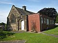
Aberford Methodist Church (former)
-
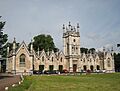
Gascoigne Almshouses (former chapel)
-
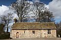
Lotherton Hall Chapel (former)
-
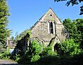
Adel Reformatory Chapel (former)
-
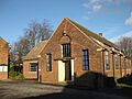
St Barnabas's Church (now hall)
-
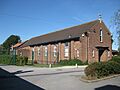
St Paul's Church (now hall)
-
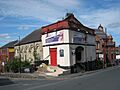
Branch Road Methodist Chapel 1877 (former)
-
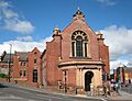
Branch Road Methodist Chapel 1905 (former)
-
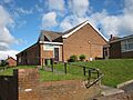
Church of the Ascension, Armley (former)
-
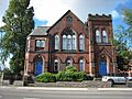
Methodist Free Church, Hall Lane (former)
-
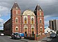
Methodist Free Church, Hall Road (former)
-
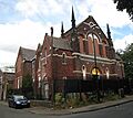
Southfield Primitive Methodist Chapel (former)
-
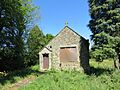
Chapel of the Blessed Sacrament (former)
-
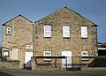
Methodist Chapel, Barwick-in-Elmet (former)
-
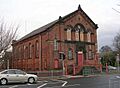
Beeston Methodist Church (former)
-
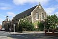
Church of Holy Spirit (former)
-
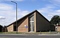
St David's Church, Beeston (former)
-
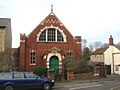
Bramham Methodist Church (former)
-
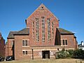
St Margaret of Antioch Church (former)
-
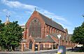
St Patrick's, Burmantofts (former)
-
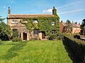
St Bartholomew's Church, Carlton (former)
-
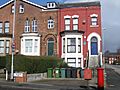
House of Faith, Chapeltown (former)
-
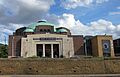
New Synagogue (former)
-
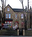
Ramgarhia Board Gurdwara (former)
-
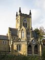
Union Chapel, Chapeltown (former)
-
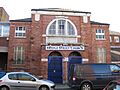
Bridge Street Church, Leeds (former)
-
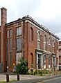
Lady Lane Chapel (former)
-
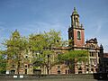
Oxford Place Methodist Church (former)
-
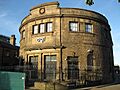
Salem Chapel, Leeds (former)
-
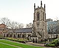
St John the Evangelist Church, Leeds (former)
-
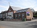
Stanks Methodist Church (former)
-
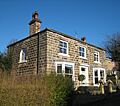
Hillside Cottage (former chapel)
-
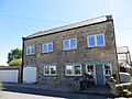
Old Mill, East Keswick (former chapel)
-
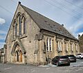
Congregational Chapel, Farsley (former)
-

Farsley Baptist Church (former)
-

Dayspring Church (former)
-
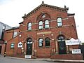
Primitive Methodist Chapel, Garforth (former)
-
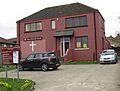
Gipton Methodist Church (former)
-
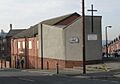
Ashley Road Methodist Church (former)
-
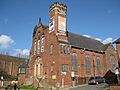
Congregational Church, Harehills (former)
-
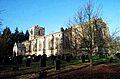
All Saints Church, Harewood (former)
-
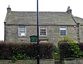
Harewood Chapel (former)
-
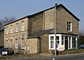
First Church of Christ Scientist Leeds (former)
-
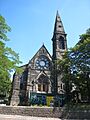
Headingley Hill Congregational Church (former)
-
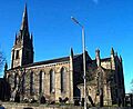
St Matthew's Church, Holbeck (former)
-
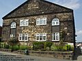
Providence Chapel, Horsforth (former)
-
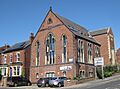
Kirkstall Methodist Chapel (former)
-
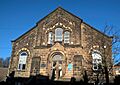
Zion Methodist Chapel (former)
-
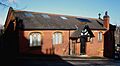
St Oswald's Church, Meanwood (former)
-
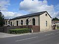
Woodside Chapel, Meanwood (former)
-
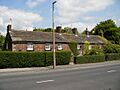
Top of the Town Cottages (former meeting house)
-
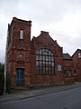
Middleton Methodist Chapel (former)
-
Leeds New Central Vilna Synagogue (former)
-
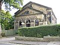
Moortown Methodist Chapel (former)
-
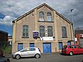
Grace Faith Ministries (former)
-
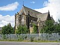
Mount St. Mary Church (former)
-
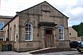
Ebenezer Chapel, Rodley (former)
-
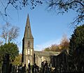
St John's Church, Roundhay (former)
-
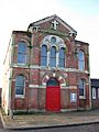
Seacroft Methodist Church (former)
-
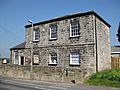
Methodist Chapel, Shadwell (former)
-
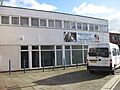
Divine Exchange Christian Centre (former)
-
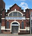
Salvation Army Church, Sheepscar (former)
-
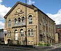
Woodhouse Carr Chapel (former)
-
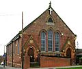
Stanningley Methodist Church (former)
-
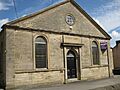
Olivet Chapel, Stanningley (former)
-
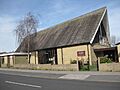
St Luke's Church, Swarcliffe (former)
-
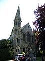
Thorner Methodist Church (1878-1985) (former)
-
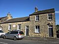
Thorner Methodist Church (1985-2020) (former)
-
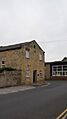
Calvinist Chapel, Victoria Street (former)
-
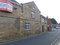
Christian Army Meeting House (former)
-
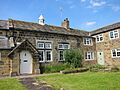
Old Schoolhouse, Wike (former chapel)
-
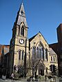
Blenheim Baptist Church (former)
-
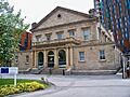
Carlton Hill Meeting House (former)
-
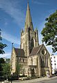
Emmanuel Church, Woodhouse Lane (former)
-
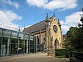
Leeds Grammar School Chapel (former)
-
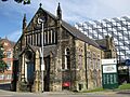
New Jerusalem Church, Woodhouse (former)
-
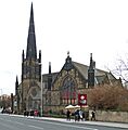
Trinity St David's Congregational Chapel (former)
-
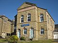
Yeadon Primitive Methodist Chapel (former)
Major Sources
- Minnis, John, (2007) Religion and Place in Leeds English Heritage (Information on architecture and dates)
- British Listed Buildings (Information on building grades)
- Mosques in Leeds (Information on mosques, past and present)
- GENUKI The Ancient Parish of Leeds (Historical information on churches)
- Leodis - a photographic archive of Leeds (Leeds Library and Information Service)
See Also
