Suriname facts for kids
Quick facts for kids
Republic of Suriname
Republiek Suriname (Dutch)
|
|
|---|---|
|
|
|
|
Anthem: God zij met ons Suriname (Dutch)
"God be with our Suriname" |
|
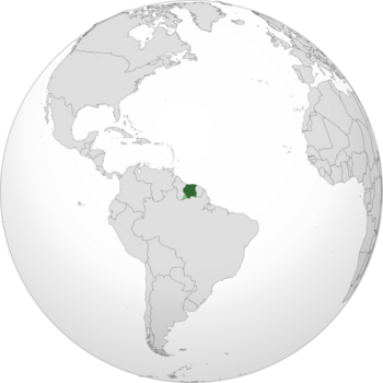
Land controlled by Suriname shown in dark green; claimed land shown in light green.
|
|
| Capital and largest city
|
Paramaribo 5°50′N 55°10′W / 5.833°N 55.167°W |
| Official languages | Dutch |
| Recognised regional languages |
8 indigenous languages
|
| Other languages |
15 languages
|
| Ethnic groups
(2012)
|
|
| Religion
(2012)
|
|
| Demonym(s) | Surinamese |
| Government | Unitary parliamentary republic with an executive presidency |
| Jennifer Geerlings-Simons | |
| Gregory Rusland | |
|
• National Assembly Chairman
|
Ashwin Adhin |
| Legislature | National Assembly |
| Independence
from the Netherlands
|
|
|
• Constituent country within the Kingdom of the Netherlands
|
15 December 1954 |
|
• Independence from the Kingdom of the Netherlands
|
25 November 1975 |
| Area | |
|
• Total
|
163,820 km2 (63,250 sq mi) (90th) |
|
• Water (%)
|
1.1 |
| Population | |
|
• 2022 estimate
|
632,638 (170th) |
|
• Density
|
3.9/km2 (10.1/sq mi) (231st) |
| GDP (PPP) | 2025 estimate |
|
• Total
|
|
|
• Per capita
|
|
| GDP (nominal) | 2025 estimate |
|
• Total
|
|
|
• Per capita
|
|
| HDI (2023) | high · 114th |
| Currency | Surinamese dollar (SRD) |
| Time zone | UTC-03:00 (SRT) |
| Date format | dd/mm/yyyy |
| Driving side | left |
| Calling code | +597 |
| ISO 3166 code | SR |
| Internet TLD | .sr |
Suriname, officially known as the Republic of Suriname, is a country located in northern South America. It is also considered part of the Caribbean region. Suriname is a developing country with a good level of human development. Its economy relies heavily on its rich natural resources, such as bauxite, gold, petroleum, and farm products. Suriname is a member of important international groups like the Caribbean Community (CARICOM) and the United Nations.
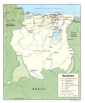
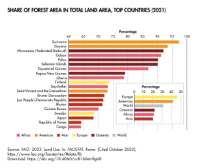
This country is located just north of the equator. More than 90% of its land is covered by rainforest, which is the highest percentage of forest cover in the world! Suriname shares borders with the Atlantic Ocean to the north, French Guiana to the east, Guyana to the west, and Brazil to the south. It is the smallest country in South America in terms of both population and land area. In 2021, it had about 632,638 people living in an area of roughly 163,820 square kilometers. The capital and largest city is Paramaribo, where about half of the country's population lives.
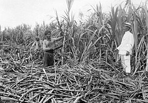
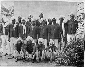
Suriname has been home to various indigenous groups since ancient times, including the Arawaks and Caribs. Europeans arrived in the 16th century. By the late 17th century, the Dutch controlled much of the area. Under Dutch rule, Suriname became a profitable plantation economy that grew crops like sugar. This economy depended on enslaved African people until slavery was abolished in 1863. After that, many workers came from British India and the Dutch East Indies as indentured servants. In 1954, Suriname became a self-governing part of the Kingdom of the Netherlands. On November 25, 1975, it became fully independent. Suriname still has strong connections with the Netherlands today.
Suriname's culture and society show a strong influence from Dutch colonial times. It is the only country outside Europe where Dutch is the official language for government, business, media, and schools. About 60% of the people speak Dutch as their first language. Sranan Tongo, a language based on English, is also widely spoken. Most Surinamese people are descendants of enslaved Africans or indentured workers from Asia. Suriname is very diverse, with many different ethnic groups. It also has some of the largest Muslim and Hindu populations in the Americas. Most people live along the northern coast, especially around Paramaribo. This makes Suriname one of the least crowded countries on Earth.
Contents
- What's in a Name? The Story of Suriname's Name
- A Look at Suriname's Past
- How Suriname is Governed
- Suriname's Geography and Nature
- Suriname's Economy
- People and Culture of Suriname
- Suriname's Culture and Traditions
- Getting Around Suriname
- Health and Education
- Media and News
- Exploring Suriname: Tourism
- See also
What's in a Name? The Story of Suriname's Name
The name Suriname might come from an indigenous group called the Surinen. They lived in the area when Europeans first arrived. The ending -ame, which is common in names of rivers and places in Suriname, may come from the Lokono language. In Lokono, aima or eima means "river or creek mouth".
Early European explorers wrote down different versions of "Suriname" for the river where colonies were later built. For example, in 1598, Dutch ships mentioned passing the river "Surinamo". British settlers, who started the first European colony there in 1630, spelled the name "Surinam". This spelling was used in English for a long time.
When the Dutch took control, the area became part of what was known as Dutch Guiana. The official English spelling of the country's name changed from "Surinam" to "Suriname" in January 1978. However, you can still see "Surinam" in some names, like Surinam Airways.
A Look at Suriname's Past
Early Settlements: Before Europeans Arrived
Indigenous people first settled in Suriname around 3,000 BC. The largest tribes were the Arawak and the Carib. The Arawak were nomadic people who lived along the coast, hunting and fishing. The Carib people later settled in the area and were known for their sailing skills. Smaller groups like the Akurio, Trió, Warao, and Wayana lived in the inland rainforests.
Colonial Times: European Influence and Plantations
Starting in the 16th century, explorers from France, Spain, and England visited the area. A century later, Dutch and English settlers began building plantation colonies along the fertile rivers. One of the earliest English settlements was Marshall's Creek. Another English colony, called Surinam, existed from 1650 to 1667.
The Dutch and English often argued over who controlled this land. In 1667, after a war, the Dutch decided to keep the new plantation colony of Surinam. In exchange, the English kept New Amsterdam in North America, which they renamed New York.
In 1683, the Society of Suriname was formed to manage the colony. The plantations relied heavily on enslaved African people to grow and process crops like coffee, cocoa, sugar cane, and cotton. The treatment of enslaved people was very harsh. Many enslaved Africans escaped these forced labor camps. Even after slavery ended, formerly enslaved people faced many challenges.
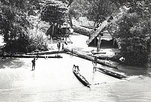
With help from native South Americans, escaped enslaved Africans created new cultures in the interior. They were known as Maroons. These Maroons formed several independent tribes, including the Saramaka, Paramaka, Ndyuka, Kwinti, Aluku, and Matawai.
The Maroons often raided plantations to free more enslaved people and get supplies. They sometimes fought against the plantation owners. The Dutch colonists also launched military campaigns against the Maroons. To end the fighting, the European authorities signed peace treaties with different Maroon tribes in the 18th century. They had to recognize the Maroons' independence and trade rights in their inland territories.
The End of Slavery and New Beginnings
The Netherlands officially ended slavery in Suriname in 1863. This was a gradual process where enslaved people had to work on plantations for 10 more years for very low pay. After this period ended in 1873, most freed people moved to the capital city, Paramaribo. Some were even able to buy the plantations where they had worked. Their descendants still live on these lands today. July 1st, 1863, is celebrated as Ketikoti, or Emancipation Day.
Because Suriname's economy relied on crops that needed a lot of workers, the Dutch brought in new laborers. These were contract workers, or indentured laborers, from the Dutch East Indies (now Indonesia) and India. Later, smaller numbers of workers also came from China and the Middle East.
This complex history of colonization and different groups of people coming to Suriname has made it one of the most ethnically and culturally diverse countries in the world.
Becoming an Independent Nation
During World War II, in November 1941, the United States sent soldiers to Suriname. This was to protect the bauxite mines, which were important for the war effort. After the war, the Dutch government began to think about how its colonies would be governed in the future.
In 1954, Suriname became one of the self-governing countries within the Kingdom of the Netherlands, along with the Netherlands Antilles and the Netherlands. The Netherlands still managed defense and foreign affairs. In 1974, the local government, led by the National Party of Suriname (NPS), began talks with the Dutch government for full independence. Independence was granted on November 25, 1975. For the first ten years after independence, much of Suriname's economy was supported by aid from the Dutch government.
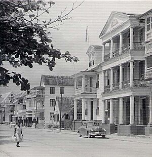
Suriname's Independence Journey
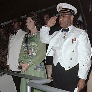
The first President of Suriname was Johan Ferrier. Henck Arron became the Prime Minister. Before independence, many Surinamese people moved to the Netherlands. They were worried about how the new country would manage on its own. After independence, Suriname faced political challenges.
A Time of Change and Challenges
On February 25, 1980, a military coup took over the government. It was led by a group of sergeants, including Dési Bouterse. There were attempts to reverse the coup.
A civil war began in 1986 between the army and Maroons. This war continued into the 1990s and made the country's situation more difficult. Many Surinamese people, especially Maroons, fled to French Guiana.
National elections were held in 1987. A new constitution was adopted. In 1990, the military leader, Dési Bouterse, dismissed the government by telephone. This event became known as the "Telephone Coup". His power began to lessen after the 1991 elections.
At the 1988 Summer Olympics in Seoul, Suriname won its first Olympic medal. Anthony Nesty won a gold medal in swimming.
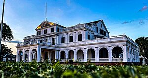
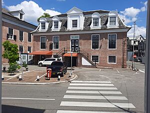
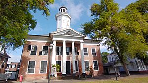
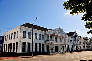
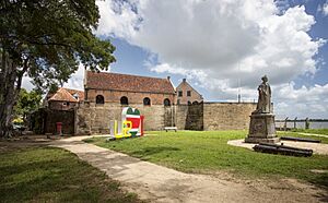
In 2002, the historic inner city of Paramaribo was named a UNESCO World Heritage Site. This recognized its beautiful Dutch colonial buildings.
On July 19, 2010, Dési Bouterse was elected as the president of Suriname. He was reelected on July 14, 2015. Dési Bouterse passed away in December 2024.
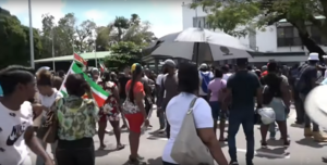
After winning the 2020 elections, Chan Santokhi became the president of Suriname. He was inaugurated on July 16, 2020. In February 2023, there were protests in Paramaribo about rising living costs.
How Suriname is Governed

Suriname is a democratic republic. It is based on its Constitution of 1987. The country's laws are made by the National Assembly. This group has 51 members who are elected by the people for five-year terms.
In the elections held on May 25, 2010, the Megacombinatie party won the most seats. Elections were held again on May 25, 2015.
The president of Suriname is elected for a five-year term. The National Assembly chooses the president. If they cannot agree, a larger group called the People's Assembly makes the choice.
The president is the head of the government and chooses a cabinet of sixteen ministers. A vice president is usually elected at the same time as the president.
The highest court in Suriname is the High Court of Justice of Suriname (Supreme Court). Its members are appointed for life by the president.
Connecting with Other Countries
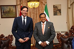
Suriname has a special relationship with the Netherlands because of its history.
The United States has had good relations with Suriname since 1991. The two countries work together on security and health programs. Suriname also gets military funding from the U.S. Department of Defense.
Suriname is a member of the The Forum of Small States (FOSS). It also has cooperation agreements with the European Union.
In recent years, Suriname has also worked more closely with other developing countries. China has helped with large building projects like port and road construction. Brazil has signed agreements to cooperate with Suriname in areas like education, health, and energy.
Suriname's Military
Suriname's Armed Forces have three parts: the Army, the Air Force, and the Navy. The president is the top commander of the Armed Forces. The Minister of Defence helps the president.
After Suriname became independent in 1975, its military was formed.
How Suriname is Divided
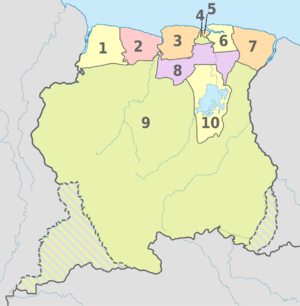
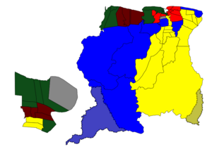
The country is divided into ten main areas called districts. Each district has a commissioner chosen by the president. Suriname is also divided into 62 smaller areas called resorts.
| District | Capital | Area (km2) | Area (%) | Population (2012 census) |
Population (%) | Pop. dens. (inhabitants/km2) | |
|---|---|---|---|---|---|---|---|
| 1 | Nickerie | Nieuw Nickerie | 5,353 | 3.3 | 34,233 | 6.3 | 6.4 |
| 2 | Coronie | Totness | 3,902 | 2.4 | 3,391 | 0.6 | 0.9 |
| 3 | Saramacca | Groningen | 3,636 | 2.2 | 17,480 | 3.2 | 4.8 |
| 4 | Wanica | Lelydorp | 443 | 0.3 | 118,222 | 21.8 | 266.9 |
| 5 | Paramaribo | Paramaribo | 182 | 0.1 | 240,924 | 44.5 | 1323.8 |
| 6 | Commewijne | Nieuw-Amsterdam | 2,353 | 1.4 | 31,420 | 5.8 | 13.4 |
| 7 | Marowijne | Albina | 4,627 | 2.8 | 18,294 | 3.4 | 4.0 |
| 8 | Para | Onverwacht | 5,393 | 3.3 | 24,700 | 4.6 | 4.6 |
| 9 | Sipaliwini | none | 130,567 | 79.7 | 37,065 | 6.8 | 0.3 |
| 10 | Brokopondo | Brokopondo | 7,364 | 4.5 | 15,909 | 2.9 | 2.2 |
| SURINAME | Paramaribo | 163,820 | 100.0 | 541,638 | 100.0 | 3.3 |
Suriname's Geography and Nature
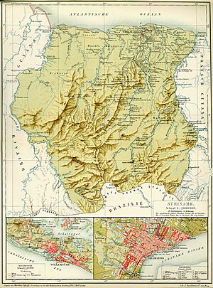
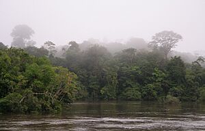
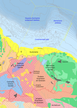
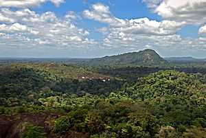
Suriname is the smallest independent country in South America. It is located between 1° and 6° North latitude and 54° and 58° West longitude. The country has two main geographic areas. The northern coastal area is low and flat, and most people live here. The southern part is covered by tropical rainforest and has some savanna areas. This southern part makes up about 80% of Suriname's land.
The two main mountain ranges are the Bakhuys Mountains and the Van Asch Van Wijck Mountains. Julianatop is the highest mountain, standing at 1,286 meters (4,219 feet) above sea level.
Suriname has many different natural environments, including moist forests and savannas. Its forest cover is 90.2%, which is the highest in the world! This means Suriname has a very healthy natural environment.
Where Suriname's Borders Lie
Suriname is located between French Guiana to the east and Guyana to the west. The southern border is with Brazil. The northern border is the Atlantic coast. There are some disagreements about the exact borders with French Guiana and Guyana along certain rivers.
Suriname's Climate
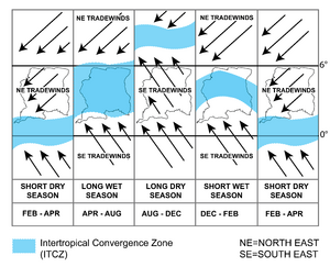
Suriname is very close to the equator, so it has a hot and wet tropical climate. Temperatures do not change much throughout the year. The average temperature is between 29°C and 34°C (84°F and 93°F). Because of high humidity, it can feel even hotter.
The year has two wet seasons, from April to August and from November to February. It also has two dry seasons, from August to November and February to April.
Climate change is causing warmer temperatures and more extreme weather events in Suriname. Because of its large forest cover, Suriname has been a "carbon negative" country since 2014. This means its forests absorb more carbon dioxide than the country produces.
Amazing Plants and Animals: Biodiversity and Conservation
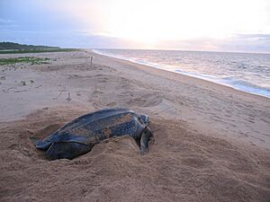
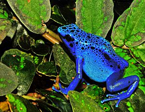
Suriname has a very high variety of plants and animals, known as biodiversity. In 2013, scientists found 60 new species during an expedition, including frogs, a snake, and fish! Suriname's fresh water is very important for its rich ecosystems.
The Central Suriname Nature Reserve is a UNESCO World Heritage Site. It is known for its untouched forests and many different species. There are also many national parks, like Galibi National Reserve and Brownsberg Nature Park. About 16% of Suriname's land is protected as national parks and reserves.
Suriname's vast forests are very important for fighting climate change and keeping the country carbon negative.
Suriname's Economy
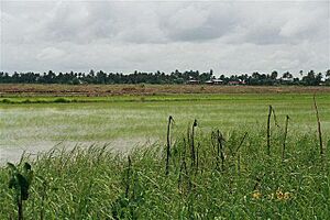
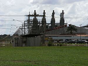
Suriname's economy has become more varied over time. In the past, bauxite (a type of aluminum ore) mining was a major source of income. However, bauxite operations ended in 2015.
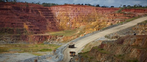
Today, finding and mining gold and oil are very important for Suriname's economy. These resources help the country be more financially independent. Farming, especially growing rice and bananas, is also a strong part of the economy. Ecotourism, which is tourism focused on nature, is creating new opportunities. Over 93% of Suriname's land is untouched rainforest, which attracts visitors. The Central Suriname Nature Reserve became a World Heritage Site in 2000.
Gold exports now make up 60–80% of all export earnings. In 2021, the gold industry contributed 8.5% to the country's economy. Oil exploration and production also add significantly to the economy, about 10% of the GDP. The national oil company, STAATSOLIE, is a key player in this industry.
Other important products that Suriname exports include rice, bananas, and shrimp. Suriname's main trading partners are Switzerland, China, the Netherlands, the United States, Canada, and Caribbean countries.
In the late 1990s, Suriname faced some economic challenges. However, the country continues to work on strengthening its economy.
People and Culture of Suriname
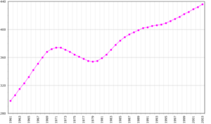
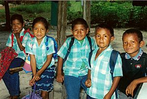
In 2022, Suriname had about 624,900 people. The population of Suriname is very diverse. No single group makes up the majority. This diversity comes from hundreds of years of Dutch rule, which brought people from many different countries and backgrounds to Suriname.
Many Cultures, One Nation: Ethnic Groups
| Ethnic groups of Suriname | ||||
|---|---|---|---|---|
| Ethnic groups | percent | |||
| Indian | 27.4% | |||
| Maroons | 21.7% | |||
| Creoles | 15.7% | |||
| Javanese | 13.7% | |||
| Mixed | 13.4% | |||
| Amerindian | 3.8% | |||
| Chinese | 1.5% | |||
| White | 0.3% | |||
| Other | 2.5% | |||
The largest group are Asian Surinamese, making up about 43% of the population. The biggest subgroup within this are Indo-Surinamese, who are descendants of workers from India. Afro-Surinamese people make up about 37.4% of the population. They are usually divided into two groups: the Maroons and the Creoles. Maroons are descendants of escaped enslaved people. Creoles are people of mixed African and European heritage.
Javanese people make up about 14% of the population. They are mostly descendants of workers from the island of Java (now part of Indonesia). About 13.4% of the population has mixed ethnic backgrounds. Chinese people make up 7.3% of the population.
Other groups include Lebanese and Jews. Various indigenous groups make up 3.7% of the population. A small number of Europeans also live in the country.
Recently, new immigrants have arrived from Brazil, Haiti, and China.
Moving to New Homes: Emigration
Before Suriname became independent in 1975, many people moved to the Netherlands. This migration continued after independence and during the 1980s and 1990s, often for economic reasons. In 2013, about 350,300 people of Surinamese background lived in the Netherlands.
Many Surinamese people also live in other countries. These include France (especially French Guiana), the United States, Guyana, Aruba, and Canada.
Faith and Beliefs: Religion in Suriname
Suriname has many different religions, showing its multicultural nature. Christians are the largest religious group, making up just over half the population (51.6% in 2012). This is followed by Hindus (19.8%) and Muslims (15.2%). Other religions include traditional folk faiths.
In 2020, 52.3% of Surinamese people were Christians. Hindus are the second largest group, making up almost one-fifth of the population. Muslims make up 14.3% of the population, which is the highest percentage of Muslims in the Americas. Folk religions like Winti are also practiced.
Speaking Many Tongues: Languages
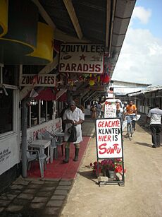
Suriname has about 14 local languages. However, Dutch is the only official language. It is used in schools, government, business, and media. More than 60% of the population speaks Dutch as their first language. Suriname is one of only three countries outside Europe where Dutch is an official language.
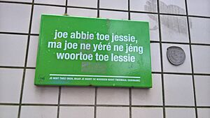
Sranan Tongo, a language based on English, is widely used in daily life and business. It is often used along with Dutch.
Sarnami Hindustani, which comes from India, is the third most used language. It is mainly spoken by people whose ancestors were Indian indentured laborers.
The six Maroons languages are also based on English. These include Saramaccan and Aukan. Surinamese-Javanese is spoken by people of Javanese descent.
Amerindian languages include Arawak-Lokono and Carib-Kari'nja. Hakka is spoken by descendants of Chinese laborers. English, Portuguese, and Spanish are also spoken, especially near the borders.
Major Cities in Suriname
The capital city, Paramaribo, is by far the largest urban area. It is home to almost half of Suriname's population. Most towns are located near Paramaribo or along the coast. About 90% of the population lives in these areas.
|
Largest cities or towns in Suriname
|
||
|---|---|---|
| Rank | Pop. | |
| 1 | Paramaribo | 223 757 |
| 2 | Lelydorp | 18 223 |
| 3 | Nieuw Nickerie | 13 143 |
| 4 | Moengo | 7 074 |
| 5 | Nieuw Amsterdam | 4 935 |
| 6 | Mariënburg | 4 427 |
| 7 | Wageningen | 4 145 |
| 8 | Albina | 3 985 |
| 9 | Groningen | 3 216 |
| 10 | Brownsweg | 2 696 |
Suriname's Culture and Traditions

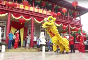
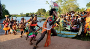
Because of its many different cultures, Suriname celebrates a variety of unique festivals.
National Holidays
- 1 January – New Year's Day
- January/February – Chinese New Year
- March (varies) – Phagwah
- March/April – Good Friday
- March/April – Easter
- March/April – Easter Monday
- 1 May – Labour Day
- 1 July – Ketikoti (Emancipation Day – end of slavery)
- 9 August – Indigenous People's Day
- 10 October – Day of the Maroons
- October/November – Diwali
- 25 November – Independence Day
- 25 December – Christmas
- 26 December – Boxing Day
- varies – Eid-ul-Fitr
- varies – Eid-ul-Adha
- varies – Satu Suro
Several Hindu and Islamic holidays, like Diwali and Eid-ul-adha, are also national holidays. Their dates change each year because they follow different calendars.
Suriname also has unique holidays. These include the arrival days for Indian, Javanese, and Chinese immigrants. They celebrate when the first ships carrying these groups arrived.
Celebrating New Year's Eve
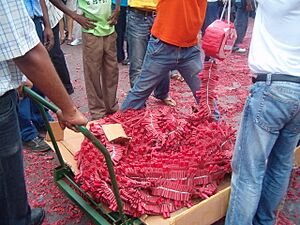
New Year's Eve in Suriname is called Oud jaar or Owru Yari, meaning "old year". People light special Firecrackers called pagaras at midnight.
Sports and Athletes
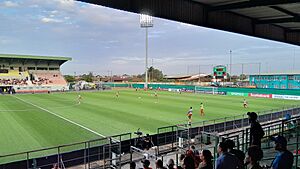
The most popular sports in Suriname are football, basketball, and volleyball. The Suriname Olympic Committee manages sports in the country. Popular mind sports include chess and draughts.
Many famous football players who were born in Suriname or have Surinamese family have played for the Dutch national team. These include Ruud Gullit, Frank Rijkaard, and Clarence Seedorf. Anthony Nesty is Suriname's only Olympic medalist. He won a gold medal in swimming at the 1988 Summer Olympics and a bronze medal in 1992.
Letitia Vriesde is a well-known track and field athlete from Suriname. She won silver and bronze medals at the World Championships in the 800 meters.
Cricket is also somewhat popular in Suriname. The national cricket team competes in international leagues.
In badminton, athletes like Virgil Soeroredjo and Sören Opti have won medals for Suriname at Caribbean and South American championships.
Several world champions in K-1 kickboxing were born in Suriname or have Surinamese roots. These include Ernesto Hoost and Remy Bonjasky.
In 2016, the Sports Hall of Fame Suriname was created to honor the achievements of Surinamese athletes.
Getting Around Suriname
Roads and Driving
Suriname is one of only two countries in mainland South America where people drive on the left side of the road. This practice likely comes from its history as a British and then Dutch colony. As of 2003, Suriname had 4,303 kilometers (2,674 miles) of roads.
Air Travel
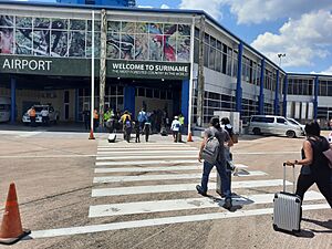
The country has 55 airports, but only six have paved runways. The main international airport for large planes is Johan Adolf Pengel International Airport.
Airlines that fly from Suriname include American Airlines, Blue Wing Airlines, Gum Air, Fly All Ways, and Surinam Airways.
Airlines that fly to Suriname include Caribbean Airlines, KLM, Gol Transportes Aéreos, Copa Airlines, and Tui. Surinam Airways also flies to several destinations like Aruba, Brazil, Curaçao, Guyana, the Netherlands, Trinidad and Tobago, and the United States.
Health and Education
Health in Suriname
The average life expectancy in Suriname in 2017 was 72 years. The leading causes of death were heart disease, cancer, and diabetes.
Learning and Schools: Education
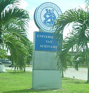
Education in Suriname is required until age 12. Most people can read and write, especially men. The main university in the country is the Anton de Kom University of Suriname.
The school system has 13 grades, from elementary to high school. Students take a test after elementary school to decide their next steps in education.
Media and News
Traditionally, De Ware Tijd was the main newspaper. Now, Times of Suriname, De West, and Dagblad Suriname are also popular. All these newspapers are mostly in Dutch.
Suriname has 24 radio stations and 12 television channels. There are also three major news websites: Starnieuws, Suriname Herald, and GFC Nieuws.
In 2022, Suriname was ranked 52nd in the worldwide Press Freedom Index.
Exploring Suriname: Tourism
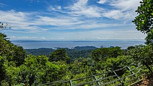
Most tourists visit Suriname to see the amazing variety of plants and animals in the Amazonian rainforests. The Central Suriname Nature Reserve is the largest and most popular reserve. Another popular spot is the Brownsberg Nature Park, which overlooks the Brokopondo Reservoir, one of the world's largest human-made lakes. The Berg en Dal Eco & Cultural Resort opened in 2008. Tonka Island in the reservoir has an eco-tourism project run by the Saramaccaner Maroons. Tourists often buy Pangi wraps and bowls made from calabashes as souvenirs.
There are also many beautiful waterfalls, like Raleighvallen (Raleigh Falls) and the Blanche Marie Falls. Tafelberg Mountain is surrounded by its own nature reserve. Many Maroon and Amerindian villages in the interior welcome visitors.
Suriname is special because it has protected areas for almost every type of natural environment found in the country. About 30% of Suriname's land is protected by law as reserves.
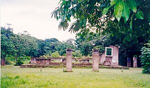
Other attractions include old plantations like Laarwijk, which can only be reached by boat.
The U.S. Department of State advises visitors to Suriname to "exercise normal precautions."
Famous Places and Buildings: Landmarks
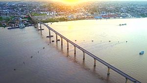
The Jules Wijdenbosch Bridge crosses the Suriname River, connecting Paramaribo with Meerzorg. It was finished in 2000. The bridge is 52 meters (171 feet) high and 1,504 meters (4,934 feet) long. It made travel much easier between these areas.
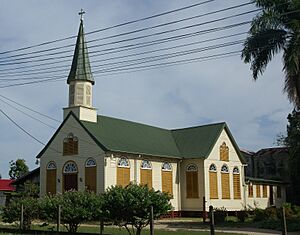
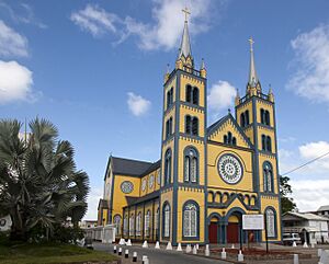
The construction of the Sts. Peter and Paul Cathedral began in 1883. Before it was a cathedral, it was a theater.
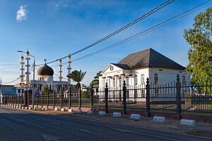
Suriname is one of the few countries where a synagogue is located right next to a mosque. These two buildings are in the center of Paramaribo. They are known to share a parking lot when their religious services happen at the same time.
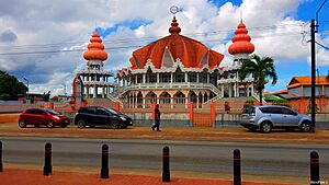
A newer landmark is the Hindu Arya Diwaker temple in Paramaribo, opened in 2001. This temple is unique because it does not have images of Hindu gods. Instead, its walls are covered with texts from Hindu scriptures. Its special architecture makes it a popular place for tourists to visit.
See also
 In Spanish: Surinam para niños


