Jackson County, Missouri facts for kids
Quick facts for kids
Jackson County
|
|
|---|---|
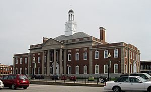
Truman Courthouse in Independence, designed by Edward F. Neild at the request of Harry S. Truman
|
|
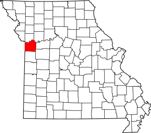
Location within the U.S. state of Missouri
|
|
 Missouri's location within the U.S. |
|
| Country | |
| State | |
| Founded | December 15, 1826 |
| Named for | Andrew Jackson |
| Seat | Independence and Kansas City |
| Largest city | Kansas City |
| Area | |
| • Total | 616 sq mi (1,600 km2) |
| • Land | 604 sq mi (1,560 km2) |
| • Water | 12 sq mi (30 km2) 1.9% |
| Population
(2020)
|
|
| • Total | 717,204 |
| • Estimate
(2021)
|
716,862 |
| • Density | 1,164.3/sq mi (449.5/km2) |
| Time zone | UTC−6 (Central) |
| • Summer (DST) | UTC−5 (CDT) |
| Congressional districts | 4th, 5th, 6th |
Jackson County is a county in the western part of Missouri, a state in the United States. It sits right on the border with Kansas. In 2020, about 717,204 people lived here. This makes it the second most populated county in Missouri.
Independence is the original county seat. A county seat is like the main town where the government offices are. However, Kansas City also serves as a county seat. It is the biggest city in the county. Jackson County was created on December 15, 1826. It was named after Andrew Jackson, who later became the President of the United States.
Contents
History of Jackson County
Early Days
Long ago, the Osage tribe lived in the area that is now Jackson County. The first Europeans to visit were French fur trappers. They used the Missouri River for travel and trade. This land was once part of "New France."
In 1763, Great Britain won the French and Indian War. France then gave this land to Spain. Later, in 1800, Spain gave it back to France. Then, in 1803, France sold a huge area, including Jackson County, to the United States. This was called the Louisiana Purchase.
Explorers Meriwether Lewis and William Clark traveled through Jackson County in 1804. They were exploring the new lands for President Thomas Jefferson. They found a good spot by the river. In 1808, Fort Osage was built there. It was an early U.S. military post and trading center.
Missouri became a state in 1821. Jackson County was officially formed on December 15, 1826. It was named after Andrew Jackson, a hero from the War of 1812. He became president in 1829. Independence was chosen as the county seat. It became a key starting point for three famous trails: the Santa Fe Trail, the Oregon Trail, and the California Trail. These trails helped people move west.
After the American Civil War, railroads were built. Kansas City grew much larger than Independence. Even so, both cities remain county seats today.
In 1838, a group bought land by the Missouri River. They called it "Westport Landing." This area is now known as the River Market district. In 1839, it was renamed "Town of Kansas." This name came from the local Kanza or Kaw tribe. The town became the "City of Kansas" in 1853. In 1889, with many people living there, it changed its name to Kansas City.
Latter Day Saints History
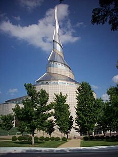
Jackson County is important in the history of the Church of Jesus Christ of Latter Day Saints. These people are also known as Mormons. In 1831, their leader, Joseph Smith, said that Independence would be a special place for them.
Many members of the Church moved to Jackson County. However, they faced problems with other settlers already living there. These disagreements were often about religious and cultural differences. Many early settlers had come from southern states and had enslaved people. They thought the Mormons, who came from northern states, were against slavery.
Because of these problems, the Latter Day Saints were asked to leave Jackson County. By 1839, they had left the entire state of Missouri. They did not return to Jackson County in large numbers until 1867, after the Civil War ended.
Civil War Events
During the American Civil War, Jackson County saw several battles. The most famous was the Battle of Westport in 1864. This battle was a big victory for the Union (Northern) side. It helped the Union gain control of Missouri. Other battles happened in Independence in 1862 and 1864, and in Lone Jack.
Union General Thomas Ewing issued a famous order called General Order No. 11 (1863). This order forced many people to leave their homes in rural Jackson County. It was meant to stop support for Confederate fighters. The order caused a lot of destruction. Many homes and farms were burned. This event affected Jackson County for many years after the war.
The 1900s and Beyond
In the late 1800s, railroads and stockyards helped Kansas City grow fast. In the 1920s and 1930s, the city became famous for Jazz and Blues music. It also became home to Hallmark Cards and Walt Disney's first animation studio.
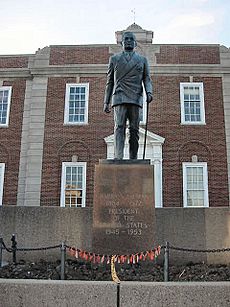
During the Great Depression, Jackson County did better than some areas. A local political leader named Thomas Pendergast started big public projects. These projects created thousands of jobs. One person who worked with Pendergast was Harry S. Truman. Truman was a veteran of World War I. He became a county leader in 1926. Later, he became a U.S. Senator, then Vice President. In 1945, he became the thirty-third President of the United States.
After World War II, new roads led to new neighborhoods. These new homes were for returning soldiers and their families. Towns like Independence, Blue Springs, and Lee's Summit grew a lot. Kansas City faced challenges as some jobs and families moved away.
Recently, there have been projects to improve Kansas City. These include work on the City Market, Westport, and the Power & Light District.
In 2024, there was a discussion about statues of Andrew Jackson. People talked about whether to keep or remove them. Plaques were added in 2021 to explain his history, including his role in moving Native Americans from their lands.
You can learn more about the county's history at the Pleasant Hill Historical Society Museum. It is located in Pleasant Hill.
Economy
As of September 2024, there were over 1.1 million jobs in Jackson County.
Courts
Jackson County has its own court system called the 16th Judicial Circuit. It has many judges who handle different types of cases. These judges are chosen by the Governor of Missouri. They serve for several years.
The county also has a municipal court. This court handles local laws and issues. The judge for this court is chosen by county leaders.
Geography
Jackson County covers about 616 square miles. Most of this is land, with about 12 square miles of water.
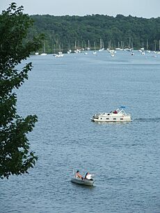
Some important lakes in the county are:
The Missouri River forms the northern border of Jackson County. This river has always been a key route for travel in America.
Neighboring Counties
Jackson County shares borders with several other counties:
- Johnson County, Kansas (to the west and southwest)
- Clay County, Missouri (to the north)
- Wyandotte County, Kansas (to the west and northwest)
- Cass County, Missouri (to the south)
- Lafayette County, Missouri (to the east)
- Ray County (to the northeast)
- Johnson County, Missouri (to the southeast)
Jackson County is unique because it borders two counties that have the same name but are in different states: Johnson County in Kansas and Johnson County in Missouri.
Main Roads
Many important highways run through Jackson County:
 Interstate 29
 Interstate 35
 Interstate 49
 Interstate 70
 Interstate 435
 Interstate 470
 Interstate 670
 U.S. Route 24
 U.S. Route 40
 U.S. Route 50
 U.S. Route 56
 U.S. Route 71
 U.S. Route 169
 Route 7
 Route 150
 Route 291
 Route 350
Public Transportation
- RideKC
- KC Streetcar
- Kansas City Area Transportation Authority
- Amtrak (trains) at Kansas City Union Station
- Greyhound Lines and Jefferson Lines (buses) at Kansas City Bus Station
Protected Areas
People of Jackson County
| Historical population | |||
|---|---|---|---|
| Census | Pop. | %± | |
| 1830 | 2,823 | — | |
| 1840 | 7,612 | 169.6% | |
| 1850 | 14,000 | 83.9% | |
| 1860 | 22,913 | 63.7% | |
| 1870 | 65,011 | 183.7% | |
| 1880 | 82,825 | 27.4% | |
| 1890 | 160,510 | 93.8% | |
| 1900 | 195,193 | 21.6% | |
| 1910 | 283,522 | 45.3% | |
| 1920 | 367,846 | 29.7% | |
| 1930 | 470,454 | 27.9% | |
| 1940 | 477,828 | 1.6% | |
| 1950 | 541,035 | 13.2% | |
| 1960 | 622,732 | 15.1% | |
| 1970 | 654,558 | 5.1% | |
| 1980 | 629,266 | −3.9% | |
| 1990 | 633,232 | 0.6% | |
| 2000 | 654,880 | 3.4% | |
| 2010 | 674,158 | 2.9% | |
| 2020 | 717,204 | 6.4% | |
| 2021 (est.) | 716,862 | 6.3% | |
| U.S. Decennial Census 1790-1960 1900-1990 1990-2000 2010-2020 |
|||
Population in 2020
Here's a look at the different groups of people living in Jackson County in 2020:
| Race | Number | Percent |
|---|---|---|
| White | 419,542 | 58.5% |
| Black or African American | 156,542 | 22% |
| Native American | 2,713 | 0.4% |
| Asian | 14,981 | 2.1% |
| Pacific Islander | 1,727 | 0.24% |
| Other/Mixed | 43,914 | 6.12% |
| Hispanic or Latino | 77,785 | 10.85% |
Religion
Many different religions are practiced in Jackson County. The most common Christian groups include Roman Catholics, Southern Baptists, and non-denominational Christians.
Education
Schools for Kids
Here are some of the school districts in Jackson County:
- Blue Springs R-IV School District
- Center 58 School District
- Fort Osage R-I School District
- Grain Valley R-V School District
- Grandview C-4 School District
- Hickman Mills C-1 School District
- Independence 30 School District
- Kansas City 33 School District
- Lee's Summit R-VII School District
- Lone Jack C-6 School District
- Oak Grove R-VI School District
- Raytown C-2 School District
Libraries and Museums
- Jackson County Historical Society
- Kansas City Public Library
- Linda Hall Library
- Mid-Continent Public Library
You can visit many interesting museums in Jackson County:
- American Jazz Museum
- National World War I Museum and Memorial
- Nelson-Atkins Museum of Art
- Negro Leagues Baseball Museum
- Harry S. Truman Library and Museum
- Harry S Truman National Historic Site
- Jackson County Jail and Marshal's House
- National Toy and Miniature Museum
- Kemper Museum of Contemporary Art
- Kansas City Museum
- Missouri Town 1855
- Vaile Mansion
- Fort Osage National Historic Landmark
- Owens-Rogers Museum
Communities
Cities in Jackson County
- Blue Springs
- Buckner
- Grain Valley
- Grandview
- Greenwood
- Independence (a county seat)
- Kansas City (a county seat, also partly in other counties)
- Lake Lotawana
- Lake Tapawingo
- Lee's Summit
- Levasy
- Lone Jack
- Oak Grove
- Pleasant Hill (mostly in Cass County)
- Raytown
- Sugar Creek
Villages
- River Bend
- Sibley
- Unity Village
Other Communities
- Blue Summit (a census-designated place)
- Tarsney Lakes (a census-designated place)
Some smaller, unincorporated communities include:
See also
 In Spanish: Condado de Jackson (Misuri) para niños
 | Kyle Baker |
 | Joseph Yoakum |
 | Laura Wheeler Waring |
 | Henry Ossawa Tanner |


