National Weather Service Lincoln, Illinois facts for kids
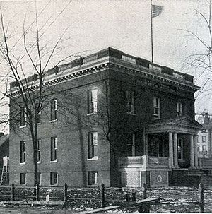
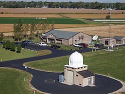 The Lincoln, Illinois National Weather Service office. |
|
| Agency overview | |
|---|---|
| Preceding agencies |
|
| Jurisdiction | Federal Government of the United States |
| Headquarters | 1362 State Route 10, Lincoln, IL 62656 40°9′6.2″N 89°20′18.2″W / 40.151722°N 89.338389°W |
| Employees | 22 |
| Agency executives |
|
| Parent agency | National Weather Service |
The National Weather Service Lincoln, Illinois office, also known as National Weather Service Central Illinois, helps keep people safe. It watches weather for 35 counties in Central and Southeastern Illinois. This office gives out weather forecasts, warnings, and special local weather updates. They also provide weather information for airplanes.
This office started from two smaller offices in Peoria and Springfield. In 1995, the current office in Lincoln became the main one. Weather tracking in this area goes way back to the 1800s. The Army Signal Service first started watching the weather in Springfield. Today, the Lincoln office uses advanced tools like the WSR-88D (NEXRAD) radar and the Advanced Weather Interactive Processing System (AWIPS). These tools help them make much better weather predictions.
Contents
How Weather Forecasting Began
First Weather Stations (1879–1930)
On July 1, 1879, the Army Signal Service set up the first federal weather station in Springfield. They used special equipment to watch the weather. About 11 years later, the U.S. Weather Bureau was created. The Springfield weather equipment was then moved to this new Weather Bureau.
In 1898, Springfield got a new weather station. This station used kites to gather weather data high in the sky. In 1905, a new U.S. Weather Bureau office opened in Peoria. It measured things like temperature, wind, rain, snow, and air pressure. A year later, the Peoria station got a telegraph. This helped them send weather information faster. The Springfield Weather Bureau also moved to a new building.
Weather for Airplanes (1931–1954)
As flying became more common, weather information for planes became very important. In 1931, the Peoria Weather Bureau started working 24 hours a day. Soon after, they began sending weather reports directly over the radio.
Special Weather Bureau Airport Stations (WBAS) opened at airports. One opened at the Peoria Municipal Airport. It checked temperature, wind, and rain. A few months later, another WBAS opened at a small airport in Springfield. In 1943, the original Peoria weather office joined the airport station. The old office then closed for good. In 1947, the Springfield airport weather station moved to the new Lincoln Capital Airport. By 1954, the main Springfield Weather Bureau closed. The airport station took over all its duties.
Radars Arrive (1955–1992)
In 1955, new weather WSR-1 radar from Saint Louis started covering parts of Central and Western Illinois. Radar coverage got even better when a new WSR-57 radar was put in Saint Louis.
In 1965, the Weather Bureau became part of a new group called ESSA. A few years later, it changed again to the National Oceanic and Atmospheric Administration (NOAA). The Weather Bureau then became the National Weather Service (NWS). The Peoria and Springfield offices were now called "Weather Service Offices."
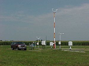
In 1974, another radar (WSR-74S) was set up in Marseilles. This greatly improved radar coverage in Central Illinois. A new radar, WSR-74C, in Moline helped the Peoria NWS give severe weather warnings. In 1980, the Springfield office also got a WSR-74C radar. This helped them warn people about local storms. By 1992, special Automated Surface Observing Systems (ASOS) were put in at both the Peoria and Springfield airports.
The Lincoln Office (1993–Today)
In 1993, work began on a new NWS Weather Forecast Office. It was built at the Logan County Airport in Lincoln. This new office was part of a big plan to make weather forecasting better. It meant closing the Peoria and Springfield offices and moving everything to Lincoln.
In 1994, the new Lincoln office was officially ready. But it didn't start working right away. The next year, special equipment for studying the upper atmosphere was moved to Lincoln. At first, the new office only used this equipment to take observations.
In the spring of 1995, construction started on a new WSR-88D radar system in Lincoln. The first five meteorologists came to the Lincoln office. But the Peoria and Springfield offices still handled the main forecasting. By September 1995, the Lincoln office was fully open. It took over watching the weather for counties that the Peoria, Springfield, Saint Louis, and Evansville offices used to cover. On October 1, 1995, the Peoria and Springfield NWS offices officially closed. They had served Central Illinois for many years.
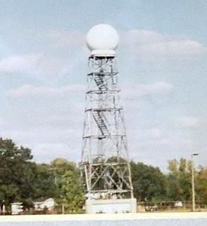
In 1996, the WSR-88D radar was finished. It became part of a large network of "NEXRAD" radars across the country. The old WSR-74C radar in Springfield was then turned off. In 1998, an Advanced Weather Interactive Processing System (AWIPS) was installed. This system helps forecasters make even more accurate weather predictions. By the early 2000s, the weather radio network grew a lot. Lincoln could now send warnings and forecasts through these stations.
How the Office Works
The Lincoln office has a powerful WSR-88D (NEXRAD) radar. This is one of 159 high-tech Doppler weather radars used by the National Weather Service. The Lincoln office also uses the Advanced Weather Interactive Processing System (AWIPS). This system helps forecasters see weather, satellite, and computer model data much better.
The Lincoln office also manages Automated Surface Observing Systems (ASOS). These are at the General Wayne A. Downing Peoria International Airport and Abraham Lincoln Capital Airport. The NWS Lincoln office has both short-term and long-term weather forecasters. Each has important jobs.
- Short-term forecasters issue the Hazardous Weather Outlook. They also create river forecasts and watch for thunderstorms.
- Long-term forecasters plan weather forecasts up to seven days ahead. They work with other forecasters in nearby areas. They also issue warnings for winter weather and thick fog.
Other meteorologists collect data. They launch weather balloons and check river levels. They also run the NOAA weather radio system. And they help with the Cooperative Observer network, where volunteers report weather.
When there's severe weather, NWS Lincoln divides its area into different zones. Different forecasters handle the severe weather for their own zone. Depending on how bad the storms are, 2 to 6 meteorologists work to issue warnings. Volunteer HAM radio operators also help. They share information between weather spotters and forecasters.
Where They Watch the Weather
The National Weather Service Central Illinois office is in charge of weather forecasts, warnings, and local updates for 35 counties. These counties are in Central and Southeastern Illinois. They include Cass, Champaign, Christian, Clark, Clay, Coles, Crawford, Cumberland, De Witt, Douglas, Edgar, Effingham, Fulton, Jasper, Knox, Lawrence, Logan, McLean, Macon, Marshall, Mason, Menard, Morgan, Moultrie, Peoria, Piatt, Richland, Sangamon, Schuyler, Scott, Shelby, Stark, Tazewell, Vermilion, and Woodford.
The office also provides aviation forecasts for five regional airports: Peoria, Springfield, Decatur, Champaign, and Bloomington/Normal.
Important Weather Events
In June 1957, the remains of Hurricane Audrey brought a lot of rain and flooding to Central Illinois. The Weather Bureau used many rain gauges to measure the storm's effects.
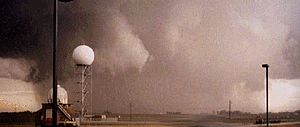
The NWS Lincoln office has covered many big weather events. Early in its history, an F3 tornado came very close to the new office on May 9, 1995. This was part of a larger series of tornadoes. During the North American blizzard of 1999, some Lincoln forecasters had to stay at the office for 1–2 days. Their replacements couldn't get through the snow.
Two very strong tornadoes have happened during the office's time in operation. These include the Roanoke, Illinois F4 tornado on July 13, 2004. Also, the Washington, IL EF4 tornado during the tornado outbreak of November 17, 2013.
NOAA Weather Radio
The National Weather Service Lincoln, Illinois office helps provide weather information for nine NOAA Weather Radio stations in Illinois. These radios broadcast weather warnings and forecasts.
| City of license | Call sign | Frequency (MHz) | Power | Counties served (in Illinois unless otherwise noted) |
|---|---|---|---|---|
| Bloomington | KZZ65 | 162.525 MHz | 300 watts | De Witt, McLean, Tazewell, Woodford |
| Champaign | WXJ76 | 162.550 MHz | 1,000 watts | Champaign, Coles, De Witt, Douglas, Edgar, Ford, Moultrie, Piatt, Vermilion |
| Galesburg | KZZ66 | 162.400 MHz | 300 watts | Henry, Knox, Mercer, Warren |
| Jacksonville | WXM90 | 162.525 MHz | 300 watts | Brown, Calhoun, Cass, Greene, Morgan, Pike, Scott |
| Newton | KXI48 | 162.450 MHz | 1,000 watts | Clark, Clay, Crawford, Cumberland, Edwards, Effingham, Jasper, Lawrence, Richland, Wayne |
| Paris | KXI47 | 162.525 MHz | 300 watts | Clark, Coles, Douglas, Edgar, Vigo County, Indiana |
| Peoria | WXJ71 | 162.475 MHz | 1,000 watts | Fulton, Knox, Marshall, Mason, Peoria, Putnam, Stark, Tazewell, Woodford |
| Shelbyville | KXI46 | 162.500 MHz | 300 watts | Christian, Effingham, Fayette, Moultrie, Shelby |
| Springfield | WXJ75 | 162.400 MHz | 1,000 watts | Cass, Christian, De Witt, Logan, Macon, Macoupin, Mason, Menard, Montgomery, Morgan, Sangamon |
 | Lonnie Johnson |
 | Granville Woods |
 | Lewis Howard Latimer |
 | James West |


