
Image: Lake District National Park UK relief location map

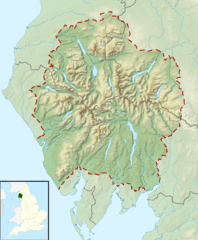
Description: Relief map of the Lake District National Park, UK Equirectangular map projection on WGS 84 datum, with N/S stretched 170% Geographic limits: West: 3.65W East: 2.60W North: 54.80N South: 54.05N
Title: Lake District National Park UK relief location map
Credit: Office of National Statistics Geography National Park boundary data Ordnance Survey OpenData. Relief data from Land-Form Panorama product. Administrative borders and coastline data from Boundary-Line product. All other geographic data from Meridian 2 product. Inset derived from England location map.svg by Spischot.
Author: Nilfanion, created using Ordnance Survey data
Permission: This file is licensed under the Creative Commons Attribution-Share Alike 3.0 Unported license. Attribution: Contains Ordnance Survey data © Crown copyright and database right You are free: to share – to copy, distribute and transmit the work to remix – to adapt the work Under the following conditions: attribution – You must attribute the work in the manner specified by the author or licensor (but not in any way that suggests that they endorse you or your use of the work). share alike – If you alter, transform, or build upon this work, you may distribute the resulting work only under the same or similar license to this one. http://creativecommons.org/licenses/by-sa/3.0 CC BY-SA 3.0 Creative Commons Attribution-Share Alike 3.0 truetrue
Usage Terms: Creative Commons Attribution-Share Alike 3.0
License: CC BY-SA 3.0
License Link: http://creativecommons.org/licenses/by-sa/3.0
Attribution Required?: Yes
Image usage
More than 100 pages link to this image. The following list shows the first 100 page links to this image only. A full list is available.
- Allen Crags
- Angle Tarn (Langstrath)
- Angletarn Pikes
- Ard Crags
- Armboth Fell
- Arnison Crag
- Arthur's Pike
- Bakestall
- Bannerdale Crags
- Barf (Lake District)
- Barrow (Lake District)
- Base Brown
- Bassenthwaite Lake
- Beda Fell
- Bell Crags
- Bigland Tarn
- Binsey
- Birkhouse Moor
- Birks (Lake District)
- Black Combe
- Black Fell (Lake District)
- Blackbeck Tarn
- Blake Fell
- Blakeley Raise
- Blea Rigg
- Blea Tarn (Eskdale)
- Blea Water
- Bleaberry Fell
- Bleaberry Tarn
- Blelham Tarn
- Blencathra
- Boat How
- Bonscale Pike
- Bowfell
- Bowscale Fell
- Brae Fell
- Brandreth
- Branstree
- Brim Fell
- Broad Crag
- Brock Crags
- Broom Fell
- Brothers Water
- Brown Pike
- Buckbarrow
- Burnbank Fell
- Burnmoor Tarn
- Calf Crag
- Carl Side
- Carrock Fell
- Carron Crag
- Castle Crag
- Castlerigg stone circle
- Cat Bells
- Catstye Cam
- Causey Pike
- Caw (hill)
- Caw Fell
- Chapelhouse Reservoir
- Claife Heights
- Clints Crags
- Clough Head
- Cogra Moss
- Cold Pike
- Crag Fell
- Crag Hill
- Crinkle Crags
- Crummock Water
- Cunswick Scar
- Dale Head
- Dent (fell)
- Derwentwater
- Devoke Water
- Dock Tarn
- Dodd (Lake District)
- Dollywaggon Pike
- Dove Crag
- Dow Crag
- Eagle Crag
- Easedale Tarn
- Elter Water
- Esk Pike
- Esthwaite Water
- Fairfield (Lake District)
- Fellbarrow
- Firbank Fell
- Flat Fell
- Fleetwith Pike
- Foxes Tarn
- Froswick
- Gavel Fell
- Gibson Knott
- Glaramara
- Glenridding Dodd
- Goat's Water
- Gowbarrow Fell
- Grange Fell
- Grasmere (lake)
- Grasmoor
- Helvellyn
