Indianapolis facts for kids
Quick facts for kids
Indianapolis
|
|||
|---|---|---|---|
|
State capital and
consolidated city-county |
|||
|
|||
| Nicknames:
"Indy", "Circle City", "Crossroads of America", "Naptown", and others
|
|||
| Country | United States | ||
| State | Indiana | ||
| County | Marion | ||
| Townships |
|
||
| Founded | January 6, 1821 | ||
| Incorporated (town) | September 3, 1831 | ||
| Incorporated (city) | March 30, 1847 | ||
| City-county consolidation | January 1, 1970 | ||
| Government | |||
| • Type | Strong mayor–council | ||
| • Body | Indianapolis City-County Council | ||
| Area | |||
| • State capital and consolidated city-county |
367.93 sq mi (952.95 km2) | ||
| • Land | 361.64 sq mi (936.64 km2) | ||
| • Water | 6.29 sq mi (16.30 km2) | ||
| Elevation | 718 ft (219 m) | ||
| Population
(2020)
|
|||
| • State capital and consolidated city-county |
887,642 | ||
| • Rank | 43rd in North America 16th in the United States 1st in Indiana |
||
| • Density | 2,454.50/sq mi (947.69/km2) | ||
| • Urban | 1,699,881 (US: 32nd) | ||
| • Urban density | 2,352.6/sq mi (908.4/km2) | ||
| • Metro | 2,111,040 (US: 34th) | ||
| Demonym(s) | Indianapolitan | ||
| GDP | |||
| • State capital and consolidated city-county | $102.8 billion (2022) | ||
| • Indianapolis (MSA) | $184.4 billion (2022) | ||
| Time zone | UTC−5 (Eastern Time) | ||
| • Summer (DST) | UTC−4 (Eastern Daylight Time) | ||
| ZIP Codes |
56 total ZIP codes:
46201–46209, 46213-46214, 46216-46222, 46224-46231, 46234-46237, 46239-46242, 46244, 46247, 46249-46251, 46253-46256, 46259-46260, 46262, 46268, 46277-46278, 46280, 46282-46283, 46285, 46288, 46290, 46298
|
||
| Area codes | 317 and 463 | ||
| FIPS code | 18-36003 | ||
| GNIS feature ID | 2395423 | ||
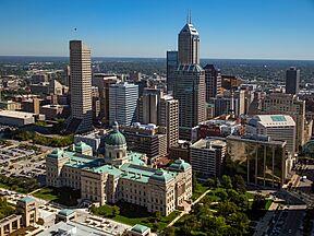
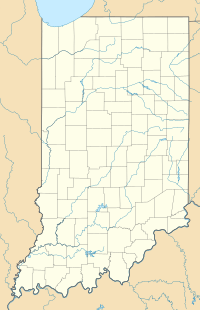
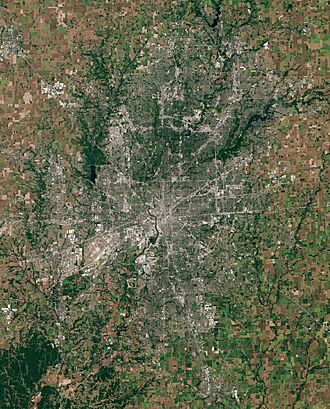
Indianapolis (pronounced IN-dee-ə-NAP-ə-lis), often called Indy, is the capital city of Indiana. It is also the largest city in the state. Indianapolis is located in the middle of Indiana, near the White River. Its official saying, "Crossroads of America", shows how important it has been for travel and trade.
In 2020, about 887,642 people lived in Indianapolis. This makes it the 16th largest city in the United States. It's also the third largest city in the Midwest, after Chicago and Columbus, Ohio. The larger Indianapolis area, including nearby towns, has over 2.1 million people. Indianapolis covers about 368 square miles (953 square kilometers).
Native American tribes lived in this area as early as 10,000 BC. In 1818, the Lenape tribe gave up their lands. In 1821, Indianapolis was created as a planned city to be Indiana's new state capital. It was designed with a grid pattern by Alexander Ralston and Elias Pym Fordham. Important roads and later railroads helped the city grow into a major center for making goods and doing business. Since 1970, the city and county governments have worked together under a system called Unigov.
Indianapolis has a strong economy. Key industries include trade, transportation, health, and business services. The city is also famous for amateur sports and auto racing. Today, Indianapolis is home to two major professional sports teams, big companies, many universities, and cultural places. This includes the world's largest children's museum. The city is best known for hosting the Indianapolis 500, the world's biggest single-day sporting event. Indianapolis also has the largest collection of monuments for veterans and war heroes in the U.S., outside of Washington, D.C..
Contents
What's in a Name?
The name Indianapolis comes from "Indiana" (meaning "Land of the Indians") and the Greek word "polis," which means "city." Jeremiah Sullivan, a judge, is credited with coming up with the name.
A Look at Indianapolis History
How Indianapolis Began
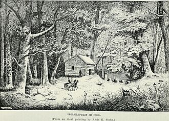
In 1816, when Indiana became a state, the U.S. Congress gave land to create a state capital. Two years later, the Lenape tribe agreed to leave their lands in central Indiana by 1821. This land included the spot chosen for the new capital in 1820.
Many early settlers in the area were from northwestern Europe. The first European American families to settle here were likely the McCormick or Pogue families around 1819-1820.
On January 11, 1820, Indiana's government decided to pick a spot for the new capital. They chose the name Indianapolis on January 6, 1821. In April, Alexander Ralston and Elias Pym Fordham were hired to plan the town. Indianapolis became the county seat for Marion County in December 1821.
Indianapolis became a town in 1832 and then a city on March 30, 1847. Samuel Henderson was the city's first mayor. The state government moved to Indianapolis in 1825.
The city grew when the National Road, a major federal highway, opened in 1827. The first railroad arrived in 1847, bringing even more growth. Indianapolis Union Station, opened in 1853, was the first of its kind in the world.
Indianapolis During the Civil War
During the American Civil War, Indianapolis strongly supported the Union. Governor Oliver P. Morton made Indianapolis a gathering place for Union soldiers. On April 16, 1861, orders were given to form Indiana's first regiments. Within a week, over 12,000 people joined the Union army.
Indianapolis became a key supply center during the war. The city's population more than doubled between 1860 and 1870. About 4,000 men from Indianapolis fought in the war. On April 30, 1865, Abraham Lincoln's funeral train stopped in Indianapolis. Over 100,000 people came to see the assassinated president's coffin.
After the Civil War, Indianapolis grew a lot. By 1880, it was the third-largest pork packing city in the world. By 1888, it was the second-largest railroad center in the U.S. By 1890, over 100,000 people lived there. Many famous businesses started during this time, like Eli Lilly and Company (1876).
Indianapolis in the 20th Century
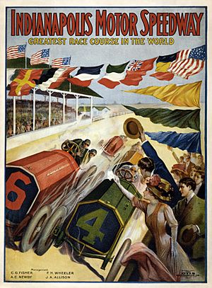
Many famous buildings and events in Indianapolis happened around 1900. The Soldiers' and Sailors' Monument, finished in 1902, became a symbol of the city. Ray Harroun won the first Indianapolis 500 race on May 30, 1911, at the Indianapolis Motor Speedway.
Indianapolis was once a major center for making cars, almost as big as Detroit. The city also saw early efforts to form labor unions.
In 1970, the city and county governments joined together. This was called Unigov. It made the government more efficient and helped the city grow. Unigov expanded the city's land area by over 300 square miles (777 square kilometers) and added about 250,000 people.
During the time of Mayor William Hudnut (1976–1992), Indianapolis worked to become a top place for sports tourism. Millions of dollars were spent on sports venues and advertising. This helped the city host events like the U.S. Olympic Festival in 1982 and the 1987 Pan American Games. It also led to the Baltimore Colts football team moving to Indianapolis in 1984.
Indianapolis in the 21st Century
In the 2000s, Indianapolis continued to grow and change. Mayor Bart Peterson (2000–2008) focused on improving education and supporting the arts. The city also created the Indianapolis Metropolitan Police Department in 2007.
Mayor Greg Ballard (2008–2016) worked on street repairs and environmental efforts. Two major projects, the new Indianapolis International Airport terminal and Lucas Oil Stadium, were finished in 2008.
More recently, the city has invested in public safety and transportation. It also started programs to help with housing and food. In 2020, local police reforms were made to improve social services.
Indianapolis Geography
Indianapolis is in the middle of the Midwestern United States. It is about 14 miles (23 kilometers) south-southeast of Indiana's center. The city is about 164 miles (264 kilometers) southeast of Chicago, Illinois.
The city limits of Indianapolis are almost the same as Marion County. This is because the city and county governments are combined. Nine townships divide the city and county: Center, Decatur, Franklin, Lawrence, Perry, Pike, Warren, Washington, and Wayne.
The land in Indianapolis is mostly flat or gently sloped. This is because glaciers moved through the area a long time ago. The city is located in the West Fork White River area. The White River flows through the city and has about 35 smaller streams that feed into it.
City Design and Buildings

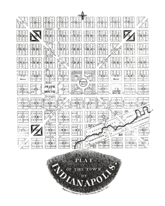
Indianapolis was a planned city. In 1820, Alexander Ralston and Elias Pym Fordham designed the town. Ralston had helped plan Washington, D.C.. His plan for Indianapolis was a 1-square-mile (2.6 square kilometers) grid.
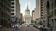
This area is known as the Mile Square. It is centered around a traffic circle called Monument Circle. This is why Indianapolis is also called "Circle City." Four diagonal roads spread out from Monument Circle. The city's address system starts at the crossing of Washington and Meridian streets.
The Indiana Central Canal, built in 1836, is the oldest artificial waterway in the city. Part of the canal downtown was turned into the Canal Walk, a popular place for walking and fun.
Indianapolis is unique because it has about 200 farms within its city limits. You can see farms mixed with suburban areas, especially in Franklin Township.
Famous Buildings
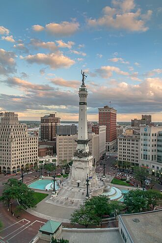
The Indiana World War Memorial Plaza Historic District in downtown Indianapolis is a great example of city design. It started being built in 1921. This area has many beautiful buildings in the neoclassical architecture style. It also has sculptures, memorials, and open spaces for events.
After the Soldiers' and Sailors' Monument was finished, rules were made to keep buildings around it from being too tall. This was to protect the view of the 284-foot (87-meter) monument. The tallest building in Indianapolis is Salesforce Tower, which is 811 feet (247 meters) tall.
Indiana limestone is a common building material in Indianapolis. You can see it in many monuments, churches, and government buildings.
Neighborhoods and Communities
Indianapolis has 99 "neighborhood areas." Many of these have their own historic districts and subdivisions. There are about 500 neighborhood groups in the city. Because Indianapolis covers a large area, it has everything from busy city neighborhoods to quiet suburban areas and even rural villages.
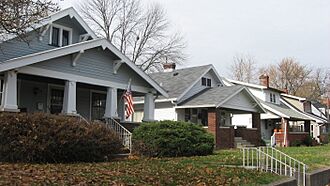
Like many Midwestern cities, Indianapolis grew a lot in the late 1800s and early 1900s. This led to dense neighborhoods built around streetcar lines. Famous streetcar suburbs include Broad Ripple and Irvington. After World War II, many new homes were built in suburban areas outside the city center.
Recently, people have been moving back to downtown Indianapolis and nearby neighborhoods. This has led to new investments and changes in these areas.
Parks and Green Spaces
Indianapolis has 212 public parks, covering over 11,258 acres (4,556 hectares). This is about 5.1% of the city's land. Eagle Creek Park is the largest and most visited park in Indianapolis. It is one of the biggest city parks in the U.S., covering 4,766 acres (1,929 hectares).
Garfield Park was the city's first park, opening in 1876. In the early 1900s, landscape architect George Kessler designed a plan for Indianapolis's parks. His plan connected parks like Brookside, Ellenberger, Garfield, and Riverside with parkways along the city's waterways.
Indiana also has state parks in Marion County, like Fort Harrison State Park and White River State Park. White River State Park is home to the Indianapolis Zoo and White River Gardens.
Plants and Animals in Indianapolis

Indianapolis is in a region known for its forests and fertile soil. Most of the original forests were cleared for farming and city growth. Today, about 33% of the city has tree cover. A rare example of an old forest can be found in Crown Hill Cemetery. This cemetery is a large green space in the city center, with lots of wildlife and about 130 types of trees. Common native trees include ash, maple, and oak.
A study in 2016 found 590 types of plants and animals along the city's rivers. Animals common in Indianapolis include white-tailed deer, eastern chipmunk, eastern cottontail, and squirrels. Recently, there have been more sightings of raccoons, groundhogs, beavers, and coyotes. Many bird species, including over 400 migratory birds, visit the city. About 57 types of fish live in the city's waterways.
Indianapolis is considered one of the most wildlife-friendly cities in the U.S.
Indianapolis Weather
Indianapolis has four clear seasons. Summers are usually hot, humid, and wet. Winters are cold with some snow. The average temperature in July is about 75.4°F (24.1°C). High temperatures can reach 90°F (32°C) about 18 days a year.
Spring and autumn are usually nice, but the weather can change quickly. Temperatures can drop by 30°F (17°C) in March and April. It's not unusual to have warm days followed by snow in these months. Winters are cold, with an average January temperature of 28.1°F (-2.2°C). Temperatures can drop to 0°F (-18°C) or below about 3.7 nights a year.
The rainiest months are in spring and summer, especially May, June, and July. Most rain comes from thunderstorms. Severe weather, like strong thunderstorms, can happen, especially in spring and summer.
The city gets about 42.4 inches (108 centimeters) of rain each year. Snowfall averages about 25.9 inches (66 centimeters) per season. The highest temperature ever recorded was 106°F (41°C) in 1936. The lowest was -27°F (-33°C) in 1994.
| Climate data for Indianapolis (Indianapolis International Airport), 1981–2010 normals, extremes 1871–present | |||||||||||||
|---|---|---|---|---|---|---|---|---|---|---|---|---|---|
| Month | Jan | Feb | Mar | Apr | May | Jun | Jul | Aug | Sep | Oct | Nov | Dec | Year |
| Record high °F (°C) | 71 (22) |
76 (24) |
85 (29) |
90 (32) |
96 (36) |
104 (40) |
106 (41) |
103 (39) |
100 (38) |
91 (33) |
81 (27) |
74 (23) |
106 (41) |
| Mean maximum °F (°C) | 58.3 (14.6) |
63.3 (17.4) |
75.3 (24.1) |
81.4 (27.4) |
86.2 (30.1) |
91.9 (33.3) |
93.6 (34.2) |
92.5 (33.6) |
89.8 (32.1) |
82.1 (27.8) |
71.3 (21.8) |
59.8 (15.4) |
94.8 (34.9) |
| Mean daily maximum °F (°C) | 35.6 (2.0) |
40.2 (4.6) |
51.7 (10.9) |
63.4 (17.4) |
72.8 (22.7) |
81.9 (27.7) |
85.0 (29.4) |
84.0 (28.9) |
77.6 (25.3) |
65.3 (18.5) |
52.2 (11.2) |
38.9 (3.8) |
62.4 (16.9) |
| Mean daily minimum °F (°C) | 20.5 (−6.4) |
23.9 (−4.5) |
32.8 (0.4) |
42.7 (5.9) |
52.6 (11.4) |
62.1 (16.7) |
65.8 (18.8) |
64.4 (18.0) |
56.2 (13.4) |
44.7 (7.1) |
35.1 (1.7) |
24.4 (−4.2) |
43.8 (6.6) |
| Mean minimum °F (°C) | −2.5 (−19.2) |
3.4 (−15.9) |
14.9 (−9.5) |
26.6 (−3.0) |
37.7 (3.2) |
48.2 (9.0) |
55.0 (12.8) |
53.8 (12.1) |
40.6 (4.8) |
29.6 (−1.3) |
20.0 (−6.7) |
3.3 (−15.9) |
−7.8 (−22.1) |
| Record low °F (°C) | −27 (−33) |
−21 (−29) |
−7 (−22) |
18 (−8) |
28 (−2) |
37 (3) |
46 (8) |
41 (5) |
30 (−1) |
20 (−7) |
−5 (−21) |
−23 (−31) |
−27 (−33) |
| Average precipitation inches (mm) | 2.66 (68) |
2.32 (59) |
3.56 (90) |
3.81 (97) |
5.05 (128) |
4.25 (108) |
4.55 (116) |
3.13 (80) |
3.12 (79) |
3.12 (79) |
3.70 (94) |
3.17 (81) |
42.44 (1,078) |
| Average snowfall inches (cm) | 8.6 (22) |
6.5 (17) |
2.6 (6.6) |
0.2 (0.51) |
trace | 0 (0) |
0 (0) |
0 (0) |
0 (0) |
0.4 (1.0) |
0.7 (1.8) |
6.9 (18) |
25.9 (66) |
| Average precipitation days (≥ 0.01 in) | 12.1 | 10.0 | 11.9 | 12.0 | 13.1 | 11.1 | 10.5 | 8.5 | 8.1 | 8.6 | 10.8 | 12.5 | 129.2 |
| Average snowy days (≥ 0.1 in) | 7.5 | 5.4 | 2.5 | 0.4 | 0 | 0 | 0 | 0 | 0 | 0.2 | 1.2 | 6.3 | 23.5 |
| Average relative humidity (%) | 75.0 | 73.6 | 69.9 | 65.6 | 67.1 | 68.4 | 72.8 | 75.4 | 74.4 | 71.6 | 75.5 | 78.0 | 72.3 |
| Mean monthly sunshine hours | 132.1 | 145.7 | 178.3 | 214.8 | 264.7 | 287.2 | 295.2 | 273.7 | 232.6 | 196.6 | 117.1 | 102.4 | 2,440.4 |
| Percent possible sunshine | 44 | 49 | 48 | 54 | 59 | 64 | 65 | 64 | 62 | 57 | 39 | 35 | 55 |
| Source: NOAA (relative humidity and sun 1961–1990) | |||||||||||||
Who Lives in Indianapolis?
| Historical population | |||
|---|---|---|---|
| Census | Pop. | %± | |
| 1840 | 2,695 | — | |
| 1850 | 8,091 | 200.2% | |
| 1860 | 18,611 | 130.0% | |
| 1870 | 48,244 | 159.2% | |
| 1880 | 75,056 | 55.6% | |
| 1890 | 105,436 | 40.5% | |
| 1900 | 169,164 | 60.4% | |
| 1910 | 233,650 | 38.1% | |
| 1920 | 314,194 | 34.5% | |
| 1930 | 364,161 | 15.9% | |
| 1940 | 386,972 | 6.3% | |
| 1950 | 427,173 | 10.4% | |
| 1960 | 476,258 | 11.5% | |
| 1970 | 744,624 | 56.3% | |
| 1980 | 700,807 | −5.9% | |
| 1990 | 731,327 | 4.4% | |
| 2000 | 781,926 | 6.9% | |
| 2010 | 820,445 | 4.9% | |
| 2020 | 887,642 | 8.2% | |
| 2023 (est.) | 879,293 | 7.2% | |
| U.S. Decennial Census | |||
The U.S. Census Bureau looks at Indianapolis in two ways: the combined city and the "balance" (the city without its independent towns). The combined city includes almost all of Marion County, except for a few independent towns like Beech Grove and Speedway.
Since the late 1990s, many Chin people from Myanmar (formerly Burma) have moved to Indianapolis. The city has one of the largest groups of Chin people outside of Myanmar.
Population and Diversity
| Historical racial composition | 2020 | 2010 | 1990 | 1970 |
|---|---|---|---|---|
| White (Non-Hispanic) | 50.1% | 58.6% | 75.2% | 80.9% |
| Black or African American | 27.6% | 27.2% | 22.6% | 18.0% |
| Hispanic or Latino | 13.1% | 9.4% | 1.1% | 0.8% |
| Asian | 4.2% | 2.1% | 0.9% | 0.1% |
| Mixed | 4.2% | 2.2% | – | – |
| Race / Ethnicity (NH = Non-Hispanic) | Pop 2000 | Pop 2010 | Pop 2020 | % 2000 | % 2010 | 2020 |
|---|---|---|---|---|---|---|
| White alone (NH) | 527,675 | 480,960 | 444,504 | 67.49% | 58.62% | 50.08% |
| Black or African American alone (NH) | 198,252 | 223,053 | 245,279 | 25.36% | 27.19% | 27.63% |
| Hispanic or Latino (any race) | 30,636 | 77,352 | 116,221 | 3.92% | 9.43% | 13.09% |
| Asian alone (NH) | 11,046 | 17,053 | 37,588 | 1.41% | 2.08% | 4.23% |
| Mixed race or Multiracial (NH) | 10,808 | 17,870 | 37,152 | 1.38% | 2.18% | 4.19% |
| Other race alone (NH) | 1,537 | 2,123 | 4,940 | 0.20% | 0.26% | 0.56% |
| Native American or Alaska Native alone (NH) | 1,648 | 1,760 | 1,627 | 0.21% | 0.21% | 0.18% |
| Pacific Islander alone (NH) | 268 | 274 | 331 | 0.03% | 0.03% | 0.04% |
| Total | 781,870 | 820,445 | 887,642 | 100.00% | 100.00% | 100.00% |
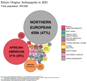
In 2020, Indianapolis had a population of 887,642. This makes it the largest city in Indiana and the 16th largest in the U.S. The larger Indianapolis area, including surrounding counties, had over 2.1 million people in 2020. This is the most populated area in Indiana.
In 2010, the population of Indianapolis was 61.8% White, 27.5% Black or African American, and 2.1% Asian. About 9.4% of the city's population was Hispanic or Latino.
Religious Beliefs
| Religion in Indianapolis | ||||
|---|---|---|---|---|
| Religion | Percent | |||
| Protestantism | 13% | |||
| Catholicism | 11% | |||
| Other Christian | 13% | |||
| No religion | 22% | |||
| Others | 1% | |||

About 42% of people in Indianapolis say they are religious. The largest group is Roman Catholics, making up about 11% of the population. Baptists are the second largest group, followed by Methodists.
SS. Peter and Paul Cathedral is the main Catholic church in Indianapolis. Many other Christian churches are also in the city. About 22% of residents say they have no religion.
Indianapolis Economy
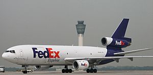

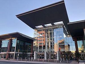
Indianapolis has a large economy, ranking as the 29th largest in the U.S. Its main exports include medicines, car parts, and medical equipment. The biggest industries for jobs are trade, transportation, health services, and business services.
Three very large companies (Fortune 500) are based in Indianapolis: Elevance Health (insurance), Eli Lilly (medicine), and Corteva (agriculture). Other well-known companies here include Allison Transmission and Simon Property Group.
Indianapolis is a key center for logistics (moving goods). This is because of its central location and good highways and rail lines. Amazon and FedEx have big operations here, employing thousands of people.
The city is also a major hub for life sciences, especially in medicines and agricultural chemicals. Eli Lilly is the city's largest private employer, with 11,000 workers.
Tourism is growing in Indianapolis, especially for conventions. The city gets almost 30 million visitors each year. Major convention places include the Indiana Convention Center and Lucas Oil Stadium.
Indianapolis is also a fast-growing area for high-tech jobs. Many tech companies have offices here, like Salesforce Marketing Cloud, which employs about 2,100 people.
Making Things: Manufacturing in Indy
In the past, manufacturing was very important to Indianapolis's economy. However, like many cities in the Rust Belt, the number of manufacturing jobs has gone down since the mid-1900s. The city has shifted more towards a service economy.
Indianapolis was once a big center for making cars, competing with Detroit. Luxury car companies like Duesenberg were based here. Today, Allison Transmission and Rolls-Royce North America still have large manufacturing facilities in the city.
Arts and Culture in Indianapolis
Visual Arts and Museums
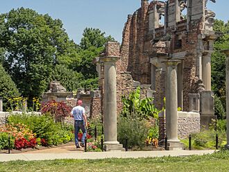
The Indianapolis Museum of Art at Newfields is the city's main art museum. It has 54,000 artworks and is one of the oldest and largest art museums in the U.S. The Newfields campus also includes gardens and performance spaces.
The Herron School of Art and Design, started in 1902, is part of IU Indianapolis. It has public galleries and art programs. The Indianapolis Art Center in Broad Ripple offers art classes and has a sculpture garden.
The Eiteljorg Museum in downtown Indianapolis has a collection of Native American and Western American art. It hosts many talks and special exhibits.
Indianapolis has over 3,000 pieces of public art. Many of these are downtown, including murals.
Performing Arts and Music
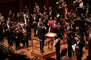
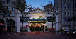
Many of the city's main performing arts places are downtown. This includes the Hilbert Circle Theatre, home to the Indianapolis Symphony Orchestra. The Indiana Theatre is home to the Indiana Repertory Theatre.
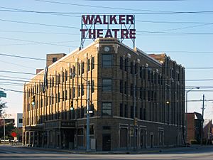
The Mass Ave Cultural Arts District has the Old National Centre, which opened in 1910. It has several theaters. The Madam Walker Legacy Center opened in 1927 and was a cultural hub for the African American community. It hosted vaudeville shows and was central to the Indiana Avenue jazz scene.
Indianapolis is home to many national music groups and events. The International Violin Competition of Indianapolis is one of the most important violin competitions in the world.
Literary Arts and Writers
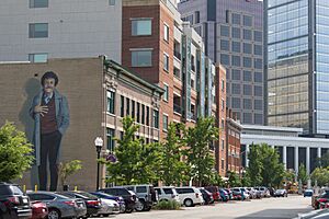
From about 1870 to 1920, Indianapolis was a major center for literature in Indiana. Famous writers like James Whitcomb Riley and Booth Tarkington lived here. Perhaps the most famous writer from Indianapolis was Kurt Vonnegut, known for his book Slaughterhouse-Five. He often included characters from Indianapolis in his stories.
Indianapolis is also home to bestselling young adult author John Green, whose book The Fault in Our Stars is set in the city. You can visit the James Whitcomb Riley Museum Home and the Kurt Vonnegut Museum and Library in Indianapolis.
Fun Places to Visit
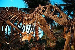
The Children's Museum of Indianapolis is the largest children's museum in the world. It has 433,000 square feet (40,200 square meters) of exhibits and over 120,000 items. It is a world leader in its field and a very popular place to visit.
The Indianapolis Zoo has over 1,400 animals and 235 species. The nearby White River Gardens has over 50,000 plants. The zoo is known for its work in animal conservation. It is one of the most visited attractions in the city.
Inside the Indianapolis Motor Speedway, the Indianapolis Motor Speedway Museum shows off a huge collection of auto racing items. You can also take tours of the track from the museum.
The Benjamin Harrison Presidential Site is the home of the 23rd U.S. president, Benjamin Harrison. He is buried nearby at Crown Hill Cemetery. This cemetery is also the resting place for other important people.
Indianapolis has many monuments for veterans and war heroes. Outside of Washington, D.C., Indianapolis has the largest collection of these memorials in the U.S.
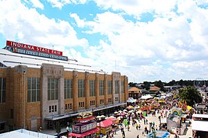
Many annual events happen in Indianapolis. The Indiana State Fair is the city's biggest event, attracting 800,000 people. The 500 Festival is a series of events leading up to the Indianapolis 500 race. Other events include the Indy Pride Festival and the Historic Irvington Halloween Festival.
Food and Dining
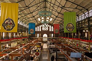
Indianapolis has a growing food scene. The Indianapolis City Market, founded in 1821, has been a public market for a long time. It has changed from a traditional market to a food hall.
Because Indianapolis is in the Corn Belt, it has strong ties to farming. Urban farms and gardens have become popular to help provide fresh food. The city has many farmers' markets.
Local dishes include pork tenderloin sandwiches, sugar cream pie, and beef Manhattan. Famous local restaurants include Long's Bakery and St. Elmo Steak House. Indianapolis has also seen a rise in international restaurants due to its growing immigrant population.
In recent years, Indianapolis has been called an "underrated food city" and a "rising star of the Midwest." The number of microbreweries (small breweries) has grown a lot, with about 50 in the city.
Movies and TV in Indy
Many people from Indianapolis have made a mark in the entertainment world. James Baskett was the first Black male to win an Oscar. Steve McQueen, a famous actor, was born nearby.
Indianapolis sports venues have been used in movies like Hoosiers. The Indianapolis 500 race has been featured in many films and TV shows. Some movies filmed in Indianapolis include Winning and Good Bones.
Indianapolis hosts several annual film festivals, including the Heartland International Film Festival. Film Indy was created in 2016 to support local filmmakers and bring more film projects to the city.
Sports in Indianapolis
Professional Sports Teams
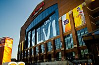
The Indianapolis Colts football team moved to the city in 1984. They have won many championships, including Super Bowl XLI in 2007. They play at Lucas Oil Stadium.
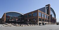
The Indiana Pacers basketball team started in 1967. They won three championships before joining the National Basketball Association (NBA) in 1976. The Indiana Fever women's basketball team has also won a championship. Both teams play at Gainbridge Fieldhouse.
The Indianapolis Indians baseball team is one of the oldest minor league teams in the U.S. They play at Victory Field.
Indianapolis also has a professional soccer team, Indy Eleven, and other minor league teams like the Indy Fuel (ice hockey).
Amateur Sports and Colleges

Indianapolis is known as the "Amateur Sports Capital of the World." The National Collegiate Athletic Association (NCAA), which governs college sports, is based here.
Two major college sports programs are in Indianapolis: the Butler Bulldogs and the IU Indy Jaguars. Hinkle Fieldhouse at Butler University is a famous basketball arena. It opened in 1928 and was once the largest basketball arena in the world. It's known as "Indiana's Basketball Cathedral."
Motorsports and Racing
Indianapolis is a global center for auto racing. It has many racing tracks and events. The city's nickname "Indy" is often used to mean auto racing.
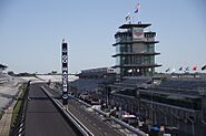
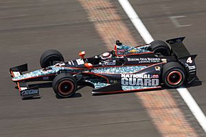
The Indianapolis Motor Speedway, built in 1909, is a famous landmark. It is the world's largest sports venue by seating capacity. Since 1911, it has hosted the Indianapolis 500 race. This race is held every Memorial Day weekend and is considered the world's largest single-day sporting event. The track also hosts NASCAR races.
Lucas Oil Indianapolis Raceway Park has a road course and a dragstrip. It hosts the NHRA U.S. Nationals, a major drag racing event. The Indianapolis Speedrome is believed to be the oldest figure 8 racing track in the U.S.
Major Sporting Events
Besides car races, Indianapolis hosts many other sports events. These include the NFL Scouting Combine (for football players) and the 500 Festival Mini-Marathon. The city also often hosts the NCAA men's and women's basketball Final Fours.
Past major events include the Pan American Games in 1987 and Super Bowl XLVI in 2012.
City Services and Utilities
Getting Around Indianapolis
Indianapolis has a big transportation system. It includes public buses, train service, highways, and airports. Most people in Indianapolis drive alone to work.
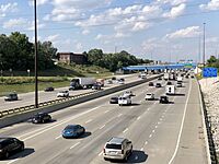
Four main Interstate Highways cross through the city: I-65, I-69, I-70, and I-74. There is also a beltway, Interstate 465, that goes around the city.
The city has increased its investment in bike lanes and trails. There are about 110 miles (177 kilometers) of trails and greenways. The Indianapolis Cultural Trail has a bike-sharing system.
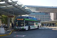
IndyGo runs the city's public bus system. The Julia M. Carson Transit Center is the main bus hub downtown.
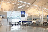
Indianapolis International Airport is a major airport. In 2023, it served 9.7 million passengers. It is also one of the busiest U.S. airports for air cargo.
Indianapolis Union Station is the main bus and train station. Amtrak provides passenger train service.
City Utilities
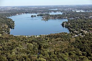
AES Indiana provides electricity to over 500,000 customers in Indianapolis. Natural gas, water, and wastewater services are provided by Citizens Energy Group. The city's water comes from the White River and reservoirs.
Telephone area codes for Indianapolis are 317 and 463. Many companies provide internet, cable TV, and phone services.
Waste collection services are handled by the city and private companies. Indianapolis is the largest U.S. city without a universal curbside recycling program.
Healthcare Services
Indianapolis has about 20 hospitals. Most are part of large hospital networks like Ascension St. Vincent Health and IU Health. Many are teaching hospitals connected to the IU School of Medicine.
Eskenazi Health runs the city's public health facilities, including Sidney & Lois Eskenazi Hospital. Riley Hospital for Children is one of the best children's hospitals in the nation.
Sister Cities
Indianapolis has ten sister cities around the world:
See also
 In Spanish: Indianápolis para niños


