List of new churches by G. E. Street facts for kids
George Edmund Street (1824–1881) was a famous English architect. He designed many buildings, mostly churches, in a style called High Victorian Gothic. This style was popular during the Victorian era.
Street first worked in a law office, but he soon decided to become an architect. He trained with architect Owen Browne Carter and later worked for George Gilbert Scott, another well-known architect. In 1849, Street started his own architecture business. He became the official architect for the diocese of Oxford in 1850 and held this job until he died. He traveled a lot, especially in Europe. Street also wrote many books about architecture. He was a member of the Royal Academy and won a special award for architects, becoming their president in 1881.
Most of Street's work involved churches. He designed new ones, fixed up old ones, and added new parts or furniture. He also designed homes, especially houses for priests (vicarages), and schools with homes for teachers. Towards the end of his life, he designed his biggest project: the Royal Courts of Justice in London. Most of his buildings are in England, especially around Oxford, where he built or restored 113 churches. You can also find his work in Wales and Ireland. He even designed some buildings abroad, like a church in Istanbul.
Almost all of Street's designs are in the Gothic Revival style. This means they look like buildings from the Middle Ages. His specific style, High Victorian, used different colored materials together (called polychromy) and ideas from European Gothic buildings. George Edmund Street passed away in 1881 and was buried in Westminster Abbey.
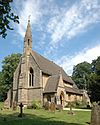
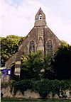
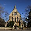
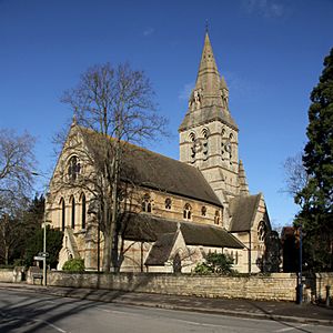
This list shows new churches designed by Street in England, Scotland, and Wales. He also designed churches in other countries, including seven in Europe (three in Switzerland), the Crimea Memorial Church in Istanbul, Turkey (1858–1868), and St Paul's American Church in Rome (1872–1876).
Understanding Building Grades
Buildings in the UK are given special grades to show how important they are historically or architecturally. This helps protect them.
| Grade (England) | What it means | ||||||||||||
|---|---|---|---|---|---|---|---|---|---|---|---|---|---|
| Grade I | Buildings that are super important, sometimes even famous around the world. | ||||||||||||
| Grade II* | Very important buildings with special features. | ||||||||||||
| Grade II | Important buildings that are special to the country. | ||||||||||||
| Category (Scotland) | What it means | ||||||||||||
| Category A | Buildings that are nationally or internationally important. They might be great examples of a certain style or time. | ||||||||||||
| Category B | Buildings important to a region or more than just a local area. They are major examples of a style, even if they've been changed a bit. | ||||||||||||
| Category C(S) | Buildings important to a local area. They are simpler examples of a style or traditional buildings that fit well with Category A and B buildings. | ||||||||||||
| "—" means the building is not graded. | |||||||||||||
Churches Designed by G. E. Street
| Name | Location | Photograph | Date | Notes | Grade |
|---|---|---|---|---|---|
| St Mary's Church | Par, Cornwall, Cornwall |  |
1848 | II* | |
| St Peter's Church | Treverbyn, Cornwall | 1848–50 | II | ||
| St Mary's Church | Colton, Staffordshire |  |
1850–52 | A new church that includes an old 13th-century tower and chapel. Street also designed two monuments inside. | II* |
| St James' Church | Eastbury, Berkshire |  |
1851–53 | II | |
| St John's Mission Church | Bournemouth, Dorset | 1853 | Started as a mission church, later used for businesses. | II | |
| St John the Evangelist's Church | Little Tew, Oxfordshire | 1853 | II | ||
| St Michael's Church | Sandhurst, Berkshire |  |
1853 | II* | |
| St Simon and St Jude's Church | Milton-under-Wychwood, Oxfordshire |  |
1853–54 | II | |
| All Saints Church | Maidenhead, Berkshire | 1854–57 | Parts were added later in 1907–1911. | I | |
| St. Peter's Church | Bournemouth, Dorset | 1855-1879 | A new church in the town center, including parts of an older church. | I | |
| St Peter's Church | Filkins, Oxfordshire |  |
1855–57 | II | |
| St Mary's Church | Wheatley, Oxfordshire |  |
1855–57 | II* | |
| St Andrew's Church | Firsby, Lincolnshire |  |
1856 | II | |
| Chapel | Cotshill Hospital, Chipping Norton, Oxfordshire |
1856–57 | II | ||
| All Saints Church | Roydon, Norfolk | 1857 | A new church built around 12th-century doorways and a 13th-century tower. | II* | |
| All Saints Church | Nash, Buckinghamshire |  |
1857–58 | II | |
| St Thomas' Church | Watchfield, Oxfordshire |  |
1857–58 | II | |
| St James' Church | New Bradwell, Milton Keynes, Buckinghamshire |
1857–60 | The north aisle (side part of the church) was added later by Street in 1897. | II* | |
| St Paul's Church | Herne Hill, Southwark, Greater London | 1858 | II* | ||
| St James' Church | Pokesdown, Bournemouth, Dorset |  |
1858 | Originally had a nave, chancel, and south porch. A north aisle was added in 1870, also by Street. The church was made even bigger later. | II |
| All Saints Church | Winterbourne, Gloucestershire | 1858 | II | ||
| St John the Evangelist's Church | Whitwell-on-the-Hill, North Yorkshire |
1858–60 | II* | ||
| St Anne's Church | Wycombe, Buckinghamshire | 1859 | II | ||
| St John's Church | Howsham, North Yorkshire | 1859–60 | Built for Hannah Cholmley. | I | |
| Church of St James the Less | City of Westminster, Greater London | 1859–61 | The railings next to the church porch were also designed by Street. | I | |
| St John's Church | Hollington, Staffordshire |  |
1859–61 | Built as a chapel of ease (a smaller church for a local community). | II |
| Convent Chapel | All Saints House, Westminster, Greater London |
1860 | II | ||
| St Peter's Church | Chalvey, Slough, Berkshire |  |
1860–61 | II* | |
| St John's Church | Kingstone, Staffordshire | 1860–61 | The south aisle was designed by Street. | II | |
| St John the Evangelist's Church | Stourbridge, West Midlands |
1860–61 | II | ||
| All Saints Church | Denstone, Staffordshire |  |
1860–62 | Built for Sir Thomas Percival Heywood. | II* |
| All Saints Church | Coleshill, Buckinghamshire |  |
1861 | II* | |
| St George's Church | St George's, Telford, Shropshire |  |
1861 | II | |
| St John the Evangelist's Church | Torquay, Devon |  |
1861–73 | The tower was finished by Street's son, A. E. Street, in 1884–85, following his father's design. | I |
| All Saints Church | Brightwalton, Berkshire |  |
1862 | Its importance was upgraded in 2017. | II* |
| SS Philip and James Church | Oxford |  |
1862 | This new church is considered one of Street's best works. Since 1983, it has been used as the Oxford Centre for Mission Studies. | I |
| Church of St Elldeyrn | Capel Llanilltern, Pentyrch, Cardiff |  |
1862 | A small, simple chapel. Street had previously restored a nearby church. | II |
| St Barnabas' Church | Hurn, Dorset | 1862–63 | A small chapel. | II | |
| St Anne's Church | Whelford, Gloucestershire |  |
1863–64 | A chapel of ease. | II |
| St Editha's Church | Amington, Tamworth, Staffordshire |  |
1864 | II | |
| St Saviour's Church | Branston, Staffordshire | 1864 | A new church that was later made bigger. | ||
| St John the Evangelist's Church | Warminster, Wiltshire | 1864–65 | Later additions were made by other architects. | II* | |
| St Michael's Church | Waters Upton, Shropshire |  |
1864–65 | A new church built in the Early English style, replacing an older Georgian church. | II |
| St Nicholas' Church | Whiston, Merseyside |  |
1864–68 | II | |
| St Peter's Church | Malvern, Worcestershire | 1865 | II | ||
| Chapel | Uppingham School, Rutland | 1865 | With changes made later. | II* | |
| St Saviour and St Peter's Church | Eastbourne, East Sussex | 1865–66 | A new church; the tower was added between 1870–72. Other additions were made later by different architects. | II* | |
| Workhouse chapel | Shipmeadow, Suffolk | 1865–66 | A chapel for the Wangford Hundred workhouse. It was later used as a farm storage building. | II | |
| St James the Great's Church | Blakedown, Worcestershire |  |
1866 | II | |
| St Mary's Church | Fawley, Berkshire |  |
1866 | Its importance was upgraded in 2017. | II* |
| All Saints Church | Monkland, Herefordshire |  |
1866 | Rebuilt, but kept some older parts. | II* |
| Chapel | Royal National Hospital, Bournemouth, Dorset | 1866–67 | II | ||
| St Andrew's Church | Church Aston, Shropshire |  |
1866–67 | A new church built to replace an older one. | II |
| St Mary's Church | Westcott, Buckinghamshire |  |
1867 | II* | |
| St Mary's Church | Whixall, Shropshire | 1867 | II | ||
| St Mary Magdalene's Church | Paddington, Westminster, Greater London | 1867–78 | A Crypt Chapel was added in 1895 by Sir Ninian Comper. | I | |
| Church of the Resurrection and All Saints | Caldy, Merseyside |  |
1868 | Originally built as a school. It was changed into a church in 1906–07. | II |
| St Mary the Virgin's Church | Wansford, East Yorkshire |  |
1868 | Built for Sir Tatton Sykes, 5th Baronet of Sledmere. | II* |
| Church of the Resurrection | Eastleigh, Hampshire |  |
1868–69 | Later additions were made by different architects. | II |
| Holy Trinity Church | Eltham, Greenwich, Greater London | 1868–69 | A new church that has since been made bigger. | II | |
| St Cynbryd's Church | Llanddulas, Conwy, Wales | 1868–69 | A new church built to replace an older one from 1732. | II* | |
| St Margaret's Church | Liverpool, Merseyside | 1868–69 | II* | ||
| St James' Church | Milnrow, Greater Manchester |
1868–69 | II | ||
| St Stephen's Church | Robin Hood's Bay, North Yorkshire |
 |
1868–70 | II* | |
| St Mary's Church | Thixendale, North Yorkshire |
 |
1868–72 | Built for Sir Tatton Sykes, 5th Baronet of Sledmere. | II* |
| All Saints Church | Clifton, Bristol | 1868–72 | Badly damaged by a bomb in 1940, but rebuilt using Street's original tower. | II | |
| St Michael and All Angels Church | Frosterley, County Durham |  |
1869 | The gate posts northeast of the church were also designed by Street. | II |
| St Andrew's Church | Kettering, Northamptonshire | 1869 | II | ||
| St Peter's Church | Swinton, Greater Manchester |
 |
1869 | Built for Revd H. R. Heywood, to replace a smaller chapel. | II* |
| All Saints Church | Bolton, Greater Manchester |
1869–71 | II | ||
| St John the Evangelist's Church | Lyneal, Shropshire |  |
1870 | Built as a memorial for Marian, Viscountess Alford's son. | II* |
| St Mary's Church | Purley on Thames, Berkshire |  |
1870 | II* | |
| Holy Trinity Church | Thurgoland, South Yorkshire |
1870 | II | ||
| Christ Church | Barnston, Merseyside |  |
1870–71 | II | |
| St Andrew's Waterside Chapel | Gravesend, Kent |  |
1870–71 | Built as a mission for sailors. Later used as an arts center. | II |
| St Mary on the Rock's Episcopal Church | Ellon, Aberdeenshire, Scotland | 1870–71 | A | ||
| St John the Evangelist's Episcopal Church | New Pitsligo, Aberdeenshire, Scotland |  |
1870–71 | A | |
| St John the Divine's Church | Kennington, Greater London |
1870–74 | The tower and spire were added by his son, A. E. Street, in 1888–89. | I | |
| St Mary's Church | Fimber, East Yorkshire | 1871 | Built for Sir Tatton Sykes, 5th Baronet of Sledmere. | II | |
| St James' Church | West Malvern, Worcestershire |  |
1871 | A rebuilding of a previous church. | II |
| All Saints Church (former) | Darlaston, West Midlands | 1871–72 | All Saints was destroyed during World War II in 1942. A new church was built on the same spot in 1951–52. | ||
| St Mary's Church | Towyn, Conwy, Wales | 1872–73 | A new church. Street also designed the stained glass in one window and altar cloths. | II* | |
| St John the Baptist's Church | Bettisfield, Wrexham, Wales |  |
1872–74 | A new church. Street also designed the lychgate (a roofed gateway to a churchyard). | II* |
| St John the Baptist's Church | Withington, Shropshire | 1872–74 | A new church built on the site of a 12th-century church. | II | |
| St Peter's Church | Helperthorpe, North Yorkshire |
 |
1872–75 | Built for Sir Tatton Sykes. Later additions were made by other architects. The churchyard wall and gates were also designed by Street. | II |
| St Peter's Church | Highfields, Leicester | 1872–79 | II | ||
| St John the Evangelist's Church | Ashley Green, Buckinghamshire |  |
1873 | II* | |
| St John's Church | Bournemouth, Dorset |  |
1873–74 | The nave, south aisle, and tower base were built by Street. Additions were made in 1886–87 and in 1923. | II |
| St Peter's Church | Little Aston, Staffordshire | 1873–74 | A chapel of ease built for Edward Swynfen Parker-Jervis. Street also designed many of the church's interior features, like the reredos (altar screen), pulpit, and font. | II | |
| All Saints Church | Middlesbrough, North Yorkshire |
1873–78 | II* | ||
| St Andrew's Church | Toddington, Gloucestershire | 1873–79 | Built for Lord Sudeley. | I | |
| St James' Church | Kingston, Dorset |  |
1873–80 | Built for the 3rd Earl of Eldon. It has been called "the most perfect Victorian church" and "a cathedral in miniature." | I |
| St John's Church | Cotebrook, Cheshire | 1874–75 | II | ||
| St Mary's Church | West Lutton, North Yorkshire |
 |
1874–75 | Built for Sir Tatton Sykes. | II* |
| Chapel | Luton Hoo, Bedfordshire | 1875 | A chapel added in the Byzantine style. | I | |
| St Michael's Church | Wigan, Greater Manchester |
1875–78 | II* | ||
| Royal Military Chapel | Wellington Barracks, City of Westminster, Greater London |
 |
1875–79 | Built to replace an earlier chapel. Most of it was destroyed in 1944, except for the apse (rounded end). | II |
| St Andrew's Church | East Heslerton, North Yorkshire |
 |
1877 | A new church built for Sir Tatton Sykes. It is now no longer used as a church and is looked after by a special trust. | I |
| Christ Church | Lausanne, Switzerland | 1877-78 | A new church. | II | |
| St Andrew's Church | Minehead, Somerset | 1877–80 | The walls, gates, and gateposts were also designed by Street. | II* | |
| St Giles' Church | Blaston, Leicestershire |  |
1878 | II | |
| Anglican Church | Mürren, Switzerland | 1878 | |||
| St Mary's Church | Southampton, Hampshire | 1878–84 | Badly damaged in World War II. It was rebuilt in 1954–56, keeping Street's steeple. | II | |
| St John's Church | Carlton, South Yorkshire | 1879 | II | ||
| St Mary's Church | Holmbury St Mary, Surrey |  |
1879 | Extended to the west in 1966. | I |
| St Lawrence's Church | Tinsley, Sheffield, South Yorkshire |
1879 | II | ||
| Rake Mission Church | Rake, West Sussex |  |
1879 | Built as a chapel of ease. It is no longer a church and has been turned into homes. | |
| St Luke's Church | Milland, West Sussex |  |
1879–80 | II | |
| St Saviour's Church | Erlestoke, Wiltshire |  |
1880 | Built for Lady Hannah Watson-Taylor. | II |
| St Mary's Church | Long Ditton, Surrey |  |
1880 | II | |
| All Saints Church | Vevey, Switzerland |  |
1880–1882 | A new church. | |
| St James' Church | Paddington, Westminster, Greater London | 1881 | A new church that includes the chancel (the part of the church around the altar) of an older church from 1841–43. | II* | |
| All Saints Church | Ffynnongroyw, Flintshire, Wales |  |
1881–82 | A new church, finished after Street's death. Street also designed the font. | II |
| All Saints Church | Rome, Italy | 1882 | A new church, finished after Street's death. | ||
| American Cathedral in Paris | Paris, France | 1881-1886 | A new church, finished after Street's death. |
See also
- List of church restorations and alterations by G. E. Street
- List of domestic buildings by G. E. Street
- List of miscellaneous works by G. E. Street
 | Chris Smalls |
 | Fred Hampton |
 | Ralph Abernathy |


