
Fresno County, California facts for kids
Quick facts for kids
Fresno County, California
|
||
|---|---|---|
| County of Fresno | ||
   Top to bottom: Fresno County Courthouse, Millerton Lake, Courtright Reservoir
|
||
|
||

Location in the state of California
|
||
| Country | United States | |
| State | California | |
| Region | San Joaquin Valley | |
| Metro area | Fresno–Madera | |
| Incorporated | 1856 | |
| Named for | The city of Fresno (Spanish for "ash tree") | |
| County seat | Fresno | |
| Largest city | Fresno | |
| Incorporated cities | 15 | |
| Government | ||
| • Type | Council–CAO | |
| • Body | Board of Supervisors | |
| Area | ||
| • Total | 6,011 sq mi (15,570 km2) | |
| • Land | 5,958 sq mi (15,430 km2) | |
| • Water | 53 sq mi (140 km2) | |
| Highest elevation | 14,248 ft (4,343 m) | |
| Population | ||
| • Total | 1,008,654 | |
| • Estimate
(2023)
|
1,017,162 |
|
| • Density | 167.801/sq mi (64.788/km2) | |
| GDP | ||
| • Total | $55.426 billion (2022) | |
| Time zone | UTC−8 (Pacific) | |
| • Summer (DST) | UTC−7 (Pacific Daylight Time) | |
| Area code | 559 | |
| FIPS code | 06-019 | |
| GNIS feature ID | 277274 | |
| Congressional districts | 5th, 13th, 20th, 21st | |

Fresno County is a county in the central part of California. As of 2020, over 1 million people live here. The main city and county seat is Fresno. It's the fifth-largest city in California.
Fresno County is in the Central Valley. This area is known for its farming. It's located south of Stockton and north of Bakersfield. Sometimes, droughts in California make it hard to get enough water for the county.
Contents
History of Fresno County
The land that is now Fresno County was originally home to the Yokuts and Mono Native American peoples. Later, Spanish explorers came looking for places to build missions. In 1846, this area became part of the United States after the Mexican War.
How Fresno County Was Formed
Fresno County was officially created in 1856. It was made from parts of Mariposa, Merced, and Tulare counties. The name Fresno comes from the Spanish word for "ash tree." This name was chosen because many ash trees, called Fraxinus dipetala, grew along the San Joaquin River.
The first county seat was in Millerton. But the town of Fresno was growing fast because of the new Southern Pacific Railroad. So, in 1874, people voted to move the county seat to Fresno.
Early Challenges and Growth
Life in early Fresno County wasn't always easy. There were arguments over land and natural disasters like floods and fires. In the 1880s, big fires destroyed parts of Fresno city.
But people worked hard to improve the area. They brought in irrigation systems to water the land. Moses Church built the first canals, known as "Church Ditches," which helped grow a lot of wheat. Francis Eisen started the raisin industry in 1875. He accidentally left some grapes to dry on the vine, and that's how it began! Other pioneers like Anthony Easterby and Clovis Cole developed large farms for grain and cattle. Their efforts helped make Fresno County one of the top farming regions in the United States today.
Oil Discovery and Historic Places
In the early 1900s, oil was found near Coalinga in the western part of the county. This led to a big economic boost. The Coalinga Oil Field became the most productive oil field in California by 1910. It still produces oil today.
Fresno County also has many historic buildings. More than thirty of them are on the National Register of Historic Places. These include the Fresno Water Tower, the Meux Home, and the Kearney Mansion Museum.
Geography of Fresno County
Fresno County covers about 6,011 square miles. Most of this is land, with a small part being water.
Towns and Cities
Fresno County has about 38 smaller towns and cities. Some of the well-known ones include Fresno, Selma, Clovis, Reedley, and Sanger.
Rivers and Mountains
Important rivers in the county are the San Joaquin River and Kings River. There are also canals like the Delta-Mendota Canal and Friant Kern Canal. The county is bordered by the Coast Range to the west and the Sierra Nevada mountains to the east.
Fresno County is known as the most agriculturally rich county in the United States. It uses a lot of fresh water for farming. The county is also part of the Madera AVA wine region.
Neighboring Counties
Fresno County shares borders with these counties:
- Madera County (north)
- Kings County (south)
- Mono County (northeast)
- Merced County (northwest)
- Tulare County (southeast)
- Monterey County (southwest)
- Inyo County (east)
- San Benito County (west)
Protected Natural Areas
Parts of these national protected areas are found in Fresno County:
- Giant Sequoia National Monument
- Kings Canyon National Park
- Sequoia National Forest
- Sierra National Forest
Interesting Rocks and Minerals
Many unique minerals have been found in Fresno County. These include macdonaldite, krauskopfite, and fresnoite.
Population and People
| Historical population | |||
|---|---|---|---|
| Census | Pop. | %± | |
| 1860 | 4,605 | — | |
| 1870 | 6,336 | 37.6% | |
| 1880 | 9,478 | 49.6% | |
| 1890 | 32,026 | 237.9% | |
| 1900 | 37,862 | 18.2% | |
| 1910 | 75,657 | 99.8% | |
| 1920 | 128,779 | 70.2% | |
| 1930 | 144,379 | 12.1% | |
| 1940 | 178,565 | 23.7% | |
| 1950 | 276,515 | 54.9% | |
| 1960 | 365,945 | 32.3% | |
| 1970 | 413,053 | 12.9% | |
| 1980 | 514,621 | 24.6% | |
| 1990 | 667,490 | 29.7% | |
| 2000 | 799,407 | 19.8% | |
| 2010 | 930,450 | 16.4% | |
| 2020 | 1,008,654 | 8.4% | |
| 2023 (est.) | 1,017,162 | 9.3% | |
| U.S. Decennial Census 1790–1960 1900–1990 1990–2000 2010 2020 |
|||
Who Lives in Fresno County?
The 2020 census showed that Fresno County had a population of 1,008,654 people. The county is very diverse. Many different groups of people live here.
| Race / Ethnicity (NH = Non-Hispanic) | Pop 2000 | Pop 2010 | Pop 2020 | % 2000 | % 2010 | % 2020 |
|---|---|---|---|---|---|---|
| White alone (NH) | 317,522 | 304,522 | 271,889 | 39.72% | 32.73% | 26.96% |
| Black or African American alone (NH) | 40,291 | 45,005 | 44,295 | 5.04% | 4.84% | 4.39% |
| Native American or Alaska Native alone (NH) | 6,223 | 5,979 | 6,074 | 0.78% | 0.64% | 0.60% |
| Asian alone (NH) | 63,029 | 86,856 | 109,665 | 7.88% | 9.33% | 10.87% |
| Pacific Islander alone (NH) | 682 | 1,066 | 1,233 | 0.09% | 0.11% | 0.12% |
| Other Race alone (NH) | 1,451 | 1,744 | 5,209 | 0.18% | 0.19% | 0.52% |
| Mixed Race or Multi-Racial (NH) | 18,573 | 17,208 | 29,546 | 2.32% | 1.85% | 2.93% |
| Hispanic or Latino (any race) | 353,636 | 468,070 | 540,743 | 43.99% | 50.31% | 53.61% |
| Total | 799,407 | 930,450 | 1,008,654 | 100.00% | 100.00% | 100.00% |
The 2010 census showed that about half of the people in Fresno County were of Hispanic or Latino background. Many different Asian groups also live here, including Hmong, Indian, and Filipino people.
Economy of Fresno County
The main industry in Fresno County is agriculture. This means farming is very important here.
Farming in Fresno County
Almost half of Fresno County's land is used for farming. In 2017, the farms here produced goods worth nearly $8 billion. This makes it the number one farming county in the entire nation! More than 300 different kinds of crops are grown.
Some of the biggest crops and livestock include:
Grapes are a huge crop, bringing in over $1 billion in 2017. Pistachio production in Fresno County makes up a large part of the total in the United States. Peaches are also a very valuable crop. Fresno is the second-largest cotton producer in California.
Companies and Jobs
Many companies are based in Fresno County. Some well-known ones include Sun-Maid Raisins and Harris Ranch Beef Company.
Many people in Fresno County work for large companies or government offices.
- Commercial/Industrial
- Cargill
- Kraft Foods
- Foster Farms Dairy
- Foster Farms
- E & J Gallo Winery
- Del Monte Foods
- Pepsi Bottling Group
- PPG Industries
- Chevron
- Pelco
- Sun-Maid
- Electronic Recyclers International
- Saladino's Inc.
- Grundfos
- Amazon
- Government
- Internal Revenue Service
- Caltrans
- Mendota Federal Prison
- Pleasant Valley State Prison
- Coalinga State Hospital
- 144th Fighter Wing of the California Air National Guard
- Healthcare
- Children's Hospital Central California
- Community Medical Center - Clovis
- Community Regional Medical Center
- Coalinga Regional Medical Center
- Fresno Surgery Center
- Kaiser Foundation Hospital - Fresno
- Kingsburg Medical Center
- San Joaquin Valley Rehabilitation Hospital
- Saint Agnes Medical Center
- Sanger General Hospital
- Selma Community Hospital
- Sierra Kings Hospital - Reedley
- University Medical Center - Fresno
- VA Medical Center - Fresno
- Nonprofits (community-based organizations)
- Fresno Regional Foundation
- Big Brothers Big Sisters
- Central California Legal Services
- Centro La Familia
- Comprehensive Youth Services
- Fresno Rescue Mission
- Marjaree Mason Center, Inc.
- Poverello House
- United Way, Fresno County
- Fresno Economic Opportunities Commission
Education in Fresno County
Fresno County has many schools and colleges.
Colleges and Universities
- California State University, Fresno opened in 1911.
- California Health Sciences University is a private university that started in 2012. It focuses on health care.
- San Joaquin College of Law is a private law school in Clovis.
- Fresno Pacific University is a private university in Fresno.
There are also community colleges:
- Clovis Community College
- Fresno City College
- Reedley College
- West Hills College Coalinga
K-12 Schools
Many school districts serve students from kindergarten through 12th grade:
- Caruthers Unified School District
- Central Unified School District
- Clovis Unified School District
- Coalinga-Huron Unified School District
- Cutler-Orosi Joint Unified School District
- Dos Palos-Oro Loma Joint Unified School District
- Firebaugh-Las Deltas Unified School District
- Fowler Unified School District
- Fresno Unified School District
- Golden Plains Unified School District
- Kerman Unified School District
- Kings Canyon Joint Unified School District
- Laton Joint Unified School District
- Mendota Unified School District
- Parlier Unified School District
- Riverdale Joint Unified School District
- Sanger Unified School District
- Selma Unified School District
- Sierra Unified School District
- Washington Unified School District
There are also high school districts and elementary school districts.
- Kingsburg Joint Union High School District
- Dinuba Unified School District (for high school in this county)
Elementary school districts include:
- Alvina Elementary School District
- Big Creek Elementary School District
- Burrel Union Elementary School District
- Clay Joint Elementary School District
- Kingsburg Elementary Charter School District
- Monroe Elementary School District
- Monson-Sultana Joint Union Elementary School District
- Orange Center Elementary School District
- Pacific Union Elementary School District
- Pine Ridge Elementary School District
- Raisin City Elementary School District
- Washington Colony Elementary School District
- West Park Elementary School District
- Westside Elementary School District
Public Libraries
The Fresno County Public Library has many branches across the county.
Getting Around Fresno County
Major Roads
You can travel through Fresno County using these main highways:
 Interstate 5
 State Route 33
 State Route 41
 State Route 43
 State Route 63
 State Route 99
 State Route 145
 State Route 168
 State Route 180
 State Route 198
 State Route 201
 State Route 245
 State Route 269
Railways
Train lines that run through the county include:
- BNSF Railway
- Union Pacific Railroad
- San Joaquin Valley Railroad
Airports
For air travel, Fresno County has:
- Fresno Yosemite Int'l Airport (for commercial flights)
Smaller airports for general aviation include:
- Fresno Chandler Executive Airport
- Firebaugh Airport
- Mendota Airport
- New Coalinga Municipal Airport
- Reedley Municipal Airport
- Sierra Sky Park Airport
Public Transport
You can get around using public transportation:
- Fresno Area Express (FAX) is the local bus service in Fresno.
- Clovis Transit Stageline serves Clovis.
- Reedley Transit offers bus services in Reedley.
- Fresno County Rural Transit Agency (FCRTA) provides bus services throughout the county.
- Long-distance bus services like Greyhound are also available.
- Amtrak trains stop in Fresno.
Fun Places to Visit
Fresno County has many attractions for visitors:
- China Peak Ski Resort
- Courtright Reservoir
- Dinkey Lakes Wilderness
- Fashion Fair Mall
- Forestiere Underground Gardens
- Fresno Art Museum
- Fresno Chaffee Zoo
- Fresno Fairgrounds
- Fresno Metropolitan Museum (closed in 2010)
- Fresno Water Tower
- Hume Lake
- Huntington Lake
- Kings Canyon National Park
- Lost Lake
- Millerton Lake
- Mount Darwin
- North Palisade
- Pine Flat Lake
- River Park
- Roeding Park
- Shaver Lake
- Sierra Vista Mall
- Simonian Farms
- William Saroyan Theatre
- Save Mart Center
- Wishon Reservoir
- Woodward Park
Communities in Fresno County
Cities
Fresno County has 15 incorporated cities:
- Clovis
- Coalinga
- Firebaugh
- Fowler
- Fresno (county seat)
- Huron
- Kerman
- Kingsburg
- Mendota
- Orange Cove
- Parlier
- Reedley
- San Joaquin
- Sanger
- Selma
Census-Designated Places (CDPs)
CDPs are areas that are like towns but are not officially incorporated as cities:
- Auberry
- Big Creek
- Biola
- Bowles
- Calwa
- Cantua Creek
- Caruthers
- Centerville
- Del Rey
- Easton
- Fort Washington
- Friant
- Lanare
- Laton
- Malaga
- Mayfair
- Millerton
- Minkler
- Monmouth
- Old Fig Garden
- Raisin City
- Riverdale
- Shaver Lake
- Yokuts Valley
- Sunnyside
- Tarpey Village
- Three Rocks
- Tranquillity
- West Park
- Westside
Unincorporated Communities
These are smaller communities that are not part of any city or CDP:
- Burrel
- Dunlap
- Highway City
- Hume
- Mercey Hot Springs
- Prather
- Rolinda
- Tollhouse
- Oleander
Community Population Ranking
This table shows the population of cities and towns in Fresno County, based on the 2010 census.
† county seat
| Rank | City/Town/etc. | Municipal type | Population (2010 Census) |
|---|---|---|---|
| 1 | † Fresno | City | 494,665 |
| 2 | Clovis | City | 95,631 |
| 3 | Sanger | City | 24,270 |
| 4 | Reedley | City | 24,194 |
| 5 | Selma | City | 23,219 |
| 6 | Parlier | City | 14,494 |
| 7 | Kerman | City | 13,544 |
| 8 | Coalinga | City | 13,380 |
| 9 | Kingsburg | City | 11,382 |
| 10 | Mendota | City | 11,014 |
| 11 | Orange Cove | City | 9,078 |
| 12 | Firebaugh | City | 7,549 |
| 13 | Huron | City | 6,754 |
| 14 | Fowler | City | 5,570 |
| 15 | Old Fig Garden | CDP | 5,365 |
| 16 | Mayfair | CDP | 4,589 |
| 17 | Sunnyside | CDP | 4,235 |
| 18 | San Joaquin | City | 4,001 |
| 19 | Tarpey Village | CDP | 3,888 |
| 20 | Squaw Valley | CDP | 3,162 |
| 21 | Riverdale | CDP | 3,153 |
| 22 | Caruthers | CDP | 2,497 |
| 23 | Auberry | CDP | 2,369 |
| 24 | Easton | CDP | 2,083 |
| 25 | Calwa | CDP | 2,052 |
| 26 | Laton | CDP | 1,824 |
| 27 | Del Rey | CDP | 1,639 |
| 28 | Biola | CDP | 1,623 |
| 29 | West Park | CDP | 1,157 |
| 30 | Minkler | CDP | 1,003 |
| 31 | Malaga | CDP | 947 |
| 32 | Tranquillity | CDP | 799 |
| 33 | Shaver Lake | CDP | 634 |
| 34 | Lanare | CDP | 589 |
| 35 | Friant | CDP | 509 |
| 36 | Cantua Creek | CDP | 466 |
| 37 | Centerville | CDP | 392 |
| 38 | Raisin City | CDP | 380 |
| 39 | Three Rocks | CDP | 246 |
| 40 | Fort Washington | CDP | 233 |
| 41 | Cold Springs Rancheria | AIAN | 184 |
| 42 | Big Creek | CDP | 175 |
| 43 | Bowles | CDP | 166 |
| 44 | Monmouth | CDP | 152 |
| 45 | Big Sandy Rancheria | AIAN | 118 |
| 46 | Table Mountain Rancheria | AIAN | 64 |
Images for kids
-
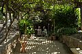
Forestiere Underground Garden

See also
 In Spanish: Condado de Fresno para niños
