Papua New Guinea facts for kids
Quick facts for kids
Independent State of Papua New Guinea
|
|
|---|---|
|
|
|
|
Motto: 'Unity in diversity'
|
|
|
Anthem: "O Arise, All You Sons"
|
|
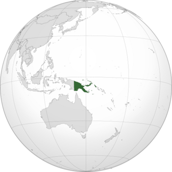
Location of Papua New Guinea (green)
|
|
| Capital and largest city
|
Port Moresby 09°28′44″S 147°08′58″E / 9.47889°S 147.14944°E |
| Official languages |
|
|
Indigenous languages
|
851 languages |
| Ethnic groups | |
| Religion
(2011 census)
|
|
| Demonym(s) | Papua New Guinean • Papuan |
| Government | Unitary parliamentary constitutional monarchy |
|
• Monarch
|
Charles III |
| Bob Dadae | |
| James Marape | |
| Legislature | National Parliament |
| Independence
from Australia
|
|
|
• Papua and New Guinea Act 1949
|
1 July 1949 |
|
• Declared and recognised
|
16 September 1975 |
| Area | |
|
• Total
|
462,840 km2 (178,700 sq mi) (54th) |
|
• Water (%)
|
2 |
| Population | |
|
• 2021 estimate
|
|
|
• 2011 census
|
7,257,324 |
|
• Density
|
15/km2 (38.8/sq mi) (201st) |
| GDP (PPP) | 2023 estimate |
|
• Total
|
|
|
• Per capita
|
|
| GDP (nominal) | 2023 estimate |
|
• Total
|
|
|
• Per capita
|
|
| Gini (2009) | 41.9 medium |
| HDI (2022) | medium · 154th |
| Currency | Kina (PGK) |
| Time zone | UTC+10, +11 (PNGST) |
| Driving side | left |
| Calling code | +675 |
| ISO 3166 code | PG |
| Internet TLD | .pg |
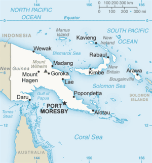
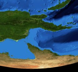
Papua New Guinea (often called PNG) is a country in Oceania. It covers the eastern half of the island of New Guinea and many smaller islands. These islands are part of Melanesia, a region in the southwestern Pacific Ocean north of Australia. The capital city is Port Moresby, located on the southeastern coast. Papua New Guinea is the world's third largest island country. Its total area is about 462,840 square kilometers (178,703 square miles).
Papua New Guinea became an independent country in 1975. Before that, it was ruled by three different countries since 1884. Australia managed the country for almost 60 years, starting during World War I. After gaining independence, Papua New Guinea became a Commonwealth realm. This means it shares the same monarch as the United Kingdom. It also joined the Commonwealth of Nations.
The country has 839 known languages of Papua New Guinea. This makes it one of the most linguistically diverse places on Earth. Most of its over 8 million people live in rural areas. Only about 13% of its population lives in cities. Many people live in traditional communities. Scientists believe Papua New Guinea is home to many undiscovered plants and animals.
The country is considered a developing economy. About 40% of its people are subsistence farmers. This means they grow food mainly for themselves and their families. They are not very dependent on money. The country's constitution supports traditional villages. It wants them to remain important parts of society. Papua New Guinea is a member of the Commonwealth of Nations and the Pacific Islands Forum.
Contents
What's in a Name?
The word papua comes from an old local term. Its exact meaning is not known. The name "New Guinea" (Nueva Guinea) was given by a Spanish explorer named Yñigo Ortiz de Retez. In 1545, he thought the people looked like those he had seen in the Guinea region of Africa. The word Guinea comes from the Portuguese word Guiné. This name often means "land of the blacks." It refers to the dark skin of the people living there.
Geography of Papua New Guinea
Papua New Guinea is the 54th largest country in the world. It covers about 462,840 square kilometers (178,703 square miles). It lies between 0° and 12°S latitude and 140° and 160°E longitude.
The country has very diverse and rugged land. A mountain range called the New Guinea Highlands runs through the island. This area is home to many people. It is mostly covered with tropical rainforest. Thick rainforests are also found in lowlands and coastal areas. Large wetlands surround the Sepik and Fly rivers. This difficult land makes it hard to build roads and other transport. In some places, airplanes are the only way to travel. The highest mountain is Mount Wilhelm, which is 4,509 meters (14,793 feet) tall.
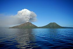
Papua New Guinea has many coral reefs. These reefs are carefully protected. The country is located on the Pacific Ring of Fire. This is where several tectonic plates meet. Because of this, there are many active volcanoes. Volcanic eruptions happen often. Earthquakes are also common and can sometimes cause tsunamis.
The main part of the country is the eastern half of New Guinea island. Here you find the largest towns, like the capital Port Moresby and Lae. Other major islands include New Ireland, New Britain, Manus, and Bougainville. Papua New Guinea is one of the few places near the equator that gets snow. This happens in the highest mountain areas.
Government and Politics
Papua New Guinea is a Commonwealth realm. This means Charles III is its King. The King is represented by the Governor-General of Papua New Guinea, who is currently Bob Dadae. Unlike most Commonwealth realms, Papua New Guinea's Governor-General is chosen by its own Parliament. The King then appoints that person.
The Prime Minister leads the government. The current Prime Minister is James Marape. The government includes 31 members of Parliament. The National Parliament of Papua New Guinea has 111 seats. Twenty-two of these seats are held by the governors of the 22 provinces. Elections for Parliament members happen every five years.
History of Papua New Guinea
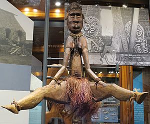
People first arrived in Papua New Guinea about 42,000 to 45,000 years ago. They were descendants of early human migrants from Africa. Around 50,000 years ago, these people reached a supercontinent called Sahul. Sahul included what is now Australia and New Guinea. About 10,000 years ago, sea levels rose, separating New Guinea from Australia.
Around 7000 BC, people in the New Guinea highlands started farming on their own. This made it one of the few places in the world where farming began independently. Around 500 BC, many Austronesian-speaking people moved to the coastal areas. They brought pottery, pigs, and new fishing methods.
In the 18th century, traders brought the sweet potato to New Guinea. It quickly became a main food source. Sweet potatoes grew much better than the previous main food, taro. This led to a big increase in the population in the highlands.
European Encounters and Colonialism
Europeans knew little about the island until the 19th century. Portuguese and Spanish explorers had visited as early as the 16th century. Traders from Southeast Asia had come to New Guinea for 5,000 years to collect bird-of-paradise feathers.
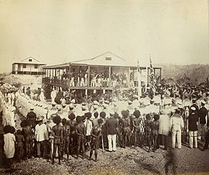
Papua New Guinea's double name comes from its complicated history. In 1884, Germany took control of the northern half. They called it German New Guinea. When World War I started in 1914, Australian forces captured German New Guinea. After the war, the League of Nations allowed Australia to manage this area. It became the Territory of New Guinea.
Also in 1884, the southern part became a British protectorate. In 1888, Britain officially took control of it as British New Guinea. In 1902, this area was given to Australia. It was officially renamed the Territory of Papua in 1906. So, until 1949, Papua and New Guinea were managed separately by Australia. This made setting up the country's laws after independence quite complex.
World War II and Independence
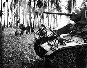
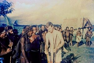
During World War II, the New Guinea campaign (1942–1945) was a major conflict. Many Japanese, Australian, and U.S. soldiers died. After the war, the two territories were combined. They became the Territory of Papua and New Guinea.
The people of Papua asked the United Nations for independence. Papua New Guinea became independent from Australia on September 16, 1975. It joined the United Nations on October 10, 1975. It still has strong ties with Australia, which provides a lot of aid.
Bougainville Conflict
In 1975–76, there was a movement for Bougainville Island to separate from Papua New Guinea. This led to changes in the country's constitution. It allowed Bougainville and other districts to become provinces with some self-rule.
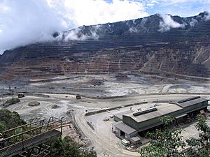
A new conflict on Bougainville started in 1988. This uprising lasted until 1997 and caused about 20,000 deaths. Bougainville was the main mining area in the country. It provided 40% of the national budget. But local people felt they suffered from the mining's environmental damage. They did not feel they got a fair share of the profits.
The government and rebels agreed to a peace deal. This created the Bougainville Autonomous District and Province. In 2019, a vote was held on whether Bougainville should become fully independent. Most voters (98.31%) chose independence. Talks between Bougainville and Papua New Guinea about this are still happening.
Amazing Nature
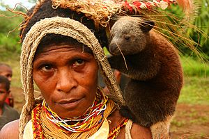
Papua New Guinea is part of the Australasia ecozone. This area includes Australia, New Zealand, eastern Indonesia, and some Pacific islands.
The island of New Guinea is a northern part of the Indo-Australian tectonic plate. It was once connected to Australia by a land bridge. This happened during ice ages when sea levels were lower.
Because of this, many animals in New Guinea are related to those in Australia. For example, both places have several types of marsupial mammals. These include kangaroos and possums, which are not found anywhere else.
Many other islands in Papua New Guinea were never connected to the main island. These include New Britain, New Ireland, and Bougainville. So, they have their own unique plants and animals. They often lack the land mammals and flightless birds found on the main island.
Australia and New Guinea were once part of a huge ancient continent called Gondwana. This continent began to break apart millions of years ago. The plants in Papua New Guinea still show links to this ancient flora.
As the Indo-Australian Plate moves north, it crashes into the Eurasian Plate. This collision created the Himalayas and New Guinea's Central Range. The Central Range mountains are very young and tall. They are so high that they even have rare equatorial glaciers. New Guinea is in the humid tropics. Many rainforest plants from Asia have spread there. They mix with the older Australian and Antarctic plants.
Papua New Guinea has many different natural areas, called ecoregions:
- Admiralty Islands lowland rain forests
- Central Range montane rain forests
- Huon Peninsula montane rain forests
- Louisiade Archipelago rain forests
- New Britain-New Ireland lowland rain forests
- New Britain-New Ireland montane rain forests
- New Guinea mangroves
- Northern New Guinea lowland rain and freshwater swamp forests
- Northern New Guinea montane rain forests
- Solomon Islands rain forests (includes Bougainville Island and Buka)
- Southeastern Papuan rain forests
- Southern New Guinea freshwater swamp forests
- Southern New Guinea lowland rain forests
- Trobriand Islands rain forests
- Trans Fly savanna and grasslands
- Central Range sub-alpine grasslands
Sadly, forests in Papua New Guinea are being cut down quickly. More than half of the country's forests could be lost or badly damaged by 2021. Almost a quarter of its rainforests were harmed or destroyed between 1972 and 2002.
Economy
Papua New Guinea has many natural resources. But it is hard to get to them because of the tough land. Building roads is very expensive. There are also problems with law and order. It can be hard to find land owners to make agreements.
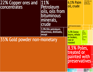
Farming provides a living for 85% of the people. The country also has rich deposits of minerals. These include oil, copper, and gold. These minerals make up 72% of the country's export earnings. Papua New Guinea also grows a lot of coffee. Other important crops are cocoa, oil palm, and tea.
People of Papua New Guinea
Papua New Guinea is one of the most diverse countries in the world. It has hundreds of different ethnic groups. Most people are Papuans. Their ancestors arrived in the region tens of thousands of years ago. Many remote Papuan tribes have little contact with the outside world.
Other groups are Austronesians. Their ancestors came to the region less than four thousand years ago. Many people from other parts of the world also live there. These include Chinese, Europeans, Australians, Filipinos, Polynesians, and Micronesians. In 1975, when Papua New Guinea became independent, there were 40,000 people from other countries living there. Most were Australian or Chinese.
Papua New Guinea has more languages than any other country. There are over 820 local languages. This is 12% of all languages in the world! But most of these languages have fewer than 1,000 speakers. The most spoken local language is Enga, with about 200,000 speakers. Then come Melpa and Huli.
Papua New Guinea has three official languages: English, Tok Pisin, and Hiri Motu. English is used by the government and in schools. But it is not widely spoken by everyone.
Tok Pisin is the main common language. It is used in Parliament and in many advertisements. Until recently, a national newspaper was published in Tok Pisin. In the southern region of Papua, people often use Hiri Motu. Even in the capital, Port Moresby, people mostly use Tok Pisin and English. Motu is spoken in the villages outside the city.
Culture
It is thought that Papua New Guinea has over a thousand different cultural groups. Each group has its own unique way of expressing itself. This includes their art, dance, weapons, costumes, singing, music, and architecture. Most of these groups also have their own language. People usually live in villages and grow their own food. In some areas, they also hunt and gather wild plants like yam roots. People who are good at hunting, farming, and fishing are highly respected.
Along the Sepik river, there is a tradition of wood carving. These carvings often show plants or animals. They represent spirits of ancestors.
Sea shells were once used as money in some parts of Papua New Guinea. This stopped in 1933. However, this tradition is still seen in local customs. In some cultures, a groom must give a certain number of golden-edged clam shells to the bride's family. This is called a bride price. In other areas, the bride price can be paid with shell money, pigs, cassowaries, or cash. In some regions, it is the brides who traditionally pay a dowry.
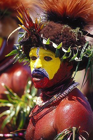
People in the highlands have colorful local rituals called "sing sings." They paint their bodies and wear feathers, pearls, and animal skins. They dress up to look like birds, trees, or mountain spirits. Sometimes, an important event, like a famous battle, is acted out during these musical festivals.
Images for kids
-
Slaked Lime holder, late 19th or early 20th century. The holder is decorated with wood carving of crocodile and bird. Details are emphasised with a white paint. The central portion, hollow to hold the slaked lime, is made of bamboo. The joints are covered with basketry work. The device is used in conjunction with chewing betel nut.
-
Prime Minister Peter O'Neill
-
The Parliament building of Papua New Guinea in Port Moresby
See also
 In Spanish: Papúa Nueva Guinea para niños


