List of West Virginia state parks facts for kids
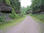
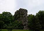
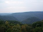
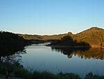
West Virginia has 37 amazing state parks! These parks are special places where you can explore nature, learn about history, and have fun outdoors. The West Virginia Division of Natural Resources (WVDNR) manages almost all of them. They also look after eight state forests.
The very first state park in West Virginia was Droop Mountain Battlefield, which opened in 1929. The newest parks, Stonewall Jackson Lake and North Bend Rail Trail, opened in the early 1990s. Some places became parks even before Droop Mountain, like Tu-Endie-Wei, which started as a monument in 1901. Over the years, a few parks have changed hands or closed. West Virginia's state parks come in all sizes, from tiny 4-acre spots to huge 10,100-acre areas. You can find different types of parks too: 10 have lodges and resorts, 25 offer cabins, camping, and day-use activities, and 2 are cool rail trails perfect for biking or walking.
Contents
Exploring West Virginia's Parks
West Virginia's state parks are managed by the West Virginia Division of Natural Resources (WVDNR) Parks and Recreation Section. This group is part of the West Virginia Department of Commerce. They take care of 37 state parks and eight state forests. Together, these lands cover about 164,000 acres! About 12,000 acres have fun facilities, while 152,000 acres are wild and undeveloped.
You can find state parks in 30 of West Virginia's 55 counties. Pocahontas County has the most, with five parks! The largest park is Watoga at 10,100 acres. The smallest are Fairfax Stone and Tu-Endie-Wei, both just 4 acres. Four parks have big lakes created by U.S. Army Corps of Engineers (USACE) dams: Beech Fork, Bluestone, Stonewall Jackson Lake, and Tygart Lake.
Nine parks have buildings and structures built between 1933 and 1942 as part of the "New Deal" programs. Lost River has the most, with 78 of these historic buildings. Cathedral is special because it's a National Natural Landmark, meaning it has unique natural features. Grave Creek Mound was once a state park and is a National Historic Landmark because of its ancient history. Stonewall Jackson Lake is the only park built and run through a partnership between the state and a private company.
In 2016, over 400 full-time and 1,000 seasonal workers helped run the parks. About 7.1 million people visited the parks that year! Most visitors (65%) were from West Virginia, and 35% were from other states. The parks have lots of places to stay and play, including 818 lodge rooms, 369 cabins, 1,522 campsites, 144 picnic shelters, and 549 playgrounds. West Virginia's state parks and forests bring in a lot of money for the state, between $160.5 million and $189.5 million each year. For every $1 the state puts into the parks, it gets back about $13.15 in new money!
A Look Back: Park History
By the early 1900s, West Virginia's forests and land had been greatly changed by logging and mining. People realized the state needed to protect its beautiful natural areas. In 1925, the West Virginia Legislature created a special group to find places for forests, parks, and wildlife. That same year, they bought land in Pocahontas County for a wildlife and timber area, which later became Watoga.
In 1927, the group suggested that scenic areas should be state parks and historical sites should be state monuments. They also listed possible park locations. One of these became West Virginia's first state park, Droop Mountain Battlefield, which opened on July 4, 1929. This park remembers a big battle from the American Civil War. Other historic places, like the Point Pleasant Monument (now Tu-Endie-Wei), were already around and later joined the park system.
In 1933, the state created the Division of State Parks to manage the growing park system. They worked with national programs like the Civilian Conservation Corps (CCC) and the Works Progress Administration (WPA) to build and improve parks. By 1945, there were 13 state parks.
Sadly, for a time, African Americans were not allowed in West Virginia's state parks. So, in 1949, the state created Booker T. Washington State Park just for them. However, after the Brown v. Board of Education decision in 1954, all state parks became open to everyone.
By 1950, there were 16 state parks, and by 1954, there were 20! The parks continued to grow and add new facilities throughout the 1950s and 1960s. New parks like Canaan Valley Resort, Pipestem Resort, and Twin Falls Resort were added. By 1971, nearly 5 million people were visiting the parks each year. In 1985, the park system moved to the West Virginia Department of Commerce, where it is today. The most recent parks, Stonewall Jackson Lake and North Bend Rail Trail, joined in 1990 and 1991.
Current State Parks
| Park name | Image | County and location |
Area in acres (ha) |
Date of establishment |
Streams and/or lakes |
Remarks |
|---|---|---|---|---|---|---|
| Audra | Barbour and Upshur 39°02′25″N 80°03′55″W / 39.04028°N 80.06528°W |
355 acres (144 ha) |
1950 | Middle Fork River | This park was once a logging town and home to Barbour County's first 4-H camp. It has a cool Alum Cave formed by different types of rock. | |
| Babcock | Fayette 37°59′38″N 80°58′16″W / 37.99389°N 80.97111°W |
4,127 acres (1,670 ha) |
1934 | Glade Creek Manns Creek |
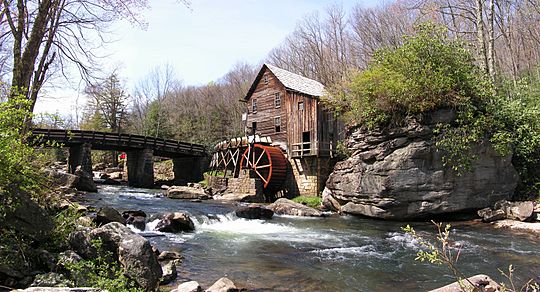
Named after a previous owner, this park has two famous buildings. One is the administration building, built by the Civilian Conservation Corps (CCC). The other is the Glade Creek Grist Mill, a working mill built in 1976. It's one of the most photographed places in West Virginia! | |
| Beartown | Greenbrier and Pocahontas 38°03′08″N 80°16′35″W / 38.05222°N 80.27639°W |
110 acres (45 ha) |
1970 | None | Explore trails winding through huge boulders with narrow cracks. Some giant "elephant ear lichens" in the park are over 500 years old! | |
| Beech Fork | Cabell and Wayne 38°18′05″N 82°19′50″W / 38.30139°N 82.33056°W |
3,860 acres (1,562 ha) |
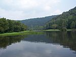
1978 | Beech Fork Lake | This park includes the 720-acre Beech Fork Lake, which was created by a dam built by the U.S. Army Corps of Engineers. | |
| Berkeley Springs | Morgan 39°37′35″N 78°13′45″W / 39.62639°N 78.22917°W |
7 acres (3 ha) |
1970 | Warm Spring Run | This park is famous for its natural warm springs, known since the 1700s. Even George Washington visited them! The spring water stays at a constant 74.3 degrees Fahrenheit. | |
| Blackwater Falls | Tucker 39°06′43″N 79°29′43″W / 39.11194°N 79.49528°W |
2,358 acres (954 ha) |
1937 | Blackwater River North Fork Blackwater River Pendleton Lake |
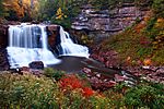
The main attractions here are the 63-foot Blackwater Falls, the 8-mile Blackwater Canyon, and other beautiful waterfalls. The forests you see today were replanted by the CCC in the 1930s after earlier logging. | |
| Blennerhassett Island Historical |
Wood 39°16′16″N 81°37′34″W / 39.27111°N 81.62611°W |
511 acres (207 ha) |
1989 | Ohio River | This park has two parts: a museum in Parkersburg and Blennerhassett Island. On the island, you can see a rebuilt mansion from the 1800s. You can get to the island by paddle steamer! | |
| Bluestone | Summers 37°37′05″N 80°56′09″W / 37.61806°N 80.93583°W |
2,155 acres (872 ha) |
1950 | Bluestone River Bluestone Lake New River |
Named for the bluish-gray rocks in the area. It's next to Bluestone Lake, West Virginia's second-largest body of water, created by a dam in 1948. | |
| Cacapon Resort | Morgan 39°31′06″N 78°18′34″W / 39.51833°N 78.30944°W |
6,115 acres (2,475 ha) |
1937 | Cacapon Lake | Built by the CCC starting in 1937, this park is a great example of the state park system. It even has a golf course added in 1973. | |
| Camp Creek | Mercer 37°30′29″N 81°07′58″W / 37.50806°N 81.13278°W |
500 acres (202 ha) |
1987 | Camp Creek | This park was created from Camp Creek State Forest in 1987. It's a lovely recreation area with a waterfall. | |
| Canaan Valley Resort |
Tucker 39°01′38″N 79°27′43″W / 39.02722°N 79.46194°W |
6,120 acres (2,477 ha) |
1957 | Blackwater River | This was one of three state parks planned in the 1960s with federal money. It has the first ski facility in West Virginia, which opened in 1971. | |
| Carnifex Ferry Battlefield |
Nicholas 38°12′32″N 80°56′22″W / 38.20889°N 80.93944°W |
165 acres (67 ha) |
1931 | Gauley River | This park is the site of an 1861 Civil War battle. The battle helped the Union gain control of western Virginia, which led to West Virginia becoming a state. You can also see a restored 19th-century farmhouse here. | |
| Cass Scenic Railroad |
Pocahontas 38°26′55″N 79°55′38″W / 38.44861°N 79.92722°W |
940 acres (380 ha) |
1961 | Greenbrier River Leatherbark Run |
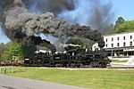
This park has a historic scenic railroad that climbs West Virginia's second-tallest mountain, Bald Knob. The state also bought and restored the town of Cass, making it West Virginia's only restored company town with rental houses and a country store. | |
| Cathedral | Preston 39°19′35″N 79°32′19″W / 39.32639°N 79.53861°W |
133 acres (54 ha) |
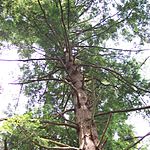
1942 | Rhine Creek | This park is a 133-acre forest that has never been cut down! It has the only remaining group of untouched Eastern hemlock trees in West Virginia. It's also a National Natural Landmark. | |
| Cedar Creek | Gilmer 38°52′54″N 80°51′44″W / 38.88167°N 80.86222°W |
2,588 acres (1,047 ha) |
1953 | Cedar Creek | This park has two historic buildings that were moved here: a Log Cabin Service Station from 1928 (now the park office) and a one-room schoolhouse from 1909. | |
| Chief Logan | Logan 37°53′57″N 82°00′46″W / 37.89917°N 82.01278°W |
3,303 acres (1,337 ha) |
1961 | Buffalo Creek | This park was once part of a coal mining camp. A historical play called The Aracoma Story is performed here. It's about Aracoma, the daughter of a Shawnee chief, and her people. | |
| Droop Mountain Battlefield |
Pocahontas 38°06′43″N 80°16′17″W / 38.11194°N 80.27139°W |
287 acres (116 ha) |
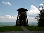
1928 | None | This is the site of one of West Virginia's biggest Civil War battles. It was the first state park in West Virginia, dedicated in 1929. The CCC built the park's famous wooden observation tower and a museum cabin in 1935. | |
| Fairfax Stone Historical Monument |
Grant, Preston, and Tucker 39°11′42″N 79°29′14″W / 39.19500°N 79.48722°W |
4 acres (2 ha) |
1957 | North Branch Potomac River headwaters |
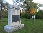
This park has the Fairfax Stone, a historic marker that used to show the western edge of Lord Fairfax's land. It also marks the border between Maryland and West Virginia today. | |
| Greenbrier River Trail |
Greenbrier and Pocahontas 37°59′42″N 80°17′55″W / 37.99500°N 80.29861°W |
936 acres (379 ha) |
1980 | Greenbrier River | This trail is a 78-mile section of an old railroad line. It's great for walking, running, and biking! | |
| Hawks Nest | Fayette 38°07′26″N 81°07′08″W / 38.12389°N 81.11889°W |
370 acres (150 ha) |
1935 | Hawks Nest Lake Mill Creek New River Turkey Creek |
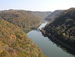
This park was planned by the National Park Service and built by the CCC. It has an aerial tramway that takes you down to a marina on the New River. The overlook offers amazing views of the New River Gorge. | |
| Holly River | Webster 38°39′53″N 80°20′04″W / 38.66472°N 80.33444°W |
8,294 acres (3,357 ha) |
1938 | Laurel Fork of Holly River | This park's land was bought in 1937 to replant trees and restore streams after a lot of logging. It has many historic buildings built by the WPA. | |
| Little Beaver | Raleigh 37°44′42″N 81°05′02″W / 37.74500°N 81.08389°W |
562 acres (227 ha) |
1971 | Little Beaver Creek Little Beaver Lake |
This park was first developed as a recreation area by the CCC in the late 1930s. Its lake was created in 1941 when the CCC and WPA built a 400-foot dam. | |
| Lost River | Hardy 38°55′22″N 78°53′22″W / 38.92278°N 78.88944°W |
3,712 acres (1,502 ha) |
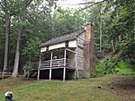
1934 | Howards Lick Run | This land was given to Henry Lee III in 1796 for his service in the American Revolutionary War. His son later started a resort here. The state bought the land in 1934, and the CCC developed the park. You can see the historic Lighthorse Harry Lee Cabin here. | |
| Moncove Lake | Monroe 37°37′19″N 80°21′04″W / 37.62194°N 80.35111°W |
896 acres (363 ha) |
1991 | Devil Creek Moncove Lake |
The park's 144-acre Moncove Lake was created in 1960. This park is a great spot to watch migrating birds of prey, like broad-winged hawks, in the autumn. | |
| North Bend | Ritchie 39°13′23″N 81°06′37″W / 39.22306°N 81.11028°W |
2,492 acres (1,009 ha) |
1951 | North Bend Lake North Fork Hughes River |
Named through a contest, this park has a special "Extra Mile Trail" for people with disabilities. It also hosts an annual sports event for athletes with physical or visual challenges. The 305-acre North Bend Lake was created in 2002. | |
| North Bend Rail Trail |
Doddridge, Harrison, Ritchie, and Wood 39°17′06″N 80°58′14″W / 39.28500°N 80.97056°W |
Not applicable | 1991 | Goose Creek Hushers Run Little Kanawha River Middle Island Creek North Fork Hughes River Walker Creek |
This is a 72-mile trail built on an old railroad line. It goes through 13 tunnels and over 36 bridges! It's also part of the huge 5,500-mile American Discovery Trail. | |
| Pinnacle Rock | Mercer 37°18′43″N 81°17′32″W / 37.31194°N 81.29222°W |
374 acres (151 ha) |
1938 | Jimmy Lewis Lake | Named for the 3,100-foot tall Pinnacle Rock sandstone formation. The park's facilities were built by the CCC in 1938, and the 15-acre Jimmy Lewis Lake was built between 1965 and 1968. | |
| Pipestem Resort | Mercer and Summers 37°32′23″N 80°59′39″W / 37.53972°N 80.99417°W |
4,050 acres (1,640 ha) |
1963 | Bluestone River Long Branch Creek Long Branch Lake Mountain Creek |
Named after the pipestem bush. When it was finished in 1971, it was called the "crown jewel" of the state park system. It has a seasonal aerial tramway that drops about 1,200 feet into Bluestone Canyon! | |
| Prickett's Fort | Marion 39°31′01″N 80°05′40″W / 39.51694°N 80.09444°W |
188 acres (76 ha) |
1975 | Monongahela River Pricketts Creek |
This park features a rebuilt 18th-century fort that protected early settlers from Native American attacks. You can also see the Prickett cemetery, the oldest burial ground in the area. | |
| Stonewall Jackson Lake |
Lewis 38°56′57″N 80°29′44″W / 38.94917°N 80.49556°W |
1,736 acres (703 ha) |
1990 | Stonewall Jackson Lake West Fork River |
This park is located along the 2,650-acre Stonewall Jackson Lake, created by the U.S. Army Corps of Engineers. It's unique because it was built and run through a partnership between the state and a private company. | |
| Tomlinson Run | Hancock 40°32′49″N 80°35′32″W / 40.54694°N 80.59222°W |
1,396 acres (565 ha) |
1935 | Tomlinson Run Tomlinson Run Lake |
This park was developed with help from the National Park Service. It features the 30-acre Tomlinson Run Lake, which was completed in 1942. | |
| Tu-Endie-Wei | Mason 38°50′21″N 82°08′28″W / 38.83917°N 82.14111°W |
4 acres (2 ha) |
1956 | Kanawha River Ohio River |
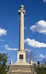
This park is where the Ohio and Kanawha rivers meet. It's the site of the Battle of Point Pleasant. The state bought the land in 1901, and a monument was built in 1909. The park also has the Mansion House Museum from around 1796. | |
| Twin Falls Resort | Wyoming 37°38′00″N 81°26′12″W / 37.63333°N 81.43667°W |
3,776 acres (1,528 ha) |
1964 | Black Fork Marsh Fork |
Named for two waterfalls about 0.5 miles apart. This was one of three resort parks built with federal funding. It has a golf course, a rebuilt pioneer homestead that acts as a living museum, and a lodge. | |
| Tygart Lake | Barbour and Taylor 39°16′24″N 80°00′26″W / 39.27333°N 80.00722°W |
2,134 acres (864 ha) |
1945 | Tygart Lake Tygart Valley River |
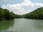
This park includes the 1,750-acre Tygart Lake, which was created by the Tygart Dam in 1938. The dam itself is a historic landmark. | |
| Valley Falls | Marion and Taylor 39°23′25″N 80°05′14″W / 39.39028°N 80.08722°W |
1,145 acres (463 ha) |
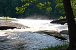
1964 | Tygart Valley River | Named for two fast-moving waterfalls, 12 feet and 18 feet high, on the Tygart Valley River. In the 1800s, this area was a busy town with mills and factories. | |
| Watoga | Pocahontas 38°06′13″N 80°09′00″W / 38.10361°N 80.15000°W |
10,100 acres (4,087 ha) |
1934 | Greenbrier River Island Lick Run Watoga Lake |
This park started as a state forest in 1926. One of West Virginia's first CCC camps was set up here in 1933. It's the largest state park in West Virginia and has an 11-acre lake. | |
| Watters Smith Memorial |
Harrison 39°10′10″N 80°24′40″W / 39.16944°N 80.41111°W |
532 acres (215 ha) |
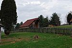
1949 | Duck Creek | This park is the historic home of pioneer Watters Smith, who moved here in 1796. You can see a rebuilt log cabin and other old farm buildings. The Smith family home from around 1876 has also been restored as a museum. |
Past State Parks
| Park name | Image | County and location |
Area in acres (ha) |
Date of establishment |
Date of disestablishment |
Streams and/or lakes |
Remarks |
|---|---|---|---|---|---|---|---|
| Booker T. Washington | Kanawha 38°22′55″N 81°44′53″W / 38.38194°N 81.74806°W |
7.43 acres (3 ha) |
1949 | By 1959 | Near Finney Branch | This was the only state park that allowed African Americans to visit until all parks became integrated in 1954. It offered picnic areas, but not as many facilities as other parks. | |
| Grandview | Raleigh 37°50′29″N 81°03′56″W / 37.84139°N 81.06556°W |
877 acres (355 ha) |
1939 | 1990 | New River | Built by the CCC, this park was known for its amazing views of the New River Gorge. In 1990, it became part of the New River Gorge National River, which is now the New River Gorge National Park and Preserve. It's still home to Theatre West Virginia, which performs plays there. | |
| Grave Creek Mound | Marshall 39°55′01″N 80°44′40″W / 39.91694°N 80.74444°W |
7 acres (2.83 ha) |
1970 | 1996 | None | The Grave Creek Mound is a huge grass-covered mound, 69 feet tall and 295 feet wide! It was built by the ancient Adena culture around 250-150 BCE. It became a state park in 1970 and a National Historic Landmark in 1966. In 1996, it was transferred to the West Virginia Division of Culture and History. | |
| James Rumsey Monument | Jefferson 39°25′58.20″N 77°47′56.81″W / 39.4328333°N 77.7991139°W |
4.09 acres (1.66 ha) |
1956 | 1978 | Potomac River | This monument honors James Rumsey, an inventor. It was a state park from 1956 to 1978. Now, it's managed by a local society and the town of Shepherdstown. It offers great views of the Potomac River valley. | |
| Mingo Oak | Mingo 37°47′37″N 82°06′46″W / 37.79361°N 82.11278°W |
1.5 acres (0.61 ha) |
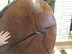
1931 | 1938 | Near Trace Fork | This park was created to protect the Mingo Oak, which was the oldest and largest white oak tree. The park was leased to the state until the tree was cut down in 1938. | |
| Mont Chateau | Monongalia 39°39′33″N 79°50′52″W / 39.65917°N 79.84778°W |
42.16 acres (17.1 ha) |
1955 | 1977 | Cheat Lake | Located along Cheat Lake, this park and its lodge didn't become a big tourist spot. In 1977, the lodge and some land were leased to a geological survey group. The rest of the park went to a private owner in 1985. | |
| Morgan Morgan Monument | Berkeley 39°20′07″N 78°03′11″W / 39.33528°N 78.05306°W |
1.05 acres (0.42 ha) |
1956 | 1970 | Mill Creek | This monument, built in 1924, honors Morgan Morgan, who is believed to be the first permanent European settler in what is now West Virginia. The monument was part of the park system from 1956 to 1970, then transferred to the West Virginia Division of Highways. |
See also
- List of West Virginia state forests
- List of West Virginia wildlife management areas
- West Virginia Division of Natural Resources
- West Virginia State Wildlife Center
 | John T. Biggers |
 | Thomas Blackshear |
 | Mark Bradford |
 | Beverly Buchanan |


