
Berks County, Pennsylvania facts for kids
Quick facts for kids
Berks County
|
|||
|---|---|---|---|

Reading, the biggest city in the county
|
|||
|
|||

Location within the U.S. state of Pennsylvania
|
|||
 Pennsylvania's location within the U.S. |
|||
| Country | |||
| State | |||
| Founded | March 11, 1752 | ||
| Named for | Berkshire, England | ||
| Seat | Reading | ||
| Largest city | Reading | ||
| Area | |||
| • Total | 866 sq mi (2,240 km2) | ||
| • Land | 857 sq mi (2,220 km2) | ||
| • Water | 9.2 sq mi (24 km2) 1.1%% | ||
| Population
(2020)
|
|||
| • Total | 428,849 | ||
| • Density | 495/sq mi (191/km2) | ||
| Time zone | UTC−5 (Eastern) | ||
| • Summer (DST) | UTC−4 (EDT) | ||
| Congressional districts | 4th, 6th, 9th | ||
|
Pennsylvania Historical Marker
|
|||
| Designated: | May 12, 1982 | ||


Berks County (in Pennsylvania Dutch: Barricks Kaundi) is a special area called a county in the state of Pennsylvania. In 2020, about 428,849 people lived here. The main town, or county seat, is Reading. Reading is also the fourth-largest city in Pennsylvania. Berks County is located in the south-central part of the state.
The county shares borders with Lehigh County to the north and east. To the north, it borders Schuylkill County. To the west, it borders Lebanon and Lancaster counties. Chester County is to its south. Berks County is about 26 miles (42 km) southwest of Allentown. Allentown is Pennsylvania's third-largest city. It is also about 50 miles (80 km) northwest of Philadelphia, the state's biggest city.
The Schuylkill River flows through Berks County. This river is 135 miles (217 km) long and flows into the Delaware River. Berks County is part of the Reading, PA metropolitan statistical area (MSA). This area is also part of the larger Greater Philadelphia metropolitan area. This bigger area is known as the Philadelphia-Reading-Camden, PA-NJ-DE-MD combined statistical area (CSA).
Contents
History of Berks County
Reading started growing in the 1740s. People living in northern Lancaster County asked for a new county to be made. With help from German immigrant Conrad Weiser, Berks County was officially formed. This happened on March 11, 1752. It was created from parts of Chester County, Lancaster County, and Philadelphia County.
The county was named after Berkshire, an English county. This was where William Penn's family home was located. Berks is a shorter way to say Berkshire. When it was first created, Berks County was much larger than it is now. Parts of its northwestern area were used to form Northumberland County in 1772. Later, in 1811, parts also went to create Schuylkill County. That's when Berks County became its current size.
In 2005, Berks County joined the Delaware Valley Planning Area. This happened because its population was growing quickly. It was also very close to other communities in that area.
Geography and Nature
The U.S. Census Bureau says Berks County covers 866 square miles (2,243 km²). Most of this area, 857 square miles (2,220 km²), is land. The remaining 9.2 square miles (24 km²) is water, which is about 1.1% of the total area.
Most of the county's water flows into the Schuylkill River. However, a small part in the northeast drains into the Lehigh River. This happens through the Little Lehigh Creek. Some areas in the northwest drain into the Susquehanna River via the Swatara Creek. The Conestoga River also starts in Berks County. It begins between Morgantown and Elverson in the very south of the county.
The county has a humid continental climate. This means it has warm summers and cold winters. The hardiness zone is mostly 7a, with some higher northern and eastern areas being 6b. This zone helps gardeners know which plants can grow there.
Neighboring Counties
- Schuylkill County (north)
- Lehigh County (northeast)
- Montgomery County (east)
- Chester County (southeast)
- Lancaster County (southwest)
- Lebanon County (west)
Special Protected Areas
- Hopewell Furnace National Historic Site in Elverson (a national park)
- French Creek State Park (a state park)
Main Roads and Highways
_from_the_overpass_for_Power_Drive_in_Upper_Tulpehocken_Township,_Berks_County,_Pennsylvania.jpg)

 I-76 / Penna Turnpike
 I-176
I-176
 I-78 / US 22
 US 222


US 222 Bus. US 422
US 422 Bus. PA 10
PA 10 PA 12
PA 12 PA 23
PA 23 PA 29
PA 29 PA 61
PA 61 PA 73
PA 73 PA 100
 PA 143
 PA 183
 PA 272
 PA 345
 PA 401
 PA 419
 PA 501
 PA 562
 PA 568
 PA 625
 PA 645
 PA 662
 PA 724
 PA 737
People and Population
| Historical population | |||
|---|---|---|---|
| Census | Pop. | %± | |
| 1790 | 30,189 | — | |
| 1800 | 32,407 | 7.3% | |
| 1810 | 43,146 | 33.1% | |
| 1820 | 46,275 | 7.3% | |
| 1830 | 53,152 | 14.9% | |
| 1840 | 64,569 | 21.5% | |
| 1850 | 77,129 | 19.5% | |
| 1860 | 93,818 | 21.6% | |
| 1870 | 106,701 | 13.7% | |
| 1880 | 122,597 | 14.9% | |
| 1890 | 137,327 | 12.0% | |
| 1900 | 159,615 | 16.2% | |
| 1910 | 183,222 | 14.8% | |
| 1920 | 200,854 | 9.6% | |
| 1930 | 231,717 | 15.4% | |
| 1940 | 241,884 | 4.4% | |
| 1950 | 255,740 | 5.7% | |
| 1960 | 275,414 | 7.7% | |
| 1970 | 296,382 | 7.6% | |
| 1980 | 312,509 | 5.4% | |
| 1990 | 336,523 | 7.7% | |
| 2000 | 373,638 | 11.0% | |
| 2010 | 411,442 | 10.1% | |
| 2020 | 428,849 | 4.2% | |
| U.S. Decennial Census 1790–1960 1900–1990 1990–2000 2010–2019 |
|||
In 2010, about 76.9% of the people in Berks County were white. About 4.9% were black, 0.3% were Native American, and 1.3% were Asian. About 2.5% were of two or more races. Also, 16.4% of the people were of Hispanic or Latino background.
Berks County is known for its large Pennsylvania Dutch population. It is part of the area called Pennsylvania Dutch Country. More recently, many Puerto Rican people have moved here, especially to the city of Reading.
In 2010, there were 411,442 people living in the county. The population density was about 479 people per square mile (185 people/km²). The average income for a household in Berks County was $54,105 in 2010.
About 33.1% of households had children under 18 living with them. About 52.1% were married couples. The average household had 2.59 people, and the average family had 3.08 people. The median age in the county was 39.1 years.
Berks County is also home to an Old Order Mennonite community. These are people who live a simple life, often using horse and buggy for travel. There are about 160 families in this community. They live near Kutztown and Fleetwood. They first bought land here in 1949. In 2012, they bought more farms in the Oley Valley. They belong to the Groffdale Conference Mennonite Church.
Population Changes (2000-2020)
| Race / Ethnicity (NH = Non-Hispanic) | Pop 2000 | Pop 2010 | Pop 2020 | % 2000 | % 2010 | % 2020 |
|---|---|---|---|---|---|---|
| White alone (NH) | 317,025 | 316,406 | 291,258 | 84.85% | 76.90% | 67.92% |
| Black or African American alone (NH) | 12,478 | 16,517 | 18,087 | 3.34% | 4.01% | 4.22% |
| Native American or Alaska Native alone (NH) | 397 | 536 | 450 | 0.11% | 0.13% | 0.10% |
| Asian alone (NH) | 3,713 | 5,244 | 6,225 | 0.99% | 1.27% | 1.45% |
| Pacific Islander alone (NH) | 57 | 58 | 61 | 0.02% | 0.01% | 0.01% |
| Some Other Race alone (NH) | 320 | 374 | 1,551 | 0.09% | 0.09% | 0.36% |
| Mixed race or Multiracial (NH) | 3,291 | 4,952 | 11,667 | 0.88% | 1.20% | 2.72% |
| Hispanic or Latino (any race) | 36,537 | 67,355 | 99,550 | 9.73% | 16.37% | 23.21% |
| Total | 373,638 | 411,442 | 428,849 | 100.00% | 100.00% | 100.00% |
City and Regional Areas

The U.S. government has named Berks County as the Reading, PA Metropolitan Statistical Area (MSA). This means it's a region with a large city and nearby areas that are closely connected. In 2010, this metropolitan area had 413,491 people. It was the 10th largest in Pennsylvania and the 128th largest in the U.S.
Berks County is also part of an even bigger area. This is called the Philadelphia-Reading-Camden, PA-NJ-DE-MD Combined Statistical Area (CSA). A CSA includes several MSAs that are linked together. This larger area is the biggest in Pennsylvania. It is the eighth largest in the nation, with a population of 7,067,807 people.
Education in Berks County
Colleges and Universities
- Albright College
- Alvernia University
- Kutztown University of Pennsylvania
- Penn State Berks
- Reading Area Community College
Public School Districts

Here are the public school districts in Berks County:
- Antietam School District
- Boyertown Area School District
- Brandywine Heights Area School District
- Conrad Weiser Area School District
- Daniel Boone Area School District
- Exeter Township School District
- Fleetwood Area School District
- Governor Mifflin School District
- Hamburg Area School District
- Kutztown Area School District
- Muhlenberg School District
- Oley Valley School District
- Reading School District
- Schuylkill Valley School District
- Tulpehocken Area School District
- Twin Valley School District
- Upper Perkiomen School District
- Wilson School District
- Wyomissing Area School District
Private High Schools
- Berks Catholic High School in Reading
- Berks Christian School in Birdsboro
- Blue Mountain Academy, a Seventh-day Adventist boarding school in Tilden Township
- Conestoga Christian School in Morgantown, Pennsylvania
- Fairview Christian School in Reading
- Gateway Christian School in Mertztown
- Lighthouse Christian Academy in Lyons
- The King's Academy in Mohrsville
- Pine Forge Academy, a Seventh-day Adventist boarding school in Pine Forge
Technical and Trade Schools
- Berks Technical Institute
- Pace Institute
- Reading Hospital School of Nursing
- Berks Career and Technology Center (east campus in Oley, west campus in Leesport)
Arts and Culture
The Reading Public Museum in Reading is a place where you can learn about art, science, and history.
The Reading Buccaneers Drum and Bugle Corps is a group of musicians who play drums and bugles. They are based in Berks County. They started in 1957 and have won the Drum Corps Associates World Champion title 11 times.
Reading is also home to the Berks Opera Company. This group was started in 2007 and performs opera shows.
There are two Pennsylvania state parks and one natural area in Berks County:
- French Creek State Park is a large park that is partly in Berks County and partly in Chester County.
- Nolde Forest Environmental Education Center is south of Reading. It was once owned by Jacob Nolde, a local businessman who cared about nature.
- Ruth Zimmerman Natural Area is part of the William Penn Forest District in Oley.
Berks County also has two Pennsylvania Historic Sites:
The Old Morlatton Village in Douglassville is looked after by the Historic Preservation Trust of Berks County. This village has four old buildings. One of them, the Mouns Jones House, was built in 1716. It is the oldest recorded building in the county.
West Reading hosts an event called Art on the Avenue every year. In 2019, it celebrated its 25th year.
Media Outlets
Berks County has several ways to get news and entertainment:
- Berks Community Television (BCTV)
- Reading Eagle, a daily newspaper based in Reading, started in 1867
- WEEU (830 AM), a radio station that plays news and talk shows
- WFMZ-TV, a TV news channel from Allentown that covers this area
- WRFY-FM (102.5 FM "Y102"), a popular music radio station in Reading
Communities in Berks County

In Pennsylvania, there are four main types of towns and cities: cities, boroughs, townships, and towns. Here are the cities, boroughs, and townships in Berks County:
City
- Reading (This is the county seat, meaning it's the main administrative center.)
Boroughs
- Adamstown (mostly in Lancaster County)
- Bally
- Bechtelsville
- Bernville
- Birdsboro
- Boyertown
- Centerport
- Fleetwood
- Hamburg
- Kenhorst
- Kutztown
- Laureldale
- Leesport
- Lenhartsville
- Lyons
- Mohnton
- Mount Penn
- New Morgan
- Robesonia
- St. Lawrence
- Shillington
- Shoemakersville
- Sinking Spring
- Topton
- Wernersville
- West Reading
- Womelsdorf
- Wyomissing
Townships

- Albany
- Alsace
- Amity
- Bern
- Bethel
- Brecknock
- Caernarvon
- Centre
- Colebrookdale
- Cumru
- District
- Douglass
- Earl
- Exeter
- Greenwich
- Heidelberg
- Hereford
- Jefferson
- Longswamp
- Lower Alsace
- Lower Heidelberg
- Maidencreek
- Marion
- Maxatawny
- Muhlenberg
- North Heidelberg
- Oley
- Ontelaunee
- Penn
- Perry
- Pike
- Richmond
- Robeson
- Rockland
- Ruscombmanor
- South Heidelberg
- Spring
- Tilden
- Tulpehocken
- Union
- Upper Bern
- Upper Tulpehocken
- Washington
- Windsor
Census-Designated Places (CDPs)
These are areas the U.S. Census Bureau defines for collecting population data. They are not official towns or cities under Pennsylvania law.
- Alleghenyville
- Alsace Manor
- Amity Gardens
- Baumstown
- Bethel
- Blandon
- Bowers
- Colony Park
- Dauberville
- Douglassville
- Dryville
- Edenburg
- Flying Hills
- Fox Chase
- Frystown
- Gibraltar
- Gouglersville
- Greenfields
- Grill
- Hereford
- Hyde Park
- Jacksonwald
- Kempton
- Kutztown University
- Lincoln Park
- Lorane
- Maxatawny
- Mertztown
- Mohrsville
- Montrose Manor
- Morgantown
- Mount Aetna
- Muhlenberg Park
- New Berlinville
- New Jerusalem
- New Schaefferstown
- Oley
- Pennside
- Penn State Berks
- Pennwyn
- Rehrersburg
- Reiffton
- Riverview Park
- Schubert
- Shartlesville
- South Temple
- Springmont
- Spring Ridge
- Stony Creek Mills
- Stouchsburg
- Strausstown
- Temple
- Virginville
- Walnuttown
- West Hamburg
- West Lawn
- West Wyomissing
- Whitfield
Other Unincorporated Communities
These are smaller places that are not officially part of a city, borough, or township.
- Brownsville
- Blue Marsh
- Cacoosing
- Geigertown
- Leinbachs
- North Heidelberg
- Pine Swamp
- Plowville
- Pricetown
- Scarlets Mill
- State Hill
- Wooltown
Population Ranking of Communities (2010 Census)
This table shows the communities in Berks County ranked by their population in 2010. † county seat CDP=census designated population
| Rank | City/Town/etc. | Municipal type | Population (2010 Census) |
|---|---|---|---|
| 1 | † Reading | City | 88,082 |
| 2 | Wyomissing | Borough | 10,461 |
| 3 | Blandon | CDP | 7,152 |
| 4 | Shillington | Borough | 5,273 |
| 5 | Birdsboro | Borough | 5,163 |
| 6 | Kutztown | Borough | 5,012 |
| 7 | Whitfield | CDP | 4,733 |
| 8 | Hamburg | Borough | 4,289 |
| 9 | Lorane | CDP | 4,236 |
| 10 | Pennside | CDP | 4,215 |
| 11 | West Reading | Borough | 4,212 |
| 12 | Reiffton | CDP | 4,178 |
| 13 | Fleetwood | Borough | 4,085 |
| 14 | Boyertown | Borough | 4,055 |
| 15 | Sinking Spring | Borough | 4,008 |
| 16 | Laureldale | Borough | 3,911 |
| 17 | West Wyomissing | CDP | 3,407 |
| 18 | Amity Gardens | CDP | 3,402 |
| 19 | Jacksonwald | CDP | 3,393 |
| 20 | Riverview Park | CDP | 3,380 |
| 21 | Mount Penn | Borough | 3,106 |
| 22 | Mohnton | Borough | 3,043 |
| 23 | Kutztown University | CDP | 2,918 |
| 24 | Kenhorst | Borough | 2,877 |
| 25 | Womelsdorf | Borough | 2,810 |
| 26 | Flying Hills | CDP | 2,568 |
| 27 | Hyde Park | CDP | 2,528 |
| 28 | Wernersville | Borough | 2,494 |
| 29 | Topton | Borough | 2,069 |
| 30 | Robesonia | Borough | 2,061 |
| 31 | West Hamburg | CDP | 1,979 |
| 32 | Leesport | Borough | 1,918 |
| 33 | Temple | CDP | 1,877 |
| 34 | St. Lawrence | Borough | 1,809 |
| 35 | West Lawn | CDP | 1,715 |
| 36 | Fox Chase | CDP | 1,622 |
| 37 | Lincoln Park | CDP | 1,615 |
| 38 | Grill | CDP | 1,468 |
| 39 | South Temple | CDP | 1,424 |
| 40 | Muhlenberg Park | CDP | 1,420 |
| 41 | Shoemakersville | Borough | 1,378 |
| 42 | New Berlinville | CDP | 1,368 |
| 43 | Oley | CDP | 1,282 |
| 44 | Greenfields | CDP | 1,170 |
| 45 | Alleghenyville | CDP | 1,134 |
| 46 | Bally | Borough | 1,090 |
| 47 | Colony Park | CDP | 1,076 |
| 48 | Stony Creek Mills | CDP | 1,045 |
| 49 | Spring Ridge | CDP | 1,003 |
| 50 | Bernville | Borough | 955 |
| 51 | Bechtelsville | Borough | 942 |
| 52 | Hereford | CDP | 930 |
| 53 | Dauberville | CDP | 848 |
| 54 | Morgantown | CDP | 826 |
| 55 | Pennwyn | CDP | 780 |
| 56 | Springmont | CDP | 724 |
| 57 | Edenburg | CDP | 681 |
| 58 | Gibraltar | CDP | 680 |
| 59 | Mertztown | CDP | 664 |
| 60 | New Jerusalem | CDP | 649 |
| 61 | Montrose Manor | CDP | 604 |
| 62 | Stouchsburg | CDP | 600 |
| 63 | Gouglersville | CDP | 548 |
| 64 | Bethel | CDP | 499 |
| 65 | Walnuttown | CDP | 484 |
| T-66 | Lyons | Borough | 478 |
| T-66 | Alsace Manor | CDP | 478 |
| 67 | Shartlesville | CDP | 455 |
| 68 | Douglass | CDP | 448 |
| 69 | Baumstown | CDP | 422 |
| 70 | Dryville | CDP | 398 |
| 71 | Centerport | Borough | 387 |
| 72 | Mohrsville | CDP | 383 |
| 73 | Frystown | CDP | 380 |
| 74 | Mount Aetna | CDP | 354 |
| 75 | Strausstown | Borough | 342 |
| 76 | Bowers | CDP | 326 |
| 77 | Rehrersburg | CDP | 319 |
| 78 | Virginville | CDP | 309 |
| 79 | Schubert | CDP | 249 |
| 80 | New Schaefferstown | CDP | 223 |
| 81 | Kempton | CDP | 169 |
| 82 | Lenhartsville | Borough | 165 |
| 83 | New Morgan | Borough | 71 |
Famous People from Berks County
Many interesting people have come from Berks County, including:
- Priscilla Ahn, a folk singer and songwriter
- Alex Anzalone, a football player for the Detroit Lions
- John Barrasso, a U.S. Senator
- Douglas Carter Beane, a playwright
- Chad Billingsley, a former professional baseball player
- Daniel Boone, a famous American pioneer and explorer
- Steve Burns, a musician and former host of Blue's Clues
- Kerry Collins, a professional football player
- Michael Constantine, an actor known for My Big Fat Greek Wedding
- Amy Cuddy, a Harvard psychologist and TED Talks speaker
- Wayne Ellington, an NBA Basketball Player
- Carl Furillo, a former professional baseball player
- Jon Gosselin and Kate Gosselin, reality TV personalities from Jon & Kate Plus 8
- Chris Guiliano, an Olympic swimmer
- Keith Haring, a famous artist
- Chad Henne, a professional football player
- Chad Hurley, who helped start YouTube
- Abraham Lincoln, the grandfather of U.S. President Abraham Lincoln
- Donyell Marshall, a former NBA player
- Kelly McGillis, an actress known for Top Gun
- Lenny Moore, a football player in the NFL Hall of Fame
- Jillian Murray, a model and actress
- Jacob Nolde, a person who worked to protect nature
- Carl Spaatz, a general during World War II
- Taylor Swift, a Grammy Award-winning singer-songwriter
- John Updike, a famous writer
- Lonnie Walker, an NBA player
Images for kids
-

The official seal of Berks County
-
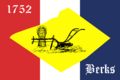
The flag of Berks County
See also
 In Spanish: Condado de Berks para niños
